Lexington-Fayette County Greenway Master Plan
An Element of the 2001 Comprehensive Plan
Adopted June 2002 by the Urban County Planning Commission
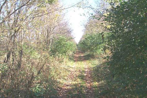
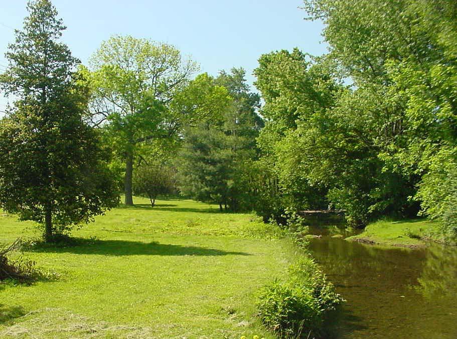 Wolf Run
Urban County Planning Commission
June 2002
Lyle Aten
Ben Bransom, Jr. Dr. Thomas Cooper
Anne Davis
Neill Day
Linda Godfrey
Sarah Gregg
Dallam Harper, Jr.
Keith Mays
Don Robinson, Chairman
Randall Vaughan
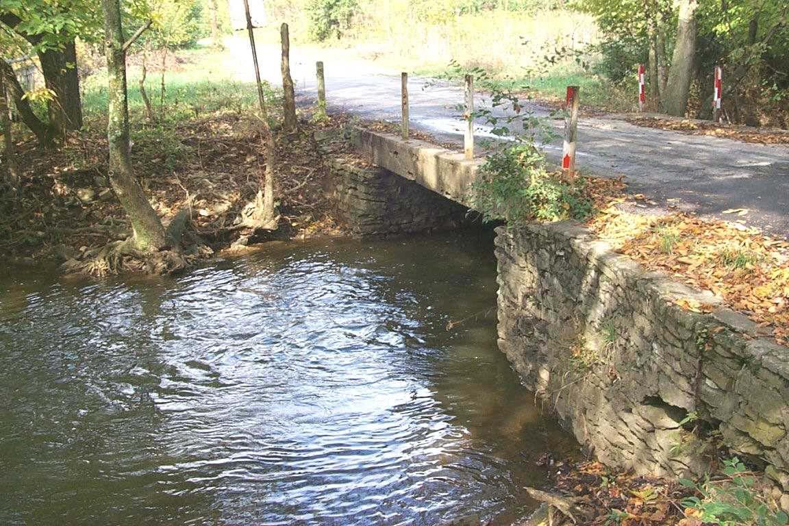
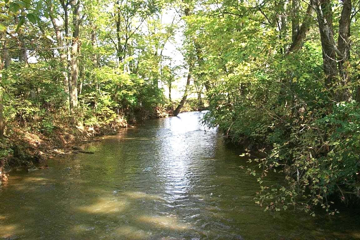
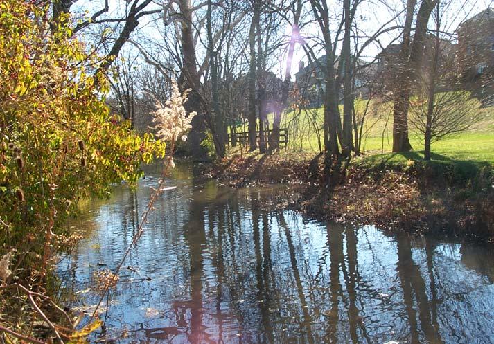
West Hickman Creek
TABLE OF CONTENTS PAGE TOC-1 Table of Contents Page # Acknowledgments........................................................................ ACK-1 Executive Summary...................................................................... EX-1 Chapter 1 Benefits of Greenways 1.1 Water Quality and Water Quantity Benefits............. 1-1 1.2 Plant and Animal Habitat Benefits............................. 1-2 1.3 Transportation and Air Quality Benefits................... 1-2 1.4 Health and Recreation Benefits.................................. 1-3 1.5 Safety Benefits............................................................... 1-3 1.6 Cultural and Historical Benefits.................................. 1-4 1.7 Economic Benefits....................................................... 1-4 Chapter 2 Inventory of Existing Conditions 2.1 Topography.................................................................... 2-1 2.2 Land Use........................................................................ 2-1 2.3 Population...................................................................... 2-3 2.4 Natural Resources......................................................... 2-3 2.5 Transportation Resources............................................ 2-10 2.6 Health and Fitness........................................................ 2-16 2.7 Parks and Recreation.................................................... 2-16 2.8 Cultural and Historic Resources................................. 2-17 2.9 Economic Resources.................................................... 2-18 2.10 Greenways...................................................................... 2-18 2.11 Urban Service Area and Rural Service Area............. 2-20 Chapter 3 Vision, Goals &Objectives 3.1 The Vision and Mission............................................... 3-1 3.2 Goals and Objectives................................................... 3-2 Chapter 4 The Greenway System 4.1 Plan Development........................................................ 4-1 4.2 Greenway Corridor System......................................... 4-2 A. Map Description..................................................... 4-2 B. Conservation Corridors......................................... 4-2 C. Trail Corridors......................................................... 4-24 4.3 Facility Development, Management and Use........... 4-81 Chapter 5 The Plan of Action 5.1 Implementation Strategy.............................................. 5-1 5.2 Greenway Program....................................................... 5-2 5.3 Procedures...................................................................... 5-5 5.4 Evaluation Criteria........................................................ 5-7
PAGE TOC-2 LFUCG GREENWAYS MASTER PLAN Appendices Appendix A: Glossary of Terms..................................................... A-1 Appendix B: Supporting Documents........................................... B-1 Appendix C: Summary of Public Input........................................ C-1 Appendix D: Returns on Greenway Investment........................ D-1 Appendix E: Lead Organizations.................................................. E-1 Appendix F: Estimates of Facility Cost........................................ F-1 Appendix G: Funding Sources........................................................ G-1 Appendix H: Land Acquisition Procedures.................................. H-1 Appendix I: Facility Design Guidelines........................................ I-1 Appendix J: Facility Management ................................................ J-1 Inventory Maps Watershed ......................................................................................... 2-7 Stream Quality....................................................................................... 2-8 Environmentally Sensitive Areas....................................................... 2-9 Transportation...................................................................................... 2-15 Key Land Use Locations..................................................................... 2-19 Conservation Greenway Corridor Maps Boone Creek Conservation Greenway.............................................. 4-7 Cane Run Conservation Greenway................................................... 4-9 East Hickman Creek Conservation Greenway................................ 4-11 Kentucky River Conservation Greenway......................................... 4-13 North Elkhorn Creek Conservation Greenway............................... 4-15 South Elkhorn Creek Conservation Greenway............................... 4-17 Town Branch Conservation Greenway............................................. 4-19 West Hickman Creek Conservation Greenway............................... 4-21 Wolf Run Conservation Greenway.................................................... 4-23 Greenway Trail Maps P-1 Cane Run Greenway..................................................................... 4-33 P-2 Constitution Greenway................................................................ 4-35 P-2a Paris Pike Greenway (Alternative Route)................................ 4-37 P-3 Phoenix Greenway........................................................................ 4-39 P-4 Briar Hill Greenway...................................................................... 4-41 P-5 Winchester Road Greenway........................................................ 4-43 P-6 Big Sandy Greenway..................................................................... 4-45 P-7 Veteran’s Greenway...................................................................... 4-47 P-8 Lafayette Greenway...................................................................... 4-49 P-9 Manchester/McConnell Greenway............................................ 4-51 P-10 Town Branch Greenway............................................................ 4-53 P-11 Masterson Greenway.................................................................. 4-55 P-12 North Elkhorn Greenway.......................................................... 4-57 P-13 Man-O’-War Greenway.............................................................. 4-59 P-13a Lakeside Greenway................................................................... 4-61 P-14 South Elkhorn Greenway.......................................................... 4-63 P-15 Cardinal/Waverly Greenway.................................................... 4-65 P-16 Citation Greenway...................................................................... 4-67 P-17 Castlewood Greenway............................................................... 4-69 P-18 Henry Clay Greenway................................................................ 4-71 Rural Bike Routes................................................................................ 4-73
Water-based Greenway Trails
W-1 Boone Creek Water-based Trail........................................ 4-75
W-2 Kentucky River Water-based Trail................................... 4-77
W-2 North Elkhorn Creek Water-based Trail........................
Greenway Master Plan Map ...................................................Pocket Inset
TABLE OF CONTENTS PAGE TOC-3
4-79
PAGE TOC-4 LFUCG GREENWAYS MASTER PLAN
Acknowledgments
The Greenway Master Plan is the product of a collaborative effort by many people. Members of the Greenspace Commission, the Greenway Coordinating Committee and the consultant team of FMSM (Fuller, Mossbarger, Scott and May), Greenways Incorporated and McIllwain and Associates wish to express their thanks and appreciation to all of the stakeholders and students who participated in the development of the Greenway Master Plan.
GREENSPACE COMMISSION MEMBERS
The Greenspace Commission was created by Ordinance in 1990 for the purpose of preserving, maintaining and enhancing the unique and special character of Lexington-Fayette County for the economic, educational and general health, safety and welfare of its citizens. The Commission was instrumental in the adoption of the Greenspace Plan and Rural Service Area Land Management Plan.
Members include:
Horst Schach, Landscape Architect, Chairman
Gloria Martin, LFUCG Council Member, Vice Chair
Betty Webb, At-Large, Treasurer
Stephen D. Austin, Land Use Planner
Linda Carroll, Historic Preservation
Maria Braden, Environmental Groups
Greg Dixon, Business Community
Fred Duerson, At-Large
Sandra Dunahoo, Farm Community
Carol Fening, Realtor
John Kiefer, Geologist/Biologist
David Lord, Lexington Visitor and Convention Bureau
William H. Martin, Conservation Group
Frank Mattone, Builder/Developer
Frank Penn, Jr., Thoroughbred Industry
Dag Ryan, At-Large
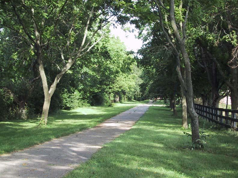
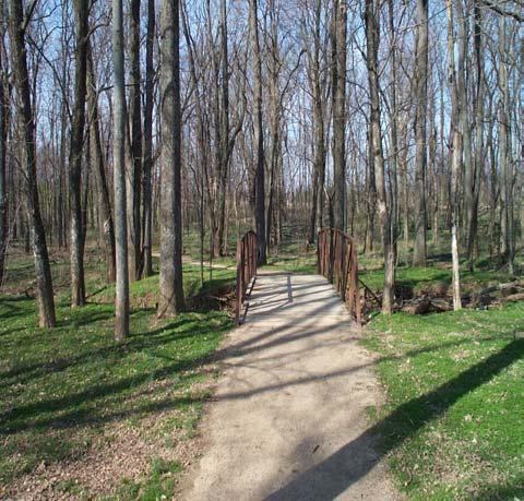
Beaumont Farm Road Trail
ACKNOWLEDGEMENTS ACK-1
GREENWAY COORDINATING COMMITTEE
The Greenway Coordinating Committee is comprised of staff from the numerous divisions within LFUCG who are responsible for greenways. The purpose is to discuss issues and concerns regarding existing and proposed greenways, and to facilitate communication among the various divisions.
Members include:
Keith Lovan, Multi-modal Engineer, Division of Engineering, Committee Chair
Cynthia Deitz, Greenspace Planner, Division of Planning
Jim Rebmann, Environmental Planner, Division of Planning
Robert Bayert, Manager Design Section, Division of Engineering
Alan Morris, Manager New Development Section, Division of Engineering
David Gabbard, Bio-Engineer, Division of Engineering
Albert Miller, Public Service Supervisor, Division of Streets and Roads
Joel Weber, Associate Traffic Engineer, Division of Traffic Engineering
Tim Williams, Administrative Officer, Office of the CAO
Jonathan Johnson, Administrative Assistant Principal, Division of Property Management
Bill Carman, Superintendent of Planning & Design, Division of Parks and Recreation
Michelle Kosieniak, Park Designer, Division of Parks and Recreation
Diane Bonfert, Superintendent of Parks Maintenance, Division of Parks and Recreation
LOCAL SCHOOLS WHO PARTICIPATED IN THE PLANNING PROCESS
Leestown Middle School
Veterans Park Elementary School
Saints Peter and Paul School
LFUCG
Thanks also to Lexington-Fayette Urban County Government (LFUCG) employees Doug Greene, Kenzie Nelson, Kathie Finnell and Kevin Wente for their expertise in Planning, Geographical Information Systems and map production
THE CONSULTANT TEAM
Fuller, Mossbarger, Scott and May Engineers, Inc.
Craig Avery, Principal
John Montgomery, Project Manager
Susan King, GIS Technician
FMSM was founded in 1966 as an engineering firm with an emphasis on geotechnical engineering and related earth sciences. Expanded services offered include water resources, environmental, geographic information systems and information systems. With offices in Lexington, Louisville, Cincinnati and Columbus, FMSM has clients throughout the Ohio and Tennessee Valleys.
Greenways Incorporated
Chuck Flink, President, Project Coordinator
David Josephus, Project Planner
Don Stier, Project Planner
Jon Parsons, CAD/GIS
Greenways Incorporated is a multi-disciplinary environmental planning and landscape architectural firm that provides consulting services to government agencies, for-profit corporations, and nonprofit organizations. The firm specializes in the preservation of open space, design and development of multi-objective greenways and implementation of bicycle and pedestrian facility projects. This award winning company has provided planning and design services to clients in more than 100 communities and 27 states, Canada and Japan.
McIllwain + Associates
Morgan McIllwain, Principal and Project Manager
Denise O’Meara, Project Planner and Landscape Architect
McIllwain + Associates is a landscape architectural and planning firm established in 1987 and based in Lexington, Kentucky. Projects throughout the Midwest range from large scale regional and community planning and design to detailed sitespecific projects. Previous experience with public and private clients includes the planning and design of parks, greenway corridor systems and college and university facilities.
ACK-2 LFUCG GREENWAY MASTER PLAN
Executive Summary
THE NEED FOR A GREENWAY MASTER PLAN
Located in the heart of the Bluegrass region, Lexington-Fayette County is a vital, growing community with a unique physical and cultural identity. Throughout the years, the LexingtonFayette Urban County Government (LFUCG) has explored and put into practice many methods and procedures for coping with growth, while maintaining a good sense of the Bluegrass character. As the Community continues to grow, it is imperative to protect and enhance the natural and cultural resources essential to the quality of life expected by its citizens. Greenways are linear corridors that can provide critical linkage and protection of natural and cultural resources. Issues, such as flooding, transportation, water quality, habitat loss, historic preservation, economic stimulation, recreation and fitness can be addressed and resolved by a multi-objective greenway system. The Greenway Master Plan communicates the importance and need for greenways, and recommends a county-wide system of interconnected greenways that, as green
infrastructure, will become an integral component in the Community’s fabric.
A SUMMARY OF GREENWAY EFFORTS
Environmental protection, floodplain management, establishment of greenways, provision of recreational opportunities and improving access to community resources close to where residents live and work are long-term goals of the Lexington-Fayette Urban County Government (LFUCG). Then Vice Mayor Pam Miller’s 1984 proposal for a Ribbon Park, presented by the Division of Planning, envisioned a system of protected floodplains and habitats that connected neighborhoods and parks with pedestrian walkways. That proposal called for the continuous protection of the West Hickman stream floodway, extending from Meadowbrook Park to the southern Lexington-Fayette County line. That area is now part of Veterans Park, and includes other floodplains that were designated by the LFUCG as future greenway corridors. The proposal illustrated the Urban County Government's innovative vision to connect the County's park, trail, and open space
West Hickman Creek
EXECUTIVE SUMMARY PAGE EX-1
resources while protecting floodplains. This idea evolved into the Greenway Concept, which was included in the 1988 Comprehensive Plan, and guided Community development over the next several years.
Since the introduction of the Greenway Concept in the 1988 Comprehensive Plan, greenways have become an important consideration in land use and development planning. In 1991, the Greenspace Commission was established and approved by ordinance as part of the Department of Housing. Assistance was supplied by the Division of Planning, the Division of Parks and Recreation, the Historic Preservation Office, the Council Office and the Department of Law. With input from the Greenspace Commission, the early 1992 Greenway Plan produced by the Division of Planning focused on greenspace acquisition and maintenance and called for a written and unified greenspace policy. The 1991 Plan was never adopted
The Division of Planning and the Greenspace Commission teamed up again in 1994 to develop the Greenspace Plan. It emphasized the use of linkages, such as streams, roads and railroads, to connect greenspace throughout the urban and rural areas.
In 1998, an ad hoc group representing involved Urban County Government divisions was brought together to form the Greenway Coordinating Committee. The goal of this Committee is a unified policy for greenway planning, development and maintenance. This Greenway Master Plan is the result of their efforts and the initial vision of the 1984 Ribbon Park, as stated in the 1996 Comprehensive Plan:
"The benefits of creating a comprehensive greenspace system go far beyond leisure and aesthetics. The benefits are fundamental to the future economy and quality of the environment of the community and the entire Bluegrass Region. Protecting the remaining Greenspace is not a luxury, it is a necessity for maintaining the quality of life that Bluegrass residents
have always enjoyed and will continue to desire for the future."
Related efforts include the 1998 Comprehensive Parks and Recreation Master Plan, the 2001 Comprehensive Plan Update, the Year 2025 BicyclePedestrian Transportation Plan, as well as urban forestry and stormwater management activities and regulations. In concert with the greenway planning effort, these related planning regulations represent significant strides toward floodplain protection, open space preservation, development of a comprehensive shared use transportation system and improvement of passive recreational opportunities. A more detailed discussion of previous greenway-related planning efforts is found in Appendix B.
The LFUCG has completed several greenway projects, including Veterans Park, Squires Road Trail, Coldstream Park, Beaumont Trail and the Viley/Skycrest Neighborhood Stormwater projects. These and other funded projects demonstrate the Urban County Government's commitment to the development of a community greenway system.
THE GREENWAY PLANNING PROCESS
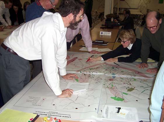
In July 2000, the LFUCG employed a consulting team led by FMSM of Lexington, Kentucky and included Greenways Incorporated of Durham, North Carolina and McIlwain & Associates of Lexington, Kentucky. The consultants worked with the Greenspace Commission, Greenway Coordinating Committee and interested citizens to prepare a Greenway Master Plan. An extensive data collection and inventory of existing physical features and socioeconomic factors was conducted in order to define opportunities and constraints for a countywide greenway system. The consultant team also conducted, in partnership with LFUCG, a series of public workshops held on October 10, 2000, December 11, 2000 and January 29, 2001 to solicit detailed input from the residents of the Urban
PAGE EX-2 LFUCG GREENWAY MASTER PLAN
County. Approximately 270 residents participated in these workshops.
Through these workshops, residents identified a variety of land and water corridors for consideration as potential greenways. The "wish list" compiled from these meetings was examined and scrutinized by the consultant team and LFUCG staff. An optimal system of land and water-based greenway corridors was defined and shared with the public for review and comment. Of particular interest to the residents were the concepts of linkage, preservation of natural, historic and cultural resources, and enhancement of economic values. The result of this discussion was a comprehensive network of both environmental and recreational greenway facilities.
In addition to the public workshops, LFUCG staff also met with key stakeholder groups to present findings and recommendations on the Master Plan and solicit input on the planning process. A listing of these stakeholders may be found in Appendix C An informational presentation was also made to the LFUCG Council.
The Greenway Master Plan is intended to work concomitantly with the goals, policies and provisions of other adopted LFUCG land use and management plans. This Plan is to be adopted by the Urban County Planning Commission as an element of the 2001 Comprehensive Plan Update.
KEY RECOMMENDATIONS
From the greenway master planning process emerged goals and objectives for a county-wide system. The proposed multi-objective Greenway System is comprised of nine conservation greenway corridors, twenty primary greenway trail corridors, a system of secondary and tertiary trails, a system of rural on-road bicycle routes, and three water-based trails. Much of the Plan responds to specific comments that were submitted by residents during the series of public workshops.
The Greenway Master Plan is a framework to provide direction for subsequent implementation strategies. Adoption of the Greenway Master Plan instigates the preparation of regulations that establishes and outlines a Greenway Program.
Conservation Corridors
With the introduction of floodplain management regulations in 2000, LFUCG has essentially prohibited development within the 100-year
floodplains of any stream. This and other restrictions will prevent increased repetitive flood losses associated with new development. However, the effects of previous development are evident throughout Lexington-Fayette County. Repetitive flood losses, channelization, loss of riparian corridors, fragmentation of habitat, and water quality impairment exist throughout the Urban Service Area Although flood losses within the Rural Service Area are of lesser concern, the effects of agricultural runoff and fragmented riparian habitat are evidenced by water quality impairment. In order to address these concerns, the proactive management of the nine major stream corridors is proposed. A crucial component of this effort is the preservation or reestablishment of open space and riparian buffers along each identified stream or river.
The primary focus of the Conservation Greenway Corridors is the preservation of floodplains in rapidly developing areas and restoration of floodplains in older developed sections of the Community. These corridors aid stormwater management by providing needed temporary storage. In addition, the corridors improve water quality, provide wildlife habitat, and provide access to the Community's stream resources.
Greenway Trail System
Greenway trails might be located in conservation corridors or manmade corridors, such as rail-trails, utility corridors, or along urban and rural roadways. The Greenway Trail System radiates from the Downtown hub, linking to major destinations and to counties beyond. These corridors provide a basic
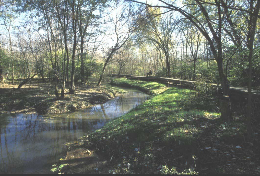
 McConnell Trace
EXECUTIVE SUMMARY PAGE EX-3
framework for alternative transportation, recreational, health, economic and educational opportunities.
As the twenty Primary Greenway Trails provide the main framework of connections throughout the County, the Secondary Greenway Trails provide linkage between primary trails. Secondary trails offer access to and from neighborhoods, and to regional and local destination points not directly accessed by the primary system. Tertiary Greenway Trails form connections at a neighborhood level.
As part of the Greenway Trails System, the Rural Road Bike Routes will provide opportunities for recreation, tourism and alternative transportation. The Rural Road Bike Routes are proposed to link the Urban Service Area to specific destinations within the County, and to potential destinations in surrounding counties.
Trails will utilize both on-road and off-road facilities, and will be designed for shared use as much as possible. It is recommended that, where feasible, equestrian trails be considered. Also included in the Trail System are three water-based trails for boating opportunities on navigable streams.
A PLAN OF ACTION
It is recommended that LFUCG creates a Greenway Program and a Greenway Coordinator position to ensure successful implementation of the Greenway Master Plan. The visionary Plan will require shortterm and long-term efforts by both the public and
private sector Funding for acquisition, planning, construction and maintenance of greenway facilities will come from a variety of federal, state and local sources. Regulations, such as an ordinance and/or manual, should be written to define the roles of key participants; procedures for acquisition and funding; and standards for design, construction, maintenance and operations of greenways.
ORGANIZATION OF THIS REPORT
This document is intended to serve as a working "greenprint" for action. LFUCG staff, consultants and Urban County residents are encouraged to use this report as a resource for implementing the proposed county-wide greenway system. The first chapter of this report identifies the benefits most frequently associated with greenways. Chapter Two is an inventory of existing conditions that provide the foundation for a community greenway system In Chapter Three, the vision, goals and objectives for the greenway system are defined. Chapter Four provides an in-depth description of the entire greenway system, and features individual greenway corridors that comprise the county-wide system. Chapter Five outlines a plan for implementing the greenway system.
As part of the Plan, there is a set of appendices that provides additional supporting information for the comprehensive greenway system. Appendices include definitions, supporting documentation, public input, cost estimates, funding sources, design guidelines, and types of management.
PAGE EX-4 LFUCG GREENWAY MASTER PLAN
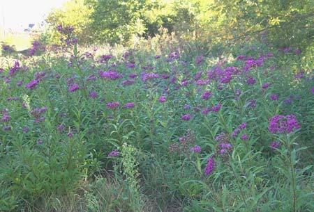
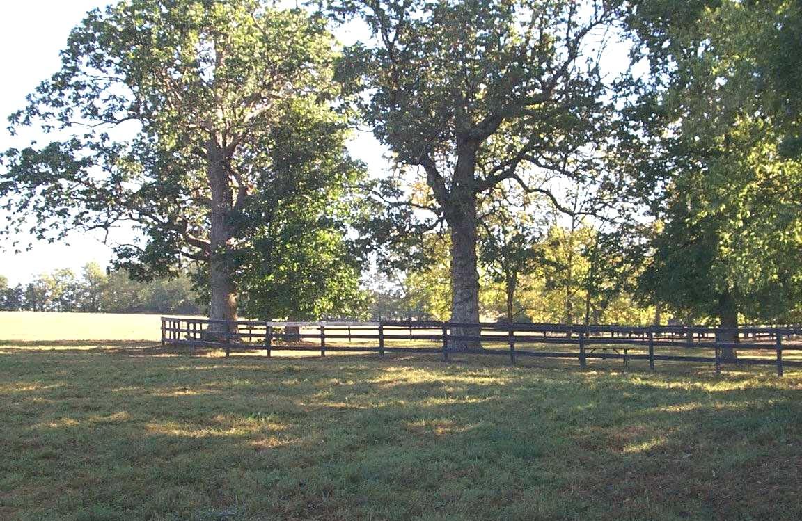
South Elkhorn Creek
Chapter 1: Benefits of Greenways
The benefits of a comprehensive greenway system go far beyond leisure and aesthetics. A multiobjective greenway system for Lexington-Fayette County, Kentucky can address and resolve many community issues that affect the future environmental and economic health of the community. Greenways, as part of the greenspace system, are not luxuries, but necessities for maintaining the quality of life that Bluegrass residents have always enjoyed and desire for the future. Greenways have been implemented by other communities to provide for mitigation of flooding, protection of water quality, conservation of wetlands, protection of wildlife habitat, development of recreation opportunities, provision of alternative transportation and buffering of adjacent land uses. Greenways typically incorporate varying types and intensity of human use, including trails for recreation and alternative transportation. Greenways have also been shown to increase the value of adjacent private properties as an amenity to residential and commercial developments. These and other benefits
of a Lexington-Fayette County greenway network are described in the following pages.
1.1. WATER QUANTITY AND WATER QUALITY BENEFITS
Greenways often preserve wooded open spaces along creeks and streams, which absorb floodwaters and filter pollutants from stormwater. Flooding has historically been a significant problem in many parts of Lexington-Fayette County. In some areas, buildings and other land uses have encroached into flood prone areas. By designating floodplains as greenways, the encroachments can be better managed, and in some cases, replaced with linear open space that serves as an amenity for adjacent residential and commercial property owners, as well as providing important flood water storage capacity.
As a flood control measure, greenway corridors serve as a primary storage zone during periods of heavy rainfall. The protected floodplain can also be
 McConnell Springs
BENEFITS OF GREENWAYS PAGE 1-1
used during non-flood periods for other activities, including recreation and alternative transportation
In conjunction with existing stormwater management policies and programs implemented in the community, greenway lands can be established as development occurs. The savings realized in reduced flood damage claims can offset the expense associated with the establishment of the greenway system. Additionally, for those residents who are required to purchase flood insurance, implementation of a community-wide greenway system in Lexington-Fayette County could result in reduced flood insurance rates.
Greenway corridors also serve to improve the surface water quality of local rivers and creeks. Water quality impairment, in many cases, is due to the effects of urban development or agricultural practices. Stream channelization, erosion, surface runoff and tree cover removal result in adverse impacts on water chemistry, riparian vegetation and wildlife habitat.
The floodplain forests and wetlands contained within greenway corridors filter pollutants from stormwater. Removal of these pollutants is impaired if stormwater is collected in pipes and discharged directly into local streams and rivers. Improving surface water quality in streams through preservation of the floodplain and wetland areas not only benefits local residents, but also numerous forms of wildlife that depend on streams for their habitat.
as dust and pollen. They absorb carbon dioxide, whose excessive buildup in the atmosphere may cause long-term increases in the earth’s temperature. Greenway corridors can serve as viable habitat for many species of plants and wildlife. They provide essential food and water sources, shelter, nesting sites and protection for birds and animals. Additionally, greenway corridors in LexingtonFayette County could become primary migratory corridors for terrestrial wildlife, serving to help maintain the integrity of many plant and animal gene pools. Some wildlife biologists have extolled greenways as future "gene-ways" and have determined that migration routes that often follow river and stream corridors are essential to maintaining healthy wildlife populations. Greenways in Lexington-Fayette County can be targeted as primary habitats for many species of plants and animals. Programs can be established, not only to protect the valuable existing forested and wetland areas of the community, but also to reclaim and restore streams to support higher quality habitat.
1.3. TRANSPORTATION AND AIR QUALITY BENEFITS
In past years, most American communities have grown in a sprawling, suburban form as a result of dependence upon the automobile as the sole means of transportation. This dependence has resulted in traffic congestion, air pollution, and a disconnection with the community that a pedestrian-based system offered. Americans have abandoned some traditional forms of transportation (such as biking and walking), and have been slow to improve other forms of transportation (such as bicycle and pedestrian networks and public transit). In order to provide relief from congested streets and highways in Lexington-Fayette County, future transportation planning and development should concentrate on providing local residents a choice in different modes of travel. For alternative transportation plans to be successful, they must offer facilities with the same benefits and appeal that transportation planners strive to achieve in conventional road design: efficiency, safety, comfort, reliability, flexibility and an enjoyable traveling experience
1.2. PLANT AND ANIMAL HABITAT BENEFITS
Forests, woodlands and riparian zones are some of the most effective tools known to protect and maintain the natural environment. Trees clean the air by removing noxious gases and particulates, such
Greenway corridors throughout Lexington-Fayette County can serve as extensions of the road network, offering realistic and viable connections between origins and destinations, such as work, schools, libraries, parks, shopping areas and tourist
PAGE 1-2 LFUCG GREENWAY MASTER PLAN
attractions. Greenway facilities can also be integrated into the mass transportation system by connecting at bus stops and using the Bike 'n Ride program. Greenway-based bikeways and walkways are most effective for certain travel distances. National surveys by the Federal Highway Administration have shown that Americans are willing to walk as far as two miles to a destination, and bike as far as five miles. It is easily conceivable that destinations can be linked to multiple origins throughout the community with a combination of off-road trails and on-road bicycle and pedestrian facilities.
caused or worsened by obesity. Soon obesity will overtake tobacco as the chief cause of preventable deaths. The report recommends that schools, communities and industry work towards reversing this trend.
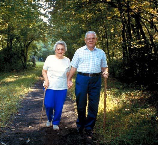
Greenways enable more people to walk or bike, thus improving the health of residents. Studies have shown that as little as 30 minutes a day of moderateintensity exercise (such as bicycling, walking, in-line skating or horseback riding) can significantly improve a person's mental health by reducing stress and depression. It also enhances physical health by reducing the risk of coronary heart disease, stroke, certain types of cancer, high blood pressure, diabetes, osteoporosis and obesity. Exercise can also be an effective tool for battling the aging process and aids in the rehabilitation of injury and disease
Providing opportunities for outdoor activities near hospitals, schools, and close to where people live and work is an important component of promoting healthy lifestyles for Lexington-Fayette County residents. Trail systems within greenways and parks can provide opportunities for primary recreation, physical rehabilitation and fitness.
Greenways provide bicyclists and walkers a viable, safe and pleasurable alternative to vehicular traffic. Since motorized vehicles are major sources of urban air pollution, offering alternative transportation choices through greenways would reduce automobile use, traffic congestion and automobile emissions. Also, many greenways are dominated by trees, which provide one of the most effective means of improving air quality. Though technology has and will continue to reduce vehicle pollution, there are more vehicles on the road, and thus more miles driven than ever before. It is likely that this trend will continue.
1.4. HEALTH AND RECREATION BENEFITS
In 1987, the President's Commission on Americans Outdoors released a report that cited limited access to outdoor resources as a growing problem for quality of life throughout the nation. The Commission recommended that a national system of greenways could provide all Americans with access to linear open space resources. In December of 2001, the Surgeon General declared that some 300,000 Americans die each year from illnesses
1.5. SAFETY BENEFITS
As an alternative transportation corridor, a greenway is designed to provide a safer and more user-friendly means of travel for pedestrian/bicycle users than is normally found in standard roadway design. Safety and accessibility are important issues in the planning, design and management of greenways. Following federal, state and local standards for public safety and use are part of greenway development. It has also been proven in statistics and reports from numerous communities across the nation that greenways typically are safe from criminal activity.
 Source: Pedestrian and Bicycle Information Center
BENEFITS OF GREENWAYS PAGE 1-3
1.6. CULTURAL AND HISTORIC BENEFITS
Greenways can enhance the culture and protect many of the historic resources in Lexington-Fayette County. Successful greenway projects across the United States have served as new "main streets," where neighbors meet, children play, and community groups gather to celebrate. For cities large and small, greenways have become a cultural asset and focal point for community activities. Some communities sponsor "greenway days" to celebrate the outdoors and local traditions. Various walking and running events are also held on greenways to support charities or extend traditional sporting events. Many civic groups adopt segments of greenways for maintenance or environmental awareness programs. Some greenways, like San Antonio's Riverwalk, are the focal point not only for community activities, but also for economic development.
The richness and diversity of Lexington's historic resources are represented by the listings on the National Register of Historic Places and other locally significant sites and historic districts. The interpretation of historic and archaeological sites along greenways can serve to increase the awareness and appreciation of Lexington-Fayette County's rich physical and cultural heritage. Greenways can also be a vehicle to provide controlled public access to important cultural sites in a manner that promotes preservation and enhances interpretive opportunities.
1.7. ECONOMIC BENEFITS
Case studies performed by the U.S. Department of Transportation have shown that trails often increase the property value of adjacent real estate, provide tourist income for communities, spur the development of new businesses, increase sales tax revenues and create new jobs to serve trail users.
Research has shown that greenways can raise the value of adjacent properties by as much as 5 to 20 percent. For example, in a new residential development in the Gleneagles and McConnell’s Trace Subdivisions, new lots situated on greenways were priced higher and sold faster than comparable lots off of the greenway. Many home-buyers and corporations are looking for real estate that provides direct access to public and private greenway systems. Greenways are viewed as amenities by commercial and office park developers as well, who in turn, are realizing higher rental values and profits. American
LIVES, a real estate research firm, completed a national study of the top reasons that people choose their new home. Walking and biking paths are viewed as extremely important to 74% of buyers nationally: outweighed only by “low traffic and quiet streets” and “lots of natural, open space”.
Tourism is currently ranked as the number one economic sector in the world. In several states, regions, and localities throughout the nation, greenways have been specifically created to capture the tourism potential of a regional landscape or cultural destination. The State of Missouri, for example, spent $6 million to create the regional, 200mile KATY Trail State Park, which in its first full year of operation, generated travel and tourism dollars exceeding the state’s expenses.
Other economic benefits to the community are realized through savings in public services and infrastructure. Greenways facilitate in promoting a healthy population, which in turn, can lead to reduced health care costs and enhanced productivity in the work place. Additionally, greenways can save local tax dollars by decreasing infrastructure costs associated with vehicular transportation (road construction, maintenance, and air quality), stormwater management (flood control) and environmental degradation (water quality, displacement of wildlife and revegetation costs).
Greenways also enhance stewardship by utilizing land that would have been otherwise categorized as vacant or considered wasteland. See Appendix D for further discussion on the economic benefits of greenways.
PAGE 1-4 LFUCG GREENWAY MASTER PLAN
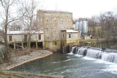
Weisenberger Mill
Chapter 2: Inventory of Existing Conditions
2.1. TOPOGRAPHY
Lexington-Fayette County is known worldwide for its scenic landscapes. Most of Lexington-Fayette County’s 280 square miles is situated in the Inner Bluegrass region of the Interior Low Plateau physiographic province. The area is characterized by gently rolling hills, fertile soils and slow moving streams. The other region, the Hills of the Bluegrass, covers only a small area in the southeastern part of the County, and includes the tributaries that are adjacent to the Kentucky River. The landscape in this area is characterized by highly dissected, long and narrow ridge tops and moderately steep to very steep hillsides. The Palisades at the River are limestone cliffs of 200 feet or greater. There is little elevation change over most of the County, except in the Hills of the Bluegrass, which has a fluctuation of some 400 feet.
Lexington is unique for a city of its size, in that it is not situated on a major river. The Urban County does have five hundred sixty (560) miles of creeks, which are tributaries that drain into the Kentucky River located at the southeast border of the County. Lexington-Fayette County has nine watersheds,
seven of which are located within the Urban Service Area. Watershed management is particularly critical for the seven major streams whose headwaters originate in the County1. (See Watershed Map on page 2-7.)
2.2. LAND USE
The initial inhabitants of Lexington-Fayette County were Native Americans who raised crops and hunted the native buffalo and deer. Later, European settlers were also attracted to Central Kentucky because of the fertile land, gently rolling landscape, hardwood forests, and slow moving streams. In 1775, William McConnell started a settlement on Town Branch, which became the City of Lexington.
In 1781, the new town's first plat was ratified by the Virginia Legislature. The plat covered 710 acres, and the layout was dictated by the orientation of Town Branch, the community’s main water source. Streets were established on a grid pattern that ran parallel to the stream. Early planners recognized the importance of public open space and water quality; the Town Commons (Vine Street today) was used
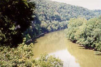 Kentucky River
EXISTING CONDITIONS PAGE 2-1
for meetings, markets, recreation and water supply protection
The town’s layout and subsequent direction of growth were largely dictated by topography. Lexington was settled on a high spot, with all streams that originate in Fayette County draining away from the downtown area. A divide southeast of town originally acted as a barrier to development. Today, watersheds continue to be a determining factor in the location of new development, with regard to the feasibility of sanitary sewer service. The landscape has and will continue to influence urban planning.
Soon after its founding, Lexington became a major economic and cultural hub for the new state. Major southeast and northeast routes brought in new residents to farm or work in the thriving industrial businesses. The town was also a major dispatching point for west bound travelers. The present day radial pattern of arterial streets is a result of Lexington’s importance as a regional link to the surrounding settlements.
Besides Lexington, other early Fayette County settlements at the end of the eighteenth century included Cross Roads (Athens), Cleveland (Clays Ferry) and Spearsville (Spears). Numerous other small communities were formed (most of them after the Civil War) for African-American housing. Fifteen of these early settlements are now classified as rural settlements. (See Key Land Use Locations Map on page 2-20.) Two of the early settlements, Bracktown and Cadentown, are still viable communities that are now within the Urban Service Area of Lexington.
Gradual residential growth extended the city’s urbanized area in all directions well into the twentieth century. Population shifts to suburban locations after World War II placed an increased demand on public services and infrastructure, including transportation, stormwater management, sewage treatment and recreation. In the 1965 Historical Development of Lexington and Fayette County, issues arising from the influence of the automobile were discussed, including some that are still relevant today, such as the lack of pedestrianoriented commercial centers, lack of good design, destruction of aesthetic qualities of the community and uncontrolled access to major roads. The report concluded that with Lexington’s continued presence as the region’s shopping and cultural center, the City
should make every effort to build an urban environment that reflects the community’s elevated status in terms of educational and cultural achievement. “The development of these cultural and aesthetic public improvements identify the ‘way of life’ of the citizens of the community and, to a large extent, enhance the ‘livability’ of the city.”2
Historically, land use plans have stressed the importance of planning for new development in an orderly fashion that protects natural resources and provides open space opportunities. In 1958, the Community established the Urban Service Area (USA) in an effort to preserve the rural atmosphere and heritage of the area by protecting the farmland surrounding the urban area.
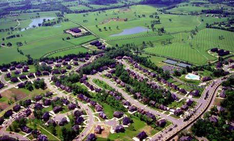
In 1960, the Urban Service Area contained 24 square miles; by 2000, it had expanded to 85 square miles. Between 1995 and 2000, 85% of the Urban County’s growth was in the south and east quadrants, with 5,400 acres added to the USA in 1996, and another 210 acres in 1998.
Urban Edge
Lexington-Fayette County’s growth throughout the years has been primarily on good soils with adequate drainage and gentle slopes. As the Urban Service Area expands, it is important to note that many of the developing areas have severe environmental problems. Physical constraints will be further aggravated by required higher density development and smaller lot sizes, so that land use may need to be redistributed according to site conditions. Higher densities, steep slopes, thin soils and floodplains will require that greenspace and floodplain management become integral components of planning. Future demands for development will have to be monitored for the carrying capacity of the land in order to maximize usage while protecting the environment, providing public services and maintaining/improving quality of life.3
PAGE 2-2 LFUCG GREENWAY MASTER PLAN
2.3. POPULATION
The populations of Lexington-Fayette County and the Census Bureau's Metropolitan Statistical Area have increased steadily over the past four decades. The population of Lexington-Fayette County basically doubled from 131,906 in 1960 to 260,512 in 2000, with an increase of 15.6% for the last decade. In the seven-county Metropolitan Statistical Area (MSA), the population has increased from 405,936 in 1990 to 479,198 in 2000, an 18% increase for the area. Fayette County, as a percentage of the MSA population, has declined from 56.3% in 1970 to 54.4% in 2000. This trend is expected to continue, as counties surrounding Fayette will grow at a faster rate
This trend will also have an important impact on land use planning decisions, especially with regard to accessibility of transportation, recreation, housing, healthcare and other services.
The distribution of urban to rural growth has also dramatically changed. In 1960, 83.6% of the urban population lived inside New Circle Road. In 2000, that had dropped to 43%. Areas of the largest increase were in the south and east quadrants. During the 1990s, there was a rapid increase in the rural population outside of the Urban Service Area The Rural Service Area Land Management Plan was adopted to reverse that trend.
Throughout the 1990s, forecasts from various sources underestimated the 2000 population. Based on the preliminary 2000 Census data, projections used in the 2001 Comprehensive Plan Update estimate the future population of Lexington-Fayette County to continue at the current 15% decennial rate, for an increase to 300,000 in 2020. As the population continues to grow and development pressure increases, the need for conservation of undeveloped lands, such as greenway corridors, will also continue to increase. With growing populations anticipated both within Lexington-Fayette County and each adjacent county, greenway planning must consider the service needs of both the urban and rural connector routes to create a comprehensive regional system.4
2.4. NATURAL RESOURCES Soils
Lexington-Fayette County is predominately underlain by the Lexington Limestone Formation
The limestone bedrock is characterized by karst
formations, such as caves, underground drainage, sinkholes, large springs and groundwater seeps. Soils in the County are derived primarily from the weathered bedrock geology They can be generally described as high in natural fertility, have clayey subsoil, deep and well drained to thin soil cover. The current soil survey for Lexington-Fayette County is from 1968. (The Natural Resource Conservation Service is working with LFUCG to develop an updated survey.) Based on the 1968 survey, 68% of the County is in prime farmland. The predominately silty loam soils have a naturally high phosphorous content. While advantageous from an agricultural standpoint, this element makes management efforts along streams more critical from a water quality perspective. There are two hydric soils, which make up 3.7% of the total County. Hydric, or waterlogged soils, can generally be found only in the floodplain areas around rivers, creeks, and groundwater seeps.5
Floodplains
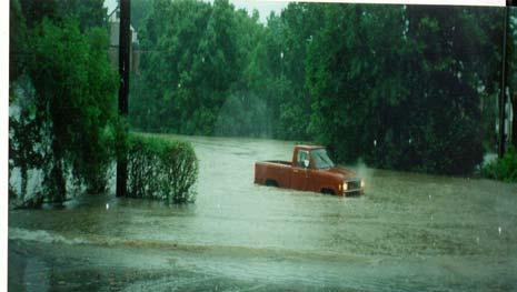
Small stream terraces constitute the majority of floodplains in Lexington-Fayette County, with a small percentage of riverine floodplain along the Kentucky River. There are over 12,000 acres of floodplain in the County, with approximately 30% of those floodplains within the Urban Service Area.
As Lexington developed, streams in or near Downtown were channeled through underground vaults. Urban Lexington does not experience widespread flooding from any one stream; however, numerous portions of streams overflow, causing localized problems. Flooding is exacerbated by urban encroachment into the floodplains, runoff from impervious surfaces and storm sewer problems. These conditions cause Lexington to experience flood damage from frequent storm events of low rainfall amounts, especially in the older parts of the City.6
EXISTING CONDITIONS PAGE 2-3
Glendover Neighborhood
A 1997 Reconnaissance Report by the Army Corps of Engineers identified flood prone areas around Wolf Run, Vaughns Branch, Big Elm, Cane Run, Town Branch, West Hickman Creek, South Elkhorn Creek, and North Elkhorn Creek. Most of these areas are narrow floodplains adjacent to residential areas, which can result in frequent basement flooding. To mitigate the impact of flood damage on the Community, the LFUCG has recognized the importance of protecting floodplains for their floodwater absorbing capabilities. Home buy-out programs and the 2001 Stormwater Manual's ban on new development in floodplains are two methods used to abate flood damage. Greenways will also be an important tool in establishing Urban-County ownership and protection of flood prone areas.
Royal Spring Aquifer in Fayette and Scott Counties. The two Counties have adopted the Royal Spring Wellhead Protection Plan to protect the groundwater, which is the source of drinking water for Scott County residents. The Aquifer is highly susceptible to pollution because of potential contamination through the region’s sinkholes, underground streams and caverns.7
Lexington-Fayette County monitors some of its streams for water quality. The Federal Clean Water Act requires each state to develop a Report to Congress (305b Report) on water quality every two years. Streams are assessed for their ability to support general aquatic life, fishing, swimming and drinking water. The assessed streams are rated as supportive, partially supportive and non-supportive. Not all streams have been assessed.8 (See Stream Quality Map on page 2-8.)
Water quality has historically been compromised in the rural parts of the County because of the practice of allowing livestock to wade in streams and ponds. This caused stream banks to erode and caused water contamination with organic waste. New clean water regulations should help with this problem.
Montavesta Neighborhood Water Quality
Historically, streams have provided drinking water, food and recreation to the area inhabitants. Ironically, the river and streams that so significantly aided in the area's development now suffer from the effects of that development. Urbanization has a two-fold effect on water sources: the first effect is increasing runoff and flooding; the second is degrading water quality. In order to provide better protection and best management practices to streams throughout the Community, a watershed management approach has evolved over the past few years in the land planning process. Efforts to achieve improved water quality include the adoption of the Rural Land Management Plan, Reforest the Bluegrass Program and the adoption of the Stormwater Manual. The adoption of the Greenway Master Plan will further enhance water resource protection.
One area of particular concern is the upper portion of Cane Run, which drains a portion of the Urban Service Area and serves as the recharge area for the
Lexington-Fayette County receives its water supply from the Kentucky River and Jacobson Reservoir. Recommendations from the Fayette County 20-Year Comprehensive Water Supply Plan include protection of the intake location on the river for at least one mile upstream, and a watershed protection area around the reservoir. The Plan also recommends protection measures for sections of Boone, Elk Lick and Raven Run Creeks that may qualify for designation as special use waters, such as Outstanding National Resource Water, State Wild River, Federal Wild River or Federal Scenic River.
Wetlands
Wetlands come in several forms, depending on the surrounding topography and hydrology of the land. Typically, wetlands occur in low-lying floodplain areas, which are adjacent to stream corridors. Nonriparian wetlands are the result of springs. Wetlands provide habitat for wildlife and are important in filtering pollutants and absorbing floodwaters.
There are no extensive wetland areas found in Lexington-Fayette County because of the karst geology. Small isolated wetlands are mostly found adjacent to the Kentucky River and streams.
PAGE 2-4 LFUCG GREENWAY MASTER PLAN
Lexington-Fayette County is unique because it contains numerous wetland springs in addition to typical ones found in floodplains.9
Vegetation
Vegetation is a critically important feature of both the natural landscape and the built environment. Vegetation filters pollutants from the air and surface waters, moderates local climates, offers relief from exposure to sun, wind and rain, and provides habitat for numerous species of wildlife. Lexington-Fayette County once had unique savanna-like vegetation with an open tree canopy. Original species included bur oak, blue ash, chinquapin oak, Shumard oak, white oak, white ash, hackberry, sugar maple, black walnut, black cherry, coffee tree, American elm, shagbark hickory, and bitternut hickory. The early groundcover consisted of grasses, white clover, buffalo grass and native cane. There were dense stands of hardwood forests in and around streams and the Kentucky River.10
When settlers arrived, much of the open savanna forests were cleared for homesteads and agricultural purposes. The settlers brought familiar plants with them, introducing both agricultural and ornamental species. While some remnant savanna areas remain, the Lexington-Fayette County landmass outside of the Urban Service Area now consists primarily of open fields and pastures. Remaining forested areas, typically located along fence rows or steep slopes, consist mainly of hardwoods such as oak, silver maple, green ash, hackberry, mulberry, elm and hickory.11
According to the U.S. Forest Service, LexingtonFayette County has 22 percent tree cover, which
ranks in the bottom four of all counties statewide 12 From 1998 aerial photography, there were approximately 17,700 acres county-wide of significant tree stands (defined as one-quarter acre or greater), of which 4,115 acres were inside the Urban Service Area. The largest concentration of tree stands is in the southeast portion of the County, in and around Raven Run Nature Sanctuary and the Kentucky River tributaries. An important stand of savanna-woodland forest remains at the Kentucky Horse Park. Stands within the Urban Service Area are at McConnell Springs, Stonewall School Woods, Shady Lane Woods, Shillito Park, Hillcrest Cemetery and Lexington Cemetery. Also, tree stands were detected on the aerial most prominently along portions of the North Elkhorn Creek, South Elkhorn Creek and Town Branch.
In the last four years, 100,000 trees have been planted by approximately 4,000 volunteers as part of the 'Reforest the Bluegrass' program.
Riparian areas of Coldstream and tributaries of Town Branch and the South Elkhorn were planted. Trees are also planted by efforts through the Corridors Committee's enhancement projects.13
According to the Kentucky State Nature Preserves Commission, Lexington-Fayette County does not have any exemplary natural communities. The following number of plant species have been noted to occur in the County that are on the state listing, including
• 1 historic plant species
• 10 threatened plant species
• 4 plant species of special concern
• 3 endangered plant species
Masterson Station Woodland Savannah
EXISTING CONDITIONS PAGE 2-5
Of these state listings, one species, the Running Buffalo Clover, is also on the federal endangered list. Another species, the Lesquereux’s bladderpod is a federal candidate.14
Wildlife
There are two broad categories of wildlife that are of concern to this planning effort: "edge" wildlife species and "interior" woodland wildlife species. Most species of wildlife that inhabit urban areas are known as edge species. These mammals, birds, amphibians and insects have adapted to urbanized landscapes and have developed harmonious relationships with urban residents. Edge environments exist in many locations throughout Lexington-Fayette County. The Greenway Master Plan is primarily concerned with those edge environments that may exist within the floodplains of the Urban County. These resource areas are arguably the most valuable for wildlife in that they provide a food source, water and shelter. Approximately 80 percent of all wildlife is dependent on riparian corridors for survival. Therefore, the protection of floodplains is crucial to sustaining a diversity of wildlife in Lexington-Fayette County.15
Besides habitat, riparian, railroad and utility corridors provide a means for migration required by many mammals. Each species has unique territorial requirements, and that territory can be enlarged by linking islands of urban wildlife habitats with linear corridors. By connecting isolated patches of habitats, populations are better controlled, and passage is safer from one area to another. Space for escape and foraging is greatly increased. The wider the corridor, the more self-sustaining and balanced the ecosystem becomes16.
The Kentucky State Nature Preserves Commission reports the following number of animal species of special importance to the state:
One of the Kentucky listed insects, the American Burying Beetle, and one mammal, the Indiana Bat, are federally listed as endangered species.
Habitats for interior and edge species exist in various forms throughout the area. However, the significant natural undisturbed areas for interior species are located in southern Lexington-Fayette County. This area includes the 274 acres in Raven Run Nature Sanctuary and State Nature Area, and the 287 acres in the Floracliff State Nature Preserve near the Kentucky River17
Environmentally Sensitive and Geologic Hazard Areas
Several areas throughout the County have been designated as environmentally sensitive because they have characteristics that could be problematic if developed. These areas include floodplains, slopes over 15%, sinkholes, significant tree stands, and other general environmental areas. Geologic hazard areas have environmental problems that are so numerous that any development would pose a serious threat to the health, safety or welfare of the Community. These include areas of excessive floodplains, areas with potential of collapse, clusters of sinkholes, or sinkholes that have been used for waste and refuse.18 (See Environmentally Sensitive Areas Map on page 2-9.)
Threatened Special Concern Endangered Insect 1 1 Amphibian 2 Bird 2 7 Mammal 1 1 PAGE 2-6 LFUCG GREENWAY MASTER PLAN
Water shed Ar ea: 56, 129 ac Flo odpl ain Area: 4,284 ac. Main Chann el L en gth: 40 4 mi % U rban Area: 12% % I mpervio us Area: 4% Nor th E lkhor n Water shed Ar ea: 18, 201 ac Flo odpl ain Area: 1,176 ac Main Channel Len gth: 14 7 mi % U rban Area: 40% % I mpervio us Area: 12% Cane Run Water shed Ar ea: 17, 263 ac Flo odpl ain Area: 871 ac Main Channel Length: 22 9 mi % U rban Area: 49% % I mpervio us Area: 18% Tow n Branch Water shed Ar ea: 24, 185 ac Flo odpl ain Area: 1,424 ac Main Channel Length: 23.7 mi % U rban Area: 28% % I mpervio us Area: 10% South Elkhor n Water shed Ar ea: 6, 494 ac Flo odpl ain Area: 385 ac Main Chann el L en gth: 7 0 mi % U rban Area: 93% % I mpervio us Area: 33% Wolf Run Water shed Ar ea: 11, 485 ac Flo odpl ain Area: 657 ac Main Channel Length: 9 7 mi % U rban Area: 100% % I mpervio us Area: 30% West Hickman Water shed Ar ea: 17, 420 ac Flo odpl ain Area: 1,168 ac. Main Chann el L en gth: 12 0 mi % U rban Area: 42% % I mpervio us Area: 9% East Hickman Water shed Ar ea: 19, 796 ac Flo odpl ain Area: 1,070 ac Main Channel Len gth: 22 4 mi % U rban Area: 0% % I mpervio us Area: 3% Boone Creek Water shed Ar ea: 11, 758 ac Flo odpl ain Area: 598 ac Main Chann el L en gth: 16 6 mi % U rban Area: 0% % I mpervio us Area: 2% Kentucky River OLDFRANKFORTPIKE VER SAILL ES RD LEESTOWNRD GEORGETOWNRD N E W T O W N P K E RUSSELL CAVERD PARISPIKE WIN CHESTER R D RICHMONDRD TATESCREEK RD NICHOLASVILLE RD HARRODSBURGRD NEWCIRCLERD MANOWARBLVD ! " n $ ! " o $ ! " n $ ! " o $ LFUCG Gre enway Ma ster Pl an Wat ersheds 20 2 Miles N E W S Scott Woodford Jessamine Bourbon Mad i son Clark Wat ershed Kentucky River Boone Creek Sou th Elkhorn North E lkhorn West Hickm an East Hickman Cane Run Town Branch Wolf R un St rea m Major R oad EXISTING CONDITIONS PAGE 2-7
LFUCG Gre enway Ma ster Pl an St re am Qu alit y N E W S Scott Wood ford Jessamine Madison Clark Bourbon LEESTOWNRD OLDFRANKFORTPIKE VERSAILLES RD HARRODSBURGRD NICHOLASVILLE RD TATESCREEKRD RICHMONDRD WINCHESTER RD PARISPIKE RUSSELLCAVERD N E W T O W N P I KE NEWCIRCLERD MANOWARBLVD ! " n $ ! " o $ ! " n $ ! " o $ Town Branch W o lf Run South Elkhorn Cane Run North Elkhorn Creek Creek West Hickman Creek KentuckyRiver Boone Cre e k BaughmanFork Avon Branch East Hickman C r ee k Stream Classif ica tion Not Supporti ng Design ated Use Par tiall y Suppo rti ng Des ign ate d Use Ful ly Su pporting D esig nated U se Unkno wn or Not A sses sed Watershed Bou ndary Major Road Urban Ser vice Boundar y 202 Miles PAGE 2-8 LFUCG GREENWAY MASTER PLAN
RAVEN RUN NATUR E SANC TUARY FLO RACL IFF NATUR E SACN TUARY LEESTOWNRD OLDFRANKFORTPIKE VERSAILLES RD HARRODSBURGRD NICHOLASVILLE RD TATES CREEK RD RICHMONDRD WIN CHEST ER R D PARISPIKE RUSSELLCAVE RD N E W T O W N P I K E GEORGETOWNRD ROYAL SPRINGS AQ UIFER MANOWARBLVD NEWCIRCLERD ! " n $ ! " o $ ! " n $ ! " o $ LFUCG Greenway Ma ster Pl an Envir onme ntally Se nsiti ve A re as Env iron me nta lly Sen si tiv e Ar ea s Cont ain : 100 Year Fl oo dplai n Sink ho les Significant Tree St ands Wetlands Geolog ic Hazards St reams # # # # # # 20 2 Miles N E W S Scott Bourbon Woo dford Jessamine Madison Clark Sensit ive Area St rea m Major R oad Urban Service Area EXISTING CONDITIONS PAGE 2-9
2.5. TRANSPORTATION RESOURCES Streets and Roads
As in most metropolitan areas in the United States, the dominant system of transportation in the Lexington area is the highway system. LexingtonFayette County is Central Kentucky's largest urbanized area, and serves as the leading market and trade center for the region. It also provides employment, education, health-care, and many other services and opportunities to Central Kentuckians. Transportation planning is conducted by the Lexington Area Metropolitan Planning Organization (MPO), which is comprised of Lexington-Fayette County and Jessamine County to the south.
The urbanized area's highway system is a radial pattern with several principal arterial and collector roads radiating outward from Downtown to the rest of the County and beyond to the surrounding communities. New Circle Road is a circumferential arterial that encompasses a large portion of the urbanized area. The northeast portion is non-limited access with numerous signals and access points. The rest is a limited access highway.
Man o’ War Boulevard parallels New Circle Road on its southern half and serves a large area of mostly residential land use. In the north, Citation Boulevard is completed from the Norfolk Southern Railroad, across Georgetown Road (US 25), to Newtown Pike (KY 922). This circumferential arterial will serve large areas of industrial land use. A network of minor arterials, major and minor collectors, and local streets make up the remainder of the system and provide access to the various land uses. Circumferential routes, which connect the radial arterials, are extremely important for the efficient distribution of traffic in this radial system. The Transportation System is shown on the Transportation Map on page 2-15.
Public Transportation
The Lexington Transit Authority, (LexTran) is Lexington's public transportation system. LexTran maintains a fleet of 46 busses and operates eight bus routes servicing the major areas around Lexington. As part of LexTran's Bike 'n Ride program, every bus in their fleet has been equipped with bike racks. With ridership at an all-time high, the addition of greenway connections to public transit stops will help develop an alternative transportation system in
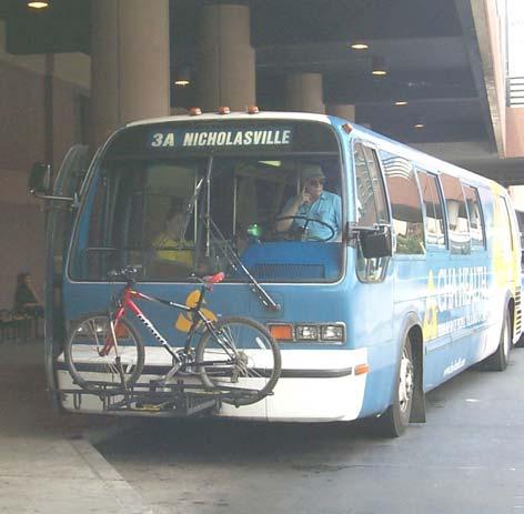
Lexington-Fayette County and will encourage further system use.19
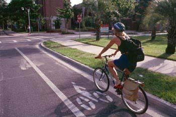
Bicycle System
Local and national studies indicate a willingness to use the bicycle for transportation. In a 1991 Harris Poll conducted for Bicycling Magazine, 21% of the 1,255 adults surveyed said they would sometimes commute to work by bike if there were safe bike lanes, showers and bike storage facilities at the work place, and financial incentives from their employer. Given these results, it follows that improving the general bicycle-riding environment would spur an increase in the number of utilitarian bicycle trips.
Designated bicycle facilities in the MPO area are limited and discontinuous. There are short sections of bicycle lanes on Rose Street, Waller Avenue, Bryan Station, Euclid Avenue, and Alumni Drive, as well as a signed route that follows portions of Bellefonte Drive, Rosemont Garden and other lowtraffic streets. At the same time, a fair amount of bicycle travel is currently being accommodated on the existing street system without the benefit of facilities designated especially for bicycles. Any change in the roadway system should evaluate the benefits of accommodating bicyclists. Unfortunately, urban development is forcing bicyclists onto the rural roads; in general, these roads throughout the Rural Service Area are narrow, rolling and winding. In addition, many roads lack wide shoulders to accommodate bike lanes.
LexTran Transit Center
PAGE 2-10 LFUCG GREENWAY MASTER PLAN
Organizations like the Bluegrass Cycling Club have had to move trailheads and routes in response to increased development and increasing traffic.
Portions of Ironworks Pike, Newtown Pike and Mount Horeb in the north quadrant, and AthensBoonesboro Road, Cleveland Road, Old Richmond Road and Jacks Creek Pike in the southern part of the County, are on the statewide bicycle route called the Bluegrass Tour.
While the bicycle has the right to travel on any street in the County (except limited access highways), much improvement is needed to create an environment where bicycling is a viable commuter option and pleasant experience for the recreational rider.
The MPO and Bicycle/Pedestrian Advisory Committee have addressed bicycle and pedestrian issues in the Year 2025 Transportation Plan. The Plan Recommendations recognize the greenway system as a very important component in the transportation goal of providing an alternative transportation system. Specific bike and pedestrian treatments are recommended; and as future road improvement projects are designed, bike and pedestrian facilities will be considered as part of these projects.
According to the 1999 AASHTO standards, there are 5 classifications of bikeway facilities.20 They are as follows:
1. Shared Roadways (no bikeway designation; includes wide shoulders, wide curb lanes)
2. Signed Shared Roadways (bike route designation)
3. Bike Lanes
4. Shared Use Paths (off-road trails)
5. Others (freeways and sidewalks where necessary)
Lexington-Fayette Urban County has the following bikeway facilities, either existing or proposed as a component of road improvement projects:
• 16 miles of existing shared roadways and 4 miles proposed
• 4 miles of signed shared roadways and none proposed
• 3 miles of bike lanes and 13 miles proposed
• 6 miles of shared use paths and funding is in place for an additional 17 miles.
As farms are developed into residential developments, the numerous farm roads provide an excellent opportunity for trails throughout the new neighborhoods. The Beaumont Trail system is based on old farm roads. Another opportunity arises when existing roads are realigned. The old road section can be adapted to a shared use facility, such as the conversion of Squires Road to Squires Road Trail.
Pedestrian System
For the most part, the urban and suburban areas of Lexington have existing sidewalk facilities for pedestrian use. However, there are newer subdivisions and small sections of older, developed areas without adequate sidewalks. A partially completed sidewalk survey by the Division of Engineering details the locations of these deficiencies. A thorough analysis of the data needs to be completed. Walking trails are in many parks (see Parks and Recreation on page 2-16), and several shared use paths exist (see Bicycle System, previous section). However, throughout the Community there are areas with insufficient linkages between residential neighborhoods, shopping, recreational, and employment areas.
Downtown Lexington serves not only as a major destination and origin, but is the central hub for outlying links. A successful linkage system will utilize Downtown as a switching point for
Beaumont Trail
EXISTING CONDITIONS PAGE 2-11
cross-town connections, taking advantage of the existing sidewalks and park system. The system will facilitate the use of pedestrian and bike facilities, resulting in an increase in participation
Pedestrian-friendly sidewalks are important in developing an alternative transportation system. The LFUCG already has standards in place for street and sidewalk design to ensure that new construction will meet standards and enhance the existing trail and multi-use transportation system. In efforts to help revitalize Downtown, the LFUCG has expressed interest in utilizing trails to encourage infill in the downtown area. This will hopefully make Downtown more attractive to pedestrians and convey a positive image, resulting in greater use of the Downtown area
Evaluating the Suitability of Lexington-Fayette County Streets for Biking and Walking
In 1999-2000, the Bicycle Pedestrian Advisory Committee (BPAC) began an effort to evaluate the bicycling suitability, or level of service, that currently exists on the major roadways within the urbanized area of Lexington-Fayette County. The BPAC chose the Bicycle Level of Service (Bicycle LOS) Model as the foundation of the evaluation. This model, developed by Bruce Landis of SCI, is the most accurate method of evaluating the bicycling conditions of shared roadway environments. It uses the same measurable traffic and roadway factors that transportation planners and traffic engineers use for other travel modes. With statistical precision, the Model clearly demonstrates the effect on bicycling suitability or compatibility, based on factors such as roadway width, bike lane widths and striping combinations, traffic volume, pavement surface conditions, motor vehicle speed and type and on-street parking. As expected, the initial evaluation of the Lexington urban area showed that the road network provides somewhat poor conditions for bicycling, with an average a level of service grade “C” on a scale of “A” through “F”.
Starting in 2002, the BPAC will complete the Bicycle LOS evaluation for the rural area. Once the initial evaluations have been completed, the model will be updated on a regular basis. Also, a component to assess the pedestrian level of service conditions will be added.
The bicycle and pedestrian level of service evaluations will be used for a variety of purposes, such as the following:
• monitoring bicycling conditions on major roadways,
• evaluating the effect of a proposed transportation project on bicycling conditions,
• evaluating the benefit of alternative bicycle improvements,
• generating route maps and
The 1990 Census data identified that 5% of Fayette County residents walk, and 0.4% use a bike as their usual mode of transportation to their place of employment. These figures compare favorably with the state (4% walk/0.1% bike) and national (4% walk/0.4% bike) averages.
• selection of projects for inclusion in the 2025 Transportation Plan and the Transportation Improvement Program.
Finally, in order to calibrate this model with real world conditions, the MPO will continually seek input from the cyclists who actually use the facilities.
Downtown Cheapside Park
PAGE 2-12 LFUCG GREENWAY MASTER PLAN
Rail System
Lexington-Fayette County's railroad system historically served as a transportation hub and was developed as a multi-use rail-line at a time when rail travel was popular. Currently, there are 59 miles of active lines in the County.21 Over the past twenty to thirty years, several railroad corridors have been abandoned by railroad companies. In most cases, the rail bed still exists, although much of the rightof-way has been acquired by adjacent property owners or disposed of intact. There is enormous potential for reuse of open space in these areas. A railroad corridor is generally considered abandoned when: (1) rail service is discontinued; (2) the Surface Transportation Board (STB) officially approves the abandonment; and (3) tariffs (pay-schedules) are canceled. A rail corridor can be legally abandoned even if the tracks and ties are still in place. However, even if the tracks have been removed, the rail corridor may not be legally abandoned.
been divided into several parcels, (deeded to adjacent property owners). The actual bed is mostly intact. The opportunity exists in the long term for purchases or dedication of scenic and access easements.
• The old Chesapeake and Ohio line runs between Loudon Avenue and I-75 and is 2.7 miles in length.
• A section of rail is located between 4th Street and 7th Street (paralleling Jefferson Street).
• There are several remnants of line around Midland Avenue, Bluegrass-Aspendale and 7th Street that have procurement or easement potential.
Air Quality and Commuting
Abandoned Rail Line
There are several abandoned line sections, including
• the old Chesapeake and Ohio line which runs from Lexington to Winchester. This line is approximately 22 miles long, (6.5 miles of which are contained within Lexington-Fayette County). It was abandoned by CSX Corporation between 1984 and 1987. Much of the line is intact, but has been sold or has reverted back to adjacent property owners. The opportunity exists in the long term to purchase right-of-way or to obtain long-term public easements or dedications for the entire length, which runs to Ashland, Kentucky.
• The Louisville and Nashville line from Lexington to Paris is approximately 13 miles long (3.5 miles within Lexington-Fayette County) and parallels Paris Pike. Abandoned in the early 1950s, the ownership of the rail bed has
The MPO is responsible for demonstrating conformity with air quality standards/goals established by the Clean Air Act Amendments of 1990. In 1990, Fayette and Scott Counties were designated by the U.S. Environmental Protection Agency as a "non-attainment" air quality district for the pollutant ozone. In 1995, the two-county area was re-designated to "attainment" but was required to maintain air quality standards by showing conformity to the State Implementation Plan (SIP). In order to maintain the standard for ozone, the emissions of carbon monoxide, ozone precursors (including the group of hydrocarbons known as volatile organic compounds) and oxides of nitrogen must be controlled and remain below emissions estimates from the SIP budget. In accordance with the 1990 Clean Air Act Amendments, Lexington Area MPO transportation projects, programs, and plans cannot contribute to violations of these standards.
Ozone levels for the past four years have been in the good or moderate levels, with the majority of days in the good range. In 1998, there were 4 days that exceeded the moderate range; in 1999, there were 11 days; in 2000 and 2001, there was one day each of exceedence. Weather is a significant factor in ozone levels. The summer of 1999 was hot and dry, resulting in the increased number of days of exceedence. 22
Most of the major employment areas in LexingtonFayette County are within New Circle Road (or on its perimeter), including Downtown, the University of Kentucky, the hospitals and LexMark. Additional employment locations are along the major arterial corridors between New Circle and Man o’ War
EXISTING CONDITIONS PAGE 2-13
Boulevard, especially on Richmond, Nicholasville and Harrodsburg Roads. This results in heavy traffic congestion along the major corridors during rush hour traffic.23 (See Key Land Use Locations Map on page 2-20.)
National surveys show that Americans are willing to walk as far as two miles and bike as far as five miles. Current data on commuters to the University of Kentucky show that there are 12,872 employees at
UK, of which 5,787 live within two miles of campus, and 11,463 live within five miles. Of the 10,170 students who live off campus, 5,629 live within 2 miles, and 9,287 are within 5 miles24. The Federal Highway Administration has a goal of 15.8 percent of all commuters bicycling or walking (National Bicycle and Walking Study, FHWA). For employees and students who travel to UK each day within a five-mile radius, that would equate to 3,113 persons not using motorized vehicles for the commute.
PAGE 2-14 LFUCG GREENWAY MASTER PLAN
Nicholasville Road
LEESTOWNRD OLDFRANKFORTPIKE HARRODSBURGRD NICHOLASVILLE RD TATES CREEK RD RICHMONDRD WINCHESTER RD PARISPIKE N E W T O W N P K E NEWCIRCLERD VERSAILLES RD MANOWARBLVD ! " n $ ! " o $ ! " n $ ! " o $ Exist ing Bike R oute Exist ing Bike La ne Exist ing Shared Use/Trail Fund ed Bike La ne Fund ed Shared Use/Trail KY Scenic Byway Bluegra ss Bike Tour Bus Rout e Railroa d Major R oad or Arterial Collector Street Urban Service Area LFU CG G re enway Ma ste r Pl an Transportat ion N E W S 20 2 Miles Scott Woodfo r d Jessamine Madison Clark Bourbon EXISTING CONDITIONS PAGE 2-15
2.6. HEALTH AND FITNESS
In Kentucky, lifestyles lacking physical activity have led to the second highest overweight population in the Country 25 According to the U.S. Center for Disease Control, over 50 percent of all Americans are overweight. For Kentuckians, the problem is even worse, with 60 percent of the population overweight. This represents a significant increase from 46 percent since 1990. Locally, 56 percent of the population in Lexington-Fayette County was overweight in 2000.26
Lexington-Fayette County is a regional center for health care. Five hospitals are within a 2-mile radius: UK Medical Center, VA Central, Samaritan Hospital, St. Joseph Hospital, and Central Baptist Hospital. Eastern State Hospital and St. Joseph East Hospital are also in the Urban Service Area. None of the medical facilities have outdoor walking paths for physical rehabilitation or employee fitness. There are numerous private fitness clubs in the area, along with four YMCA branches and a YWCA. (See Key Land Use Locations Map on page 2-20.)
2.7. PARKS AND RECREATION
Public outdoor recreation is currently limited to open space in municipal parks and school grounds.
The LFUCG's Division of Parks and Recreation manages approximately 4,275 acres of public parks, playgrounds, swimming pools, and golf courses. The Division maintains 99 different parks, which include community parks, a nature sanctuary, and recreation centers. In addition to the local parks system, there is one state owned and operated park, the 1,032-acre Kentucky Horse Park. (See Key Land Use Locations Map on page 2-20.)
The LFUCG's 1998 Comprehensive Parks and Recreation Master Plan establishes goals for the acreage of park lands according to the area population. Their standards call for 2.5 acres of neighborhood parks, 2.5 acres of multineighborhood parks, and 5 acres of community parks per 1,000 people. This is a total of 10 acres for every 1,000 people. Currently Lexington-Fayette County exceeds this goal with approximately 16 acres per 1,000 people, but this does not consider the proximity of parks to the population served. The 1998 Master Plan calls for the establishment of proximity standards, meaning that parks should be located within their intended service area.
There is a total of 27 miles of existing hard surface trails within municipal parks, of which 7 miles were designed for shared use, as defined by the 1999 AASHTO Guide for the Development of Bicycle Facilities and this Greenway Master Plan The longest trail is an eight-mile natural surface trail in Raven Run Nature Sanctuary. Large community parks, such as Masterson Station, Shillito, Southland and Woodland, have informal paths of natural surface. The University of Kentucky has a two-mile shared use trail at the Arboretum.
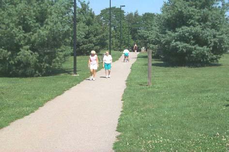
Existing park trails will be incorporated into the proposed greenway system. Additionally, within the 4,275 acres of parkland are approximately 22 miles of stream channel. Calculating corridor width at 50 feet, there are an estimated 134 acres of conservation greenway within parks. As part of the comprehensive greenway system, the greenways inside of the LFUCG park system need to be maintained and managed in the same manner as the entire system.
The 1998 Comprehensive Parks and Recreation Master Plan identifies the establishment of greenways as one of the highest priorities for the County. The plan calls for the development of greenways to first connect the community parks to adjacent neighborhoods and schools, then neighborhood parks to adjacent residential areas and schools. The third priority is to connect greenways with government facilities and private commercial centers. The plan recommends standards of one mile of greenway per 5,000 residents, or 50 miles of greenways.
Kirklevington Park
PAGE 2-16 LFUCG GREENWAY MASTER PLAN
2.8. CULTURAL AND HISTORICAL RESOURCES
When Kentucky became a state in 1792, Lexington was the largest city and the cultural center of the area, commonly referred to as the “Athens of the West”. Early on, Lexington boasted a public library, schools, bookstores, printing offices, theatrical groups and a musical society. Transylvania University, founded in 1788, was the first university west of the Alleghenies. Lexington had hundreds of businesses, some paved streets, sidewalks and street lighting. Horse racing started early in Lexington’s history, racing on the Town Commons.27 A prominent politician, Henry Clay, built his 400-acre estate, Ashland, in 1812.
Today, Ashland is one of Lexington's prime historical attractions. The 20-acre site, along with Keeneland Race Course, is designated as National Historic Landmarks. Numerous other historic sites are open to the public. There are 16 urban and 5 rural National Register Historic Districts. Approximately 120 individual properties are included in the National Register of Historic Places. Thousands of structures are included in the 14 local H-1 historic overlay districts Fifteen historic rural settlements are scattered throughout the County, plus Bracktown and Cadentown, located within the Urban Service Area.28
Lexington-Fayette County continues to be the center of the region’s educational and cultural activities. The University of Kentucky, Transylvania University and Lexington Theological Seminary are institutions for higher education. Museums include the U.K. Art Museum, Children’s Museum and Headley-Whitley Museum. Several theater, dance and art groups have strong community support and will enjoy the recent completion of the Cultural Arts Center in Downtown. (See Key Land Use Locations Map on page 2-20.)
As the horse capital of the world, Lexington-Fayette County's identity is deeply rooted in its history of equine agriculture. The region is known worldwide for its affiliation with horses; there are numerous horse farms, two racetracks (Keeneland and the Red Mile); the Kentucky Horse Center and the Kentucky Horse Park.
The Bluegrass Region of Central Kentucky has a distinct identity derived from its rural character of farms, fences, tree-lined roads, rolling topography
Kentucky Horse Park and meandering streams. “Greenspace” refers to the essential characteristics of the Community that give the Bluegrass its special identity and quality of life. Greenspace, however, is more than vernacular landscapes of horse farms and rock fences. It also encompasses natural environments (such as streams and the Palisades) and the built environment (such as parks, and structures and sites that recall the Community’s history). The greenspace system refers to the rich fabric of these urban and rural landscape elements woven together throughout the Community, giving it a coherent identity. The greenway system will connect greenspace resources and sites throughout the Urban County that can be experienced by citizens on bicycles or on foot.
Communities evolve over time. As development occurs, Lexington-Fayette County is in danger of becoming Commonplace, USA. It is important to recognize the small and large features that shape the Community’s image, and take measures to preserve and strengthen that image.
Designated areas/elements identified as important greenspace resources include:
Scenic View Sheds Scenic Byways
Nature Sanctuaries Reservoirs
Stone Fences Street Trees
Historic Public Spaces Historic Districts
Kentucky River Palisades
Significant Stands of Trees
Community Icons* & Linkages** 29
*Community Icons: i.e., Calumet, Keeneland, Ashland, Rupp Arena
**Linkages: Natural Corridors, Transportation Corridors, Abandoned Railroad Rights-of-Way
EXISTING CONDITIONS PAGE 2-17
2.9. ECONOMIC RESOURCES
The health of the local economy influences land use decisions and quality of life, so the success of the greenway program will be dependent upon a stable and sound economic base. Historically, LexingtonFayette County has been a regional employment hub, with good growth in total number of jobs and low unemployment. Growth has been especially strong in the wholesale, retail and service industries, with the result that over fifty percent of all jobs are in these categories (1996). This trend is expected to continue, with Lexington-Fayette County as the regional center for retail trade and personal services (especially health care). While agriculture only employs 1.6 percent of the total workforce, it accounts for 80 percent of the County’s total acreage.
Visitors and residents alike enjoy scenic drives and horse farm tours in the Rural Service Area. Tourism is a very important sector of the economy in Lexington-Fayette County, ranking second in the state. As an industry, tourism created over 14,000 jobs and 600 million dollars in revenue during the year 200030
Top destinations in Fayette County include the Kentucky Horse Park, Rupp Arena, Keeneland Race Track, Red Mile Racetrack, Henry Clay Estate, Mary Todd Lincoln House, Opera House, Children’s Museum and several other museums located throughout the area31. It is important to protect Lexington-Fayette County’s natural, cultural, historic and scenic resources that are so vital to the tourism industry.32
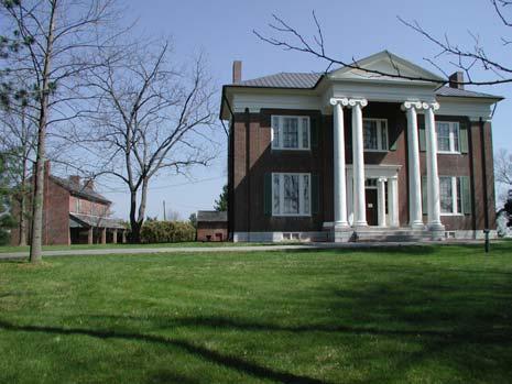
2.10. GREENWAYS
The LFUCG currently owns title or easement on approximately 135 acres of greenway, with plans to secure another 65 acres within the next year. In addition, approximately 22 miles of streams are located within the local parks. To date, the existing greenways have been acquired when there has been an opportunity to obtain the land during new development, associated with a park or road project, or through buy-outs for flood control. This approach has resulted in small and isolated fragments of greenways. Efforts involving greenways include the following:
• property acquisition through the planning process (from the greenways that were identified on the 1996 Comprehensive Plan Update Land Use Map),
• construction of bicycle and pedestrian projects (from the bike and pedestrian routes identified in transportation plans),
• construction of trails within parks and
• property acquisition for flood control (protection of the 100-year post development floodplains as described in the Stormwater Manual).
Currently, the management of greenways is divided among various departments and divisions within the LFUCG. For greenways located in or adjoining a park, the Division of Parks and Recreation provides the maintenance. For all other greenways, maintenance is the responsibility of the Division of Engineering, who may either contract the maintenance or provide funds to other divisions as needed. The Division of Streets and Roads has assisted with maintenance when the greenway is associated with a hard surface, structure failure or an erosion problem. In some locations, local residents provide the maintenance and in other locations there is no maintenance conducted.
There has not been a comprehensive approach to a county-wide system. As the greenway system grows, a more well defined program is needed to plan, develop and maintain these facilities.
Waveland State Historic Site
PAGE 2-18 LFUCG GREENWAY MASTER PLAN
LFUCG Gre enway Ma ster Pl an Key Landu se L oca tio ns
è è è è è è è è è è è è è è è è è è è è è è èè è è è èè è è è è è è è èè è è èè è è Æ P Æ P Æ P Æ P Æ P Æ P Æ P Æ P Æ P $ Z $ Z $ Z $ Z $ Z Z Z Z Z Z Z Z Z Z Z ñ ñ ñ ñ ñ # # # # # # # # # # # # ! " o $ ! " n $
N E W S Library ñ Com munity/Senior Cent er Z YMCA/YWCA $ Z Hospit al Æ P Shopping Center è Point of I nt erest # Central Business District Industrial Park University of K ent ucky Transylvania University Histoirc District Com munity Park Public School Urban Service Boundary Rural Act ivity Center Rural Set tlem ent Exist ing Rural Resident ial Major R oad 20 2 Miles EXISTING CONDITIONS PAGE 2-19
2.11. DESCRIPTION OF THE URBAN SERVICE AREA AND RURAL SERVICE AREA33
The Urban County Government has divided the Urban County into the Urban Service Area and the Rural Service Area, in recognition of each area's different needs and for ease of management. The Urban Service Area extends from the Jessamine County line north to just beyond the I-64 and I-75 exchange. It extends basically along New Circle Road to the west, and a couple of miles east from I75 along Winchester Road. The Urban Service Area consists of 85 square miles, or approximately 30% of the County.
Outside of the Urban Service Area is the Rural Service Area, which consists of 200 square miles, or approximately 70% of Lexington-Fayette County. Each section is described below, and the discussions include references to existing opportunities and constraints for greenway development.
The 2001 Comprehensive Plan Update shows that greenspace/open space and water accounts for a total of 1,962 acres in the Urban Service Area. An additional 2,184 acres are in public recreation, 691 acres in public education, 2,408 acres in semi-public spaces and 1,677 acres in other public uses
Within the Urban Service Area, 25% of the land, or 14,000 acres, was undeveloped in 2000. Approximately 10%, or 1,400 acres of this, is environmentally sensitive with floodplains, areas of steep slopes or sinkholes. Another 340 acres, or 2%, are geologic hazard areas. Special attention will have to be given to these areas. Remediations to existing neighborhoods for flood control, improved water quality, improved pedestrian access and greenspace acquisition and linkage are areas identified as needing attention.
Many origin and destination points are in the Urban Service Area, including schools, employment centers, parks, cultural/historic attractions, community centers and shopping areas. Downtown is considered the core of the Community, and is a vital hub for cross-town linkages. In efforts to help revitalize Downtown, the LFUCG has expressed interest in utilizing trails to encourage infill in the Downtown area. This will hopefully make Downtown more attractive to pedestrians and convey a positive image, which will result in greater use of the Downtown area.
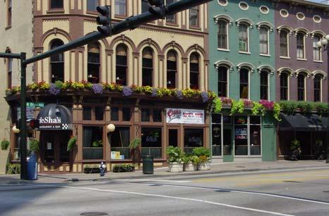
Urban Service Area
The purpose of the Urban Service Area is to protect the vital agricultural and natural resources in the rural portions of the County. The vast majority of Lexington-Fayette County’s residential, commercial and industrial development lies within the Urban Service Area. As Lexington has continued to grow as a regional retail, employment and health care center, the Urban Service Area has grown to accommodate the influx of new residents and commerce. In 1996, 5,400 acres of once vacant or agricultural land were added as the Expansion Area to provide additional housing, shopping, employment and public/semi-public land.
The Urban Service Area contains tributary reaches of the North Elkhorn, Cane Run, Town Branch, South Elkhorn, and East and West Hickman Creeks and spans seven watersheds. During the development of downtown, much of the natural stream system and drainage corridors were replaced with underground
Downtown Lexington
PAGE 2-20 LFUCG GREENWAY MASTER PLAN
pipes and runoff collection facilities. The alteration of the natural drainage system and addition of impervious area increases the importance of floodplain protection in undisturbed areas.
In the eastern Urban Service Area, greenways have been identified in several of the North Elkhorn tributaries. South of Downtown, greenways have been designated for parts of the West Hickman and South Elkhorn Tributaries. In the north, Town Branch Tributary Greenways have been preserved near Masterson Station Park and further south near the Wolf Run confluence. Active trails in the Urban Service Area include Squires Road Trail, Beaumont Trail and Coldstream Trail
Numerous possibilities exist for road projects with bike facilities, which would complement the proposed trails for Brighton East Rail Trail, the Shillito Connector, Coldstream and Jacobson Parks.
Greenways in Expansion Areas
The Expansion Areas are considered part of the Urban Service Area and designated for development. The principal organizing feature of the Expansion Areas is a series of greenways, which are located along stream corridors. No private development will be allowed in the greenways, however the owners will be allowed to use the acreage within a greenway to calculate permitted density on contiguous lands. The greenways are established to serve as community character-defining open space that provides the framework for the natural resource and recreational opportunities. Depending on the particular use and function of the greenway, appropriate access will be required.
Rural Service Area
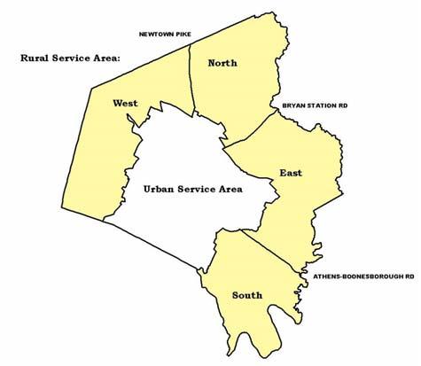
Most of the County's agricultural resources lie within the Rural Service Area (RSA). As a result, planning and management within this area is conducted in a manner that will preserve those resources, as well as many scenic views. For the sole purpose of describing resources and facilities within the RSA, the area has been divided into four quadrants. The following discussions describe resources and facilities, as well as provide references to existing opportunities and constraints for greenways within the RSA.
West Quadrant
The west quadrant lies between the Urban Service Area and the Woodford County line. It extends from Jessamine County north to Newtown Pike and includes Old Frankfort Pike, the Town Branch watershed, Cane Run watershed and part of the South Elkhorn watershed.
Along Town Branch are steep slopes and some remaining treestands. One of the largest landowners in the Cane Run watershed is the Kentucky Horse Park, which contains woods reminiscent of the savanna-like forests original in the area Much of Cane Run watershed contains sinkholes and is the recharge area for the Royal Spring Aquifer. The South Elkhorn Creek corridor includes tree stands, steep slopes, and sinkholes. The South Elkhorn Creek watershed has also been identified as a priority watershed in the State 2000 Watershed Management framework program.
The Rural Land Management Plan identifies three areas of ecological high priority within the west
Fayette county Urban service Expansion area Expansion Area Urban Service Area Rural Service Area
EXISTING CONDITIONS PAGE 2-21
quadrant: the Kentucky Horse Park's native savanna woods, Masterson Station's rare bird habitats, and Mare Haven Farm's 20 to 30 acres of native plants. The Rural Land Management Plan advises that a greenway trail be developed along the Town Branch, Cane Run and South Elkhorn Creek.
The western quadrant's land use, scenery, and economic base are defined by the presence of the equine industry. This rural agricultural area serves as a cultural and historic resource; the Redd Road, West Fayette County, Pisgah and Bowman Mill Road Rural Historic Districts are located here, as well as four rural settlements.
North Quadrant
The north quadrant extends from the Urban Service Area to the Scott County and Bourbon County borders, and from Newtown Pike to Bryan Station Road. There are extensive floodplains, significant tree stands, environmentally sensitive or geologic hazard areas in the North Elkhorn Creek watershed. The Rural Land Management Plan recommends that these natural resources be protected, and has potential for a trail and recreational destination. Conservation efforts are underway throughout North Elkhorn by citizen groups, such as the Elkhorn Creek Corridor Coalition.
The horse industry and historical rural heritage also characterize this area of the County. There are three rural settlements, but as a rural setting, there are minimal origins and destinations in the North Quadrant.
Kentucky Horse Park
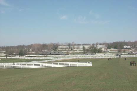
The quadrant has four major recreational destinations: the Kentucky Horse Park, Keeneland, and two community parks at Masterson Station and Cardinal Run. The spectacular scenery is displayed on the Kentucky Scenic Byway Tour along Old Frankfort Pike; Elkchester, Rice and Van Meter Roads; and Iron Works Pike. Bluegrass Airport and Spindletop Office Park are Rural Activities Centers that are additional destination and employment centers. With little development, there are minimal origin points.
The rural county roads, while scenic, are generally narrow, rolling and winding Main arterials, Leestown Road and Old Frankfort Pike, are generally unsuitable for bicycle travel because of heavy vehicular traffic. Another potential transportation corridor is the CSX rail corridor adjacent to Town Branch. This line could be utilized as a rail-trail to connect Scott, Woodford, and Franklin Counties.
Some of the rural roads are suitable for bicycle travel, with speeds around 35 mph and acceptable sight distance and grading Portions of Russell Cave, Hughes Lane, Iron Works, and Paris Pike have been designated as Scenic Byways and Driving Tour. There are three-and-a-half miles of abandoned railroad line running parallel and just north of Bryan Station Road that has potential for a Rails-to-Trails corridor. The Rural Land Management Plan suggests that rural roads connecting Lexington with Georgetown and Paris be designated as bike routes.
East Quadrant
The east quadrant extends from the Urban Service Area to the Clark County line, and from Bryan Station Road to Athens-Boonesboro Road. The Boone Creek watershed is located in the east, as well as several headwater branches of the North Elkhorn Creek, including Avon Branch, Davis Fork and David Creek. Boone Creek is a beautiful, wooded stream that has potential for seasonal water boating The Rural Land Management Plan recommends that any trails would need to be designed carefully to impact the area as little as possible.
Like the rest of the Rural Service Area, general agriculture characterizes the east quadrant. The other two of the four Rural Activity Centers are located in this area and serve as potential destinations. Avon Rural Activity Center (Blue Grass Station) is located on Briar Hill Road and Houston-Antioch Road, and its land use is warehousing and light industry. The Blue Sky Rural
PAGE 2-22 LFUCG GREENWAY MASTER PLAN
Activity Center, located at the intersection of Athens-Boonesboro Road and I-75 has warehousing, light industry and interstate commercial development. Origin points include rural residential development along Winchester Road and seven rural settlements. The Middle Reaches of the Boone Crrek Rural Historic District encompass thousands of acres in this quadrant.
A designated greenway in the quadrant is the 6.5mile abandoned rail line. Funding for portions of the line inside the Urban Service Area has been approved. The trail could extend east through the Rural Service Area to the Clark County line and on to Winchester, Mt. Sterling, and eventually Ashland, Kentucky.
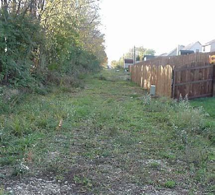
Raven Run Nature Sanctuary is located in this area and the goal of the park is to preserve the scenic and biotic resources of the region, while providing recreation facilities and hiking trails for public use. The Environmentally Sensitive Areas in this quadrant include the Kentucky River Palisades and Boone Creek. The Palisades are defined by their steep slopes, limestone cliffs and unique habitat. Boone Creek is regarded for its scenic wooded hillsides with exposed bedrock. Marble Creek and Elk Lick Creek are just two of the many tributaries in the area
Existing conservation easements along Elk Lick Creek contain numerous native wildflowers. South of Raven Run Nature Sanctuary, there is a remaining 10 to 20 acre beech-tulip forest along Dry Branch Road.
There are many streams in the area that drain directly into the Kentucky River. In their watershed-based approach to improving water quality, the Environmental Protection Agency stresses the importance of protecting these streams, since protection and preservation of tributary stream habitat helps to improve water quality downstream at the Kentucky River.
Future Brighton East Rail Trail South Quadrant
The south quadrant extends from the Urban Service Area and Athens-Boonesboro Road to the Jessamine and Madison County lines. Most of the northern and central parts of the quadrant are agricultural areas, while the southern edges along the county lines are designated as Environmentally Sensitive Areas. The quadrant includes the Kentucky River watershed and portions of the Boone Creek and East Hickman watersheds. Steep slopes characterize Kentucky River and East Hickman area, limiting trail use to hiking.
The importance of the southern quadrant can be found in its natural resource and scenic value. The natural and wildlife resources are included in parks and reserves, such as Flora Cliff Nature Preserve and Raven Run Nature Sanctuary, which are home to many rare species of plants For some species, these are their only known locations in the Country.
The Rural Land Management Plan proposed that Raven Run Nature Sanctuary be extended north to I75 and south to include the many tributaries of the Kentucky River. Inclusion of these tributaries would help to protect the floodplains and water quality of the streams and the Kentucky River. The expansion of the Nature Sanctuary would also help protect several endangered or threatened species that have been cited in the area. The LFUCG has had some success in expanding Raven Run in recent years, growing by approximately 200 acres.
Designated State Scenic Byways include Old Richmond, McCalls Mill and Grimes Mill Roads. Three Nationally Registered Historic Districts, Boone Creek Middle Reaches, Athens, and Boone Creek, are in this quadrant, as well as three rural settlements.
There are many potential areas for greenways and trails in the South Quadrant because of its scenic and recreational value. However, individual studies must be done to determine the impact trails and public access would have to the abundance of rare native plants. Hiking trails would have to be carefully
EXISTING CONDITIONS PAGE 2-23
designed to ensure the preservation of the natural scenic beauty of the area and to avoid impact on the sensitive species. The steep terrain would also
present grading problems for shared use trails and compliance with the Americans with Disabilities Act.
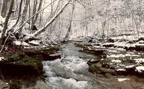
PAGE 2-24 LFUCG GREENWAY MASTER PLAN
Raven Run
1 2001 Comprehensive Plan Update 2 The Historical Development of Lexington and Fayette County, City-County Planning Commission, 1965 3 2001 Comprehensive Plan Update 4 2001 Comprehensive Plan Update 5 2001 Comprehensive Plan Update 6 2001 Comprehensive Plan Update 7 2001 Comprehensive Plan Update 8 LFUCG Division of Engineering, 2001 Update of 2000 305b Report to Congress 9 2001 Comprehensive Plan Update 10 Wharton, M.E. Trees & Shrubs of Kentucky. Lexington, UP of Ky. 1973 11 Army Corp of Engineers Reconnaissance Report 12 Dwyer, John Connecting People with Ecosystems: An Assessment of Our Nation’s Urban Forests, U.S.D.A. 2000 13 LFUCG, Division of Planning 14 Kentucky State Nature Preserves Commission, August 2000 15 Greenways Inc , Asheville Greenways Master Plan 16 Forman, M. Godson. Landscape Ecology, Wiles and Son, New York, N.U. 1986 17 Kentucky State Nature Preserves Commission, August 2000 18 2001 Comprehensive Plan Update 19 LexTran Website: www.lextran.com 20 Guide for the Development of Bicycle Facilities 21 Year 2025 Transportation Plan 22 Ozone Season Summary, September 2001; LFUCG Division of Planning 23 1996 Comprehensive Plan 24 Lexington-Fayette Urban County Government, 2002 25 CDC. Behavioral Risk Factor Surveillance System. 1997 26 CDC. Behavioral Risk Factor Surveillance System. 2000 27 The Historical Development of Lexington and Fayette County, City-County Planning Commission, 1965 28 LFUCG, Division of Historic Preservation 29 Rural Land Management Plan 30 KY Department of Travel. 2000 31 Lexington Convention and Visitors Bureau. 2000 32 2001 Comprehensive Plan Update 33 2001 Comprehensive Plan Update EXISTING CONDITIONS PAGE 2-25
SOURCES OF INFORMATION
PAGE 2-26 LFUCG GREENWAY MASTER PLAN
Chapter 3: Vision, Mission, Goals & Objectives
3.1 THE VISION AND MISSION
In the 2001 Comprehensive Plan Update, an emphasis is placed on planning to preserve the quality of life that makes Lexington-Fayette County a desirable place to work and live. The numerous benefits of a greenway system will certainly contribute to this mission. A principal vision of the 2001 Comprehensive Plan Update is the realization of the recommendations set forth in the 1994 Greenspace Plan, which proposes to preserve open space, provide facilities and amenities to serve all citizens and help create a sense of community. The vision of the two Plans serves as the precedent for the Greenway Master Plan Because greenways are linear, the proposed greenway system will form the framework for a greenspace system, linking greenspaces, public spaces and destinations throughout the Urban County.
It is the vision of the Greenway Master Plan to create a community-wide system of linkages that will
contribute to the connectivity, preservation, protection and enhancement of riparian corridors, floodplain areas, environmentally sensitive areas, biologically diverse natural areas and habitats. The greenway system is anticipated to encourage the appreciation and protection of scenic viewsheds and places of historic and cultural significance. The corridors are planned to link neighborhoods, parks, Downtown Lexington, schools, recreational and fitness facilities, shopping and work destinations. It is intended that the proposed greenway system be used and appreciated by citizens of all ages with a variety of interests.
The Mission of the Greenway Master Plan is the development of a dual system of conservation corridors and trail corridors that will provide physical and functional linkages between greenspaces, habitats, recreational areas, neighborhoods, cultural and historic resources and workplaces. These linkages will occur both within
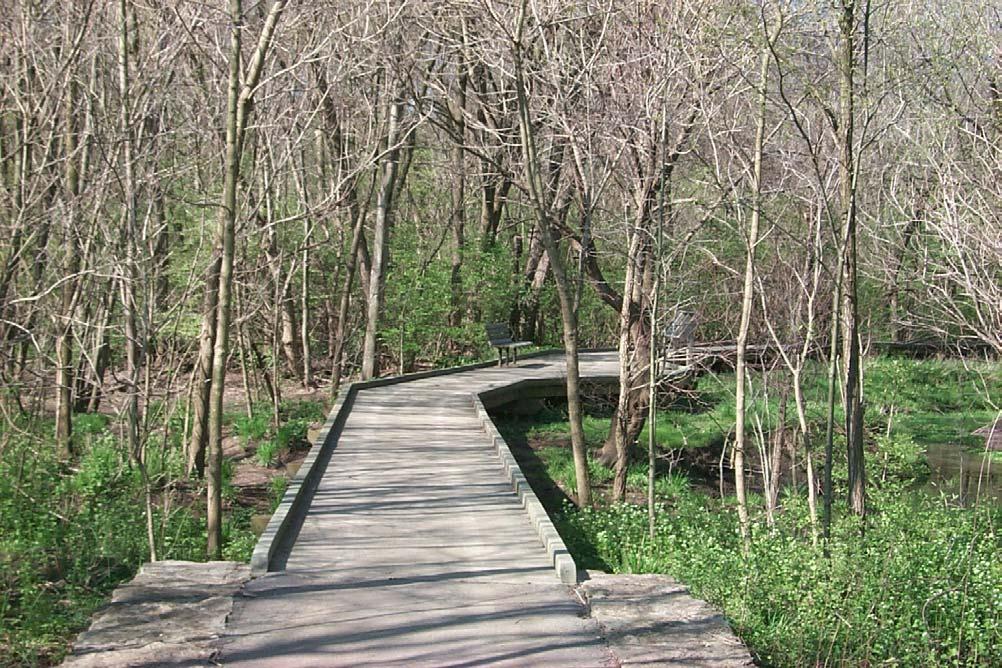 Source: Pedestrian and Bicycle Information Center
VISION, GOALS & OBJECTIVES PAGE 3- 1
Lexington-Fayette County and beyond to surrounding counties.
3.2 GOALS AND OBJECTIVES
The mission of the Greenway Master Plan is reflected in the following goals and objectives. The basis for the development of these goals and objectives is derived from the 2001 Comprehensive Plan Update
Future planning decisions regarding the realization of the Greenway Master Plan should reflect the intention of the goals and objectives as a whole. Likewise, individual portions of this Plan should not be considered out of context. In order to assure that the intent of the Greenway Master Plan is followed, decisions should be based upon this Plan in its entirety, including the goals, the objectives, the greenway system and the implementation strategies and appendices.
Connectivity Goal
To develop and implement a greenway system that links neighborhoods to each other and to schools, parks, cultural facilities, workplaces, natural areas and the region
Objectives
A. Encourage cooperation and establish communication throughout the Bluegrass Region in order to link greenways beyond the Urban County line.
B. Identify and promote specific rural roads for bicycle routes to link the Urban Service Area with the Rural Service Area and Natural Areas.
C. Strive for greenways to be within a reasonable distance of every residence in the Urban Service Area.
D. Develop greenways to provide connectivity of individual corridors or trails with the entire greenway system.
E. Develop an interconnected system of shared use trails, sidewalks, bike lanes and bike routes.
F. Connect natural areas, parks and open spaces to support healthy functioning of ecosystems.
G. Establish a comprehensive on-street and offstreet bikeway/pedestrian system for commuters.
Natural Resources Goal
To develop and implement a greenway system that will function to preserve, protect and restore the natural resources of Lexington-Fayette County, and to establish the greenway system as green infrastructure.
Objectives
A. Protect floodplain lands as vital areas for the absorption and storage of floodwaters, thereby helping to reduce economic losses caused by flooding, and providing sound watershed management.
B. Protect and enhance the overall quality of the stream and river corridors and aquifer recharge areas in both urban and rural areas, meeting or exceeding water quality standards.
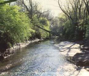
C. Protect environmentally sensitive areas, geologic hazard areas and natural landscapes within and adjacent to greenways.
D. Protect and enhance riparian and other natural areas along greenways that will support biological diversity of native flora and fauna.
E. Restore or establish habitat and migration corridors where possible.
F. Protect and restore aquatic habitat.
Transportation Goal
To develop and implement a greenway system that provides opportunities for alternative transportation modes, such as bicycling and pedestrian use.
Town Branch Courtesy of Van Meter Pettit
PAGE3-2 LFUCG Greenway Master Plan
Objectives
A. Include destination points and commuter routes in the greenway trail system to link residents to their places of work, shopping, study and play.
B. Provide and promote an interconnected system of on-road bike lanes and off-road trails and sidewalks as alternatives to vehicular transportation, thus decreasing motorized use and improving air quality.
C. Develop and promote the greenway system as an integral element in transportation planning.
D. Promote bicycle and pedestrian use for significant transportation corridors, while preserving, protecting and enhancing the visual character of the corridor.
E. Protect scenic corridors.
F. Design trails, bikeways or sidewalks to provide each neighborhood with adequate public safety in an aesthetically pleasing manner.
G. Provide incentives to property owners for the upkeep of sidewalks.
H. Promote new development and capital improvement projects that provide for safe, well-organized pedestrian and bicycle friendly facilities.
B. Strive for greenway trails to be accessible to all persons, regardless of their ability. Utilize the most current federal and national guidelines on outdoor accessibility where possible.
C. Develop and promote greenways as a destination for health and fitness activities, for both daily use and special events.
D. Promote greenway use as a therapeutic and healing resource to the health care community.
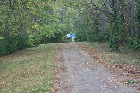
E. Develop and promote greenways as a recreational asset to neighborhoods, property owners and the entire Community
F. Provide trails oriented to nature-appreciation recreation.
G. Develop off-road trails where possible, as the preferred choice to on-road facilities.
Cultural and Historic Goal
To develop and implement a greenway system that promotes, protects and enhances the unique cultural and historic identity of Lexington-Fayette County.
Objectives
A. Preserve and protect linkages to cultural and historic resources within, adjacent to, or in close proximity to trail corridors. These include museums, libraries, schools, parks, churches, historic sites and districts, cultural landscapes, community icons, and scenic corridors and byways.
B. Promote bicycling and pedestrian access in and around the Downtown area
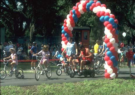
C. Promote the greenway system as a public amenity that contributes to Community character and identity
Health, Fitness and Recreation Goal
To develop and implement a greenway system that offers community residents an opportunity to utilize their leisure time to maintain a fit and healthy lifestyle.
Objectives
A. Develop a shared use trail system within greenways that is accessible to citizens for a variety of recreational activities, providing both active and passive opportunities and close to where people live and work.
Beaumont Trail
VISION, GOALS & OBJECTIVES PAGE 3- 3
Economic Goal
To develop and implement a greenway system that offers numerous economic benefits to Community residents.
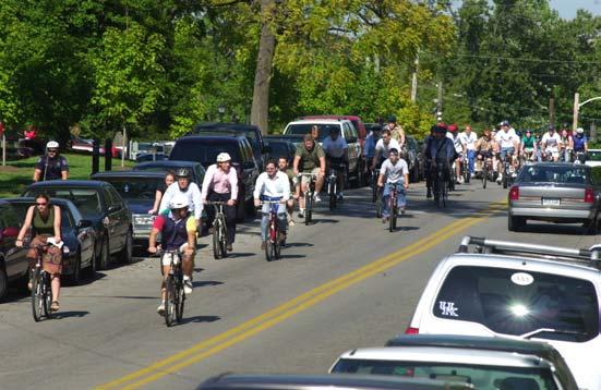
Objectives
A. Promote greenways for tourism dollars. Preserve the natural, cultural and historic resources that are an integral resource for greenways.
B. Identify and promote Lexington-Fayette County’s role in regional tourism.
C. Promote greenways as an economic asset to the Community by enhancing the quality of life for its citizens, thus attracting new businesses to the area.
D. Promote the value-added characteristics of greenways as an economic asset to neighborhoods and property owners.
E. Encourage greenspace/greenways in revitalization projects.
F. Identify and promote destination points along greenways that will benefit from the increase in visits by trail users.
G. Promote the value of greenways regarding reduction of health care costs associated with a healthier, fitter population.
H. Promote the value of greenways regarding reduction in overall transportation costs and improved air quality in the provision of transportation alternatives.
I. Protect homeowners’ investments through greenway acquisition in areas identified as needing flood control.
J. Promote the value of greenways regarding savings associated with water quality improvements
Education Goal
To develop and implement a greenway system that recognizes Lexington-Fayette County’s unique environmental, cultural and historic resources, and promotes opportunities for learning about them.
Objectives
A. Promote outdoor classrooms and interpretive signage or exhibits within greenways.
B. Promote the development of programs and curricula that incorporate the study and appreciation of greenways, in conjunction with the Fayette County Public Schools, private schools and universities.
C. Promote the development of programs that incorporate the use and appreciation of greenways in conjunction with the Division of Parks and Recreation
D. Develop educational workshops for stakeholder groups, such as elected officials, LFUCG staff; developers, landscape architects, engineers, health care professionals, transportation planners, historic preservation groups, environmental groups, civic groups, neighborhood associations, adjacent property owners and corporate sponsors. Offer the workshops as continuing education for professional groups.
E. Establish an "Adopt-a-Greenway" program to include participation among local business, industry, neighborhood and civic organizations.
F. Develop a program and dialogue with the media, including print, radio and television. Establish a greenways publication and web site to keep residents informed of progress and activities.
PAGE3-4
Photo by Lexington Herald Leader
LFUCG Greenway Master Plan
Implementation Goal
To develop and implement a greenway program that addresses issues, such as responsibilities, acquisition, funding, facility development and management.
Objectives
A. Encourage implementation of the Greenway Master Plan through regulation, Comprehensive Plan Updates, plan administration, capital improvement budgeting, and other strategies.
B. Develop an implementation strategy for greenways that is based on public/private partnerships and community participation
C. Assign responsibilities for the greenway program to appropriate LFUCG divisions and private sector organizations.
D. Adopt a management philosophy and policies that encourage natural resource stewardship.
E. Establish a dedicated source of funding for operation and management activities.
F. Establish regulation standards for greenway acquisition, facility development and management.
G. Provide for the periodic review of the Greenway Master Plan and related documents.
H. Maintain a GIS database and maps with pertinent information on the greenway program and the components comprising the greenway system.
I. Design trails to balance the needs between minimizing any potential adverse impacts on adjacent property while, at the same time, providing trail facilities that meet design specifications.
J. Provide buffering between greenway trails and adjacent lands, where necessary, to minimize impacts.
K. Use greenways, where appropriate, as buffers between incompatible land uses.
L. Plan for greenway acquisition and development to reasonably coincide with the occurrence of development and capital improvement projects.
M. Encourage the private dedication of greenways for public acquisition.
N. Design greenways to best safeguard the safety and security of the user. Establish rules of use and penalty mechanisms for violators.
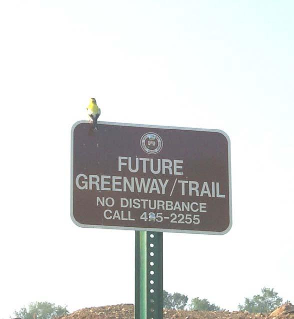
VISION, GOALS & OBJECTIVES PAGE 3- 5
PAGE3-6 LFUCG Greenway Master Plan
Chapter 4: The Greenway System
4.1. PLAN DEVELOPMENT
The county-wide greenway system is developed through a synthesis of numerous inputs:
• The impetus to develop the system comes from the implementation strategy of the Greenspace Plan and the 2001 Comprehensive Plan Update These plans, as well as other plans and manuals, were reviewed for related goals and recommendations.
• Benefits of greenways were explored.
• Meetings were conducted to examine the needs and visions of the general public and relevant stakeholders.
• An inventory and analysis revealed natural and cultural resources, as well as potential linkages that could create an interconnected greenspace system.
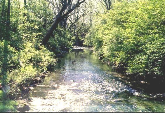
• Goals and objectives for the greenway system were formulated, based on the identified vision, needs and benefits.
It should be noted that completion of all sections of each greenway corridor might not, either in the short or long term, be feasible. Properties integral to completion of a project may never become available at affordable cost levels. Acquisition of specific properties may be consistently outweighed by other priorities, both within the greenways program and without. As opportunities are presented (and given available resources), every effort should be made to gain greenway properties for continuity of the corridor and the system as a whole.
The Plan text and map is intended to serve as a framework and guide for greenway planning. The proposed system is comprised of a generalized
THE GREENWAY SYSTEM PAGE4-1
Town Branch Courtesy of Van Meter Pettit
description and location of the designated greenway corridors, and should not be interpreted as definitive.
The Lexington-Fayette County greenway system is proposed, in this Plan, to be comprised of two distinct but interrelated systems. The first is a system of Conservation Greenway Corridors, which run congruently with the County's streams. Greenways identified on the 1996 Comprehensive Plan Land Use Map were used as the basis for the Conservation Greenway Corridors. These greenways were described in the 1992 Greenway Plan as 100-year floodplains, flood-prone soils, steep slopes and sinkholes, with additional consideration given to connecting parks. A fifty-foot riparian buffer that surrounds all streams has been added for this Plan to complete the Conservation Greenway System. The associated riparian areas would function to protect stream corridors, floodplains, and steeply sloped areas, as well as the quality of water running through these areas and the limestone bedrock through which the water table drains. Also, this system would function to protect and augment sensitive habitat and migration corridors for wildlife and plant species alike.
the Community for recreational and leisure activities, connections for alternative transportation, educational opportunities, and chances to view and appreciate the Community’s natural and man-made landscapes at a pedestrian level.
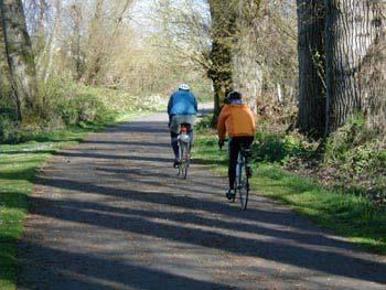
A related system of Greenway Trails would be developed to provide connections between neighborhoods of the Urban County and destination points that would include parks and other recreational facilities, schools, the Downtown area, the workplace, shopping, historic areas and destinations beyond the Urban County boundaries. This trail system would, where feasible, access the Conservation Greenway Corridor system, utilize utility and rail corridors, make use of roadways and sidewalks and access public open space. The trail network would provide a physical framework within
4.2. GREENWAY CORRIDOR SYSTEM
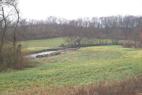
A. Greenway Maps
The Greenway Master Plan Map identifies the generalized location and extent of the proposed Conservation Greenway System and Greenway Trail System. In addition, proposed trailheads and some destination points are identified.
B. Conservation Greenway Corridors General
The beauty of the Lexington-Fayette County landscape is fed by an abundance of streams and is augmented by the presence of the Kentucky River and Palisades. However, urban development has compromised floodplains and water quality. The development of greenways along the river and streams can be a vital component in efforts to reclaim these bodies of water, helping to reconnect Lexington to its natural heritage.
Conservation Greenway Corridors can provide a tool in the efforts to mitigate existing problems. In fact, Conservation Corridors can be created by purchasing areas that suffer from chronic flooding, effectively reclaiming and restoring the floodplain to its intended function. Also, as the Urban County continues to grow, it will be critical to preserve stream corridors during development by protecting floodplains from further degradation -- not only to improve water quality, but also to protect lives and property from the distress and economic devastation caused by flooding.
PAGE 4-2 LFUCG GREENWAY MASTER PLAN
Source Pedestrian and Bicycle Information Center
Town Branch
According to Russell Cohen of the Riverways Program in a 1977 report on the functions of riparian areas for storm prevention, Massachusetts Department of Fisheries, Wildlife and Environmental Law Enforcement found that the "alterations to riparian areas that impair their ability to prevent storm damage are: (1) the placement of buildings and other damageable property within…locations that are susceptible to storm damage, and (2) the clearing of vegetation, particularly if it is replaced with impervious surfaces…will amplify the effect of storms…” Accordingly, this effect is cumulative as stormwaters move downstream, with the water's force, speed and volume steadily increasing. A floodplain covered in vegetation reduces that force and volume. Storm waters are able to spread out over a large area, and vegetation absorbs the water's force and blocks debris from moving downstream. Vegetative debris left within the stream corridor can provide ideal habitat for a variety of wildlife species, and allows for further re-growth of vegetation across the floodplain -- reducing erosion of the stream bed and banks, and preventing excessive sediment from moving downstream. The slowed waters may then infiltrate the ground, removing pollutants, excess nutrients and sediment, thus invigorating the protective cycle.
While it is envisioned that much of the greenway development within the Urban Service Area and Expansion Areas will be coordinated and funded through efforts of the Lexington-Fayette Urban County Government (LFUCG), development of the Conservation System within the Rural Service Area will likely be the result of the efforts of private property owners or agencies. For example, the goals for the Conservation Greenway Corridor System in the Rural Service Area complements the water quality enhancement efforts promoted by the Natural Resources Conservation Service (NRCS). The corridors can be incorporated into a farm's water quality management plan that is filed with NRCS. The NRCS can provide technical assistance, as well as funding through several programs, including the Wetland Reserve Program, the Wildlife Habitat Incentives Program or the Environmental Quality Incentives Program, among others.
Conservation Greenway Corridor Descriptions
With the regulations delineated in the Division of Engineering’s Stormwater Manual, LFUCG has essentially prohibited development within the 100year floodplain of any stream. This and other
restrictions will prevent additional repetitive flood losses associated with new development and will help to reduce flood loss from existing development. In order to address flooding concerns, channelization, fragmentation of habitat, and water quality impairment, the proactive management of main stream and river corridors is proposed. A major component of this effort is the preservation or re-establishment of open space and riparian buffers along each identified stream or river.
In addition to filtering pollutants from runoff and providing flood water storage, riparian buffers provide connectivity between patches of remaining, fragmented habitat. Riparian corridors also provide an opportunity to establish open space that would complement protection of drinking water supplies, sensitive karst areas, scenic viewsheds, and historic properties.
Streams are selected for inclusion in the Plan with an emphasis on the following factors. Documented repetitive structural flooding; Existence of water pollution that results in conditions that impair aquatic life or make human recreational contact unsafe; The presence of open space (parks and greenways); Urban encroachment into floodplain areas.
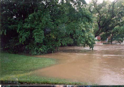
Stream corridors that exhibit any of these characteristics and/or form the main drainageways of a watershed are identified and focused on within this Plan as the Conservation Greenway Corridors.
Individual Conservation Greenway Corridors are identified and described in the following pages. Within many segments of these Corridors, Primary and Secondary Trails are proposed, particularly within the Urban Service Area. In areas with
THE GREENWAY SYSTEM PAGE4-3
Montavesta Neighborhood
sensitive habitat or restricted access, no trail facility development, or limited, low impact uses, are envisioned. In most areas, it is envisioned that the Conservation Greenways will encompass the 100year post development floodplain and will adhere to the minimum standards as required by the LFUCG Stormwater Manual. In addition, the Stormwater Manual prescribes credits toward offsetting water quality impacts from development for floodplains, which are set aside as riparian areas.
The Conservation Greenway Corridors selected for and focused on in this Plan are comprised of the main stream and tributaries of the primary
watersheds of Lexington-Fayette County. In accordance with the intent of the LFUCG Stormwater Manual regulations, greenway conservation corridors will extend along all blueline streams within the Rural and Urban Service Areas. However, it is the recommendation of this Plan that greenway development efforts focus on the main streams in order to provide continuity, not only in the efficacy of each corridor, but in the development process. It should be noted, however, that the importance of preserving and enhancing the riparian habitat along all streams should be acknowledged in the decision-making and implementation process.
Conservation Greenway Descriptions and Maps
The Conservation Greenway Maps show the watershed, greenway and main channel, stormwater capital improvement projects (CIP), stream gauges, monitoring sites and points of interest. The maps are not to scale.
Boone Creek Conservation Greenway Corridor
Cane Run Conservation Greenway Corridor
East Hickman Creek Conservation Greenway Corridor
Kentucky River Conservation Greenway Corridor
North Elkhorn Creek Conservation Greenway
South Elkhorn Creek Conservation Greenway Corridor
Town Branch Conservation Greenway Corridor
West Hickman Creek Conservation Greenway Corridor
Wolf Run Conservation Greenway Corridor
PAGE 4-4 LFUCG GREENWAY MASTER PLAN
T HE G REENWAY S YSTEM P AGE 4-5
BOONE CREEK CONSERVATION GREENWAY CORRIDOR
Corridor Description: The Boone Creek Conservation Greenway Corridor is located in rural southeastern Lexington-Fayette County , and is comprised of Boone Creek and its tributaries, including Baug hman Fork. The area along Boone Creek is essentially undeveloped and contains many valuable natural and historic resources.
Two endangered, threatened, or sp ecial concern species have been identified in the Boone Creek Corri dor: Running Buffalo Clover, along both banks of Boone Creek and behind the Iroquois Hunt Club; and Walter's Violet, found along the le dges and points above the creek.
The Boone Creek Corridor encompasses a portion of nationally registered historic districts and the Athens Rural Settlement. Baughman Fork essentially reflects Boone Creek in that much of it lies within an undeveloped area. At the head of the stream, however, is the Blue Sky Rural Activity Center, where the light industrial and commercial land uses are sources of water impairment from both stormwater discharges and a wastewater treatment plant.
Corridor Objectives: The primary objective of the Boon e Creek Conservation Greenway Corridor is preservation of natural resources, including habitat for rare birds and animals. Management of the Corridor also presents opportunities to manage water quality, particularly along Baughman Fork, and to protect unique hist oric areas and viewsheds.
P AGE 4-6 LFUCG G REENWAY M ASTER P LAN
T HE G REENWAY S YSTEM P AGE 4-7
CANE RUN CONSERVATION GREENWAY CORRIDOR
Corridor Description: This Conservation Greenway extends along Cane Run Creek and its tributaries in the northern section of Lexington-Fayette County. The Greenway includes both urban and rural areas as well as Expansion Area No. 3, along a line of sinkholes and other karst features. The Cane Run Conservation Greenway lies within the Royal Spring Aquifer Recharge Area, which is the primary source of drinking water for the neighboring city of Georgetown. Along this Corridor are the Kentucky Horse Park, Spindletop Research Park, Coldstream Park and Coldstream Research Park.
The LFUCG should continue to fo cus its efforts on preserving the undeveloped floodplain between Newtown Pike and I-75/I-64. Incorporation of greenways into the development of Coldstream Research Park is a recent example of successful floodplain management. Upstream of Newtown Pike, most opportunities exist on undeveloped parcels of the Lexmark property. The LFUCG should work with Lexmark to develop a multi-functional greenway from Newtown Pike to New Circle Road. An appropriately planned greenway would complement expansion plans Lexmark may have for this property. In addition, a multi-functional greenway would provide a connection to Coldstream Park that could be easily accessed by Lexmark employees.
The floodplain from I-75/I-64 to the Kentucky Horse Park should also be preserved and established as a green way. This would not only protect the floodplain from urban encroachment, but would establish a wildlife habitat and pedestrian corridor betw een Coldstream Park and the Horse Park.
Corridor Objectives: The objectives of the Cane Run Conservation Greenway include drinking water protection, water quality improvement, floodplain preservation, open space preservation and habitat restoration.
P AGE 4-8 LFUCG G REENWAY M ASTER P LAN
T HE G REENWAY S YSTEM P AGE 4-9
EAST HICKMAN CREEK CONSERVATION GREENWAY
CORRIDOR Corridor Description: The East Hickman Creek Conservation Greenway Corridor is located in the eastern portions of the Urban Service Area, rural parts of the County and Expansion Areas 1 and 2. The Corridor includes East Hickman Creek and it tributaries. Water quality impairment and encroachment upon the floodplain is evident. Land uses associated with this corridor include agricultural, commercial and residential uses. Jacobson Reservoir and Jacobson Park are in this watershed. In addition to species identified throughout the Urban County, two endangered, threatened, or special concern species have been identified in the East Hickman Greenway: Running Buffalo Clover, located along roads and grazed areas; and the Least Weasel, believed to inhabit this area (although the specifics of its location and habitat are unknown). The Corridor sections extending through Expansion Areas No. 1 and No. 2 should receive high priority by the LFUCG in order to preserve the floodplain for water quality and stormwater control purposes before development occurs. In addition, consideration should be given to creating/preserving a riparian buffer around Jacobson Reservoir, as this water resource, along with much of its perimeter, is undeveloped.
Corridor Objectives: Objectives for this Corridor incl ude improvement of water quality (particularly in Jacobson Reservoir), preservation of floodplains and open space, and buffering between incompatible land uses. The East Hickman Creek Conservation Greenway Corridor also provides an opportunity to proactively manage water resources within the undeveloped portions of Expansion Areas No. 1 and No. 2.
P AGE 4-10 LFUCG G REENWAY M ASTER P LAN
T HE G REENWAY S YSTEM P AGE 4-11
Corridor Objectives:
The primary objective of this Conservation Greenway Corridor is the protection and preservation of unique and significant habitat, water quality, cultural resources, viewshed s and open space. The Corridor also provides significant educational oppo rtunities that complement existing activities at Raven Run Nature Sanctuary.
KENTUCKY RIVER CONSERVATION GREENWAY
CORRIDOR
Corridor Description:
The Kentucky River Conservation Greenway Corridor includes the portion of the Kentucky River that runs along the southeastern edge of the County, as well as its tributaries, including Raven Run and Elk Lick Creek. Along with the unique habitat, landscape and scenic views of the Kentucky Palisades, the area contains steep slopes, cultural and natural resources. Historic si tes within and adjacent to the proposed Corridor include the Clays Ferry Rural Settlement and the Valley View Rural Settlement.
The Corridor contains several areas know n for unique species habitat. In addition to species identified throughout the Urban County, eight endangered, threatened, or special concern species have been identified in the Kentucky River Corridor: Svenson's Wildrye, north of the ferry crossing along Tates Creek Road; the Northern Leopard Frog, along Tates Creek Pike and adjacent to the Kentucky River area and its tributaries; and the Water Stitchwort on the River’s western cliffs, north of Valley View.
Raven Run Nature Sanctuary and Floracliff State Nature Preserve are located along this Corridor. Raven Run is home to several unique species, including the Hairy False Gromwell, Nodding Rattlesnake Root and the Softleaf Arrowwood. Floracliff is also home to numerous unique species, including White Walnut.
The Raven Run and Elk Lick Creek tributaries should receive high priority by the LFUCG in order to preserve the unique habitat identified in the area, and to improve and protect the quality of water flowing into the Kentucky River, (as this is the main water supply source for Lexington-Fayette County). Consideration should also be given to protection of the river's shores an d surrounding slopes prior to any development.
P AGE 4-12 LFUCG G REENWAY M ASTER P LAN
T HE G REENWAY S YSTEM P AGE 4-13
represents an opportunity to proactively manage the water resources of Expansion Area No. 2.
NORTH ELKHORN CREEK CO NSERVATION GREENWAY
Corridor Description: The North Elkhorn Creek Conservation Greenway, in the northeast portion of Lexington-Fayette County, encompassing the North Elkhorn Creek and its tributaries, including Avon Branch, Goose Creek and Bryan Station Creek. Much of the Corridor is located in prime agricultural areas. The upper reaches of North Elkhorn Creek and Bryan Station Creek extend into the Urban Service Area, with the North Elkhorn located within Expansion Area No. 2. Other developed areas along the Corridor include Avon (Bluegrass Station) Rural Activity Center, and the rural settlements of Jimtown and Loradale . As a result of development activities, extensive fragmentation of the riparian corridor has occurred. Three endangered, threatened, or special concern species have been identified in the North Elkhorn Corridor: Yellow-Crowned Night-Heron on both the Preston Johnson and C.V. Whitney Farms; Grape Honeysuckle found along rocky wood s and banks; and Canada Anemone in the Elkhorn Watershed (in damp prairies and along creeks).
Within the Urban Service Area, the LFUCG should continue its focus on preserving the floodplains from urban encroachment within Expansion Area No. 2 and the Hamburg property. Multi-functional greenways should be planned that include pedestrian opportunities, enhance wildlife habitat, and provide the necessary stormwater storage and conveyance. The Conservation Greenway Corridor would also provide connections between parks, neighborhoods, and commercial facilities within these developments. Currently developed greenways located within this Corridor and owned by LFUCG includ e seven parcels (8 acres) at Bluegrass Wilkes near Executive Driv e, and three parcels totaling 6 acres on Ft. Sumpter Drive.
Corridor Objectives: Objectives for this Conservation Gr eenway Corridor include water quality improvement, habitat restoration, open space restoration, floodplain preservation, and buffering of incompatible land uses. As with the East Hickman Corridor, the North Elkhorn Creek Conservation Greenway
P AGE 4-14 LFUCG G REENWAY M ASTER P LAN
T HE G REENWAY S YSTEM P AGE 4-15
few large parcels of property just upstream of Man
o' War Boulevard. Stormwater capital improvement projects are planned along this Corridor, and consideration should be given to implementing greenways as part of the solution.
Corridor Objectives: Objectives of this Conservation Greenway include preservation and restoration of floodplains (particularly in the upstream reaches), water quality improvements, habitat restoration, viewshed protection and riparian buffers between incompatible land uses.
SOUTH ELKHORN CREEK CO NSERVATION GREENWAY
CORRIDOR Corridor Description:
Located in southwestern Lexington-Fayette County, the South Elkhorn Creek Conservation Greenway Corrido r is comprised of South Elkhorn Creek and its tributaries, including Clemons Run, Shannon Run and Cave Creek. Within the Corridor is bot h rural and urban landscapes, and includes the Bluegrass Airport, the Fort Springs Rural Settlement, and historical zoning at Helm Place. Four endangered, threatened, or special concern species have been identified in the South Elkhorn Co rridor: Running Buffalo Clover, along Parkers Mill Road near South Elkh orn Creek; the Sedge Wren, along Paynes Mill Road (in wet or boggy grasslands); The Yellow-Crowned Nigh Heron at the Bar-Y camp (in ma rshes, swamps, lakes, and lagoons); and Canada Anemone in the Elkhorn Watershed (in damp prairies and along creeks).
Within the Urban Service Area, the Conservation Corridor extends along South Elkhorn and its tributaries to Sh illito Park, Waveland State Historic Site and the proposed Wellington Park at Wellington Road and Clays Mill Road. Focus along this Corridor shou ld be directed to preserving the undeveloped floodplain that extends along South Elkhorn Creek from Harrodsburg Road to just upstream of Clays Mill Road. Much of this property is commonly referred to as the Osborne Sewer Property. Opportunities also exist to secure and protect undeve loped floodplains along Clemons Run, upstream of Boston Road to Waveland.
Consideration of this floodplain should receive high priority by the LFUCG because the watershed is currently being developed. Existing or developing greenways owned by LFUCG within this Corridor include the Wellington Subdivision off Reynolds Road, the Beaumont Preserve connecting to Cardinal Run Park, and the proposed South Elkhorn Trail.
Opportunities along the other tributaries are limited due to urban encroachment. Limited opportunit ies may exist along undeveloped reaches of the unnamed tributary leading to Dogwood Park just upstream of Harrodsburg Road, the stream on the Wellington Park property, and a
P AGE 4-16 LFUCG G REENWAY M ASTER P LAN
T HE G REENWAY S YSTEM P AGE 4-17
Greenway complements the faciliti es at McConnell Springs and its educational opportunities.
TOWN BRANCH CONSERVATION GREENWAY CORRIDOR
Corridor Description: Located in the west section of Lexington-Fayette County, this Conservation Greenway Corridor extends along Town Branch and its tributaries through both rural and urban areas. The Corridor includes McConnell Springs at its upstream reach, then along an industrial area to Masterson Station Park. Although the rural section of the Corridor generally includes agricultural land us es, residential land use is becoming more common. Town Branch is within the Redd Road and West Fayette Rural Historic Districts.
The Corridor includes significant habitat, such as Masterson Station Park, which has been identified as a priority breeding block for the Nesting Bobolink. Six endangered, threatened, or special concern species have been identified within the Town Br anch Corridor: Masterson Station Park provides habitat for the Savannah Sparrow, Henslow Sparrow, Sedge Wren and Nesting Bobolink (six pairs of Savannah Sparrow have been confirmed); the Northern Leopard Fr og; and the Northern Hairstreak insect found in habitats where oaks and nectar are available.
The Town Branch Greenway Corridor provides an ideal illustration of the improvements and benefits that can be achieved through multi-objective planning and design of greenway sy stems. LFUCG's greenway efforts should focus on preserving the floodplain in the rapidly developing sections between New Circle Road and Masterson Station Park. LFUCG should also build on its successes within the Masterson Station
Subdivision to expand existing gr eenways along these tributaries. Upstream of New Circle Road, habitat restoration opportunities exist within undeveloped land along Town Branch, including and adjacent to the Old Frankfort Pike Landfill; Town Branch Waste Water Treatment Plant; Fayette Detention Center and Fleet Services.
Corridor Objectives: Objectives for this Conservation Greenway include preservation and restoration of significant wildlife habitat, floodplain preservation, water quality improvements, and open space protection. The Conservation
P AGE 4-18 LFUCG G REENWAY M ASTER P LAN
T HE G REENWAY S YSTEM P AGE 4-19
riparian buffer around the reservoirs at the head of West Hickman Creek should be explored. Lakeview Park, Belleau Woods Park, Veterans Elementary School and Veterans Park are public properties adjacent to the Greenway. Also, the potential redevelopment of the Lexington Mall shopping center would open up th e possibility for incorporation of a greenway buffer to help filter surface runoff from the parking lot.
Corridor Objectives: Objectives for this corridor include fl oodplain and riparian preservation, floodplain restoration, flood damage reduction, water quality improvement and drinking water protection, preservation of open space, habitat mitigation, and buffering of incompatible land uses.
WEST HICKMAN CREEK CONSERVATION GREENWAY
CORRIDOR Corridor Description: The West Hickman Creek Conservation Greenway Corridor begins at Lexington Reservoirs 2 and 3, and extends along West Hickman Creek and its tributaries in the southeastern portion of the Urban Service Area to Veterans Park. West Hickman su ffers from water quality impairment, and encroachment upon the floodplain is highly problematic. Due to this encroachment, areas along the Corridor have suffered from repetitive flood losses.
Two endangered, threatened, or sp ecial concern species have been identified in the West Hickman Corridor: Lesquereux's Bladderpod is a vascular plant that has been confirmed near Troy Road (close to Belleau Woods Park); the Indiana Bat has also been located in the area near Henry Clay High School and reservoirs. Planning and implementation of the Greenway should focus on preservation of the floodplain along West Hickman downstream of Wilson Downing Road, with primary efforts being directed toward the undeveloped section between Man o' War Boulevard and Veterans Park. In addition, LFUCG should pursue ownership and maintenance responsibility for the greenway corrido rs that have been developed along the unnamed tributaries extending into the Waterford and Pinnacle Subdivisions. These tributaries conn ect to the main stream corridor and Veterans Park.
Upstream of Wilson Downing Road, few opportunities exist due to urban development. Repetitive flood loss has been identifi ed in some areas, and seven stormwater capital improvement projects have been identified along the Corridor. These projects may provide opportunities to incorporate greenways, and should be considered during planning. This may involve purchasing flood-prone properties, which is a floodplain mitigation strategy that has been su ccessfully employed in other areas of the Urban County. Several properties at Ol ympia Drive, Armstrong Mill and Greentree Roads have already been pu rchased as greenway, totaling over one acre. Though the perimeter is mostly developed, creation of a
P AGE 4-20 LFUCG G REENWAY M ASTER P LAN
T HE G REENWAY S YSTEM P AGE 4-21
Corridor Objectives: Objectives for this Conservation Greenway Corridor include floodplain reclamation and flood reduction. In areas of ongoing urban development, preservation of floodplains and habitat is the issue. The Conservation Greenway also seeks to improve water quality and provide open space.
WOLF RUN CONSERVATI ON GREENWAY CORRIDOR
Corridor Description: This Conservation Greenway includ es Wolf Run and its tributaries, including Vaughn's Branch. It is loca ted in the west-central portion of the County, and is almost all urban. The 100-year floodplain throughout Wolf Run and Vaughn's Branch has been severely encroached upon by development. LFUCG recently pu rchased and demo lished numerous homes along Wolf Run, effectively reclaiming a portion of the floodplain. This buy-out program occurred along Roanoke Road and Furlong Drive (Skycrest Area), and represents a successful example of greenway and floodplain reclamation as a cost-effective solution to stormwater problems. The LFUCG also purchased four properties on Lane Allen Road to prevent development of an area known to have a flooding problem. With these properties (totaling 17+ acres), plus park and school properties along the stream, there has been good progress towards acquisition along the Corridor. In the long term, continuous connections within the floodplain should be acquired to provide continuity in stormwater management and habitat. To extend the Corridor to Lane Allen Road, it is recommended that the LFUCG purchase the undeveloped floodplain upstream of the Furlong property. It is further recommended that the LFUCG place a priority on developing this Corridor as a pilot project to demonstrate the success of proper floodplain management and a multi-functional greenway system. Buy-outs of homes having a history of flooding are also occurring in the Kilrush and Deauville areas. As bu y-outs proceed, the greenways along these sections can be further en hanced. The LFUCG should also prioritize the preservation of floodplains between Old Frankfort Pike and Alexandria Drive where development is rapidly occurring. The opportunity still exists to preserve the undevelope d floodplain upstream of Versailles Road. Park properti es adjacent to th e Greenway include Valley Park, Wolf Run, Cross Keys, Pine Meadows, Preston Springs and Picadome Golf Course. James Lane Allen Elementary School is also located on Wolf Run.
P AGE 4-22 LFUCG G REENWAY M ASTER P LAN
T HE G REENWAY S YSTEM P AGE 4-23
Beaumont Trail
C. Greenway Trail Corridors General
Many opportunities exist for the creation and development of Greenway Trail Corridors throughout the Urban County. This is evidenced in the description of the predominant corridor types:
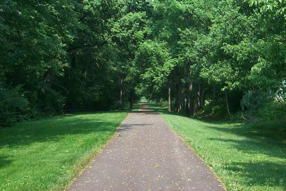
• off-road corridors: river and stream corridors, abandoned roads, utility easements, and abandoned railroad corridors
• on-road corridors: sidewalks and other bike facilities, such as bike lanes, wide curb lanes and bike routes
A second classification for the proposed system is the delineation of each Trail Corridor as Primary, Secondary Tertiary, Rural Road Bike Route or Water-Based Trail (see page 4-26).
A third classification is based on usage, and is described in Facility Development. The purpose and intended usage of a greenway dictate what type of facility is designed and how it will be managed. Design considerations are discussed for corridors with no facility development, limited development,
shared use trails, sidewalks, bikeways, Rural Road Bike Routes, Water Trails and Equestrian Trails (see page 4-81).
Greenway Trail Corridor Types
Off-Road Corridors
The advantage of off-road corridors is that they allow people to travel along trails that are removed from the noise, congestion and pollution associated with on-road facilities. Pedestrian and bicyclists are in less conflict with vehicles, which makes them safer. Riparian corridors, abandoned roads, utility corridors and abandoned/active rail corridors provide open spaces that can be a respite from the urban environment, and should be used whenever possible.
• Rivers and Streams
In addition to the value and potential of LexingtonFayette County's waterways in the creation of an environmentally sound and economically sensible Greenway Conservation Corridors System, the abundance of streams and waterways provide numerous opportunities to utilize these linear corridors to provide trails and connections. The
PAGE 4-24 LFUCG GREENWAY MASTER PLAN
design process for each trail or trail segment will include the detailed research necessary to determine the viability for trail use, and evaluate potential impact, both environmentally and economically.
The trails within Conservation Greenway Corridors should be designed with the sensitivity of the environment as a primary consideration. The Conservation Greenways will provide opportunities to experience and observe the functions and beauty of the natural environment.
As an added benefit, a stream or river provides trail opportunities in the water as well as adjacent to it. Water-Based Trails are designated for the Kentucky River, which is navigable year-round, as well as parts of Boone Creek and the North Elkhorn, which are navigable by canoe, kayak or boat during times of high water.
• Abandoned Roads
As road improvements permanently reroute traffic off of older roads, these abandoned lanes can be converted to trail use. The Squires Road Trail is such an abandoned road. Portions of Higbee Mill Road are currently planned for future conversion. Farm roads, abandoned because of urban growth, also have the potential for trail locations, such as the trails in the Beaumont development.
• Utility Rights-of-Way
Utility easements in Lexington-Fayette County usually exist along lines for electric, sanitary, storm sewer and water services. Across the nation, many communities have made dual use of utility rights-ofway and easements in the incorporation of trail corridors. In corridors owned by a utility company, an agreement with that utility company would be required. Other utility corridors are easements, and they will require the individual property owners be contacted for permission to develop
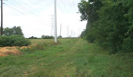
a greenway. Greenways are more difficult to establish in utility easements - particularly where these easements extend through residential areasdue to property owners' concerns. This method of greenway development in residential areas is often far easier to implement in later years of greenway development when other types of greenways have already been established in the community and have become widely popular with residents.
Corridors of this type require careful coordination with utility companies and adjacent landowners, and liability and risk management should be thoroughly resolved before this type of corridor is accepted for trail development.
• Abandoned/Active Railroad Corridors
Rail Trails are public shared use facilities created from abandoned or active railroad rights-of-way. Rail corridors are well suited to trail development because the grades are normally flat to slightly sloping; and the bridges, trestles and other support structures that lie within the corridor were developed to support heavy and frequent rail car use. It should be noted that existing railroad corridors also make ideal trail settings because impact to native vegetation and soil has already occurred, and surface drainage has also been successfully resolved.
Some of the problems typically encountered with rail corridors include the following: title issues related to the possible use of the corridor; opposition from land owners regarding conversion to trail use; presence of toxic chemicals in the ballast, soil and surrounding vegetation; and missing bridges, ballast and other facilities (removed as part of the rail operator's salvage of the abandoned corridor). Each project must be evaluated on an individual basis to determine its feasibility for inclusion as part of a viable rail-trail conversion effort.
It will be important to monitor railroad activity in Lexington-Fayette County in the future. Active freight lines need to be identified and monitored so that action may be taken quickly should they become abandoned. The status of local lines could change in the future, depending on freight demand. A shortline railroad could become abandoned with only a brief public notice to indicate the owner's intent. Therefore, all railroad lines in Lexington-Fayette County should be periodically monitored to determine their current status.
THE GREENWAY SYSTEM PAGE4-25
Utility Right-of-Way Proposed South Elkhorn Trail
Once a railroad company has formally registered its intent to abandon a specific line, the line can be preserved as a corridor for trail use through "railbanking". The railbanking program was created through the 1983 National Trails System Act to allow for interim conversion of rail lines for trail use. In 2000, the Kentucky State Legislature passed House Bill 221 to create a state railbanking law to preserve abandoned railways and provide for their use as greenway trail corridors. The window of opportunity for filing railbanking requests for aboutto-be-abandoned rail lines is relatively narrow. If a line is railbanked, the corridor is treated as if it had not been abandoned; as a result, the integrity of the corridor is maintained and any reversions to adjacent landowners are prevented. However, the line is subject to possible future restoration of rail service.
Several abandoned line sections are potential rail-totrail candidates:
• The Chesapeake and Ohio line, from Lexington to Winchester (6.5 miles within Fayette County).
• The Louisville and Nashville line from Lexington to Paris (3.5 miles within Fayette County)
• The Chesapeake and Ohio line, from Loudon Avenue to I-75 (2.7 miles)
• Several remnants around Midland Avenue, 4th and 7th Street.
Additional active rail lines, which may be abandoned in future years, have the potential to be utilized as Rail-Trails. Recently abandoned rails in developed areas are often the last remaining traffic-free linear corridors and present exciting opportunities for shared use greenway trails.
Development of rails-with-trails usually involves a public shared use trail running parallel to an active railroad track and installed in such a way that is safe to all users. This practice presents a viable option when it is difficult to find alternative land on which trails can be built. This approach is becoming an increasingly important tool in trail building efforts across the nation. Safety is a major concern for both the trail user and the railroad company. Despite these fears, rails-with-trails appear to be just as safe as other trails. A study completed by the Rails-toTrails Conservancy, entitled Rails-with-Trails: Sharing Corridors for Recreation and Transportation, found that appropriately designed rails-with-trails are highly successful and extremely safe. Other surveys indicate that there are fewer
accidents attributed to rails-with-trails than to other trails. In fact, using a rail-with-trail may well be significantly safer than walking or cycling next to a busy main road, and may serve as well to prevent people from walking on active rail tracks. Lexington-Fayette County is host to 59 miles of active lines.
On-Road Corridors
Many of the successful greenway systems across the country combine off-road trails with an on-road system of bicycle facilities and sidewalks. This type of network is able to satisfy the needs of those who bicycle and walk as a means of transportation, since major destinations are generally located along the street and road system. The advantage of on-road corridors is that designated greenways can become extensions of the existing street system, offering users the choice of walking or biking to a destination. In many cases, the street and road network is the only linear corridor available for bicycle and pedestrian use.
Local streets typically do not need special improvements to safely accommodate bicycle traffic. However, given that they serve young bicyclists and casual family riders, there are some important issues to consider. For example, several key types of residential street bike/car crashes involve bicyclists and motorists who are unable to see each other in time to avoid a collision. In some intersections, for example, vegetation and fences block their views. Therefore, residential local streets may benefit from basic sight distance improvements and, where warranted, traffic calming measures.
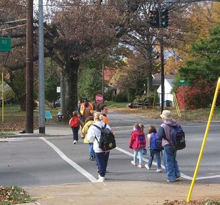
PAGE 4-26 LFUCG GREENWAY MASTER PLAN
Pedestrian crossing at Tates Creek Road
Collector streets are preferred by commuters to local streets because they offer a more continuous and direct route. Like local streets, collectors typically do not need special improvements to accommodate bicycle traffic. In some cases wide curb lanes, bicycle lanes, paved shoulders or limited parking may be appropriate design treatments to accommodate cyclists on collectors, depending on traffic volumes, speeds and the number of motor vehicle turning movements.
Minor arterials are popular commuter bike routes because they carry less traffic than principal arterials and offer greater connectivity than collectors. Minor arterials normally act as boundaries to residential areas, and therefore become critical bicycling links between neighborhoods and community shopping areas, employment centers, recreation areas, and other neighborhoods. Preferred design treatments include wide curb lanes or paved shoulders for advanced cyclists, and designated bike lanes or shoulders for less-skilled cyclists.
Bicycling activity on principal arterials is influenced by factors such as travel distance, personal experience operating in traffic, availability of alternate routes and the presence of extra roadway width. Wide curb lanes or paved shoulders may be all that is necessary to encourage experienced cyclists to use major arterials. For those cyclists less experienced at riding in traffic, designated bicycle lanes or an alternative on-street route may be the facility of choice. Shared use paths for use by beginner cyclists and child cyclists may be considered along major arterials when adequate right-of-way is present and intersections with driveways and cross streets are infrequent.
For Lexington-Fayette County, use of the rural roadways is both an attractive and sensible approach to providing access to historical and scenic landscapes. This Plan proposes the formal establishment of a "rural bike touring" system. This system is already in place informally, and is utilized by thousands of cyclists annually. The advantages to using rural roadways over the establishment of independent public rights-of-way along rural streams can include availability of publicly owned land, ease of access and use, and public familiarity with the rural road network. Factors that must be taken into consideration in planning rural road bike routes and trails in the Urban County include the safety issues
associated with narrow roadways and high volume intersections.
According to current regulations, all new development shall have sidewalks in the public rightof-way. Many older streets and roads do not have sidewalks, or they are in disrepair. Sidewalks are an important element in the urban landscape, and retrofitting older neighborhoods with safe and efficient pedestrian access is encouraged. Discontinuous sidewalks and missing sidewalks need to be connected, constructed or improved.
Retrofitting public streets and roadways for bicycle and pedestrian use must be coordinated with the appropriate LFUCG divisions and the Kentucky Transportation Cabinet. It will also be important to monitor future road improvement planning to ensure that projects consider pedestrian and bicycle facilities and use.
Greenway Trail Corridor System
Greenway Trail Corridors comprise a system of linkages that form a network of passages to many destinations and landscapes throughout the County. Both on-road and off-road facilities are utilized in the development of the trail system. Trails located in Conservation Greenways will be developed to ensure that the primary functions of water quality, floodplain management or habitat preservation are not compromised. The comprehensive system of greenways with trail facilities is classified as: Primary, Secondary and Tertiary Trails; Rural Road Bike Routes and Water-Based Trails.
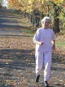
THE GREENWAY SYSTEM PAGE4-27
Squires Road Trail
PrimaryTrails
Primary Trails are defined as those trails that form the main framework of the county-wide trail system. As Lexington-Fayette County's streets form a radial circulation pattern, so too does the organization of the Primary Trails. Extending out in all directions from downtown, Primary Trails run to neighborhoods, the rural countryside and beyond to bordering counties. Also included are Primary Trails that provide connections between those radiating trails in a manner reflecting the circular arterials, such as New Circle Road, Man o' War Boulevard and Citation Boulevard. Primary Trails might be located in Conservation Greenways, or in on-road or off-road locations.
Several projects by the Division of Engineering are already in design and construction, including sections of the Big Sandy (P-6), Citation (P-16), Cane Run (P1), Masterson Station (P-11), Lakeside (P-13a) and South Elkhorn (P-14) Trail Corridors. These sections should be extended through additional and continuous acquisitions to complete the proposed trail corridor. Additionally, private organizations such as Town Branch, Inc., have coordinated efforts in trail development, and these efforts will likely become more prevalent as successful implementation is recognized throughout the community.
SecondaryTrails
As Primary Trails create the framework for the greenway trail system, the Secondary Trails create the linkages between Primary Trails to form an interconnected network system. Secondary Trails also provide access from neighborhoods to regional and local destination points not directly on a Primary Trail. Secondary Trails might be found in Conservation Greenways, or utilize on-road or offroad facilities.
TertiaryTrails
The Primary and Secondary Greenway Trail System should be supported by a system of Tertiary Trails that would provide additional access to areas not reached by the designated Primary or Secondary Trails. Comprised of on-road and off-road facilities, the physical components of Tertiary Trails would be similar to the Secondary Trails, but generally reduced in scope. This system would complete the circulation links within the urban and suburban areas of the Greenway Trail Corridors System, by
connecting neighborhoods to parks, schools, churches, shopping and other public facilities.
Trailheads
An additional element in the system of Greenway Trail Corridors is the Trailhead. A Trailhead is a designated location at which a trail may be accessed. The Trailhead may include amenities, such as parking; staging areas; bathroom facilities; trail and event information; signage and sources for food, drink and communications.
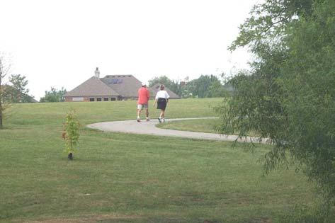
Rural Road Bike Routes
As development has increased within the Urban Service Area, bicyclists have made increasing use of rural roads. Local residents and tourists alike enjoy the scenic views of the rolling countryside that is characteristic of the Bluegrass landscape. As part of the proposed comprehensive system of Greenway Trails, existing urban and suburban bike routes are expanded into a network of Rural Road Bike Routes, which will provide opportunities for recreation, alternative transportation, and tourism.
The Rural Road Bike Routes are proposed to connect trail corridors within the Urban Service Area to destinations in the Rural Service Area and surrounding counties. Points of interest or destinations include the historic rural settlements, Kentucky Horse Park and Briar Hill Park. Rural Road Bike Routes include roads currently and frequently used by bicyclists to create a more comprehensive, identifiable and safer system of connections and routes. Another important criterion used for the development of the system included the county-wide Bicycle Level of Service. Signing of preferred bike routes will identify shared roadways.
PAGE 4-28 LFUCG GREENWAY MASTER PLAN
Hartland Park
Designation of a signed Rural Road Bike Route provides the following:
• continuity to and from other bicycle facilities such as shared use trails, extending bike routes from local neighborhoods, parks schools or commercial districts;
• route designation based on lower motor vehicle traffic volume or paved shoulder availability;
• destination information;
• assurance to cyclists that there are particular advantages to using signed shared routes, indicating that the responsible agencies have taken action to ensure the roads' suitability as shared routes.
In addition to the rural roads, other on-road and offroad facilities of the Greenway Trail System, such as rails-to-trails, rails-with-trails, utility corridors and
some Conservation Greenway Corridors will create a more varied biking experience. For example, trail development has begun for portions of the abandoned C&O Rail Line within the Urban Service Area. This trail is part of the Lexington Big Sandy Trail, which will offer the opportunity to provide a scenic, off-road, shared use route between Lexington and Winchester.
Because the horse industry and general agriculture are vital to Central Kentucky, there are some additional rules, as well as bike etiquette, that are necessary when riding on rural roads. While it is the goal for cyclists to enjoy the wonderful views and beautiful countryside, there are some basic manners that need to be acknowledged and followed for the protection of both the farming community and the cyclists. See Appendix J.4 for a listing of these rules.
THE GREENWAY SYSTEM PAGE4-29
Rural Road Bike Route
Trailheads accessible to the Rural Road Bike Routes would be at the following locations:
• Raven Run Nature Sanctuary;
• Athens Elementary School on Athens-Walnut Hill Pike;
• Russell Cave Elementary School, near the intersection of Russell Cave Road and Iron Works Pike;
• Indian Ceremonial Mounds, on Mt. Horeb Pike and the
• Police Firing Range, off of Parkers Mill Road, south of the Blue Grass Airport.
These Trailheads are proposed to include parking, restrooms and information kiosks. Additional amenities could include communications, food and beverage vendors and rest areas.
Water-Based Trails
Several streams provide recreational opportunities for boaters. The Kentucky River runs year-round for all boats, including those that are motorized. The North Elkhorn and Boone Creeks are navigable on a seasonal basis for canoe, rowboat and kayak.
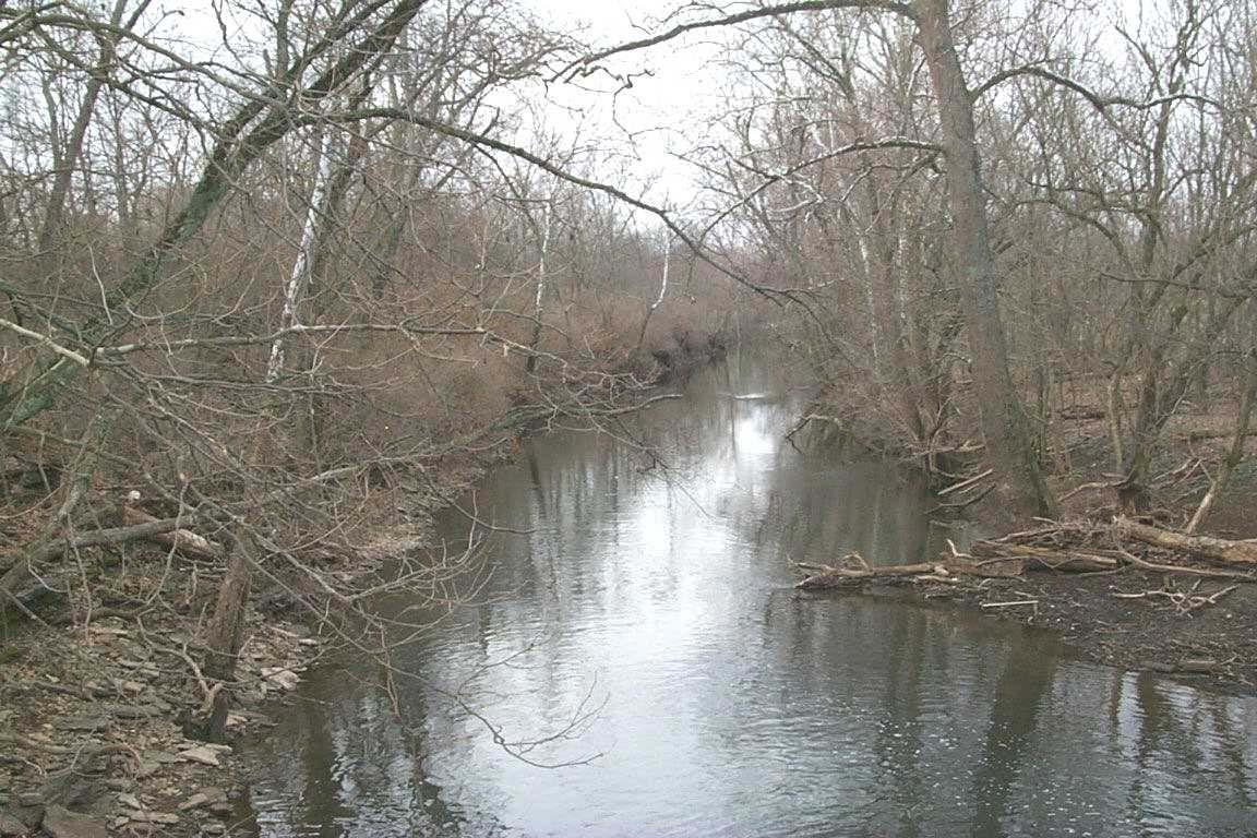
PAGE 4-30 LFUCG GREENWAY MASTER PLAN
North Elkhorn Creek
Greenway Trail Corridor Descriptions and Maps
(Primary Trails)
The Greenway Trail Corridor Maps show the Trail System, Conservation Greenways, streets, railroads, streams, and trailheads. It also includes cultural
points of interests, including libraries, community/senior centers, YMCAs, parks, schools and historic sites. The map shows employment destinations that include hospitals, shopping centers, industrial parks and Rural Activity Centers.
Primary Trail Maps
Trail P-1: Cane Run Greenway Trail
Trail P-2: Constitution Greenway Trail
Trail P-2a: Paris Pike Greenway Trail
Trail P-3: Phoenix Greenway Trail
Trail P-4: Briar Hill Greenway Trail
Trail P-5: Winchester Road Greenway Trail
Trail P-6: Big Sandy Greenway Trail
Trail P-7: Veterans Greenway Trail
Trail P-8: Lafayette Greenway Trail
Trail P-9: Manchester/McConnell Greenway Trail
Trail P-10: Town Branch Greenway Trail
Trail P-11: Masterson Greenway Trail
Trail P-12: North Elkhorn Greenway Trail
Trail P-13: Man o’ War Greenway Trail
Trail P-13a: Lakeside Greenway Trail
Trail P-14: South Elkhorn Greenway Trail
Trail P-15: Cardinal-Waverly Greenway Trail
Trail P-16: Citation Greenway Trail
Trail P-17: Castlewood Greenway Trail
Trail P-18: Henry Clay Greenway Trail
Rural Road Bike Route Map
Water-Based Trail Maps
Trail W-1: The Boone Creek Waterway
Trail W-2: The Kentucky River Waterway
Trail W-3: North Elkhorn Creek
THE GREENWAY SYSTEM PAGE4-31
TRAIL P-1: CANE RUN GREENWAY TRAIL
Trail Corridor Description: The Cane Run Greenway Trail is located within the Cane Run Conservation Greenway Corridor, which runs roughly parallel to Georgetown Road. The Trail begins Downtown at the intersection of the CSX Railroad Line and Cane Run Creek, then runs parallel to the stream corridor. Midway, the Trail can be accessed at a Trailhead in the newly designated Coldstream Park. The Tra il then follows Cane Run Creek to a Trailhead at the Kentucky Horse Park, which is the Trail's outer destination point. The Trail passes through a variety of land uses, including residential, office/industrial parks, the developing University of Kentucky research facility and UK’s Main Chance Farm.
Trail Objectives: The Greenway Trail Corridor should provide open space links between the Downtown area, North Side neighborhoods, Coldstream Park and the Kentucky Horse Park. As part of a Conservation Greenway, the Corridor would provide for wildlife habi tat and a water quality tool.
Trail Components: Hard or natural surfaces for shared use trails are envisioned for the full length of the Trail, with a hard su rface trail utilized between Downtown and the Coldstream Park area, and a mixture of hard and natural surfaces utilized to access the stream corridor out to the Kentucky Horse Park. There is no indication of the necessity of 'no trails' areas, and the stream depth would prohibit Water-Based Tra ils. The Coldstream Park Trailhead would include parking, restroom facilities and information kiosks. The Kentucky Horse Park Trailhead would in clude parking, restroom facilities, information kiosks, and would provide the opportunity for food, beverage and supply vendors.
Opportunities and Challenges in Design:
Road crossing at Newtown Pike Road crossing at New Circle Road
Road crossing at Citation Greenway Trail (P-16)
Road crossing at I-75
P AGE 4-32 LFUCG G REENWAY M ASTER P LAN
T HE G REENWAY S YSTEM P AGE 4-33
Trail Components: The majority of the Corridor is intended as an off-road trail designed with a hard surface for shared use, with the integration of on-road bikeways and/or sidewalks where necessary. In more environmentally sensitive rural areas, natural surface trails may be utilized. The opportunity for Water-Based Trails may exist in the creation of a Trailhead for small craft where the Trail meets the navigable section of the North Elkhorn Creek. The Bryan Station Historic Fort Tr ailhead would include parking and information kiosks.
TRAIL P-2: CONSTITUTION GREENWAY TRAIL
in Design: Acquisition of abandoned rail line right-of-way Sharing of rail right-of-way on active line or acquisition of adjacent easement Stream crossings Road crossing at New Circle Road Road crossing at I-75
Opportunities and Challenges
Trail Corridor Description: This Greenway Trail would begin Downtown at Cox Street behind the Civic Center, and run east along the CSX Railroad Line, passing Applebee's Park (baseball stadium) and continuing northeast along the railroad right-of-way to the juncture with Old Paris Pike. From that point, the Trail is envisioned to follow the abandoned L&N rail bed (easily visible in aerial photographs), which runs through privately owned farms to the east, paralleling Bryan St ation Road to the County line. The Trail could then contin ue to destinations in Bourbon County. The Primary Trail may be accessed from the Bryan Station Historic Fort Trailhead via the Briar Hill Greenway Trail (P-4) and Br yan Station Road. An alternative to following the alig nment of the abandoned L&N rail line would be to develop a greenway trail along the Paris Pike right-of-way to the County line. This alignment (Paris Pike Greenway Trail, P-2a) is discussed in greater detail in the next section. Along the way, the Trail meets with Coolivan Park and passes near Constitution Park. Outside of I-75, the Trail would cross several streams and intersect several of the proposed Rural Road Bike Routes in the northeast section of the County. The Trail also intersects with the Cane Run (P-1) and Briar Hill (P-4) Greenway Trails. It would encounter a wide variety of land uses, including in dustrial, residential, commercial and agricultural. An area of potential conflict occurs as the Trail along North Broadway encounters the CSX Line ov erpass and New Circle Road within the space of a few hundred yards. It should be noted that the location and development of the urban sections of the Trail are dependent upon future abandonment of that section of rail.
Trail Objectives: This Greenway Trail will utilize existi ng rail line corridors to provide access for northeast area residents to Downtown, and will allow off-road access from Downtown along existing or previously existing rights-of-way to the Rural Service Area and beyond.
P AGE 4-34 LFUCG G REENWAY M ASTER P LAN
T HE G REENWAY S YSTEM P AGE 4-35
TRAIL P-2A: PARIS PIKE GREENWAY TRAIL
(ALTERNATIVE ROUTE)
Trail Corridor Description: This Paris Pike Greenway Trail is pro posed as an alternative route to the Constitution Greenway Trail (P-2). The Trail diverges from the Constitution Greenway where that Trail turns east along the CSX Rail Line, following instead, the Paris Pike right-of-way to the County line.
Trail Objectives: The Paris Pike Corridor is known worldwide for its historic horse farms and farm properties. The Greenway Trail would provide unique opportunities for experiencing this scenic area. Tourists and residents alike could utilize the Trail as a recreational resource for biking from Downtown (via Constitution Trail) or the I-75 area, to the County line, and perhaps into Paris. It should be noted that the proposed highway improvements on Paris Pike present a safer transportation environment, while maintaining vernacular edges and viewsheds. The highway will have a wider right-of-way, allowing for the possible accommodation of the Trail. Trail Components: A hard surface, off-road trail may be utilized here in making use of the road right-of-way as a shared use fac ility. Special attention would be paid to mature trees and historic stone walls along the route.
Opportunities and Challenges in Design:
Integration of the Trail into the Paris Pike right-of-way, or possible acquisition of additional rightof-way Stream crossings
P AGE 4-36 LFUCG G REENWAY M ASTER P LAN
T HE G REENWAY S YSTEM P AGE 4-37
TRAIL P-3: PHOENIX GREENWAY TRAIL
Trail Corridor Description: The Phoenix Greenway Trail begins Downtown at the Vine Street Trailhead, which is proposed to be located near the Transit Center. The Phoenix Greenway Trail reflects the historic existence of the passenger rail line and creek that once ran through the Downtown area. The Trail travels east to Midland Avenue and picks up the CSX Rail Line right-ofway to Loudon Avenue, following that rail line to its end near New Circle Road. At that point, the Trail would follow the abandoned L&N Rail Line under I-75, and northeast until it intersects with the CSX Rail Line (the Briar Hill Greenway Trail, P4). Downtown destinations include Phoenix Park, the Lexington Main Library, the new Courthouses, the LexTran Transit Center and Thoroughbred Park. The Trail bypasses the busy commercial activities of Winchester Road, traversing neighborhoods, where it offers the opportunity to access Kenawood Park via tertiary trails. The Trail then transitions to agricultural land outside of I-75.
Trail Objectives: This Greenway Trail will engage user s with the Downtown District, and will provide the primary co nnection from Do wntown to the east areas of the Urban and Rural Services Areas.
Trail Components: The Trail is intended as a shared us e facility, composed of a combination of enhanced sidewalks, bike facilities and hard surface trails along the rail corridors. The Vine Street Trailhea d would provide access to parking, restroom facilities, information kiosks , and proximity to sources for food, beverages, and other activities.
Opportunities and Challenges in Design:
Acquisition of abandoned rail line right-of-way
Sharing of rail right-of-way on active line
Road crossing at New Circle Road
Road crossing at I-75
Integration of Trail along busy urban streets
Development of Downtown Trailhead
P AGE 4-38 LFUCG G REENWAY M ASTER P LAN
T HE G REENWAY S YSTEM P AGE 4-39
TRAIL P-4: BRIAR HILL GREENWAY TRAIL
Trail Corridor Description: Briar Hill Greenway Trail would function both as a Primary Trail and as an alternative to the Winchester Road Greenway Trail (P-5). Briar Hill Trail emanates from the Constitution Greenway Trail (P-2), forking off where the CSX Rail Line turns south from the abandoned L&N Rail Line. The Trail travels eastward along the rail right-of-way, engaging several creeks, including the North Elkhorn and Avon Branch. It then proceeds to a proposed Trailhead in the currently undeveloped Briar Hill Park. The Trail passes through the Avon (Bluegrass Station) Rural Activity Center, near the Avon Golf Course and resident ial area. It continues southeast to the Fayette County line, serving as a potential link to Clark County and beyond. The Primary Trail may also be accessed from the proposed Bryan Station Historic Fort Trailhead via Bryan Station Road or Briar Hill Road. Trail Objectives: This Trail would serve primarily as an off-road recreational route to destinations in the eastern portion of the County, and would provide potential linkage with Clark County.
Trail Components: An off-road facility designed with a hard surface for shared use is proposed along the rail corridor. The Briar Hill Park Trailhead would include parking, restroom facilities an d information kiosks. For the Bryan Station Historic Fort Trailhead, refer to the Trailhead description for the Phoenix Greenway Trail (P-3). Opportunities and Challenges in Design: Integration of the Trail along active rail line or future acquisition of abandoned rail line right-of-way Stream Crossings Road crossing at I-75
P AGE 4-40 LFUCG G REENWAY M ASTER P LAN
T HE G REENWAY S YSTEM P AGE 4-41
TRAIL P-5: WINCHESTER ROAD GREENWAY TRAIL
Trail Corridor Description: The Winchester Road Greenway Trail is an alternative route to the Briar Hill Greenway Trail (P-4), described pr eviously. The Trail begins at the Phoenix Greenway Trail (P-3) where it intersects with Hume Road just past I-75. It follows Hume Road southeast until it picks up on the Winchester Road right-of-way to the Clark County line, where it could be continued to provide a Trail for the full distance to Winchester. The Trail crosses the North Elkhorn Creek Co nservation Greenway, as well as David Creek, which is a tributary of North Elkhorn Creek. The land use along this Trail is agriculture.
Trail Objectives: Along with recreational use, this Gr eenway Trail will provide alternative transportation for existing and future residences near the corridor along Winchester Road. The Trail section running north-south from the Phoenix Greenway Trail could provide habitat, as well as recreational opportunities. The Trail has regional potential since it crosses the County line.
Trail Components: An off-road facility designed with a hard surface for shared use is recommended. The Trail would be incorporated into the Winchester Road right-of-way, with similar treatment implemented at Hume Road with the acquisition of easements or additional right-of-way. Local country stores might serve as rest/r efreshment/communication stops for users.
Opportunities and Challenges in Design: Sharing right-of-way along Winchester Road corridor Acquisition of additional easement or right-of-way at Hume Road Stream crossings
P AGE 4-42 LFUCG G REENWAY M ASTER P LAN
T HE G REENWAY S YSTEM P AGE 4-43
Opportunities and Challenges in Design:
Acquisition of abandoned rail line right-of-way
Sharing of rail right-of-way on active line in industrial areas
Stream crossings Road crossing at New Circle Road Road crossing at Man o' War Road crossing at I-75
TRAIL P-6: BIG SANDY GREENWAY TRAIL
Trail Corridor Description: The Big Sandy Greenway Trail is a previously designated rail-to-trail corridor that begins where the Phoenix Greenway Trail (P-3) diverges on Midland Avenue to follow another CSX Rail Line. The Big Sandy roughly parallels Liberty Road, traversing southeast through a zone of commercial, industrial and residential land uses to the end of the existing line just before intersecting with Liberty Road. The Primary Trail may be accessed from the proposed Liberty Road Trailhead via a Secondary Trail. From the Liberty Road intersection, the Trail follows the abandoned C&O Rail Line due east, crossing Man o' War Boulevard and I-75, meeting a Trailhead at Pleasant Ridge Park and continuing through agricultural lands to the Fayette County line. It is an important link from Downtown to the outlying areas of the County in the east, and provides direct access through publicly owned lands to on-r oad bike facilities systems in the northeast and southeast, as well as northernmost reaches of the Boone Creek Conservation Greenway Corrido r. The Big Sandy Greenway Trail could develop as a potential link to Winchester, Morehead and Ashland, Kentucky.
Trail Objectives: Though planned primarily as a long distance Trail in the Rural Service Area, the Trail inside of I-75 will provide recreational and alternative transportation opportunities for older and newer neighborhoods alike. Neighborhood connectors provide access to shopping and large-scale recreation, such as Jacobson Park.
Trail Components: The Trail will provide an ideal situati on for the implementation of an offroad, shared use Trail that incorporates both hard and natural surfaces. The Liberty Road Trailhead would include parking and information kiosks, with possible proximity to rest/food/communications at local commercial establishments. The Pleasant Ridge Trailhead would provide parking, information kiosks, restrooms, and possible food/beverage vendors. For the Vine Street Trailhead description, refer to the trailhead description in Phoenix Greenway Trail (P-3).
P AGE 4-44 LFUCG G REENWAY M ASTER P LAN
T HE G REENWAY S YSTEM P AGE 4-45
in Design:
Opportunities and Challenges
Sharing of roadway right-of-way for bike lanes
Stream crossings Road crossing at New Circle Road Road crossing at Man o' War Development of Trail through the University of Kentucky Campus
TRAIL P-7: VETERANS GREENWAY TRAIL
Trail Corridor Description: Veterans Greenway Trail begins at the intersection of Vine Street and Rose Street/Elm Tree Lane and runs south, entering the University of Kentucky campus at Euclid Avenue. The Trail winds through the campus to emerge at Alumni Drive; then cont inues south, skirting the Arboretum and accessing a proposed Trailhead th ere. Three hospitals are located along the Trail. From the Arboretum, the Trail winds through Shady Lane Woods, then picks up on Bellefonte Drive, which is an existing bike route. The Trail runs through neighborhoods and skirts Kirklevington Park, Meadowbrook Golf Course an d several branches of the West Hickman Creek Conservation Greenway Corridor. There is another proposed Trailhead access at Veterans Park, through which the Trail continues to the Fayette County line.
Trail Objectives: The Trail will provide opportunitie s for expansive recreational and alternative transportation routes, and can allow locals and tourists to experience many aspects of the City and County's attractions within a relatively comprehensive area. The Veterans Greenway Trail will engage several major destinatio n points throughout the south-central core of Fayette County, with potential linkages to Jessamine County. In particular, this Trail area provides one of the few viable trail corridor options between Nicholasville Road and Tates Creek Road, and between the University of Kentucky and Down town. As the Trail engages busy roadway intersections, at-grade crossi ngs will need to be designed with both safety and aesthetics in mind.
Trail Components: All uses other than Water-Based Tra ils are considered for this Trail system. On-road, hard surface tra ils comprise a major portion of the facilities, while off-road hard and n atural surfaces are proposed for the areas traversing West Hickman Creek Conservation Greenway. The Arboretum Trailhead would include parking, restrooms, information kiosks, potential food/beverage vendors (at special events) and access to the Arboretum itself. The Veterans Park Trailhead would include the same amenities, with access, in this case, to Veterans Park.
P AGE 4-46 LFUCG G REENWAY M ASTER P LAN
T HE G REENWAY S YSTEM P AGE 4-47
information kiosks, and will have acce ss to the amenities of the Waveland State Historic Site.
Opportunities and Challenges in Design:
Sharing of roadway right-of -way for bike facilities
Stream crossings Road crossing at Forbes Road Road crossing at Harrodsburg Road
Sharing of utility easement/active rail line easement Road crossing at New Circle Road Road crossing at Man o' War
TRAIL P-8: LAFAYETTE GREENWAY TRAIL
Trail Corridor Description: The Lafayette Greenway Trail ties th e inner west-side neighborhoods to the southern extents of the County. Beginning at the intersection with the Town Branch Greenway Trail (P-10), the Lafayette Trail follows Forbes Road, and passes near the proposed Trailhead at McConnell Springs Park. The Trail runs south along Red Mile Road, turning onto Unity Drive, traversing the eastern edge of Picado me Golf Course, an d picking up on Shaker Drive. It then crosses Harro dsburg Road to follow Clay's Mill Road to the new Wellington Way Ex tension and proposed Wellington Park. The Trail may then follow the Wellington Road/Reynolds Road right-of-way or utilize po tential easements throug h commercial and other non-residential properties. It then turns into Shillito Park, where a Trailhead is proposed. The Trail woul d then traverse the utility easement paralleling the Norfolk Southern Rail Line to meet the South Elkhorn Greenway Trail (P-14) at the proposed Waveland Trailhead and continue to the Fayette County line, potentially extending to Jessamine County. This Trail engages many neighborhood and connector roadways to provide neighborhood access to recreational fa cilities, shopping, schools and churches.
Trail Objectives: The Lafayette Greenway Trail will provid e opportunities for recreation and alternative transportation. With access to McConnell Springs and Shillito Park, Waveland, and the many schools and churches along Clay's Mill Road, the user will encounter ripari an areas, open recreational areas, historic sites, neighborhoods, shopping and community services.
Trail Components: With an emphasis on alternative trans portation, the Trail will be serviced by on-road and off-road shared use facilities. The McConnell Springs Trailhead is proposed to include parking, information kiosks, restroom facilities, and will have access to th e food/beverage/activity centers of Downtown Lexington. The Shillito Park Trailhead will include parking, information kiosks and restrooms, and will have the potential for food/beverage kiosks and access to the amenities of the Shillito Park complex. The Waveland Trailhead will include parking, restrooms,
P AGE 4-48 LFUCG G REENWAY M ASTER P LAN
T HE G REENWAY S YSTEM P AGE 4-49
Opportunities and Challenges in Design:
Sharing of active rail right-of-way with Trail
Acquisition of abandoned rail right-of-way (future)
Stream crossings Crossing at Forbes Road Crossing under New Circle Road
Acquisition of land or easements through farming operations
TRAIL P-9: MANCHESTER/MCCONNELL GREENWAY
TRAIL Trail Corridor Description: This Greenway Trail follows the Sout hern Rail Line right-of-way, which runs to Versailles and eventually Lawrenceburg. It begins near the intersection of the Norfolk Southern and CSX Rail Lines on Manchester Street, crosses the Lafayette Greenw ay Trail (P-9), then engages the McConnell Springs Park and proposed Trailhead. The Trail continues along the rail right-of-way to broach Preston Springs Park and intersects with the Cardinal-Waverly Greenway Trail (P-15) and Citation Greenway Trail (P-16). Beyond New Circle Road, the Manchester/McConnell Trail turns west through farmland, crossing a couple of Rural Road Bike Routes and Shannon Run Creek, then on to the Woodford County line. The Trail passes through neighborhood s, industrial areas, parks and farmland of Lexington's west side. Trail Objectives: This Greenway Trail will provide opportunit ies for recreational exploration of natural areas, parks, open spaces and extended trails within the context of a wide range of land us es. This Trail intersects with other trails that are within Conservation Greenways, allowing the user to engage in exploration of habitat and riparian corridors. Trails through this area also provide alternative transportation opportunities. The rail line extends into Anderson County; therefore, it has the potential for regional use.
Trail Components: The opportunity exists to provide a completely off-road trail along the rail corridor. Areas near or along the Conservation Greenway Corridors may call for either hard or natural surfa ces. No opportunities exist for WaterBased Trails, and the Trail is intended for shared use. Amenities at the McConnell Springs Trailh ead are listed for the Lafayette Greenway Trail (P-8).
P AGE 4-50 LFUCG G REENWAY M ASTER P LAN
T HE G REENWAY S YSTEM P AGE 4-51
recommended. Areas along the stream where there should be no disturbance, the rail right-of-way would be utilized. On-road bike facilities, sidewalks and hard surface of f-road trails should be utilized in the Downtown sections of the Trail. Descriptions for the Vine Street Trailhead and Masterson Station Park Trailhead may be found for the Phoenix Greenway Trail (P-3) and the Man o’ War Greenway Trail (P-11), respectively. Opportunities and Challenges in Design: Sharing of active rail right-of-way with trail Acquisition of abandoned rail right-of-way (future) Stream crossings Acquisition of land/easements in industrial and institutional areas Road crossing under New Circle Road Acquisition of land or easements through farming operations Steep slope conditions in rural sections
TRAIL P-10: TOWN BRANCH GREENWAY TRAIL
Trail Corridor Description: The Town Branch Greenway Trail makes use of city streets, the CSX Rail Line right-of-way and the Town Branch Conservation Greenway Corridor. Beginning Downtown at the proposed Vine Street Trailhead, the Trail utilizes on-road facilities to access the rail right-of-way. Following that right-of-way, the Trail would skirt the edge of the Town Branch Conservation Greenway, where users may also access the Trail via the proposed McConnell Springs Trailhead. The Trail passes under New Circle Road and traverses industrial and institutional land uses. It will intersect with the Citation Greenway Trail (P-16) then alternate between the rail right-of-way and the Town Branch Conservation Greenway Corridor, depending upon availability of land, rights-of-way and terrain conditions. The Trail may be acce ssed from the proposed Masterson Station Park Trailhead via internal Park trails and the Masterson Greenway Trail (P-11). Intersecting the Yarnallton Pike Rural Road Bike Route, the Trail would follow the ra il right-of-way to the Woodford County line.
Trail Objectives: The Town Branch Greenway Trail will access much of the Town Branch Conservation Greenway Corrido r, providing opportunities for recreational/educational opportunities. This Trail could be promoted as a tourist attraction, taking advantage of the historical, habitat and water quality enhancement and flood prevention components of the Conservation Greenway, as well as the close proximity to Downtown. Access to Masterson Station Park fr om Downtown and the west side neighborhoods would be considered a ma jor objective of the Trail. There is the possibility of regional linkage with Woodford, Scott and Franklin Counties.
Trail Components: The Town Branch Conservation Gree nway will serve as an exemplary stream restoration, providing educational opportunities for all users, while allowing for passive recreation along the length of the Corridor. The rail right-of-way could be utilized to provid e a hard surface, off-road trail. Where the Trail traverses the stream, a natural surface might be
P AGE 4-52 LFUCG G REENWAY M ASTER P LAN
T HE G REENWAY S YSTEM P AGE 4-53
TRAIL P-11: MASTERSON GREENWAY TRAIL Trail Corridor Description: The Masterson Greenway Trail is located within a tributary of the Town Branch Conservation Greenway. The Greenway Trail provides a primary connection between the Citation (P-16) and Town Branch (P-10) Greenway Trails, and for access to Masterson Station Park. The Trail begins at the intersection of the Citation Greenway Trail, running west along the existing conservation greenway in Masterson Hills, traversing the south end of the Park, and crossi ng Leestown Road to engage the Town Branch Greenway Trail.
Trail Objectives: This Greenway Trail will provide the alternative transportation opportunities where it intersects with the Citation Greenway Trail and Town Branch Greenway Trail. Ac tive and passive recreation will be available, both on the Trail, and at Masterson Station Park. The Town Branch Conservation Greenway Corrido r will function in the capacity of enhancing water quality, providing habitat and demonstrating flood control within a newer subdivision. Access to a community park is a major advantage. The Trail will ut ilize previously planned trail and greenway systems in that area.
Trail Components: This Trail is planned as an off-road facility that might use natural or hard surfaces, using hard surfaces where possible. Users would include all activity types other than Water-Based Trails. The Masterson Station Park
Trailhead will include parking, inform ation kiosks, restrooms, potential food/beverage vendors and communications facilities, as well as access to the amenities of Masterson Station Park.
Opportunities and Challenges in Design: Stream crossings Road crossing at Leestown Road
Development of bike facilities along existing streets
P AGE 4-54 LFUCG G REENWAY M ASTER P LAN
T HE G REENWAY S YSTEM P AGE 4-55
TRAIL P-12: NORTH ELKHORN GREENWAY TRAIL
Trail Corridor Description: The North Elkhorn Greenway Trail follows the upper reaches of the North Elkhorn Creek Conservation Greenway, east of the Urban Service Area. The Trail is predominately rural, except a portion that runs through the Expansion Area south of Winchester Road. The North Elkhorn begins at the intersection with the Briar Hill Greenway Trail (P-4), runs under Interstate 64, then intersects with the Winchester Road Greenway Trail (P5). Continuing along the Creek, the Trail ends at the Big Sandy Greenway Trail (P-6). The Trail may be accessed from the nearby, proposed Trailheads located at Briar Hill Park and Pleasant Ridge Park.
Trail Objectives: This Greenway Trail w ill provide a major rural connector for the above Trails, and will provides users with the opportunity to experience an extended length of the North Elkhorn Creek Conservation Greenway. The Conservation Greenway provides habitat, flood control and enhanced water quality mechanisms, along with passive recreational/educational opportunities for the user.
Trail Components: This portion of the North Elkhorn Creek does not provide Water-Based Trail opportunities. The off-road Tra il should use either hard or natural surfaces, depending upon the terrain and conditions. Certain areas of the Conservation Greenway may necessitate that there be no trails, perhaps compensating by moving trails away from the Conservation Greenway in those sensitive areas. Descriptions of the Briar Hill Park Trailhead and Pleasant Ridge Trailhead may be fo und at Trail (P-4) and Trail (P-6) descriptions, respectively.
Opportunities and Challenges in Design
Stream crossings
Acquisition of land/easements throughout the Conservation Corridor
Road crossing Winchester Road Road crossing I-64
P AGE 4-56 LFUCG G REENWAY M ASTER P LAN
T HE G REENWAY S YSTEM P AGE 4-57
TRAIL P-13: MAN O' WAR GREENWAY TRAIL
Trail Corridor Description: The Man
o’ War Greenway Trail begins at the intersection with the Big Sandy Greenway Trail (P-6), then follows Man o' War Boulevard to terminate at the intersection with the Veterans Greenway Trail (P-7).
Along the way, the Trail intersects with the Lakeside Greenway Trail (P13a) and several designated Secondary Trails. It crosses Richmond Road, Alumni Drive and Tates Creek Road, along with branches of the East Hickman Creek Conservation Greenway. The Trail runs close to River Hill and Belleau Woods Parks, and en gages open spaces, commercial areas and neighborhoods.
Trail Objectives: The Man o' War Greenwa y Trail will provide linkage between several Greenway Trail Corridors, as well as opportunities for alternative transportation. It will link neighborho ods, nearby parks and shopping.
Trail Components: The Man o' War Greenway Trail is proposed to utilize the right-of-way of Man o' War Boulevard, and will repla ce the existing sidewalk along the south side of the road with a 10 to 12-foot-wide asphalt trail, creating a hard surface, off-road, shared use facility. The nearest Trailheads are described for the P-6, P-7 and P-13a Trails, along with a Trailhead located at Hartland Park.
Opportunities and Challenges in Design
Stream crossings Road crossing Tates Creek Road Road crossing Richmond Road Road crossings other major streets
Replacement of street sidewalk
P AGE 4-58 LFUCG G REENWAY M ASTER P LAN
T HE G REENWAY S YSTEM P AGE 4-59
TRAIL 13A: LAKESIDE GREENWAY TRAIL
Trail Corridor Description: This Greenway Trail provides a major connection between the Man o' War Greenway Trail (P-13) and Jacobson Park. Beginning at the Man o' War Greenway Trail, this Trail runs along Blazer Parkway and Eagle Creek Drive to pick up an existing roadside walkway which currently serves the Richmond Road side of Jacobson Park. The Trail would provide access to an internal trail system at Jacobson Park, accessing a proposed Trailhead there. Neighborhoods, professional office, commercial, and open space are traversed via this Greenway Trail.
Trail Objectives: This Greenway Trail will provide op portunities to access open space and the major destination of Jacobson Park . It will also allow for alternative transportation through a neighborhood area and an off-road facility along a major thoroughfare.
Trail Components: Use of this Greenway Trail will be fo r all activities other than a WaterBased Trail. The Trail could utilize existing neighborhood sidewalks and create bike facilities for on-road fa cilities, utilizing and expanding the existing off-road hard surface trail along Richmond Road to meet up with the internal Park trail system. The Jacobson Park greenspace is an existing example of water quality enhancement and flood control, and could be further enhanced to provide greater habitat opportunities. The Jacobson Park Trailhead will include parking, information kiosks, access restrooms and other amenities of the Park.
Opportunities and Challenges in Design
Share roadway right-of-way for potentia l bike facilities and shared use trail
P AGE 4-60 LFUCG G REENWAY M ASTER P LAN
T HE G REENWAY S YSTEM P AGE 4-61
TRAIL 14: SOUTH ELKHORN GREENWAY TRAIL
Trail Corridor Description: The South Elkhorn Greenway Trail begins at a proposed Trailhead in Veterans Park and follows a tributar y of West Hickman Creek west to Nicholasville Road. The Greenway Trail passes through neighborhoods and open areas, crossing Nicholasv ille Road and intersecting with the Lafayette Greenway Trail and proposed Trailhead (P-8). It also accesses Man o' War Boulevard for a one-mile stretch, intersecting with the Cardinal-Waverly Trail (P-15) prior to rejoining the Creek. From there it follows portions of Clemons Run and South Elkhorn Creek, ending at a proposed Trailhead just beyond Harrodsburg Road. Destinations include Waveland State Historic Site, shopping and business areas.
Trail Objectives: The South Elkhorn Creek is in a suburban area that provides opportunities for water quality enhancement and habitat, as well as passive recreational and educational pr ospects, with access to more active recreation areas nearby. The Gree nway Trail will pass through many neighborhoods and will allow access to nearby shopping. The Trail will be accessible from three different trailheads.
Trail Components: All except Water-Based Trail users are intended for this Trail. Both onroad and off-road facilities are propos ed. On-road facilities include new bike facilities and existing sidewalks. Off-road facilities might incorporate either hard or natural surface trails, as called for by terrain, conditions and intended use. Refer to Veterans Greenway Trail (P-7) for the description of Veterans Park Trailhead and to the Lafayette Greenway Trail (P-8) for a description of the Waveland Trailhead. The Elkhorn Trailhead would include parking and information kiosks
Opportunities and Challenges in Design
Stream crossings Sharing right-of-way at Man o' War for off-road hard surface trail Road crossing Ha rrodsburg Road Road crossing Nicholasville Road
P AGE 4-62 LFUCG G REENWAY M ASTER P LAN
T HE G REENWAY S YSTEM P AGE 4-63
include parking, information kiosks , and access to restrooms and other amenities provided within Cardinal Run Park.
Opportunities and Challenges in Design
Stream crossings Sharing right-of-way at Man o' War for off-road hard surface trail Road crossing Ha rrodsburg Road Road crossing Nicholasville Road Limited right-of-way and road way along Parkers Mill Road
Possible acquisition of State Highway right-of-way for overpass at New Circle Road
TRAIL P-15: CARDINAL-WAVERLY GREENWAY TRAIL
Trail Corridor Description: This Greenway Trail begins at the point where the South Elkhorn Trail (P-14) leaves Man o' War Boulev ard to the west, running instead northwest along Man o' War to the Paul Laurence Dunbar High School. There, the Trail crosses Man o' Wa r, follows an existing farm road through the Beaumont Development to a proposed trailhead at Cardinal Run Park. The Trail continues on Parkers Mill Road, goes under New Circle Road, then picking up a tributary of the Wolf Run Conservation Greenway. It passes Valley Park and Preston Springs Park, before ending at the intersection of the Manchester/McConnell Greenway Trail (P-9) and the Citation Greenway Trail (P-16). The Trail traverses many neighborhoods and open spaces, and provides access to the Palomar, Beaumont and Gardenside shopping areas and public facilities via Secondary Trails. Trail Objectives: This Greenway Trail w ill provide alternative transportation routes and recreational opportunities for local neighborhoods and longer distance users. It will utilize portions of the Wolf Run Conservation Greenway Corridor, existing roadways and tra ils, and will access several park and public facilities. The Wolf Run Greenway Corridor wi ll provide water quality enhancement as well as flood control measures. The potential exists to provide an overpass at New Circle Road from an area near Cardinal Run Park to the older Beau mont subdivision located within the Circle. This would require State Highway right-of-way acquisition.
Trail Components: All except Water-Based Trail users could access the Cardinal-Waverly Greenway Trail. The Trail will make extensive use of on-road and offroad hard surface trails, including the addition of off-road shared use facilities to existing right-of-way, and off-road hard surface trails through undeveloped neighborhood areas. Intersections at New Circle Road and Versailles Road will need to be designed for ease in crossing. Both hard and natural surfaces could be utilized through the Wolf Run Conservation Greenway section of the Trail. Th e Cardinal Run Park Trailhead will
P AGE 4-64 LFUCG G REENWAY M ASTER P LAN
T HE G REENWAY S YSTEM P AGE 4-65
Trail Components: The Trail is intended as a shared use, on-road and off-road facility. With a major emphasis on alternative transpor tation, the Trail should be a hard surface, except in the Wolf Run Greenway Corridor, where the Trail might utilize a hard or natural surface. A description of the Coldstream Trailhead is available in the Cane Run Greenway Trail (P-1).
Opportunities and Challenges in Design Stream crossings Sharing right-of-way at Citation Boulevard Sharing right-of-way in neighborhood areas Road crossing at Russell Cave Road Road crossing Newtown Pike Road crossing Georgetown Road Road crossing Leestown Road
TRAIL P-16: CITATION GREENWAY TRAIL Trail Corridor Description: The Citation Greenway Trail extends outside of New Circle Road, providing a major connection between the Cane Run (P1) and Constitution (P-2) Greenway Trails. The Trail begins on Haggard Lane across from the Constitution Greenway Trail, and extends along the rightof-way for the existing and proposed Citation Boulevard through several neighborhoods. Crossing Newtown Pike, the Trail intersects with internal trails within Cane Run Park and the Cane Run Greenway Trail (P-1). Following the circular alignment of Citation Boulevard, the Trail intersects with the Town Branch Greenway Trail (P-10) at the Town Branch Conservation Greenway. From there, the Trail would progress southeast along the Wolf Run Conservation Greenway to the intersection of the Cardinal-Waverly (P-15) and Manchester/McConnell Greenway Trail (P-9) at Preston Springs Parks. The Trail would pass through open areas, neighborhoods, industrial areas, corporate parks and farmland. Destination points include the North Broadway shopping area, Martin Luther King Park, Coldstream Park, and Highlands Park -all of which could be accessed either directly from the Trail or via Secondary Trails or connectors. The Citation Greenway Trail would traverse riparian areas, and future development along Cit ation Boulevard. The Trail will encounter the Norfolk Southern and CSX Rail Lines, as well as major traffic corridors, including Russell Cave Road, Newtown Pike, Georgetown Road and Leestown Road. It is recommended that these intersections be considered in the further development and design of Citation Boulevard to accommodate the Trail.
Trail Objectives: The Citation Greenway Trail will provide alternative transportation opportunities for the north and west sides of the City, with needed connections provided between the Manchester-McConnell (P-9), Town Branch (P-10) and Cane Run (P-1) Greenway Trails. The Trail also offers recreational opportunities in nearby parks, as well as educational opportunities as it encounters the Wolf Run and Town Branch Conservation Greenways.
P AGE 4-66 LFUCG G REENWAY M ASTER P LAN
T HE G REENWAY S YSTEM P AGE 4-67
P-17: CASTLEWOOD GREENWAY TRAIL
Trail Corridor Description: The Castlewood Greenway Trail is a primary connector between the Constitution (P-2) and Phoenix (P-3) Greenway Trails, both of which follow rail lines. The Castlewood Tra il also utilizes a CSX Rail Line rightof-way within the Urban Service Area, northeast of Downtown. The Trail traverses urban neighborhoods, the African Cemetery #2, Northend Park and limited commercial zones. Access to Coolivan Park, Castlewood Park and Community Center is via Secondary trails.
Trail Objective: This Trail is proposed to provide alternative transportation and access to recreation for residents of this area and for connection between the Constitution and Phoenix Greenway Trails.
Trail Components: The Trail is intended for shared use, incorporating a hard surface, offroad facility along the railroad rightof-way. As necessary, neighborhood streets may be used temporarily unt il the rail right-of-way is acquired.
Opportunities and Challenges in Design
Acquisition of abandoned rail right-of-way
Sharing of right-of-way with active rail line
P AGE 4-68 LFUCG G REENWAY M ASTER P LAN
T HE G REENWAY S YSTEM P AGE 4-69
Opportunities and Challenges in Design
Sharing right-of-way at new Newtown Pike Extension Road crossing South Broadway Sharing right-of-way in neighborhood areas Road crossing Richmond Road Connection from Idle Hour Park to Young Drive through developed property Development of bike facilities on Avenue of Champions, Fontaine Road and St. Ann Drive
TRAIL P-18: HENRY CLAY GREENWAY TRAIL
Trail Corridor Description: The Henry Clay Greenway Trail originates Downtown, then follows a southeast direction to terminate with the Big Sandy Greenway Trail (P-6). This Trail begins at the Cox Street intersection, close to the Constitution (P-2) and Town Branch (P-10) Greenway Trails. Access is from either the proposed Town Branch Trailhead or the Vine Street Trailhead. It then travels south along the proposed alignment of Newtown Pike Extension, skirting Southend Park. Beyond South Broadway, the Trail picks up Euclid Avenue and intersects with the Veterans Greenway Trail (P-7). It continues along Euclid, Fontaine, Fincastle, and Fontaine again. The Trail then crosses Richmond Road to meet with the Big Sandy Greenway Trail (P-6) beyond Idle Hour Park. The Trail is proposed to traverse urban neighborhoods, suburban neighborhoods and open space areas, with access to Henry Clay High School, the Henry Clay Estate, parks, shopping and commercial areas, and Conservation Greenways.
Trail Objectives: This Greenway Trail will be utilized as a local and tourist route, allowing visitors to experience the Town Bran ch Conservation Greenway, historic neighborhoods and University activities within a relatively short distance from Downtown. It offers alternative transportation opportunities for Downtown and Campus destinations , and would provide the needed connection through the inner southeast neighborhoods to the extensive trails of the eastern portion of th e County. Access to parks, shops, schools and churches is provided along the way.
Trail Components: The on-road trail will consist of a hard surface, adding bike facilities and improved intersections, and utilizing e xisting sidewalks. A final segment of off-road hard surface trail could provide the tie-in to the Big Sandy Greenway Trail (P-6). All users except Water-Based Trails apply here.
Descriptions of the Town Branch and Vine Street Trailheads are available in the individual trail descriptions above.
P AGE 4-70 LFUCG G REENWAY M ASTER P LAN
T HE G REENWAY S YSTEM P AGE 4-71
RURAL ROAD BIKE ROUTE
Route Description:
The Rural Road Bike Route identifies 44 rural roads that are suitable or could be suitable for biking with some modifications. Several of these roads are already promoted by the state as part of the KY Bicycle Tours, specifically the Bluegrass Tour.
Objectives:
The bike routes are intended to give the experienced cyclist an opportunity to tour the rural roads and experience the scenic countryside. Numerous roads within the rural area are suitable for bike touring. Many of the selected routes intersect with Primary Trails, or can be accessed from designated Trailheads.
Components:
These on-road facilities were selected based on their width, speed limit, traffic volume and level of service. Trailheads will provide, at a minimum, parking and an information kiosk.
Opportunities and Challenges in Design
Sharing right-of-way
Regional connections
Poor shoulder conditions
Poor visibility
Scenic viewsheds
Trailhead development
PAGE 4-72 LFUCG GREENWAY MASTER PLAN
THE GREENWAY SYSTEM PAGE4-73
THE WATER-BASED TRAILS TRAIL W-1: THE BOONE CREEK WATER-BASED TRAIL
Water-Based Trail Corridor Description:
The Boone Creek Water-Based Trail runs through the Boone Creek Conservation Greenway. A water access point needs to be established for access at the highest point of navigable water. The Water-Based Trail runs south, ending at the confluence of the Creek and the Kentucky River Trail (W-2). The area is mostly undeveloped, with a high relief that provides a “wilderness” experience for the user. The Clay's Ferry Water Access Point would function as a take-out point. Most of the Greenway terrain would limit inclusion of pedestrian trails; however, portage routes and points could be established. It should be pointed out that this WaterBased Trail exhibits only seasonal use and requires a high level of skill on the part of the user, as this stream contains many rapidly flowing and dangerous areas. Trail Objectives: This Trail will provide opportunities for seasonal non-motorized boating recreation. The Trail user will experience an area of the County that is unique and significant because of its beauty, natural and historic resources.
Trail Components: Limited off-road natural surface trails are proposed, mostly to provide access to the landing zones along the Creek. Most areas will require an absence of land trails, the Water-Base d Trail providing the only means of traverse through the Greenway. The inclusion of ADA accessible launch points should be explored, as is reasonable for the terrain. Refer to Trail (W-2) for a description of the Clay's Ferry Water Access Point.
P AGE 4-74 LFUCG G REENWAY M ASTER P LAN
T HE G REENWAY S YSTEM P AGE 4-75
TRAIL W-2: THE KENTUCKY RIVER WATER-BASED TRAIL
Water-Based Trail Corridor Description: This stretch of the river is within the Kentucky River Conservation Greenway. One possible Water Access Point to the Kentucky River is at the confluence with Boone Creek, located northeast of the Clay's Ferry exit of I-75. A second Water Access Point could be loca ted off the east leg of Dry Branch Road or the west leg of Jack's Creek Pike. A third Water Access Point could be located where the River meets the County line at Valley View. The River Water-Based Trail would skirt the Kentucky River Palisades, as well as the areas below Floracliff State Nature Preserve (a restricted acce ss facility) and Raven Run Nature Sanctuary.
Trail Objectives: This Water-Based Trail runs year-round for water-based activities, such as boating, fishing and swimming. It will provide the user with some of the most spectacular scenery in the County, as well as recreational and educational opportunities. The Kentucky River Greenway will demonstrate habitat environs unique within the County. The potential for carrying the parameters of Greenway maintenance, study and activity to surrounding counties along the length of the River could be pursued.
Trail Components: The Valley View Ferry, Jack's Creek an d Clay's Ferry Water Access Points would function as Trailheads, which would need to include parking, information kiosks, restrooms and po ssibly supply and/or fuel depots.
ADA accessibility to launch points should be explored as is reasonable for the terrain. In addition, natural surface portage trails could be added where terrain and conditions allow, with no trails along most segments of the Greenway. Users of this Trail area would be limited to waterway users and viewers.
P AGE 4-76 LFUCG G REENWAY M ASTER P LAN
T HE G REENWAY S YSTEM P AGE 4-77
TRAIL W-3: NORTH ELKHORN CREEK
Water-Based Trail Corridor Description:
The Trail is within the North Elkhorn Creek Conservation Greenway. The exact extents of the North Elkhorn Creek Water-Based Trail are dependent on yearly weather trends, the season and the ability of the user. The Trail runs through agricultural areas, including open areas, ravines and valleys, with a few transportation route crossings within the County. The Water-Based Trail may be accessed from the Indian Ceremonial Mounds Trailhead, located at one of the North Elkhorn Tributaries. Additional access points need to be determined, based on availability of land and terrain.
Trail Objectives: The Creek is currently a popular navigable stream for seasonal, nonmotorized, small crafts (canoes, sm all rowboats, kayaking). The best navigable sections of the stream, how ever, are located in Scott County.
Trail Components: Access points should be located near roadways and provide parking near the Creek. In addition, natural surface portage and/or hiking trails could be added where terrain and conditions allow, with no trails along most segments of the Greenway. Users of this Trail will be limited to WaterBased Trail users. ADA accessibility to launch points should be explored, as is reasonable for the terrain. The Indian Ceremonial Mounds Trailhead will include parking, restrooms, in formation kiosks, communications and the potential for food and beverage vendors.
P AGE 4-78 LFUCG G REENWAY M ASTER P LAN
T HE G REENWAY S YSTEM P AGE 4-79
PAGE 4-80 LFUCG GREENWAY MASTER PLAN
4.3 FACILITY DEVELOPMENT, MANAGEMENT AND USE
The remaining classification of greenways pertains to facility development and management. Facility development refers to the planning, design and construction of greenway facilities. Management refers to operations and maintenances. Facility development and management are dependent upon the greenway objective and the level and type of use allowed in the greenway. The classification terminology and philosophy that is applied in this Plan is shared in common by communities throughout the nation to clarify the different uses and purposes of greenways.
The level of facility development and management for a greenway corridor will vary significantly, and is defined according to different types of use. Each corridor will be assigned a particular type and level of use, based on detailed studies of that corridor and further Community involvement. In many cases, it may be appropriate for one corridor to contain more than one type of use, depending on its intended function and purpose. The designation of "type" should in no way be construed to establish priority or hierarchy.
For the management of greenway corridors, there are two primary maintenance goals. The first is to maintain the integrity of the riparian environment. Stream banks and channels must remain in optimal condition to prevent erosion and provide optimal habitat conditions while allowing for reduced drainage velocity to assist in flood prevention. Implementation of stream restorations may be integral to this goal. The second goal is the safety and security of human users. This will be accomplished through maintenance of trail surfaces, clearing of obtrusive vegetation, mowing of a trail clear zone, maintenance of pedestrian bridges and culverts, inspection and maintenance of lighting figures, periodic general inspections and trash removal. The level of maintenance and the associated costs are dependent upon the level of amenities and the extent of development.
Other issues of operations and management include methods of access, land uses and practices on adjacent land, the establishment and enforcement of trail user rules and regulations, management of emergency situations and overall risk and liability management. These management issues are
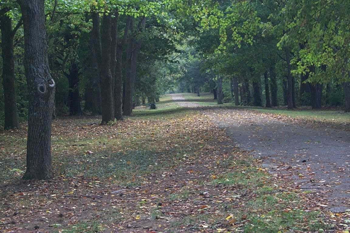
THE GREENWAY SYSTEM PAGE4-81
Beaumont Trail
discussed in detail in Appendix J: Operations and Management, and are recommended to be organized and defined within a comprehensive management plan.
No Facility Development
This designation would apply to Corridors containing environmentally sensitive areas, such as steep slopes, wetlands or other constraints that make greenway facilities undesirable or impossible. The Corridor would remain primarily in a “natural” condition, as human access would be extremely limited. Other functions for these Corridors would include floodplain management, water quality protection and conservation of important habitat for wildlife and plants. Maintenance may or may not include stream restoration, but would surely include procedures to ensure bank stability and appropriate stream flow. Management issues would include acquisition, adjacent land uses and practices, as well as risk and liability management.
Limited Facility Development, Low Impact Uses
This designation would apply to Corridors containing environmentally sensitive features that limit the extent of greenway facility development. Examples of limited development trails are at Raven Run Nature Sanctuary and McConnell Springs Park. The Corridor would remain primarily in a natural state, with gravel or dirt trails (4 to 6 feet wide) for use by low impact user groups, such as hikers or joggers. Trailhead facilities and other amenities (such as signage and picnic tables) would be limited. Boardwalks would be desirable to cross through wetlands in these areas. Maintenance of trails, boardwalks and bridges, vegetation control at the trail edges, as well as stream and flow protection, would be necessary. Management issues would encompass all issues mentioned above.
Shared Use Natural Surface Trail Development
This designation would apply to Greenway Corridors located outside of areas that experience frequent flooding. Aggregate surface trails are appropriate for corridors outside the floodplain where anticipated use or adjacent landscape dictates a more natural trail. These ten-foot-wide trails would be restricted to bicycle, pedestrian and wheelchair activity. Wheelchair users and persons with strollers can use natural surface trails if they are designed to ADA standards and are surfaced with compacted crushed stone or similar approved material. Horses prefer natural surface trails; so typically, with a shared use facility that accommodates horses, there will be adjacent but separate trails: one with a hard surface and the other natural. Trailhead facilities and other amenities (such as benches, signage and picnic tables) would be developed as needed and where appropriate. Maintenance would be organized to prevent erosion and maintain safety. While initial costs for natural surface materials are less expensive than hard surface materials, additional costs will accrue with the frequent need to replace the material throughout the years. Other management issues would encompass all issues mentioned above.
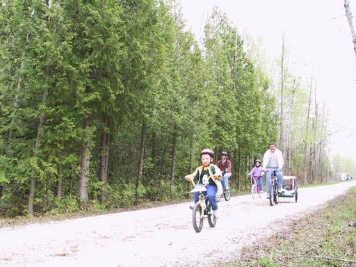
Shared Use Hard Surface Trail Development
This designation would apply to off-road or on-road corridors where a high level of use is anticipated. Off-road locations may include trails located within frequently flooded areas. Coldstream and Masterson Station Greenways present two existing examples of this type of trail development in Lexington-Fayette County. The hard surface trails should be designed using AASHTO standards to accommodate several user groups, including walkers, bicyclists, runners, wheelchair users and rollerbladers. Although asphalt is the most common paved surface used for
PAGE 4-82 LFUCG GREENWAY MASTER PLAN
Low Impact Trail
Shared Use Natural Surface Ahnapee State Trail Ride 2001
greenway trails, concrete may be preferable for areas experiencing frequent flooding. Trailhead facilities and other amenities (such as lights, benches, and signage) would be developed as needed and where appropriate. Maintenance of these trails would be more intensive. Amenities would be more abundant and require more upkeep, and facility use and wear would occur at higher levels. Other management issues would encompass all issues mentioned above, with emphasis on establishment and enforcement of rules and regulations, as well as risk and liability issues.
are several reasons for designating signed bike routes:
• The route provides continuity to other bicycle facilities, such as bike lanes and shared use paths.
• The road is a common route for bicyclists through a high demand corridor.
• The route extends along local neighborhood streets and collectors that lead to an internal neighborhood destination, such as a park, school or commercial district.
• An effort has been made to adjust traffic control devices (e.g., stop signs, signals) to give greater priority to bicyclists on the route, as opposed to alternative streets. This could include placement of bicycle-sensitive detectors where bicyclists are expected to stop.
• Street parking has been removed or restricted in areas of critical width to provide improved safety.
• A smooth surface has been provided (e.g., adjust utility covers to grade, install bicycle-safe drainage grates, fill potholes, etc.).
• Maintenance of the route will be sufficient to prevent accumulation of debris (e.g., regular street sweeping).
On-Road Facility Development
This designation would apply to Corridors in urban areas where an off-road option is not possible, or to Corridors that function as connections between offroad trails, major origin and destination points. Onroad greenway trails would consist of sidewalks for pedestrian use and bikeways for cyclists. Sidewalks should be built or improved so that they are wide enough to accommodate two pedestrians walking side by side with ease. This is typically considered to be a minimum of five feet. The addition of landscaping, site furnishings and pedestrian-scale lighting (where appropriate) would also enhance the spatial quality of these trails and encourage use. Trail and amenity maintenance and other management components would probably share procedures with roadway maintenance measures and personnel.
Bikeways can vary from bicycle lanes (complete with pavement striping and signage) to paved roadway shoulders, to wide curb lanes (to be shared by cyclists and motorists), to signed bike routes.
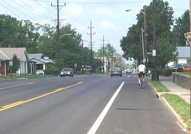
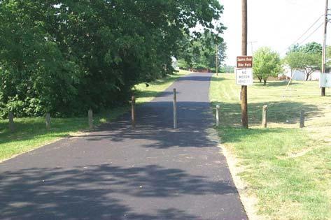
Signed shared roadways are those that have been identified by signage as preferred bike routes. There
• Wider curb lanes are provided compared to parallel roads.
• Shoulder or curb lane widths generally meet or exceed width requirements in the Roadway Manual
Bike route signs may also be used on streets with bike lanes, as well as on shared used paths. Regardless of the type of facility or roadway where they are used, it is recommended that bike route signs include destination information.
THE GREENWAY SYSTEM PAGE4-83
Shared Use Hard Surface Squires Road Trail
On Road Facility Euclid Avenue Bike Lane
On-Road Facility Development (Rural Road Bike Routes)
Rural Road Bike Routes are another type of on-road facility that utilize existing rural roads to provide a different biking experience other than the urban bikeways or off-road shared use trails. These routes may be easily implemented at a minimal cost by the simple addition of signage and pavement markings to the Route. Minimal widening of roads for some Rural Road Bike Routes may be required, with lane widths varying according to locale and conditions. Signing will not only provide safer bicycling, but will also give drivers improved visual parameters for locating bicyclists. Attention to roadside landscaping is essential.
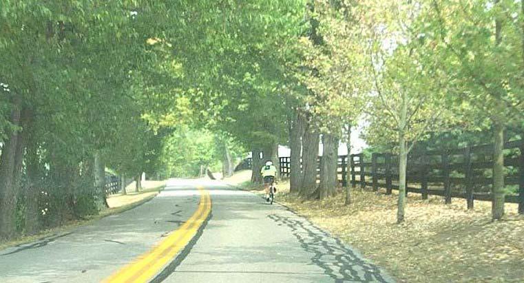
Water-Based Trail Development
This designation applies to those streams that can successfully accommodate canoeing, kayaking and boating. Water-based trails can be designed with features and facilities that make this activity more enjoyable for residents, including signage and safety systems. Most water-based trails within LexingtonFayette County allow only seasonal use, with the exception of the Kentucky River. The maintenance issues that accompany stream bank integrity, freeflow of streams (including removal of dangerous
debris) and habitat efficacy would apply. Additional maintenance associated with development of land trails, parking and water access areas would be essential. Other management issues would encompass all issues mentioned above, with emphasis on establishment and enforcement of rules and regulations, as well as risk and liability issues.
Equestrian Trail Development
Lexington-Fayette County is considered the horse capital of the world. Many area residents either work in the industry or ride for pleasure. Equestrian facilities open to the public are located at Masterson Station Park and the Kentucky Horse Park. Others ride at private stables or on trails across private property. Where feasible and compatible, the proposed Greenway Trail System should accommodate equestrian use. Trails that are proposed to connect to existing equestrian facilities should be explored for horse trails. Rail trails are another potential location for horseback riding. Trailheads would need to be designed to accommodate horse vans, and should include tieposts and a water source. Management issues would encompass all issues mentioned above, with emphasis on establishment and enforcement of rules and regulations.
PAGE 4-84 LFUCG GREENWAY MASTER PLAN
Rural Road Bike Route Delong Road
Chapter 5: The Plan of Action
A plan of action is a set of implementation strategies for transforming concepts into reality. The proposed greenway system in Lexington-Fayette County is a direct outgrowth from concepts and implementation recommendations proposed in previous plans throughout the years. Throughout the nation, all successful community-wide Greenway Programs have one important thing in common -- a commitment on the part of community leaders to integrate the resources required to fully implement the greenway vision. Many communities have chosen to integrate greenways into the existing institutional fabric of local government. Other communities have chosen to form public-private partnerships in order to implement a Greenway Program. It is important that a course of action be taken that takes advantage of the opportunities and strengths found within Lexington-Fayette County. All actions regarding greenways must aim at achieving the goals and objectives outlined in Chapter 3, and the Greenway Plan outlined in
Chapter 4. An evaluation of the program’s success should be conducted periodically, as discussed in Section 5.4.
5.1. IMPLEMENTATION STRATEGY
The first step in the implementation of the Greenway Master Plan is its adoption by the Greenspace Commission. Subsequently, the Urban County Planning Commission must hold public hearings and adopt the Greenway Master Plan as an element of the 2001 Comprehensive Plan Update Once the Greenway Master Plan is officially adopted, it is recommended that the following steps be taken:
1. The implementation of the Greenway Master Plan will necessitate the development of a Greenway Program, with new staffing, budgeting, policies, standards and procedures (see Section 5.2, “Greenway Program” and Section 5.3, “Procedures”).
Veterans Park Trail
PLAN OF ACTION PAGE 5-1
2. While existing tools and techniques for regulating land use, such as the Engineering Manuals, Zoning Ordinance and Subdivision Regulations, will continue to be used, these documents will need to be reviewed to determine if any amendments are necessary to achieve the goals and objectives of the Greenway Program. Changes to the Engineering Manuals are not expected.
3. In addition to the above mentioned documents, it is recommended that regulations and policies, such as an ordinance and procedural manual, be created and adopted to meet the needs of a Greenway Program. The new documents should include: pertinent information about the Program, such as the roles of various divisions, committees, staff and non-profits; procedural information regarding facility development, acquisition and management; and standards used in facility design, construction and maintenance. It is therefor recommended that a Greenway Ordinance be written to establish the Program and outline these roles and responsibilities. Administrative policy regarding procedures and standards could be written as a Greenway Manual and adopted by reference in the Ordinance (see Section 5.3, “Greenway Procedures”). It is not expected that the Ordinance or Manual will add costs to new development.
4. Seek out funding sources for the acquisition, planning, design and construction of greenway facilities (see Section 5.3, “Greenway Procedures”).
5. Develop an action plan to implement each goal and objective listed in Chapter 3. Indicate how the goal/objective is addressed in the Greenway Plan (Chapter 4), and identify actions that need to be taken for its implementation. Then, establish indicators to measure the success of the strategy (see Section 5.4, “Evaluation”).
6. Along with regulatory mechanisms, implementation will include the development of a strategy that promotes the Greenway Program to the public. Successful implementation of the Plan is dependent upon the support and acceptance of the greenway system by LFUCG staff, public and elected officials.
5.2. GREENWAY PROGRAM The Role of Staff and Associated Parties
The implementation of the Greenway Program will require a concerted effort by various public and private parties. Coordination of greenway activities among the various government entities, committees, commissions and non-profit organizations is essential. A successfully implemented and properly managed Greenway Program, at the scale envisioned, will require its own administrative structure. There are numerous ways to approach the administrative needs of the Greenway Program, ranging from an entirely new department to selecting a non-profit organization to lead in greenway efforts. Five different organizational structures have been considered, and a description of the advantages and disadvantages of each is described in Appendix E.
It is recommended that a Greenway Coordinator, within the Chief Administrative Officer's (CAO) Office, should lead in the management of the Greenway Program. The Coordinator would work with the Greenspace Commission, the Greenway Coordinating Committee, other boards or committees, elected officials and non-profit organizations. The Greenspace Commission would give input on policy issues. The Greenway Coordinating Committee, whose members are comprised of LFUCG staff from the various divisions, would coordinate the administration of the Greenway Program, then report back to their respective divisions to implement the decisions made by the Committee.
A description for the various greenway responsibilities is described below.
Role of Greenway Coordinator
The LFUCG should create a new position of Greenway Coordinator to administer the Greenway Program. The position will be under the Chief Administrative Officer (CAO) and will be responsible for coordinating all aspects of greenway projects. The Greenway Coordinator will act as chair of the Greenway Coordinating Committee, and as liaison with the Greenspace Commission, other non-profit organizations, boards and committees.
Role of Greenway Coordinating Committee
The LFUCG Greenway Coordinating Committee will become the lead entity for all greenway activities, including the coordination of policy, projects and budgeting. The mission of the Committee will be
PAGE 5-2 LFUCG GREENWAY MASTER PLAN
the implementation of the greenway system through a cooperative effort between government departments. The Committee will serve the needs of the Greenway Program through a team approach under the leadership of the Greenway Coordinator. The Committee will act as an administrative clearinghouse for all aspects of the Greenway Program, such as planning, funding, prioritization, acquisition, design, construction and management.
The current ad hoc Committee will need a formalized structure, with procedures, roles, responsibilities and membership legally specified. It is imperative that the Committee be given authority in the implementation of the Greenway Master Plan, a line-item budget for operational expenses and the needed staffing to achieve its goals.
Greenway projects may be initiated by the Committee, or the Committee may act as the review board for projects from other sources. This holistic approach will ensure uniformity and consistency in the application of design and maintenance standards. It has the added advantage of allowing all involved staff to be informed of ongoing and planned projects.
Suggested members and responsibilities of the Committee are as follows:
Department of Public Works:
• Division of Engineering: stormwater management, water quality and erosion control, stream bank stabilization, planning, design, project administration, conservation education
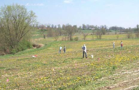
• Division of Streets and Roads: maintenance, construction
• Division of Traffic Engineering: signage, street systems
Department of General Services
• Division of Parks and Recreation: planning, design, project administration, maintenance, recreational/event programming
• Division of Property Management: maintenance, site amenities
Department of Administrative Services
• Division of Planning: development plan review, planning commission action, updates to plans and regulations, acquisition, planning, design, urban forestry, transportation planning,
bike/pedestrian coordination, environmental planning
Other Staffing on an as-needed basis
• Law
• Historic Preservation/Cultural Resource
• Health/Fitness
• Naturalist
• Public Outreach
• Board of Education
• Police
• Fire and Emergency Response
Role of the Mayor and Urban County Council
The Mayor and Urban County Council will be called upon to support this Master Plan. They will need to work with the various departments inside the LFUCG to determine the most effective implementation strategy for the county-wide greenway system. This will include engaging in unique public-private partnerships, determining an appropriate financing strategy for the Greenway Program, and defining appropriate coordinated capital improvement projects that maximize the use of Urban County resources. The Mayor and Urban County Council will also be viewed as the ultimate "Champion" of this Plan and will need to exhibit appropriate leadership toward the goals and objectives defined herein.
Role of the Department of Public Works
The Division of Engineering
The Division of Engineering will develop plans, plus design and administer the construction of most elements of the greenway system, with oversight from the Greenway Coordinating Committee. Engineering will be responsible for conservation greenways and trail facilities associated with alternative transportation. This will include property
Volunteers for Reforest the Bluegrass
PLAN OF ACTION PAGE 5-3
acquisition, on-road facilities, off-road facilities, stormwater and floodplain management, stream bank stabilization, riparian plantings, reforestation and trail design. The Division will also address water quality issues, which can be improved through enhancing or preserving the natural vegetation in greenways. In addition, the Division of Engineering will be responsible for coordinating and implementing watershed education programs as they relate to greenways.
The Division of Streets and Roads
The Division of Streets and Roads will construct hard surfaces, such as sidewalks or paved trails, that are a part of the greenway system. This division will perform maintenance (sweep trails) and perform minor repairs.
The Division of Traffic Engineering
Traffic Engineering will be instrumental in incorporating signage and markings into new road projects. These important elements can complement the greenway system by providing necessary links on-road where none exist off-road.
Role of the Department of General Services
The Division of Parks and Recreation
The Division of Parks and Recreation will provide input for the planning, design, construction and management of greenways, with oversight from the Greenway Coordinating Committee. This will include property acquisition, off-road facilities, riparian plantings, landscaping, and trail design for recreational greenways within or adjacent to any park. In addition, the Division of Parks and Recreation will be responsible for coordinating and implementing fitness and nature programs and events as they relate to greenways.
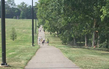
The Division of Property Management
The Division of Property Management will be needed to maintain greenways that are not maintained by the Division of Parks and Recreation
The Division of Planning
The Division of Planning will support the Greenway Coordinator, as necessary, when updating this Master Plan and portions of other plans and regulations pertaining to greenways. The Division will facilitate the acquisition of land designated for greenways through the land development planning process. Divisional planners for greenspace, transportation, environment, and urban forestry will assist in the planning and design of greenways, and will review development plans and subdivision plans for compliance with regulations regarding greenways.
Role of the Greenspace Commission
The principal responsibilities of the Greenspace Commission in the implementation of the Greenway Program should be policy, decision-making and advocacy. Working with the Greenway Coordinator and Greenway Coordinating Committee, the Commission should hear issues and assist in establishing policies for greenways -- in the context of both the comprehensive greenway system, and within the broader, county-wide Greenspace as a whole. The Commission should advocate for the Greenway Master Plan and educate non-profit organizations, businesses, schools, neighborhoods, elected officials and the general public about greenways. Commissioners could actively encourage and support such groups to become active participants in the funding, development and management of greenway projects. The Commission should become a non-profit organization, increasing its potential for fundraising and land acquisition. An annual work plan should be done by the Commission to identify the goals they would like to accomplish for the year, and the course of action necessary to achieve those goals
Role of Non-profit Organizations
The most successful greenway programs throughout the country have non-profit organizations working to gain funding, develop citizen interest, promote public education and adopt trails for maintenance. Lexington-Fayette County already has several successful non-profit organizations, including the Fayette County Neighborhood Council, Friends of the Park and Friends of McConnell Springs. Town Branch, Inc. is a group of interested citizens who are
Kirklevington Park
PAGE 5-4 LFUCG GREENWAY MASTER PLAN
actively engaged in the development of a trail along Lexington’s Town Branch Non-profit organizations associated with the Greenway Program will work with the Greenway Coordinator and Greenspace Commission.
Role of Civic Organizations
Local civic groups and organizations, including the Junior League, Boy Scouts and Girl Scouts of America, garden clubs, YMCA, Kiwanis, Sierra Club, Retired Senior Volunteer Program (RSVP) and Rotary Clubs can be participants in the LexingtonFayette County greenway system. There are many ways in which civic organizations can participate in the development of the greenway system. They can play a vital role in building sections of greenway trails, maintaining and managing greenway facilities and co-hosting events that raise money for the greenway system. The most appropriate involvement can be determined by matching the goals and objectives of each organization to the needs of the Greenway Program. The involvement of such organizations should be coordinated through the Greenway Coordinator.
Role of Local Businesses and Corporations
Lexington-Fayette County businesses and corporations might choose to sponsor a segment of greenway for development or maintenance. Businesses and corporations can work with the Department of Public Works or Division of Parks and Recreation to provide money, materials, products and labor for the development of a greenway facility. Businesses can also consider installing facilities, such as bike racks or lockers, benches, and signage that link their operations to the greenway system through partnership programs.
Role of Individual Citizens
Local residents who are interested in the development of Lexington-Fayette County’s greenway system can participate by agreeing to donate their time, labor, and expertise. Through an Adopt-a-Greenway Program, residents might choose to partner with a friend, or form a local neighborhood group, to adopt a section of greenway for maintenance and management purposes. Individuals could help patrol trails during daylight hours or volunteer to plant trees, shrubs, and flowers along segments of greenways. The involvement of such individuals should be coordinated through the Greenway Coordinator
5.3. PROCEDURES
The logistics of how the Greenway Program will be implemented and followed by all divisions, organizations, developers and property owners need to be written as policy. The regulations should include procedural provisions and standards for the planning, acquisition, facility development (design, construction) and management of greenways.
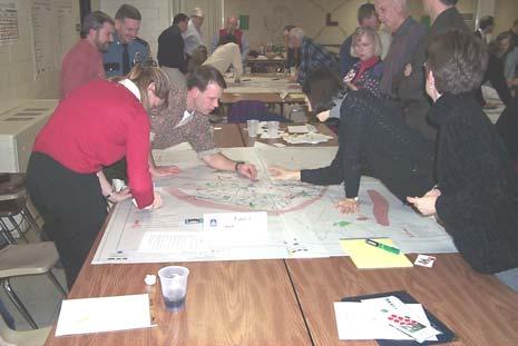
Planning
The Greenway Coordinator and the Greenway Coordinating Committee will work closely with the Division of Planning, the Division of Engineering, the Division of Parks and Recreation, and other organizations inside and outside the LFUCG to direct planning activities related to greenways. Procedures should be created for the planning and review of potential greenway projects. Review of greenway projects must be based on their compliance with the Greenway Master Plan, and any other applicable regulations. Projects may be generated from various divisions, non-profit organizations, neighborhood associations, or the Coordinating Committee itself.
The Coordinating Committee should have an annual work plan that identifies greenway projects to be started in the next fiscal cycle. The plan would include a course of action, so that divisions and organizations would know their responsibilities and could plan accordingly. Actions may include corridor master planning, grant writing, acquisition, design, construction, maintenance, repair, programming, public outreach, plan/regulation updates, and evaluation of the Greenway Master Plan implementation
Once the work plan is determined, a budget must be prepared to implement the projects identified. It will
Public Workshop
PLAN OF ACTION PAGE 5-5
be the responsibility of the Greenway Coordinating Committee to develop the annual budget for the Greenway Program. Using the expertise of the Committee members, the budget is agreed upon by the Committee and disbursed from a central account. The Committee does, however, have the flexibility to make modifications as unanticipated needs or opportunities arise. Appendix F shows estimates of typical greenway costs.
Adequate funding for the Greenway Program is imperative for a successful implementation of the Greenway Master Plan. Funding will probably come from numerous sources. The Greenway Coordinator will be responsible for identifying potential sources and obtaining the necessary funding. Potential sources are listed in Appendix G.
Acquisition
The Greenway Coordinating Committee will be responsible for identifying properties to be acquired for the greenway system. Normally, properties in the Expansion Area will be acquired at the time of new development. In existing neighborhoods, greenways will be acquired or developed during capital improvement projects, or as particular greenway projects are funded. The determination for greenway acquisition should be based on the Greenway Master Plan, as outlined in Chapter 4, and on a prioritization ranking. Such prioritization criteria are listed in Appendix H.2.
The Greenway Coordinator will oversee the acquisition of greenways, which may be acquired through various methods. Land can be dedicated to LFUCG or a non-profit organization. In other circumstances, greenways may be purchased, an easement may be granted, or it may be part of a park reservation. Methods for acquisition of greenways are discussed in Appendix H.
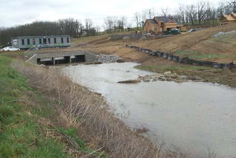
It is preferable that the acquisition of greenway properties be done as early as possible in the subdivision/zoning planning process, before any adjacent development begins. This is to protect the greenway during construction, and to have the greenway in place before lots are sold. This would ensure the integrity of greenways during the construction of adjacent lots and streets. It is recommended that signs and/or protective fencing be placed along the greenway for identification.
Facility Development
Development of greenway facilities is different from other types of LFUCG facility development. It may involve a combination of reforestation, stream restoration, establishment of riparian buffers, flood mitigation or construction of trails. It will be important for the Greenway Coordinator to bring together property owners, neighborhoods, the development community and the various LFUCG divisions to ensure that appropriate greenway links are developed while protecting the environment.
Facility development includes corridor/site inventory and analysis, site planning or corridor master planning, engineering, and construction. The Greenway Coordinator will oversee the implementation of these functions with input from the expertise of the Greenway Coordinating Committee. Facility development should follow adopted standards for access, trail design, buffers, setbacks, site amenities, plant material and environmental protection. See Appendix I for examples of design guidelines.
The greenway and trail system should be incorporated into new development and subdivision plans. The exact boundaries and location for all
Highland Lakes Subdivision
PAGE 5-6 LFUCG GREENWAY MASTER PLAN
Typical Development Plan
trails (including Tertiary Trails), should be determined during the review process of such plans and plats by the Division of Planning.
Chapter 4 outlines the general location and use of the greenway system. Master plans will need to be done for individual greenway corridors to determine specifically the appropriate type and level of use along the corridor. Each corridor master plan, or site plan for a segment of a corridor, should involve residents from the surrounding neighborhoods, as well as adjacent property owners and businesses.
After the corridor master plan has been completed, detailed construction documents will be produced for the project, as well as a detailed cost estimation and assignment of responsibilities. The actual construction of greenway facilities, such as trails, habitat restoration, and stream restoration will take place, depending on the type of use appropriate for the greenway corridor. Construction and development operations could be phased, as necessary, to meet budget and time constraints.
Facility Management
Facility management should begin immediately after a greenway facility has been constructed. Successful management includes proper maintenance, safety, security and appropriate programs to encourage public participation. Policies should be adopted to ensure uniform and suitable management of all greenways. Examples of management policies are found in Appendix J.
Maintenance regimes for all greenways should follow adopted protocols and standards. Greenways should be designed with the long-term goal of having a consolidated, low-maintenance or no-maintenance system. Eventually, the maintenance of greenways should shift to either a specialized LFUCG maintenance crew, or to contract-labor, based on a revised unit-price contract Until that time, the Greenway Coordinator will work with Property Management, Parks and Recreation, and Streets and Roads to maintain the greenways. The Greenway Coordinator will direct maintenance activities and work with property owners, neighborhood associations, service organizations, civic groups, and other volunteers for help with minor general maintenance See Appendix J.5 for information on an Adopt-a-Greenway Program.
Safety is a duty and obligation for all public facilities. In order to provide a standard of care that offers reasonable and ordinary safety measures, the LFUCG shall cooperatively develop safety and security policies for the greenway system. The policies must be well defined and coordinated with law enforcement officials and any other entities, such as a Neighborhood Watch or Adopt-a-Trail organization. See Appendix J.8 for examples of measures for safety and security. Additional sections in Appendix J discuss recommendations concerning trail rules, risk management and liability.
Some greenways may support programming for activities, such as environmental studies and recreational sporting events. Such programming can be accomplished by the LFUCG or by private sponsors. Environmental, cultural and fitness education can take place along greenways. Special signage can be installed to interpret local landmarks and landscapes. Programs promoting fitness can be coordinated with health associations and hospitals. Educational programs can be coordinated with local school systems and universities.
5.4. EVALUATION CRITERIA FOR ACHIEVING GOALS AND OBJECTIVES
The level of success in the implementation of the Greenway Master Plan should be evaluated on a timely basis. Plans need to be reviewed to determine if they are still applicable and relevant. The review should focus on the questions - How well have the goals and objectives been realized? Does the
Signage: Rules of the Trail
PLAN OF ACTION PAGE 5-7
greenway system need alterations? What new issues need to be addressed, and is the Greenway Program headed in the right direction? Were the recommendations in the implementation chapter feasible and applicable in achieving the Plan’s goals?
It is suggested that criteria be established that evaluate the successful implementation of the greenway system, based on the goals and objectives discussed in this Master Plan. Measurable indicators may be identified, such as statistics on increased bicycle ridership, air quality, reforestation, health indicators, safety, property values, economic savings in flood mitigation, tourism, number of greenway events, number of users, educational programs, interpretive signage, protected cultural resources and habitat restoration.
One approach to developing an evaluation system might use the following example:
Greenway Benefit from Chapter 1: Greenways serve as habitats for many species of plants and wildlife, and are primary migratory corridors.
Goal from Chapter 3: To develop and implement a greenway system that preserves, protects and restores the natural resources of Lexington-Fayette County, and to establish the greenway system as green infrastructure.
Objective from Chapter 3: Promote sensitivity to wildlife by establishing habitat and migration corridors where possible.
Plan Development from Chapter 4: Identify locations for conservation corridors.
Implementation Action and Evaluation: Action #1 New policy that requires site inventories of existing wildlife and habitat during corridor planning stage.
Indicator Corridor plans that are sensitive to existing wildlife habitat in the location of trails or human activities.
Indicator Increased migratory movement.
Action #2 Construction standards that use best management practices for conservation corridors to reduce pollutant loads.
Indicator Water quality data.
Action #3 New policy that promotes the use of native plant material and biodiversity.
Indicator Less exotic plant species per acre and increased number of plant species.
Action #4 Maintenance standards developed that protect riparian vegetation.
Indicator Fewer incident reports of damaged plants or encroachment into riparian zones
Action #5 Programs and events that educate the public on natural resources and stewardship.
Indicator Less litter in greenways.
Indicator Number of events.
Indicator Number of participants.
PAGE 5-8 LFUCG GREENWAY MASTER PLAN
Cane Run
Appendix A: Glossary
AASHTO: American Association of State Highway and Transportation Officials.
ADA: Americans with Disabilities Act. Refers to a law which mandates that a site, building, facility, or trail complies with the ADA Accessibility Guidelines and can be approached, entered, and used by people with disabilities.
Alternative Transportation: modes of transportation, such as public transit, bicycle, or walking; alternative to automobile travel.
Bikeway: any road, path or way which in some manner is specifically designated as open to bicycle travel, regardless of whether such facility is designated for the exclusive use of bicycles, or is shared with other transportation modes.
Bike Facilities: a general term denoting improvements and provisions made to accommodate or encourage bicycling, including bikeways, parking and storage facilities, lockers, showers and signage.
Bike Lane: one-way facility adjacent to the travel lane that is striped a minimum of 4 feet and designated for bicycle use only.
Bike Route: roadways that are identified by signing as preferred bike routes.
Bio-diversity: species diversity; changes in species composition, species richness and/or functional type affect the efficiency with which resources are processed within an ecosystem.
Buffer: any type of natural or constructed barrier (trees, shrubs, berms or fences) used between the greenway and adjacent lands to minimize impacts (physical or visual). Buffers also provide a transition between adjacent land uses.
Cultural and Historic Resources: as defined by the Secretary of Interior’s definition or per Article 13 of the Zoning Ordinance.
Destination Point: location of interest that attracts people to it.
Easement: grants the right to use a specific portion of land for a specific purpose or purposes. Easements may be limited to a specific period of time, granted in perpetuity or predicated upon the occurrence of a specific event. An easement agreement survives transfer of landownership and is generally binding upon future owners until it expires on its own terms.
Facility: general term denoting improvements and provisions made to a greenway.
Fee Simple (Fee Simple Absolute): an interest in land in which the owner is entitled to the entire property without limitation or restriction, and with unconditional power of disposition.
FEMA Floodplain: floodplains and flood hazard areas that have been shown on maps developed by National Flood Insurance Program (NFIP). A soils floodplain consists of the alluvial soils as defined by the U.S. Department of Agriculture Natural Resources Conservation Service.
Green Infrastructure: an interconnected network of waterways, wetlands, woodlands, forests, wildlife habitats, and other natural areas, greenways, parks and other conservation lands. Wilderness and other open spaces that support native species, maintain natural ecological processes, sustain air and water resources, and contribute to the health and quality of life for communities and people.
Greenspace: natural areas, open spaces, trails, and greenways that function for both wildlife and people. From the Greenspace Plan, a greenspace is defined as the essential natural and cultural characteristics that give the Bluegrass its special identity and quality of life.
APPENDIX A PAGE A-1
Greenway: a linear open space established along a natural corridor (such as a river, stream, ridgeline), rail-trail, utility corridor, scenic road, or other route for conservation, recreation, or alternative transportation purposes. Greenways can connect parks, nature preserves, cultural facilities, and historic sites with business and residential areas.
Greenway, Conservation: a greenway that protects bio-diversity and water resources by connecting natural features, such as streams, wetlands, forests, and steep slopes. It may also function for stormwater management.
Greenspace: natural areas, open spaces, parks, trails, and greenways that function for both wildlife and people.
Hard Surface: trails with surfaces that use paved materials or other firm and stable surfaces that are capable of supporting wheels and accessibility.
Natural Surface: trails with surfaces that are not necessarily ADA accessible, such as compacted dirt, wood chips or stones.
Off-Road Facilities: trails that are physically separated from motorized vehicular traffic by an open space or barrier; includes riparian corridors, abandoned roads, utility corridors and rail corridors.
On-Road Facilities: extensions of the existing street system right-of-way, offering users the choice of sidewalks or bike facilities.
Origin Point: site along greenway where people may gain access, such as a staging area or trailhead.
Paved Shoulder: an extension of the pavement generally found in rural areas. Paved shoulders are anywhere from 6 inches to 12 feet in size. The preferred minimum width is four (4) feet.
Post-Development Floodplain: portion of land adjacent to a stream covered by water during the 100-year, 24-hour storm. It shall be determined using the procedures outlined in the Stormwater Manual and shall be based on a fully developed watershed.
Primary System: trails that form the main framework for the county-wide system; and may be
located in Conservation Greenways, on-road or offroad locations.
Rail-to-Trail: a public shared use path (paved or natural) created along an inactive or abandoned rail corridor.
Rail-with-Trail: any shared use path that is located on or directly adjacent to an active railroad or fixed route transit corridor.
Railbank(ing): retaining a rail corridor for future railroad uses after service has been discontinued. The National Trails System Act, Sec. 8d, provides for interim public use of the corridor, allowing the establishment of recreational trails.
Riparian Zone: an area of vegetation that is strongly influenced by water and that occurs adjacent to streams, shorelines, and wetlands.
Rural Road Bike Route: rural roads in the Rural Service Area that have been selected because they are conducive to biking or could be with minimal improvements. These roads have low volume, low speeds and relatively wide shoulders.
Secondary System: links Primary Trails, forming an interconnected network system; may be found in Conservation Greenways, or utilize on-road or offroad facilities.
Shared Roadways: A roadway which is open to both bicycle and motor vehicle travel. This may be an existing roadway, street with wide curb lanes, or road with paved shoulders.
Shared Use Trail: Any corridor that is designed to accommodate various uses; including bicycling, walking, jogging, hiking, rollerblading, horseback riding; and should meet AASHTO standards.
Signed Shared Roadway: roads that have been identified by signing as preferred bike routes.
Staging Area: an area where users can congregate, park, and begin or end a trip.
Stream: includes intermittent and perennial streams represented on the USGS 7.5-minute topographic maps as either a solid or dashed blue line and channels that are not shown as a solid or dashed blue line but have a drainage area of at least 50 acres.
PAGE A-2 LFUCG GREENWAY MASTER PLAN
Tertiary System: trails that provide additional access to areas not reached by the designated Primary or Secondary Trails; may be found in Conservation Greenways, or utilize on-road or offroad facilities.
Trail: route on land or water with protected status and public access for recreation or transportation purposes, such as walking; jogging; hiking; bicycling; rollerblading; horseback riding; canoeing and kayaking.
Trailhead: an access point to a trail or trail system often accompanied by various public facilities, such as parking areas, loading areas, toilets; water, directional and informational signs, and a trail use register.
Walking Path: a linear route for general pedestrian use that is not a sidewalk and may not meet AASHTO standards; generally found in parks.
Wide Curb Lane: a lane where there is no designated bike lane and where the outside travel lane is wider than the usual lane width. This lane is meant to accommodate both cyclist and motorist. In many cases, the motorist will not need to change lanes in order to pass the cyclist.
Wildlife Habitat: a place that supports a plant or animal population because it supplies that organism's basic requirements of food, water, shelter, living space, and security.
APPENDIX A PAGE A-3
PAGE A-4 LFUCG GREENWAY MASTER PLAN
Appendix B: Supporting Documents
The several planning and operational documents utilized for the management and improvement of Lexington-Fayette County lands and resources offer rudimentary consideration of Greenways and indicate the need for a Greenway Master Plan. The Greenway Master Plan expands upon and integrates the functional elements of greenways with the purposes set forth in these documents. This Master Plan establishes a systematic physical framework and provides recommendations for policies and programs that address the concerns and opportunities that protection and utilization of green spaces present to the Community. Some of the long-term concerns of the Lexington-Fayette Urban County Government (LFUCG) include the protection of stream corridors and overall water and habitat quality, preservation and enhancement of our unique Bluegrass aesthetic environs, improvement of access to community resources via alternative transportation modes and provision of recreational and health enhancing amenities.
The 1991 Greenway Plan
In 1991, a Greenway Plan was produced via the LFUCG Division of Planning with input from the Greenspace Commission. This Plan was subsequently updated (1992), and functioned as a “general overview, with specific concept recommendations”. The Plan was not incorporated into the 1996 Comprehensive Plan; however, it served to define greenways as a planning component: identifying the resources of the Urban County, describing the benefits of greenways and suggesting strategies for acquisition, implementation and maintenance of improvements. Specific recommendations were incorporated into the 1994 Greenspace Plan
The 1994 Greenspace Plan
A statement from the 1994 Greenspace Plan defines the perceived purpose of the existing documents at the time. “The primary goal is to prevent development in the 100-year floodplain and riparian forest in order to preserve the natural flood management capabilities of streams, with the
secondary goal of recreation and neighborhood enhancement. The Greenspace Plan is intended to satisfy a wider range of important natural and cultural values, such as protecting historic resources and scenic corridors as well as ecological systems.”
“As the greenspace system is further detailed for each neighborhood, all designated greenways should be evaluated for incorporation. This evaluation should consider whether greenways that serve (solely in) flood management purpose(s) are appropriate for the greenspace system, or whether there are other implementation methods for floodplain protection that can be applied through the development approval process to protect greenways.” It states further that “... plans emphasize preserving the natural qualities of greenways. However, all greenways incorporated in the greenspace system should be considered for recreational access and trails development.” The new Greenway Master Plan moves beyond this philosophy. The new Plan is comprised of a natural corridors system component and a trails system component, wherein each system operates as both an independent system and as a system complementary to the other. Thus, the new Greenway Master Plan incorporates the goals, objectives and development concepts of the Greenspace Plan, adding in a systematic and comprehensive network.
The 1996 and 2001 Comprehensive Plans
The process for the development of the Greenway Master Plan began with the 1996 Comprehensive Plan as its basis. In December 2001, the 1996 Comprehensive Plan was updated and approved. Compatibility with the goals and objectives of the 1996 Comprehensive Plan and later 2001 Comprehensive Plan is evidenced throughout the Greenway Master Plan. All seek to promote land use that is sensitive to the natural and built environment; protect and preserve/enhance the Urban County’s significant historic and cultural heritage and existing neighborhoods; ensure the vitality of Downtown; establish and promote urban activity centers to provide services to multineighborhood areas; promote tourism and
APPENDIX B PAGE B-1
employment opportunities; and generally enhance the quality of life. Within the 1996 Comprehensive Plan, "Greenways are proposed to preserve selected environmentally-sensitive areas, to add passive open space to residential developments and to add variety to the suburban neighborhood streetscape…". The Plan recommends that greenways be acquired in both developed and undeveloped areas. Both Comprehensive Plans refer to the importance of greenways in the linkage of parks, neighborhoods, and other community amenities, and refers in depth to the 1994 Greenspace Plan. Scattered greenways following 100-year floodplains were identified on the Land Use Map.
The 1996 Expansion Area Master Plan
The 1996 Expansion Area Master Plan organizes new development within several expansion areas with four elements: Future Land Use, Community Design, Infrastructure and Implementation. Future Land Use criteria include organization “according to the natural resources”… Community Design “establishes a physical framework…reflect(ing) the cultural heritage of the Bluegrass by organizing urban development around a series of ‘greenways’” and linking areas with greenways, trails, paths and roads. Infrastructure criteria include “area-wide watershed management ‘systems’ using the designated greenways for storage, treatment and discharge of runoff” and new parks to be connected via the greenways system. Implementation includes general government actions, infrastructure finance programs and land development regulations consistent with the above criteria. This document is fully supportive of the greenways effort.
The 2000 Comprehensive Parks and Recreation Master Plan
The 2000 Comprehensive Parks and Recreation Master Plan names greenways as the second highest priority for facility development, behind only multiuse community centers. Public input during the Plan development process indicated greenways to be consistently rated one of the highest needs. The Parks Master Plan describes greenway development as a linkage system between community parks, neighborhoods, neighborhood parks and schools. Specific corridors are proposed for acquisition and easement, and recommendations are made for feasibility studies for each. The Parks Master Plan recommends that acquisition and management of greenways be an administrative function of the Division of Parks and Recreation. The Greenway
Master Plan recommends that the greenways system be implemented and managed through the Division of Public Works, with a greenway coordinator and Greenway Coordinating Committee as lead. The new Greenway Master Plan’s dual system of conservation corridors and trail corridors expands beyond the Parks Master Plan philosophies of greenways makeup and purpose, administration and implementation. It is recommended that the Parks Master Plan be revised to reflect the Greenway Trail System in the Greenway Master Plan.
The 2001 Stormwater Manual
The 2001 Stormwater Manual supports the concept and implementation of greenways conservation corridors. Parameters and restrictions are established for the protection and mitigation of riparian corridors, including continual floodplain examination and building restrictions, riparian buffer guidelines, water quality criteria and stream restoration guidelines. It is recommended that specific references to the new Greenway Master Plan be added to this document to enhance coordination of efforts. The Procedures Manual for Infrastructure Development supports the tenets of the Stormwater Manual, and includes guidelines that refer directly to protection of greenways. It is recommended that this document be revised to contain additional, detailed references to greenways, in order to coordinate opportunities to ‘piggyback’ projects.
The Rural Service Area Land Management Plan
The Rural Service Area Land Management Plan was adopted in April of 1999. It includes a complete inventory of the natural and cultural resources in the Rural Service Area, including rural settlements, scenic roads and environmentally sensitive areas. It recognized that access to rural areas for urban residents of Lexington is limited to driving rural roads and visiting the Raven Run Nature Sanctuary. In order to provide more opportunities, the Plan recommended implementation of a rural greenway system that could be accomplished by planning connection systems between rural settlements, parks, subdivisions, and other developments. This system would have trailheads or staging areas that provide supportive features, such as parking, restrooms, concessions and rental of bikes, canoes and horses.
A rural greenway was defined as an area of relatively undisturbed floodplains passing through private farms and along roads. The emphasis of the
PAGE B-2 LFUCG GREENWAY MASTER PLAN
development of a rural greenway system was to preserve plant and animal species, protect existing streams, and to provide increased recreational opportunities. To meet these needs, the Plan recognized five focus areas, plus additional areas that were identified previously in the 1994 Greenspace Plan. The areas considered a priority for creating rural greenways were:
Five Focus Areas:
• North Elkhorn Drainageway (North Elkhorn Creek, Goose Creek, David Fork)
• Boone Creek Drainageway (Boone Creek, Jones Creek, Baughman Run, Boggs Fork)
• South Elkhorn Drainageway (South Elkhorn Creek, Cave Creek)
• Kentucky River Palisades
• Old Frankfort Pike Area
Three Additional Areas:
• Town Branch Drainageway (Town Branch Creek, Steeples Run)
• Cane Run Creek
• East Hickman Drainageway (East Hickman Creek, Shelby Branch)
It was suggested that each of these greenways could be implemented through public acquisition and scenic/conservation easements.
The Year 2025 Transportation Plan
The Year 2025 Transportation Plan was completed in April 2001. The pedestrian and bicycle portions of the Plan were written to be consistent with the draft Greenway Master Plan. The Transportation Plan includes goals and objectives specific to pedestrian and bicycle use, plus identifying road improvement projects with pedestrian or bicycle components.
The LFUCG Zoning Ordinance and Subdivision Regulations
Currently, the Zoning Ordinance and the Subdivision Regulations do not specifically address greenways. There are references in the Ordinance to traffic studies, including pedestrian and bicycle evaluations; historic preservation; floodplains and erosion control. The Regulations include language for environmentally sensitive areas and floodplains; design standards for sidewalks, shared-use paths, bike lanes, access, and provisions for reservations.
APPENDIX B PAGE B-3
.
PAGE B-4 LFUCG GREENWAY MASTER PLAN
Appendix C: Summary of Public Input
Preparation of the Lexington-Fayette County Greenway Master Plan involved working with the citizens of the Community in several ways. First, the consultant team worked closely with LexingtonFayette Urban County Government (LFUCG) staff to define the history of the greenway effort and strategies for implementation of a greenway program. Second, the consultant conducted three public workshops. Third, the consultant met with a variety of stakeholder groups to discuss detailed aspects of the greenway plan.
C.1 Summary of Greenways Workshop
October 30, 2000
On the evening of October 30, 2000, the first of three public workshops was conducted by the FMSM team at the Lexington Public Library. Approximately 120 people were in attendance. Mayor Miller opened the workshop by encouraging residents to keep an open mind and ask questions of the consultants and staff. The consultant began the workshop with a multi-media presentation on the benefits that greenways offer to communities. This was followed by a question and answer period in which residents, the consultant and LFUCG staff discussed a variety of issues. After a short break, workshop attendees were invited to participate in breakout sessions intended to define two principal outcomes:
1) Where would residents like to see Greenways protected in Lexington-Fayette County?
2) What are some of the issues that will influence the protection of Greenways in Lexington-Fayette County?
At the close of the evening, group facilitators presented the results of the breakout session. The consultant defined the next steps in the planning process and the location and time for the next public workshop. The input from this workshop was summarized by the consultant and used as the basis for preparing the first set of GIS-based maps for the project. Additionally, LFUCG staff published a community newsletter that described the workshop
and its outcomes. LFUCG also published results of the workshop along with photographs on a community web site www.lfucg.com/greenways
C.2 Summary of Greenways Workshop
December 11, 2000
Using the results of the first workshop and in-field investigations completed by the consultant, a second public workshop was conducted on the evening of December 11, 2000 at the Leestown Middle School. Approximately 75 people attended the workshop The consultant opened the workshop by summarizing the planning efforts completed to date, and the results from the first workshop. The consultant presented the emerging network of greenways on a series of large format maps. Attendees were then asked to break into groups in order to more closely review and critique the preliminary greenway routes that resulted from the first public workshop. Participants were also asked to define priorities for future greenway facility development. The results of this workshop were once again summarized by the consultant and incorporated into the evolving greenway master plan. LFUCG staff published the results of the workshop in a second newsletter and incorporated comments of the attendees in the community web site.
C.3 Summary of Greenways Workshop
January 29, 2001
A final community workshop occurred on the evening of January 29, 2001 at the Veterans Park Elementary School. An estimated 75 people were in attendance for this workshop. The principal goal of this workshop was the presentation of the draft Greenways Master Plan by the consultant. A detailed presentation by the consultant outlined the entire greenway system by its component parts. Additionally, implementation strategies, funding and future operations and management were featured in the consultant’s presentation. After the presentation, workshop participants were asked to make one final critical examination of the draft maps. Results of the workshop were summarized by the consultant and incorporated into the Master Plan. LFUCG staff published the results of the workshop in a
APPENDIX C PAGE C-1
community newsletter and on the community web site.
C.4 Stakeholder Meetings
In addition to the public workshops, the consultant conducted four (4) separate stakeholder meetings that focused on specialized matters with respect to the preparation of the Greenway Master Plan. On December 11, 2000, the consultant conducted a "governance" work session with approximately 40 LFUCG staff and department heads to discuss the future organization, operation and implementation of greenways. On December 12, 2000, the consultant facilitated three stakeholder meetings, the first with the Lexington Chamber of Commerce and area business leaders to discuss the relationship
between greenways and economic growth. The second was conducted with environmental and outdoor user groups to discuss issues related to outdoor access, water quality protection and design standards for trails. The third meeting was conducted before a work session of the LexingtonFayette Urban County Council. On January 29, 2001, the consultant conducted two stakeholder meetings, the first with the Kentucky Thoroughbred Association to discuss the proper interface between greenway implementation and the horse industry; and the second with the Greenspace Commission to define the current status of the Greenway Master Plan. The results of these meetings were summarized by the consultant and incorporated into the final Greenway Master Plan recommendations.
PAGE C-2 LFUCG GREENWAY MASTER PLAN
Appendix D: Returns on Greenway Investment
Many communities across the United States do not look upon greenway development as a cost, but more as an investment in the proper management of green infrastructure and native landscape resources. Communities like Denver, Minneapolis, Chicago and Portland, have realized that for every $1 invested in greenway facility development, $3 in income is derived from greenway-related or greenwaygenerated activities. Although most of the costs for future greenway facility development in LexingtonFayette County will be borne by the Urban County, investing dollars in greenways should yield a substantial return to the community as a whole. This return could be in the form of reduced flooding costs, reduced costs of water quality improvement, increased tourism revenue, reduced transportation costs, increased property values and increased business attraction.
Increased Business Revenue:
• Orange County, Florida spent $2 million to create the 16-mile West Orange Greenway, and expects to realize a complete return on its investment in the first year of operation through the economic revitalization of the small towns that lie along the trail's route
• The Northern Central Rail Trail attracts 457,000 visitors every year and has led to the creation and support of 262 jobs in Baltimore County, Maryland. These positions range from trail construction and maintenance work, to jobs in local restaurants and hotels serving trail users, to added positions in regional sporting goods companies and supermarket chains due to increased business. A study found that the trail's cost to the public in 1993 was $191,893, and it generated $303,750 that same year in tax revenue a result of increased sales, property and income taxes resulting from the Trail.
• East Grand Forks, Minnesota, population 5,000, suffered one of the worst flood disasters in U.S. history. Ninety-five percent of the town was under floodwaters in April 1997. With the flood recovery efforts in full swing in 1999, Cabelas
(one of the largest outdoor retailers in North America) opened a new store in the recently restored downtown, right on the banks of the Red River. Cabelas specifically chose the downtown over Interstate highway locations due to its proximity to the newly planned Red River Greenway, a 2,200-acre facility. Cabelas estimated that, in the first year of operation, approximately one million people would visit the store. They underestimated the popularity by one-half. Today, East Grand Forks boasts a thriving economy that it can thank, in large part, to the presence of the Greenway.
Increased Property Values:
• In Shephard's Vineyard, an Apex, North Carolina neighborhood, the neighborhood greenway is used as a selling point for nearby properties and has increased the value of adjacent properties. The developer of this community concluded that "property immediately adjacent to the trail is significantly easier to sell, and sells for an average of $5,000 more, as a result of its proximity to the trail."
Decreased Transportation Costs:
• According to the Federal Highway Administration, the public saves from 5 to 22 cents for every automobile mile displaced by bicycling or walking. This savings comes from the reduced costs of air pollution (health costs), oil importation, and traffic congestion (such as lost wages and lost time on the job)
• A household can save $3,000 a year by giving up one automobile and taking advantage of bicycling, walking, and transit.
Decreased Costs of Clean Water:
• Over the next decade, New York County plans to spend $250 million on watershed protection, including the acquisition of greenway lands along riparian corridors, in order to avoid spending $5 billion on a federally mandated water filtration system.
APPENDIX D PAGE D-1
Decreased Health Costs:
• People who exercise regularly, including bicyclists and pedestrians, have 14 percent lower claims against their medical insurance and spend 30 percent fewer days in the hospital (National Park Service, "Economic Impacts of Protecting Rivers, Trails, and Greenway Corridors").
Decreased Criminal Activity:
• Evidence suggests that crime rates frequently drop dramatically when recreation opportunities are improved. To avoid spending $30,000 to keep one teenager in detention for a year,
communities are investing money in greenways and other recreation facilities as crime prevention tools. According to recent research in Mecklenburg County, North Carolina, regarding crime in the Mallard Creek Greenway area, it has been found that the crime rates for the Mallard Creek Greenway and adjacent properties are significantly lower than both the overall Mallard Creek Police district and other parts of Mecklenburg County. People who live along the Mallard Creek Greenway are, in fact, at less risk for crime. Less money will be spent on crime prevention and patrol in this area.
PAGE D-2 LFUCG GREENWAY MASTER PLAN
Appendix E: Greenway Program Lead Organization Options
DIVISION OF PARKS AND RECREATION AS LEAD AGENCY
The Division of Parks and Recreation may be a logical lead organization for the LFUCG Greenway Program. Oftentimes, greenways have trails, so the long, linear greenspaces are considered part of the recreational system that is extended beyond the community and neighborhood parks. The Division of Parks and Recreation has much to offer toward the successful implementation and management of a greenway system. Profiled below are some of the advantages and disadvantages that should be considered in designating the Division of Parks and Recreation as lead organization.
Advantages
• Parks and Recreation is familiar with greenway concepts and operating facilities that are open for public access and use.
• Parks and Recreation staff is trained in key disciplines that are essential to a successful Greenway Program, including landscape architecture, events programming and grounds maintenance.
• Parks and Recreation is accustomed to budgeting for park facility development and has successfully implemented a wide variety of park facility projects throughout the Community.
Disadvantages
• Greenway facilities may be viewed within the Division as competing with other park facility needs, and may not receive the funding or attention that is necessary to implement the Program.
• Parks and Recreation staff lacks the engineering services and technical background in multiobjective greenway implementation that is the hallmark of this Plan.
DEPARTMENT OF PUBLIC WORKS AS LEAD AGENCY
The Department of Public Works is another potential and logical LFUCG organization that can serve as lead agency for the Greenway Program. Public Works has been working on multi-objective greenway projects, both as a sole agency and in partnership with other agencies, landowners and non-profit organizations for several years. Several greenway projects completed by Public Works include: Wolf Run Neighborhood Improvement Project, Brighton East Rail-Trail, Squires Road Trail, and Reforest the Bluegrass. Profiled below are some of the advantages and disadvantages that should be considered in designating Public Works as lead organization.
Advantages
• Public Works has both the stature and the funding to support the immediate implementation of a county-wide Greenway Program.
• Public Works understands and is prepared to implement the concept of multi-objective greenways that is the hallmark of this Plan.
• Using water quality and floodplain management as the cornerstone for the Program, Public Works is best suited to lead the greenway effort.
• Public Works staff possesses the technical and professional background necessary to implement all aspects of the Greenway Program.
• Funding for the Greenway Program could come from a variety of sources that are related to infrastructure issues, such as stormwater management, transportation and environmental protection. For example, a stormwater user fee could be a potential source of funding.
Disadvantages
• Public Works is not as familiar with the operation and management of public access/use facilities as the Division of Parks and Recreation.
APPENDIX E PAGE E-1
• Keeping with the recommendations of this Plan, Public Works would need to ensure an appropriate level of financial commitment to the Greenway Program.
NON-PROFIT ORGANIZATION AS LEAD AGENCY
A non-profit organization could be selected as “Champion” for the Greenway Program. Similar efforts have occurred in Cincinnati, Denver, Chicago and Chattanooga. One strong advantage of a nonprofit organization is its ability to raise funds from private sector sources and granting organizations. Profiled below are some of the advantages and disadvantages that should be considered in designating a non-profit organization as lead organization.
Advantages
• A non-profit organization exists outside the framework of local government and is not burdened with the "government" label that can serve as a handicap for greenway implementation.
• A non-profit organization has the ability to solicit funds from private sources who may never consider giving money to a local government program.
• A non-profit organization may be able to work more efficiently than local government in implementing certain aspects of the Greenway Program and activities.
Disadvantages
• A non-profit organization exists outside the framework of local government and may have difficulty implementing a multi-objective Greenway Program throughout the County.
• A non-profit may not have the ability to employ staff with the technical backgrounds that are required to implement a multi-objective Greenway Program.
DEPARTMENT OF NATURAL RESOURCES AS A LEAD AGENCY
A long-term possibility for the administration of the Greenway Program is to create a Department of Natural Resources within the Lexington-Fayette Urban County Government. Establishing this type of agency would bring all issues and activities
involving natural resources under one department. No such agency currently exists, and the prospects for creating such an agency are not good. Profiled below are some of the advantages and disadvantages of a Department of Natural Resources acting as the lead agency.
Advantages
• All staff involved in natural resource protection and management would be working together.
Disadvantages
• There might be a duplication of services and the burden of coordinating services with other departments. Creating another Department competing for money may seem excessive to some.
• Reorganization of the current system would require a change in attitudes and procedures. Changes of this magnitude are frequently met with resistance from individuals and groups trying to protect their turf.
GREENWAY COORDINATING COMMITTEE AS LEAD AGENCY
The Greenway Coordinating Committee could act as lead agency. The Greenway Coordinating Committee currently exists and has the cumulative expertise to be an effective lead agency. However, the Coordinating Committee has neither authority nor a budget. Profiled below are some of the advantages and disadvantages of the Greenway Coordinating Committee acting as lead agency.
Advantages
• Committee already exists, with its members comprising LFUCG personnel who are involved with greenways, maintenance and acquisition. With the various departments represented, the Plan’s multi-objective approach can be achieved using the expertise of the various Divisions.
Disadvantages
• Currently does not have authority or a budget. The Committee is not under the auspices of a particular department, so its authority and a budget will have to be mandated by Council.
PAGE E-2 LFUCG GREENWAY MASTER PLAN
Appendix F: Estimates of Facility Cost
The following defines opinions of typical costs for off-road, water-based and on-road greenway facility development and management. Greenway projects can be developed as an element of other capital improvement projects, such as transportation improvements to roads, public works improvements for sanitary sewers or stormwater projects, or park and recreation improvements that might include a trails component. In these cases, the costs for greenway facilities are incorporated into the overall project budget, usually at a lower rate than for a stand-alone project.
The costs provided in this Appendix are for greenway facility development not associated with a capital improvement project. They are based on dollar amounts that communities across the nation are spending on greenway program development, management, maintenance and. The cost opinions are followed by examples of how other communities are receiving a return on their investment in greenways, in terms of reduced flooding costs, reduced costs for water quality improvements, increased tourism revenue and increased business attraction
It is important to identify partnership opportunities with public sector agencies and private sector
organizations, as well as individuals who can serve to reduce the cost of implementing and managing greenways.
Potential short- and long-term cost savings associated with greenway implementation should be identified then weighed against the prevailing circumstances. For example, certain materials may be cheaper in the short term, but they cost more for maintenance or replacement in the long run. Another example is the cost for the eradication of exotic species in the greenway. With every year’s growth of vegetation, costs will increase dramatically. However, the cost saved by eradicating sooner than later has to be balanced with the feasibility and expense of maintaining the cleared area.
F.1 GREENWAY FACILITY DEVELOPMENT COSTS
Costs do not include those for land acquisition. Labor costs are included in facility estimates. Costs for engineering and design development are estimated at 10-15% of construction costs.
APPENDIX F PAGE F-1
Greenways with No Facility Development (Type 1):
Vegetation Unit Cost Trees (1-3/4" caliper) $250 each Shrubs (3 gallon) $25 each
*Costs include plant and installation.
Greenways with Limited Facility Development (Type 2):
Trail Treads
6-Foot Bare Earth Hiking/Mtn. Bike Trail $5 per foot
8-Foot Bare Earth Equestrian Trail $8 per foot
14-Foot Wood Deck/Boardwalk Trail $150 per foot (without rail)
*Costs include site preparation, clearing, grading, and mobilization
Greenways with Shared Use, Natural Surface Trail Facility Development (Type 3):
10-Foot Aggregate/Stone Trail
14-Foot Wood Deck/Boardwalk Trail $150 per foot
Signage Information Signs $1,000 each Direction Signs $200 each Warning Signs $200 each Mile Marker Signs $250 each
Trail
Treads
$12 per foot
Signage Information Signs $1,000 each Direction Signs $200 each Warning Signs $200 each Mile Marker Signs $250 each Furniture/Furnishings Benches $600 each Trash Receptacles $400 each Security Bollards $250 each Bicycle Racks $500 each Gates $750 each 911 Emergency Phones $1,000 each Pre-Fabricated Steel Bridges $1,000 per foot PAGE F-2 LFUCG GREENWAY MASTER PLAN
Greenways with Shared Use, Hard Surface Trail Facility Development (Type 4)
Trail Treads
10-Foot Asphalt Shared Use Trail $35 per foot
10-Foot Concrete Shared Use Trail $50 per foot
14-Foot Wood Deck/Boardwalk Trail $150 per foot
Signage
Information Signs
$1,000 each
Direction Signs $200 each
Warning Signs $200 each
Mile Marker Signs $250 each
Furniture/Furnishings
Benches $600 each
Trash Receptacles $400 each
Security Bollards $250 each
Drinking Fountains $2,500 each
Pre-Fabricated Steel Bridges $1,000 per foot
On-Road Greenway Facilities (Level 5):
Restriping
Conducted as part of a regularly scheduled roadway resurfacing project and does not include right-of-way acquisition and changes to signal actuation.
Bicycle Lanes $7,200/mile
Wide Outside Lanes $6,450/mile
Independent Projects
Listing is for development of facility type. Right-of-way cost estimates are provided as a general guide. Not all projects will require the acquisition of right-of-way. Real estate values fluctuate dramatically and will need to be adjusted on a parcel-by-parcel basis.
Share the Road Bike Route (signage) $15,000/mile
Urban Bike Lanes (5' wide, both sides) $250,000/mile
Paved Shoulders (4' wide, both sides) $150,000/mile
Wide Curb Lane (14' wide, both sides) $160,000/mile
Other Bicycle Facilities
Class I Bicycle Parking (Bicycle Lockers - per 2 bikes) $500-$1,500
Class II Bicycle Parking (Secure wheels and frame) $65 - $150/bike
Class III Bicycle Parking (Inverted U's or rail racks) $65 - $80/bike
Bike Route/"Share the Road" Sign
$250/sign
APPENDIX F PAGE F-3
F.2 FACILITY MAINTENANCE COSTS
The following maintenance costs are provided as a guide to establishing a budget for the operation, maintenance and management of each trail segment within the greenway system. These costs are derived from national industry averages and have not been adjusted to reflect unique labor, material and cost issues within Lexington-Fayette County, Kentucky.
It may be possible to lower the cost of maintaining one mile of paved trail through the development of an Adopt-a-Greenway Program. Volunteers have been proven effective in performing some of the routine maintenance activities that are listed below. Savings of 50% of the estimated cost per mile defined below are possible through a coordinated and well-run Adopt-a-Greenway Program, and some of these costs are already being covered along highways, roads, parks, and other areas.
PAGE F-4 LFUCG GREENWAY MASTER PLAN
Typical Maintenance Costs
Trail) Drainage and Storm Channel Maintenance (4 x/year) $500 Sweeping/Blowing Debris Off Trail Tread (20 x/year) $1,200 Pick-up and Removal of Trash (20 x/year) $1,200 Weed Control and Vegetation Management (10 x/year) $1,000 Mowing of 3-Foot Grass Safe Zone Along Trail (20 x/year) $1,200 Minor Repairs to Trail Furniture/Safety Features $500 Maintenance Supplies for Work Crews $300 Equipment Fuel and Repairs $600 Total Maintenance Costs per Mile of Paved Trail $6,500 Re-Surfacing of Paved Trail Tread (20-year cycle) $50,000/mile
(For a One-Mile Paved
Appendix G: Funding Sources
Funding a county-wide greenway system throughout Lexington-Fayette County will be one of the most challenging aspects of this Plan. To have a successful funding program, the Community must be committed to developing multi-objective greenways. Communities that have shown such a commitment have had very little trouble finding the financial resources necessary to implement a greenway program.
Successful greenway programs in other communities demonstrate that the most successful method of funding greenway implementation is to combine private sector funds with funds from local, state and federal sources. Many communities involved with greenway implementation leverage local dollars with other funding sources to increase the resources available for greenway acquisition, development and maintenance.
In order to successfully implement the LFUCG greenway system, the Urban County Government will need to partner with local greenway advocates, private businesses and other public sector agencies to pursue a variety of funding sources. The funding sources listed in this chapter represent some of the greenway funding opportunities that have typically been used by other communities.
G.1. FEDERAL FUNDING SOURCES
Several federal programs offer financial aid for projects that aim to improve community infrastructure, transportation, housing and recreation programs. Some of the federal programs that can be used to fund greenways include the following:
Transportation Equity Act for the 21st Century (TEA-21)
The primary source of federal funding for greenways is through the Transportation Equity Act of 1998 (TEA-21), formerly the Intermodal Surface Transportation Efficiency Act (ISTEA). ISTEA provided millions of dollars in funding for bicycle
and pedestrian transportation projects across the Country, and will provide millions more as TEA-21.
There are many sections of TEA-21 that support the development of bicycle and pedestrian transportation corridors. The Kentucky Transportation Cabinet can distribute funding from any of these subsets of TEA-21 to support greenway development within Lexington-Fayette County. Those sections that apply to the creation of greenways, sidewalks and bikeways include:
Surface Transportation Program (STP) Funds
These funds can be used for bicycle and pedestrian facility construction or non-construction projects, such as brochures, public service announcements and route maps. The projects must be related to bicycle and pedestrian transportation and must be part of the Long Range Transportation Plan.
Transportation Enhancements Program
Nationally, a total of $3.6 billion is available through TEA-21 for Transportation Enhancements. Ten percent of Kentucky's annual STP funds are available for Enhancements projects, which include projects such as trails, greenways, sidewalks, signage, bikeways, safety education and wildlife undercrossings. The program is operated by the Kentucky Transportation Cabinet's Division of Multi-Modal Programs. There are several key requirements that projects must meet in order to receive these funds. Local applicants must provide a financial match totaling 20 percent of the project’s cost, and local government sponsorship is required. Projects funded through this program must have "a clearly defined relationship to surface transportation." Twelve specific activities are eligible, some of which are recreation-related; e.g., provision of facilities for pedestrians and cyclists.
Transit Enhancement Program
This TEA-21 program will generate approximately $30 million annually for transit enhancement activities, which will be divided among the 125 largest urban areas in the U.S. Activities eligible for
APPENDIX G PAGE G-1
funding include pedestrian access and walkways, bicycle access, bike storage facilities, bike-on-bus racks, and transit connections to parks within the transit service area.
Recreational Trails Program
A component of TEA-21, the Recreational Trails Program is a funding source for the development of non-motorized and motorized recreational trails. The Program uses funds generated from fees on non-highway recreational fuel used by off-road vehicles. Program money can be spent on easement acquisition, property acquisition, trail development, construction and maintenance. Local government or a non-profit entity can be a project sponsor. This competitive grant program requires a 100 percent match, and the maximum grant award is $50,000. Applications are normally due in October for the following year’s funding cycle.
Congestion Mitigation and Air Quality Improvement Program (CMAQ)
The CMAQ program was created to reduce congestion on local streets and improve air quality. Funds are available to communities designated as "non-attainment" areas for air quality, meaning the air is more polluted than federal standards allow. Funds are also available to "maintenance" areas, which are former non-attainment areas that are now in compliance. Funds are distributed to states based on population by county and the severity of air quality problems. A 20 percent local match is required.
Community Development Block Grant Program
The U.S. Department of Housing and Urban Development (HUD) offers financial grants to communities for neighborhood revitalization, economic development, and improvements to community facilities and services, especially in lowand moderate-income areas.
Land and Water Conservation Fund (LWCF) Grants
This federal funding source was established in 1965 to provide park and recreation opportunities to residents throughout the United States. Money for the fund comes from the sale or lease of nonrenewable resources, primarily federal offshore oil and gas leases and surplus federal land sales. LWCF funds are used by federal agencies to acquire additions to National Parks, Forests, and Wildlife Refuges. In the past, Congress has also appropriated
LWCF moneys for so-called "state-side" projects. These "state-side" LWCF grants can be used by communities to acquire and build a variety of park and recreation facilities, including trails and greenways.
The program requires a 100 percent match of nonfederal funds or in-kind match, and project sponsors must be a local unit of government. There is an annual LWCF funding cycle in Kentucky, with applications due at the beginning of each fiscal year. Appropriations vary from year to year. The maximum grant award is currently $75,000, which may change with increased funding levels.
United States Department of Agriculture (USDA) Service
Watershed Protection and Flood Prevention Grants
The USDA Natural Resource Conservation Service (NRCS) provides funding to state and local agencies or non-profit organizations authorized to carry out, maintain and operate watershed improvements involving less than 250,000 acres. The NRCS provides financial and technical assistance to eligible projects to improve watershed protection, flood prevention, sedimentation control, public waterbased fish and wildlife enhancements, and recreation planning. The NRCS requires a 50 percent local match for public recreation and fish and wildlife projects
Conservation Reserve Program
The USDA, through its Agricultural Stabilization and Conservation Service, provides payments to farm owners and operators to place highly erodible or environmentally sensitive landscapes into a 10-15 year conservation contract. The participant, in return for annual payments during this period, agrees to implement a conservation plan (approved by the local conservation district) for converting these sensitive lands to a less intensive use. Individuals, associations, corporations, estates, trusts, cities, counties and other entities are eligible for this program. This program can be used to fund the maintenance of open space and non-public use greenways along water bodies and ridge lines.
Wetlands Reserve Program
The USDA also provides direct payments to private landowners who agree to place sensitive wetlands under permanent easements. This program can be used to fund the protection of open space and greenways within riparian corridors. Landowners
PAGE G-2 LFUCG GREENWAY MASTER PLAN
can receive up to the fully appraised value for land that is very difficult to farm. In Kentucky, eligible land can be protected through easements. This program is voluntary and landowners retain control of access.
Wildlife Habitat Incentives Program
The USDA Natural Resource Conservation Service (NRCS) will work with local landowners to develop a wildlife habitat plan that a landowner implements and maintains. The NRCS provides up to 75% of the initial cost for installing a habitat. The landowner agrees to allow NRCS to have access to the land for monitoring purposes.
Environmental Quality Incentives Program
The USDA Natural Resource Conservation Service (NRCS) will provide cost share assistance of up to 75% to farms and ranches for environmental protection practices. Examples of this assistance include: grassed waterways, filter strips, manure management facilities, capping abandoned wells and wildlife enhancement. Contracts are made for 5- to 10-year increments. Incentive payments can also be used to assist farmers with land management practices.
Forestry Incentives Program
The USDA will provide cost share assistance of up to 65% to local landowners for the planting of trees and timber on non-industrial, privately owned forest lands.
Conservation Contracts
The USDA Farm Service Agency can forgive debt from the Farm Loan Program in exchange for conservation contracts on environmentally sensitive portions of a borrower 's property. Contracts can be set up for conservation, recreation and wildlife purposes on farm property, including properties adjacent to streams and rivers.
Federal Emergency Management Agency Hazard Mitigation Grant Program
The Federal Emergency Management Agency (FEMA) provides grants to state and local governments for implementing long-term hazard mitigation measures following a major disaster declaration. Eligible projects include the acquisition and relocation of repetitive flood structures. Such lands, once acquired, can be converted into greenways for flood mitigation purposes. A 25 percent local match is required. All applications
must be submitted no later than 90 days following FEMA's approval of the State Hazard Mitigation plan.
Flood Mitigation Assistance
This FEMA program provides funds to states and communities to help reduce the long-term risk of flood damage to structures. Eligible projects include acquisition and relocation of insured structures. Grantees must participate in the National Flood Insurance Program and a 25 percent local match is required. The total amount of Flood Mitigation Assistance Grants provided during any 5-year period cannot exceed $10 million to any state or $3.3 million to any community.
G.2. STATE OF KENTUCKY FUNDING SOURCES
The Kentucky Heritage Land Conservation Fund
The Kentucky Heritage Land Conservation Fund (KHLCF) is the premier state funding mechanism to acquire lands in their natural state. It was established by the 1994 Kentucky General Assembly to implement the functions of the 1990 Heritage Land Conservation Act. The Fund is administered by a 12 member board. The mission of the fund is to purchase lands from willing sellers to meet one or all of the statutory priorities to preserve: (1) natural areas that possess unique features, such as habitat for rare and endangered species; (2) areas important to migratory wildlife, particularly waterfowl and songbirds; (3) areas that perform important natural functions that are subject to alteration or loss, such as wetlands, old-growth or riparian forests, and forested watersheds; and/or (4) areas to be preserved in their natural state for public use, outdoor recreation, and education. Greenspace and greenways minimally meet the last priority and may commonly meet all four priorities. The fund also provides for initial management expenses, such as biological and archeological inventories; trail development; signage; and recreational/educational displays. Fund applications include a project description, a resource management plan, and discussion as to how fund priorities are met by the proposed project. Local governments, colleges and universities, and state agencies are eligible to apply to the fund. The KHLCF is supported by the state portion of the unmined minerals tax, environmental fines (other than
APPENDIX G PAGE G-3
mining) and the $10 additional fee to purchase the Kentucky Nature License Plate.
The Kentucky River Authority
The Kentucky River Authority was first established by the Kentucky General Assembly in 1986 to take over operation of the Kentucky River Locks and Dams 5 through 14 from the United States Corps of Engineers. Following the drought of 1988, the Authority was given a mission to protect and improve the waters of the Kentucky River through environmental management of the entire watershed. It is the first effort by the Commonwealth of Kentucky to protect a significant water resource through watershed management on a regional scale. Watershed management recognizes that a river is more than the water flowing in the main channel, and that human activities throughout the drainage area of the river affect the amount and quality of water that flows through the waterways. The Authority is charged with developing comprehensive plans for the management of the Kentucky River Basin, including long-range water supply, drought response and groundwater protection plans. It will do this by adopting regulations to improve and coordinate water resource activities within the basin among state agencies. It is also charged to develop recreational areas within the basin. The Authority is supported by water-user fees collected from facilities that withdraw water from the basin (except for those facilities using water for agricultural purposes). These fees are passed on to the citizens in the basin who purchase water.
The Kentucky Heritage Council
The mandate of the Kentucky Heritage Council is to identify, preserve and protect the cultural resources of Kentucky. The Council also maintains continually updated inventories of historic structures and archaeological sites and nominates properties to the National Register of Historic Places. By working with other state and federal agencies, local communities, and interested citizens, the Council seeks to build a greater awareness of Kentucky's past and to encourage the long-term preservation of Kentucky's significant cultural resources. Through its various programs, the Council strives to show how historic resources contribute to the heritage, economy, and quality of life of all Kentuckians.
Kentucky Community Rivers and Streams Grant Program
The purpose of this grant program is to promote community and local government participation in restoring, maintaining, and enhancing local and regional river resources and their accompanying watersheds, streams, and riparian areas. Examples of typical grants include: (1) development of river, stream and watershed assessments, protection strategies, and multi-use management plans; (2) activities to promote tourism, recreation, historic preservation, economic development and other river and stream-related opportunities; and (3) river and stream cleanups. Grant awards are determined by the Rivers and Streams Coordinating Committee, using rating criteria developed for the program. The maximum Grant award is $5,000.00.
Kentucky Division of Community Development
The Division of Community Development administers three federally funded grant programs, as well as some state funded programs. These programs are geared to enhance the quality of life of all Kentucky communities by working through and with city and county governments. The U.S. Department of Housing and Urban Development (HUD) funded Community Development Block Grant (CDBG) program provides assistance to communities for use in revitalizing neighborhoods, expanding affordable housing and economic opportunities and/or improving community facilities and services.
A variety of programs designed to improve the quality of life for the residents of the Commonwealth are located Under the Recreation and Neighborhood Programs Branch. They include the CDBG Community Projects, CDBG Community Emergency Relief Fund (CERF) projects, and the Renaissance Kentucky program. CDBG Community Projects are designed to provide funds for community and senior center projects, as well as small infrastructure projects. As part of the Commonwealth's allocation from the CDBG program, these projects were allocated $2,049,020, for FY 2001 (with the maximum amount of $500,000 of CDBG funding per project).
G.3. LOCAL FUNDING SOURCES Revenue from Taxes
Greenways can be funded through sales tax revenues. One example of a community that is using
PAGE G-4 LFUCG GREENWAY MASTER PLAN
sales tax dollars to fund bicycle and pedestrian facilities is Cobb County, Georgia, where citizens voted to implement a 1 percent special local option sales tax to provide funding for transportation projects. Over four years, Cobb County will receive $3.8 million of this sales tax revenue for bicycle improvements alone to be used as a match for federal dollars. Another example is Oklahoma City, where voters approved a temporary $0.01 sales tax, which generated millions of dollars for greenway acquisition and development.
Hotel/Motel Tax
A hotel/motel tax might be one avenue for generating income for the greenway system in Lexington-Fayette County. The Greenspace Commission has calculated that a 1 percent increase in this tax could generate $670,000 in annual revenue for the greenway system.
Park Improvement Fees
An increase in Park Improvement Fees could generate dollars for both land acquisition and greenway facility development.
Impact Fees
Impact fees are monetary, one-time charges levied by a local government on new development. Unlike required dedications, impact fees can be applied to finance greenway facilities located outside the boundary of development. The Kentucky General Assembly has permitted a "small but growing number of local governments to impose impact fees." These fees can be levied through the subdivision or building permit process to finance greenways in Lexington-Fayette County.
Bond Referendums
Communities like Charlotte-Mecklenburg, North Carolina have successfully used bond referendums to fund greenway programs. During a four-year period in the 1990s, Charlotte-Mecklenburg raised more than $15 million for the implementation of its county-wide greenway program. Lexington-Fayette County is currently considering a bond referendum that would fund park improvement projects.
Local Capital Improvements Program
Some local governments have initiated a yearly appropriation for greenway and trail development in the Capital Improvements Program. In Raleigh, North Carolina, greenways continue to be built and maintained, year after year, using a dedicated source
of annual funding that has ranged from $100,000 to $500,000.
G.4. PRIVATE FUNDING SOURCES
Many communities have solicited greenway funding from a variety of private foundations, corporations and other conservation-minded benefactors. As a general rule, local foundations and businesses have a greater interest and are more likely to fund local projects. These local sources should be approached first, before seeking funds outside the community.
Foundations
The following provides a listing of charities principally located within Lexington, Kentucky. The purpose of this listing is to provide information about organizations that may be interested in financially participating in the development of certain elements of the Lexington-Fayette County Greenway system. This participation may include funding the development of trails or other outdoor facilities, programming for educational or cultural events, improvements to local income neighborhoods, or enhancement for water quality purposes. This is not a comprehensive listing, and the foundations and organizations listed herein may not support greenway initiatives.
Edith Gardner Foundation
201 East Main Street Room 1000
Lexington, Kentucky 40507
Mary E. Wharton Nature Sanctuary at Floracliff
400 Old East Vine
Lexington, Kentucky 40507
(Supports environmental causes)
Brain, Frances Hollis Foundation, Inc.
1558 Lakewood Court
Lexington, Kentucky 40502
Catholic Charities USA
Sister Frances E. Moore, CDP
Diocesan Director
Catholic Social Service Bureau
1310 West Main Street
Lexington, Kentucky 40508-2040
Phone: (859) 253-1993
Fax: (859) 254-6284
APPENDIX G PAGE G-5
The Kentucky Waterway Alliance
Judith D. Petersen, Executive Director
854 Horton Lane
Munfordville, Kentucky 42765-8135
(270) 524-1774
email: Judy@KWAlliance.org
(Supports water quality initiatives)
Kentucky Society of Natural History Graduate Student Research Grants
W.H. (Wally) Roberts
President, K.S.N.H.
3792 Illinois Avenue
Louisville, Kentucky 40213
(Supports research on bio-diversity)
Kentucky Rails to Trails Council
Post Office Box 597
Lexington, Kentucky 40588-0597
KyRailTrail@hotmail.com
(Supports for rails-to-trails projects)
Good Samaritan Foundation, Inc.
270 South Limestone Street
Lexington, Kentucky 40508-2566
Attn: Arch G. Mainous, Jr., President
Verona Cumberledge, Vice President
(Supports health care related projects only)
The Howe Charities, Inc.
Investing in Humanity
658 Montclair Drive
Lexington, Kentucky 40502
Phone: (859) 266-3030
(support for arts, sciences and education)
Local Businesses
Local industries and private businesses may agree to provide support for development of greenways in Lexington-Fayette County through the following:
• donations of cash to a specific greenway segment;
• donations of services to reduce the cost of greenway implementation, including equipment and labor to construct and install elements of a trail; or
• reductions in the cost of materials purchased from local businesses which support greenway implementation and can supply essential products for facility development.
This method of raising funds requires a great deal of staff coordination. One example of a successful endeavor of this type is the Swift Creek Recycled Greenway in Cary, North Carolina. A total of $40,000 in donated construction materials and labor made this trail an award-winning demonstration project. (Some materials used in the "recycled trail" were considered waste materials by local industries!)
Trail Sponsors
A sponsorship program for trail amenities allows for smaller donations to be received from both individuals and businesses. The program must be well planned and organized, with design standards and associated costs established for each amenity. Project elements that may be funded can include wayside exhibits, benches, trash receptacles, entry signage and picnic areas. Usually, plaques recognizing the individual contributors are placed on the constructed amenities or at a prominent entry point to the trail.
Volunteer Work
Community volunteers may help with trail construction and fund raising. Potential sources of volunteer labor in Lexington-Fayette County could include local bicyclists; local historical groups; neighborhood associations; local churches; conservation groups; school groups and local civic clubs, such as Kiwanis, Rotary and Lions Clubs.
A good example of a volunteer greenway program is Cheyenne, Wyoming, which generated an impressive amount of community support and volunteer work. The program has the unusual problem of having to insist that volunteers wait to begin landscaping trails until construction is completed. A manual for greenway volunteers was developed in 1994 to guide and regulate volunteer work. The manual includes a description of appropriate volunteer efforts, request forms, waiver and release forms, and a completion form (volunteers are asked to summarize their accomplishments). Written guidelines are also provided for volunteer work in 100-year floodplains.
To better organize volunteer activity, Cheyenne developed an "Adopt-a-Spot" program. Participants who adopt a segment of trail are responsible for periodic trash pick-up, but can also install landscaping, prune trail-side vegetation, develop wildlife enhancement projects and install site amenities. All improvements must be consistent with the Greenway Development Plan and must be
PAGE G-6 LFUCG GREENWAY MASTER PLAN
approved by the local Greenway Coordinator. Adopt-a-Spot volunteers are allowed to display their names on a small sign along the adopted section of greenway.
"Buy-a-Foot" Programs
"Buy-a-Foot" programs have been successful in raising funds and awareness for trail and greenway projects across the Country. Under local initiatives, citizens are encouraged to purchase one linear foot of the greenway by donating the cost of construction. An excellent example of a successful endeavor is the High Point Greenway "Buy-a-Foot" campaign, in which linear greenway "feet" were sold at a cost of $25 per foot. Those who donated were given a greenway T-shirt and a certificate. This project provided an estimated $5,000 in funds.
American Greenways DuPont Awards
The Conservation Fund's American Greenways Program has teamed with the DuPont Corporation and the National Geographic Society to award small grants ($250 to $2,500) to stimulate the planning, design and development of greenways. These grants can be used for activities, such as mapping; conducting ecological assessments; surveying land; holding conferences; developing brochures;
producing interpretive displays; incorporating land trusts; building trails and other creative projects. Grants cannot be used for academic research, institutional support, lobbying or political activities.
REI Environmental Grants
REI (Recreational Equipment Incorporated) awards grants to organizations in the protection and enhancement of natural resources for outdoor recreation. Grants of up to $2,000 are available through this program and can be used for:
Preservation of wild lands and open space
Advocacy-oriented education for the general public on conservation issues
Building the membership base of a conservation organization
Direct citizen action (lobbying) campaigns for public land and water recreation issues
Projects that serve to organize a trail constituency or enhance the effectiveness of a trail organization's work as an advocate
Grants cannot be used for trail construction and maintenance.
APPENDIX G PAGE G-7
PAGE G-8 LFUCG GREENWAY MASTER PLAN
Appendix H: Land Acquisition Procedures
This section of the Plan defines land acquisition procedures that have been used throughout the Nation. It is recommended that for greenways in Lexington-Fayette County, the land be acquired on a voluntary basis wherever possible. Listed below is a menu of tools that landowners, land conservation organizations and LFUCG can use to establish the physical boundaries of the greenway system. In the event that certain parcels of land are considered vital to the overall efforts of the greenway system, mechanisms defined herein enable the LFUCG to purchase or negotiate for the dedication of certain property rights. Dedication should be negotiated in a manner that is consistent with local, state and Federal laws that permit and govern such action.
Properties designated for greenway acquisition must be properly maintained by the property owner (or designated person/entity) until such time that it is acquired by LFUCG. The property must be in a reasonably well-maintained condition before acceptance by LFUCG. A reasonably wellmaintained parcel includes removal of any construction debris, trash, fill material, dangerous or dead trees. If any removal of ground cover or grading was permitted, then the site must be regraded and seeded.
H.1. METHODS FOR GREENWAY ACQUISITION Methods for Acquisition of Land through Management
Management is a method of conserving the resources of a specific greenway parcel through either an established set of policies called Management Plans, or through negotiated agreements or easements with private property owners.
Management Plans
Management plans are prepared by the LFUCG for Urban County-owned greenways. In addition, agencies can work together to establish management plans for lands under their control. Management
plans should identify valuable resources, determine compatible uses for the parcel, determine administrative needs of the parcel (such as maintenance, security and funding requirements) and recommend short-term and long-term action plans for the treatment and protection of the resources.
Easements
An easement is an agreement between two parties: one who owns the land, and the other who is granted the right to use it for a specific purpose. Easements may be limited to a specific period of time or may be granted in perpetuity; or the termination of the easement may be predicated upon the occurrence of a specific event. An easement agreement survives transfer of land ownership and is generally binding upon future owners until it expires on its own terms. The purpose of an easement is to establish a legally binding contract for a mutual understanding of the specific use, treatment and protection that a greenway will receive. Property owners who grant easements retain all rights to the property except those that have been granted by the easement. The property owner is responsible for all taxes associated with the property, less the value of the easement granted. Easements are generally restricted to certain portions of property; although in certain cases, an easement can be applied to an entire parcel of land. Three types of greenway easements are:
• A. Conservation Easements
This type of easement generally establishes permanent limits on the use and development of land to protect the natural resources of that land. Dedicated conservation easements can qualify for both federal income tax deductions and state tax credits. Tax deductions are allowed by the Federal government for donations of certain conservation easements. The donations may reduce the donor's taxable income
• B. Preservation Easements
This type of easement is intended to protect the historical integrity of a structure or important elements of the landscape by sound management
APPENDIX H PAGE H-1
practices. Preservation easements may qualify for the same federal income tax deductions and state tax credits as conservation easements.
• C. Public Access Easements
Right of public access easements provide the general public with the right to access and use a specific parcel of property. Both conservation easements and preservation easements may contain clauses for the right of public access and still be eligible for tax incentives.
Methods for Acquisition of Land through Regulation
The second method of protecting greenways is through government regulation. Regulation is defined as the government's ability to control the use and development of land through legislative powers The following types of development ordinances are regulatory tools that can meet the challenges of projected suburban growth and development and, at the same time, conserve and protect greenway resources.
Dedication/Density Transfers
Also known as incentive zoning, this mechanism allows greenways to be dedicated to a local government in exchange for density transfers on the development of the property. The subdividing of a property can be expressed in dwelling units per acre, or density. Known as density transfers, these dwelling units may be relocated to other portions of the same parcel or to contiguous land that is part of a common development plan. Dedicated density transfers can also be conveyed to subsequent holders if properly noted in transfer deeds.
Negotiated Dedications
The local government may ask a landowner to enter into negotiations for certain parcels of land that are deemed beneficial to the protection and preservation of greenway corridors. The government may ask for the dedication of land for greenways when landowners subdivide property (a minimum size would be determined). Such dedications would be proportionate to the relationship between the impact of the subdivision on community services and the percentage of land required for dedication—as defined by the U.S. Supreme Court in Dolan v. Tigard
Fee-in-Lieu
To complement negotiated dedications, a fee-in-lieu program may be necessary to serve as a funding
source for other land acquisition pursuits of the Greenway Program. Based on the density of development, this method allows a developer the alternative of paying money for the development/ protection of greenways in lieu of dedicating land for greenways. This money is then used to implement greenway management programs or acquire additional greenway lands.
Reservation of Land
A reservation of land does not involve any transfer of property rights but simply constitutes an obligation to keep property free from development for a stated period of time, such as 6 or 12 months. At the end of this period, if an agreement has not already been reached to transfer certain property rights, the reservation expires.
Buffer/Transition Zones
This mechanism recognizes the problem of reconciling different, potentially incompatible land uses by preserving greenways that function as buffers or transition zones between uses. Care must be taken to ensure that use of this mechanism is reasonable and will not destroy the value of a property.
Overlay Zones
An overlay zone and its regulations are established in addition to the zoning classification and regulations already in place.
Subdivision Exactions
An exaction is a condition of development approval that requires a developer to provide or contribute to the financing of public facilities at his/her own expense. For example, a developer may be required to build a greenway on site as a condition of developing a certain number of units because the development will create a need for new parks or will harm existing parks due to overuse. The mechanism can be used to protect or preserve a greenway, which is then dedicated to the local government. Consideration should be given to including greenway development in future exaction programs.
Methods for Protection of Greenways through Acquisition
The third method of protecting greenway corridors is through the acquisition of property. A variety of methods can be used to acquire property for greenway purposes.
PAGE H-2 LFUCG GREENWAY MASTER PLAN
Donation/Tax Incentives
A local government agency agrees to receive full title to a parcel of land at virtually no cost. In most cases, the donor is eligible to receive federal and state deductions on personal income, as previously described under conservation easements. In addition, property owners may be able to avoid inheritance taxes, capital gains taxes and recurring property taxes
Fee Simple Purchase
This is a common method of acquisition where a local government agency or private greenway manager purchases property outright. Fee simple ownership conveys full title to the land and the entire "bundle" of property rights, including the right to possess land; to exclude others; to use land and to alienate or sell land.
Easement Purchase
This mechanism is the fee simple purchase of an easement. Full title to the land is not purchased, only those rights granted in the easement agreement. Therefore, the easement purchase price is less than full title value.
Purchase/Lease Back
A local government agency or private greenway organization can purchase a piece of land and then lease it back to the seller for a specified period of time. The lease may contain restrictions regarding the use and development of the property.
Bargain Sale
A property owner can sell property at a price less than the appraised fair market value of the land. Sometimes the seller can derive the same benefits as if the property were donated. Bargain Sale is attractive to sellers when the seller wants cash for the property, the seller paid a low cash price and thus is not liable for high capital gains tax, and/or the seller has a fairly high current income and could benefit from a donation of the property as an income tax deduction.
Option/First Right of Refusal
A local government agency or private organization establishes an agreement with a public agency or private property owner to provide the right of first refusal on a parcel of land that is scheduled to be sold. This form of agreement can be used in conjunction with other techniques, such as an easement, to protect the land in the short term. An
option would provide the agency with sufficient time to obtain capital to purchase the property or successfully negotiate some other means of conserving the greenway resource.
Purchase with Grant Assistance
A local government agency may acquire greenway property through the assistance of public and private funding sources, as described in Appendix G.
Rezoning Petitions
Petitions for rezoning that are adjacent to or include areas identified as a potential park or greenway sites are recommended by the Planning Commission for inclusion into the system Planning staff encourages the dedication of those areas as part of the rezoning process.
Purchase of Development Rights
A voluntary Purchase of Development Rights (PDR) program has been established in Lexington-Fayette County, and is used to protect agricultural lands. PDR involves purchasing the development rights from a private property owner at a fair market value. The landowner retains all ownership rights under current use, but exchanges the rights to develop the property for cash payment.
Condemnation
The practice of condemning private land for use as greenways is viewed as a last resort policy. Using condemnation to acquire property or property rights can be avoided if private and public support for the Greenway Program is present. Condemnation is seldom used for the purpose of dealing with an unwilling property owner. In most cases, condemnation for greenway purposes has been exercised when there has been absentee property ownership, when title to the property is not clear, or when it becomes apparent that obtaining the consent for purchase will be difficult because there are numerous heirs located in other parts of the United States, or in different countries. The community must exercise caution in using eminent domain
It is recommended that the right of eminent domain for a specific property be exercised by the community only if all of the following conditions exist:
A. That the property is valued by the community as an environmentally sensitive parcel of land, significant natural resource, or critical parcel of
APPENDIX H PAGE H-3
land and, as such, has been defined by the community as an irreplaceable property;
B. That written scientific justification for the community's claim that the property possesses such value should be prepared and offered to the property owner;
C. That all efforts to negotiate with the property owner for the management, regulation and acquisition of the property have been exhausted and that the property owner has been given reasonable and fair offers for compensation and has rejected all offers;
D. That due to the ownership of the property, the timeframe for negotiating the acquisition of the property will be unreasonable, and in the interest of pursuing a cost effective method for acquiring the property, the community has deemed it necessary to exercise the right of eminent domain
H.2 SCORING CRITERIA FOR ACQUISITION PRIORITIZATION
Property on greenways should be acquired by the Lexington-Fayette Urban County Government at such time when new development occurs or capital improvement projects are constructed. All other properties on greenways will need to be evaluated for acquisition by other means. While all greenways are considered equally important within the greenway system, their acquisition and development is a long-term endeavor. Criteria should be established to determine which greenways receive priority funding.
To facilitate in the ranking of greenways for acquisition, criteria should be based on the goals and objectives established in Chapter 3. Fundamental to the Criteria is a need to give equal weighting and balance to all of the goals, which include greenways for the following uses or purposes:
• connectivity of neighborhoods to schools, parks, cultural facilities, workplaces, natural areas and the region
• natural resource protection
• alternative transportation opportunities
• health, fitness and recreation opportunities
• cultural and historic enhancement/ preservation
• economic stimulation
• educational opportunities
• operations and management
Another way of looking at the criteria is:
• Greenway Trail System
transportation alternative
health and recreation
cultural resources enhancement and preservation
• Conservation Greenway System
floodplain protection
water quality mitigation and enhancement
bio-diversity restoration and preservation
• Operations and Management
locational: proximity, accessibility, threat of loss
feasibility: funding, availability
It can be argued that all greenways have a connectivity, educational and/or economic benefit, so extra points would be given for any greenway that has a specific linkage, educational or economic component to it.
PAGE H-4 LFUCG GREENWAY MASTER PLAN
Scoring Criteria
Scoring Criteria is for the evaluation of an individual parcel or group of parcels along a proposed greenway, for the purpose of acquisition of the parcel(s) into the greenway system. In scoring a parcel, all criteria should be considered, since a
particular parcel may possess opportunities in several categories. For example, a parcel on a Greenway Trail might also have a stream or rare plant species. Or a parcel on a Conservation Greenway might include a low-impact trail.
The following is an example, or guideline for the future development of scoring criteria.
Alternative Transportation:
POINTS CRITERIA
5
Parcel(s) is on greenway that supports several opportunities for transportation alternatives, linking major employment centers, neighborhoods, schools, other businesses, or other community facilities; or
Parcel(s) includes a major employment center, school or other community facility.
3
Parcel(s) is on greenway that supports a few opportunities for transportation alternatives, linking major employment centers, neighborhoods, schools, other businesses or community facilities; or
Parcel(s) is adjacent to employment centers, school or other community facility.
1
Parcel(s) is on greenway that supports very limited opportunities for transportation alternatives, linking major employment centers, neighborhoods, schools, other businesses or community facilities; or
Parcel(s) is in close proximity to employment centers.
0 Parcel(s) provides no potential for transportation alternative.
Health, Fitness and Recreation:
POINTS CRITERIA
Parcel(s) provides opportunity for several passive or active recreational uses; or
5
Parcel(s) provides ADA accessibility with little or no modification; or
Parcel(s) includes a healthcare facility or senior citizen facility.
Parcel(s) provides opportunity for a few passive or active recreational uses; or
3
Parcel(s) provides ADA accessibility with some modification; or
Parcel(s) is adjacent to a healthcare facility or senior citizen facility.
1 Parcel(s) provides very limited potential for passive or active recreational uses; or
Parcel(s) provides ADA accessibility with considerable modification
0 Parcel(s) provides no opportunities for health and recreation
APPENDIX H PAGE H-5
Cultural and Historic Resources:
POINTS CRITERIA
5
Parcel(s) includes a cultural or historic resource: buildings, landscapes, sites or districts listed or eligible for listing per definition of cultural or historic resource; identified community icons and landmarks, or any designated scenic road or byway. Other cultural resources include: libraries, museums, cemeteries, churches and stone fences; or
Parcel(s) provides opportunities for community-wide cultural activities.
Parcel(s) is adjacent to a cultural or historic resource (as listed above)
Parcel(s) provides opportunities for neighborhood-level cultural activities; or
3
Parcel(s) includes unique landscape features, such as stone fences, tree-lined streets, waterfalls, rapids, springs, or variety in the landscape
1 Parcel(s) is in close proximity to a cultural or historic resource (as listed above)
0 Parcel(s) provides no opportunities for enhancement/protection of cultural or historic resources or cultural activities
Floodplain Protection:
POINTS CRITERIA
5 Parcel(s) contains a floodplain with structures that have had numerous flood events.
3 Parcel(s) contains a floodplain with structures that have had several flood events.
1 Parcel(s) contains a floodplain with structures that have had no reported flooding; or
Parcel(s) contains a floodplain with no structures, and flooding is in open space areas.
0 Parcel(s) contains no floodplain.
PAGE H-6
LFUCG GREENWAY MASTER PLAN
Water Quality:
POINTS CRITERIA
Parcel(s) is located along a stream that is listed by state agencies as impaired; or
Parcel(s) is located on a stream or drainageway within a drinking water recharge watershed; on a water supply reservoir, or in a wellhead protection area; or
5
Parcel(s) is in a designated geographic hazard area (GHA) or natural areas (NAT); or
Parcel(s) has a well-established riparian buffer; or
Parcel(s) stream quality has been adversely affected by land use development or poor land use decisions
Parcel(s) is not designated as impaired, but is along one of the nine identified primary streams; or
3
Parcel(s) has excellent potential for re-establishment of riparian vegetation.
Parcel(s) is in a designated environmentally sensitive area (ESA)
1 Parcel(s) is located along any other perennial stream or tributary.
0 Parcel(s) provides no opportunities for enhancement of water quality
Bio-diversity:
POINTS CRITERIA
Parcel(s) has been identified as part of a wildlife corridor or wildlife network; or
Parcel(s) has known rare or endangered plant or animal life; or
5
Parcel(s) has known significant plant communities, native species or tree stands; or
Parcel(s) has known significant wildlife or aquatic habitat
Parcel(s) has potential for being a part of a wildlife corridor or wildlife network; or
Parcel(s) has potential for rare or endangered plant or animal life; or
3
Parcel(s) has potential for significant plant communities, native species or tree stands; or
Parcel(s) has potential for significant wildlife or aquatic habitat.
1 Parcel(s) has plant or fauna that is common to the area, with few significant habitat, plant, fauna or migration corridors.
0 Parcel(s) provides no opportunities for preservation/enhancement of biotic life
APPENDIX H PAGE H-7
Operation and Management:
POINTS CRITERIA CRITERIA Locational Availability
Parcel(s) includes a designation point, trailhead, borrowable resource or other public access; or
Parcel(s) shall be donated or funding is in place immediately; or
5
Parcel(s) has an immediate threat of loss and is in immediate need for protection; or
Parcel(s) is adjacent on two sides by existing greenway; or
Parcel(s) provides a substantial buffer to incompatible land uses; or Parcel(s) is readily or moderately accessible for management
Parcel(s) is in close proximity to a designation point, trailhead borrowable resource or other public access; or
Parcel(s) has a moderate threat of loss and is in moderate need for protection; or
Parcel(s) is adjacent on one side by existing greenway;
Parcel(s) has been available for acquisition for over two years; or
Parcel(s) provides opportunity for public/private partnership.
Parcel(s) has potential in near future to be donated or funded; or
Parcel(s) has been available for acquisition for between one and two years; or
Parcel(s) provides a partial buffer to incompatible land uses; or
Parcel(s) is in the viewshed of publicly owned land or cultural resources; or
Parcel(s) is adjacent to private open space in easement (i.e., PDR); or
Parcel(s) is readily or moderately accessible for management
Parcel(s) has a low threat of loss and is in no immediate need for protection; or
Parcel(s) is not adjacent to existing greenway; or
Parcel(s) is difficult to access for management
Parcel(s) has been available for acquisition for less than one year; or
Parcel(s) has potential for public/private partnership. 1
Parcel(s) has little potential for public/private partnership
3
PAGE H-8 LFUCG GREENWAY
PLAN
MASTER
Additional points:
POINTS CRITERIA
Parcel(s) provides specific educational or scientific opportunities, such as an outdoor classroom or interpretative signage; or
Scorecard:
5
Parcel(s) provides specific economic opportunity, such as flood control; water quality improvements; local or regional tourism; revitalization projects; local business access
Category Score Comments
Transportation Alternative
Health, Fitness and Recreation
Cultural and Historic Resources
Floodplain Protection
Water Quality
Bio-diversity
Locational Availability
Additional Points
APPENDIX H PAGE H-9
PAGE H-10 LFUCG GREENWAY MASTER PLAN
Appendix I: Facility Design Guidelines:
The purpose of the Facility Design Guidelines is to assist public and private sector agencies, organizations and individuals in developing greenway facilities that are in keeping with the overall Greenway Program goals and objectives. Every effort shall be made to preserve and protect the natural, cultural and historic resources found within all Greenway corridors. These Guidelines provide a variety of trail facility and ecological system restoration concepts and ideas.
The Guidelines are not a substitute for a more thorough examination and detailed landscape architectural and engineering evaluation of specific facility projects. LFUCG disclaims any liability for the use, appropriateness and accuracy of these Guidelines as they apply to a specific project; the Guidelines are intended to be used as a generalized guide towards establishing minimum standards for greenway facility development. It is recommended that explicit Design Guidelines be developed in a new Greenway Manual that will be used for the development of all Greenway Corridors.
Guidelines should meet or exceed national standards for water quality, on-road and off-road greenway facility design. Should the national standards be revised in the future, the local standards should be then re-examined for any needed changes. Standards for greenway facilities should be delineated as per the LFUCG Engineering Manuals. Standards for bicycle facilities, sidewalk facilities and signage in the Roadway Manual are based on standards set by the American Association of State Highway Transportation Officials (AASHTO). In addition, the following resource materials have been used in the preparation of these Guidelines:
• Guide to the Development of Bicycle Facilities (AASHTO), FHWA or AASHTO, www.aashto.org/bookstore/abs.html
• Americans with Disabilities Act
• Manual on Uniform Traffic Control Devices (MUTCD)
• Lexington-Fayette Urban County Government Roadway Manual,
• Lexington-Fayette Urban County Government 2001 Stormwater Manual
• Lexington-Fayette Urban County Government Division of Parks and Recreation Design Standard Manual
• Andy Clarke, American Pedestrian/Bicycle Professionals, 2002 Kentucky Rails to Trails Conference, Frankfort, KY.
For more in-depth information and design development standards, the following publications are suggested:
• Greenways: A Guide to Planning, Design and Development, Authors: Charles A. Flink and Robert Searns, Published by Island Press, 1993, www.greenways com
• Trails for the Twenty-First Century, Authors: Charles A. Flink, Robert Searns and Kristine Olka, Published by Island Press, 2001,www.greenways.com
• Manual on Uniform Traffic Control Devices (MUTCD), Published by the U.S. Department of Transportation, Washington, DC
• Mountain Bike Trails: Techniques for Design, Construction and Maintenance, Published by Bike-Centennial, Missoula, MT
• Universal Access to Outdoor Recreation: A Design Guide, Published by PLAE, Inc., Berkeley, CA, 1993
Other useful web sites for information include:
• Rails-to-Trails Conservancy - www.railtrails.org
• National Park Service - www.nps.org
• US Department of Transportation –www.fhwa.dot.gov/environment/bikeped/
APPENDIX I PAGE I-1
• Pedestrian and Bicycle Information Center www.walkinginfo.org and www.bicyclinginfo.org
• Trails and Greenways Clearinghousewww.trailsandgreenways.org
• National Bicycle and Pedestrian Clearinghouse www.bikefed.org/clear.htm
PAGE I-2 LFUCG GREENWAY MASTER PLAN
I.1. Conservation Greenways
The development of a Conservation Greenway may include measures to improve water quality and/or water quantity. All development shall be in accordance with the approved LFUCG Stormwater Manual. For the purposes of a Conservation Greenway, it is preferred that the entire floodplain (as defined by the Stormwater Manual) be included. It is recommended that there be a minimum buffer of 50 feet (100 feet preferred) from the top of stream bank. (A minimum 25-foot buffer is required by LFUCG on each side of creeks and streams). Some Conservation Greenways will include a shared use trail or walking trail. In those cases, the minimum setback from the top of a stream bank for trail construction should be 25 feet
Refer to the Manual for explanations concerning stream bank stabilization, erosion control, vegetative planting and best management practices. The restoration of stream banks should use vegetative or bioengineering techniques as a first and second choice. Vegetation is an important component to stream bank stabilization, water quality, flood control and wildlife/aquatic habitats. Where possible, desirable plant material should remain undisturbed, invasive species be removed and native species planted. As needed, install rock check dams to enhance the natural stream meander and create deeper pools of water to provide habitat for aquatic species and improve flooding conditions.
Wolf Run
APPENDIX I PAGE I-3
I.2. Constructing Trails in Floodplains
Building trails within flood prone landscapes is equal part art, science and engineering. A trail should be designed to fit the natural contours of the landscape as closely as possible but still adhere to design standards. Trails should be developed in such a manner as to support and highlight the ecological features of the floodplain environment. Finally, trails should be properly engineered to withstand the rigors of frequent flooding The only
surface materials suitable for floodplain trails will be asphalt or concrete. It is also critically important to use geotextile fabric in constructing trails. The fabric serves to keep the subbase intact, which will, in turn, support the trail surface. Hydrostatic pressure can become a problem for trails constructed in floodplains; therefore, care and attention must be given to establishing proper surface and subsurface drainage patterns
 Source: Pedestrian and Bicycle Information Center
PAGE I-4 LFUCG GREENWAY MASTER PLAN
I.3. Boardwalk Trail
Source: Pedestrian and Bicycle Information Center Boardwalks, or wood surface trails, are typically required when crossing wetlands or poorly drained areas. While boardwalks can be considered shared use trails, the surface tends to be slippery when wet and not suited for wheeled users. Boardwalks intended for use by bikes, pedestrians, in-line skaters, etc., should be a minimum of 14 feet wide. However, boardwalk trails limited to pedestrian use can be as narrow as 8 feet Wood surfaced trails are usually composed of sawn wooden planks or lumber that forms the top layer of a bridge, boardwalk or deck. Synthetic wood, manufactured from recycled plastics, is now available for use as a
substitute in conventional outdoor wood construction. While these products are more expensive than wood lumber, recycled plastic lumber lasts much longer, does not splinter or warp and will not discolor. The most commonly used woods for trail surfacing are exposure-and decayresistant species, such as pine, redwood, fir, larch, cedar, hemlock and spruce. Wood is a preferred surface type for special applications because of its strength and comparative weight, its aesthetic appeal and its versatility. However, wood can be very slippery when wet.
APPENDIX I PAGE I-5
I.4. Low Impact or Limited Facility Path
These paths are off-road facilities designed to accommodate pedestrians and are not intended for cyclists or other wheeled users. These natural surface trails typically make use of dirt, rock, soil, forest litter, mulch, and other native materials for the trail surface. Preparation varies from machineworked surfaces to those worn only by usage. This is the most appropriate surface for ecologically sensitive areas, such as Conservation Greenways (where designated).
These pathways, often very narrow, sometimes follow strenuous routes and may limit access to all but skilled users. Some paths may permit equestrian use.
Construction of these trails mainly consists of providing positive drainage for the trail tread and should not involve extensive removal of existing vegetation. These trails vary in width from 3 feet to 6 feet, and vertical clearance should be maintained at 9 feet (12 feet when equestrian use is allowed).
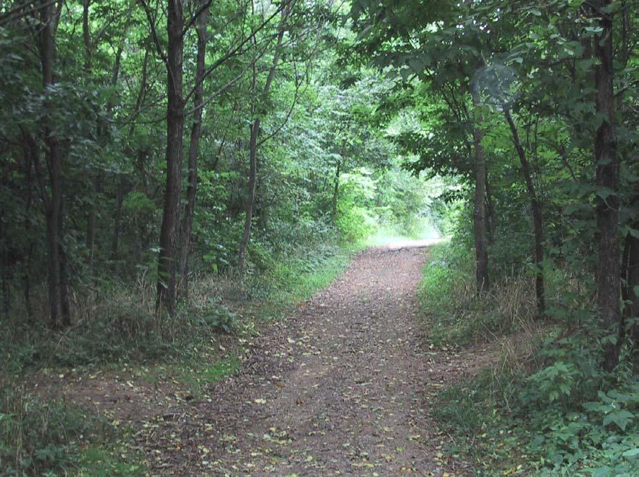 McConnell Springs
PAGE I-6 LFUCG GREENWAY MASTER PLAN
I.5. Shared Use Trail -Natural Surfaces
The off-road shared use trail designed with natural surface materials is intended to accommodate a variety of users, including walkers, joggers, bicyclists, equestrians and others. These pathways are intended for use outside of floodplains and on a grade of less than 5 percent longitudinal and 2 percent cross slope.
Materials that can be used to surface a trail include natural materials (see I.4, Low Impact or Limited Facility Path), soil cement, graded aggregate stone, granular stone, and shredded wood fiber The soft surface materials are compatible with the natural environment; however, they do not always accommodate certain users, such as roller-bladers and disabled persons. Soft surfaced trails are preferred by some runners, mountain bicyclists and equestrians. While less expensive to install, unpaved trails typically have higher maintenance costs than hard surface trails, and require more frequent repairs. Careful consideration should be given to the amount of traffic the specific trail will generate, as these surfaces tend to deteriorate with excessive use.
Soil cement will support most user groups, though bicyclists and horseback riders should have only restricted use. Soil cement surfaces last longer if installed on top of a properly prepared subgrade and subbase. Graded aggregate stone material suitable for trail surfacing includes dense graded aggregate or crushed stone. This surface will often need to be kept in place with wood or metal edging. Because it is a loose, uncompacted surface, graded aggregate stone is limited in application to flatter slopes. Granular stone includes a broad range of aggregate stone, such as limestone, sandstone, crushed rock, gravel and sand. This is one of the best surface types for greenway trails because it can be densely compacted and is compatible with the natural environment. If properly constructed, granular stone can support bicycle and handicapped accessible trail development. Shredded wood fiber is usually composed of mechanically shredded hardwood and softwood pulp, pine bark chips or nuggets, chipped wood pieces, or other by-products of tree trunks and limbs. However, shredded wood fiber decays rapidly and must be installed on flat subgrades.
Proposed Brighton West Rail Trail
APPENDIX I PAGE I-7
I.6. Shared Use Trail – Hard Surfaces
Squires Road Trail
Typical pavement design for hard surface, off-road, shared use trails should be based upon the specific loading and soil conditions for each project. These trails, typically composed of asphalt or concrete, should be designed to withstand the loading requirements of occasional maintenance and emergency vehicles. In areas prone to frequent flooding, it is recommended that concrete be used for its excellent durability.
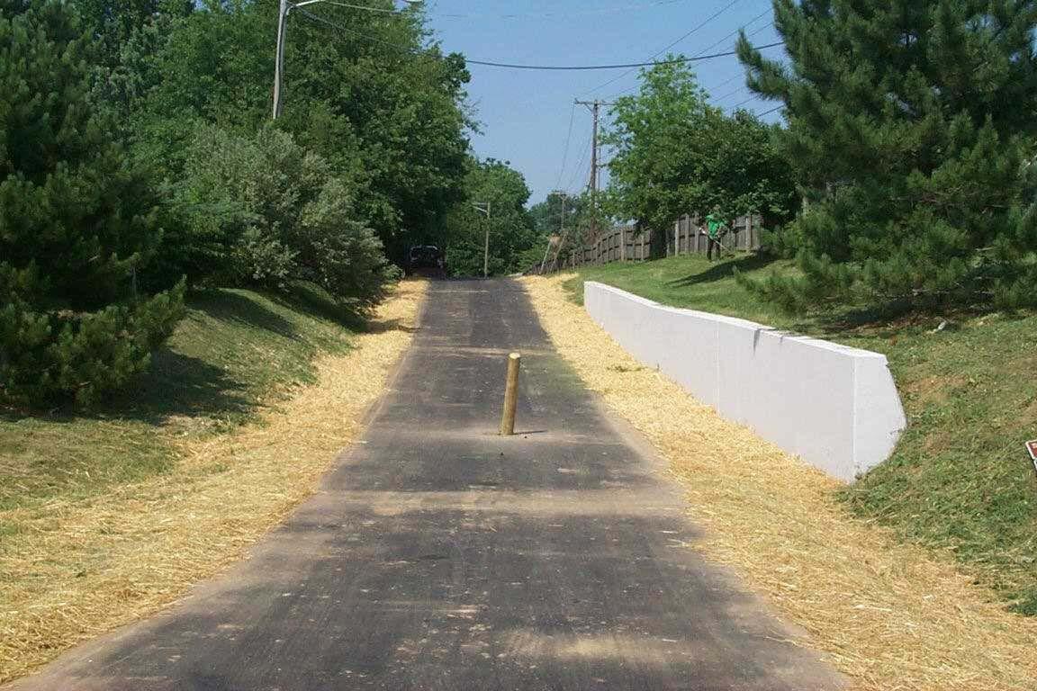
One important concern for asphalt shared use trails is the deterioration of trail edges. Installation of a geotextile fabric beneath a layer of aggregate base course can help to maintain the edge of a trail. It is also important to provide a 2-foot-wide graded shoulder to prevent trail edges from crumbling. Refer to the LFUCG Roadway Design Manual for specifications on the thickness of shared use paths.
Currently, the minimum width for two-directional trails is 10 feet, however, 12 foot widths are
preferred where heavy traffic is expected. Centerline stripes should be considered for paths that generate substantial amounts of pedestrian traffic. Possible conflicts between user groups must be considered during the design phase, as cyclists often travel at a faster speed than other users.
Bituminous asphalt is a hard surface material that is popular for a variety of trails. It is composed of asphalt cement and graded aggregate stone, and is a flexible pavement that can be installed on virtually any slope.
Concrete surfaces are capable of withstanding most powerful environmental forces. They hold up well against the erosive action of water, root intrusion and subgrade deficiencies, such as soft soils. Most often, concrete is used for intensive urban applications. Of all surface types, it is the strongest and has the lowest maintenance requirement if it is properly installed.
PAGE I-8 LFUCG GREENWAY MASTER PLAN
I.7. Clear Zone
A Clear Zone refers to the amount of space adjacent to a trail that is free from obstruction. This includes horizontal and vertical clearance. The amount of clearing required will depend on the type of trail being developed: low impact trails require little or no vegetation removal, while shared use
trails may require significantly more. The clear zone along trails should be a minimum of 3 feet horizontal and 10 feet vertical (12 feet for equestrian use). Refer to LFUCG Roadway Design Manual for minimum clearing distances from solid objects for on-road facilities
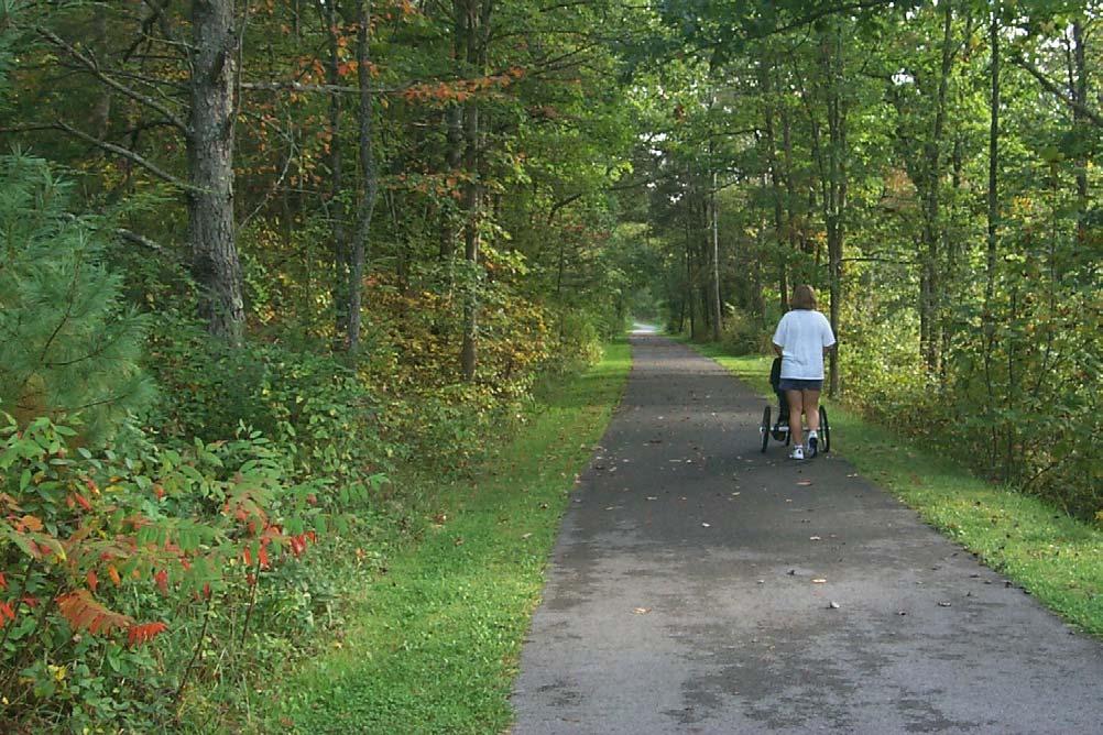 Huckleberry Trail in Virginia
APPENDIX I PAGE I-9
I.8. Proximity and Buffers
A positive relationship can be established between publicly accessible greenways and adjacent private property. For greenways with publicly accessible trails, a minimum 50-foot (100-foot preferred) corridor should be established. This should allow enough room for the trail and any buffering or screening from surrounding private property. Trails should be located away from property lines to the greatest extent possible, and no closer than 10 feet. Buffering should be considered along greenways where there is a need for separation between the trail and adjacent properties. Separation may be necessary because of safety, privacy, aesthetics or natural resource protection. For example, in residential neighborhoods, a visual buffer provides privacy to homeowners; in rural areas, a buffer is used to separate trail users from active farming
operations. A buffer could also be considered as transitional space, such as the riparian zone between a trail and a stream, or between a trail and an active railroad or busy street.
The width of a mid-block access to a greenway depends on the intended use: if the access is for local neighborhood use, then a standard sidewalk located in a 20 foot easement should suffice; if the access shall be used by maintenance crews or in a commercial district, then the width will have to be larger. Other considerations involve signage, ADA accessibility and side yard setbacks.
For trails or paths adjacent to a stream, a minimum setback from the top of a stream bank to the trail should be 25 feet.
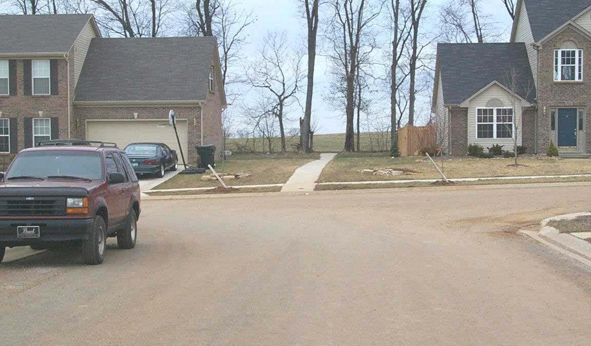 Masterson Station Subdivision
PAGE I-10 LFUCG GREENWAY MASTER PLAN
I.9. Sidewalk
Sidewalks are a critical component of the Lexington-Fayette County on-road Greenway System. They not only encourage walking, but they also improve the safety of pedestrians. An individual’s decision to walk is as much a factor of the perceived quality of the experience as it is convenience. Pedestrian facilities should be designed with the following factors in mind:
Protection from Traffic
High volume and/or high speed (>35 mph) motor vehicle traffic creates dangerous and uncomfortable conditions for pedestrians. Physical (and perceptual) separation can be achieved in several ways, or a combination of methods, such as a grassy planting strip with trees, a raised planter, bike lanes, or on-street parallel parking.
Streetscape
Streetscape design is essential for a high quality pedestrian environment. Paving, street trees, lighting, benches, building facades, and scale are a
few elements of the streetscape that contribute to a pleasurable walking experience. Corridors should be designed for walking in safe and enjoyable surroundings.
Pedestrian-Scaled Design
Signage should be designed for clear visibility by pedestrians. Street lighting should likewise be scaled to the level of the pedestrian, instead of providing light poles that are more appropriate on high-speed roadways. Pedestrian scale also refers to the height and width ratio of buildings and trees to the sidewalk and street.
Pedestrian facilities are often discontinuous, particularly when private developers are not encouraged to link on-site pedestrian facilities to adjacent developments and nearby sidewalks or street corners. New development should be designed to encourage pedestrian access from nearby streets. Existing gaps in the system should
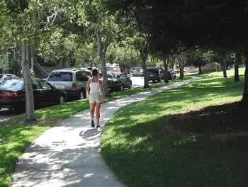 Source: Pedestrian and Bicycle Information Center
APPENDIX I PAGE I-11
be placed on a prioritized list for new sidewalk construction
Clearances
Vertical clearance above sidewalks for landscaping, trees, signs, awnings and similar obstructions should be at least 10 feet. The vertical clearance for building overhangs that cover the majority of the sidewalk should be 12 feet. Horizontal clearance needs to be a minimum of 3 feet for shrubs and other stationary obstacles. Large shrubs should be discouraged to avoid a fear of the unknown.
Conformance with National Standards
Sidewalk design should be consistent with Americans with Disabilities Act requirements and/or ANSI requirements. Specific guidance is provided by the Architectural and Transportation Barriers Compliance Board ’ s ADA Accessibility Guidelines
Sidewalk Obstacles
Street furniture and utility poles create obstacles to pedestrian travel when located directly on the sidewalk. At a minimum, there should be 36" of sidewalk clearance to allow wheelchairs to pass. Where possible, utilities should be relocated so as not to block the sidewalk. Benches should not be sited directly on the sidewalk, but should be set back at least 3 feet
The design of new intersections or re-design of existing intersections presents an opportunity to improve pedestrian circulation. In general, the designer should consider the impact on sight distance for all features located in the vicinity of roadway intersections.
Sidewalk Pavement Design
Sidewalks and roadside pathways should be constructed of a solid surface designed to withstand adequate load requirements. Depth of pavement should consider site specific soil conditions, but in no case should it be less than 4½ inches. Brick and concrete pavers are popular materials for more decorative sidewalks. The use of stylized surfaces is encouraged, however, they must be installed properly or they will deteriorate over time.
Sidewalk Width and Setback Guidelines
Sidewalks should accommodate anticipated volumes based on adjacent land uses, and should, at a minimum, allow two adults to walk abreast with
ease. It is important to note that there are some areas that warrant wider sidewalks than the minimum. For example, sidewalks in and around local universities and colleges must accommodate a much higher volume of pedestrians, and therefore warrant additional width. The recommendations below are based upon standards used by other pedestrian-friendly communities in the United States.
By following the recommendations below, Lexington-Fayette County can ensure that basic needs of pedestrians are addressed. In existing residential and commercial areas that lack sidewalks, new sidewalk construction (independent of new development) should occur first in locations that demonstrate the most need. Note that the current Subdivision Regulations require a 4-foot minimum width for sidewalks.
Sidewalks on Local Streets in Residential Areas
Five-foot-wide sidewalks are recommended on both sides of the street, with a 5- to 7-foot-wide planting strip. The planting strip may need to be slightly wider to accommodate the roots of street trees, if they are included in the design.
Sidewalks on Collector Streets in Residential and Commercial Areas
Five-foot-wide sidewalks are recommended on both sides of the street. A 5.5-foot-wide planting strip is recommended for residential areas, and a 10.5-foot strip is recommended for commercial areas.
Sidewalks on Arterial Streets in Residential and Commercial Areas
A minimum of six-foot-wide sidewalks is recommended on both sides of the street, with 10foot-wide planting strips.
Sidewalks on Streets within 2000' of Schools
Sidewalk width and setback should be based on the specific roadway type as described above. For all roadway types, however, sidewalks should be installed on both sides of the road, and should include well-marked crosswalks and school crossing signs.
Sidewalks on Streets with No Curb and Gutter
The setback requirements described above are based on roadway cross sections that include curb and gutter. Sidewalks located immediately adjacent to pavement with no curb and gutter are not
PAGE I-12 LFUCG GREENWAY MASTER PLAN
recommended. However, if sidewalks are to be constructed, then a much greater setback from the pavement is required, depending on roadway conditions. Engineers should consult the AASHTO Policy on Geometric Design of Highways and Streets for more specific guidelines.
Sidewalks in Rural Areas
In most rural areas, the low volume of pedestrians does not warrant sidewalk construction. In most cases, 4 to 6-foot-wide paved shoulders can provide an adequate area for pedestrians to walk on rural roadways, while also serving the needs of bicyclists.
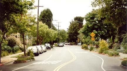
APPENDIX I PAGE I-13
Source Pedestrian and Bicycle Information Center Pedestrian Crosswalk with striping, signage, bump and median
I.10. Wide Curb Lane
There are three types of on-road bicycle facilities: wide curb lanes, paved shoulders, and bike lanes. Refer to the LFUCG Roadway Design Manual and AASHTO's Guide to the Development of Bicycle Facilities for details.
Wide curb lanes, or outside lanes, are wider than the standard 12-foot travel lane and can provide more space for cyclists and easier passing for motorists. Under most conditions, automobiles and bicycles can coexist in a 14-foot-wide curb lane, without the need for the motorist to move into the next adjacent lane

Location and Width
Wide curb lanes best accommodate advanced cyclists, as these riders are more comfortable operating directly in traffic. The wide curb lane is always the furthest right-hand lane, and should optimally be 14-16 feet wide, not including the gutter pan, (consistent with the LFUCG Roadway Design Manual). Wide curb lanes are not required to have curb and gutter. A width greater than 16' is not recommended.
In order to achieve the extra space needed for a 14' wide outside lane, the roadway may either be physically widened or re-striped to reduce the lane width of inner lanes and increase the width of outer lanes. Re-striping proposals should be reviewed by
LFUCG transportation engineers to ensure adequate safety for the motorists, as well as bicyclists.
Signage
There is no special “wide curb lane” sign, however, on high volume urban arterials, LFUCG may choose to install “Share the Road” warning signs (standard bicycle warning plate with a subplate stating “SHARE THE ROAD”).
Intersection Design
As wide curb lanes approach intersections with turning lanes, the 14' wide lane should continue through the intersection as the outside throughlane.
Design Issues
Acceptance:: Bicycle programs in numerous communities have found that less experienced bicyclists seldom see a difference when wide curb lanes are provided. Therefore, if the desired outcome is greater numbers of bicyclists or a visible “Pro Bicycle” statement, this option will not satisfy the need.
Traffic speeds: Wider curb travel lanes may tend to increase motorist speeds. Whether a marginal increase in speeds is important in a particular situation should be a subject for analysis.
Source Pedestrian and Bicycle Information Center
PAGE I-14 LFUCG GREENWAY MASTER PLAN
I.11. Paved Shoulder
Winchester Road
The second type of on-road facility is paved shoulders, which are used along rural roads and some urban streets such as Tates Creek Road and Richmond Road. Paved shoulders are not only an excellent way to accommodate the motoring public, they are also beneficial to bicyclists as well. Paved shoulders have the added advantage of eliminating problems caused when the pavement edge begins to deteriorate, thus extending the life of the road surface and requiring less maintenance. Paved shoulders also provide a pull-off for motorists with car trouble.
Width
Shoulders should be a minimum of 4 feet wide to accommodate cyclists, depending upon the speed and volume of motor vehicle traffic (consistent with LFUCG Roadway Design Manual). Paved shoulders for bicycles can be designed according to typical roadway cross sections for bicycle lanes, with the exception that no pavement decals or bicycle lane signage is used.
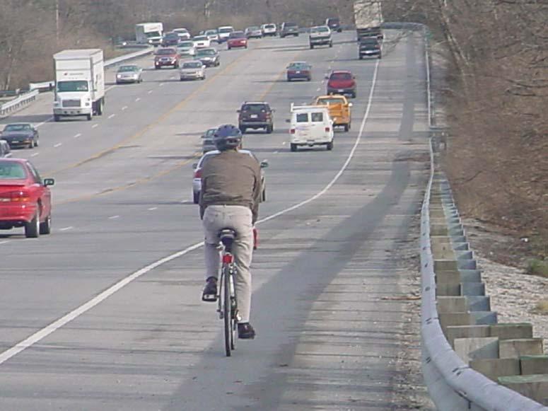
Although 4 feet of width is preferable, certainly any additional shoulder width is preferable to none at all. Shoulders that are 2-3 feet wide can improve conditions and are recommended in cases where 4foot widths cannot be achieved. “Share the Road” signs would be acceptable in these locations, as they would serve to warn motorists of the likely presence of bicyclists.
As with bicycle lanes, paved shoulders should have the same pavement thickness and subbase as the adjacent roadway, and should be regularly swept and kept free of potholes.
Signage
Paved shoulders can be designated as bikeways by erecting standard bicycle route warning signs. As described above, these “Share the Road ” signs may be installed on roads with paved shoulders that are less than 4 feet in width.
APPENDIX I PAGE I-15
I.12. Bicycle Lane
The third type of on-road bicycle facility is a bike lane. Design of bicycle lanes should conform to the standards found in the LFUCG Roadway Design Manual They should not be separated from other motor vehicle lanes by curbs, parking lanes, or other obstructions. General standards for width, striping, and intersections are provided below.
Location and Use
Bicycle lanes serve the needs of experienced and inexperienced bicyclists in urban and suburban areas, providing them with their own travel lane Bicycle lanes are always located on both sides of the road (except when they are constructed on one-way streets). By this design, cyclists are encouraged to follow the rules of the road, which require them to travel in the same direction as adjacent motor vehicle traffic. During the repair and reconstruction of roads, consideration should be given to the installation of bicycle lane facilities as designated in the Greenway Master Plan and 2025 Transportation Plan. Additionally, collector roads (existing and proposed) should be considered for bike lane facilities.
Width
The minimum width of bike lanes should be 4 feet, exclusive of the gutter pan. For roads with parallel
parking, bike lanes should be a minimum of 5 feet wide, and should be installed adjacent to the motor vehicle lanes, rather than between the parking lane and the curb
Signage
The MUTCD specifies standard signage for bicycle lanes.
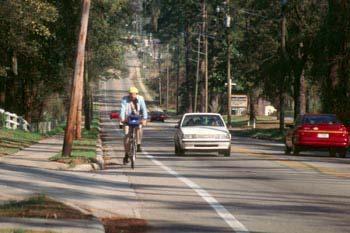
Striping
A bicycle lane stripe should be a solid, six inch wide white line. Care should be taken to use pavement striping that is skid resistant. Bicycle-shaped pavement symbols and directional arrows should be placed in the bicycle lane to clarify its use. Pavement letters that spell “BIKE ONLY” are also highly recommended. Symbols should be installed at regular intervals, immediately after intersections, and at areas where bicycle lanes begin.
Bike lane striping at intersections is challenging. Traffic has a tendency to mix at intersections: motorists who are turning right must cross paths with cyclists who wish to continue straight, and cyclists who wish to turn left must cross into lefthand turn lanes. Several intersection striping patterns are provided by AASHTO’s Guide for the Development of Bicycle Facilities and the MUTCD.
Source: Pedestrian and Bicycle Information Center
PAGE I-16 LFUCG GREENWAY MASTER PLAN
I.13. Trail and Trailhead Amenities
One component of greenway facility design will be the installation of amenities, such as bike racks, benches, trash receptacles, landscaping, bollards, water fountains and signage. All trailheads should have parking, restrooms and kiosks. Some trailheads will need to be designed to accommodate special events or regional tourism. Trails with equestrian use will need additional space for unloading and parking horse trailers, tie posts and water troughs. Users of water trails will need adequate space to unload kayaks and canoes at a distance near to the water.
All amenities should be chosen according to the specific needs of the site; and, where appropriate, should be compatible in style to the surrounding elements. An individual trail may have a particular "theme", however for the majority of time, the details for amenities should be uniform throughout the greenway system. Amenities should also be chosen for their ease of installation, vandal resistance and low maintenance costs.
Bike Racks
It is important to choose a bicycle rack design that is simple to operate and allows for a variety of lock types. Racks should be located within 50 feet of building entrances. Racks should be installed in a public area within easy viewing distance from a main pedestrian walkway, usually on a wide sidewalk with five or more feet of clear sidewalk space remaining (a minimum of 24" clear space from a parallel wall, and 30" from a perpendicular wall).
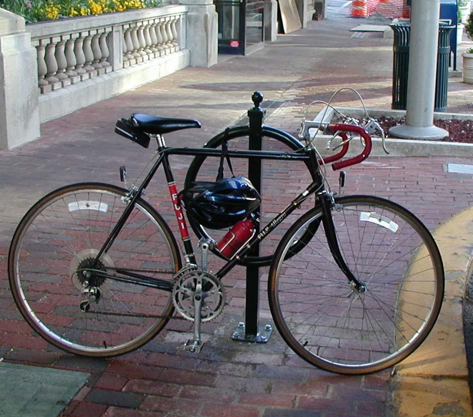
Racks are placed to avoid conflicts with pedestrians. They are usually installed near the curb and at a reasonable distance from crosswalks. Racks should be installed at bus stops, but must not interfere with boarding or loading patterns. Lexington Transit buses already have installed racks on their buses to facilitate bike-on-transit travel.
Trash Containers
Trash containers are necessary at trailheads and staging areas. They can be attractive as well as functional, and should be selected based on the amount of trash expected, overall maintenance
Bike Hitch Rack Downtown Lexington
APPENDIX I PAGE I-17
program of the trail, and types of users. Trash cans need to be accessible to both trail users and maintenance personnel. At a minimum, containers should be located at each entranceway. Trash cans are not recommended along the trail. A policy of 'bring it in, take it out' should be adopted. The location of additional trash cans will depend upon the location of concessions, facilities adjacent to the trail and areas where trail users tend to congregate
Benches
Benches along trails allow users to rest, congregate, and enjoy the view or activities. Trail benches should comfortably accommodate the average adult. They should be located at the primary and
secondary entrances to the trail, and at regular intervals along the trail. Benches should be set back three feet from the trail edge.
Signage
Necessary signage shall be provided on all trails, prior to opening, as per AASHTO and LFUCG standards. Directional signage instructs trail users as to the location of trails, intersections, trailheads and points of interest. “Rules of the Trail” is a sign listing the rules of trail use, and these need to be posted at trail access points. Interpretive signage educates trail users about a particular site or feature that they encounter along the way.
PAGE I-18 LFUCG GREENWAY MASTER PLAN
Bike Rack and Locker
I.14. Roadway Crossings
The intersection of trails/sidewalks and roadways is one particular area of concern in the greenway system development. On heavily traveled roadways, trails and sidewalks should be separated from the vehicular traffic with an overpass or underpass, where feasible.
There are two common types of trail/sidewalk and roadway conflicts: at roadway intersections and at mid-block crossings. Safety is of utmost importance when designing roadway crossings. Considerations for trail/sidewalk crossings of roads include the following:
• Use MUTCD sign standards to clearly mark the trail and road.
• Design the crossing so that trail/sidewalk users are visible and predictable to the vehicular traffic (and vice versa)
• Design with consistency throughout the greenway system.
• Design intersection and mid-block trail/sidewalks to cross at a curb cut, be at a 90degree angle, and with no compound grade changes or curves. It is best to raise the
roadway to the level of the trail so that the trail user doesn't have to contend with grade changes at the intersection.
• Catch stormwater before it crosses the trail/sidewalk to avoid slick conditions for cyclists and pedestrians.
• Stripe the pavement at intersections to indicate the crosswalk. At mid-block crossings, (depending upon the volume of traffic) striping the trail crossing may also be advisable.
• Design other traffic calming devices, such as pavement texture changes, a median, bump-out or signalized light where necessary for safety purposes.
• Include signage that identifies the greenway, since intersections are also access points.
• Use bollards or a Y-shaped planting median on a trail to keep unwanted vehicles off of the trail.
Mid-block crossings can be the greenway corridor itself, or an access easement to the greenway. The spacing distance between mid-block access easements is dependent upon several factors, such
Source: Pedestrian and Bicycle Information Center
APPENDIX I PAGE I-19
as grade, adjacent land use, and local regulations for maximum block length. If there is a “T” intersection within the block, it is preferred that the access be located across from the intersection for maximum exposure and use. Width of the access depends on the intended use: if it is for local
neighborhood access, then a standard sidewalk in a 20-foot easement should suffice; if the access will be used by maintenance crews, or in a commercial district, then the width should be larger. Other considerations involve signage, accessibility and distance of the sidewalk to adjacent homes.
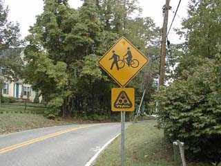
PAGE I-20 LFUCG GREENWAY MASTER PLAN
Source: Pedestrian and Bicycle Information Center
I.15. Native Plant Species
There are a number of ways to help ensure that riparian areas provide the necessary water quality and quantity protection.. First and foremost is to retain as much of the area as possible in a naturally vegetated, undisturbed condition, especially the portion of the riparian area that is closer to the adjacent stream or creek. In most situations, "naturally vegetated" means native forest cover. Streamside forest vegetation, whether living, decaying or dead, on the ground or fallen or extending into the water, should be left in place wherever possible to maximize its detention capability and allow plenty of time for the
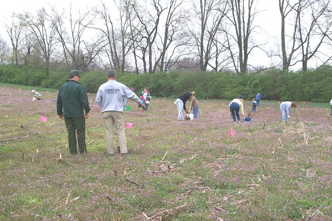
breakdown of pollutants by plants and microorganisms. Excessive "tidying up" of riparian areas by leaf raking, brush clearing, removing fallen logs or other removal of plant material from the forest floor and/or streambank can significantly reduce detention time and the opportunity for the riparian area's living filter to beneficially interact with and attenuate water-borne pollutants.
In order to insure proper native and non invasive species the attached table provide the recommended native and non invasive species.
Reforest the Bluegrass
APPENDIX I PAGE I-21
NATIVE PLANT SPECIES SUITABLE FOR STREAMBANKS AND RIPARIAN BUFFERS IN CENTRAL KENTUCKY
Herbaceous Ground Covers:
Common Name Scientific Name Shade/Sun
River Oats Chasmanthium latifolia shade
Indian Grass Sorgastum nutans
Switch Grass Panicum virgatum sun
Redtop Agrostis alba
Deertongue Panicum clandestinum
Broomsedge Andropogon virginicus
Big Blue Stem Andropogon gerardii
Frank’s Sedge Carex frankii
Gray’s Sedge Carex grayii
Soft Rush Juncus effusus
Flat Sedge Cyperus strigosus
Lady Fern Athyrium felix-femina
Sensitive Fern Onoclea sensibilis
Cinnamon Fern Osmunda cinnamomea
Common Boneset Eupatorium perfoliatum
Golden Ragwort Senecio aureus
Wrinkled Goldenrod Solidago rugosa
Tall Goldenrod Solidago gigantea
Beard Tongue Penstemon hirsutus
Monkey Flower Mimulus ringens
Cardinal Flower Lobelia cardinalis
Great Blue Lobelia Lobelia silphilitica
sun
sun
shade
sun
sun
sun
shade
sun
sun
shade
shade
shade
sun
shade
sun
sun
shade
shade
shade
shade PAGE I-22 LFUCG GREENWAY MASTER PLAN
NATIVE PLANT SPECIES SUITABLE FOR STREAMBANKS AND RIPARIAN BUFFERS IN CENTRAL KENTUCKY
Vines and Shrubs: Common Name Scientific Name Shade/Sun
Cross Vine Bigononia capreolata shade
Trumpet Creeper Campsis radicans sun
Climbing Hydrangea Decumaria barbara shade
Giant Cane Arundinaria gigantea sun
Buttonbush Cephalanthus occidentalis sun
Meadowsweet Spirea alba sun
Sweetspire Itea virginica shade
Spicebush Lindera benzoin shade
Paw-paw Asimina triloba shade
Arrowwood Viburnum dentatum shade
Nannyberry Viburnum lentago sun
Swamp Haw Viburnum nudum shade
Ninebark Physocarpus opolifolius sun
Hazelnut Corylus americana sun
Possum Haw Ilex decidua sun
Winterberry Ilex verticillata shade
Chokeberry Aronia arbutifolia sun
Elderberry Sambucus candensis sun
Juneberry Amelanchier arborea shade
Mountain Camelia Stewartia ovata shade
Sweetbells Leucothe racemosa shade
Smooth Azalea Rhododendron arborescens shade
Silky Dogwood Cornus amomum sun
Redosier Dogwood Cornus stolonifera shade
Rough-leaf Dogwood Cornus drummondii shade
Pagoda Dogwood Cornus alternifolia shade
Smooth Alder Alnus serrulata sun
Sandbar Willow Salix interior sun
Silky Willow Salix sericea sun
Dwarf Willow Salix humilis var. macrophylla sun
Pussy Willow Salix discolor sun
Streamco Willow Salix purpurea sun
Bankers Willow Salix x cotteti sun
Heart-leaf Willow Salix rigida sun
APPENDIX I PAGE I-23
Trees:
Common Name
NATIVE PLANT SPECIES SUITABLE FOR STREAMBANKS AND RIPARIAN BUFFERS IN CENTRAL KENTUCKY
Scientific Name
Black Willow Salix nigra
Boxelder Acer negundo
Red Maple Acer rubrum
Silver Maple Acer saccharinum
Green Ash Fraxinus pennsylvanica
White Ash Fraxinus americana
Red Elm Ulmus rubra
Silverbell Halesia carolina
Persimmon Diospryros virginiana
River Birch Betula nigra
Black Gum Nyssa sylvatica
Hackberry Celtis occidentalis
Cottonwood Populus deltoides
Sweet Gum Liquidambar styraciflua
Tulip Polar Liriodendron tulipifera
Sycamore Plantanus occidentalis
American Beech Fagus grandiflora
Ironwood Carpinus caroliniana
Yellow Buckeye Aesculus octandra
Shellbark Hickory Carya lacinosa
Shagbark Hickory Carya ovata
Pecan Carya illinoensis
Black Walnut Juglans nigra
Bur Oak Quercus macrocarpa
Pin Oak Quercus palustris
Swamp Oak Quercus bicolor
Swamp Chestnut Oak Quercus michauxii
PAGE I-24 LFUCG GREENWAY MASTER PLAN
NATIVE HERBACEOUS SPECIES SUITABLE FOR WET PONDS AND CONSTRUCTED WETLANDS IN CENTRAL KENTUCKY
Common Name
Scientific Name
Water Depth
Barnyard grass Echinochloa crusgalli transitional
Switch Grass
Panicum virgatum transitional
Swamp Milkweed Asclepias incarnata transitional
Giant Cane
Jewelweed
River oats
Deertongue
Arundinaria gigantea transitional
Impatiens capensis transitional
Chasmanthium latifolia transitional
Panicum clandestinum transitional
Boneset Eupatorium perfoliatum transitional
Sedges Carex spp. shallow
Soft rush Juncus effusus shallow
Rice cutgrass Leersia oryzoides shallow
Flat sedges Cyperus spp. shallow
Blue iris Iris virginicus shallow
Panic grass Panicum agrostoides shallow
Wool grass Scirpus cyperinus shallow
Pink smartweed Polygonum pennsylvanicum shallow
Green bulrush Scirpus atrovirens mid
Pickerelweed Pontederia cordata mid
Duck potato Sagittaria latifolia mid
Arrow arum Peltandra virginica mid
Bur-reed Sparganium eurycarpum mid
Wild rice Zinzania aquatica mid
Spike rushes Eleocharis spp. mid
Water plantain Alisima subcordatum mid
Three square sedge Scirpus americanus mid
Yellow water crowfoot Ranunculus flabellaris deep
White water buttercup Ranunculus longirostris deep
Water lotus Nelumbo lutea deep
Spaderdock Nuphar luteum deep
White water lily Nymphaea tuberosa deep
Duckweed Lemna spp floating
Note: transitional = seasonally flooded edge; shallow = 0 – 6 inches, semi-flooded pool; mid = 6 – 20 inches, permanent pool; deep = 20 – 60 inches, permanent pool; floating = non rooted
APPENDIX I PAGE I-25
PAGE I-26 LFUCG GREENWAY MASTER PLAN
Appendix J: Facility Management
Operating and managing a system of greenways in Lexington-Fayette County will require a coordinated effort among all Urban County Government (LFUCG) departments, private sector organizations and individuals. The following text defines key aspects of greenway system management, such as access, maintenance, safety and security, trail user rules and regulations, emergency response and risk management. More specific problems and issues may arise during the long-term development of the system that result in additional policies being considered and adopted.
As defined in previous sections of this Plan, the protection of stream corridors from urban encroachment is essential in order to permit stream channels and their floodplains to perform natural functions. Stream corridors are best protected by first delineating the landscape boundaries of the regulatory floodplain and then by encouraging landowners and government to engage in land stewardship practices. A strategy should be established for stream mitigation, where needed, and protection of undeveloped stream corridors.
J.1. ACCESS AND SCREENING Right of Public Access and Use of Trail Lands
The general public should have free access to and use of greenways that support public use (land that Lexington-Fayette County owns or has secured the right of public access and use). All access and use is governed by existing Urban County policies and should also be governed by a new Greenway Ordinance. Trails should be limited to nonmotorized uses, including hiking, bicycling, running, jogging, wheelchair use, skateboarding, rollerblading, equestrian use, mountain biking and other uses that are determined to be compatible with the Urban County's greenway trails.
Cross-Access Agreements
The LFUCG can use cross-access agreements that will permit private landowners that have property on
both sides of a greenway corridor to access and use the greenway corridor to facilitate their operation and land use activities.
Cross-access agreements are based on case law of the United States and specific experiences from other greenway trail systems throughout the United States. Adjacent landowners generally have the right to use the access at any time. However, access cannot block the right-of-way for trail users, other than for temporary measures, such as permitting livestock to cross, or transporting equipment. Adjacent landowners are responsible for acts or omissions that would cause injury to a third party using the trail. If a landowner must move products, materials, livestock or equipment across the trail on a regular basis, appropriate signage should be installed to warn users of the trail to yield for such activities
Crossing of abandoned or active rail lines, utility corridors, roads or highways will require the execution of agreements with companies, local, state or federal agencies and organizations that own the rights-of-way. These crossings must provide clearly controlled, recognized, and defined intersections in which the user will be warned of the location. In accordance with the American Association of State Highway Transportation Officials (AASHTO) and the Manual on Uniform Traffic Control Devices (MUTCD), the crossing will be signed with appropriate regulatory, warning and information signs.
Screening
The LFUCG should work with each landowner on an individual basis to determine if screening is required, appropriate and feasible. The Urban County may agree to fund the installation of screening. Maintenance or replacement of the screening will typically be the responsibility of LFUCG if within the greenway, or the responsibility of the adjacent property owner if on adjacent property.
APPENDIX I PAGE J-1
J.2.MAINTENANCE Adopt-A-Greenway Program
An Adopt-A-Greenway Program should be established by the LFUCG to encourage community groups, families, businesses, school groups, civic clubs and other organizations to join in managing the greenway system. The LFUCG should implement this program for every greenway corridor in the system, and work closely with local organizations to ensure that these groups manage and maintain trails in a manner that is consistent with the LFUCG objectives. The LFUCG should develop written agreements for each Adopt-AGreenway entity and keep a current record of this agreement on file. Adopt-A-Greenway entities will be assigned a specific section of the greenway system, defined by location or milepost. The activities of each organization should be monitored by the LFUCG (or LFUCG designee). Agreements for management can be amended or terminated at any time by either party, giving 30 days written notice.
Management Agreements
and adjacent property owners. To the extent possible, the property shall also be maintained in a manner that enables the corridor to fulfill multiple functions (i.e. passive recreation, alternative transportation, stormwater management and habitat for wildlife). Property that is owned or managed by other entities should be managed and maintained in accordance with the policies as set forth by Lexington-Fayette Urban County Government.
All trail surfaces should be maintained in a safe and usable manner at all times. Rough edges, severe bumps or depressions, cracked or uneven pavement, gullies, rills and washed out treads should be repaired immediately. Volunteer vegetation occurring in the tread of the trail should be removed in such a manner so that the trail surface is maintained as a continuous, even and clean surface.
Management
Agreements
will be established between the LFUCG and specific public or private organizations wishing to assist with the management of designated segments of the greenway system. The objective of these agreements is to define areas of maintenance and management that are compatible with existing land management activities, especially where greenways intersects with public or private properties and/or rights-of-way. Management agreements spell out specific duties, responsibilities and activities of the LFUCG, and public or private organization that wishes to assist with management activities. They can be amended or terminated at any time by either party, giving 30 days written notice.
Facility Maintenance
All greenway facilities should be managed by the LFUCG (or LFUCG designee). Greenway maintenance should include the removal of debris; trash; litter; obnoxious and unsafe man-made structures; and other foreign matter, so as to be safe for public use. Trailheads, points of public access, rest areas and other activity areas should be maintained in a clean and usable condition at all times. .
Property owned or used by the LFUCG for the greenway system shall be maintained in a condition that promotes safety and security for greenway users
Vegetation within each greenway corridor shall be managed to promote safety, serve as wildlife habitat, buffer public trail use from adjacent private property (where applicable), protect water quality, and preserve the unique aesthetic values of the natural landscape. Removal of native vegetation, significant trees or riparian cover shall be highly discouraged. Removal of exotic species should be accomplished in a systematic and thorough manner. LFUCG may choose to remove exotic species and other unwanted vegetation using various means, depending on the specific location and circumstances.
Vegetation adjacent to trails shall be managed as necessary to maintain clear and open lines of sight along the edge of the trail, and eliminate potential hazards that could occur due to natural growth, severe weather or other unacceptable conditions. To promote safe use of any greenway trail, all vegetation should be clear cut to a minimum distance of three (3) feet from each edge of a trail. Selective clearing of vegetation should be conducted within a zone that is defined as being between three (3) to ten (10) feet from each edge of a trail. At any point along a trail, a user should have a clear, unobstructed view along the centerline of a trail, 300 feet ahead and 300 feet behind his/her position. The only exception to this policy should be where terrain or curves in a trail serve as the limiting factor. The LFUCG or their designated agent should be responsible for the cutting and removal of vegetation. Removal of vegetation by an individual or entity other than the LFUCG or its designee shall be deemed unlawful and subject to fines and/or prosecution.
PAGE J-2 LFUCG GREENWAY MASTER PLAN
It may be necessary for the LFUCG to conduct wildlife management programs on lands that are publicly owned. This shall be accomplished in a manner that is in keeping with accepted laws, professional practices and/or recommended strategies that are provided to the LFUCG by wildlife management experts.
J.3. SAFETY AND SECURITY
Safety is a duty and obligation of all public facilities. In order to provide a standard of care that offers reasonable and ordinary safety measures, the LFUCG should cooperatively develop and implement a Safety and Security Program for the greenway system. This Program would consist of well-defined safety and security policies that identify trail management, law enforcement, emergency and fire protection agencies, proper postings and means for the notification and education of the trail user policies. The Program would also outline a system that offers a timely response to the public for issue or problems that are related to safety and security. The safety and security of the greenway system will need to be coordinated with local law enforcement officials, local neighborhood watch associations, and Adopt-A-Greenway organizations.
Important components of the Safety and Security Program include the following. The LFUCG should:
1. Work with law enforcement agencies to establish a Greenway Safety and Security Committee that can meet periodically to discuss management of the greenway system.
2. Prepare a Greenway Safety Manual and distribute this to management agencies and post it at all major trailheads.
3. Post User Rules and Regulations at all public access points to greenway trails.
4. Work with the management agencies to develop Trail Emergency Procedures
5. Prepare a Safety Checklist for the greenway system, and utilize it monthly during field inspection of greenway facilities.
6. Prepare a Greenway User Response Form for complaints and complements and provide copies at all trailheads
7. Work with management agencies to develop a system for accident reporting analysis.
8. Conduct a regular Maintenance and Inspection Program, and share the results of these investigations with all management agencies.
9. Coordinate other Public Information Programs that provide information about greenway events and activities in which County residents may participate.
10. Have an ongoing evaluation of greenway program objectives.
J.4. USER RULES AND REGULATIONS
Trails within greenway corridors shall be operated like all other parks within the LFUCG, open for public use from sunrise to sunset, 365 days a year, except as specifically designated. Individuals who are found to be using unlighted facilities after dusk and before dawn should be deemed in violation of these hours of operation and treated as trespassers. Where trails are lighted for nighttime use, the rules established within future Greenway regulations should govern permitted uses and activities.
The LFUCG shall enforce trespassing laws as defined under Kentucky Revised Statutes for publicly owned lands and facilities.
The LFUCG should always discourage the general public from using any segment of a greenway trail that is under construction. Trail segments should not be considered officially opened for public use until such time as a formal dedication ceremony and official opening has been completed. Individuals who use greenway segments that are under construction, without written permission from the LFUCG should be deemed in violation of this access and use policy and treated as a trespasser.
Off-Road Trail Rules
Multi-use conflict is a national problem for community and regional greenway systems. Typically, conflicts are caused by overuse of a greenway trail, however, other factors may be problematic including poorly designed and engineered trail alignments, inappropriate user behavior, or inadequate facility capacity. The most effective conflict resolution plan is a well-conceived safety program that provides the individual user with a Code of Conduct. Several communities across the United States have adopted progressive trail ordinances to govern public use and keep trails safe for all users. The following Rules and Regulations are recommended for the LFUCG Greenway Trails System. These rules should be displayed both on brochures and information signs throughout the greenway system:
APPENDIX I PAGE J-3
1. Be Courteous: All Trail users, including bicyclists, joggers, walkers, wheelchairs, skateboarders and skaters, should be respectful of other users, regardless of their mode of travel, speed, or level of skill. Never spook animals; this can be dangerous for you and other users. Respect the privacy of adjacent landowners! No trespassing is allowed from trails. Remain on trails at all times.
2. Keep Right: Always stay to the right as you use the Trail, or stay in the lane that has been designated for your user group. The exception to this rule occurs when you need to pass another user.
3. Pass on the Left: Pass others going in your direction on their left. Look ahead and behind to make sure that your lane is clear before you pull out and around the other user. Pass with ample separation. Do not move back to the right until you have safely gained distance and speed on the other user. Faster traffic should always yield to slower on-coming traffic.
4. Give Audible Signal When Passing: All users should give a clear warning signal before passing. This signal may be produced by voice, bell or soft horn. Voice signals might include "Passing on your left!" or "Cyclist on your left!" Always be courteous when providing the audible signal—profanity is unwarranted and unappreciated.
5. Be Predictable: Travel in a consistent and predictable manner. Always look behind before changing position on the Trail, regardless of your mode of travel.
6. Control Your Bicycle: Lack of attention, even for a second, can cause disaster—always stay alert! Maintain a safe and legal speed at all times.
7. Do Not Block the Trail: When in a group (including your pets), use no more than half of the trail, so as not to block the flow of other users. If your group is approached by trail users from both directions, form a single line or stop and move to the far right edge of the Trail to allow safe passage by these users.
8. Yield when Entering or Crossing Trails: When entering or crossing the Trail at an uncontrolled intersection, yield to traffic already using the other trail.
9. Do not Use this Trail Under the Influence of Alcohol or Drugs: It is illegal to use this Trail if you have consumed alcohol in excess of the statutory limits, or if you have consumed illegal drugs. Persons who use a prescribed medication
should check with their doctor or pharmacist to ensure that it will not impair their ability to safely operate a bicycle or other wheeled vehicle.
10. Clean-up your Litter: Please keep this Trail clean and neat for other users to enjoy. Do not leave glass, paper, cans or any other debris on or near the Trail. Please clean up after your pets. Pack out what you bring in—and remember to always recycle your trash.
11. Keep Pets on Leashes: All pets must be kept on secure and tethered leashes. Keep pets off of adjacent private property. Failure to do so will result in a fine.
12. Prohibition on Camp Fires: Fires, for any purpose, are prohibited within the Trails System. Any person caught lighting a fire for any purpose will be prosecuted to the fullest extent of the law.
On-Road Facility Rules
The LFUCG recommends the following safety tips for both pedestrians and cyclists who use the onroad components of the county-wide greenway system. It is important to remember that a bicycle is a legal vehicle in the State of Kentucky and is therefore subject to all the rights and responsibilities of other vehicles. A cyclist, by law, must obey all traffic laws, signs and signals.
1. Ride on the right side of the road with traffic.
2. Always wear a helmet when riding a bicycle.
3. Use hand signals to communicate your intended actions to motorists. Establish eye contact with motorists at intersections whenever possible.
4. Ride no more than two abreast on the road and stay in the same lane as other vehicle traffic. Large groups should spread out to allow motorists to pass.
5. Ride defensively. Always be alert and plan your bike route carefully.
Because the horse industry and general agriculture are very important to Central Kentucky, there are some additional rules and bike etiquette that are necessary while riding our rural roads. While it is the goal for cyclists to enjoy the wonderful views and beautiful countryside, the rules are for the protection of both the farming community and cyclists. Some basic manners need to be acknowledged and followed because the consequences could be detrimental to both the agricultural industry and cyclists.
PAGE J-4 LFUCG GREENWAY MASTER PLAN
Here are rules for cyclists to follow along rural roads:
1. Some things that seem quite harmless can actually jeopardize livestock. Contact with horses, cattle, etc., can easily spread serious diseases that have the potential to kill the animals and cause huge financial losses for the affected farms. Therefore, the following rules should be observed:
2. Please do not litter; the horses or livestock could eat the trash and become sick. Respect the environment and keep our landscape beautiful.
3. Do not trespass onto private property. Kentucky law now states that the property owner will not be held responsible for any individual that trespasses onto private property and is injured. Respect private property owners’ rights and stay off their property.
4. Do not climb or lean over fences to get a better view. Getting off the road to take a picture would be better than doing it from the road.
5. Do not try to touch or pet the horses or livestock. The animals can bite and are dangerous.
6. Do not lean your bike against farm fences
7. Do not spook the horses or livestock by making sudden movement or noise.
8. Do not feed the horses or other animals.
9. Get completely off the road if you have to make an emergency stop.
10. Ride in single file. Some of the rural roads are very narrow; farm traffic sometimes carries wide loads and could be hazardous if riding is done two abreast. Be aware that the months from February to May are breeding and foaling season, and there is a large amount of horse van traffic on the rural roads.
11. Avoid smoking. If you do smoke, be careful to extinguish cigarettes carefully; it is easy to inadvertently start a wildfire, especially in dry weather
12. Wear bright clothing.
J.5. EMERGENCY RESPONSE
In order to effectively patrol the greenway system and respond to the potential for fire, flash floods and other natural or human-caused disasters, the LFUCG should adopt a Greenway Emergency Response Plan. This plan defines a cooperative law enforcement strategy for greenways based on services required and those that are typically provided by police, sheriff, fire and EMS agencies.
Specifically, all trails should be provided with an address system that denotes specific locations along the length of a trail corridor. A site plan that illustrates points of access to each trail corridor should be produced and kept on file at the LFUCG and provided to each agency. Trails in flash flood areas shall be appropriately signed to warn users. Each trail should be designed to permit access for law enforcement, fire and EMS agencies and vehicles that are not in excess of 6.5 tons gross vehicle weight. Typically, inter-governmental agreements are executed for this. A system of cellular-type emergency phones should be located in remote sections of the system, providing users with access to the area 911 Emergency System. All emergency phones should be placed above the flood elevation to ensure long-term usage.
The emergency response plan should also define the agencies that should respond to 911 calls, and provide easy to understand routing plans and access points for emergency vehicles. For long distance trails, access points for emergency and maintenance vehicles should be located at reasonable distances from trail heads (approximately every 2-3 miles). Local hospitals should be notified of these routes so that they may also be familiar with the size and scope of the project. The entire greenway system should be designed and developed to support a minimum gross vehicle weight of 6.5 tons.
Risk Management
The purpose of a Risk Management Plan is to increase safety for the users of the LFUCG Greenway System, and reduce the potential for accidents to occur within the system or on lands adjacent to the system. While it is impossible to guarantee that all risk will be eliminated by a Risk Management Plan, implementation of a Plan is in fact a critical step to reduce liability and improve safety. A Risk Management Plan establishes a methodology for greenway management that is based on current tort liability and case law in the United States related to the development, operation and management of public use greenway lands and facilities. The ultimate responsibility for managing the greenway system, as defined within this Plan, rests with the LFUCG. The Risk Management Plan has as its major goals:
1. Risk Identification: determining where risk (threat to safety or potential loss) exists within the corridor.
APPENDIX I PAGE J-5
2. Risk Evaluation: conducting appropriate examination of areas defined as a risk, and determining the factors that contribute to risk.
3. Risk Treatment: defining and implementing an appropriate solution to the area of risk, in accordance with one of the four options:
a. Risk avoidance: prohibiting use of a risk area;
b. Risk reduction: limiting use of the area and repairing a risk area immediately;
c. Risk retention: obtaining waivers from all potential users of the risk area;
d. Risk transfer: transferring risk area (property) to an agency better suited to manage the area.
The following sixteen-steps should be implemented by the LFUCG to establish a Risk Management Plan for the LFUCG greenway system:
1. Develop a policy statement about risk management;
2. Conduct a needs assessment for the greenway program;
3. Determine goals and objectives for risk management - what are acceptable and not acceptable management levels;
4. Develop specifications for site and facility development;
5. Establish a clear and concise program for risk management;
6. Define supervision and responsibility for risk management;
7. Define appropriate rules and regulations that govern the use of the trail system;
8. Conduct routine/systematic inspections and investigations of the trail system;
9. Develop an accident reporting and analysis system;
10. Establish procedures for handling emergencies;
11. Develop appropriate releases, waivers and agreements for use and management;
12. Identify best methods for insuring against risk;
13. Develop a comprehensive in-service training program for employees of the County;
14. Implement a public relations program that can effectively describe the risk management program and activities;
15. Conduct periodic reviews of the Risk Management Plan by outside agents to ensure that the Plan is up to date;
16. Maintain good legal and insurance representation.
Liability
The design, development, management, and operation of the LFUCG greenway system must be carefully and accurately executed in order to provide a resource that protects the health and welfare of the public. Liability may occur when a facility has been under-designed to handle its intended volume of use; when management of the facility is poor; or when unexpected accidents occur because the trail manager failed to recognize the possibilities of a potentially hazardous situation. To reduce the possibility and exposure to liability, the Urban County should have in operation the following measures prior to opening the first segment of greenway:
1. A thorough Maintenance Program that provides the appropriate duty or level of care to greenway users;
2. A Risk Management Plan that appropriately covers all aspects of the greenway system, and as necessary adjacent landowners;
3. A comprehensive working knowledge of public use laws and recent case history applicable in Kentucky.
The LFUCG's existing self-insurance program may be adequate to protect the Urban County government from financial loss that might occur through the development and operation of the greenway system. Trails are no greater liability to the LFUCG than park and recreation, sidewalk or urban open space resources. The Urban County should review its current policy and check coverages to be certain that all aspects of its policies are up-to-date.
The LFUCG should exercise reasonable care in the design and construction of all greenway facilities to reduce hazardous, public nuisance and life threatening situations. Recreational Use Statutes in Kentucky serve to reduce the exposure that adjacent landowners might expect to realize from the proximity of trails to private property. In fact, it is very difficult to find any case law in the United States where an adjacent property owner has been sued because a trail user strayed onto the adjacent private property and fell victim to an accident that was caused by the adjacent landowner. Some landowners have claimed that their insurance rates will go up because of the presence of a trail abutting their property. Once again, there is no case history among insurance companies to support this claim— provided the landowner has not gone out of their
PAGE J-6 LFUCG GREENWAY MASTER PLAN
way to create an attractive nuisance and lure trail users onto their property.
It is also important that a fee not be charged to use any portion of the greenway system, because
typically this may impact the way in which the recreational use statutes in Kentucky apply to the use of the system. A voluntary donation applied to the greenway system will generally not affect the recreational use statute.
APPENDIX I PAGE J-7
