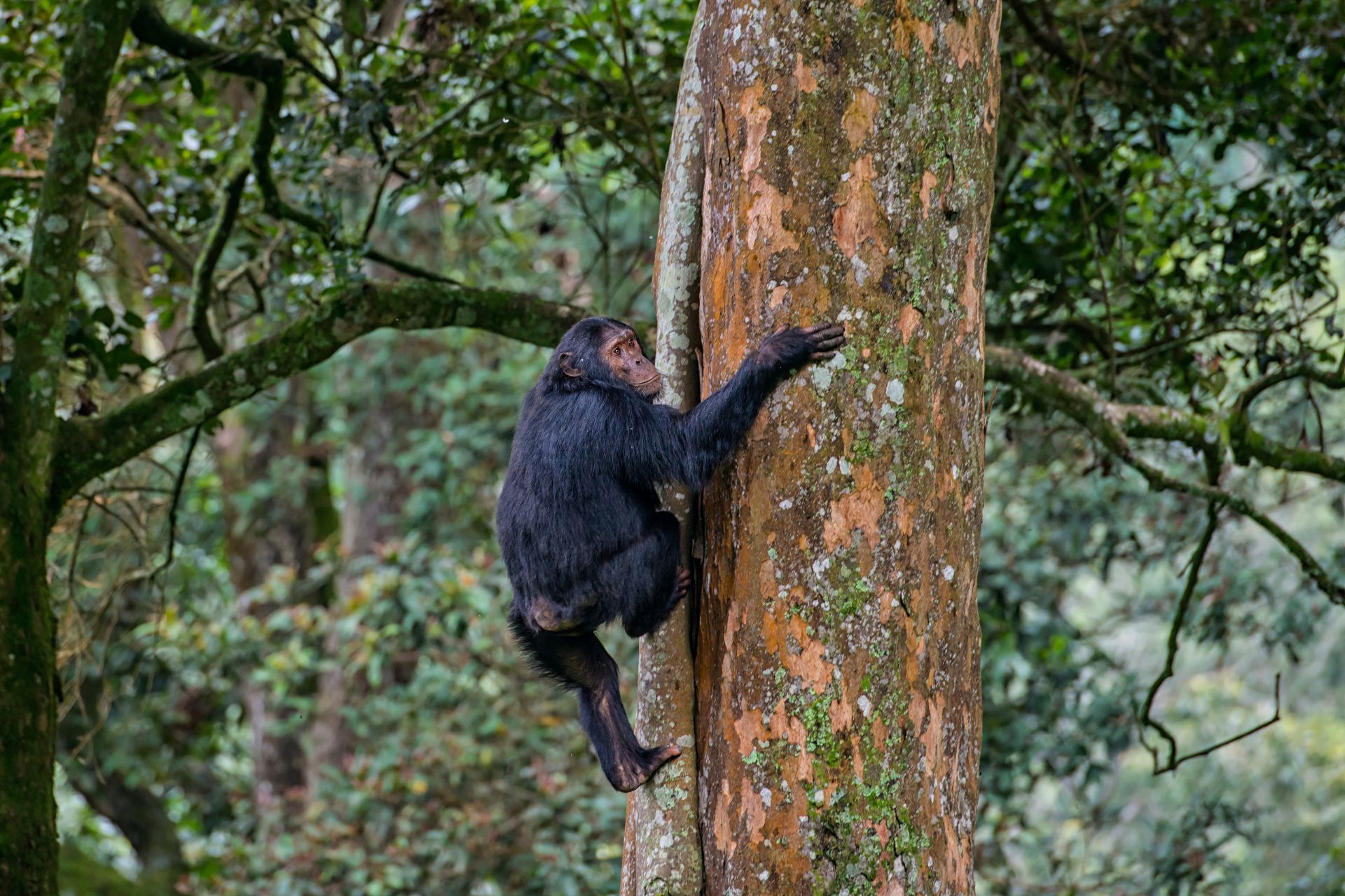
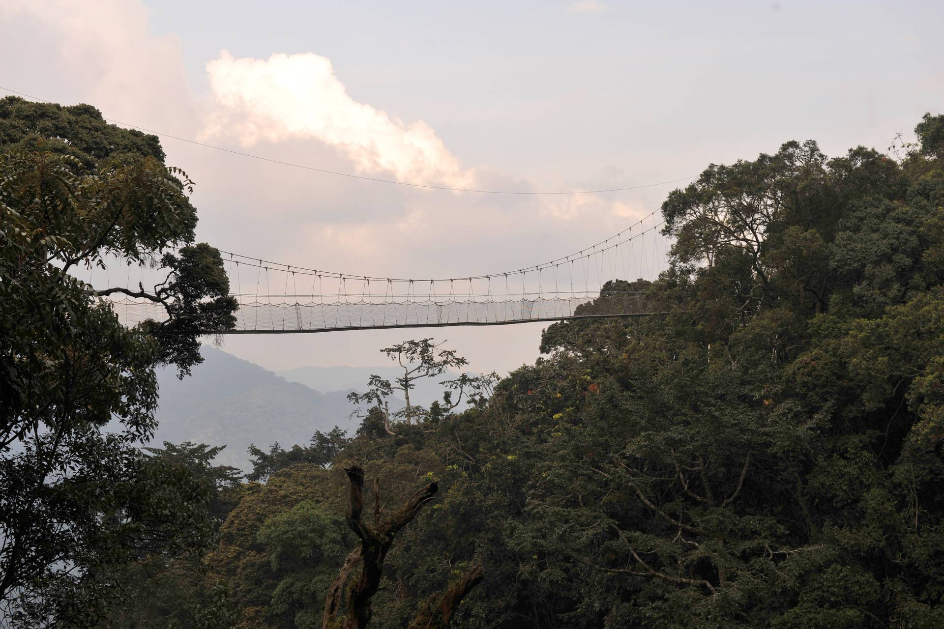
Experience the beauty and biodiversity of Africa’s largest and oldest montane forest at Nyungwe Forest National Park. Located in Rwanda’s Kivu Belt region, Nyungwe is part of the Congo-Nile divide forest that originally stretched across the entire mountain range dividing the Congo and Nile basins from Burundi to Uganda. Today, only Nyungwe and a few other small and fragmented forests remain. The park is home to over 500 eastern chimpanzees and 13 other primate species, as well as a variety of monkeys, mammals, and endemic bird species. Visitors can explore the park’s hiking trails, waterfalls, and the world-renowned Canopy Walk, a series of hanging bridges that allow for a unique view of the forest canopy.
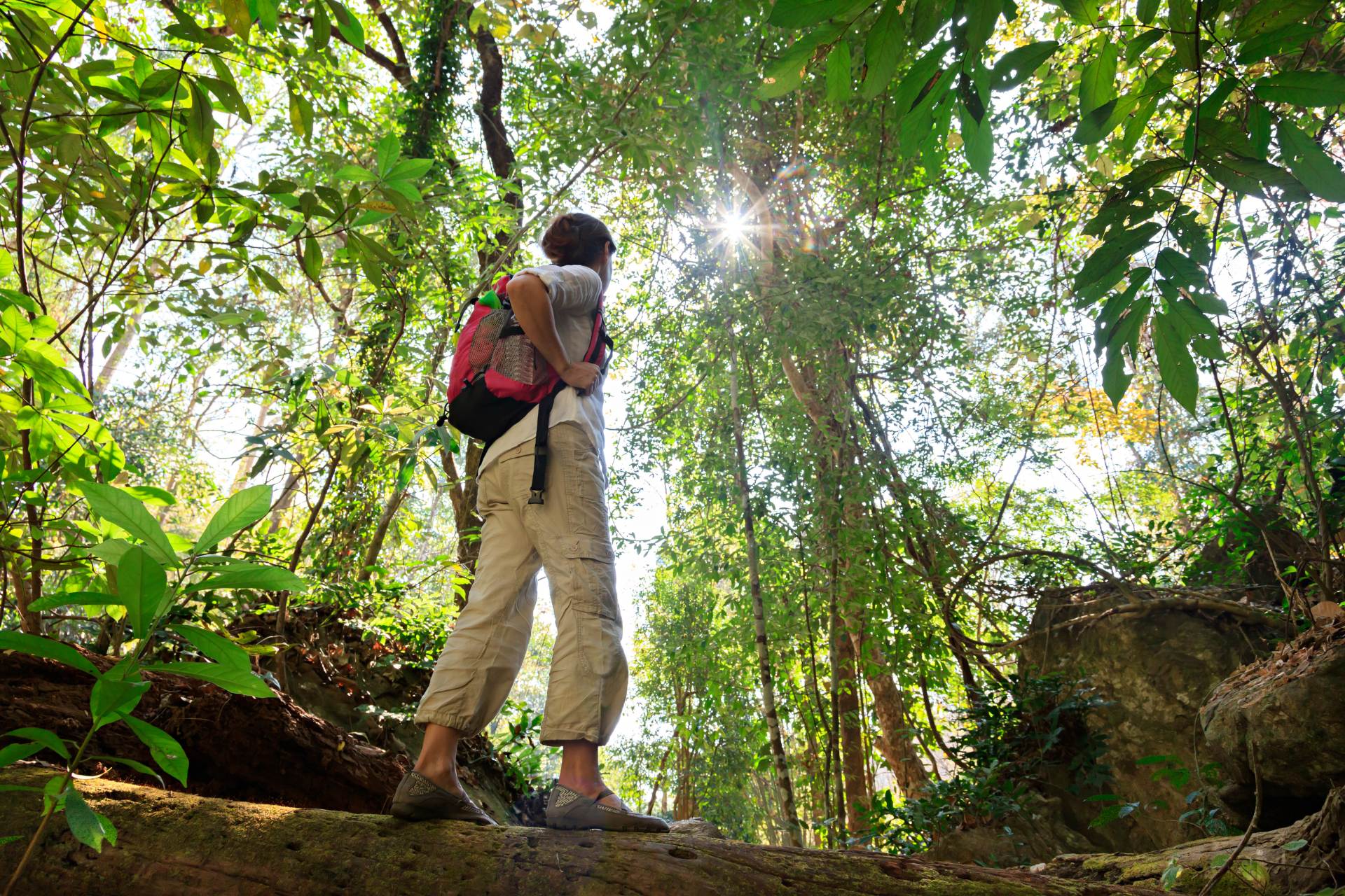
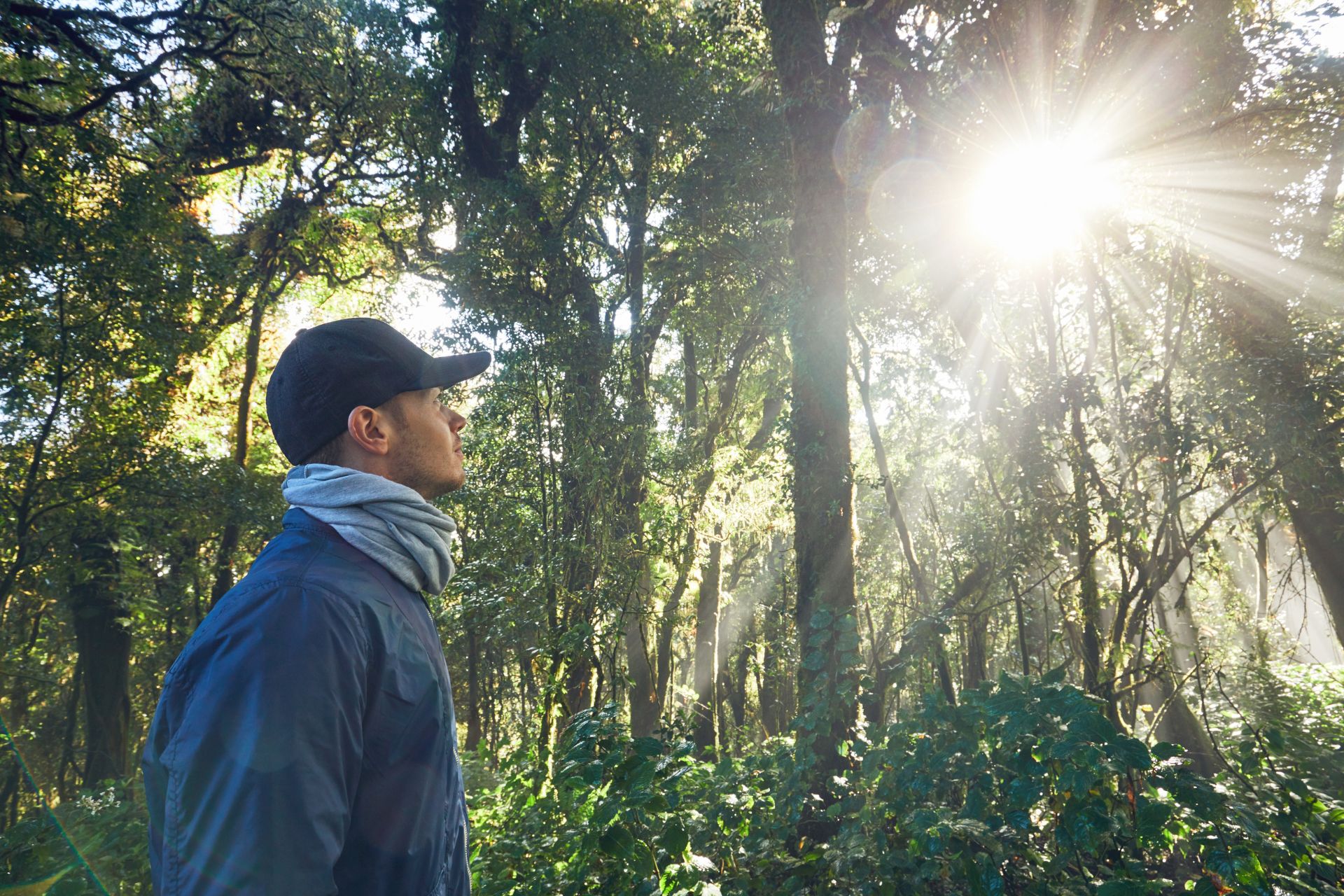
Nyungwe Forest National Park offers a unique hiking experience for outdoor enthusiasts. Located in the south west of Rwanda, the park boasts an extensive network of scenic hiking trails that wind through one of the oldest rainforests in Africa. The steep landscape of Nyungwe makes it an ideal destination for hikers, whether novice or experienced. The park is known for its biodiversity and spectacular beauty, with a wide variety of flora and fauna. One of the highlights of hiking in Nyungwe is the Canopy Walk suspension bridge, which offers visitors a chance to experience the forest from a different perspective. With more than 12 hiking trails to choose from, visitors can sample the delights of the forest or indulge themselves for a week or more in one of Africa’s most stunning forests. It’s important to note that all hikes in Nyungwe Forest are guided, and visitors are not allowed to enter the park on their own.
Tails to the west of Uwinka display 3 potpourri of Nyungwe landscapes, including the Park’s highest waterfall and largest body of water, and the most spectacular display of orchids. Hikers will experience striking changes in landscapes, whether wandering through tea plantations into dense, tropical forest on the way to Kamiranzovu Falls or dropping down from the high Afro-montane forest into the Kamisanzovu Marsh. Birding Opportunities abound, especially for early risers and late afternoon hikers.
Isumo Trail
This trail 10.6 km takes hikers through verdant tea fields, a steep rainforest ravine and to top it off, the biggest waterfall in the Nyungwe National Park. One of the most memorable trails for hiking in Nyungwe Forest!
This trail of great contrasts provides a feast for the senses. Beginning at the Gisakura Reception Center, the first half winds through brilliant green tea fields, with grassy verges maintained by goats and full of sun-loving wildflowers and butterflies. This is big sky country, with gorgeous views northwest to Lake Kivu and the DRC. The beit of tea cultivation bordering the forest is like a desert to most herbivorous forest creatures. They are not adapted to browse this alien shrub from China, and so return to the forest, tea is thus an ideal buffer zone plant. The animals’ lack of interest in the tea also helps keep tea interests and the Park on friendly terms.
At 2.3 km, the trail descends into one of the steepest and most densely vegetated rainforest ravines on any trail at Nyungwe. Cool moist air and the murmur of a river rise from below, mingled with calls of birds, tree frogs, and insects. Ferns, mosses, lichens, and flowers are exceptionally abundant in the high humidity. Curiously, three successive benches are completely surrounded by a brilliant display of wildflowers, each a single, different species. The first is wreathed with deep pink jewelweed and has a fabulous view of the ravine, the second bench is encircled by delicately fragrant white begonias and a third by white flowers with heart-shaped leaves.
Several species of primates are commonly found here, as well as many birds. Although visitors will almost never see any, this is reputed to be the best trail for finding snakes. None are deadly. The ultimate goal at the end of the trail is Nyungwe’’s biggest waterfall and the inspiration for the trail’s name—isumo is a waterfall in Kinyarwanda. At roughly 17 m in height, it is even more impressive for the force with which it shoots through a narrow gap into a stunning amphitheatre lined with fluttering fronds of ferns, flowers, and lianas, all thriving in the mist zone of the fall. There are caves in the overhanging cliffs, and a rainbow in the spray on sunny days. Three km to the east, and 100 m higher in elevation, lies the bottom of the 13 sq km Kamiranzovu Marsh, which drains over the rim of this water-carved canyon.
You may enjoy the waterfall from two main vantage points depending upon how wet you want to get. The first is at the end of a short spur, which leads to a picnic bench overlooking the fall at 50 m distance. Small trees partially obscure the view. The fall itself can be reached by descending to the wild river below and then clambering over wet rocks to a large boulder in the middle of the amphitheatre. From here, you’ll be thrillingly close to the bottom of the fall, where it thunders down, full blast, nearly
at your feet. Watch your rooting on the wet surface as you gaze upward. The water in the fall and the river rushing toward Lake Kivu has a tea-coloured tint due to the tannin content in the waters of the marsh. While you’re there, don’t forget to look down too. You may be startled by dark brown crabs scuttling around the dark wet rocks, looking like they have lost their way from the sea. Mist keeps the bench permanently wet but you will want to stay here for a while to enjoy the awesome beauty and power of this one very special! place in the heart of Africa.
Hikers may save 3.2 km round trip by starting at Car Park 1, or 4 km round trip by Starting at Car Park 2. The latter is accessible only in 4×4 vehicles and even these can get in trouble if the hard packed, clay surface is wet. There are two entrances to the forest. Starting at Entrance 2 saves another 0.25 km. Consider varying your entrance and exit routes. If you like orchids, be sure to include Car Park 2 on your route, even if you do not park there. Look in the scraggly, old jacaranda trees for some of the best views of epiphytic orchids in the nark—right at eye level
Kamiranzovu Trail
Start in the tea plantations and enter the forest, passing by Nyungwe’s largest swamp and the boardwalk.
Kamiranzovu Marsh, Nyungwe National Park’s largest wetland, is an impressive geological formation. With its nearly circular rim of lush, forested mountains, it resembles a giant caldera and drains through a dramatic gap between two peaks. On the more elevated western side of the trail, hikers will reach several good vantage points for taking in the whole marsh, including its outlet. Through that gap, the tannin-rich, tea-colored marsh water flows about 3 km, to Kamiranzovu Waterfall, then onward to Lake Kivu, Lake Tanganyika, the Congo River, and finally the Atlantic Ocean. The name is said to be derived from kamira (to swallow) and nzovu (elephant), and refers to the elephants that used to roam Nyungwe, occasionally becoming trapped in the ooze of the marsh. The last elephant died in 1999 and its skull is displayed in the Uwinka interpretation Center.
There are two Kamiranzovu trailheads off the main road, 0.7 km apart. Starting at Traithead 2, to the east, reduces the altitude gain by about 37 m, unless you plan to do a complete loop. This route also has a long, lovely descent to the marsh, with fine views. Setting off from Trailhead 1 means you reach the marsh very quickly. if you want a shorter version of the trip, start at Trailhead 1 and explore only the section of trail bordering the marsh or to view marsh birdlife or plant life, then return to the road. From Trailhead 1 to the far end of the Orchid Loop back is about 4 km. Hikers who do the full Kamiranzovu Trail but bypass the Orchid Loop, will save about 0.5 km. For the end of the hike, visitors can arrange a pick-up at either trailhead oy walk back along the road to a parked vehicle at either end of the loop.
Two of the endemic Albertine Rift bird species found by the marsh are Grauer’s Rush Warbler and the Albertine Owlet. For the latter, you can arrange a special trip to the marsh at night with one of the guides who has a recording of its call. Although not always seen, the owlet can usually be heard.
Only a small section of trail actually reaches the very marsh itself, and two stretches of boardwalk let the hiker enter with dry feet—getting out with dry feet is the challenge! The wooden-plank walkways are slimy, so walk with care. Wetlands in general are especially rich in organic life and visitors will find here a contrast to the thickets and rainforest higher up on the trail. One of the boardwalks spans a corner of the marsh where visitors can view a great variety of wetland vegetation at close range. There are flowering herbs, shrubs, small trees, orchids, grasses, ferns, mosses and giant lycopods. Soon after stepping on the boardwalk, and in season, one can see the large-flowered, pink, metre-plus-tall, foxglove orchid, one of the most widespread orchids in Africa. Among many other showy orchids one can find Disa Eminii and Calanthe Sylvatica, the latter you may recognize from gardens back home in Europe or America.
The Orchid Loop has a short section of boardwalk into the marsh. If you’re taking this trail especially for the flora, don’t miss looking into the thickets, which begin at the wet edges of the marsh. In the warm. humid air, the lianas, shrubs, and small trees there are thickly laden with mosses ferns, lichens, and other epiphytes or air plants. One of the botanical specialties of this trail is an endemic, glossy, lemon yellow-flowered begonia. While looking for it you may also see large, waxy, white flowers of wild magnolia that have fallen on the trail.
At the far northern point of the hike, the Uwinka Trail comes in on the left. This connects the Kamiranzovu Trail to the Uwinka Visitor Center compound, many uphill kilometres away.
The trail climbs through humid thickets and eventually enters classic rainforest again. Along the way there are several views of the marsh. As you stop to rest you can hear the diversity of frog, insect, and bird calls coming from the marsh and in the trees. If you think the views of the marsh are lovely, consider doing the Uwinka Trail for your next hike. It is a gorgeous trail. usually done one way, beginning near the height of Uwinka Ridge and ending at Kamiranzovu Trail. The views of the marsh from the higher elevations offered by Uwinka Trail are some of the most satisfying in the Park.
Karamba Trail
Another relatively easy trail for hiking in Nyungwe Forest, the Karamba Trail is 6 km long and located on the former site of a gold mine, market and army camp. The trail is considered one of the best spots for birding in Nyungwe as it is flanked by numerous fern trees.
This easy stroll reaches a 360-degree viewpoint with little physical effort and is the premier bird walk in the park. [It is short and relatively flat and has excellent traction. If you’ve spent a few days hiking on rainforest trails, you will notice the dearth of big trees. Most of this trail is open to the sky due to substantial human influence in the relatively recent past—first as a gold mine and market, then as a quarry for road-building material, and more recently as an army camp. Although such disturbances are now kept to a minimum, it is gratifying to see the degree to which even severely degraded habitat can recover. The open habitats, low young trees of secondary vegetation, and the forest margin are all conducive to good birding.
The hike begins by an army camp and, except for the final brief climb to a knoll with a view, follows an abandoned road, which still appears on old maps. The first few hundred meters of trail are in very early Stages of forest regeneration. The pebbly trail, made up of sparkly quartz, is a nice change from slippery trails elsewhere at Nyungwe but it doesn’t drain well and becomes a mini stream in the rainy season.
Half a kilometer into your trip, in the midst of the environmental disturbance, you’ll be startled to find a large, deep hole in the ground, rather like a well-kept terrarium, with a perfect cutaway view of all the layers of a typical, lovely rainforest. Its steep sides must have offered it some protection. The forest layers include a low, herbaceous ground cover, shrubs, tree ferns, saplings, and fully mature trees. Notice the variety of leaf shapes, greens, and textures.
Not far beyond, the trail passes an inactive quarry. Still somewhat raw-looking, its thin, stony soil is slowly being improved by a number of brave, hardy plants, including a common, white-flowered ground orchid in the genus Satyrium. If you find one, look closely at one of the flowers for a pair of lit tle white horns, typical of the genus. Thesé are spurs, which usually contain nectar for the purpose of enticing and rewarding potential pollinators. The name Satyrium may have been inspired by the two-horned satyrs of Greek mythology.
Soon the trail passes through a small colony of beautiful, giant tree ferns normally seen in moist, rainforest valleys. Your guide will tell you about the traditional use of giant tree fern fronds—they may save your life! Ahead, on the hillside, you can see some relatively pristine-looking rainforest edges, in addition to second-growth forest, both ideal for spotting birds.
At 1.9 km, there is a sign on the right that says, ‘Point de Vue’. Before proceeding, continue straight a few metres to the rocky outcrop on the left. Try to look just behind it, where there is a precipitous drop down into the beautiful rainforest. The area where you are standing appears to have been blasted out of the mountainside. It is much rockier than most of the other trails at similar altitude in the Park. Returning (6 the viewpoint sign, the trail climbs a few short switchbacks through a small patch of forest to the summit. Alongside the trail are the pretty heart-shaped leaves of the white-flowered Cincinnobotrys oreophila, a true rainforest flower. Even these very small pockets of remaining forest harbour the seeds and plants of the stock needed to replenish the rainforest.
The small summit looks back down the trail, to a deep valley in the middle ground and beyond, to many layers of overlapping ridges. There is a viewing bench with a narrow table where you can sit for a light snack or a full picnic. While resting on the summit, listen for blue monkeys and turacos or watch for the red flash of a turaco’s wings. Early risers, and especially birders, may want to arrange to come here with flashlights before dawn one morning to watch the sunrise over the hills and to listen to the morning chorus as birds and other diurnal species come to life.
Uwinka Trail
Although considered a difficult hike, this 17.8 km trail takes hikers through rather lovely ravines and is the perfect place to listen to early morning bird calls.
Uwinka Trail is one of the finest in the Park, although it is often bypassed in favor of the half dozen other trails closer to the Uwinka Visitor Center. The route is long but not too strenuous. The trail has some of the most pleasing views in the Park, the finest of them overlooking Kamiranzovu Marsh from high vantage points. There are impressive trees, long stretches of beautiful trail, and a small, lovely, remote waterfall. Mangabeys and blue monkeys can often be seen here and large groups of colobus have been known to cross the forest here.
This 17.8 km trail is usually done as a one way trek. Hikers may set off from the Uwinka Visitor Center OF from one of the nearby trailheads along the Huye-Rusizi Road. For the purpose of this narrative, the hike begins at the lreboro Trailhead 2; starting at the centre would add another 0.8 km of walking along the road, or a much longer distance by way of the Imbaraga Trail spur.
After a little over half a kilometer, there is a lovely clearing with a view across the Park to Burundi. Moments after the junction with the Umogote Trail, having crossed the ridge, hikers turn left onto the Imbaraga Trail. You’ll spill back onto the Uwinka Trail after 1 km. At this spot there is a bench overlooking the rainforest and a small section of the road where the trail began. The Visitor Center is hidden to the left. The trail contours down hill, with the Uwinka Ridge on the left. Soon, there is a good view of several villages outside the Park, including Banda, and beyond lies Lake Kivu and Idjwi Island in the DRC. Not too much farther down the trail, there is a bench overlooking Cyurugeyo Ridge. The name is derived from the sheep said to graze there at one time. Inka, in the name Uwinka, refers to the cattle that used to find salt here.
The trail soon passes between Uwinka Ridge and Cyurugeyo. For the first time hikers will be on the Kamiranzovu side of the mountain. For the next several kilometers, the forest is mainly closed, with few views, but here you’ll really begin to feel like you’re in the rainforest. The trail contours along the sides of several minor ridges, sometimes passing between small prominences, but remaining mostly in the forest.
In the rainforest around Uwinka, there are some amazing examples of massive trees leaning out precariously over steep mountainsides. It’s amazing that they have the root system to support such tests of gravity! Along this trail there is one that seems to have grown just one kilo too heavy and now lies across the trail. Just after stooping to pass under it, look right, at a magnificent welcome tree—tall and straight and with branches that curve up almost at 45 degree angles, as if conducting a symphony.
At the next bench, which requires Several metres of ascent off the trail, you’ll catch a glimpse of Nyanzoga Mountain. Continuing down the trail, the first view of Kamiranzovu Marsh appears. It is obscured a little, by saplings and larger trees, but Kamiranzovu Marsh is on the left and there will be tantalising glimpses of it now and then before the better views appear. The remainder of the path only grows in beauty, all the way back to the road, and hikers should probably congratulate themselves on a fine choice of trail.
Not far beyond this last bench, there is a dead Carapa grandiflora tree on the right, which looks like it has been clawed or chewed at its base. Angolan black and white colobus and blue monkeys use it for medicine. Research shows that this tree may contain medicinally valuable compounds and that primates really do make deliberate use of medicinal plants.
As you continue down the trail, watch for epiphytic orchids fallen from tree limbs. Some are in bloom and provide hikers with a rare opportunity to inspect them closely. Have & look and you may handle them since they will not be able to survive on the ground. The international CITES (Convention on International Trade in Endangered Species) agreement protects all of the world’s wild orchids from removal without a permit.
Uwinka Trail also has a great variety of jewelweeds, with the violet-pink jewelweed by far the most common. Ndondoli is the local name. Another common name of jewelweeds is busy lizzie, maybe inspired by their ability to multiply prolifically, which they do by ‘exploding’ their seeds away from the parent plant. There are, of course, many other fine wildflowers on this trail. tn June and July the air is filled with the scent of them. March, April, and December are the best months for seeing orchids. Epiphytic ferns occur in great variety year round.
While looking at the vegetation, listen for the guttural cat-like call of blue monkeys and for other primate voices, tree frogs. Mountain Orioles, White-headed Woodhoopoes, the three turacos, Narina’s trogon, and the amazing seven voices of the Mountain Boubou.
The next bench has the highest altitude {2369 m) and affords a good view of the marsh, although there will be even lovelier views ahead, but from lower down. At the far point northwest on the hike, the trail bends around left to continue down the ridge. Soon, through the trees, you will see the pretty Uwinka Waterfall. The trail crosses a small bridge over a narrow stream for a better view. The fall, about 7 m in height, spills down a cliff, separating into two narrow cascades a third of the way down. Impatiens, ferns, moss, and tree ferns thrive in the moist air around It. There is a picnic bench to the right of the fall.
The trail now continues wandering in and out of much smaller, minor ravines with crossing logs over little rivulets. Hikers will see increasing numbers of an endemic, glossy, yellow-flowered begonia. The red succulent flowers strewn on the trail are from the welcome tree. About 2 km beyond the waterfall, you’ll finally reach the most spectacular view of Kamiranzovu Marsh. Turunga Ridge lies on the far side. In the foreground there is an impressive, deep ravine, making this viewpoint especially good for photography on a clear, sunny day.
At the junction with Kamiranzovu Trail, a left turn returns hikers to the main road at Kamiranzovu Marsh Trailhead 2, in about 2 km. Hikers who feel energetic or ambitious may want to turn right, to explore the edge of the marsh, which will otherwise not be reached on this trip. Including the Orchid Loop, this adds less than 1 km to the hike and exits at Kamiranzovu Marsh Trailhead 2. See the Kamiranzovu Marsh Trail description for more details.
Most visitors will arrive from Kigali at the eastern entrance to the Park at Kitabi. The trails east of Uwinka feature ridgeline walking, ascents of Nyungwe’s highest peaks, and fabulous vistas of deep valleys, mountaintops, and mountain ridges as far as you can see. The trails featured in this section are drier than trails to the west and, in some places, much colder. Most of the forest fires in the past have occurred in this area of the Park and, as a result, visitors pass through extensive areas of post-fire emergent vegetation including ferns, shrubs, and pioneer tree species. The gem of the eastern region of the Park is Congo-Nile Divide Trail, a multi-day hike along ridges and mountain summits, with a spur trail to the source of the White Nile.
To the highest peak in the park, this 13.2 km trail offers incredible flora and on a clear day views of Lake Kivu as well as hills and islands belonging to the Democratic Republic of the Congo.
Guides at Uwinka turn their gaze to Mt. Bigugu, the highest summit in the Park, to predict the afternoon’s weather. Hikers who like to take on the highest peaks or biggest challenges will put this mountain on the top of their list. Birders come here to see the Red collared Mountain babbler among others. While Bigugu Trail is rated as difficult, the return trip is downhill.
Bigugu is a great mountain for enjoying the incredible array of flora offered in Nyungwe. Ascend the summit in the dry season and you may be rewarded with three fiery blossoms to light your way to the top —the large, conical, orange flowers of the orchid Disa robusta, red orange flowers of Redhot Poker, and the scarlet flowers of the endemic Nyungwe Jewelweed. The latter two might look familiar as they’ve found their way into gardens across Europe and North America. Also special to Bigugu is the beautiful little Lobelia petiolata, which occurs only between elevations of 2,400 and 3,000 meters. When Sericostachys scandens, an invasive indigenous weed, blooms every 14 to 15 years, the mountain appears white from so many flowers. Your guide will tell you about the significance of this plant in traditional lore and honey production.
The trail begins by climbing steps, and gains 150 m of elevation in the first half kilometer of steep mountainside. At this point, a mossy, old roadbed appears, which contours around shallow prominences on the long shoulder of the mountain. This section of trail, being relatively flat and very pretty, provides some of the most pleasant three kilometers of hiking in the Park and is a welcome relief after the steep start. Eventually the trail leaves the old road for a moderate gradient to the broad, heath-covered dome of the summit. This Is partly occupied by a radio relay station, staffed by RDB, which has an important role in keeping trackers, guides, and rangers in touch so that the chimps are tracked and poachers are kept out of the forest.
From the summit, you are rewarded for the climb with a fantastic overview of the whole Park. If the weather behaves, you can see the shimmer of Lake Kivu beckoning in the distance, the hills and islands of the Democratic Republic of Congo (DRC), and the extension of Nyungwe’s forest in Kabira National Park in Burundi. If you’re lucky, you may even see the proud summits of Volcanoes National Park, home to the majestic mountain gorilla.
Not too far from the summit there is a bench for a well deserved picnic, overlooking Banda Village, a peninsula of densely populated and cultivated land surrounded by buffer zone and park on three sides. Your guide may even be able to point out his own fields and home. The ridge beyond Banda is Kigogo Mountain and Gisakura is hidden just on the other side. You may just want to call Bigugu home for the evening. If so, you’ll find a campsite just below the summit.
The lower slopes of Bigugu are a home range for chimpanzees. When they’re busy feeding on their favourite food trees at the higher elevations, it becomes easier to observe them since the trees diminish in size with altitude. Not far below the summit, the trail leaves the rainforest for a shrub zone on rocky soil. This vegetation community is also typical of other summits in the Park, including Mts. Muzimu, Ngabwe. and Ruhindu.
3 day hike through the entire forest from the Gisove in the north to the main Rusizi-Huye Road at Uwinka.
In 2007, the RDB opened a wilderness trail along the continental ridge between the northern end of Nyungwe National Park to the main Huye-Rusizi Road. At 42.2 km in length, the trail weaves between the Nile and Congo sides of the divide and includes a short spur to the ‘Source of the White Nile’ In several places, hikers can literally straddle the divide, with one foot in each watershed. The trail crosses dozens of prominences, offering many beautiful views. Along the way, you’ll pass through bracken fields, secondary forest, bamboo forest, ericaceous shrub, marsh, and primary rainforest. The many open habitats support a rich variety of birds and colorful wildflowers. The hike includes the panoramic summit of Mount Yahahi, and the six peaks on Mount Ruhindy, resulting in a cumulative ascent of more than 1765 m. The steeper sections are well graded with switchbacks but this is a long and arduous trail. Most of the trail is above 2,500 m.
The Congo-Nile Divide Trail involves a multi day trek and RDB recommends doing it from north to south, with three overnight stops. This schedule provides a wonderful opportunity to enjoy the serene beauty of the Nyungwe wilderness, while getting plenty of exercise. For hikers accustomed to long treks, or who are pressed for time, the route can be completed with one or two overnight stops.
The Congo-Nile Divide trailhead is reached on a rough dirt road near the mountain village of Musarara. The first 2 kilometers of the hike climbs and then descends at a gentle grade, through a buffer zone of pines and acacia. These were planted by the government to separate areas of cultivation outside the Park from the forest within. Hikers may hear the voices of children coming from high up the trunks of pine trees, where they harvest dead branches for firewood.
At 2 km from the trailhead, the trail enters the Park and natural forest vegetation begins, accompanied by a dramatic increase in birdlife. The non-native pine forest is a desert by comparison. At about 4.5 km from the trailhead, hikers reach the junction with a spur trail to a small spring in a sedge marsh that has been documented as Richard Kandt’s ‘Source of the White Nile’, 2,538 m above sea level. The spur to the source is a gentle walk, about a 0.6 km round trip from the junction. Camp 1 is about 0.25 km past the junction; hikers could do the spur on the way to camp, or settle in at camp first and retrace their steps.
Continuing on from Camp 1, the trail follows the divide in a continual series of undulating hills, alternating between regenerating burn zones with wide-open views and cool mountain forests draped with epiphytes and tangled lianas. There are many fine views to enjoy along the way. The more open landscapes once had forest cover, which was killed off by an enormous dry-season fire in 1997, apparently set by poachers who were smoking out bee hives to gather wild honey.
Camp 2, at the base of Mt. Yahahi, is reached at about 8 km from Camp 1, making this an easy day with plenty to see and a chance to rest up before hitting the harder parts of the trail.
From Camp 2 the trail ascends the summit Mt. Yahahi (2680 m), one of the highlights of the trip. You’ll want to stop here for a long rest to drink in the extraordinary panoramic views of both watersheds. The trail then descends the far side of Mt. Yahahi and continues its pattern of climbing and descending numerous minor hills. Some relief is offered when the trail temporarily coincides with a section of an old road, which used to connect the districts of Ruzizi and Musebeya. It is still used by villagers and their cows. Hikers who prefer to spend just one or two nights in the wild may exit the Congo-Nile Divide Trail at this point by turning right to Musebeya, about an hour to the east, where pick-up can be arranged ahead of time.
When the trail leaves the old road, hikers enter some of the finest wilderness of the entire trek and, very soon after starting on this section, one of the steepest ascents. The trail climbs more than 300 m in 2 km, on a long series of switchbacks, up the nearly 7 km long ridge of Mt. Ruhindu. On the ridge, you’ll encounter large communities of small-leaved, ericaceous shrub vegetation, and a long section of trail dominated by bamboo. The latter is not encountered on any other trail currently in use in the Park. Violet-pink jewelweed dominates the ground cover. Camp 3 lies in a deep col between summits four and five The main road and southern trailhead are still 14 km distant, leaving a long hard trek for the last day on the trail.
The final leg of the trek begins with an ascent of the last two peaks on Mt. Ruhindu, the highest peak reaching 2888 m. From here there are stunning views first to the Nile side of the divide, and then to the Congo side, with the majestic peaks of Mt. Muzimu to the west and Mt. Bigugu to the southwest. The hard work is soon over and the remaining 12 km are gratifying by mostly downhill. Hikers weave in and out of primary vegetation, secondary forest, and increasing amounts of open bracken savanna with tree skeletons. Many people believe bracken fern, an indigenous invasive plant species, impedes forest regeneration, but it is actually a natural part of a lengthy succession of the forest ecosystem Pioneer tree species are starting to enter the landscape and RDB is making headway by reintroducing certain tree species to the mix isolated pockets of moist, shady ground serve as refugia for rainforest herbs and shrubs, waiting for the original forest to expand again.
The last 7.5 km of trail are very gently graded until you reach the Huye Rusizi Road. The Uwinka Visitor Center is about 17 km to the west.
In historical terms, an even more important feature of the landscape is that the Nyungwe segment of the Congo Nile Divide has an unpretentious little marsh, from which flows a tiny spring that was documented in 1898 as the long sought Source of the White Nile. The source of the White Nile has been mired in controversy for centuries—going back to ancient Egypt and ancient Greece, through the age of great explorers—and occupied legends such as Richard Francis Burton, David Livingstone, and Henry Morton Stanley. tn fact, it was on his journey to find the source of the Nile that Stanley uttered those famous words, “Dr. Livingstone, I presume?’
It is still under dispute, but in 2006 the Ascend of the Nile Expedition traveled more than 7,000 km looking for the farthest source of the Nile only to find it 14 km from the marsh Kandt identified. (It is possible to visit the new source at Gisovu by reservation through RDB.) Walking along this challenging trail gives you a chance to be part of the legend.
Muzimu Trail
A relatively easy trail for hiking in Nyungwe Forest in the remote north-eastern part of Rwanda takes hikers through pine and eucalyptus forests on a distance of 5.2 km. On this trail, you encounter many bird species and also get perfect views of the Lake Kivu and Virunga Volcanoes on a clear day.
This beautiful trail lies in remote northeastern Nyungwe. From Gisakura, the drive alone would be a four hour round trip. From the Gisovu trailhead, the Muzimu trail is reached after a 20 minute drive through a buffer zone of pine and eucalyptus plantations. This relatively short, easy hike climbs through pine forest to a ridge of rounded, exposed summits.
The trail begins in the forested buffer zone and soon exits out into the open. Those familiar with other trails in the park may immediately notice the absence of large rainforest trees. Instead, the rocky, shallow soils support a small-leaved heath community with occasional taller, large-leaf vegetation in pockets of deeper soil. Much of the trail is quite open and thus has many spectacular views. It is worth looking over your shoulder at regular intervals to see the many fine views, which only get better as you ascend. The lack of big canopy trees makes it easier to see some of Nyungwe’’s fantastic bird species and there is an unusually great variety of sun-tolerant wildflowers. Pines are occasionally encountered along the trail although the park has a program to remove pine and other exotic trees. Bracken fern, while native, is a pest of the trail. Don’t hesitate to trample it. You may see signs of civet cats (scat) and francolin (digging) in the path.
At about 0.5 km from the trailhead, there is a spur to the right, with 270-degree views of the forest. At 1.6 km, hikers reach the first and highest of two summits, with a 360-degree panoramic view of the majestic Nyungwe National Park. The massive Mt. Bigugu is to the south and Mt. Ruhindu, on the Congo-Nile Divide, is to the southeast. Lake Kivu and Idjwi Island in the DRC are to the northwest.
The trail continues past the first summit, then down to a small, forested mountain Pass, followed by a nearly 50 meter ascent to the second summit. On both summits, the plants are only just above knee high and either summit would be an ideal picnic spot in dry weather.
Among the flowers to be seen along the trail are heaths, blue and yellow Commelina species, morning glories, wild geraniums, yellow starflowers, doll’s powderpuff, yellow Senecio, ground and epiphytic orchids, a small pink flowered shrub and aromatic everlastings.
The descent of Muzimu can be pure joy. Most of the uphill work on this trail is done, the traction is excellent and now the grandiose views spread out in front. As hikers re-enter the buffer zone, footsteps muffled in drifts of pine needles, you may notice how eerily silent and still the monoculture of the pine plantation is by comparison with the rich diversity of the park.
On the way to or from Muzimu, visitors may travel close to the Kivu lakeshore. In clear weather, the strikingly handsome peaks of Volcanoes National Park, world famous for its thriving population of mountain gorillas, can be seen to the north. In the near-distance, you can see the extent of the tree plantation buffer zone, the long, winding roads that must be negotiated to get here, and the steep hillside cultivation of mountain villages. Some garden plots are so tilted that it is a wonder that villagers can hoe, weed, and harvest them, without losing their balance!
Ngabwe Trail
Two paths of 4.7 km lead hikers to the summit of mountain Ngabwe, which is a lovely picnic and camping site.
This beautiful trail on the eastern edge of Nyungwe National Park offers beautiful views, fine birding and a chance to see primates. The mountain is convenient hiking or picnic destination for residents and visitors in the greater Huye region. For visitors new to Nyungwe, this is a great place to test lung capacity before blithely descending those fabulous ravine or mountain trails deeper in the Park. On the way out of the Park at the end of your visit to Nyungwe, you could still climb Ngabwe in a few hours and arrive in Kigali well before dinner. Hikers with experience in Nyungwe will appreciate two special advantages this trail offers—the return trip is mostly downhill rather than up, and the traction is good due to sandier soil. Other advantages include a surprising variety of vegetation communities (given the short distances traveled) and a spectacularly placed camping and picnic site with a toilet, at the summit.
There are two main trails leading to the summit and it 1s recommended that hikers use one to ascend and the other to return, for a variety of scenery. Taking the counter clockwise route means you hit the steepest section for the descent.
The trail begins 200 m down a short side road, located about 3 km from the Park entrance on the Kitabi side. You’ll see a water tank on the right that supplies water to the Kitabi tea factory; the side road continues briefly to the left; and the trail climbs up a ridge between them.
The forest is mixed, with mature forest species and secondary species. There are also strangler figs, including a Particularly well-developed one with a waterberry tree as the host or ‘mother tree’. While there are fine, gnarled old trees, you won’t see many with the same tall, straight trunks like those near Uwinka. In general, the eastern part of the Park is less biologically rich than the western side but they’re both beautiful in their own right The tra | passes in and out of several zones of shrubs on shallow soil and exposed bedrock
On an open shoulder to one side of the ridge, the summit comes into view From here it is easy to see where the darker green forest vegetation abruptly stops and the heath begins—the heath community is paler green, more finely textured, and shorter. If you enjoy flowers, don’t forget to look up at the trees—it is easier to see air plants, birds, and primates because the trees here are much shorter. Monkey species include mountain, blue, and Angolan black and white colobus; the latter 1s being tracked by a team in the process of habituating them. Mangabeys and chimpanzees may also be spotted. Black fronted duikers, a small mammal related to the antelope, feed on the grasses higher up.
At the summit, there are two benches facing different directions, and a camp. The first bench, off to the left, has a sweeping view to the east, looking out of the Park, past the buffer zone of eucalyptus, pine, and tea, to villages and their patchwork cultivation plots. The second bench, one minute farther down the trail, looks down over rainforest on the hillside to an area of regenerating forest, which resembles a savanna. Burundi is hidden behind a large distant ridge. Swooping past, between the visitor and the landscape, are red-rumped swallows, which are often associated with rocky outcrops.
Along the eastern route back, there are several small gaps in the trees that provide views to the south and east. You meet a trail junction halfway down the mountain and if you’re up for it, you can continue on an 8-hour walk to the Kitabi tea plantation, or begin on that trail but branch off to reach Park headquarters instead. At the junction there is also a trail to the left that heads up the mountain to the summit of Mt. Ngabwe and back down through colobus territory, ending in Uwasenkoko. Before reaching the end of the trail, eucalyptus saplings, with their medicinally aromatic leaves, begin to appear, mixed in with weeds and regenerating indigenous vegetation. Soon the trail crosses a brook and climbs back up the other side of a small, open valley. An increasing number of invasive eucalyptus saplings are seen, in addition to pioneer saplings of the umbrella tree. Soon a sand quarry comes into view, ahead. It is on the far side of the road from the end of the trail, and 1.2 km closer to the main gate than where the hike started. The quarry is a good place to meet a pick-up vehicle.
Rukuzi Trail
This exhilarating 9 km hike provides outstanding chimpanzee spotting locations as well as views of Banda Village, from where children’s voices carry up the mountainside.
This gorgeous trail was created to facilitate chimpanzee viewing but is superb for hiking even if the chimps are not around. While most trails in the Park wander through forest with occasional stretches of open view, this trail is characterised by the reverse. The nearly continuous vistas on one side of the trail, combined with the mountainside steeply falling away on the other, may give the hiker a slight sensation of being airborne. It’s an exhilarating hike!
Rukuzi Trail begins at Pindura along an old dirt track that used to be the main road in the Park. Great views begin as soon as you set foot on the trail. Look left to see Lake Kivu and idjwi Island in the DRC. In the near distance, down below, lies the well watered valley of Banda Village. Its cultivated fields sweep up the lower deforested slopes to the buffer zone of conifer and eucalyptus half way up the mountainside. Although the trail does not reach the villlage, it approaches close enough so that hikers can see what looks like well-protected forest and the adjacent community co existing harmoniously. The tree plantations between them serve as a protective barrier between village activity and the pristine rainforest above. Buffer zones, mainly around the northern half of Nyungwe, were planted by the Forestry Department in the 1970s and 1980s. They help delineate the boundaries and reduce dependence on forest resources.
Rukuzi Trail is close enough to the boundary that hikers may hear children’s voices carrying up the mountainside. It provides the best views of the village. Many of the guides, rangers, trackers, trail maintenance crew, and other staff live in Banda Village. These local residents with jobs in the Park become protective of the forest and are known to discourage other villagers from breaking the rules. The incursions are not one-sided. Baboons and vervet monkeys, in particular, raid villagers’ crops, resulting in less time at school for children who are assigned to guard the fields.
At 0.7 km the trail departs left to descend the ridge, reaching the junction with the Umuvumu Trail at about 2 km. The latter, used by primate trackers and for chimp viewing, can be followed as far as Biqugu Mountain to the east or to Banda Village in the valley below. Rukuzi Trail, instead, continues descending the ridge, then follows a gentle series of ups and downs, in and out of a number of minor ravines on the northwest flank of the mountain. Several of these ravines have fine colonies of giant tree ferns and one in particular has a large enough stand along the trail that you may feel like you’ve wandered back into the age of the dinosaurs, Another ravine has a steep headwall impressively carpeted with large, magenta-flowered jewelweeds. If you don’t see chimps along the trail, you may hear or see signs of them, including nests, scat, and chewed fruit.
Rukuzi Trail exits on Rangiro Road, where hikers can be met by vehicle or where you can walk to the Uwinka Visitor Center in about 2 km on a steep grade. To do this, turn left on Rangiro Road and then right on the Huye-Rusizi Road.
Uwinka is about halfway between the eastern and western entrances of the Park and is the trailhead for several hikes in Nyungwe’s spectacular high mountain cloud forest. Uwinka is the highest point on the Huye—Rusizi Road—all trails head downhill along ridges then dip down into luxuriant and moisture laden valleys. The trails showcase majestic mahogany trees and other tropical giants, and a vast number of flowering plants including orchids. There are waterfalls along two of the trails, and you may be lucky enough to see Blue or Mountain monkeys and hear the song of the great blue turaco. Uwinka is the most visited point in Nyungwe and the start of the trail to Nyungwe Canopy Walk.
In 2009-2010, the Destination Nyungwe Project, with financial support from USAID, renovated the Uwinka Visitor Center, the principal reception centre in Nyungwe. The centrepiece of the renovation is the interpretation centre, which formerly housed Uwinka’s reception centre. In 2022, African Parks Renovated and expanded Uwinka Visitors Centre with a larger cafe and seating area, 2 campsites and extended services such as wifi.
From the Uwinka parking lot, visitors climb a flight of stairs to the overlook, a flat hill housing the reception centre, the interpretation centre, and a cafe and curio shop. To the visitor’s right is the reception centre, where a Park guide greets visitors, provides an overview of trails attractions, and facilities; answers questions; and arranges hikes. Restrooms are located at the rear of the reception. To the visitor’s near left, the curio shop and cafe is reached by climbing a few steps. There is plenty of seating with views over the canopy here for visitors to relax before or after a trek.
Buhoro Trail
The shortest hike at Uwinka, and one of the two shortest in the Park, it features exceptional views, big trees, good birding, and pretty wildflowers. It is an excellent introduction to Nyungwe.
Whether you’ve brought an energetic five-year-old with you or your grandfather with his arthritic hip, you can manage this lovely little stroll through the forest. Thus the kinyarwandan name for the trail means ‘slow’. The shortest hike at Uwinka, and one of the two shortest in the Park, it features exceptional views, big trees, good birding, and pretty wildflowers. It is an excellent introduction to Nyungwe.
The trail begins at the north end of the Uwinka Visitor Center. This is the starting point for all of the Uwinka trails with the exception of the Umugote Trail, which starts on the south side of the Huye—Rusizi Road Take a few minutes to enjoy the view to the Uwinka Ridge from the trailhead and listen to the Park guides introduce the Park and the hike. After dropping down a flight of stairs the trail follows a series of switchbacks until it connects to the junction on a relatively flat section of the Buhoro-Imbaraga Trail. Turn left—turning right will take you to the Igishigishigi Imbaraga, and Umuyove Trails.
About halfway from the beginning of the walk, the trail traverses the headwall of a large ravine the watershed for the two biggest waterfalls seen on the Imbaraga Trail There are two benches from which to enjoy the long distance views out to Lake Kivu and the DRC. Many visitors on this trail will see or hear at least one of the Park’s famous turacos, the black-billed, the great biue, and the Ruwenzon. Among the more spectacular trees to be admired on the Buhoro Trail are East African yellowWoods and Ocotea usambarensis, named after the Usambara Mountains in Tanzania.
One particular Ocotea has an identification sign in front of it. Look just behind it for two remarkable strangler figs. Guides can often identify the ‘mother’ trees encased in them. Giant lobelias can also be found along this trail, either in bloom or with improbably tall, hollow, dried flower stalks.
Quicker than you may want to leave the forest, you’ll reach the second and last bench for resting and enjoying the vegetation, birds, and views before the trail retreats back into closed forest. It then begins a somewhat steep ascent, relieved by several switchbacks. The trail ends at the road, where you may be met by vehicle or walk the last half-kilometer back to the Visitor Center.
Igishigishigi Trail
A comfortable trek for novices, this 2.1 km hike will amaze you with its majestic views of the Canopy Walkway and dazzling wildflowers. The Igishigishigi Trail is named after the giant tree ferns which are dotted along the trail. It can also be combined with the longer Imbaraga or Umuyove Trails.
Would you hike to view the forest from the top of the trees instead of from the forest’s floor? Looking for an exhilarating walk across a series of bridges reaching nearly 60 m above the ground. The Igishigishigi Trail is the trail for you.
The igishigishigi Trail, named for the majestic giant tree ferns along the trail, was selected in 2008 as the site of a canopy walkway because it could be reached via a short, relatively easy trail in close proximity to the Uwinka Visitor Center. The canopy walkway is situated about halfway down the Igishigishigi Trail. Hikers leave the trail and cross three bridges and connect to the trail across a ravine. The canopy walkway can be planned as a short 2.1 km round trip hike of combined with the longer Imbaraga or Umuyove Trails.
The trail begins at the north end of the Uwinka Visitor Center. Take a few minutes to enjoy the view to the Uwinka Ridge from the trailhead and listen to the park guides introduce the Park and the hike. After cropping down a flight of stairs, the trail follows a series of switchbacks until it connects to a relatively flat section of the Buhoro Trail. Turn right and continue to the junction with the Igishigishigi Trail, which forks left from the main trail.
Along this part of the trail, the birding is good, there are wildflowers year round, and hikers have a good chance of hearing and spotting numerous species of monkeys. At the first bench, in a grove of scented begonias, there is a great cutaway view of the forest, where you’ll see all the layers from the ground to the ‘air plant’ world of the upper canopy. In the latter, a rich assortment of ferns, mosses, lichens, orchids, and other flowering species thrive. It is well worth examining through binoculars.
Nearby, there is a magnificent strangler fig that nearly encases an endemic Beilschmiedia Rwandensis tree. Along this stretch of trail you can also see handsome examples of the umbrella tree, which is sometimes cultivated in public gardens for its aesthetic branching and large leaves. Hikers may see scattered along the trail, the fallen red flowers of the welcome tree, which has a mottled trunk and odd 45 degree angled branches as if conducting a symphony. And speaking of sounds, hikers may hear the telephone-lik call of the Chestnut-throated apalis.
About 100 m beyond the first bench there is a fabulous view of Uwinka Ridge. Shortly after this viewpoint, you will reach the Starting point for the canopy walkway. Leave the trail to the left and climb the tower close to the trail with views of the ravine below the canopy walkway. Park guides will talk about the construction of the canopy walkway and safety in walking across. After this orientation, you will descend from the tower and walk across the first of three bridges, ending at the top of the forest canopy at the second tower. Here, the park guides will describe the birds and monkeys that frequent the higher branches of the forest. This is a good viewing point and affords the hiker a chance to get ready for the walk across the 90-meter bridge that spans the ravine.
You will likely be hiking with other visitors and the Park guides will recommend that you walk at a steady pace across the bridge to the third tower, then grab your camera and walk back out onto the bridge for photographs. From the bridge, there will be spectacular views of the Uwinka Ridge and deep valley as well as the forest canopy at eye level. Look down to the floor 57 m below if you dare. Return to the tower and the final bridge will take you down to the trail to continue your walk. After your rest, the trail will continue past the start of the canopy walkway to Uwinka
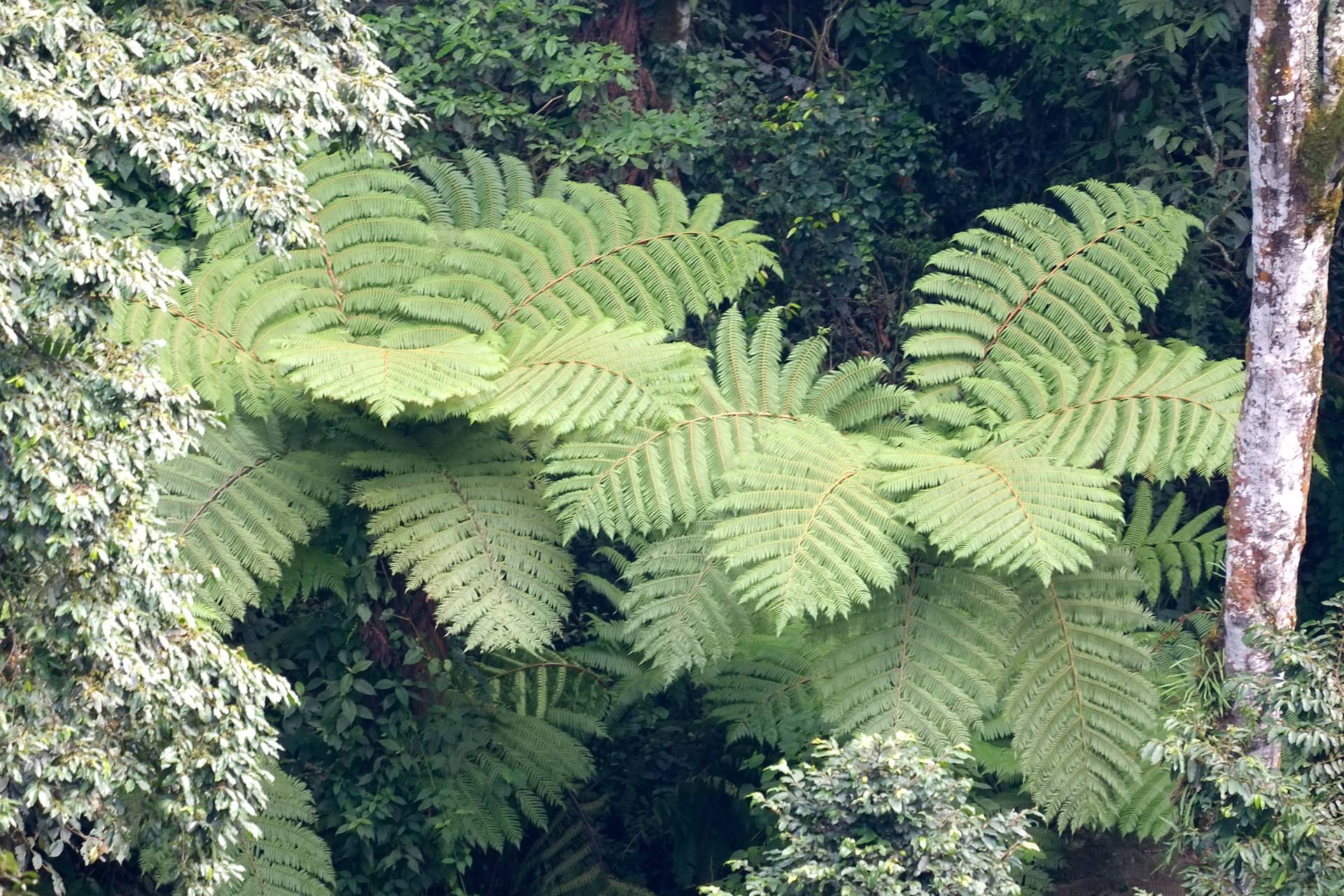
Back on solid ground, you will have three options for continuing your hike. For those returning to the Visitor Center, reverse direction and head downhill toward the head of the ravine. After a short distance you will come to a solid bridge that crosses the stream of the ravine this is a great time for refreshments and photos of the canopy walkway above you and looking down at the geometric patterns of the tree ferns growing along the banks of the stream. It is easy to confuse them with palms but they are true ferns belonging to an ancient group of plants that are ancestral to conifers and flowering plants. After your rest, the trail past the start of the canopy walkway to Uwinka Visitor Center.
You can also return to Uwinka Visitor Center via the spur trail to the right, but you will miss the tree ferns and spectacular views from the bridge. For those hikers who plan to continue on the Imbaraga or Umuyove Trails, take the trail to the left. Of course, you won’t want to miss the short detour to the bridge and tree ferns. This will only take a few minutes and add a few hundred metres to your walk.
Imbaraga Trail
Geared toward experienced hikers, the trail rewards hikers with the sight of four scenic waterfalls and any of them will be refreshing after trekking a little less than 10 km.
Are you up for the challenge? The Imbaraga Trail is one of the premier paths in Nyungwe, but also among its toughest. This loop trail circumnavigates the head of the Bururi Valley, passing through habitats that range from under-story thickets high on Uwinka Ridge to lush riverine forests 500 m below. Special features include great views down and across the Bururi Valley, some of the finest trees in the Park, and four lovely waterfalls.
The Imbaraga Trail should only be attempted by hikers with enough strength and stamina to manage a long climb up the western wall of the valley to return to the ridge at over 2400 m above sea level—hence, its Kinyarwandan name means strength. The ascent is continuous for about 2.5 km and will really get your heart thumping!
From Uwinka Visitor Center, follow the trail to the Buhoro-Imbaraga junction, turn right, and continue to the junction with the Igishigishigi Trail. If you follow the Igishigishigi Trail, which forks left from the main trail, you will add the canopy walkway experience to your hike. Or, you can continue to the next junction and turn left.
This segment of the trail has four benches for resting or simply taking in the wonderful and changing views. While relaxing, listen to the variety of bird calls. You may also be able to distinguish tree frogs, crickets, cicadas, and sometimes monkeys. Near the bottom of this valley, the trail enters a grove of giant tree ferns with their huge, distinctive lacy fronds. The fourth bench, at kilometre 2.0, is located at the base of the first waterfall—a narrow stream spilling over a nearly vertical wall of bedrock about 12 m high. Shortly beyond the waterfall, the trail gets steeper and passes a massive African mahogany tree. This is only the first of many impressive trees that are a hallmark of the trail.
At kilometer 3.2, the trail again crosses the Stream, just below the second waterfall. This one is similar to the first but several meters higher. Look for giant lobelias near the bridge, either in flower or with the remains of extremely long flower stalks. The latter are hollow and used for making flutes. The trail continues descending at a gentler gradient along the wall of the ravine, which drops off steeply to the right. Here the underbrush is dominated by rampant growth of a creeper, Sericostachys scandens, which used to be eaten by elephants and buffalo, but is now growing with diminished biological control. Colobus monkeys will sometimes descend from the trees to eat it.
Before you know it, you hit the third waterfall. This is the best of the lot—a superb series of cascades fanning down angular bedrock steps to a small crescent pool, surrounded by lush vegetation. The best view of the full formation is from the trail just beyond the cleared sites formerly used as campsites. From the base of the fall, though, you’ll probably only see the bottom section, which is about 15 m high.
After crossing the Bururi River, the trail immediately begins to climb the side of a deep, narrow ravine on a long series of switchbacks to the top of the Uwinka Ridge, passing a fourth scenic waterfall. On the ascent there are six benches—use them! They give you a perfect excuse to stop without having to admit to being winded and a few great views of the forest to boot. The last bench is located at the junction with the Uwinka Trail, on the right. Just after that junction, the trail reaches the top of the ridge, where it continues to climb at a gentle gradient to a junction with the far end of the lrebero Trail. From that point, the Imbaraga Trail contours around the Bururi River side of the Uwinka Ridge on a fairly level path that coincides with the northern section of the lrebero Trail and the Buhoro Trail. Soon you are at the junction where you began your hike, and the short but not so gentle climb to Uwinka.
Irebero Trail
This 3.4 km trail loops around two of the highest peaks in the park and provides views of Lake Kivu in Rwanda.
This moderate length trail loops around one of the two highest summits on the Uwinka Ridge. It has the highest altitude viewpoints of any trail in the Uwinka trail network and overlooks the park and beyond from both sides of the ridge. To the south, you’ll gaze all the way across the Rwandan border to the first ridge of Burundi, about 15 km away as the crow flies. On the northwestern side, you’ll see Idjwi Island in Lake Kivu, 30 km distant. In fact, the name lrebero means ‘place to observe from’ and that definitely describes the path’s many viewpoints that invite you to pass the time taking in the beauty of Rwanda.
Like all trails in the area, there are large rainforest trees, wildflowers and good birding. Handsome francolins are commonly sighted here. Visitors fresh from low altitudes might choose this trail as their introductory hike.
There are several options for starting the hike. (Refer to the map of the Imbaraga Trail to see how the whole Uwinka network of trails interconnect). Hikers may park at Uwinka Visitor Center, meet the guide, and travel to the Irebero Trail either by road or by taking the Imbaraga Trail spur down to the main Imbaraga Trail. Walking by road from reception to Irebero Trailhead makes the round trip hike 4.6 km. Taking the Imbaraga Trail spur makes the total round trip 5.4km long.
We’ll take you on a loop beginning and ending at lIrebero Trailhead 1. The trail sets off from the road and quickly reaches the imbaraga Trail, with which it will coincide for about 2 km. This segment of the hike is on the north side of Uwinka Ridge, which overlooks the beautiful Bururi Valley and beyond to the DRC. The trail contours through pleasant forest and the air is full of bird song, with tree frogs chiming in. Listen for turacos and even to the sounds of small insect life. When the Irebero Trail turns left from the imbaraga Trail, it starts to cross over to the southern side of Uwinka Ridge. In minutes, at the next junction, you’ll hit Umugote Trail junction on the right. Those who stay faithful to the Irebero Trail will soon be rewarded with a gorgeous view across the hills of the southwestern side of the park and beyond to Burundi.
Much of the higher sections of the trail are characterised by dense thickets in the undergrowth. One of the special shrubs of the Irebero Trail is the relatively rare and strongly aromatic Mimulopsis Arborescens. The flowers are white or cream-coloured with violet-brown nectar guides and can be seen in mass bloom only once every eight years or so. You’ll also find it around Kamiranzovu Marsh. Also on this trail, in season, you may see the strange, red, tubular flowers of mistletoes, fallen from parasitic shrubs in the tall trees. Catch a glimpse of it up in the high branches and lean over to surprise your hiking partner with a quick kiss!
Although you’re almost done, there is a clearing with another dazzling view of Lake Kivu. Stop here to soak in the sights and mentally plan for a canoe trip across the lake later on in the week. At the road, turn right and bird-watch along your half kilometer walk back to the reception at Uwinka if no vehicle is there to pick you up.
Umugote Trail
This 3.6 km hike provides marvelous views of numerous ridges, rainforests, stunningly beautiful flowers and on a clear day, the Kibira National Park in Burundi. The trail is also a prime location for primate viewing and birding.
Isolated from the rest of the Uwinka trail system on the south side of the Huye Rusizi Road, the upper and lower Umugote Trails descend the southeastern side of the Uwinka Ridge. The trail was renamed in 2008 after the beautiful Syzygium tree, which appears along this trail in abundance. Wandering in and out of two ravines, the lower Umugote Trail drops an extra 70 m in elevation. Many sections of the path have dense vegetation on the uphill side and an exhilarating open vista on the steep downhill side. Clearings in the deep ravines give you a chance to look at different levels of the forest, from the canopy to the forest floor, or to admire the steepness of a mountainside that you just descended. The rainforest here is pristine and hikers can enjoy many fine views framed by giant old-growth trees. On a clear day you can count as many as a dozen ridges, as far as the mountains of Kibira National Park in Burundi which is contiguous with Nyungwe. In the foreground you can look south across the valley to neighbouring Busozo Mountain. Just behind it, to the right, you’ll see Bukamba Mountain, and to the southwest on the same ridge, Rugazi Mountain. Immediately beyond those peaks, there is a steep descent to a broad valley, which contains the second largest marsh in the park.
The Umugote Trail has three junctions with the main road. Trailhead 1 is used as a starting point for the purpose of this description. Taking this route, you leave some of the altitude gain for your return trip along the main road; this saves a little of your energy since the road has an easy gradient. As soon as you take a few steps down the path from the road, the first fine landscape comes into view. In the foreground, there Is a Hagenia abyssinica tree, easily recognized by the old brown leaves that seem to remain on the tree longer than you would think necessary. However, this is a secondary species. Pretty quickly, you’ll enter pristine rainforest with the usual wide variety of trees found throughout the Uwinka Trail System. Some of the special specimens on this trail include impressive strangler figs. When in fruit, these trees attract primates, birds, and other wildlife.
There is a good chance of seeing monkeys on the Umugote Trail, especially blue or mountain. If you keep still, some primates will actually move closer to investigate their human visitors. You may notice some of their narrow paths disappearing into the bush. Other mammals sometimes seen along this stretch of trail include bushpigs and duikers. Listen for cicadas, crickets, tree frogs, birds, and other primates. Watch the swirling flights of butterflies, brightly coloured or camouflaged to blend right into the forest itself.
Birders love this trail for the wide array of species that inhabit this part of the forest and are easily visible from many of the intersections with the main road. Some guides say there is a 95 percent chance of seeing a Great Blue Turaco. You may also see Red Collared Mountain Babblers, a Mountain Buzzard, Handsome Francolins, Crowned Eagles, and, if you are patient and can wait about 30 minutes, you are nearly guaranteed to see a Purple-breasted Sunbird. Listen for Blue-headed Sunbirds, Mountain Orioles, and the ever-present Chesnutthroated Apalis, which sounds a little like a telephone.
The many clearings on this trail, compared to the trails on the other side of the ridge, provide more sunlit space for flowers to bloom. Soon after starting on the trail you’ll see a dense bank of begonias, thriving effortlessly, without a gardener in attendance. Look up into the trees for flowers too. Using binoculars, you’ll spot orchids, ferns and other epiphytes. One of
the More showy species found on this trail is Canarina eminii—a cousin of the Canary Island bellflower—with large orange bell shaped flowers; you may spot these on the ground or up in the trees—quite unusual behaviour for a flower of this type. Some of the more spectacular tree species on this trail include waterberry, welcome trees, Tabernaemontana johnstonii, Cassipourea Ruwenzoriensis, and East African yellowwood. Your guide will tell you about their traditional uses as food, medicine and in crafts and magic. Speaking of big things…if earthworms are any indicator of soil health, visitors will be impressed by Nyungwe’s giants. These worms are half a metre long and as thick as a man’s finger!
When the trail reaches the road, a right turn takes hikers 0.7 km back to the starting point. Alternatively, Hikers can turn ler on the road, walk along it for 130 m, and cross the road to a third Umugote trailhead. This short spur of the Umugote Trail ascends steeply to a junction with the Irebero Trail. If you’re feeling ambitious, turn right onto the Irebero Trail to go higher up on the same side of the mountain. From the lrebero Trail, you’ll get some of the same views but from a higher elevation. For those who like to see what is just around the next corner, walk ahead a few minutes to the junction of the Imbaraga Trail to see what lies on the opposite side of the Uwinka Ridae.
Umuyove Trail
Also known as the Mahogany Trail, visitors relax by a waterfall, take a stroll under some of the park’s tallest trees and savour the scent of aromatic leaves during this trek. With a distance of 5.5 km, the Umuvoye Trail provides access to several side trails used for chimpanzee viewing.
This is one of the most popular hikes in Nyungwe. In a relatively short distance, you’ll relax by a waterfall, try out the views from 10 different benches, and be amazed by the birds, the colourful flowers, and some of the most massive trees in the Park. The Kinyarwanda name for the trail, Umuyove, means ‘mahogany’ and you’ll find some of Nyungwe’s finest examples of this valuable tree along this trail. The Umuyove Trail also serves as access to several side trails used for viewing Grey-cheeked Mangabeys, Angolan Black and White Colobus, and chimpanzees, any of which, in addition to blue monkeys, might be seen or heard on the trail. There is also a path that connects to Rangiro Road and Banda Village in the valley below, which supplies the majority of RDB’s Uwinka staff.
From the Uwinka Visitor Center, follow the trail to the Buhoro-imbaraga junction, turn right, and continue to the junction with the Igishigishigi Trail. You will immediately be surrounded by the serenity of lush, green rainforest and the pleasant sound of birds, tree frogs, and crickets. Many of the trails here are cut into the hillside, providing hikers with a chance to peer into all levels of the forest, from flowering herbs on the forest floor, to thickets of lichen draped lianas and shrubs, to epiphytes, taking advantage of giant trees for sunlight. If you follow the Igishigishigi Trail, which forks left from the main trail, you will add the canopy walkway experience to your hike. Or, you can continue to the next junction and turn left.
The main Imbaraga Trail is reached about 400 m along, with the junction of the Buhoro Trail. The Igishigishigi Trail joins from the left after another 50 m. (Refer to the map of the Imbaraga Trail to see the layout of the whole Uwinka Trail System.) Since most of the Uwinka trails interconnect, numerous possibilities for variations of the routes are available.
At 800 m along the path, the Umuyove Trail comes in from the right, while to the left it coincides with the Igishigishigi and Imbaraga Trails. The Umuyove circuit can be done in either direction but is commonly done clockwise.
Continue to descend the ridge and the trail only gets more beautiful as you venture onward. Some sections of the path are covered in moss or carpeted with flowers fallen from the canopy. Impatiens, begonias, and numerous other flowers line the sides of the trail. Here you’ll find the classic, textbook inventory of rainforest trees of Nyungwe. Your guide will know the names of most of them and will tell you the traditional uses or lore.
The trail continues descending to a steep sided, narrow valley full of giant tree ferns. At the bottom of the trail, a 12 m high waterfall spills over a nearly vertical wall of glistening, black rock. Large-flowered, magenta jewelweeds thrive in the moist, sunny clearing. Now that the easy part is over, you’ll immediately ascend the other side of the v-shaped valley. After about 0.35 km, the Imbaraga Trail branches off to the left and Umuyove Trail goes right, continuing up the side of a ridge.
The ascent is gradual and relieved by several short downhill or flat sections. There are six more benches for resting. The Umuyove Trail is short enough that hikers are encouraged to indulge themselves in the luxury of walking at a comfortable pace, slow enough to absorb the amazing beauty of Africa’s finest mid-altitude montane rainforest. Consider taking a minute to remain still and silent. Listen for cicadas, crickets, tree frogs, birds, and the gurgle of the stream below. Watch leaves in the canopy flutter soundlessly. Enjoy the spots of colour of impatiens, begonias, mistletoes, and numerous other flowers against the deep, rich greens. Using your binoculars, search for orchids and other air plants’ high up in the canopy. Note the amazing variety of ferns, from small grass like fronds to the lacy fronds of giant tree ferns found at the bottom of the valley. Although huge trees are a big attraction for this trail, the little things can be absorbing too, from tiny blue flowers in the trail,to mosses, lichens, butterflies and other insects. Inhale the scent of humid forest, the aromatic leaves and scented flowers. You may find yourself calmer and with a sense of well being on the rainforest trails of Uwinka. Don’t forget_ to bring that feeling back with you to the hustle and bustle of Kigali.