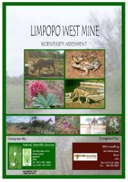
Biodiversity (1 - SRK Consulting
Biodiversity (1 - SRK Consulting
Biodiversity (1 - SRK Consulting

You also want an ePaper? Increase the reach of your titles
YUMPU automatically turns print PDFs into web optimized ePapers that Google loves.
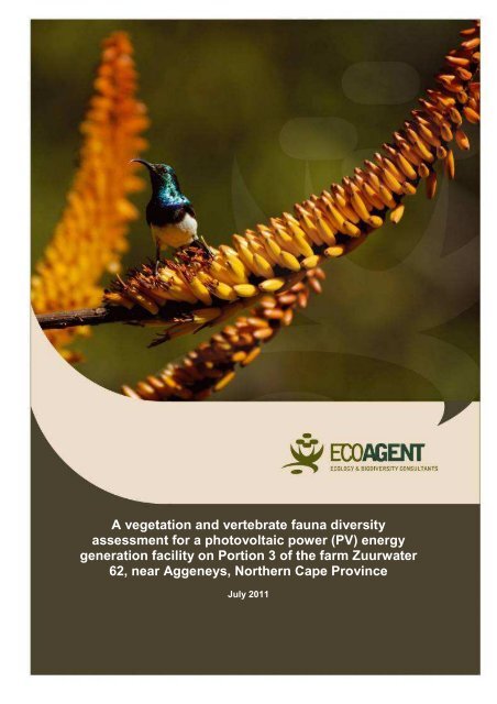
A vegetation and vertebrate fauna diversity<br />
assessment for a photovoltaic power (PV) energy<br />
generation facility on Portion 3 of the farm Zuurwater<br />
62, near Aggeneys, Northern Cape Province<br />
July 2011
July 2011<br />
A vegetation and vertebrate fauna diversity<br />
assessment for a photovoltaic power (PV) energy<br />
generation facility on Portion 3 of the farm Zuurwater<br />
62, near Aggeneys, Northern Cape Province<br />
Commissioned by:<br />
<strong>SRK</strong> <strong>Consulting</strong> Engineers and Scientists<br />
Conducted by<br />
EcoAgent CC<br />
PO Box 23355<br />
Monument Park<br />
0181<br />
Tel 012 4602525<br />
Fax 012 460 2525<br />
Cell 082 5767046<br />
Contributors:<br />
G.J. Bredenkamp D.Sc., Pr.Sci.Nat., Botanist<br />
I.L. Rautenbach Ph.D., Pr.Sci.Nat., Mammalogist<br />
A. Kemp Ph.D., Pr.Sci.Nat., Ornithologist<br />
J.C.P. van Wyk M.Sc., Pr.Sci.Nat., Herpetologist<br />
July 2011<br />
SATO Aggeneys July 2011 2
Some of the rare or beautiful succulent plants found on the Farm Zuurberg 62<br />
near Aggeneys, Northern Cape Province<br />
SATO Aggeneys July 2011 3
TABLE OF CONTENTS<br />
DECLARATION OF INDEPENDENCE ................................................................... 12<br />
EXECUTIVE SUMMARY ........................................................................................ 13<br />
1. PROJECT BACKGROUND ................................................................................ 16<br />
2. ASSIGNMENT ................................................................................................. 19<br />
2.1. Initial preparations: .................................................................................... 19<br />
2.2. Vegetation and habitat survey: .................................................................. 19<br />
2.3. Plant community delimitation and description ............................................ 19<br />
2.4. Faunal assessment ................................................................................... 20<br />
2.5. General ..................................................................................................... 20<br />
3. RATIONALE .................................................................................................... 21<br />
4. SCOPE AND OBJECTIVES OF THE STUDY.................................................. 23<br />
5. STUDY AREA ..................................................................................................... 24<br />
5.1 Regional setting ............................................................................................. 24<br />
5.2 Physical Environment .................................................................................... 26<br />
5.3 Vegetation Types ........................................................................................... 27<br />
5.4 The Study Site for the Proposed Development .............................................. 28<br />
6. METHODS .......................................................................................................... 31<br />
6.1. Flora.......................................................................................................... 31<br />
6.1.1 Vegetation and flora ................................................................................ 31<br />
6.1.2 Plant Conservation Priority ................................................................. 32<br />
6.1.3 Sensitivity ........................................................................................... 33<br />
6.2. Mammals .................................................................................................. 33<br />
6.2.1. Field Survey ....................................................................................... 34<br />
6.2.2. Desktop Survey .................................................................................. 34<br />
6.2.3. Specific Requirements ....................................................................... 35<br />
6.3. Birds.......................................................................................................... 35<br />
6.3.1 Bird Habitats ...................................................................................... 36<br />
6.3.2 Bird Species ....................................................................................... 38<br />
SATO Aggeneys July 2011 4
6.3.3 Field Survey ....................................................................................... 38<br />
6.3.4 Desktop Survey .................................................................................. 39<br />
6.4. Herpetofauna ............................................................................................ 41<br />
6.4.1. Field Surveys ..................................................................................... 41<br />
6.4.2. Desktop Surveys ............................................................................... 41<br />
6.4.3. Specific Requirements ....................................................................... 42<br />
7. RESULTS: VEGETATION AND FLORA ............................................................ 44<br />
7.1 Classification of the vegetation ...................................................................... 44<br />
7.2 Description of the plant communities ............................................................. 45<br />
1 Bushmanland Sandy Grassland .................................................................... 45<br />
2 Bushmanland Arid Grassland ........................................................................ 48<br />
2.1. Grassland on sandy hummocky plains ...................................................... 50<br />
2.2. Grassland on flat sandy plains................................................................... 51<br />
3. Gravelly calcrete plains (=Aggeneys Gravel Vygieveld) ................................ 52<br />
4. Bushmanland Inselberg Shrubveld ............................................................... 53<br />
4.1 Shrubveld on mountains, hills, slopes and crests ....................................... 54<br />
4.2 South facing slopes .................................................................................... 55<br />
4.2.1 South-facing scree slopes ....................................................................... 55<br />
4.2.2 Steep south-facing slopes ....................................................................... 57<br />
4.3 Rocky north-facing foot slopes ................................................................... 58<br />
5. Azonal vegetation ......................................................................................... 60<br />
5.1 Pans ........................................................................................................... 60<br />
5.2 Washes ...................................................................................................... 63<br />
7.3 <strong>Biodiversity</strong> Areas .......................................................................................... 64<br />
7.4 Fine Scale <strong>Biodiversity</strong> ................................................................................... 67<br />
7.5 Zuurberg Important <strong>Biodiversity</strong> Areas ........................................................... 67<br />
7.6 Sensitive Vegetation ...................................................................................... 69<br />
7.7 Species of Conservation Concern .................................................................. 70<br />
7.7.1 Protected species .................................................................................... 71<br />
7.7.2 Threatened species ................................................................................. 71<br />
7.8 Land Use in the Zuurwater Area .................................................................... 72<br />
7.9. Discussion .................................................................................................... 74<br />
SATO Aggeneys July 2011 5
7.10 References .................................................................................................. 75<br />
8. RESULTS: MAMMALS ....................................................................................... 78<br />
8.1 Mammal Habitat Assessment ................................................................... 78<br />
8.2 Observed and Expected Mammal Species Richness ................................ 82<br />
8.3 Red Listed Mammals ................................................................................ 85<br />
8.4 Discussion ..................................................................................................... 86<br />
8.5 Conclusion ..................................................................................................... 87<br />
8.6 References .................................................................................................... 87<br />
9. RESULTS: AVIFAUNA ....................................................................................... 90<br />
9.1 General .......................................................................................................... 90<br />
9.2 On-site Bird Habitat Assessment ............................................................... 90<br />
9.3. Expected and Observed Bird Species Diversity ...................................... 100<br />
9.4. Threatened and Red-Listed Bird Species ................................................ 106<br />
9.5. General Conclusions................................................................................... 108<br />
9.6 Limitations, Assumptions and Gaps in Knowledge ...................................... 109<br />
9.7 References .................................................................................................. 109<br />
10. RESULTS: HERPETOFAUNA ........................................................................ 112<br />
10.1. Herpetofauna Habitat Assessment ............................................................ 112<br />
10.2. Observed and Expected Herpetofauna Species Richness ................... 119<br />
10.3. Red Data Listed Reptiles .......................................................................... 120<br />
10.4. Red Data Listed Amphibians ..................................................................... 121<br />
10.5 Discussion ................................................................................................. 126<br />
10.6 Conclusions ............................................................................................... 128<br />
10.7. References ............................................................................................... 128<br />
11. ENVIRONMENTAL IMPACT ASSESSMENT FOR BIODIVERSITY ............... 130<br />
11.1 The ecological importance of the study site ............................................ 130<br />
11.2 General impacts associated with PV arrays ............................................ 130<br />
12 RECOMMENDED MITIGATION MEASURES .................................................. 139<br />
SATO Aggeneys July 2011 6
12.1 Specific mitigation measures ..................................................................... 139<br />
12.2 Generic Mitigation measures ..................................................................... 142<br />
13. ENVIRONMENTAL MANAGEMENT PLAN .................................................... 143<br />
Fauna and Flora ............................................................................................. 144<br />
Decommissioning phase ................................................................................ 145<br />
Flora ............................................................................................................... 146<br />
Fauna ............................................................................................................. 146<br />
APPENDICES ....................................................................................................... 147<br />
APPENDIX 1: EIA METHODS ........................................................................... 147<br />
APPENDIX 2: CURRICULII VITAE .................................................................... 152<br />
Abridged Curriculum Vitae: George Johannes Bredenkamp .............................. 152<br />
Abridged Curriculum Vitae: Ignatius Lourens Rautenbach ................................. 158<br />
Abridged Curriculum Vitae: Alan Charles Kemp ................................................. 160<br />
Abridged Curriculum Vitae: Jacobus Casparus Petrus van Wyk ........................ 164<br />
List of Figures<br />
Figure 1. Map of solar radiation, showing the high levels of radiation expected in<br />
western South Africa (www.slc-group.net) ............................................................... 16<br />
Figure 2. The locality of the SATO/SHE property, Portion 3 of the Farm Zuurwater<br />
63, in relation to Aggeneys, the N14 National Road and the Koa River drainage<br />
system..................................................................................................................... 24<br />
Figure 3. Satellite image showing the location of Portion 3 of the farm Zuurwater 63<br />
(purple line), in relation to the N14 National Road and the currently dominant<br />
drainage line of the Koa River wash. Aggeneys mines and villages are situated in<br />
and below the hills just above the N14 sign. ............................................................ 25<br />
Figure 4. Satellite image of Portion 3 of the farm Zuurwater 62 (purple lines), in<br />
relation to the general area around Aggeneys and the route of the N14 National<br />
Road. ...................................................................................................................... 25<br />
Figure 5. Satellite image of Portion 3 of the farm Zuurwater 62 (purple lines), showing<br />
the principal features of and names for the topography, habitats and relevant<br />
neighbouring features. ............................................................................................. 26<br />
Figure 6. Close-up satellite image of the east-central section of Portion 3 of the farm<br />
Zuurwater 62 (cf. Figures 2-4), showing the principal habitat and topographical<br />
features influencing the identification of this site as ecologically of low sensitivity but<br />
still technologically and socially suitable. The least ecologically sensitive sector of the<br />
development (1, thick dark blue line) is proposed for west of the N14 (yellow line),<br />
SATO Aggeneys July 2011 7
with adjacent slightly more sensitive extensions, including east of the N14 (2, shaded<br />
pale blue), and an even less preferable north-western extension (3, thin dark blue<br />
line).The route of a high-voltage transmission line and pylons (green lines) is also<br />
shown, from the Eskom substation to the east to Springbok in the west. The eastern<br />
boundary of Zuurwater is also shown (purple line). Engineers will present a final<br />
footprint, outline and spacing for how to fit the 5-panel table arrays into minimum<br />
non-sensitive space available and as close as possible to the Eskom substation.<br />
Access to a water pipeline between Zuurwater farmhouse and Aggeneys also has to<br />
be accommodated. .................................................................................................. 29<br />
Figure 7. Impression of how solar panel tables are arranged and spaced, but note<br />
this is only a 2-deep panel array, supported on a single leg/foot line embedded in the<br />
ground and with only a narrow space between tables (from www.slc-group.net). The<br />
Zuurwater design calls for a 5-deep array, supported on a 2-feet line and bolted to a<br />
concrete slab resting on the ground surface, and with an 8 m shade gap between<br />
tables. ..................................................................................................................... 30<br />
Figure 8. View of power connection and distribution cables housed under the solar<br />
panel tables. The design allows small livestock to graze under and around the tables<br />
(sheep, but not goats, cattle or horses on Zuurwater). The upper surfaces of the solar<br />
panels are washed automatically with water at appropriate intervals, and the waste<br />
runs into collection channels for recycling (from www.slc-group.net). ...................... 30<br />
Figure 9. Vegetation map of the study site .............................................................. 45<br />
Figure 10. Typical Bushmanland Sandy Grassland with mobile sand dunes ........... 46<br />
Figure 11. Bushmanland Sandy Grassland on the sands dunes. ............................ 46<br />
Figure 12. Stipagrostis namaquensis typical of dune crests. ................................... 47<br />
Figure 12: Figure 13. Typical Bushmanland Arid Grassland. Note the Inselberg on<br />
the right. .................................................................................................................. 49<br />
Figure 14. Grassland on sandy hummocky plains ................................................... 51<br />
Figure 15. Grassland on flat sandy plains ................................................................ 52<br />
Figure 16. Typical mountains and hills – the habitat of Bushmanland Inselberg<br />
Shrubveld. ............................................................................................................... 53<br />
Figure 17. A scree slope ......................................................................................... 57<br />
Figure 18 Steep south-facing slopes and cliffs ........................................................ 58<br />
Figure 19. Rocky north-facing slopes ...................................................................... 59<br />
Figure 20. Two examples of Pans – above dry during the survey period, below still<br />
with water. ............................................................................................................... 62<br />
Figure 21. Critical <strong>Biodiversity</strong> Areas (CBA’s) in the Namakwa District Municipality.<br />
Note the presence of CBA1 north of Aggeneys, with CBA2 in the vicinity, while an<br />
Ecological Support Area (ESA) forms a corridor south of Aggeneys (from Marsh et al.<br />
2009) ....................................................................................................................... 65<br />
Figure 22. Map indicating biodiversity areas (Image provided by <strong>SRK</strong> <strong>Consulting</strong>) . 67<br />
Figure 23. Map indicating Zuurwater Important <strong>Biodiversity</strong> Areas (SKEP 2005)<br />
(Image provided by <strong>SRK</strong> <strong>Consulting</strong>) ...................................................................... 68<br />
Figure 24. Sensitive vegetation types (Image provided by <strong>SRK</strong> <strong>Consulting</strong>) ............ 69<br />
SATO Aggeneys July 2011 8
Figure 25. The vegetation sensitivity map compiled for the site during this survey. . 70<br />
Figure 26. A map indicating the Black Mountain Land Use Plan (SKEP 2008) with the<br />
Zuurwater area immediately west of the mining area (Image provided by <strong>SRK</strong><br />
<strong>Consulting</strong>) .............................................................................................................. 73<br />
Figure 27. A south-westerly view over the gravelly plain earmarked for the proposed<br />
development. Note the sparse basal cover. ............................................................ 80<br />
Figure 28. The dammed water in the Koa River wash and pan. This water body<br />
appears to be a permanent feature and as such probably support insects which can<br />
be expected to rise during summer sunsets and serve as feeding patches for<br />
hawking bats commuting from roosting sites in the various mountains on the<br />
property. .................................................................................................................. 80<br />
Figure 29. An aardvark burrow in the Kalahari duneveld. ........................................ 81<br />
Figure 30. The Bobbejaansgat Mountain. The many boulder overhangs and deep<br />
crevices are likely to offer suitable daytime roosting sites for bats. .......................... 81<br />
Figure 31. View north down the Koa River drainage where the deepest part passes<br />
under the N14, about where the eastern boundary of Zuurwater meets the road. Note<br />
the good but patchy stands of grasses, few woody plants, and the mountains,<br />
Hoedkop (left) around Aggeneys in the background (right). ..................................... 91<br />
Figure 32. View west from the east boundary of Zuurwater, with Hoedkop on the<br />
centre and Skelemberg on the left horizon, showing the open flats of the Koa wash<br />
with the Springbok powerline on the right side of the proposed northeast end of the<br />
PV arrays. ............................................................................................................... 91<br />
Figure 33. View east from the Zuurwater farmhouse, showing a Karoo Korhaan in the<br />
overgrazed plains on a calcrete substrate with shallow soils and some Rhigozum<br />
trichotomum shrubs, the sort of habitat at the south end of the PV array. ................ 92<br />
Figure 34. View east from a dune crest in the northern dune fields, looking across a<br />
dune street with a lone Acacia karroo to the Springbok power lines coming from the<br />
Eskom substation behind the Aggeneys hills on the left. ......................................... 93<br />
Figure 35. View south west from rocky outcrop at crest of the northern dune field on<br />
Zuurwater, showing the tussocky grass, few trees/bushes and the Koa wash behind,<br />
with the Skelemberg on the left and Hoedkop on the right. ...................................... 93<br />
Figure 36. View north from the southern sandy area with mainly Centropodia grass,<br />
looking north of the eastern half of the Windhoekberg (with the N14 passing at the<br />
extreme left of the picture. ....................................................................................... 94<br />
Figure 37. View west from northeast corner of Zuurwater, showing the pan just inside<br />
the fenceline that forms the downstream end and overflow of water from the mine<br />
dam/vlei just outside the farm. Hoedkop ison the horizon. ....................................... 95<br />
Figure 38. View west down the main Koa River wash where it would flow into the<br />
wide expanese of Pan 1, looking along the fence line that marks the approximate<br />
northern edge of the PV array and also the ecotone between the open plains (left)<br />
and the start (right) of the northern dune fields. Hoedkop is in the background, with<br />
Pan 2 near its base. ................................................................................................ 95<br />
SATO Aggeneys July 2011 9
Figure 39. View west towards Hoedkop, looking across Pan 2 and the water that<br />
accumulated in the ditch dug across its centre from the unexpected 30 mm of rain<br />
that fell the fortnight before. ..................................................................................... 96<br />
Figure 40. Panoramic view along the south side of Windhoekberg W, showing the<br />
steep, shaded southern slope, the collections of rocks and gravels forming a skirt<br />
around its base, and the small drainage lines formed by previous runoff. Note the<br />
lack of mountains to the west towards Springbok and the Namaqualand habitats. .. 97<br />
Figure 41. Panoramic view over the north side of Skelemberg, showing the less<br />
steep, sunny northern slope, with fewer rocks and gravels forming less of a skirt<br />
around its base, but many small drainage lines from previous runoff and denser<br />
bushes around the 'gutter'. Hoedkop is on the left and the Aggeneys mountains on<br />
the centre horizon. .................................................................................................. 97<br />
Figure 42. Patch of green vegetation formed on the gravel skirt below the north slope<br />
of the western Windhoekberg, from runoff and seepage after the 30 mm of rain that<br />
fell a fortnight previously. ......................................................................................... 98<br />
Figure 43. Flowers blooming and succulents growing on the gravel skirt below the<br />
north slope of the western Windhoekberg, after the 30 mm of rain that fell a fortnight<br />
previously. ............................................................................................................... 98<br />
Figure 44. A patch of succulent mesembryanthemums/vygies flowering on a patch of<br />
rocks and gravels at the crest of red dunes just south of Aggeneys, after the 30 mm<br />
of rain that fell a fortnight previously. Hoedkop on the left and Skelemberg on the<br />
right horizon. ........................................................................................................... 99<br />
Figure 45. A north-easterly view from Windhoekberg towards Springbok. Note the<br />
two main habitat types of the study: terrestrial to the left and rupiculous towards the<br />
right. ...................................................................................................................... 113<br />
Figure 46. A view of red dunes and their vegetation in the foreground. Skelemberg is<br />
on the right-hand side and in the distance Windhoekberg lies on the left-hand side.<br />
.............................................................................................................................. 114<br />
Figure 47. Typical natural rupiculous habitat on the unnamed hill near the farmhouse.<br />
.............................................................................................................................. 114<br />
Figure 48. Habitat on Skelemberg. Note the rupiculous habitat on the left and the red<br />
sand and dunes to the left. .................................................................................... 115<br />
Figure 49. Man-made rupiculous habitat in natural terrestrial habitat. Often many<br />
species use these structures for refuge. ................................................................ 115<br />
Figure 50. Man-made quarry on the western side of the study site. In the<br />
background is Windhoekberg. ............................................................................... 116<br />
Figure 51. A dry pan in the Koa River drainage line with Skelemberg on the left. .. 116<br />
Figure 52. A man-made dam in the Koa River drainage line, with Hoedkopberg in the<br />
background. .......................................................................................................... 117<br />
Figure 53. A view west from the man-made dam in the northeast corner of the study<br />
site. Note Hoedkopberg in the background. .......................................................... 117<br />
SATO Aggeneys July 2011 10
Figure 54. An easterly view from Bobbejaansgat towards Windhoekberg. Note the<br />
cement weir and the pool of water in the foreground. Such artificial aquatic sources<br />
can create habitat for the Namaqua stream frog and other frog species. ............... 118<br />
Figure 55. A view to the west from Windhoekberg. Note the few quiver trees. The<br />
farmhouse is in the centre of the picture with flat terrestrial habitat surrounding it. On<br />
the left is Skelemberg and in the distance on the right lies Ghaamsberg. .............. 119<br />
Figure 56. Bibron’s tubercled gecko found on the study site. ................................. 127<br />
Figure 57. A giant ground gecko found on the study site. ...................................... 127<br />
SATO Aggeneys July 2011 11
DECLARATION OF INDEPENDENCE<br />
I, George Johannes Bredenkamp, Id 4602105019086, declare that I am the owner of<br />
Eco-Agent CC, CK 95/37116/23, and we (George Johannes Bredenkamp<br />
Id4602105019086, Ignatius Lourens Rautenbach Id4212015012005, Alan Charles<br />
Kemp Id4405075033081, Jacobus Casparus Petrus van Wyk Id6808045041084) and<br />
Lukas Jurie Niemand Id 7403125004084 furthermore declare that we<br />
• Are committed to biodiversity conservation but concomitantly recognize the need<br />
for economic development. Whereas we appreciate the opportunity to also learn<br />
through the processes of constructive criticism and debate, we reserve the right<br />
to form and hold our own opinions and therefore will not willingly submit to the<br />
interests of other parties, be it the client or the relevant competent authorities, or<br />
change our statements to appease them;<br />
• Abide by the Code of Ethics of the S.A. Council for Natural Scientific Profession;<br />
• Act as independent specialist consultants respectively in the fields of ecology,<br />
vegetation science and botany, as well as in mammalogy, ornithology,<br />
herpetology and as well as invertebrates;<br />
• Are assigned as specialist consultants by the <strong>SRK</strong> Group for the proposed<br />
project “A vegetation and vertebrate fauna diversity assessment for a<br />
photovoltaic power (PV) energy generation facility on Portion 3 of the farm<br />
Zuurwater 62, near Aggeneys, Northern Cape Province ” described in this report;<br />
• Do not have or will not have any financial interest in the undertaking of the activity<br />
other than remuneration for work performed;<br />
• Have or will not have any vested interest in the proposed activity proceeding;<br />
• Have no and will not engage in conflicting interests in the undertaking of the<br />
activity;<br />
• Undertake to disclose to the client and the competent authority any material<br />
information that have or may have the potential to influence the decision of the<br />
competent authority required in terms of the Environmental Impact Assessment<br />
Regulations 2006;<br />
• Will provide the client and competent authority with access to all information at<br />
our disposal, regarding this project, whether favourable or not.<br />
GJ Bredenkamp<br />
I. L. Rautenbach<br />
A. C. Kemp JCP van Wyk<br />
SATO Aggeneys July 2011 12
EXECUTIVE SUMMARY<br />
Vegetation<br />
Although there are no statutory conservation area within this vegetation type, very<br />
little of the area has been transformed. A local exception is in the mine area close to<br />
Aggeneys, where mining infrastructure and mine dumps, and also residential areas,<br />
transformed some land.<br />
All the results indicate that the area is of biodiversity importance. However, the most<br />
important areas are the Inselbergs including their quartz gravel plateaus and foot<br />
slopes. The dry grassy plains are of relatively less biodiversity importance. Although<br />
the proposed development site is not located on the Inselbergs or quartz plains, it is<br />
still emphasized that these are considered as No-Go areas and should be protected.<br />
Any development on the property should be in accordance with the conservation<br />
policies of the relevant authorities.<br />
It is suggested that the proposed the development of proposed photovoltaic power<br />
generation facility be supported with the condition that the lay-out as shown in this<br />
document be strictly followed and no changes be done to the lay-out without<br />
consultation of the biodiversity specialists.<br />
Mammals<br />
Four pertinent matters emerge from the list of mammals compiled during the site visit<br />
and the subsequent desktop study:<br />
1. the species assemblage is typical of a western semi-arid region (particularly<br />
species such as the elephants shrew species, the ground squirrel, the spectacled<br />
dormouse, the various gerbil species, the dassie rat, whistling rats, the blackfooted<br />
cat, the bat-eared fox, the Cape fox, the gemsbok, the springbok etc.);<br />
2. the species richness of 56 is typical of an extensive area such as the property<br />
(5000 ha) and of adjoining areas, with a near-natural degree of connectivity;<br />
3. land-use practices and civilization pressures are geared to low-key grazing with a<br />
focus on concomitant floral conservation to benefit year-round grazing, which are<br />
conducive to species richness; and<br />
4. field observations suggested that population levels were low during the site visit.<br />
SATO Aggeneys July 2011 13
Population fluctuations are not uncommon, and often have a domino effect (for<br />
instance when prey population densities decrease in numbers, this will have an<br />
adverse effect on carnivore and raptor numbers).<br />
The rest of the species richness is made up from common and robust mammals with<br />
wide distributional ranges such as aardvarks, springhares, four-striped grass mouse,<br />
porcupines, the caracal, the genet, the two mongoose species, the black-backed<br />
jackal etc.<br />
The role of insectivorous bats in an ecosystem is often under-estimated, whereas<br />
their susceptibility to reigning environmental conditions is under-appreciated. Bats<br />
are sensitive to adverse daytime environmental conditions and predation, and<br />
suitable daytime roosting sites are of cardinal importance. Especially the<br />
Bobbejaansgat Mountain has many boulders and rock faces forming many<br />
overhangs and deep crevices suitable for daytime roosts. The dammed water and<br />
marshland conditions in the Koa River Wash to the north-east of the site are likely to<br />
support insect populations for hawking bats.<br />
The intended development will result in a progressive loss of ecological sensitive and<br />
important habitat units, ecosystem function e.g. reduction in water quality, loss of<br />
faunal habitat, and of loss/displacement of threatened or protected fauna. The main<br />
conservation objectives for mammals on Portion 3 of the farm Zuurwater 62 are to<br />
retain untransformed the mountains and their gravel skirts, the deep red sands and<br />
dunes, and as much as possible of the Koa River washes and pans, and the<br />
untransformed adjacent grassy plains. The mountains, pans and dunes should be<br />
designated sensitive areas and excluded from any development, apart from low<br />
densities of livestock grazing.<br />
Birds<br />
The main conservation objectives for birds on Portion 3 of the farm Zuurwater 63 are<br />
to retain untransformed the mountains and their gravel skirts, the deep red sands<br />
and dunes, and as much as possible of the Koa River washes and pans, together<br />
with whatever of the adjacent grassy plains is not transformed by the proposed solar<br />
PV electricity generation facility. The mountains, pans and dunes should be<br />
SATO Aggeneys July 2011 14
designated sensitive areas and excluded from any development, apart from low<br />
densities of livestock grazing. Of 169 bird species recorded and/or expected on<br />
Zuurwater, nine are threatened species, of which the resident, near-endemic, habitatspecific<br />
and range-restricted Ludwig's Bustard and Red Lark are both considered<br />
Vulnerable by IUCN criteria. The PV array is not considered a direct threat to any<br />
bird species, given its limited impact in space (
1. PROJECT BACKGROUND<br />
South Africa, along with many other parts of the world, is experiencing a rising<br />
demand for various forms of energy, especially electricity. Traditionally, the country's<br />
electricity has been generated mainly by coal-fired power stations, plus a single<br />
nuclear energy plant. Coal is a non-renewable resource, and burning coal also adds<br />
to the rising threat of global warming, so South Africa is joining the worldwide trend to<br />
develop additional and renewable sources of energy. The arid western region of<br />
South Africa enjoys many days of clear unpolluted skies and hence one of the higher<br />
incidences of solar radiation in the world, making it an ideal area to invest in solar<br />
power generation.<br />
Figure 1. Map of solar radiation, showing the high levels of radiation expected in western<br />
South Africa (www.slc-group.net)<br />
The mining and mineral beneficiation industries are among the major consumers of<br />
electricity in South Africa, so placement of energy generation facilities as close as<br />
possible to such activities makes sense for both economic and power-distribution<br />
reasons. The farm Zuurwater 63 borders the property of the Aggeneys mining<br />
complex, in particular the Black Mountain Mining (Pty) Ltd zinc-lead-copper mines.<br />
These mines currently receive their electricity from the Eskom grid via an on-site<br />
transformer substation, and from here it is distributed to their shafts at Broken Hill,<br />
Swartberg, Big Syncline and Gamsberg.<br />
The proposed development is to generate 500MW of electricity daily using<br />
photovoltaic (PV, solar panel) power generation and is planned by Sato Energy<br />
SATO Aggeneys July 2011 16
Holdings (SHE, Pty Ltd). The main components would be shipped to South Africa<br />
from Germany in containers before being transported to and erected on the site. SHE<br />
will use local contractors to produce the 'feet' of concrete slabs for the units, and to<br />
assist with erection and maintenance of the units and the terrain. SHE will purchase<br />
the property for the duration of the project, estimated at 30-40 years. The property is<br />
currently being used for low-density livestock grazing (sheep, goats, cattle, horses),<br />
typical of such a semi-arid area, and such activities will continue on the property<br />
alongside re-zoning of all or part of the land from agricultural to a different use.<br />
The c. 5,000 ha Portion 3 of the Farm Zuurwater 62 straddles the National N14 Road<br />
about 10 km east of the mining village of Aggeneys, 60 km west of Pofadder and 100<br />
km east of Springbok, in the Khai Ma Local Municipality of the Northern Cape<br />
Province. Most of the farm lies north of the road on flat to undulating terrain classified<br />
as part of the Bushmanland Sandy Grassland vegetation unit (NKb 4), with isolated<br />
mountains that create conditions for the Aggeneys Gravel Vygieveld (SKr 19, Mucina<br />
& Rutherford 2006).<br />
The proposed development is for 26 generation units, with each site capable of<br />
producing 19.5 MWp (megawatts of power), that all together would cover a total area<br />
of about 884 ha (18% of the farm's area) and produce about 500MWp of electricity<br />
daily. Each unit consists of 820 5-solar-panel-deep 'tables', with each table statically<br />
supported on metal legs and beams with the feet anchored on concrete slabs that<br />
rest on the ground surface. Each table is orientated to face due north, at an<br />
appropriate angle (25 o ) to capture as much sunlight as possible throughout the year,<br />
but with a gap between tables of 8.5 m (minimum 7.7 m) to ensure that one table<br />
does not cast shade on another in any of the sun's positions during its annual<br />
passage between the tropical meridians. Each generation unit covers a site of total<br />
area 33,83 ha.<br />
Each solar panel is 1,956 x 992 x 50 mm, can produce 280Wp and weighs 27 kg,<br />
with a total of 1,812,200 panels with a payload mass of almost 50 metric tons<br />
required for the whole development. The panels will be shipped from Germany in<br />
3,596 40' high-cube containers, each with a tare mass of c. 3,800 kg. The concrete<br />
'foot' slabs will be manufactured locally, and possibly the metal frameworks to<br />
support the panels.<br />
SATO Aggeneys July 2011 17
The original plan was for all units/sites/tables to be placed in one section of<br />
Zuurwater, ideal for connectivity and management, but during our assessments we<br />
detected various biodiversity sensitivities that suggested where possible alternative<br />
sites were needed for some of the tables.<br />
This report combines a 2-day site visit by the EcoAgent team (Vegetation Scientist<br />
mammalogist, ornithologist and herpetologist), on 27-28 June 2011; accompanied by<br />
the <strong>SRK</strong> Environmental Assessment Practitioners (EAPs) to assess the vegetation<br />
and vertebrate fauna and possible impacts of the development and to suggest<br />
possible mitigation options should it be approved.<br />
SATO Aggeneys July 2011 18
2. ASSIGNMENT<br />
Eco-Agent Ecological Consultants CC was appointed by <strong>SRK</strong> <strong>Consulting</strong> Engineers<br />
and Scientists to assess the vegetation and undertake a mammal, bird, reptile and<br />
amphibian study for the relevant portion of the Farm Zuurwater 62. This assignment<br />
is in accordance with the EIA Regulations (No. R.385, Department of Environmental<br />
Affairs and Tourism, 21 April 2006) emanating from Chapter 5 of the National<br />
Environmental Management Act 1998 (Act No. 107 of 1998), as well as according to<br />
the Mineral and Petroleum Resources Development Act (MPRDA, Act No. of 2002)<br />
The assignment is interpreted as follows: Compile a study of the vegetation, flora and<br />
vertebrate fauna of the site, with emphasis on Red Data plant and vertebrate species<br />
that occur or may occur on the site. In order to compile this, the following had to be<br />
done:<br />
2.1. Initial preparations:<br />
<br />
<br />
Obtain all relevant maps and information on the natural environment of the<br />
concerned area.<br />
This includes information on Red Data plant and vertebrate species that may<br />
occur in the area.<br />
2.2. Vegetation and habitat survey:<br />
<br />
<br />
List the plant species (trees, shrubs, grasses and herbaceous species)<br />
present for plant community and ecosystem delimitation.<br />
Identify potential red data plant species, alien plant species, and medicinal<br />
plants.<br />
2.3. Plant community delimitation and description<br />
<br />
<br />
<br />
<br />
<br />
Process data (vegetation and habitat classification) to determine vegetation<br />
types (= plant communities) on an ecological basis.<br />
Describe the habitat and vegetation.<br />
Determine the sensitivity of the site for biodiversity, veld condition and<br />
presence of rare or protected species.<br />
Prepare a vegetation map of the area.<br />
Prepare a sensitivity map of the plant communities present, if relevant.<br />
SATO Aggeneys July 2011 19
2.4. Faunal assessment<br />
<br />
<br />
<br />
<br />
Obtain lists of the Red Data vertebrates that can be expected in the area.<br />
Assess the quantitative and qualitative condition of suitable habitat for the<br />
Red Listed vertebrates that may occur in the area.<br />
Assess the possibility of Red Listed fauna being present on the study site.<br />
Compile a list of occurrences.<br />
2.5. General<br />
<br />
<br />
<br />
Identify and describe particular ecologically sensitive areas.<br />
Identify problem areas in need of special treatment or management, e.g. bush<br />
encroachment, erosion, water pollution, degraded areas, reclamation areas.<br />
Make recommendations on aspects that should be monitored during<br />
development.<br />
SATO Aggeneys July 2011 20
3. RATIONALE<br />
It is widely recognised that to conserve natural resources it is of the utmost<br />
importance to maintain ecological processes and life support systems for plants,<br />
animals and humans. To ensure that sustainable development takes place, it is<br />
therefore important that possible impacts on the environment are considered before<br />
relevant authorities approve any development. This led to legislation protecting the<br />
natural environment. In 1992, the Convention of Biological Diversity, a landmark<br />
convention, was signed by more than 90 % of all members of the United Nations. In<br />
South Africa, the Environmental Conservation Act (Act 73 of 1989), the National<br />
Environmental Management Act, 1998 (NEMA) (Act 107 of 1998) and the National<br />
Environmental Management <strong>Biodiversity</strong> Act, 2004 (Act 10 0f 2004) ensure the<br />
protection of ecological processes, natural systems and natural beauty, as well as<br />
the preservation of biotic diversity within the natural environment. They also ensure<br />
the protection of the environment against disturbance, deterioration, defacement or<br />
destruction as a result of man-made structures, installations, processes, products or<br />
activities. In support of these Acts, a draft list of Threatened Ecosystems was<br />
published (Government Gazette 2009), as part of the National Environmental<br />
Management <strong>Biodiversity</strong> Act, 2004 (Act 10 of 2004), and these Threatened<br />
Ecosystems are described by SANBI & DEAT (2009). International and national Red<br />
Data lists have also been produced for various plant and animal taxa.<br />
All components of the ecosystems (physical environment, vegetation, animals) at a<br />
site are interrelated and interdependent. A holistic approach is therefore imperative<br />
to include effectively the development, utilisation and, where necessary, conservation<br />
of the given natural resources into an integrated development plan, which will<br />
address all the needs of the modern human population (Bredenkamp & Brown 2001).<br />
It is therefore necessary to make a thorough inventory of the plant communities and<br />
other biodiversity on the site, in order to evaluate the biodiversity and possible rare<br />
species. This inventory should then serve as a scientific and ecological basis for the<br />
planning exercises and the subsequent development.<br />
SATO Aggeneys July 2011 21
This development of a PV generation facility close to the mining complex of<br />
Aggeneys is obviously optimal for SATO/SEH essential for the facility to proceed. If<br />
the development can proceed without any significant addition to the environmental<br />
impacts on the least sensitive grazing areas of the livestock farm, then it is also<br />
strategically important for the adjacent mine(s) in the light of national energy planning<br />
and concerns.<br />
SATO Aggeneys July 2011 22
4. SCOPE AND OBJECTIVES OF THE STUDY<br />
• To identify and map the vegetation units as ecosystems that occur on the<br />
site,<br />
• To assess the ecological sensitivity of these ecosystems comment on<br />
ecologically sensitive areas, in term of their biodiversity and where needed<br />
ecosystem function<br />
• To assess qualitatively and quantitatively the significance of the habitat<br />
components and current general conservation status of the site,<br />
• To comment on connectivity with natural vegetation and habitats on adjacent<br />
sites,<br />
• To recommend suitable buffer zones, if relevant,<br />
• To provide a list of plant and vertebrate fauna species that do or might occur<br />
on site and that may be affected by the development, and to identify species<br />
of conservation concern,<br />
• To highlight potential impacts of the proposed development on vegetation,<br />
fauna and flora of the study site, and<br />
• To provide management recommendations that might mitigate negative and<br />
enhance positive impacts, should the proposed development be approved.<br />
SATO Aggeneys July 2011 23
5. STUDY AREA<br />
5.1 Regional setting<br />
Portion 3 of the farm Zuurwater 62 is situated in the flat, open habitats of the<br />
Bushmanland area of the Northern Cape Province (Figures 2-4). Most of the farm is<br />
situated just north of the N14 National Road, and about 10 km southwest of the<br />
mining complex of Aggeneys (Fig. 5). Its drainage systems, red sand dunes and<br />
scattered rocky mountains forms the south-western edge of the Gariep (Orange)<br />
River catchment, Kalahari semi-desert, and Bushmanland granite topography, and its<br />
climate is at the eastern edge of the winter rainfall areas.<br />
Figure 2. The locality of the SATO/SHE property, Portion 3 of the Farm Zuurwater 63, in<br />
relation to Aggeneys, the N14 National Road and the Koa River drainage system.<br />
SATO Aggeneys July 2011 24
Figure 3. Satellite image showing the location of Portion 3 of the farm Zuurwater 63 (purple<br />
line), in relation to the N14 National Road and the currently dominant drainage line of the Koa<br />
River wash. Aggeneys mines and villages are situated in and below the hills just above the<br />
N14 sign.<br />
Figure 4. Satellite image of Portion 3 of the farm Zuurwater 62 (purple lines), in relation to the<br />
general area around Aggeneys and the route of the N14 National Road.<br />
SATO Aggeneys July 2011 25
Figure 5. Satellite image of Portion 3 of the farm Zuurwater 62 (purple lines), showing the<br />
principal features of and names for the topography, habitats and relevant neighbouring<br />
features.<br />
5.2 Physical Environment<br />
Regional Climate<br />
The mean annual precipitation is 99 mm, with a high annual coefficient of variation<br />
(40%). Rain can fall in any month but is mainly in the later austral summer, peaking<br />
in February-April. However, mean annual evaporation potential exceeds rainfall<br />
almost 30-fold, so mean annual soil moisture stress is high (87%). Mean annual<br />
temperature is 17.3 o C, but mean monthly temperatures exceed 30 o C in mid-summer<br />
and drop close to zero in mid-winter, with 21 mean frost days annually.<br />
Geology<br />
The general area is formed mainly of eroded Quaternary sediments, sands and<br />
calcretes, overlain in some areas with aeolian red Kalahari sands. The harder<br />
igneous intrusions of the Bushmanland quartzites protrude at scattered localities,<br />
eroded into the gravel patches found around their bases and spread along drainage<br />
lines.<br />
SATO Aggeneys July 2011 26
Topography and drainage<br />
The topography is generally flat and open, except for the few quartzite mountains<br />
and, given the low rainfall, recent drainage lines that are relatively lightly incised and<br />
shallow. The area does form part of the palaeo-drainage system of the Gariep River<br />
basin, evident on and around the site as the rather ill-defined Koa River wash(es)<br />
and some of their pans (Figs 2-5). The mountains on site generally have their<br />
steepest and coolest sides facing southwest, into the prevailing wind, and their<br />
warmest and less steep sides facing northeast, with associated effects on the<br />
biodiversity on either side.<br />
Soil<br />
Much of the area is covered in deep (up to 30 cm) red sands, forming scattered<br />
and/or fields of red dunes in places most subject to the prevailing southwest wind<br />
and with structures that impede their movement (Fig. 5). The quartzite gravels occur<br />
in three main forms, small fine-grained patches on the tops and foothills of the<br />
mountains, more variable and widespread sizes around the erosion zones below the<br />
mountains, and small feldspar patches (with pink Hoogoor Suite gneiss evident), with<br />
calcrete gravels also emerging in a few patches where exposed by erosion on the<br />
flats. The effects of the mountains, plus the prevailing winds, result in sand and<br />
dunes accumulating mainly on their southern foothills, or in channels between them,<br />
with more exposed and gravelly plains forming in their northeast lee.<br />
Land Use<br />
The only agricultural land use is livestock grazing at low densities (?about 4 large<br />
stock units (LSU)/100 ha), with sheep, cattle and goats currently present on site. A<br />
few game animals (springbok, ostrich) also occur.<br />
5.3 Vegetation Types<br />
The main vegetation type on site is classified as the Bushmanland Sandy Grassland<br />
vegetation unit (NKb 4), with the isolated mountains creating conditions for the<br />
Aggeneys Gravel Vygieveld (SKr 19, Mucina & Rutherford 2006).<br />
The Khai Ma local municipality (KMLM) lies to the east of the Richtersveld and<br />
contains virtually the entire extent of the Bushmanland Inselberg priority area - one of<br />
the nine zones identified through the SKEP process as important conservation areas<br />
SATO Aggeneys July 2011 27
in the Succulent Karoo (Marsh et al. 2009). It comprises the eastern part of the<br />
Gariep Centre of Plant Endemism, which includes the Koa river valley to the north<br />
and the mountainous terrain to the south east. The area experiences summer rainfall<br />
patterns, and is characterized by an expansive, undulating landscape. The area is<br />
dominated by a plain of dry grasslands with scattered ancient rocky outcrops, named<br />
Inselbergs. These Inselbergs are important refugia for plants and animals and act as<br />
steppingstones for rock-loving species migrating east west across the sand-covered<br />
plains of Bushmanland. The isolation of populations has led to diversification within<br />
the dwarf succulent shrublands, creating remarkable local populations of plant life<br />
(Marsh et al. 2009). The KMLM spans across practically the entire extent of the<br />
Bushmanland Inselberg priority area identified through the SKEP process – and thus<br />
consists of a unique and dynamic region that contains many rare and fragile habitat<br />
types, including the fine grain quartz patches found on the plateau’s - and in the case<br />
of the Gamsberg and Achab - on the mountain apron. These unique and confined<br />
areas are host to a remarkable number of endemic plants (Marsh et al. 2009).<br />
The Gariep-Koa River Watershed marks the highest point in the Bushmanland. Most<br />
of the Inselbergs make up this SE-NW watershed. A number of drainage basins exist<br />
to the north and south of this watershed. Maintaining the integrity of these drainages<br />
is essential as they play an important role in the structure and dynamics of specific<br />
habitats and populations.<br />
5.4 The Study Site for the Proposed Development<br />
The general location of the property on which the development is planned (Portion 3<br />
of the farm Zuurwater 62) is described and illustrated above (Figures 2-4). Within this<br />
property, a preliminary on-site assessment suggested that the least sensitive habitats<br />
and biodiversity lay just west of the N14 National Road (and the eastern farm<br />
boundary), with some additional, slightly more sensitive, and possible alternative<br />
sites adjacent to the main area (Figure. 6).<br />
SATO Aggeneys July 2011 28
Figure 6. Close-up satellite image of the east-central section of Portion 3 of the farm<br />
Zuurwater 62 (cf. Figures 2-4), showing the principal habitat and topographical features<br />
influencing the identification of this site as ecologically of low sensitivity but still<br />
technologically and socially suitable. The least ecologically sensitive sector of the<br />
development (1, thick dark blue line) is proposed for west of the N14 (yellow line), with<br />
adjacent slightly more sensitive extensions, including east of the N14 (2, shaded pale blue),<br />
and an even less preferable north-western extension (3, thin dark blue line).The route of a<br />
high-voltage transmission line and pylons (green lines) is also shown, from the Eskom<br />
substation to the east to Springbok in the west. The eastern boundary of Zuurwater is also<br />
shown (purple line). Engineers will present a final footprint, outline and spacing for how to fit<br />
the 5-panel table arrays into minimum non-sensitive space available and as close as possible<br />
to the Eskom substation. Access to a water pipeline between Zuurwater farmhouse and<br />
Aggeneys also has to be accommodated.<br />
The exact form and location of the development will require accommodation of the<br />
surface area necessary to generate 500 MW of electricity, in the conformation<br />
essential to capture maximal solar radiation, and so no GPS coordinates that<br />
spatially define the study site are offered. The principal factors for the solar panels<br />
are that they must face north, at the best angle to capture sunlight for that latitude,<br />
and with sufficient space between 'tables' to exclude any shading of one another<br />
during the sun's annual traverse. The tables for this project have been designed for a<br />
minimal footprint overall, with tables 5 panels deep (length depending on site<br />
conformation) and 8 m between table rows.<br />
SATO Aggeneys July 2011 29
Figure 7. Impression of how solar panel tables are arranged and spaced, but note this is only<br />
a 2-deep panel array, supported on a single leg/foot line embedded in the ground and with<br />
only a narrow space between tables (from www.slc-group.net). The Zuurwater design calls for<br />
a 5-deep array, supported on a 2-feet line and bolted to a concrete slab resting on the ground<br />
surface, and with an 8 m shade gap between tables.<br />
Figure 8. View of power connection and distribution cables housed under the solar panel<br />
tables. The design allows small livestock to graze under and around the tables (sheep, but<br />
not goats, cattle or horses on Zuurwater). The upper surfaces of the solar panels are washed<br />
automatically with water at appropriate intervals, and the waste runs into collection channels<br />
for recycling (from www.slc-group.net).<br />
SATO Aggeneys July 2011 30
6. METHODS<br />
Prior to the field visits, a desktop study of the available literature and relevant reports<br />
was made.<br />
The EcoAgent team (Prof G.J. Bredenkamp (vegetation scientist) Dr I.L. Rautenbach<br />
(mammalogist), Dr A. Kemp (ornithologist) and Mr J.C.P. van Wyk (herpetologist).<br />
Conducted a site visit on 27-28 June 2011; accompanied by the <strong>SRK</strong> Environmental<br />
Assessment Practitioners (Ms Lyn Brown and Dr Jenny Lancaster ). The available<br />
roads on the site were driven using a 4x4 pick-up. The farm owner, Mr Deon<br />
Maasdorp and his family (and Hester, Olivia, Waldo and Dayle) guided the EcoAgent<br />
team on site, and Ms Jennifer Brown (SATO) and technology consultant Mr Alfred<br />
Ostenreid (SLC Group) advised on details of the development.<br />
Regular stops were made to record diversity and veld conditions by walking random<br />
transects. Coordinates were taken at localities of note.<br />
6.1. Flora<br />
6.1.1 Vegetation and flora<br />
The vegetation was stratified into relatively homogeneous units on recent aerial<br />
photographs of the area. At several sites within each homogeneous unit a description<br />
of the dominant and characteristic species was made. These descriptions were<br />
based on total floristic composition, following established vegetation survey<br />
techniques (Mueller-Dombois & Ellenberg 1974; Westhoff & Van der Maarel 1978).<br />
Data recorded included a list of the plant species present, including trees, shrubs,<br />
grasses and forbs. Comprehensive species lists were therefore derived for each<br />
plant community / ecosystem present on the site. These vegetation survey methods<br />
have been used as the basis of a national vegetation survey of South Africa (Mucina<br />
et al. 2000) and are considered to be an efficient method of describing vegetation<br />
and capturing species information. Notes were additionally made of any other<br />
features that might have an ecological influence.<br />
SATO Aggeneys July 2011 31
The identified systems are not only described in terms of their plant species<br />
composition, but also evaluated in terms of the potential habitat for red data plant<br />
species.<br />
Red data plant species for the area were obtained from the SANBI data bases, with<br />
updated threatened status, (Raimondo et al. 2009). These lists were then evaluated<br />
in terms of habitat available on the site, and also in terms of the present development<br />
and presence of man in the area.<br />
Alien invasive species, according to the Conservation of Agricultural Resources Act<br />
(Act No.43 of 1983) as listed in Henderson (2001), are indicated.<br />
Medicinal plants are indicated according to the PRECIS list of SANBI, and is<br />
obtained from Smit (2007).<br />
The field observations were supplemented by literature studies from the area<br />
(Coetzee et al. 1994, 1995).<br />
6.1.2 Plant Conservation Priority<br />
The following conservation priority categories were used for each site:<br />
High: Ecologically sensitive and valuable land with high species richness<br />
and/or sensitive ecosystems or red data species that should be<br />
conserved and no developed allowed.<br />
Medium-high: Land where sections are disturbed but which is in general<br />
ecologically sensitive to development/disturbances.<br />
Medium:<br />
Medium-low:<br />
Low:<br />
Land on which low impact development with limited impact on the<br />
vegetation / ecosystem could be considered for development. It is<br />
recommended that certain portions of the natural vegetation be<br />
maintained as open space.<br />
Land of which small sections could be considered to conserve but<br />
where the area in general has little conservation value.<br />
Land that has little conservation value and that could be considered<br />
for developed with little to no impact on the vegetation.<br />
SATO Aggeneys July 2011 32
6.1.3 Sensitivity<br />
Only High and Low sensitivity must be indicated. No development should be allowed<br />
on High sensitive areas.<br />
In terms of sensitivity the following criteria applies:<br />
High: High and Medium-High conservation priority categories mentioned<br />
above are considered to have a High sensitivity and development<br />
should not be supported.<br />
Low:<br />
Medium, Medium-Low and Low conservation priority categories<br />
mentioned above are considered to have a Low sensitivity and<br />
development may be supported. Portions of vegetation with a<br />
Medium conservation priority should be conserved.<br />
Plant species recorded in each plant community with an indication of the status of the<br />
species by using the following symbols:<br />
A = Alien woody species<br />
D = Dominant<br />
d = subdominant<br />
G = Garden or Garden Escape<br />
M = Medicinal plant species<br />
P = Protected trees species<br />
p = provincially protected species<br />
RD = Red data listed plant<br />
W = weed<br />
6.2. Mammals<br />
The site visit was conducted on 27-28 June 2011. During this visit the observed and<br />
derived presence of mammals associated with the recognized habitat types of the<br />
study site, were recorded. This was done with due regard to the well recorded global<br />
distributions of Southern African mammals, coupled to the qualitative and<br />
quantitative nature of recognized habitats.<br />
SATO Aggeneys July 2011 33
6.2.1. Field Survey<br />
During the site visits mammals were identified by visual sightings through random<br />
transect walks and patrolling with a vehicle. No trapping or mist netting was<br />
conducted, as the terms of reference did not require such intensive work. In addition,<br />
mammals were also identified by means of spoor, droppings, burrows or roosting<br />
sites.<br />
Three criteria were used to gauge the probability of occurrence of vertebrate species<br />
on the study site. These include known distribution range, habitat preference and the<br />
qualitative and quantitative presence of suitable habitat.<br />
6.2.2. Desktop Survey<br />
As many mammals are either secretive, nocturnal, hibernators and/or seasonal,<br />
distributional ranges and the presence of suitable habitats were used to deduce the<br />
presence or absence of these species based on authoritative tomes, scientific<br />
literature, field guides, atlases and data bases. This can be done with a high level of<br />
confidence irrespective of season.<br />
The probability of occurrences of mammal species was based on their respective<br />
geographical distributional ranges and the suitability of on-site habitats:<br />
• High probability would be applicable to a species with a distributional range<br />
overlying the study site as well as the presence of prime habitat occurring on<br />
the study site. Another consideration for inclusion in this category is the<br />
inclination of a species to be common, i.e. normally occurring at high<br />
population densities.<br />
• Medium probability pertains to a mammal species with its distributional<br />
range peripherally overlapping the study site, or required habitat on the site<br />
being sub-optimal. The size of the site as it relates to its likelihood to sustain<br />
a viable breeding population, as well as its geographical isolation is also<br />
taken into consideration. Species categorized as medium normally do not<br />
occur at high population numbers, but cannot be deemed as rare.<br />
SATO Aggeneys July 2011 34
• Low probability of occurrence will mean that the species’ distributional range<br />
is peripheral to the study site and habitat is sub-optimal. Furthermore, some<br />
mammals categorized as low are generally deemed to be rare.<br />
6.2.3. Specific Requirements<br />
During the site visits, the site was surveyed and assessed for the potential<br />
occurrence of Red Data and/or wetland-associated species such as: Juliana’s golden<br />
mole (Neamblosomus juliana), Highveld golden mole (Amblysomus septentrionalis),<br />
Rough-haired golden mole (Chrysospalax villosus), African marsh rat (Dasymys<br />
incomtus), Angoni vlei rat (Otomys angoniensis), Vlei rat (Otomys irroratus), Whitetailed<br />
rat (Mystromys albicaudatus), Forest shrew (Myosorex varius), Short-eared<br />
trident bat (Cloeotis percivali), African clawless otter (Aonyx capensis), Spottednecked<br />
otter (Lutra maculicollis) and Marsh mongoose (Atilax paludinosus).<br />
6.3. Birds<br />
I made a 2-day site visit on 27-28 June 2011 as part of an EcoAgent team, led by<br />
Prof G.J. Bredenkamp (botanist), comprising Dr I.L. Rautenbach (mammalogist) and<br />
Mr J.C.P. van Wyk (herpetologist), and in the company of the farm owner Mr Deon<br />
Maasdorp. The visit was made in mid-winter, after Palaearctic and intra-African<br />
migrant bird species had departed. The weather during the visit was cold at night and<br />
cool during the day, under clear mild clear conditions and with only a slight breeze.<br />
Good rains had fallen the previous summer, after a 3-year drought, and unusually<br />
heavy rains of 30 mm had fallen two weeks before the survey, inducing some<br />
unexpected plant growth and flowering.<br />
During a site visit, selected roads and tracks on the site were driven, with regular<br />
stops made to record plant and vertebrate diversity and habitat types by walking<br />
random transects. Coordinates were taken at localities of note, and attention was<br />
also paid to the biological conditions and diversity within at least 500 meters on<br />
adjoining properties.<br />
SATO Aggeneys July 2011 35
6.3.1 Bird Habitats<br />
While bird distributions have been related to broad vegetation types, there is a<br />
general consensus internationally that vegetation structure, rather than floral<br />
composition, is the most critical parameter in most bird habitat preferences (Allan et<br />
al. in Harrison et al. 1997). The principal vegetation units identified for birds in South<br />
Africa, based primarily on similarity in vegetation structure rather than composition,<br />
are divided into four major groups Karoo (subdivided into Succulent, Nama and<br />
Grassy), Grassland (Sweet, Mixed, Sour and Alpine) Kalahari (South and Central),<br />
and Woodland (Arid, Moist and Mopane), plus the discrete and smaller areas of<br />
Fynbos, Valley Bushveld, East Coast Littoral and Afromontane Forest habitat<br />
(Allan et al. in Harrison et al. 1997).<br />
Of course vegetation structure is determined by and offers a surrogate for a wide<br />
variety of abiotic factors (of which climate, in South Africa, particularly rainfall and<br />
temperature, are most important). The habitats occupied by flying birds differ from<br />
those of most terrestrial vertebrates in being three-dimensional, especially for aerialfeeding<br />
species and those regularly using the airspace above landscapes with low<br />
relief and/or short vegetation, but in the two horizontal dimensions birds depend most<br />
on vegetation structure and substrate texture and colour (except of a minority of<br />
species with particular food/nest requirements of substrate, foliage, flowers, fruit or<br />
seeds). Although plant species composition is the main criterion used to delimit most<br />
vegetation biomes and units described for South Africa, the most recent analyses<br />
also take into account and offer good synopses of such abiotic factors that underlie<br />
these divisions as landscape structure and topography, geology and soil types, and<br />
climate, besides details of the flora and its conservation (Mucina & Rutherford 2006).<br />
The principal habitats on site were identified and stratified into relatively<br />
homogeneous units on recent satellite (Google Earth) images of the area, including<br />
any particular natural features and/or indications of transformed habitats (croplands,<br />
mining, buildings). Within each homogeneous unit, a description was made,<br />
illustrated by images, of the principal features that might influence bird distribution<br />
(vegetation structure, composition, quality and extent; water-related moist patches,<br />
marshes (vleis) and areas of open water; topographical and geological features such<br />
as cliffs, steep slopes, deep valleys or rocky outcrops; or man-made plantations or<br />
structures that might provide roost/nest sites).<br />
SATO Aggeneys July 2011 36
The biodiversity significance of an area relates to its species diversity, endemism (of<br />
species or ecological processes) and significant occurrence of threatened/legallyprotected<br />
species or ecosystems. The following conservation priorities were used for<br />
each avian habitat type recognised on site or nearby:<br />
High: Ecologically sensitive and valuable land, with high species richness,<br />
sensitive ecosystems or Red Data species, that should be conserved<br />
and no development allowed.<br />
Medium-high: Land where sections are disturbed but that is still ecologically<br />
sensitive to development/disturbance.<br />
Medium:<br />
Medium-low:<br />
Low:<br />
Land on which low-impact development with limited impact on the<br />
ecosystem could be considered, but where it is still recommended<br />
that certain portions of the natural habitat be maintained as open<br />
spaces.<br />
Land on which small sections could be considered for conservation<br />
but where the area in general has little conservation value.<br />
Land that has little conservation value and that could be considered<br />
for developed with little to no impact on the habitats or avifauna.<br />
Only High or Low sensitivity is indicated for the habitats, with no development<br />
allowed on areas of High sensitivity, applying the following criteria:<br />
High: High and Medium-High conservation priority categories mentioned<br />
above are considered to have a High sensitivity and development<br />
should not be supported. These include sensitive ecosystems with<br />
low inherent resistance and/or resilience to disturbance factors, or<br />
highly dynamic systems important for maintenance of ecosystem<br />
integrity. Most such systems represent ecosystems with high<br />
connectivity to other important ecological systems or support high<br />
species diversity and provide suitable habitat for a number of<br />
threatened or rare species.<br />
Low:<br />
Medium, Medium-Low and Low conservation priority categories<br />
mentioned above are considered to have a Low sensitivity and<br />
development may be supported. Portions of habitat with a Medium<br />
conservation priority should be conserved as open areas and/or<br />
SATO Aggeneys July 2011 37
uffers wherever possible. These are slightly modified systems that<br />
occur along disturbance gradients of low-medium intensity, with<br />
some degree of connectivity with other ecological systems or<br />
ecosystems with intermediate levels of species diversity that include<br />
potential ephemeral habitat for threatened species. Low sensitivity<br />
habitats are degraded, highly disturbed and/or transformed systems<br />
with little ecological function and low species diversity.<br />
6.3.2 Bird Species<br />
On the site visit(s) I recorded the presence of bird species, or assessed the<br />
probability of their occurrence based on the habitat types recognized on and around<br />
the study site. This was done with due regard to the well-recorded general<br />
distributions of southern African birds at the quarter-degree grid cell (QDGC) scale<br />
(SABAP 1, Harrison et al. 1997) or the pentad (5’ lat. x 5’ long) scale (SABAP 2, ongoing,<br />
Animal Demography Unit website www.adu.org.za), coupled to my<br />
assessment of and experience with the qualitative and quantitative nature of the<br />
habitats recognized on site. Due to the mobility of most birds, I also scanned at least<br />
500 m of adjoining properties for important faunal habitats and avian species, and<br />
took note of the extent and proximity of other major areas of natural habitat and<br />
conservation potential within the normal flying distance of birds. I also extended my<br />
assessment of the extent, qualities, and limits of the various habitat types, both on<br />
site and on adjacent properties, by study of satellite images from Google Earth.<br />
While the QDGC mapping of South African bird species provides the best current<br />
information of what birds to expect where, the roughly 26-23 km (north-south) x 27.3<br />
km grid area usually far exceeds the area of most assessment sites and can only be<br />
expected to support regularly a subset of the QDGC species recorded, depending on<br />
the subset of possible QDGC habitats available on site. Furthermore, the bird<br />
species listed for each QDGC are only those recorded during the atlas survey period<br />
and not necessarily as comprehensive as they may appear, with biases neglecting<br />
cryptic species and less accessible grids.<br />
6.3.3 Field Survey<br />
Birds are a relatively visible and audible group of homoeothermic vertebrates, active<br />
throughout the day/night and year, and with habitat preferences that we can evaluate<br />
SATO Aggeneys July 2011 38
oth by reference to the comprehensive literature available and by the subset of<br />
species detected during a field survey done at a particular season and time of<br />
day/night. Such information and personal experience also informs searches for<br />
particular species of conservation concern.<br />
I identified bird species by visual sightings during random transect walks and drives<br />
across the site, attempting to visit and search samples of all recognised habitat types<br />
and with special attention to any unusual features within each habitat. Where<br />
necessary, I used 10x40 binoculars, a 30x spotting scope, the most appropriate field<br />
guide (Sinclair et al. 2002, plus any local guides), and for calls the Roberts VI PDA<br />
version (Gibbon 1997). No trapping or mist netting was conducted, since the terms of<br />
reference did not require such intensive work. The presence of some species was<br />
recognised by their calls or inferred from old nests, food remains, droppings and/or<br />
moulted feathers. Where possible, local people were questioned to try and confirm<br />
occurrence or absence of particular species.<br />
6.3.4 Desktop Survey<br />
Three criteria were used to gauge the probability of occurrence of bird species on the<br />
study site: their known distribution range, their habitat preference(s) and the quality<br />
and extent of suitable habitat(s) on site. Initially, I derived and compared lists of bird<br />
species expected to occur on site from the QDGC records presented in the atlas of<br />
southern African birds (Harrison et al. 1997). Where necessary, I also consulted the<br />
pentad-scale (5' lat. X 5' long.) records of southern African birds from the on-going<br />
SABAP2 project (www.adu.org.za). Based on an assessment of the habitats present<br />
on site, and on the most recent regional field guide(s) for the area (Sinclair et al.<br />
2002), the list was then reduced to those species recorded on site during this study,<br />
or expected subjectively to occur within those habitats as either resident species or<br />
regular visitors.<br />
The probability of occurrence of a bird species on site was based primarily on its<br />
geographical distribution and the suitability of on-site habitats, taking into account<br />
that birds use their mobility to make intermittent use of habitats available when these<br />
are in a particular condition (e.g. during or after rain, flood, drought, burning, grazing,<br />
seeding, flowering) or season (e.g. regional, intra-African or inter-continental<br />
summer/winter migrants and nomads). I assessed the overall expectation of each<br />
species on site as:<br />
SATO Aggeneys July 2011 39
• High probability: Applies to a species with a distributional range overlying<br />
the study site plus the presence of prime habitat on site. Another<br />
consideration for inclusion in this category is the tendency for the species to<br />
be ‘common’, i.e. to occur normally at a high population density.<br />
• Medium probability: Applies to a species with a distributional range that<br />
peripherally overlaps the study site and/or the required habitat on site being<br />
sub-optimal. The extent of suitable habitat on site, related to its likelihood to<br />
sustain a viable breeding or non-breeding population, and its geographical<br />
isolation are also taken into consideration. Species categorized as ‘medium’<br />
normally do not occur at high population densities, but cannot be deemed<br />
rare.<br />
• Low probability: Means that the species’ distributional range is peripheral to<br />
the study site and the habitats are sub-optimal. Furthermore, some bird<br />
species categorized as ‘low’ are generally deemed rare.<br />
Due to the considerable aerial mobility of birds, one might expect a number of<br />
additional species as either infrequent nomads or rare vagrants, some of which may<br />
even be recorded by chance during the site visit. For these Unlikely species, I<br />
judged that the habitats available would offer no significant material support or<br />
conservation assistance to them, other than a temporary stopover, and that even if<br />
they did occur it would only be briefly and in insignificant numbers.<br />
I made no objective assessment of the carrying capacity of the habitat for any<br />
species, since this varies through time, birds being capable of arriving or departing<br />
as conditions change, and our ability to detect them varying seasonally. Such an<br />
assessment would require a much longer time and greater expense. However, I did<br />
pay special attention to species considered as threatened internationally or<br />
nationally, so-called Red Data or Red-listed species (Birdlife International website<br />
www.birdlife.org; DEAT 2007; Barnes, 2000), and so for any threatened species<br />
expected even to visit the area I elevated the category assigned to them based on<br />
the Precautionary Principle.<br />
SATO Aggeneys July 2011 40
6.4. Herpetofauna<br />
6.4.1. Field Surveys<br />
The study site visit was conducted on 27-28 June 2011. During the site visits, reptiles and<br />
amphibians were identified by visual sightings through random transect walks.<br />
Amphibian diversity was also established by means of acoustic identification. No<br />
trapping was conducted, as the terms of reference did not require such intensive<br />
work. The observed and derived presence of reptiles and amphibians (herpetofauna)<br />
associated with the recognised habitat types of the study site, was recorded. This<br />
was done with due regard to the well-recorded global distributions of Southern<br />
African vertebrates, coupled with the qualitative and quantitative nature of recognised<br />
habitats. Where possible, the adjoining properties were scanned for important fauna<br />
habitats.<br />
Three criteria were used to gauge the probability of occurrence of reptiles and<br />
amphibian species on the study site. These include known distribution range, habitat<br />
preference and the qualitative and quantitative presence of suitable habitat.<br />
6.4.2. Desktop Surveys<br />
As the majority of reptiles and amphibians are either secretive, nocturnal,<br />
poikilothermic and/or seasonal, distributional ranges and the presence of suitable<br />
habitats were used to deduce the presence or absence of these species based on<br />
authoritative tomes, scientific literature, field guides, atlases and data bases. This<br />
can be done with a high level of accuracy irrespective of season.<br />
The probability of the occurrence of reptile and amphibian species was based on<br />
their respective geographical distributional ranges and the suitability of on-site<br />
habitats.<br />
High probability would be applicable to a species with a distributional range overlying<br />
the study site as well as the presence of prime habitat occurring on the study site.<br />
Another consideration for inclusion in this category is the inclination of a species to<br />
be common to the area, i.e. normally occurring at high population densities.<br />
Medium probability pertains to a reptile or amphibian species with its distributional<br />
range peripherally overlapping the study site, or required habitat on the site being<br />
sub-optimal. The size of the site as it relates to its likelihood to sustain a viable<br />
SATO Aggeneys July 2011 41
eeding population, as well as its geographical isolation is also taken into<br />
consideration. Species categorized as medium normally do not occur at high<br />
population numbers, but cannot be deemed as rare.<br />
Low probability of occurrence will imply that the species’ distributional range is<br />
peripheral to the study site and habitat is sub-optimal. Furthermore, some reptiles<br />
and amphibians categorized as low are generally deemed to be rare.<br />
Based on the impressions gathered during the site visit, as well as publications, such<br />
as FitzSimons’ Snakes of Southern Africa (Broadley, 1990), Field Guide to Snakes<br />
and other Reptiles of Southern Africa (Branch, 1998), A Guide to the Reptiles of<br />
Southern Africa (Alexander and Marais, 2007), Amphibians of Central and Southern<br />
Africa (Channing, 2001), Atlas and Red Data Book of the Frogs of South Africa,<br />
Lesotho and Swaziland (Minter, et al, 2004) and A Complete Guide to the Frogs of<br />
Southern Africa (Du Preez & Carruthers, 2009), a list of species which may occur on<br />
the site was compiled. The latest taxonomic nomenclature was used. The<br />
vegetation type was defined according to the standard handbook by Mucina and<br />
Rutherford (eds) (2006).<br />
6.4.3. Specific Requirements<br />
During the visit the site was surveyed and assessed for the potential occurrence of<br />
Red Data reptile and amphibian species in Mpumalanga (Alexander and Marais,<br />
2007; Minter, et al, 2004, Du Preez & Carruthers, 2009, 2009; Measey (ed.) 2011<br />
and Carruthers and Du Preez, 2011), such as:<br />
During the visit the site was surveyed and assessed for the potential occurrence of<br />
Red Data species such as:<br />
• Giant Bullfrogs (Pyxicephalus adspersus);<br />
• Desert Rain Frog (Breviceps macrops);<br />
• Namaqua Stream Frog (Strongylopus springbokensis);<br />
• Karoo Caco (Cocosternum karooicum);<br />
• Speckled padloper (Homopus signatus);<br />
• Namaqua Day Gecko (Phelsuma ocellata);<br />
• Namaqua Plated Lizard (Gerrhosaurus typicus);<br />
SATO Aggeneys July 2011 42
• Armadillo Girdled Lizard (Cordylus cataphractus);<br />
• Lawrence’s Girdled Lizard (Cordylus lawrenci);<br />
• Lomi’s Blind Legless Skink (Typhlosaurus lomiae);<br />
• Namaqua Dwarf Adder (Bitis schneideri);<br />
• Fisk’s House Snake (Lamprophis fiskii)<br />
• Southern African Python (Python natalensis).<br />
SATO Aggeneys July 2011 43
7. RESULTS: VEGETATION AND FLORA<br />
The site is situated within the Arid Karoo and Desert False Grassland veld type, as<br />
described by Acocks (1988). According to Low & Rebelo (1996) the site is close to<br />
the boundary between the Orange River Nama Karoo and the Bushmanland. In the<br />
new vegetation map of South Africa, the area falls within the Bushmanland Sandy<br />
Grassland vegetation type (NKb4, Mucina & Rutherford 2006). However, the rare<br />
Bushmanland Inselberg Shrubland (SKr 18) and Aggeneys Gravel Vygieveld (SKr19)<br />
are also present in the area.<br />
7.1 Classification of the vegetation<br />
The plant communities identified on the study site are the following:<br />
Vegetation type / Plant Community Size (ha) Sensitivity<br />
1. Bushmanland Sandy Grassland (=Vegmap Unit Mucina<br />
High<br />
& Rutherford 2006)<br />
2. Bushmanland Arid Grassland (=Vegmap Unit Mucina &<br />
Low<br />
Rutherford 2006)<br />
2.1 Grassland on sandy hummocks Low<br />
2.2 Grassland on sandy plains Low<br />
3 Gravelly calcrete plains(=Vegmap Unit: Aggeneys<br />
High<br />
Gravel Vygieveld, Mucina & Rutherford 2006)<br />
4. Bushmanland Inselberg Shrubveld (Vegmap Unit<br />
High<br />
Mucina & Rutherford 2006)<br />
4.1 Shrubveld on mountains, hills slopes and crests High<br />
4.2 South facing slopes High<br />
4.2.1 South-facing scree slopes High<br />
4.2.2 Steep south-facing slopes High<br />
4.3 Rocky north-facing slopes High<br />
5 Azonal vegetation High<br />
5.1 Pans High<br />
5.2 Washes High<br />
SATO Aggeneys July 2011 44
7.2 Description of the plant communities<br />
The distribution of the plant communities identified in this study are shown in the<br />
vegetation map (Figure 9)<br />
Figure 9. Vegetation map of the study site<br />
1 Bushmanland Sandy Grassland<br />
The largest patch of this vegetation type occurs south-east and west of Aggeneys. This is<br />
the grassland of the valley bottoms on mobile or semi-mobile dunes. The largest patch of<br />
this vegetation type fills the shallow valley of the Koa River. The sands and calcrete are of<br />
Quarternary sediments. The area is mostly representing the Af land type, with deep red<br />
sands predominant, with red sand dunes. The sand dunes suggest similarity to southern<br />
Kalahari duneveld flora Mucina & Rutherford 2006). Rainfall is low, 70-110 mm per<br />
annum, mostly falling in late summer to autumn.<br />
The area is typically covered by sparse open grassland, with Stipagrostis species and<br />
Schmidtia kalahariensis prominent, with scattered, drought resistant dwarf shrubs or small<br />
trees, e.g. Rhigozum trichotomum, Boscia albitrunca, Parkinsonia africana and Lycium<br />
cinereum (Figures 10 & 11).<br />
SATO Aggeneys July 2011 45
Figure 10. Typical Bushmanland Sandy Grassland with mobile sand dunes<br />
Figure 11. Bushmanland Sandy Grassland on the sands dunes.<br />
SATO Aggeneys July 2011 46
Figure 12. Stipagrostis namaquensis typical of dune crests.<br />
The most prominent species include:<br />
Trees, Shrubs and Dwarf shrubs<br />
Aridaria noctiflora<br />
Boscia albitrunca<br />
Eriocephalus microphyllus d<br />
Galenia fruticosa<br />
Lycium bosciifolium<br />
Lycium cinereum<br />
Parkinsonia africana<br />
Pentzia spinescens<br />
Plinthus karroicus<br />
Pteronia mucronata<br />
Rhigozum trichotomum<br />
Rosenia humilis<br />
Sarcostemma viminale<br />
Tetragonia arbuscula<br />
Zygophyllum microphyllum<br />
D<br />
d<br />
Grasses<br />
Aristida adscensionis<br />
Aristida congesta<br />
Centropodia glauca<br />
Cladoraphis spinosa<br />
Enneapogon desvauxii<br />
Schmidtia kalahariensis<br />
Stipagrostis anomala<br />
Stipagrostis brevifolia<br />
Stipagrostis ciliata<br />
Stipagrostis namaquensis<br />
d<br />
d<br />
D<br />
d<br />
SATO Aggeneys July 2011 47
Stipagrostis obtusa<br />
D<br />
Forbs<br />
Barleria rigida<br />
Berkheya spinosissima<br />
Crassula muscosa<br />
Dicoma capensis<br />
Felicia namaquana<br />
Gazania lichtensteinii<br />
Grielum humifusum<br />
Heliophila arenaria<br />
Hermannia coccocarpa<br />
Hermannia spinosa<br />
Hirpicium echinus<br />
Indigofera daleoides<br />
Manulea nervosa<br />
Monechma incanum<br />
Oxalis eckloniana<br />
Peliostomum leucorrhizum<br />
Requienia sphaerosperma<br />
Ruschia robusta<br />
Salsola tuberculata<br />
Senecio cotyledonis<br />
Sesamum capense<br />
Thesium lineatum<br />
Tribulus zeyheri<br />
Wahlenbergia prostrata<br />
Zygophyllum flexuosum<br />
This vegetation is the habitat for the rare and endemic Red Lark, which is unique to<br />
this area.<br />
The farmers in the area regard this vegetation as most valuable grazing for their<br />
cattle.<br />
2 Bushmanland Arid Grassland<br />
This vegetation type has a wide distribution, from Namaqualand in the west to Prieska in<br />
the east. In the vicinity of Aggeneys the Bushmanland Arid Grassland is interrupted by<br />
Bushmanland Sandy Grassland, especially in the Koa River valley, and also by the<br />
Bushmanland Inselberg Shrubland that occurs on the scattered mountains and hills in the<br />
Aggeneys area and the Aggeneys Gravel Vygieveld, which is considered to be a rare<br />
ecosystem, restricted to gravel patches. A large area is covered by quaternary alluvium<br />
and sand, though Palaeozoic diamictites of the Dwyka Group and meta-sediments of<br />
Mokolian age outcrop in the area, forming the mountains and hills. The soil is red-yellow,<br />
apedal freely drained but shallow, typically representing the Ag and Ae land types. Rainfall<br />
SATO Aggeneys July 2011 48
is low, 70-110 mm per annum, mostly falling in late summer to autumn (Mucina &<br />
Rutherford 2006).<br />
The extensive plains are sparsely vegetated by grassland with Stipagrostis species giving<br />
the appearance of a semi-desert steppe. Drought resistant dwarf shrubs are often present<br />
(Figure 13), while annual forbs flower abundantly in years with good rainfall.<br />
Figure 12: Figure 13. Typical Bushmanland Arid Grassland. Note the Inselberg on the right.<br />
The most prominent and general species include:<br />
Trees, Shrubs and Dwarf shrubs<br />
Eriocephalus spinescens<br />
Kleinia longiflora<br />
Lycium bosciifolium<br />
Lycium cinereum<br />
d<br />
Pentzia spinescens<br />
Plinthus karroicus<br />
Pteronia mucronata<br />
Rhigozum trichotomum<br />
Rosenia humilis<br />
Salsola aphylla<br />
Salsola tuberculata<br />
D<br />
d<br />
Grasses<br />
SATO Aggeneys July 2011 49
Aristida adscensionis<br />
Aristida congesta<br />
Cenchrus ciliaris<br />
Enneapogon desvauxii<br />
Enneapogon scaber<br />
Eragrostis nindensis<br />
Schmidtia kalahariensis<br />
d<br />
Sporobolus nervosus<br />
Stipagrostis brevifolia<br />
Stipagrostis ciliata<br />
Stipagrostis obtusa<br />
Stipagrostis uniplumis<br />
Tragus berteronianus<br />
d<br />
D<br />
D<br />
Forbs<br />
Acanthopsis hoffmannseggiana<br />
Aizoon canariense<br />
Amaranthus praetermissus<br />
Aptosimum spinescens<br />
Arctotis leiocarpa<br />
Avonia albissima<br />
Barleria rigida<br />
Berkheya annectens<br />
Berkheya canescens<br />
Blepharis mitrata<br />
Cotula microglossa<br />
Dicoma capensis<br />
Foveolina albida<br />
Galenia africana<br />
Hermannia spinosa<br />
Hirpicium echinus<br />
Hoodia gordonii<br />
Limeum aethiopicum<br />
Lophiocarpus polystachyus<br />
Mesembryanthemum guerichianum<br />
Monechma incanum<br />
Monsonia parviflora<br />
Peliostomum leucorrhizum<br />
Polygala seminuda<br />
Senecio niveus<br />
Solanum capense<br />
Tephrosia dregeana<br />
Trianthema parvifolia<br />
Tribulus terrestris<br />
During the site visit it was found that different plant communities (as functional<br />
ecosystems) occur within the Bushmanland Arid Grassland:<br />
2.1. Grassland on sandy hummocky plains<br />
At these sites the landscape is slightly undulating with sandy hummocks where the<br />
sand is deep. The three species of Stipagrostis namely S. brevifolia, S. obtusa and<br />
S. ciliata are prominent, while the shrubby Rhigozum trichotomum is prominent on<br />
the hummocks or disturbed areas.
Figure 14. Grassland on sandy hummocky plains<br />
2.2. Grassland on flat sandy plains<br />
The flat sandy plains are covered with shallow sand with calcrete exposed locally.<br />
The open, sparse grassland is dominated by Stipagrostis brevifolia and S. ciliata.<br />
The shrubby Rhigozum trichotomum is prominent on the sandy localities while<br />
Salsola aphylla is more prominent where calcrete is exposed.<br />
SATO Aggeneys July 2011 51
Figure 15. Grassland on flat sandy plains<br />
3. Gravelly calcrete plains (=Aggeneys Gravel Vygieveld)<br />
A patch of calcrete plains occur on the apron of Hoedkop hill, with a further small<br />
patch at the north-western end of Skefe berg mountain (See Figures 5 and 9). Where<br />
the overlying sand is eroded away the calcrete is exposed. The calcrete may have a<br />
thin layer of pebbles or gravel or a solid calcrete hardpan, but also have a high<br />
proportion sand on the surface. These calcrete patches therefore form an<br />
intermediate habitat between the floristically extremely rich Aggeneys Gravel<br />
Vygieveld which are restricted to gravel patches on mountain plateaus, and the<br />
sandy Bushmanland Arid Grassland plant communities. Having a high proportion of<br />
sand on the surface, the vegetation shows similarity to the Grassland on flat sandy<br />
plains with Stipagrostis obtusa and Stipagrostis ciliata the dominant species, while<br />
the shrub Zygophyllum decumbens is often dominant. However, the gravel forms the<br />
habitat for some smaller, rare succulent plant species, such as Lithops julii subsp<br />
fulleri, Titanopsis hugo-schlechteri and Crassula mesembrianthemopsis.<br />
SATO Aggeneys July 2011 52
This plant community with its specific floristic composition is regarded as highly<br />
sensitive. On the sensitivity map (Figures 5, 16 and 25). This plant community is<br />
regarded as Aggeneys Gravel Vygieveld, which is regarded as a rare and threatened<br />
ecosystem.<br />
4. Bushmanland Inselberg Shrubveld<br />
Mountains and hills occur scattered within the Bushmanland Sandy Grassland. These<br />
mountains and hills are covered with the Bushmanland Inselberg Shrubveld, considered<br />
as a rare vegetation type. These are described as a group of individual mountains and<br />
hills towering over the surrounding flat plains in northern Bushmanland in the Aggeneys<br />
and Pofadder regions.<br />
Figure 16. Typical mountains and hills – the habitat of Bushmanland Inselberg Shrubveld.<br />
This vegetation type as a whole is considered to be rare and highly sensitive, due to its<br />
specific plant species composition.<br />
The following plant communities were recognised:<br />
SATO Aggeneys July 2011 53
4.1 Shrubveld on mountains, hills, slopes and crests<br />
The vegetation on the slopes and crests of the mountains and hills (Figure 15) is a<br />
shrubland with both succulent and non-succulent bushes and a sparse grassy layer. The<br />
geology is varied and complex with metamorphic rocks consisting of clastic sediments,<br />
volcanic and intrusive rocks of Mokolian age. The land type is mostly Ib and Ic, indicating<br />
the shallow rocky or gravelly soils.<br />
The most prominent or general species found in this vegetation include the following:<br />
Trees, Shrubs and Dwarf shrubs and Succulent Shrubs<br />
Adromischus diabolicus<br />
Aloe dichotoma<br />
P<br />
Nymania capensis<br />
Othonna euphorbioides<br />
Boscia albitrunca<br />
P<br />
Ozoroa dispar<br />
Boscia foetida<br />
Ehretia rigida<br />
Eriocephalus pauperrimus<br />
Euphorbia avasmontana<br />
Euphorbia gariepina<br />
Euphorbia gregaria<br />
Ficus ilicina<br />
Kleinia longiflora<br />
Lycium cinereum<br />
d<br />
Pappea capensis<br />
Pteronia unguiculata<br />
Rhigozum trichotomum<br />
Salsola aphylla<br />
Sarcostemma viminale<br />
Searsia undulata<br />
Tetragonia reduplicata<br />
Tylecodon rubrovenosus<br />
Tylecodon sulphureus<br />
D<br />
d<br />
Grasses<br />
Aristida adscensionis<br />
Aristida congesta<br />
Digitaria eriantha<br />
Enneapogon desvauxii<br />
Eragrostis annulata<br />
Eragrostis nindensis<br />
Oropetium capense<br />
Stipagrostis obtusa<br />
D<br />
Forbs<br />
Acanthopsis hoffmannseggiana<br />
Anacampseros karasmontana<br />
Aptosimum spinescens<br />
Blepharis mitrata<br />
Blepharis pruinosa<br />
Ceraria namaquensis<br />
Chascanum garipense<br />
Conophytum fulleri<br />
Conophytum sp<br />
Cotyledon orbiculata<br />
SATO Aggeneys July 2011 54
Crassula sericea<br />
Dicoma capensis<br />
Cucumis rigidus<br />
Drosanthemum godmaniae<br />
Dyerophytum africanum<br />
Galenia fruticosa<br />
Helichrysum tomentosum<br />
Hermannia stricta<br />
Hermbstaedtia glauca<br />
Hibiscus elliottiae<br />
Hirpicium alienatum<br />
Hoodia gordonii<br />
Monechma spartioides<br />
Osteospermum armatum<br />
Pelargonium spinosum<br />
Rogeria longiflora<br />
Ruschia robusta<br />
4.2 South facing slopes<br />
The high and steep south facing slopes are considered as an important plant community<br />
(Anderson 2000, Desmet 2010). The vegetation on the steep south-facing slopes is dense<br />
shrubveld and very low cover of grass species. Due to the cooler south-facing slopes and<br />
availability of moisture in winter, this vegetation is regarded by Desmet (2010) as a<br />
remarkable outlier of Succulent Karoo vegetation and shows some similarity to the<br />
Namaqualand Klipkoppe Shrubland. It is therefore considered as being floristically very<br />
important and is regarded as highly sensitive.<br />
4.2.1 South-facing scree slopes<br />
The most prominent or general species found in this vegetation include the following:<br />
Trees, Shrubs and Dwarf shrubs and Succulent Shrubs<br />
Aloe dichotoma<br />
P<br />
Euphorbia gariepina<br />
Boscia foetida<br />
Cadaba aphylla<br />
Chrysocoma ciliata<br />
Cineraria alchemilloides<br />
Didelta carnosa<br />
Diospyros ramulosa<br />
Eriocephalus microphyllus<br />
Eriocephalus scariosus<br />
Euphorbia avasmontana<br />
Euphorbia mauritanica<br />
Haworthia venosa<br />
Huernia campanulata<br />
Montinia caryophyllacea<br />
Nymania capensis<br />
Ozoroa dispar<br />
Pentzia lanata<br />
Pteronia leucoclada<br />
Rhigozum trichotomum<br />
D<br />
SATO Aggeneys July 2011 55
Sarcostemma viminale<br />
Searsia incisa<br />
Searsia undulata<br />
Tetragonia spicata<br />
Grasses<br />
Digitaria eriantha Panicum arbusculum<br />
Forbs<br />
Acanthopsis hoffmannseggiana<br />
Adromischus alstonii<br />
Berkheya canescens<br />
Berkheya spinosissima<br />
Blepharis mitrata<br />
Chascanum garipense<br />
Cissampelos capensis<br />
Conophytum sp<br />
Cotyledon orbiculata<br />
Crassula exilis<br />
Crassula muscosa<br />
Crassula subaphylla<br />
Dianthus namaensis<br />
Drosanthemum godmaniae<br />
Dyerophytum africanum<br />
Drosanthemum karooense<br />
Euphorbia rectirama<br />
Euryops subcarnosus<br />
Felicia muricata<br />
Hermannia spinosa<br />
Hermbstaedtia glauca<br />
Hirpicium alienatum<br />
Hoodia gordonii<br />
Limeum aethiopicum<br />
Microloma incanum<br />
Monechma spartioides<br />
Ornithogalum glandulosum<br />
Osteospermum armatum<br />
Othonna abrotanifolia<br />
Othonna protecta<br />
Pegolettia retrofracta<br />
Pelargonium spinosum<br />
Phyllobolus latipetalus<br />
Phyllobolus lignescens<br />
Psilocaulon subnodosum<br />
Ruschia divaricata<br />
Ruschia robusta<br />
Sarcocaulon crassicaule<br />
Senecio bulbinifolius<br />
Senecio longiflora<br />
Senecio radicans<br />
Sericocoma avolans<br />
Stachys rugosa<br />
Schwantesia pillansii<br />
Trichodiadema obliquum<br />
The scree habitats with the rocks and gravel form an exceptional habitat for a large<br />
number of plant species, including rare and protected species, notably succulent plants.<br />
This area is considered to have a high sensitivity.<br />
SATO Aggeneys July 2011 56
Figure 17. A scree slope<br />
4.2.2 Steep south-facing slopes<br />
The steep south-facing slopes are covered with small trees and shrubs (Figure 18). These<br />
are special habitats for flora and fauna (reptiles and birds), but due to inaccessibility, and<br />
due to the fact that there will not be any development in or even close to these habitats,<br />
they were not sampled in detail and only general observations were made.<br />
Trees, Shrubs and Dwarf shrubs and Succulent Shrubs<br />
Azima tetracantha<br />
Euphorbia gariepina<br />
Boscia foetida<br />
Euphorbia mauritanica<br />
Buddleja saligna<br />
Ficus cordata<br />
Cadaba aphylla<br />
Montinia caryophyllacea<br />
Chrysocoma ciliata<br />
Nymania capensis<br />
Didelta carnosa<br />
Ozoroa dispar<br />
Diospyros ramulosa<br />
Rhigozum trichotomum<br />
Eriocephalus microphyllus<br />
Sarcostemma viminale<br />
Eriocephalus scariosus<br />
Searsia incisa<br />
Euphorbia avasmontana<br />
Searsia undulata<br />
D<br />
SATO Aggeneys July 2011 57
Grasses<br />
Panicum arbusculum<br />
Forbs<br />
Acanthopsis hoffmannseggiana<br />
Cissampelos capensis<br />
Cotyledon orbiculata<br />
Crassula muscosa<br />
Hermannia spinosa<br />
Hermbstaedtia glauca<br />
Limeum aethiopicum<br />
Microloma incanum<br />
Ornithogalum glandulosum<br />
Senecio longiflora<br />
Senecio radicans<br />
Stachys rugosa<br />
Figure 18 Steep south-facing slopes and cliffs<br />
4.3 Rocky north-facing foot slopes<br />
These areas occur on the apron of the north-facing slopes of Windhoekberg and Skefe<br />
berg (Figure 19). These areas are very rocky, dry and hot and have a low vegetation<br />
cover. The species present are mostly dwarf shrubs and very sparse grass. Most of these<br />
SATO Aggeneys July 2011 58
species also occur on the mountain slopes (excluding the special and unique species of<br />
the south-facing slopes).<br />
Figure 19. Rocky north-facing slopes<br />
The most prominent or general species found in this vegetation include the following:<br />
Trees, Shrubs and Dwarf shrubs and Succulent Shrubs<br />
Eriocephalus pauperrimus<br />
Euphorbia gregaria<br />
Kleinia longiflora<br />
Lycium cinereum<br />
d<br />
Pteronia unguiculata<br />
Rhigozum trichotomum<br />
Salsola aphylla<br />
Tylecodon rubrovenosus<br />
Othonna euphorbioides<br />
D<br />
d<br />
Grasses<br />
Aristida adscensionis<br />
Aristida congesta<br />
Enneapogon desvauxii<br />
Oropetium capense<br />
Stipagrostis obtusa<br />
D<br />
SATO Aggeneys July 2011 59
Forbs<br />
Aptosimum spinescens<br />
Blepharis mitrata<br />
Blepharis pruinosa<br />
Cotyledon orbiculata<br />
Crassula sericea<br />
Galenia fruticosa<br />
Hirpicium alienatum<br />
Pelargonium spinosum<br />
Ruschia robusta<br />
In spite of the low floristic richness of this dry habitat, it is still considered as a rare habitat<br />
and therefore as sensitive.<br />
5. Azonal vegetation<br />
The azonal vegetation includes the vegetation of pans and washes, which are the<br />
“wetlands” and drainage lines of the site.<br />
5.1 Pans<br />
The pans are often dry, but they do have water after rains during the rainy season<br />
(Figure 20). The central parts of the pans are normally bare, without vegetation.<br />
Vegetation is restricted to pan edges, and mostly corresponds to the surrounding<br />
Bushmanland Arid Grassland or Bushmanland Sandy Grassland, with a few<br />
additional species. These include the following:<br />
Trees, Shrubs and Dwarf shrubs<br />
Boscia foetida<br />
Eriocephalus spinescens<br />
Euclea undulata<br />
Kleinia longiflora<br />
Lycium bosciifolium<br />
Lycium cinereum<br />
d<br />
Pentzia spinescens<br />
Plinthus karroicus<br />
Pteronia mucronata<br />
Rhigozum trichotomum<br />
Rosenia humilis<br />
Salsola aphylla<br />
Salsola tuberculata<br />
Sisyndite spartea<br />
D<br />
d<br />
Grasses<br />
Aristida adscensionis<br />
Aristida congesta<br />
Cenchrus ciliaris<br />
Enneapogon desvauxii<br />
Enneapogon scaber<br />
Eragrostis nindensis
Schmidtia kalahariensis<br />
d<br />
Stipagrostis obtusa<br />
D<br />
Sporobolus nervosus<br />
Stipagrostis uniplumis<br />
Stipagrostis brevifolia<br />
d<br />
Tragus berteronianus<br />
Stipagrostis ciliata<br />
D<br />
Forbs<br />
Acanthopsis hoffmannseggiana<br />
Aizoon canariense<br />
Amaranthus praetermissus<br />
Aptosimum indivisum<br />
Aptosimum spinescens<br />
Arctotis leiocarpa<br />
Avonia albissima<br />
Barleria rigida<br />
Berkheya annectens<br />
Berkheya canescens<br />
Blepharis mitrata<br />
Cotula microglossa<br />
Dicoma capensis<br />
Didelta carnosa<br />
Foveolina albida<br />
Galenia africana<br />
Gazania lichtensteinii<br />
Geigeria plumosa<br />
Geigeria plumosa<br />
Hermannia spinosa<br />
Hermbstaedtia glauca<br />
Hirpicium echinus<br />
Hoodia gordonii<br />
Indigofera heterotricha<br />
Limeum aethiopicum<br />
Lophiocarpus polystachyus<br />
Mesembryanthemum guerichianum<br />
Monechma incanum<br />
Monsonia parviflora<br />
Peliostomum leucorrhizum<br />
Polygala seminuda<br />
Senecio niveus<br />
Sesamum capense<br />
Solanum capense<br />
Tephrosia dregeana<br />
Trianthema parvifolia<br />
Tribulus terrestris<br />
Zygophyllum retrofractum<br />
Zygophyllum simplex<br />
The pans are considered to be sensitive ecosystems, due to the availability of open<br />
water to fauna and as special habitat conditions for amphibia and birds.<br />
SATO Aggeneys July 2011 61
Figure 20. Two examples of Pans – above dry during the survey period, below still with water.<br />
SATO Aggeneys July 2011 62
5.2 Washes<br />
The drainage lines within the plains of the study area are regarded as washes, as<br />
water will only flow after good rains, and soon they will be dry again. These washes<br />
are wide and sandy, and blend into the landscape, merging with the adjacent<br />
grassland vegetation. They are however noticeable on good quality areal photos.<br />
The vegetation is often somewhat heterogeneous and with weeds, due to the<br />
disturbance of the periodic flooding. The species composition is similar to that of the<br />
pans, given above.<br />
Washes are of conservation concern and regarded as sensitive ecosystems, due to<br />
the ecosystem processes linked to provision and transport of water in the landscape.<br />
SATO Aggeneys July 2011 63
7.3 <strong>Biodiversity</strong> Areas<br />
This discussion of Critical <strong>Biodiversity</strong> Areas (CBA’s) is from Marsh et al. (2009). Critical<br />
biodiversity areas are terrestrial and aquatic features in the landscape that are critical for<br />
retaining biodiversity and supporting continued ecosystem functioning and services.<br />
These form the key output of a systematic conservation assessment and are the<br />
biodiversity sectors inputs into multi-sectoral planning and decision making tools.<br />
• Critical biodiversity areas (CBA’s) are areas of the landscape that need to be<br />
maintained in a natural or near-natural state in order to ensure the continued<br />
existence and functioning of species and ecosystems and the delivery of ecosystem<br />
services. In other words, if these areas are not maintained in a natural or nearnatural<br />
state then biodiversity conservation targets cannot be met. Maintaining an<br />
area in a natural state can include a variety of biodiversity-compatible land uses and<br />
resource uses.<br />
• Ecological support areas (ESA’s) are areas that are not essential for meeting<br />
biodiversity representation targets/thresholds but which nevertheless play an<br />
important role in supporting the ecological functioning of critical biodiversity areas<br />
and/or in delivering ecosystem services that support socio-economic development,<br />
such as water provision, flood mitigation or carbon sequestration. The degree of<br />
restriction on land use and resource use in these areas may be lower than that<br />
recommended for critical biodiversity areas.<br />
From a land-use planning perspective it is useful to think of the difference between<br />
CBA’s and ESA’s in terms of where in the landscape the biodiversity impact of any landuse<br />
activity action is most significant:<br />
• For CBA’s the impact on biodiversity of a change in land-use that results in a change<br />
from the desired ecological state is most significant locally at the point of impact<br />
through the direct loss of a biodiversity feature (e.g. loss of a populations or habitat).<br />
• For ESA’s a change from the desired ecological state is most significant elsewhere in<br />
the landscape through the indirect loss of biodiversity due to a breakdown,<br />
interruption or loss of an ecological process pathway (e.g. removing a corridor results<br />
64
in a population going extinct elsewhere or a new plantation locally results in a<br />
reduction in stream flow at the exit to the catchment which affects downstream<br />
biodiversity).<br />
The purpose of CBA’s is simply to indicate spatially the location of critical or important<br />
areas for biodiversity in the landscape. The CBA, through the underlying land<br />
management objectives that define the CBA, prescribes the desired ecological state in<br />
which we would like to keep this biodiversity. Therefore, the desired ecological state or<br />
land management objective determines which land-use activities are compatible with<br />
each CBA category based on the perceived impact of each activity on biodiversity<br />
pattern and process.<br />
Figure 21. Critical <strong>Biodiversity</strong> Areas (CBA’s) in the Namakwa District Municipality. Note the<br />
presence of CBA1 north of Aggeneys, with CBA2 in the vicinity, while an Ecological Support Area<br />
(ESA) forms a corridor south of Aggeneys (from Marsh et al. 2009)<br />
65
CBA 1: Natural landscapes:<br />
• Ecosystems and species fully intact and undisturbed<br />
• These are areas with high irreplaceability or low flexibility in terms of meeting<br />
biodiversity pattern targets. If the biodiversity features targeted in these areas are<br />
lost then targets will not be met.<br />
• These are landscape that are at or past their limits of acceptable change<br />
CBA 2: Near-natural landscapes:<br />
• Ecosystems and species largely intact and undisturbed.<br />
• Areas with intermediate irreplaceability or some flexibility in terms of area required to<br />
meet biodiversity targets. There are options for loss of some components of<br />
biodiversity in these landscapes without compromising our ability to achieve targets.<br />
• These are landscapes that are approaching but have not passed their limits of<br />
acceptable change.<br />
Ecological Support Areas (ESA):<br />
Functional landscapes:<br />
• Ecosystems moderately to significantly disturbed but still able to maintain basic<br />
functionality.<br />
• Individual species or other biodiversity indicators may be severely disturbed or<br />
reduced.<br />
• These are areas with low irreplaceability with respect to biodiversity pattern targets<br />
only.<br />
The presence of CBA 1 north of Aggeneys, and with CBA 2 in the vicinity (Figure 21),<br />
indicates that there are important biodiversity areas in that vicinity. An Ecological<br />
Support Area (ESA) forms a corridor south of Aggeneys (from Marsh et al. 2009).<br />
From this data it is suggested that the proposed photovoltaic power generation facility be<br />
located in an area which does not qualify for CBA 1 or CBA 2.<br />
66
7.4 Fine Scale <strong>Biodiversity</strong><br />
Fine scale biodiversity maps of the area were produced SKEP (2005).<br />
Figure 22. Map indicating biodiversity areas (Image provided by <strong>SRK</strong> <strong>Consulting</strong>)<br />
The biodiversity map (Figure 22) indicates that proposed development is located in the<br />
“Plains sandy hummocky” and “Plains sandy flat”, which has relatively low biodiversity, in<br />
relation to the “Plains rocky” and “Mountains”.<br />
This data indicates that, from an ecological and biodiversity perspective, the<br />
development will be located on the least sensitive areas on the property.<br />
7.5 Zuurberg Important <strong>Biodiversity</strong> Areas<br />
These <strong>Biodiversity</strong> Areas are indicated in Figure 23.<br />
67
Figure 23. Map indicating Zuurwater Important <strong>Biodiversity</strong> Areas (SKEP 2005) (Image provided<br />
by <strong>SRK</strong> <strong>Consulting</strong>)<br />
68
The SKEP (2005) biodiversity map for the Zuurwater area (Figure 23) indicates that<br />
proposed site for development is not located within “Special Concern” or “Important”<br />
area, but is located in the Ecological Corridor, which is an area connecting Core Areas<br />
with each other or with surrounding areas.<br />
7.6 Sensitive Vegetation<br />
Figure 24. Sensitive vegetation types (Image provided by <strong>SRK</strong> <strong>Consulting</strong>)<br />
The map on Sensitive Vegetation (Figure 24) indicates that the proposed development<br />
site is located within the “Bushmanland Hummocky Arid Grassland” or “Bushmanland<br />
Flat Arid Grassland”, both being of the less sensitive areas within the study site.<br />
69
Figure 25. The vegetation sensitivity map compiled for the site during this survey.<br />
7.7 Species of Conservation Concern<br />
According to Marsh et al. (2009, p78) a total of 854 plant species have been recorded in<br />
the Khai Ma Local Municipality area. As many as 41 species are known to be endemic to<br />
the area and a further 20 are potentially endemic. Many of the most special plants can<br />
be found within the fine grained quartz patches – an area that typically contains a<br />
number of special dwarf succulents (Marsh et al. 2009).<br />
The Bushmanland Inselbergs are a remarkable feature of this landscape. In total, the<br />
31,400-hectare area includes 429 plant species, of which 67 are found only in this<br />
hotspot and 87 are Red List species (Marsh et al. 2009, p81).<br />
The SANBI POSA data base for the 2918BB Quarter Degree Square Grid, which<br />
includes only part of the Khai Ma Local Municipality area and part of the Bushmanland<br />
Inselbergs, contains 257 species. It is important to note that the PRECIS plant list of<br />
SANBI contains only the species of which there are herbarium specimens housed in the<br />
70
National Herbarium. This is therefore not regarded as a totally comprehensive and<br />
complete list, though it is considered as an extremely handy data base, containing<br />
scientifically based and proven data.<br />
7.7.1 Protected species<br />
The only protected tree that occurs in the area is Acacia erioloba (Camel Thorn), which<br />
may be present on the sandy plains.<br />
7.7.2 Threatened species<br />
A Threatened species and Species of Conservation Concern list for the Grid 2918BB<br />
was obtained from the POSA database on the SANBI website. Threatened species are<br />
those that are facing high risk of extinction, indicated by the categories Critically<br />
Endangered, Endangered and Vulnerable. Species of Conservation Concern include the<br />
Threatened Species, but additionally have the categories Near Threatened, Data<br />
Deficient, Critically Rare, Rare and Declining. This is in accordance with the new Red<br />
List for South African Plants (Raimondo et al. 2009).<br />
Species of Conservation Concern (SANBI website, Quarter degree square Grid<br />
2918BB):<br />
Family Species Status Endemic<br />
Amaryllidaceae Brunsvigia herrei F.M.Leight. ex W.F.Barker VU No<br />
Mesembryanthemaceae Lithops olivacea L.Bolus VU Yes<br />
Mesembryanthemaceae Conophytum limpidum S.A.Hammer NT Yes<br />
Apocynaceae Hoodia gordonii (Masson) Sweet ex Decne. DDD No<br />
Amaryllidaceae Brunsvigia namaquana D.& U.Müll.-Doblies DDT No<br />
Mesembryanthemaceae Drosanthemum godmaniae L.Bolus DDT Yes<br />
Mesembryanthemaceae Trichodiadema obliquum L.Bolus DDT Yes<br />
Crassulaceae Adromischus diabolicus Toelken Rare Yes<br />
Crassulaceae Crassula exilis Harv. subsp. exilis Rare Yes<br />
Eriospermaceae Eriospermum pusillum P.L.Perry Rare Yes<br />
Lachenalia polypodantha Schltr. ex<br />
Hyacinthaceae<br />
W.F.Barker Rare Yes<br />
Mesembryanthemaceae Cephalophyllum staminodiosum L.Bolus Rare Yes<br />
Fabaceae Acacia erioloba E.Mey. Declining No<br />
71
Most of these species could occur on the rocky inselbergs and/or quartz plains, not<br />
present in the proposed sites for the development of the photovoltaic power generation<br />
facility. Acacia erioloba (Camel Thorn) may be present on the sandy plains.<br />
7.8 Land Use in the Zuurwater Area<br />
During the SKEP planning process, the dialogue between biodiversity groups and Anglo<br />
continued, and an agreement was reached to establish a partnership project: the<br />
Bushmanland Conservation Initiative (BCI)(Anglo American 2008). This partnership<br />
between conservation NGOs, the mining company and local communities aims to<br />
establish a multi-owned protected area through a variety of innovative interventions and<br />
mechanisms that draw in local landowners. The protected area will achieve conservation<br />
targets for biodiversity features in this priority area through a multi-use approach (see<br />
below). The BCI will develop local conservation management capacity through training<br />
local community members as conservators within the project management team.<br />
A Multi-use Landscape Plan included:<br />
• Areas under high protection<br />
• Areas managed for extensive grazing<br />
• Areas set aside for more intensive activities, including mining<br />
The initiative aims to demonstrate best-practice lessons for the engagement between<br />
mining and conservation. Central to this is creating a culture in which mining not only<br />
minimises adverse environmental impacts within its operations, but also works to<br />
positively enhance in situ biodiversity conservation. Anglo has made an in-principle<br />
commitment to make a substantial contribution to the BCI. This will include setting aside<br />
the land surrounding the Gamsberg mine for conservation within the BCI (Anglo<br />
American 2008).<br />
It is proposed that the Maasdorp family will remain on the farm and manage the rest of<br />
the farm for extensive grazing.<br />
72
Figure 26. A map indicating the Black Mountain Land Use Plan (SKEP 2008) with the Zuurwater<br />
area immediately west of the mining area (Image provided by <strong>SRK</strong> <strong>Consulting</strong>)<br />
The Land Use map (Figure 26) indicates that the proposed development is not located<br />
within <strong>Biodiversity</strong> Areas of Special Concern or of Importance, or with areas with Critical<br />
Plant Populations.<br />
From this perspective the proposed development site can be considered as suitable for<br />
the development of proposed photovoltaic power generation facility.<br />
73
7.9. Discussion<br />
Although there are no statutory conservation area within this vegetation type, very little of<br />
the area has been transformed. A local exception is in the mine area close to Aggeneys,<br />
where mining infrastructure and mine dumps, and also residential areas, transformed<br />
some land.<br />
All the results indicate that the area is of great biodiversity importance. However, the<br />
most important areas are the Inselbergs including their quartz gravel plateaus and foot<br />
slopes. The dry grassy plains are of relatively less biodiversity importance. Although the<br />
proposed development site is not located on the Inselbergs or quartz plains, it is still<br />
emphasized that these are considered as No-Go areas and should be protected. Any<br />
development on the property should be in accordance with the conservation policies of<br />
the relevant authorities.<br />
It is suggested that the proposed the development of proposed photovoltaic power<br />
generation facility be supported with the condition that the lay-out as shown in this<br />
document be strictly followed and no changes be done to the lay-out without consultation<br />
of the biodiversity specialists.<br />
74
7.10 References<br />
Acocks, J.P.H. 1988. Veld types of South Africa, 3 rd ed. Memoirs of the Botanical Survey<br />
of South Africa. 57: 1–146.<br />
Anglo American, 2008. The Bushmanland Conservation Initiative. International Council<br />
on Mining & Metals (ICMM).<br />
Bredenkamp, G.J. & Brown, L.R. 2001. Vegetation – A reliable ecological basis for<br />
environmental planning. Urban Greenfile Nov-Dec 2001: 38-39.<br />
Department of Environmental Affairs and Tourism. 2007. National Environmental<br />
Management: <strong>Biodiversity</strong> Act, 2004 (Act 10 of 2004): Publication of Lists of Critically<br />
Endangered, Endangered, Vulnerable and Protected Species. Government Notices.<br />
Low, A.B. & Rebelo, A.G. (eds) 1996<br />
Swaziland. Dept Environmental Affairs & Tourism, Pretoria.<br />
Vegetation of South Africa, Lesotho and<br />
Marsh, A, Desmet, P & Oosthuysen, E (2009). Namakwa District Municipality<br />
<strong>Biodiversity</strong> Sector Plan, Version 2, February 2009. Northern Cape Province Department<br />
of Tourism, Environment & Conservation (DTEC), Directorate: Policy Coordination and<br />
Environmental Planning, Springbok.<br />
Mucina, L, & Rutherford, M.C. (Eds.) 2006. The vegetation of South Africa, Lesotho and<br />
Swaziland. Strelitzia 19. South African National <strong>Biodiversity</strong> Institute, Pretoria.<br />
Raimondo, D., Von Staden, L., Foden, W., Victor, J.E., Helme, N.A., Turner, R.C.<br />
Kamundi, D.A. & Manyama, P.A. (Eds.). 2009. Red list of South African plants 2009.<br />
Strelitzia 25:1-668.<br />
SANBI & DEAT. 2009. Threatened Ecosystems in South Africa: Descriptions and Maps.<br />
DRAFT for Comment. South African National <strong>Biodiversity</strong> Institute, Pretoria, South<br />
Africa.<br />
75
SKEP, 2008. Succulent Karoo Ecosystem Programme Phase 2.<br />
The Conservation of Agricultural Resources Act, 1983 (Act 43 of 1983).<br />
The Environmental Conservation Act, 1989 (Act 73 of 1989)<br />
The National Environment Management Act, 1998 (Act No. 107 of 1998)<br />
The National Environmental Management <strong>Biodiversity</strong> Act, 2004. (Act 10 0f 2004).<br />
Government Gazette RSA Vol. 467, 26436, Cape Town, June 2004.<br />
The National Environmental Management <strong>Biodiversity</strong> Act, 2004. (Act 10 0f 2004). Draft<br />
List of Threatened Ecosystems. Government Gazette RSA Vol. 1477, 32689, Cape<br />
Town, 6 Nov 2009.<br />
The National Forest Act of 1998 (Act 84 0f 1998, amended in 2006)<br />
The Natural Scientific Professions Act (Act 27 of 2003)<br />
76
8. RESULTS: MAMMALS<br />
Acocks (1988), Mucina and Rutherford (2006), Low & Rebelo (1996), Knobel and<br />
Bredenkamp (2006), SANBI & DEAT (2009) discuss the peculiar natural plant<br />
associations of the study area in broad terms. Rautenbach (1978 & 1982) found that<br />
mammal assemblages can at best be correlated with botanically defined biomes, such<br />
as those by Low and Rebelo (1996 & 1998), and latterly by Mucina and Rutherford<br />
(2006) as well Knobel and Bredenkamp (2006). Hence, although the former’s work has<br />
been superseded by the work of the latter two, the definitions of biomes are similar and<br />
both remain valid for mammals and are therefore recognized as a reasonable<br />
determinant of mammal distribution.<br />
The local occurrences of mammals are, on the other hand, closely dependent on broadly<br />
defined habitat types, in particular terrestrial, arboreal (tree-living), rupiculous (rockdwelling)<br />
and wetland-associated vegetation cover. It is thus possible to deduce the<br />
presence or absence of mammal species by evaluating the habitat types within the<br />
context of global distribution ranges. Sight records and information from residents or<br />
knowledgeable locals audit such deductions.<br />
8.1 Mammal Habitat Assessment<br />
Most of the study site comprises natural habitats, subject to relatively low stocking levels<br />
of livestock (sheep, goats, cattle, horses), with the most disturbed areas around water<br />
points, farm houses, access tracks and along the old road and water pipeline servitudes<br />
north of and more or less parallel to the N14.<br />
The local occurrences of mammals are closely dependent on broadly defined habitat<br />
types, in particular terrestrial, arboreal (tree-living), rupiculous (rock-dwelling) and<br />
wetland-associated vegetation cover. It is thus possible to deduce the presence or<br />
absence of mammal species by evaluating the habitat types within the context of global<br />
distribution ranges.<br />
From a mammal habitat perspective, it was established that two of the four major<br />
habitats are very prominent on the study site, namely terrestrial and rupiculous (rock-<br />
78
dwelling) habitat. Very little arboreal and wetland-associated vegetation cover habitat<br />
occurs on the study site.<br />
Terrestrial habitat forms a large part of the study site and is of great ecological<br />
significance. Many mammal species have burrows or live almost permanently in the soil<br />
(Figure 29). The grassy plains are the most extensive habitat on site, characterised by<br />
the flat topography and red sandy surface, but with a mosaic of patches of grass and/or<br />
gravel (Figure 27). Most of these were found near the washes of the Koa River drainage<br />
system, but also extending up slopes to the feet of the various mountains and hills<br />
scattered across the landscape. The open plains grade into the red sand and dune<br />
fields. Very few termitaria or moribund termitaria, which are the preferred habitat for<br />
some mammal species, were found.<br />
The various rocky mountains (Windhoek, Hoedkop, Skelemberg) form prominent and<br />
well-defined habitats that support their own special biodiversity (Figure 30). These<br />
mountains and hills are an important habitat for rupiculous mammals.<br />
Although not obvious in dry conditions, during periods of exceptional rainfall there are<br />
watercourses that flow and pans that fill with water, supporting a range of unusual<br />
biodiversity (Figure 28). The Koa River wash with its associated pans are the most<br />
obvious. In the northeast corner of the study site a dam constructed by the mines<br />
provides permanent open water and relatively dense reeds and bushes, some of which<br />
overflow onto study site.<br />
Arboreal habitat is almost non-existent on the study site. A few Acacia species and<br />
other small trees and bushes occur scattered in the dunes. A few Quiver trees (Aloe<br />
dichotoma) occur on some of the mountain slopes.<br />
The 500 metres of adjoining zones along the study sites are similar to conditions<br />
described. The broader adjacent habitats are extensions of those present on site.<br />
79
Figure 27. A south-westerly view over the gravelly plain earmarked for the proposed<br />
development. Note the sparse basal cover.<br />
Figure 28. The dammed water in the Koa River wash and pan. This water body appears to be a<br />
permanent feature and as such probably support insects which can be expected to rise during<br />
summer sunsets and serve as feeding patches for hawking bats commuting from roosting sites in<br />
the various mountains on the property.<br />
80
Figure 29. An aardvark burrow in the Kalahari duneveld.<br />
Figure 30. The Bobbejaansgat Mountain. The many boulder overhangs and deep crevices are<br />
likely to offer suitable daytime roosting sites for bats.<br />
81
8.2 Observed and Expected Mammal Species Richness<br />
Of the 56 mammal species expected to occur on the study site (Table 1), no less than 22<br />
were confirmed during the site visit (Table 2). It should be noted that potential<br />
occurrences is interpreted as to be possible over a period of time as result of expansion<br />
and contractions of population densities and ranges which stimulate migration. All feral<br />
mammal species expected to occur on the study site (e.g. house mice, house rats, dogs<br />
and cats) were omitted from the assessment since these species normally associate with<br />
human settlements.<br />
Mammals reliant on wetland and arboreal habitats were a priori omitted from the list of<br />
occurrences since these habitat-types are absent from the study site. As such a species<br />
richness of 56 species in an area with average habitat diversity and a low carrying<br />
capacity is high.<br />
Table 1: Mammal diversity. The species observed or deduced to occupy the site.<br />
(Systematics and taxonomy as proposed by Bronner et.al [2003] and Skinner and<br />
Chimimba [2005])<br />
SCIENTIFIC NAME<br />
ENGLISH NAME<br />
* Macroscelides proboscideus Round-eared elephant shrew<br />
√ Elephantulus rupestris Western rock elephant shrew<br />
√ Orycteropus afer Aardvark<br />
√ Procavia capensis Rock dassie<br />
√ Lepus capensis Cape hare<br />
√ Lepus saxatilis Scrub hare<br />
√ Pronolagus rupestris Smith’s red rock rabbit<br />
√ Hystrix africaeaustralis Cape porcupine<br />
√ Petromus typicus Dassie rat<br />
√ Pedetes capensis Springhare<br />
√ Xerus inaurus South African ground squirrel<br />
? Graphiurus ocularis Spectacled dormouse<br />
* Rhabdomys pumilio Four-striped grass mouse<br />
* Mus minutoides Pygmy mouse<br />
82
* Aethomys namaquensis Namaqua rock mouse<br />
√ Parotomys brantsii Brant’s whistling rat<br />
√ Parotomys littledalei Littledale’s whistling rat<br />
* Desmodillus auricularis Cape short-tailed gerbil<br />
* Gerbillurus paeba Hairy-footed gerbil<br />
* Gerbillurus vallinus Brush-tailed hairy-footed gerbil<br />
DD* Gerbilliscus leucogaster Bushveld gerbil<br />
* Gerbilliscus brantsii Highveld gerbil<br />
? Saccostomus campestris Pouched mouse<br />
* Malacothrix typical Gerbil mouse<br />
* Petromyscus collinus Pygmy rock mouse<br />
? Papio hamadryas Chacma baboon<br />
DD* Crocidura cyanea Reddish-grey musk shrew<br />
? Sauromys petrophilus Flat-headed free-tailed bat<br />
* Tadarida aegyptiaca Egyptian free-tailed bat<br />
? Cistugo seabrai Angolan hairy bat<br />
* Neoromicia capensis Cape serotine bat<br />
? Eptesicus hottentotus Long-tailed serotine bat<br />
? Nycteris thebaica Egyptian slit-faced bat<br />
? Rhinolophus fumigatus Rüppel’s horseshoe bat<br />
NT? Rhinolophus clivosus Geoffroy’s horseshoe bat<br />
NT? Rhinolophus darlingi Darling’s horseshoe bat<br />
? Rhinolophus capensis Cape horseshoe bat<br />
? Rhinolophus denti Dent’s horseshoe bat<br />
√ Proteles cristatus Aardwolf<br />
√ Caracal caracal Caracal<br />
√ Felis silvestris African wild cat<br />
? Felis nigripes Black-footed cat<br />
* Genetta genetta Small-spotted genet<br />
* Suricata suricatta Suricate<br />
√ Cynictis penicillata Yellow mongoose<br />
? Galerella sanguinea Slender mongoose<br />
? Galerella pulverulenta Cape grey mongoose<br />
83
√ Otocyon megalotis Bat-eared fox<br />
√ Vulpes chama Cape fox<br />
√ Canis mesomelas Black-backed jackal<br />
NT? Mellivora capensis Honey badger<br />
* Ictonyx striatus Striped polecat<br />
√ Oryx gazella Gemsbok<br />
√ Antidorcas marsupialis Springbok<br />
Raphicerus campestris<br />
Steenbok<br />
√ Oreotragus oreotragus Klipspringer<br />
√ Definitely present or have a high probability to occur;<br />
* Medium probability to occur based on ecological and distributional parameters;<br />
? Low probability to occur based on ecological and distributional parameters.<br />
Red Data species rankings as defined in Friedmann and Daly’s S.A. Red Data Book /<br />
IUCN (World Conservation Union) (2004) are indicated in the first column: CR= Critically<br />
Endangered, En = Endangered, Vu = Vulnerable, LR/cd = Lower risk conservation<br />
dependent, LR/nt = Lower Risk near threatened, DD = Data Deficient. All other species<br />
are deemed of Least Concern.<br />
Table 2: Mammal species positively confirmed from the study site, observed indicators<br />
and habitat.<br />
SCIENTIFIC ENGLISH NAME OBSERVATION HABITAT<br />
NAME<br />
INDICATOR<br />
O. afer Aardvark Burrows Sandy substrates<br />
P. capensis Rock dassie Resident’s records Boulders & rock faces<br />
L. capensis Cape hare Resident’s records Short grass on plains<br />
L. saxatilis Scrub hare Resident’s records Short grass on plains<br />
P. rupestris Smith’s red rock rabbit Resident’s records Rocky, grassy slopes<br />
H. africaeaustralis Cape porcupine Resident’s records Broad adaption<br />
P. capensis Springhare Resident’s records Sandy plains<br />
X. inaurus SA ground squirrel Sight records Sandy plains<br />
P. brantsii Brant’s whistling rat Burrows Sandy plains<br />
84
P. littledalei Littledale’s whistling rat Burrows Sandy plains<br />
P. cristatus Aardwolf Resident’s records Sandy plains<br />
C. caracal Caracal Resident’s records Broad adaption<br />
F. silvestris African wild cat Resident’s records Broad adaption<br />
S. suricatta Suricate Resident’s records Sandy plains<br />
C. penicillata Yellow mongoose Resident’s records Broad adaption<br />
O. megalotis Bat-eared fox Resident’s records Sandy plains<br />
V. chama Cape fox Resident’s records Sandy plains<br />
C. mesomelas Black-backed jackal Resident’s records Broad adaption<br />
O. gazella Gemsbok Grassy plains<br />
A. marsupialis Springbok Sight records Grassy plains<br />
R. campestris Steenbok Resident’s records Grassy plains<br />
O. oreotragus Klipspringer Resident’s records Rocky terrain<br />
All 22 species are robust and widespread, mostly with the proviso that suitable habitat<br />
and sufficient space to maintain home ranges / territories are available. Given no or lowkey<br />
prosecution all species are capable of maintaining their presences in remote areas<br />
such as the site and surrounding properties. The N14 is obviously a main source of<br />
fatalities – several carcasses of bat-eared foxes road kills The rupiculous habitat<br />
available in the Hoedkop, Windhoek, Skelem and Bobbejaangat mountains are sufficient<br />
to amply provide for species such as dassies, red rock rabbits and klipspringers.<br />
8.3 Red Listed Mammals<br />
All Red Data species listed in Table 1 as Critically Endangered, Rare, Near Threatened<br />
or Data Deficient are discerning species and became endangered as result of the<br />
deterioration of their preferred habitats.<br />
No other Red Data or sensitive species are deemed present on the site, either since the<br />
site is too disturbed, falls outside the distributional ranges of some species, or does not<br />
offer suitable habitat(s).<br />
85
8.4 Discussion<br />
Four pertinent matters emerge from the list of mammals compiled during the site visit<br />
and the subsequent desktop study:<br />
5. the species assemblage is typical of a western semi-arid region (particularly species<br />
such as the elephants shrew species, the ground squirrel, the spectacled dormouse,<br />
the various gerbil species, the dassie rat, whistling rats, the black-footed cat, the bateared<br />
fox, the Cape fox, the gemsbok, the springbok etc.);<br />
6. the species richness of 56 is typical of an extensive area such as the property (5000<br />
ha) and of adjoining areas, with a near-natural degree of connectivity;<br />
7. land-use practices and civilization pressures are geared to low-key grazing with a<br />
focus on concomitant floral conservation to benefit year-round grazing, which are<br />
conducive to species richness; and<br />
8. field observations suggested that population levels were low during the site visit.<br />
Population fluctuations are not uncommon, and often have a domino effect (for<br />
instance when prey population densities decrease in numbers, this will have an<br />
adverse effect on carnivore and raptor numbers).<br />
The rest of the species richness is made up from common and robust mammals with<br />
wide distributional ranges such as aardvarks, springhares, four-striped grass mouse,<br />
porcupines, the caracal, the genet, the two mongoose species, the black-backed jackal<br />
etc.<br />
The role of insectivorous bats in an ecosystem is often under-estimated, whereas their<br />
susceptibility to reigning environmental conditions is under-appreciated. Bats are<br />
sensitive to adverse daytime environmental conditions and predation, and suitable<br />
daytime roosting sites are of cardinal importance. Especially the Bobbejaansgat<br />
Mountain has many boulders and rock faces forming many overhangs and deep crevices<br />
suitable for daytime roosts. The dammed water and marshland conditions in the Koa<br />
River Wash to the north-east of the site are likely to support insect populations for<br />
hawking bats.<br />
86
8.5 Conclusion<br />
The intended development will result in a progressive loss of ecological sensitive and<br />
important habitat units, ecosystem function e.g. reduction in water quality, loss of faunal<br />
habitat, and of loss/displacement of threatened or protected fauna. The main<br />
conservation objectives for mammals on Portion 3 of the farm Zuurwater 62 are to retain<br />
untransformed the mountains and their gravel skirts, the deep red sands and dunes, and<br />
as much as possible of the Koa River washes and pans, and the untransformed adjacent<br />
grassy plains. The mountains, pans and dunes should be designated sensitive areas<br />
and excluded from any development, apart from low densities of livestock grazing.<br />
8.6 References<br />
Acocks, J.P.H. 1988. Veld types of South Africa, 3 rd ed. Memoirs of the Botanical Survey<br />
of South Africa.<br />
Bredenkamp, G.J. & Brown, L.R. 2001. Vegetation – A reliable ecological basis for<br />
environmental planning. Urban Greenfile Nov-Dec 2001: 38-39.<br />
Bronner, G.N., Hoffmann, M., Taylor, P.J., Chimimba, C.T., Best, P.B., Mathee, C.A. &<br />
Robinson, T.J. 2003. A revised systematic checklist of the extant mammals of the<br />
southern African subregion. Durban Museum Novitates 28:56-103.<br />
Department of Environmental Affairs and Tourism. 2007. National Environmental<br />
Management: <strong>Biodiversity</strong> Act, 2004 (Act 10 of 2004): Publication of Lists of Critically<br />
Endangered, Endangered, Vulnerable and Protected Species. Government Notices.<br />
Directorate of Nature Conservation, GDACE. 2009.<br />
<strong>Biodiversity</strong> Assessments, Version 2. Gauteng Provincial Government.<br />
GDACE Requirements for<br />
Friedman, Y. and Daly, B. (editors). 2004. Red Data Book of the Mammals of South<br />
Africa: A Conservation Asessment: CBSG Southern Africa, Conservation Breeding<br />
Specialist Group (SSC/IUCN), Endangered Wildlife Trust. South Africa.<br />
87
Knobel, J. & Bredenkamp, G. 2005. The magnificent natural heritage of South Africa.<br />
Roggebaai, Sunbird Publishers.<br />
Low, A.E. & Rebelo, A.G. (eds). 1998. Vegetation of South Africa, Lesotho and<br />
Swaziland. A companion to the Vegetation Map of South Africa, Lesotho and Swaziland.<br />
Department of Environmental Affairs & Tourism, Pretoria.<br />
Meester, J.A.J., Rautenbach, I.L., Dippenaar, N.J. & Baker, C.M. 1986. Classification of<br />
Southern African Mammals. Transvaal Museum Monograph No. 5. Transvaal Museum,<br />
Pretoria, RSA.<br />
Mills, G. & Hes, L. 1997. The complete book of Southern African Mammals. Struik<br />
Winchester, Cape Town, RSA.<br />
Mucina, L. & Rutherford, M.C. 2006. The vegetation of South Africa, Lesotho and<br />
Swaziland. Strelitzia 19. South African National <strong>Biodiversity</strong> Institute, Pretoria.<br />
Rautenbach, I.L. 1978. A numerical re-appraisal of the southern African biotic zones.<br />
Bulletin of the Carnegie Museum of Natural History 6:175-187.<br />
Rautenbach, I.L. 1982. Mammals of the Transvaal. Ecoplan Monograph No. 1.<br />
Pretoria, RSA.<br />
Russel, P.J., Wolfe, S.L., Hertz, P.E., Starr, C., Fenton, M.B., Addy, H., Maxwell, D.,<br />
Haffie, T. and Davey, K. 2010. Biology: Exploring the Diversity of Life. First Canadian<br />
Edition. Nelson Education, Toronto. 1256pp.<br />
Skinner, J.D. & Chimimba, T.C. 2005. The Mammals of the Southern African<br />
Subregion. 3rd edition. Cambridge University Press.<br />
Skinner, J.D. & Smithers, R.H.N. 1990. The Mammals of the Southern African<br />
Subregion. 2nd edition. Pretoria: University of Pretoria.<br />
Smithers,R.H.N. 1983. The Mammals of the Southern African Subregion. Pretoria:<br />
University of Pretoria.<br />
88
Taylor, P.J. 1998. The Smaller Mammals of KwaZulu-Natal. University of Natal Press:<br />
Pietermaritzburg.<br />
Taylor, P.J. 2000. Bats of Southern Africa. University of Natal Press: Pietermaritzburg.<br />
The Conservation of Agricultural Resources Act, 1983 (Act 43 of 1983).<br />
The Environmental Conservation Act, 1989 (Act 73 of 1989)<br />
The National Environment Management Act, 1998 (Act No. 107 of 1998)<br />
The National Forest Act of 1998 (Act 84 0f 1998, amended in 2006)<br />
89
9. RESULTS: AVIFAUNA<br />
9.1 General<br />
The habitat at the site occurs within the Nama Karoo biome (with Succulent Karoo just to<br />
the west) as identified for bird distributions (Allan et al. in Harrison et al. 1997) and more<br />
specifically the Bushmanland Sandy Grassland vegetation unit (NKb 4), with patches of<br />
Aggeneys Gravel Vygieveld (SKr 19, Mucina & Rutherford 2006). Most of the study site<br />
comprises natural habitats, subject to relatively low stocking levels of livestock (sheep,<br />
goats, cattle, horses), with the most disturbed areas around water points, farm houses,<br />
access tracks and along the old road and water pipeline servitudes north of and more or<br />
less parallel to the N14.<br />
The aerial mobility of birds also demands attention to the principal habitats surrounding<br />
the study site and their conservation status, not just those along the immediate borders<br />
but also more distant habitats that might provide sources for species visiting the site and<br />
sinks for those breeding on site. In this context, the study site is situated in wide<br />
expanses of similar habitat, while more distant sources, such as the Gariep River gorges<br />
are of different habitat and less likely to influence the Aggeneys area.<br />
9.2 On-site Bird Habitat Assessment<br />
The four principal habitat types detected on and/or adjacent to the site, and considered<br />
most relevant to bird ecology and community structure, were:<br />
• Grassy plains. This habitat was most the most extensive on site, recognized by<br />
the flat topography and red sandy surface, but differing in a mosaic of patches by<br />
the amount of grass and/or gravel that was present. Most of it was found in the<br />
broad and ill-defined washes of the Koa River drainage system, but also<br />
extending up slopes to the feet of the various mountains and hills scattered<br />
across the landscape. It appeared dominated by Aristida spp., Stipagrostis<br />
uniplumis and Scmidtia kalahariensis grasses in the more grazed and/or<br />
disturbed areas, and by St. obtusa and St. ciliata in the deeper and more<br />
productive soils. Various herbs and a few woody shrubs were also present in the<br />
more variable and disturbed substrates.<br />
90
Figure 31. View north down the Koa River drainage where the deepest part passes under the<br />
N14, about where the eastern boundary of Zuurwater meets the road. Note the good but patchy<br />
stands of grasses, few woody plants, and the mountains, Hoedkop (left) around Aggeneys in the<br />
background (right).<br />
Figure 32. View west from the east boundary of Zuurwater, with Hoedkop on the centre and<br />
Skelemberg on the left horizon, showing the open flats of the Koa wash with the Springbok<br />
powerline on the right side of the proposed northeast end of the PV arrays.<br />
91
Figure 33. View east from the Zuurwater farmhouse, showing a Karoo Korhaan in the<br />
overgrazed plains on a calcrete substrate with shallow soils and some Rhigozum<br />
trichotomum shrubs, the sort of habitat at the south end of the PV array.<br />
• Red sand plains and dune fields. The open plains grade into the red sand and<br />
dune fields, but most noticeable is that the various gravels are no longer on the<br />
surface, the grass clumps are larger but more widely spaced, and some trees as<br />
well as shrubs grow in these deeper soils. Various Stipagrostis grasses are still<br />
present in the flatter areas, especially the large-seeded St. ciliata and some<br />
Brachiaria glomerulata, with the tall coarse St. amabilis more common on the<br />
dune crests and Centropodia glauca on the deeper rolling sands. Small<br />
Parkinsonia trees, and the similar Prosopis alien together with a few Acacia<br />
species, are scattered in the dunes, while Rhigozum bushes are also<br />
widespread.<br />
92
Figure 34. View east from a dune crest in the northern dune fields, looking across a dune street<br />
with a lone Acacia karroo to the Springbok power lines coming from the Eskom substation behind<br />
the Aggeneys hills on the left.<br />
Figure 35. View south west from rocky outcrop at crest of the northern dune field on Zuurwater,<br />
showing the tussocky grass, few trees/bushes and the Koa wash behind, with the Skelemberg on<br />
the left and Hoedkop on the right.<br />
93
Figure 36. View north from the southern sandy area with mainly Centropodia grass, looking north<br />
of the eastern half of the Windhoekberg (with the N14 passing at the extreme left of the picture.<br />
• Bare washes and pans. Although not obvious under the dry conditions of our<br />
visit, during periods of exceptional rainfall there are watercourses that flow and<br />
pans that fill with water, supporting a range of unusual biodiversity and a major<br />
attractant to water birds. The Koa River wash is the most obvious, with Pans 1 &<br />
2 in its bed, but these satellite images and elevated images (see 4 below) also<br />
show a network of minor 'tributaries' draining off the surrounding slopes and<br />
mountains, often with a more vegetated 'gutter' around their edges. The previous<br />
marsh, now converted to a dam by the mines at the northeast corner, provides<br />
permanent open water and relatively dense reeds and bushes, some of which<br />
overflows onto Zuurwater. Bushes and temporary marginal vegetation also forms<br />
around the dry pans after high rainfall seasons.<br />
94
Figure 37. View west from northeast corner of Zuurwater, showing the pan just inside the<br />
fenceline that forms the downstream end and overflow of water from the mine dam/vlei just<br />
outside the farm. Hoedkop ison the horizon.<br />
Figure 38. View west down the main Koa River wash where it would flow into the wide expanese<br />
of Pan 1, looking along the fence line that marks the approximate northern edge of the PV array<br />
and also the ecotone between the open plains (left) and the start (right) of the northern dune<br />
fields. Hoedkop is in the background, with Pan 2 near its base.<br />
95
Figure 39. View west towards Hoedkop, looking across Pan 2 and the water that accumulated in<br />
the ditch dug across its centre from the unexpected 30 mm of rain that fell the fortnight before.<br />
• Rocky mountains and gravel skirts. The various rocky mountains that protrude<br />
from the flat landscape form prominent and well-defined habitats that support<br />
their own special biodiversity of plants and animals. Most range run east-west,<br />
their southern slopes more shaded, facing the prevailing moist winds, and<br />
accumulating blown sand at their bases, the northern slopes warmer, drier, and<br />
with more wind erosion. Quiver tree/Kokerboom Aloe dichotoma and Boscia<br />
albitrunca are their largest and most obvious woody plants, and a diversity of<br />
succulents are also characteristic. Rocks and gravels of various sizes form 'skirts'<br />
as they accumulate around the bases.<br />
96
Figure 40. Panoramic view along the south side of Windhoekberg W, showing the steep, shaded<br />
southern slope, the collections of rocks and gravels forming a skirt around its base, and the small<br />
drainage lines formed by previous runoff. Note the lack of mountains to the west towards<br />
Springbok and the Namaqualand habitats.<br />
Figure 41. Panoramic view over the north side of Skelemberg, showing the less steep, sunny<br />
northern slope, with fewer rocks and gravels forming less of a skirt around its base, but many<br />
small drainage lines from previous runoff and denser bushes around the 'gutter'. Hoedkop is on<br />
the left and the Aggeneys mountains on the centre horizon.<br />
97
Figure 42. Patch of green vegetation formed on the gravel skirt below the north slope of the<br />
western Windhoekberg, from runoff and seepage after the 30 mm of rain that fell a fortnight<br />
previously.<br />
Figure 43. Flowers blooming and succulents growing on the gravel skirt below the north slope of<br />
the western Windhoekberg, after the 30 mm of rain that fell a fortnight previously.<br />
98
Figure 44. A patch of succulent mesembryanthemums/vygies flowering on a patch of rocks and<br />
gravels at the crest of red dunes just south of Aggeneys, after the 30 mm of rain that fell a<br />
fortnight previously. Hoedkop on the left and Skelemberg on the right horizon.<br />
Otherwise, the broader habitats adjacent to the study sites are mainly extensions of<br />
those present on site, or mentioned specifically in the habitat types described above.<br />
99
Table 1: Rating of recognised on-site avian habitats (site + 500 m buffer) on the farm<br />
Zuurwater, with assessment of a site(s) for solar panel tables on the property.<br />
Conservation Priority<br />
Sensitivity<br />
Mediumhiglow<br />
Medium-<br />
High<br />
Medium<br />
Avian Habitats<br />
Low High Low<br />
1. Grassy plains X X<br />
2. Red sands/dunes X X<br />
3. Bare washes/pans X X<br />
4. Rocky mountain<br />
and gravel skirts<br />
X<br />
X<br />
9.3. Expected and Observed Bird Species Diversity<br />
I assessed that 167 bird species have a high, medium or low probability of occurrence<br />
on site, based on the habitats available, and of these I confirmed the presence of 44<br />
species (27%), which offers a good sample in support of general species:habitat<br />
correlations (Table 2). The number would surely have been higher if we had spent more<br />
days in search of species, if the surveys had started earlier and extended later in the<br />
day/night, and if we had covered every sector in more detail. In these arid conditions,<br />
different seasons and rainfall are also relevant. I scored 73 species (46%) as having a<br />
high probability of occurrence, 53 species (32%) a medium probability and 41 species<br />
(25%) a low probability, and of these I confirmed the presence of 42, 1 and 1 species,<br />
respectively. The total number of species expected would be much larger if other unlikely<br />
species that are only recorded as rare vagrants to the area were not excluded from this<br />
analysis due to inadequate availability of their preferred habitat(s).<br />
The ford different habitat types that I distinguished either supported or are expected to<br />
support somewhat different species of birds (Table 2). I generally did not assign aerialfeeding<br />
species, such as swifts, martins and swallows, to a specific habitat on site,<br />
except for those habitats that offered potential nesting habitats, since they feed wherever<br />
aerial wind-borne plankton is available. Only 9 generalist species (5%) are expected to<br />
use all four habitat-types, excluding 11 species (7%) classed as aerial feeders and<br />
expected to range across all habitats when feeding. Forty-six species (28%) preferred<br />
three habitats, 46 (28%) preferred two, and 49 (30%) only a single habitat type, and<br />
100
ather even distribution using 1-3 habitats. Based on a total of 339 assessments of<br />
predicted habitat preference, red sand and dunes were the richest and most distinctive<br />
habitat, predicted to be used by 102 (62%) for the expected species. Grassy plains are<br />
preferred by an estimated 83 species (51%), with 77 species (47%) in the bare washes<br />
and pans and 66 species (40%) on the rocky mountains and their gravel bases. The 11<br />
aerial-feeding species are included within the above analysis, not for all the habitats they<br />
range across when feeding, but only for the terrestrial habitats some might use for<br />
breeding. Overall, the different habitats attracted a more similar number of bird species<br />
than in more mesic areas, with red sand/dunes only 1.55 more attractive than the least<br />
attractive mountains (and the other plain and pan habitats only slightly more attractive)..<br />
Table 2: Bird species diversity observed and expected on and around Portion 3 of the<br />
farm Zuurwater 62 near Aggeneys, Northern Cape (2918BC). Based on the national list<br />
and annotations of Birdlife South Africa (2011), sorted in the order of ‘Roberts VII’<br />
(Hockey et al., 2005), with probability of occurrence and habitat preferences assessed<br />
after a site visit on 27-28 June 2011.<br />
Common English Name<br />
Scientific Name<br />
Probability of Preferred<br />
Status Codes<br />
occurrence<br />
Habitats<br />
(see below)<br />
(see 5.4 above) (see 6.2 above)<br />
RD S E High Medium Low 1 2 3 4<br />
Common Ostrich Struthio camelus L X X X<br />
Maccoa Duck Oxyura maccoa L X<br />
Egyptian Goose Alopochen aegyptiaca M X<br />
South African Shelduck Tadorna cana H X<br />
Spur-winged Goose Plectropterus gambensis L X<br />
Cape Teal Anas capensis H X<br />
Yellow-billed Duck Anas undulata M X<br />
Cape Shoveler Anas smithii M X<br />
Red-billed Teal Anas erythrorhyncha M X<br />
Southern Pochard Netta erythrophthalma M X<br />
Acacia Pied Barbet Tricholaema leucomelas H X X<br />
African Hoopoe Upupa africana H X X X X<br />
Swallow-tailed Bee-eater Merops hirundineus H X X X X<br />
European Bee-eater Merops apiaster B/NBM M X X X<br />
White-backed Mousebird Colius colius H X X X<br />
Red-faced Mousebird Urocolius indicus M X X X<br />
101
Burchell’s Coucal Centropus burchellii L X<br />
Alpine Swift Tachymarptis melba BM H Aerial<br />
Common Swift Apus apus NBM M Aerial<br />
Bradfield’s Swift Apus bradfieldi H Aerial<br />
Little Swift Apus affinis H Aerial,4<br />
White-rumped Swift Apus caffer BM H Aerial,1<br />
Barn Owl Tyto alba H X X X X<br />
Cape Eagle-Owl Bubo capensis H X X<br />
Spotted Eagle-Owl Bubo africanus H X X X X<br />
Freckled Nightjar Caprimulgus tristigma M X<br />
Rufous-cheeked Nightjar Caprimulgus rufigena BM H X X X<br />
Rock Dove Columba livia L X<br />
Speckled Pigeon Columba guinea H X<br />
Laughing Dove Streptopelia senegalensis M X X X<br />
Cape Turtle-Dove Streptopelia capicola H X X X<br />
Namaqua Dove Oena capensis H X X X<br />
Ludwig’s Bustard Neotis ludwigii Vul H X X<br />
Kori Bustard Ardeotis kori Vul M X X<br />
Karoo Korhaan Eupodotis vigorsii H X X<br />
African Rail Rallus caerulescens L X<br />
Red-knobbed coot Fulica cristata M X<br />
Namaqua Sandgrouse Pterocles namaqua H X X X<br />
Double-banded Sandgrouse Pterocles bicinctus L X X X<br />
Marsh Sandpiper Tringa stagnatilis NBM M X<br />
Common Greenshank Tringa nebularia NBM M X<br />
Wood Sandpiper Tringa glareola NBM M X<br />
Common Sandpiper Actitis hypoleucos NBM M X<br />
Ruddy Turnstone Arenaria interpres NBM L X<br />
Little Stint Calidris minuta NB L X<br />
Curlew Sandpiper Calidris ferruginea NBM L X<br />
Ruff Philomachus pugnax NBM M X<br />
Spotted Thick-knee Burhinus capensis H X X X<br />
Black-winged Stilt Himantopus himantopus H X<br />
Pied Avocet Recurvirostra avosetta H X<br />
Common Ringed Plover Charadrius hiaticula NBM L X<br />
Kittlitz’s Plover Charadrius pecuarius M X<br />
Three-banded Plover Charadrius tricollaris H X<br />
Chestnut-banded Plover Charadrius pallidus NT H X<br />
Blacksmith Lapwing Vanellus armatus L X<br />
Crowned Lapwing Vanellus coronatus H X X<br />
Double-banded Courser Rhinoptilus africanus H X X<br />
Burchell's Courser Cursorius rufus H X X X<br />
102
White-winged Tern Chlidonias leucopterus NBM L X<br />
Black-shouldered Kite Elanus caeruleus M X X<br />
Yellow-billed Kite Milvus aegyptius M X X<br />
Black-chested Snake-Eagle Circaetus pectoralis H X X X<br />
Black Harrier Circus maurus NT (*) L X X<br />
Southern Pale Chanting Goshawk Melierax canorus M X X X<br />
Gabar Goshawk Melierax gabar L X X X<br />
Steppe Buzzard Buteo buteo NBM M X X X<br />
Jackal Buzzard Buteo rufofuscus (*) H X X X<br />
Verreaux’s Eagle Aquila verreauxii H X<br />
Martial Eagle Polemaetus bellicosus Vul M X X X<br />
Secretarybird Sagittarius serpentarius Vul L X X<br />
Pygmy Falcon Polihierax semitorquatus L X X X<br />
Rock Kestrel Falco rupicolus H X X X<br />
Greater Kestrel Falco rupicoloides H X X<br />
Red-necked Falcon Falco chicquera L X X<br />
Lanner Falcon Falco biarmicus NT M X X X<br />
Little Grebe Tachybaptus ruficollis M X<br />
Yellow-billed Egret Egretta intermedia L X<br />
Grey Heron Ardea cinerea M X<br />
Black-headed Heron Ardea melanocephala L X X X<br />
Cattle Egret Bubulcus ibis M X X X<br />
Little Bittern Ixobrychus minutus L X<br />
Bokmakierie Telophorus zeylonus H X X X<br />
Pririt Batis Batis pririt M X X X<br />
Cape Crow Corvus capensis H X X<br />
Pied crow Corvus albus H X X<br />
Red-backed Shrike Lanius collurio NBM L X X<br />
Lesser Grey Shrike Lanius minor NBM L X X<br />
Common Fiscal Lanius collaris H X X X X<br />
Cape Penduline-Tit Anthoscopus minutus L X X<br />
Ashy Tit Parus cinerascens L X X<br />
Grey Tit Parus afer (*) L X X<br />
Brown-throated Martin Riparia paludicola L Aerial,3<br />
Barn Swallow Hirundo rustica NBM H Aerial<br />
White-throated Swallow Hirundo albigularis BM M Aeria,3l<br />
Greater Striped Swallow Cecropis cucullata BM M Aerial,1,4<br />
Rock Martin Hirundo fuligula H Aerial<br />
Common House-Martin Delichon urbicum NBM M Aerial<br />
African Red-eyed Bulbul Pycnonotus nigricans H X X X<br />
Fairy Flycatcher Stenostira scita (*) M X X X<br />
Yellow-bellied Eremomela Eremomela icteropygialis L X X X<br />
103
Karoo Eremomela Eremomela gregalis (*) M X X X<br />
Lesser Swamp-Warbler Acrocephalus gracilirostris L X<br />
Layard’s Tit-Babbler Sylvia layardi (*) H X X X<br />
Orange River White-eye Zosterops pallidus M X X X<br />
Grey-backed Cisticola Cisticola subruficapilla H X X X<br />
Zitting Cisticola Cisticola juncidis M X X<br />
Tawny-flanked Prinia Prinia subflava L X<br />
Karoo Prinia Prinia maculosa (*) M X X X<br />
Namaqua Warbler Phragmacia substriata (*) L X<br />
Rufous-eared Warbler Malcorus pectoralis M X X<br />
Cinnamon-breasted Warbler Euryptila subcinnamomea (*) H X<br />
Cape Clapper Lark Mirafra apiata (*) H X X<br />
Sabota Lark Calendulauda sabota H X X X<br />
Fawn-coloured Lark Calendulauda africanoides M X X<br />
Red Lark Calendulauda burra Vul * H X X<br />
Karoo Lark Calendulauda albescens (*) H X X<br />
Spike-heeled Lark Chersomanes albofasciata H X X<br />
Karoo Long-billed Lark Certhilauda subcoronata H X<br />
Black-eared Sparrowlark Eremopterix australis (*) H X X<br />
Grey-backed Sparrowlark Eremopterix verticalis H X X<br />
Red-capped Lark Calandrella cinerea H X X X<br />
Stark’s Lark Spizocorys starki M X X<br />
Pink-billed Lark Spizocorys conirostris L X X<br />
Sclater’s Lark Spizocorys sclateri NT (*) M X X<br />
Large-billed Lark Galerida magnirostris (*) L X X<br />
Short-toed Rock-Thrush Monticola brevipes M X<br />
Karoo Thrush Turdus smithi (*) M X X<br />
Chat Flycatcher Bradornis infuscatus L X X<br />
Spotted flycatcher Muscicapa striata NBM L X X X<br />
Cape Robin-Chat Cossypha caffra M X X<br />
Karoo Scrub-Robin Erythropygia coryphoeus H X X X X<br />
Mountain Wheatear Oenanthe monticola H X X X<br />
Capped Wheatear Oenanthe pileata H X X<br />
Sickle-winged Chat Cercomela sinuata (*) H X X<br />
Karoo Chat Cercomela schlegelii H X X X<br />
Tractrac Chat Cercomela tractrac H X X<br />
Familiar Chat Cercomela familiaris H X X<br />
Ant-eating Chat Myrmecocichla formicivora H X X<br />
Pale-winged Starling Onychognathus nabouroup M X X X<br />
Cape Glossy Starling Lamprotornis nitens M X X X<br />
Wattled Starling Creatophora cinerea M X X X<br />
Common Starling Sturnus vulgaris I L X<br />
104
Malachite Sunbird Nectarinia famosa L X<br />
Southern Double-collared Sunbird Cinnyris chalybeus (*) L X<br />
Dusky Sunbird Cinnyris fuscus H X X X<br />
Scaly-feathered Finch Sporopipes squamifrons H X X<br />
Sociable Weaver Philetairus socius H X X X<br />
Southern Masked-Weaver Ploceus velatus H X X<br />
Red-billed Quelea Quelea quelea M X X X<br />
Southern Red Bishop Euplectes orix M X X X<br />
Red-headed Finch Amadina erythrocephala M X X<br />
Common Waxbill Estrilda astrild M X X X<br />
Pin-tailed Whydah Vidua macroura L X X X X<br />
House Sparrow Passer domesticus I M X<br />
Cape Sparrow Passer melanurus H X X X X<br />
Southern Grey-headed Sparrow Passer diffusus L X X X<br />
African Pied Wagtail Motacilla aguimp L X<br />
Cape Wagtail Motacilla capensis H X<br />
African Rock Pipit Anthus crenatus (*)? M X<br />
African Pipit Anthus cinnamomeus H X X<br />
Long-billed Pipit Anthus similis H X<br />
Black-headed Canary Serinus alario (*) H X X X X<br />
Black-throated Canary Crithagra atrogularis H X X<br />
Yellow Canary Crithagra flaviventris H X X X<br />
White-throated Canary Crithagra albogularis H X X<br />
Lark-like Bunting Emberiza impetuani H X X X<br />
Cape Bunting Emberiza capensis M X<br />
Red Status Status in south Africa (S) Endemism in South Africa (E)<br />
T = Threatened BM = breeding migrant Endemism in South Africa (E) (not southern Africa as in<br />
NT = Near-Threatened<br />
NBM = non-breeding migrant field guides)<br />
Vul = Vulnerable<br />
V = vagrant<br />
* = endemic<br />
E = Endangered<br />
I = introduced<br />
CE = Critically Endangered R = rare<br />
(*) = near endemic (i.e. ~70% or more of population in<br />
RSA)<br />
RE = Regionally Extinct PRB = probable rare breeder B* = breeding endemic<br />
§ = Refer to footnote RB = rare breeder B(*) = breeding near endemic<br />
RV = rare visitor<br />
W* = winter endemic<br />
Red Status is from The Eskom<br />
Red Data Book of Birds of South<br />
Africa, Lesotho and Swaziland,<br />
Barnes (2001).<br />
105
9.4. Threatened and Red-Listed Bird Species<br />
Nine species of international and/or national conservation concern (Red Data species,<br />
IUCN/Birdlife International 2011, Barnes 2000), ranging from Near Threatened to<br />
Vulnerable, were considered as possible to occur on site, of which two were recorded<br />
during the survey (Ludwig's Bustard, Red Lark) and a third reported by the landowner<br />
(Kori Bustard). Most of these threatened species fall into a few obvious categories by<br />
habitat preference (Table 3) and their likelihood of occurrence on site (Table 4).<br />
Table 3: List of threatened species that will possibly make use of the habitats on and<br />
around Portion 3 of the farm Zuurwater 62, showing their preferred habitat types. Note<br />
that one species may have more than one habitat preference.<br />
Preferred Habitat Type(s)<br />
Threatened<br />
Species Grassy Red<br />
Bare Rocky mountains<br />
Status<br />
plains sand/dunes washes/pans & gravel<br />
Near<br />
Threatened<br />
Chestnut-banded<br />
Plover<br />
X<br />
Black Harrier X X<br />
Lanner Falcon X X X X<br />
Sclater's Lark<br />
X<br />
Vulnerable Ludwig's Bustard X X X<br />
Kori Bustard X X X<br />
Martial Eagle X X X<br />
Secretarybird X X X<br />
Red Lark X X<br />
TOTALS 9 7 7 6 2<br />
106
Table 4: The expected frequency of occurrence of threatened bird species on and<br />
around Portion 3 of the farm Zuurwater 63.<br />
Probability of occurrence on site<br />
Threatened Status<br />
Species<br />
Regular<br />
resident<br />
Frequent<br />
visitor<br />
Erratic<br />
visitor<br />
Infrequent<br />
vagrant<br />
Near Threatened Chestnut-banded Plover X<br />
Black Harrier<br />
X<br />
Lanner Falcon<br />
X<br />
Sclater's Lark<br />
X<br />
Vulnerable Ludwig's Bustard X<br />
Kori Bustard<br />
X<br />
Martial Eagle<br />
X<br />
Secretarybird<br />
X<br />
Red Lark<br />
X<br />
TOTALS 9 2 2 5 0<br />
These analyses indicate that by far the most important habitats to conserve for<br />
threatened species are the grassy plains and the red sand/dunes, with the bare washes<br />
and pans also important at the times when they are productive after rains. However, the<br />
grassy plains form part of extensive similar habitat in the area, while the red dunes are<br />
more restricted but also much more productive, for livestock and birds alike, including<br />
the Red Lark that is a restricted-range endemic to Bushmanland. The bare washes/pans<br />
(for Chestnut-banded Plover) and gravel fields (for Sclater's Lark) are only really<br />
productive after good rains, while the mountains have nest sites for the Lanner Falcon<br />
when good rains attract large numbers of nomadic insect- and seed-eating birds.<br />
Two Vulnerable species are expected to be regular breeding residents (Ludwig's<br />
Bustard and Red Lark). The Vulnerable Martial Eagle and Secretarybird, and the New<br />
Threatened Lanner Falcon are expected to be regular visitors to the area, when their<br />
prey animals are abundant, but while no sufficiently large trees were seen as likely nest<br />
sites for the Eagle or Secretarybird, the large south-facing cliffs, especially on Hoedkop,<br />
could well support nesting ledges for the falcon, as they apparently do for Verreaux's<br />
Eagle. The Vulnerable<br />
107
The remaining four threatened species are expected to be erratic visitors when high<br />
rainfall creates productive conditions (plant cover, seeds, insects, small vertebrates).<br />
Some are resident species in the general area of the Northern Cape whose ephemeral<br />
habitats on the property are also only likely to become suitable after good rains, the<br />
Chestnut-banded Plover visiting and possibly feeding and breeding in/around the more<br />
saline pans and Sclater's Lark using large grass seeds on the few chalky gravel<br />
patches. The Kori Bustard generally prefers higher rainfall areas with more ground<br />
cover and productivity, so although they do sometimes visit the area it seems unlikely<br />
that they breed there. Finally, the Black Harrier is expected only as an erratic, nonbreeding<br />
winter visitor to the area from the western Cape, again most likely when good<br />
rains have produced abundant small animals.<br />
9.5. General Conclusions<br />
The main conservation objectives for birds on Portion 3 of the farm Zuurwater 62 are to<br />
retain untransformed the mountains and their gravel skirts, the deep red sands and<br />
dunes, and as much as possible of the Koa River washes and pans, together with<br />
whatever of the adjacent grassy plains is not transformed by the proposed solar PV<br />
electricity generation facility. The mountains, pans and dunes should be designated<br />
sensitive areas and excluded from any development, apart from low densities of<br />
livestock grazing. Of 169 bird species recorded and/or expected on Zuurwater, nine are<br />
threatened species, of which the resident, near-endemic, habitat-specific and rangerestricted<br />
Ludwig's Bustard and Red Lark are both considered Vulnerable by IUCN<br />
criteria. The PV array is not considered a direct threat to any bird species, given its<br />
limited impact in space (
9.6 Limitations, Assumptions and Gaps in Knowledge<br />
The primary data for this assessment came from the distribution and status information<br />
collected for southern African birds during the SABAP1 atlas project, and is therefore<br />
only as accurate and reliable as the limitations and assumptions described for that<br />
exercise (Harrison et al. 1997), augmented with information from the key Roberts VII<br />
reference (Hockey et al. 2005). I also had access to suitable databases, information and<br />
identification resources, and did not consider that the present assignment warranted a<br />
more detailed (and expensive) survey, even though summer migrants were absent. My<br />
personal field experience includes work with birds around Pomander and in the then<br />
Kalahari Gemsbok National Park, and community surveys across a wide range of<br />
southern African habitats.<br />
Environmental Impact Assessments (EIAs) attempt to provide an accurate but subjective<br />
study of the main environmental factors and possible mitigation measures that might<br />
apply to a given development proposal. EIAs are limited in scope, time and budget, even<br />
though every care is taken to ensure their accuracy. Even a more factual report, based<br />
on field sampling and observation over several years and seasons, to account for<br />
fluctuating environmental conditions and migrations, may be insufficient since one is<br />
dealing with dynamic natural systems, especially for birds that have such a mobile<br />
response to changing conditions. The lack of avian experience with local PV array<br />
developments, especially in the habitats around Aggeneys is also relevant. I offer this<br />
EIA in good faith, based on the information available to me at the time, but cannot accept<br />
responsibility for subsequent changes in knowledge or conditions.<br />
9.7 References<br />
Barnes, K.N. (ed.). 2000. The Eskom Red Data Book of Birds of South Africa, Lesotho<br />
and Swaziland. BirdLife South Africa, Johannesburg.<br />
BirdLife South Africa. 2011. Checklist of Birds in South Africa 2011. BirdLife South<br />
Africa, Johannesburg.<br />
Bredenkamp, G.J. & Brown, L.R. 2001. Vegetation – A reliable ecological basis for<br />
environmental planning. Urban Greenfile Nov-Dec 2001: 38-39.<br />
Convention on Biological Diversity. Signed 1993 and ratified 2 November 1995.<br />
109
Department of Environmental Affairs and Tourism. 2007. National Environmental<br />
Management: <strong>Biodiversity</strong> Act, 2004 (Act 10 of 2004): Publication of Lists of<br />
Critically Endangered, Endangered, Vulnerable and Protected Species.<br />
Government Notices.<br />
Gauteng Department of Agriculture, Conservation & Environment (2009). GDACE<br />
Minimum Requirements for <strong>Biodiversity</strong> Assessments Version 2. Directorate<br />
Nature Conservation, Johannesburg<br />
Gibbon, G. 1997. Roberts VI PDA, version 3. SABirding, Durban<br />
Harrison, J.A., Allan, D.G., Underhill, L.G., Herremans, M., Tree, A.J., Parker, V. &<br />
Brown, C.J. (eds.). 1997. The Atlas of Southern African Birds. Vol. 1 & 2. BirdLife<br />
South Africa, Johannesburg.<br />
Hockey, P. A. R., Dean, W. R. J. & Ryan, P. G. (eds) 2005. Roberts – Birds of Southern<br />
Africa, VIIth ed. The Trustees of the John Voelcker Bird Book Fund, Cape Town.<br />
IUCN Red List. Birds. 2011. Birdlife International, www.birdlife.org.<br />
Knobel, J. & Bredenkamp, G. 2005. The magnificent natural heritage of South Africa.<br />
Roggebaai, Sunbird Publishers.<br />
Mucina, L, & Rutherford, M.C. (Eds.) 2006. The vegetation of South Africa, Lesotho and<br />
Swaziland. Strelitzia 19. South African National <strong>Biodiversity</strong> Institute, Pretoria.<br />
National Environmental Management <strong>Biodiversity</strong> Act, 2004 (Act No. 10 of 2004).<br />
SANBI & DEAT. 2009. Threatened Ecosystems in South Africa: Descriptions and Maps.<br />
DRAFT for Comment. South African National <strong>Biodiversity</strong> Institute, Pretoria, South<br />
Africa.<br />
Sinclair, I, Hockey, P. & Tarboton, W. 2002. Sasol birds of southern Africa, 3rd Edn.<br />
Struik, Cape Town<br />
The Conservation of Agricultural Resources Act, 1983 (Act No. 43 of 1983)<br />
The Environmental Conservation Act, 1989 (Act No. 73 of 1989)<br />
the Mineral and Petroleum Resources Development Act (MPRDA, Act No. of 2002)<br />
The National Environment Management Act, 1998 (Act No. 107 of 1998)<br />
The National Environmental Management <strong>Biodiversity</strong> Act, 2004. (Act 10 0f 2004).<br />
Government Gazette RSA Vol. 467, 26436, Cape Town, June 2004.<br />
The National Environmental Management <strong>Biodiversity</strong> Act, 2004. (Act 10 0f 2004). Draft<br />
List of Threatened Ecosystems. Government Gazette RSA Vol. 1477, 32689, Cape<br />
Town, 6 Nov 2009.<br />
The National Forest Act of 1998 (Act 84 0f 1998, amended in 2006)<br />
110
The Natural Scientific Professions Act (Act 27 of 2003)<br />
111
10. RESULTS: HERPETOFAUNA<br />
10.1. Herpetofauna Habitat Assessment<br />
The vegetation types of the site are the Bushmanland Arid Grassland vegetation unit<br />
(NKb 3), Bushmanland Sandy Grassland vegetation unit (NKb 4) with patches of the<br />
Bushmanland Inselberg Schrubland (SKr 18) and Aggeneys Gravel Vygieveld (SKr 19)<br />
(Mucina & Rutherford 2006).<br />
Most of the study site comprises natural habitats, subject to relatively low stocking levels<br />
of livestock (sheep, goats, cattle, horses), with the most disturbed areas around water<br />
points, farm houses, access tracks and along the old road and water pipeline servitudes<br />
north of and more or less parallel to the N14.<br />
The local occurrences of reptiles and amphibians are closely dependent on broadly<br />
defined habitat types, in particular terrestrial, arboreal (tree-living), rupiculous (rockdwelling)<br />
and wetland-associated vegetation cover. It is thus possible to deduce the<br />
presence or absence of reptile and amphibian species by evaluating the habitat types<br />
within the context of global distribution ranges.<br />
From a herpetological habitat perspective, it was established that two of the four major<br />
habitats are naturally present and very prominent on the study site, namely terrestrial<br />
and rupiculous (rock-dwelling) habitat.<br />
Very little arboreal and wetland-associated vegetation cover habitat occurs on the study<br />
site. The scarcity of trees on the study site makes this habitat type almost non-existent.<br />
However the same cannot be said about the wetlands and their associated vegetation<br />
cover habitat as these are very important in a dry area such as the study site.<br />
112
Figure 45. A north-easterly view from Windhoekberg towards Springbok. Note the two main<br />
habitat types of the study: terrestrial to the left and rupiculous towards the right.<br />
Terrestrial habitat forms a large part of the study site and is of great ecological<br />
significance. Many herpetofauna species have burrows or live almost permanently in the<br />
soil. The grassy plains are the most extensive habitat on site, characterised by the flat<br />
topography and red sandy surface, but with a mosaic of patches of grass and/or gravel.<br />
Most of these were found near the washes of the Koa River drainage system, but also<br />
extending up slopes to the feet of the various mountains and hills scattered across the<br />
landscape.<br />
The open plains grade into the red sand and dune fields, but most noticeable is that the<br />
various gravels are no longer on the surface and the grass clumps are larger, but more<br />
widely spaced. Very few termitaria or moribund termitaria, which are the preferred<br />
habitat for many herpetofauna species, were found.<br />
113
Figure 46. A view of red dunes and their vegetation in the foreground. Skelemberg is on the<br />
right-hand side and in the distance Windhoekberg lies on the left-hand side.<br />
The various rocky mountains (Windhoek, Hoedkop, Skelemberg etc.) that protrude from<br />
the flat landscape form prominent and well-defined habitats that support their own<br />
special biodiversity. These mountains and hills are a very important habitat for<br />
rupiculous herpetofauna.<br />
Figure 47. Typical natural rupiculous habitat on the unnamed hill near the farmhouse.<br />
114
Figure 48. Habitat on Skelemberg. Note the rupiculous habitat on the left and the red sand and<br />
dunes to the left.<br />
Man-made rupiculous habitat exists in the form of a farm house and its surrounding<br />
outbuildings, disused cement dams, old farm worker accommodation and building<br />
rubble. A few quarries also provide additional rupiculous habitat. These man-made<br />
habitats are often islands in the sea of terrestrial habitat and have created excellent<br />
artificial habitat for many rupiculous reptile species.<br />
Figure 49. Man-made rupiculous habitat in natural terrestrial habitat. Often many species use<br />
these structures for refuge.<br />
115
Figure 50. Man-made quarry on the western side of the study site.<br />
Windhoekberg.<br />
In the background is<br />
Although not obvious in dry conditions, during periods of exceptional rainfall there are<br />
watercourses that flow and pans that fill with water, supporting a range of unusual<br />
biodiversity. The Koa River wash is the most obvious, together with its pans.<br />
Figure 51. A dry pan in the Koa River drainage line with Skelemberg on the left.<br />
In the direction of Hoedkopberg there is a man-made dam wall that catches the water in<br />
the Koa River drainage line.<br />
116
Figure 52. A man-made dam in the Koa River drainage line, with Hoedkopberg in the<br />
background.<br />
In the northeast corner of the study site, the former marsh, now converted to a dam by<br />
the mines, provides permanent open water and relatively dense reeds and bushes,<br />
some of which overflow onto study site. Bushes and temporary marginal vegetation also<br />
form around the dry pans after high rainfall seasons.<br />
Figure 53. A view west from the man-made dam in the northeast corner of the study site. Note<br />
Hoedkopberg in the background.<br />
117
In the western corner of the study site a small cement weir is built in a drainage line from<br />
the Bobbejaansgat, and provides permanent water.<br />
Figure 54. An easterly view from Bobbejaansgat towards Windhoekberg. Note the cement weir<br />
and the pool of water in the foreground. Such artificial aquatic sources can create habitat for the<br />
Namaqua stream frog and other frog species.<br />
Although not abundant on the study site, these limited permanent and temporary water<br />
sources provide important habitat for moisture-reliant herpetofauna.<br />
All rivers, streams and wetlands in the Northern Cape Province are protected and are<br />
regarded as sensitive.<br />
Arboreal habitat is almost non-existent on the study site. A few Acacia species and<br />
other small trees and bushes are scattered in the dunes. In the mountains Quiver trees<br />
(Aloe dichotoma) are the largest and most obvious woody plants.<br />
118
Figure 55. A view to the west from Windhoekberg. Note the few quiver trees. The farmhouse is<br />
in the centre of the picture with flat terrestrial habitat surrounding it. On the left is Skelemberg<br />
and in the distance on the right lies Ghaamsberg.<br />
A very important aspect of arboreal habitat is dead logs that normally provide shelter and<br />
food for some herpetofauna. With the exception of a few dead quiver trees, almost no<br />
such micro habitat exists on the study site.<br />
The 500 metres of adjoining zones along the study sites are similar to conditions<br />
described. The broader adjacent habitats are extensions of those present on site.<br />
Connectivity as a whole is fair and real opportunities for migration exist. The major<br />
obstacle for migration is the N14 national road that bisects the study site to the south.<br />
10.2. Observed and Expected Herpetofauna Species Richness<br />
The Northern Cape is renowned for its biodiversity and the herpetofauna is no exception<br />
to the rule. It is especially true for reptiles in general and lizards in particular. Many<br />
species in this area are endemic. Often a herpetafauna species is called by its common<br />
name, Namaqua. Namaqualand (Succulent Karoo biome) lies west, near the town<br />
Springbok and the study site in the Bushmanland (Nama Karoo biome), thus the study<br />
site falls outside the natural range of most of these endemics.<br />
119
Very few trees occur on the study site, which provided habitat for arboreal (tree-living)<br />
herpetofauna. As a result arboreal species like the Kalahari tree skink are excluded from<br />
the species list.<br />
The farm owner, Mr Deon Maasdorp, gave me a list of herpetofauna species he has<br />
found on his farm. Some interesting observations he and his family have make in the<br />
few years they have farmed on the study site, were that they have never seen a single<br />
frog, but have observed rock monitors on the property.<br />
Of the 56 reptile species, which are deduced to possibly occupy the study site (Table 1),<br />
six were confirmed during the site visit (Table 2) and of the possible 11 amphibian<br />
species which may occur on the study site (Table 1), none was confirmed during the site<br />
visit (Table 2). The number of species would certainly have been higher if the survey<br />
had been conducted during the summer months, especially after good rains. The three<br />
Red Data reptiles which may occur on the study site are discussed below. No exotic<br />
herpetofauna species are expected to occur on the study site.<br />
The species assemblage is typical of what can be expected in a fairly natural<br />
environment, with sufficient habitat to sustain populations. Most of the species of the<br />
resident diversity (Table 1) are fairly common and widespread (viz. Karoo tent tortoise,<br />
brown house snake, common egg eater, puff adder, horned adder, Cape cobra, Bibron’s<br />
tubercled gecko, giant ground gecko, Anchieta’s agama and western rock skink).<br />
The high species richness expected on the study site is due to the size of the study site,<br />
the renowned endemic biodiversity of the Northern Cape and the presence of three of<br />
the four habitat types. The excellent presence of rupiculous habitats have also enhanced<br />
the species richness.<br />
10.3. Red Data Listed Reptiles<br />
The study site area falls outside the natural range of the speckled padloper, Namaqua<br />
day Gecko, Lawrence’s girdled lizard, Armadillo girdled lizard, Lomi’s blind legless skink,<br />
120
Namaqua dwarf adder and the Southern African python, and these species should not<br />
occur on the study site.<br />
The Namaqua plated lizard inhabits dry sandy areas and are rocky hillsides (McLachlan<br />
1988), which occur in abundance on the study site. This species has been recorded<br />
from Springbok (McLachlan 1988). Although the possibility is very small that this species<br />
may occur on the study site, it might be there nonetheless.<br />
Very few Fisk’s house snake specimens are ever collected and little is known of its<br />
biology. There is a specimen collected from Steinkopf in the Ditsong National Museum<br />
of Natural History (Transvaal Museum) (Broadley 1990). It is very difficult to confirm<br />
whether this cryptic snake is present on any study site, but it is highly unlikely that it<br />
occurs on this particular study site.<br />
10.4. Red Data Listed Amphibians<br />
The study site area falls outside the natural range of giant bullfrogs, desert rain frog and<br />
the Karoo caco, and these species should not occur on the study site.<br />
The Namaqua stream frog occurs in areas which receive annual rainfall of < 60mm. In<br />
this arid environment, these frogs are restricted to the proximity of springs, seps, small<br />
permanent and non-permanent streams and artificial impoundments. (Channing 2004).<br />
The study site contains some of these water sources and the fact that a fragmented subpopulation<br />
has been recorded at the nearby Ghaamsberg, makes the occurrence of this<br />
frog species on the study site a real possibility.<br />
Due to this it is very important that all the water sources and drainage lines on the study<br />
site should be excluded from any development.<br />
121
Table 1: Reptile and Amphibian species diversity observed on or deduced to be on<br />
Portion 3 of the farm Suurwater 63 near Aggeneys, Northern Cape (2918BC).<br />
Systematic arrangement and nomenclature according to Branch (1998), Alexander and<br />
Marais (2007), Minter, et.al (2004) & Du Preez and Carruthers (2009).<br />
SCIENTIFIC NAME<br />
ENGLISH NAME<br />
CLASS: REPTILIA<br />
REPTILES<br />
Order: TESTUDINES<br />
TORTOISES & TERRAPINS<br />
Family:Testudinidae<br />
Tortoises<br />
√ Psammobates tentorius verraxii Karoo Tent Tortoise<br />
Order: SQUAMATA<br />
SCALE-BEARING REPTILES<br />
Suborder:LACERTILIA<br />
LIZARDS<br />
Family: Gekkonidae<br />
Geckos<br />
√ Chondrodactylus angulifer Giant Ground Gecko<br />
* Goggia lineate Striped Dwarf Leaf-toed Gecko<br />
? Goggia rupicola Namaqualand Dwarf Leaf-toed Gecko<br />
? Lygodactylus bradfieldi Bradfield’s Dwarf Gecko<br />
√ Chondrodactylus bibronii Bibron’s Tubercled or Thick-toed Gecko<br />
? Pachydactylus labialis Western Cape Thick-toed or Western<br />
Cape Gecko<br />
? Pachydactylus capensis Cape Thick-toed or Cape Gecko<br />
√ Pachydactylus mariquensis Marico Thick-toed Gecko<br />
? Pachydactylus namaquensis Namaqua Thick-toed Gecko<br />
? Pachydactylus rugosus Rough Thick-toed Gecko<br />
√ Ptenopus garrulus Barking Gecko<br />
Family: Agamidae<br />
Agamas<br />
? Agama aculeata Ground Agama<br />
√ Agama anchietae Anchieta’s Agama<br />
√ Agama atra Southern Rock Agama<br />
Family:Chamaeleonidae<br />
Chameleons<br />
√ Chamaeleo namaquensis Namaqua Chameleon<br />
Family: Scincidae<br />
Skinks<br />
122
√ Acontias lineatus Striped Legless Skink<br />
? Acontias gracilicauda namaquensis Thin-tailed Legless Skink<br />
√ Trachylepis capensis Cape Skink<br />
√ Trachylepis occidentalis Western Three-striped Skink<br />
√ Trachylepis sulcata Western Rock Skink<br />
Family:Lacertidae<br />
Old World Lizards or Lacertids<br />
√ Meroles suborbitalis Spotted Desert Lizard<br />
? Pedioplanis laticeps Cape Sand Lizard<br />
√ Pedioplanis lineoocellata Spotted Sand Lizard<br />
√ Pedioplanis namaquensis Namaqua Sand Lizard<br />
* Pedioplanis inornata Plain Sand Lizard<br />
* Nucras tessellata Western Sandveld Lizard<br />
Family: Gerrhosauridae<br />
Plated Lizards<br />
? Cordylosaurus subtessellatus Dwarf Plated lizard<br />
?Vu Gerhosaurus typicus Namaqua Plated Lizard<br />
Family: Cordyidae<br />
* Cordylus polyzonus Karoo Girdled Lizard<br />
? Platysaurus broadleyi Augrabies or Broadley’s Flat Lizard<br />
Family: Varanidae<br />
Monitors<br />
√ Varanus albigularis Rock Monitor<br />
Suborder: SERPENTES<br />
SNAKES<br />
Family: Typhlopidae<br />
Blind Snakes<br />
* Rhinotyphlops lalandei Delalande’s Beaked Blind Snake<br />
* Rhinotyphlops schinzi Schinz’s Beaked Blind Snake<br />
Family: Leptotyphlopidae<br />
Thread Snakes<br />
* Leptotyphlops occidentalis Namaqua Worm or Western Thread<br />
Snake<br />
Family: Colubridae<br />
Typical Snakes<br />
√ Lamprophis capensis Brown House Snake<br />
? Lamprophis guttatus Spotted House Snake<br />
?Vu Lamprophis fiskii Fisk’s House Snake<br />
√ Pseudaspis cana Mole Snake<br />
123
? Prosymna bivittata Two-striped Shovel-snout<br />
√ Prosymna frontalis South-western Shovel-snout<br />
√ Dipsina multimaculata Dwarf Beaked Snake<br />
√ Psammophis notostictus Karoo Whip or Sand Snake<br />
√ Psammophis trinasalis Kalahari Sand Snake<br />
√ Psammophis leightoni namibensis Namib Sand Snake<br />
? Psammophis crucifer Crossed Whip Snake<br />
√ Dasypeltis scabra Common or Rhombic Egg Eater<br />
√ Telescopus beetzii Beetz’s Tiger Snake<br />
Family: Elapidae<br />
Cobras, Mambas and Others<br />
√ Aspidelaps lubricus Coral Shield Cobra<br />
√ Naja nivea Cape Cobra<br />
√ Naja nigricollis Black-necked Spitting Cobra<br />
Family: Viperidae<br />
Adders<br />
√ Bitis caudalis Horned Adder<br />
√ Brits arietans Puff Adder<br />
? Bitis xeropaga Desert Mountain Adder<br />
? Bitis cornuta Many-horned Adder<br />
CLASS: AMPHIBIA<br />
AMPHIBIANS<br />
Order: ANURA<br />
FROGS<br />
Family: Pipidae<br />
Clawed Frogs<br />
? Xenopus laevis Common Platanna<br />
Family: Bufonidae<br />
Toads<br />
? Vandijkophrynus gariepensis Karoo Toad<br />
* Vandijkophrynus robinsoni Paradise Toad<br />
Family: Microhylidae<br />
Rubber Frogs<br />
? Phrynomantis annectens Marled Rubber Frog<br />
Family: Breviceptidae<br />
Rain Frogs<br />
? Breviceps namaquensis Namaqua Rain Frog<br />
Family: Pyxicephalidae<br />
? Amietia fuscigula Cape River Frog<br />
*Vu Strongylopus springbokensis Namaqua Stream Frog<br />
124
? Cocosternum boettgeri Boettger’s Caco or Common Caco<br />
* Cocosternum namaquense Namaqua Caco<br />
* Tomopterna delalandii Cape Sand Frog<br />
? Tomopterna tandyi Tandy’s Sand Frog<br />
√ Definitely there or have a high probability of occurring;<br />
* Medium probability of occurring based on ecological and distributional parameters;<br />
? Low probability of occurring based on ecological and distributional parameters.<br />
Red Data species rankings as defined in Branch, The Conservation Status of South<br />
Africa’s threatened Reptiles’: 89 – 103..In:- G.H.Verdoorn & J. le Roux (editors), ‘The<br />
State of Southern Africa’s Species (2002) and Minter, et.al, Atlas and Red Data Book of<br />
the Frogs of South Africa, Lesotho and Swaziland (2004) are indicated in the first<br />
column: CR= Critically Endangered, En = Endangered, Vu = Vulnerable, NT = Near<br />
Threatened, DD = Data Deficient. All other species are deemed of Least Concern.<br />
Table 2: Reptile and Amphibian species positively confirmed on the study site, observed<br />
indicators and habitat.<br />
SCIENTIFIC NAME ENGLISH NAME OBSERVATION HABITAT<br />
INDICATOR<br />
Chondrodactylus Giant Ground Sight record Under man-made<br />
angulifer<br />
Gecko<br />
rupiculous habitat<br />
Chondrodactylus Bibron’s Tubercled Sight record Under man-made<br />
bibronii<br />
or Thick-toed<br />
rupiculous habitat<br />
Gecko<br />
Trachylepis sulcata Western Rock Sight record Under and above<br />
Skink<br />
rocks and manmade<br />
rupiculous<br />
habitat<br />
Pedioplanis Namaqua Sand Sight record Red sand dunes<br />
namaquensis Lizard<br />
Agama anchietae Anchieta’s Agama Sight record Basking above<br />
125
Psammophis<br />
notostictus<br />
Karoo Whip or<br />
Sand Snake<br />
huge boulders in<br />
the first rays of the<br />
sun and inside an<br />
old tyre.<br />
Sight record Under man-made<br />
rupiculous habitat<br />
10.5 Discussion<br />
Despite the site visit being conducted in mid-winter, when many poikilothermic<br />
herpetofauna are inactive, 6 species were observed. The diurnal western rock skink was<br />
found in fair numbers on and under natural and man-made rupiculous habitat. Quite a<br />
few Anchieta’s agamas were found on boulders on the south side at the foot of<br />
Windhoekberg where they were basking in the first rays of the sun. A single specimen<br />
was also found inside an old tyre. A single giant ground gecko specimen was caught<br />
under a corrugated iron sheet plate. A single Bibron’s tubercled gecko specimen was<br />
caught under a wooden panel near disused workers accommodation. A single Karoo<br />
Whip or Sand Snake was found under a wooden panel near disused workers<br />
accommodation. A few very fast-moving Namaqua sand lizards were observed in the<br />
sand dunes.<br />
All the species listed in Table 2 should be abundant on the study site and elsewhere in<br />
its range.<br />
The study site is situated in an area of habitat transitions - the northern edge in South<br />
Africa of the Nama-Karoo and Bushmanland habitat, the western edge of the Kalahari<br />
savanna, the southern edge of the Gariep River drainage and the eastern edge of<br />
Namaqualand. Three of the four habitats for herpetofauna occur on the study site. Three<br />
Red Data species may possibly be found on the study site.<br />
The habitats considered most sensitive on the farm are the red dunes and areas of deep<br />
sand, the mountains and their gravel skirts, and the Koa River washes and pans. This<br />
leaves the open grassy plains, with shallow soils of mixed gravels and sands, as the<br />
least sensitive and most widespread habitat on the farm and surrounding areas. It is<br />
126
proposed that any development should be on the most disturbed areas of the grassy<br />
plains, with as little overlap as possible into the Koa River system.<br />
On the mountains, the Aggeneys Gravel Vygieveld is considered an isolated, arid and<br />
most north-eastern part of true Succulent Karoo vegetation, worthy of special protection.<br />
Almost none of this area and the more widespread Bushmanland Sandy Grassland<br />
vegetation unit are formally conserved.<br />
Figure 56. Bibron’s tubercled gecko found on the study site.<br />
Figure 57. A giant ground gecko found on the study site.<br />
127
10.6 Conclusions<br />
The main conservation objectives for herpetofauna on Portion 3 of the farm Suurwater<br />
63 are to retain untransformed the mountains and their gravel skirts, the deep red sands<br />
and dunes, and as much as possible of the Koa River washes and pans, together with<br />
the untransformed adjacent grassy plains y. The mountains, pans and dunes should be<br />
designated sensitive areas and excluded from any development, apart from low<br />
densities of livestock grazing. Of 66 herpetofauna species recorded and/or expected on<br />
Suurwater, three are Red Data species. The PV array is not considered a direct threat to<br />
any bird species, given its limited impact in space (
Channing, A. 2001. Amphibians of Central and Southern Africa. Protea Bookhouse<br />
Pretoria. 470pp.<br />
Channing, A. 2004. Strongylopus springbokensis Pp. 314-316 in Minter,L.R., Burger, M.,<br />
Harrison, J.A., Braack, H.H., Bishop, P.J. and Kloepfer, D. eds. 2004. Atlas and<br />
Red Data Book of the Frogs of South Africa, Lesotho and Swaziland.SI/MAB<br />
Series #9. Smithsonian Institution, Washington, DC<br />
Carruthers, V. & Du Preez, L. 2011. Frogs & Frogging in South Africa. Struik Nature,<br />
Cape Town. 108pp.<br />
Department of Environmental Affairs and Tourism. 2007. National Environmental<br />
Management: <strong>Biodiversity</strong> Act, 2004 (Act 10 of 2004): Publication of Lists of<br />
Critically Endangered, Endangered, Vulnerable and Protected Species.<br />
Government Notices.<br />
Directorate of Nature Conservation, GDACE. 2008 and revised on February 2009.<br />
GDACE Requirements for <strong>Biodiversity</strong> Assessments, Version 2. Gauteng<br />
Provincial Government.<br />
Du Preez, L. & Carruthers V. 2009. A Complete Guide to the Frogs of Southern Africa.<br />
Struik Publishers, Cape Town. 488 pp.<br />
McLachlan, G.R. 1988. Gerrhossaurus typicus Pp. 109-110 in Branch, W.R. (ed.) South<br />
African Red Data Book – Reptiles and Amphibians.<br />
S.Afr.Nat.Sci.Prog.Rep.151:241pp<br />
Measey, G.J. (ed.) 2011. Ensuring a future for South Africa’s frogs: a strategy for<br />
conservation research. SANBI <strong>Biodiversity</strong> Series 19. South African National<br />
<strong>Biodiversity</strong> Institute, Pretoria.84pp<br />
Minter, L.R., Burger, M., Harrison, J.A., Braack, H.H., Bishop, P.J. and Kloepfer, D. eds.<br />
2004. Atlas and Red Data Book of the Frogs of South Africa, Lesotho and<br />
Swaziland.SI/MAB Series #9. Smithsonian Institution, Washington, DC.<br />
Mucina, L. & Rutherford, M.C. 2006. The vegetation of South Africa, Lesotho and<br />
Swaziland. Strelitzia 19. South African National <strong>Biodiversity</strong> Institute, Pretoria.<br />
129
11. ENVIRONMENTAL IMPACT ASSESSMENT FOR BIODIVERSITY<br />
11.1 The ecological importance of the study site<br />
Zuurwater farm stands in an area of vegetation and habitat transitions - the northern<br />
edge in South Africa of the Nama-Karoo and Bushmanland habitat, the western edge of<br />
the Kalahari savanna, the southern edge of the Gariep River drainage and the eastern<br />
edge of Namaqualand. The larger area has at least thirteen plant species of<br />
conservation concern. It supports four main structural habitats for fauna, it is expected to<br />
host nine threatened bird species, including the Vulnerable and near-endemic Ludwig's<br />
Bustard and Red Lark that are resident and breeding on and around the site. There is a<br />
possibility of about five red data mammals species may occur on the site, while there is a<br />
remote possibility that 2 red data reptile species can be present. A single red data frog<br />
may occur on the site.<br />
The habitats considered most sensitive on the farm are the red dunes and areas of deep<br />
sand, the mountains and their gravel skirts, and the Koa River washes and pans. This<br />
leaves the open grassy plains, with shallow soils of mixed gravels and sands, as the<br />
least sensitive and most widespread habitat on the farm and surrounding areas. It is<br />
proposed that any development should be on the most disturbed areas of the grassy<br />
plains, with as little overlap as possible into the Koa River system.<br />
On the mountains, the Aggeneys Gravel Vygieveld is considered an isolated, rainfallimpoverished<br />
and most north-eastern form of true Succulent Karoo vegetation, worthy of<br />
special protection due to several rare plant species along with some of its bird<br />
inhabitants (e.g. Cinnamon-breasted Warbler). Almost none of this and the more<br />
widespread Bushmanland Sandy Grassland vegetation unit are formally conserved.<br />
11.2 General impacts associated with PV arrays<br />
• Effects of PV table arrays and associated structures – For birds, the top of the<br />
PV tables form a dark (blue or black) sloping surface that should constitute neither a<br />
reflective or collision risk (Fig. 7). Birds are unlikely to try and land on the structure,<br />
except along the top ridge, and maybe on the water drainage channel along the base<br />
unless these are specially designed to avoid this. The three main effects of the PV<br />
tables will be underneath them where 1) they will cast shade on what is naturally a<br />
130
virtually unshaded flora and fauna, 2) their 'feet' of concrete slabs resting on the<br />
ground that will resemble loose rocks, and 3) the legs, struts and wiring will provide<br />
possible roost and/or nest sites for some bird species (e.g. Cape Sparrow) and<br />
shelter for some reptiles (e.g. skinks and some geckos).<br />
The effect of shading is difficult to predict, but many bird species seek shade during<br />
the extreme summer heat and may be expected to hide under the tables, at least<br />
around the edges of the layout. An important effect may arise from effects of shading<br />
on the vegetation, altering plant community composition, survivorship and/or<br />
structure.<br />
The effect of the foot slabs is unlikely to differ from that of naturally occurring rocks<br />
(or strewn debris), locally eliminating plant cover but providing cover for small<br />
animals. However, if shallow excavation is necessary to level the ground first and so<br />
alter its soil structure, a slight risk of permanent transformation is expected in the<br />
long term. Given the natural instability of the soil surface under constant strong winds<br />
and/or occasional heavy rains, and the ability of the vegetation to adapt to this<br />
instability may mean the effects are temporary or at least capable of rehabilitation.<br />
The effect of the legs, struts and wiring will depend on how well the design<br />
discourages birds, such as having only vertical and sloping surfaces, and concealing<br />
wiring, to prevent perching and/or nest attachment. Obviously, for operations and<br />
safety, care must be taken to ensure that no living organisms can come into contact<br />
with or entangled by any electrical wiring that might cause short circuits, injury or<br />
death. Since it proposed that sheep graze in and around these PV tables,<br />
presumably the latter factor is already controlled.<br />
• Effect on use and management of water – Water is a scarce and valuable<br />
commodity in this arid landscape and so needs to be managed wisely. Water is used<br />
in an automatic washing system to periodically clean the upper surfaces of the solar<br />
panels on the PV tables. The water runs off into a gutter at the base of the panel<br />
arrays and is then stored for re-cycling. The only effect on fauna would be if residual<br />
water gathers in the drain and attracts birds to drink, or on herpetofauna, especially<br />
frogs is the potential creation of habitat in the form of small artificial wetlands,<br />
131
assuming that the water does not have any potentially toxic ingredients to assist with<br />
cleansing the panel surfaces. A regular supply is required to initiate and replenish the<br />
required volumes, especially given the high evaporation rates in the area, and this<br />
will be taken from a pipeline that supplies the farmhouse and passes through the<br />
panel arrays. Access to and maintenance of the supply has to be built into the overall<br />
design, the details of which are still under development.<br />
• Loss of conservation-significant taxa and/or changes in community structure –<br />
The relatively small footprint of the total solar array on the landscape is unlikely to<br />
cause direct and widespread loss of threatened fauna taxa or change in community<br />
structure. It is placed in the least sensitive and productive habitat on Zuurwater, and<br />
the actual footprint of the table's feet is limited and expected to be temporary and<br />
capable of rehabilitation. It is however expected that the plant species composition<br />
will change, but being the least sensitive area on the farm, this is not considered to<br />
have a great influence on any rare plant species.<br />
• Increased habitat fragmentation & loss of connectivity – The scope of the solar<br />
panel array within the greater area is unlikely to have any significant effect on habitat<br />
fragmentation or connectivity, especially for birds that can move over, under and<br />
around the development. The affected habitats are widespread all around the<br />
development and even the Koa River washes are relatively ill-defined, broadly<br />
distributed and thus unlike more typical riverine/riparian systems that are such<br />
sensitive movement corridors.<br />
• Increased anthropogenic encroachment – The solar panel arrays do markedly<br />
extend the normal anthropogenic effects for this arid and sparsely populated farming<br />
region, but on a relatively small spatial (
scrutiny, as does the provision of access roads and staff accommodation/facilities<br />
during operation, and the provisions made for removal and rehabilitation on<br />
completion. In addition, no mention has been made of security provisions, such as<br />
fencing, which could create significant impact for birds. Pre- and post-development<br />
activities have the potential to be more damaging to the delicate substrate than<br />
operational activities.<br />
Table 11.1: Impacts expected to occur during the proposed development of the SATO-SLC PV<br />
array on the farm Zuurwater near Aggeneys.<br />
Mitigation<br />
Severity* Likelihood**<br />
Activity Nature of Impact 0 (low) – 10 (high)<br />
(see 8<br />
High/Medium/Low<br />
+ve or -ve<br />
below)<br />
Construction impacts<br />
Container delivery Substrate damage -8 High M1<br />
Table assembly Substrate damage -8 High M1<br />
Water supply Servitude disturbance -5 Medium M2<br />
Electricity<br />
connection<br />
Staff facilities on<br />
site<br />
Access/maintenance<br />
management<br />
Servitude<br />
management<br />
Water management<br />
Servitude disturbance -5 Medium M2<br />
Substrate<br />
transformation<br />
Operational impacts<br />
-8 High M3<br />
Substrate damage -5 Medium M1<br />
Loss of habitat -3 Low M2<br />
Water wastage,<br />
contamination risk<br />
-3 Low M4<br />
Faunal interference Soiling/shorting/shading ±2 Low M5<br />
Vegetation<br />
management<br />
Material<br />
removal/recycling<br />
Control of plant<br />
diversity/structure<br />
Closure impacts<br />
±5 Medium M6<br />
Substrate damage -5 Medium M1<br />
Substrate repair Substrate damage -5 Medium M1<br />
133
Vegetation Deficient plant<br />
-5 Medium M6<br />
restoration communities<br />
Facility conversion Substrate damage -5 Medium M1<br />
* Positive (+) or Negative (-) in the absence of mitigation. Severity score: 0-10, where 0 = no discernible<br />
impact and 10 = extremely severe impact extending well beyond the immediate area of the proposed<br />
development.<br />
* Probability (low, medium, high) of a negative impact occurring.<br />
The following Impact Tables are in accordance with the methodology proposed by <strong>SRK</strong><br />
<strong>Consulting</strong> See Appendix 1). The Mitigation and environmental management are given<br />
in Chapter 12.<br />
134
Impact Table1a: Impact on biodiversity of the SATO-SLC PV array on the farm Zuurwater near Aggeneys during the Construction Phase<br />
- Without mitigation<br />
Impact by Likelihood Consequence<br />
Frequency of activity Freq of impact Benefit/Severity of<br />
impact<br />
Spatial/Population<br />
scope<br />
Duration<br />
Container delivery 1 2 2 1 2 15 Very Low<br />
Table assembly 2 3 4 1 2 35 Low<br />
Water supply 1 2 1 1 2 12 Very Low<br />
Electricity connection 1 2 1 1 2 12 Very Low<br />
Staff facilities on site 2 3 3 1 2 30 Low<br />
Rating<br />
Impact Table 1b: Impact on biodiversity of the SATO-SLC PV array on the farm Zuurwater near Aggeneys during the Construction Phase<br />
- With mitigation<br />
Impact by Likelihood Consequence<br />
Frequency of activity Freq of impact Benefit/Severity of<br />
impact<br />
Spatial/Population<br />
scope<br />
Duration<br />
Container delivery 1 2 1 1 2 12 Very Low<br />
Table assembly 2 3 3 1 2 30 Low<br />
Water supply 1 2 1 1 2 12 Very Low<br />
Electricity connection 1 2 1 1 2 12 Very Low<br />
Staff facilities on site 2 3 2 1 2 25 Very Low<br />
Rating<br />
135
Impact Table 2a:: Impact on biodiversity of the SATO-SLC PV array on the farm Zuurwater near Aggeneys during the Operational Phase<br />
- Without mitigation<br />
Impact by Likelihood Consequence<br />
Frequency of<br />
activity<br />
Freq of impact<br />
Benefit/Severity of<br />
impact<br />
Spatial/Population<br />
scope<br />
Duration<br />
Water supply 1 2 1 1 2 12 Very Low<br />
Electricity connection 1 2 1 1 2 12 Very Low<br />
Staff facilities on site 2 3 3 1 2 30 Low<br />
Access/maintenance<br />
management<br />
Rating<br />
4 4 4 1 4 72 Medium<br />
Low<br />
Servitude management 2 3 4 1 2 35 Low<br />
Water management 1 2 1 1 2 12 Very Low<br />
Faunal interference 4 2 2 1 4 42 Low<br />
Vegetation management 4 4 4 1 4 72 Medium<br />
Low<br />
Impact Table 2b: Impact on biodiversity of the SATO-SLC PV array on the farm Zuurwater near Aggeneys during the Operational Phase -<br />
With mitigation<br />
Impact by Likelihood Consequence<br />
Frequency of<br />
activity<br />
Freq of impact<br />
Benefit/Severity of<br />
impact<br />
Spatial/Population<br />
scope<br />
Duration<br />
Water supply 1 2 1 1 2 12 Very Low<br />
Electricity connection 1 2 1 1 2 12 Very Low<br />
Staff facilities on site 2 3 2 1 2 25 Very Low<br />
Access/maintenance 4 3 3 1 4 56 Medium<br />
Rating<br />
136
management<br />
Low<br />
Servitude management 2 3 2 1 2 25 Very Low<br />
Water management 1 2 1 1 2 12 Very Low<br />
Faunal interference 3 2 1 1 4 30 Low<br />
Vegetation management 4 4 3 1 4 64 Medium<br />
Low<br />
Impact Table 3a: Impact on biodiversity of the SATO-SLC PV array on the farm Zuurwater near Aggeneys during the Closure Phase -<br />
Without mitigation<br />
Material<br />
Impact by Likelihood Consequence<br />
removal/recycling<br />
Frequency of<br />
activity<br />
Freq of impact<br />
Benefit/Severity of<br />
impact<br />
Spatial/Population<br />
scope<br />
Duration<br />
Rating<br />
2 2 3 1 1 20 Very Low<br />
Substrate repair 2 2 3 1 2 24 Very Low<br />
Vegetation restoration 2 3 3 1 2 30 Low<br />
Facility conversion 2 2 3 1 2 24 Very Low<br />
Impact Table 3b: Impact on biodiversity of the SATO-SLC PV array on the farm Zuurwater near Aggeneys during the Closure Phase -<br />
With mitigation<br />
Material<br />
Impact by Likelihood Consequence<br />
removal/recycling<br />
Frequency of<br />
activity<br />
Freq of impact<br />
Benefit/Severity of<br />
impact<br />
Spatial/Population<br />
scope<br />
Duration<br />
Rating<br />
1 1 2 1 1 8 Very Low<br />
137
Substrate repair 1 2 2 1 2 15 Very Low<br />
Vegetation restoration 2 3 2 1 2 25 Very Low<br />
Facility conversion 2 2 2 1 2 20 Very Low<br />
138
12 RECOMMENDED MITIGATION MEASURES<br />
Alternative placement of part of the development, based on concerns about habitat and<br />
biodiversity sensitivity, was discussed with the developers on site, and a new proposed<br />
layout has been prepared (Figure. 6).<br />
The mitigation measures proposed below for the construction, operation and closure<br />
phases are derived from personal experience, the position statement of BirdLife South<br />
Africa (2011) on effects of solar power facilities on birds, and from the comprehensive<br />
set of guidelines developed by the Gauteng authorities (GDACE 2009). It is suggested<br />
that the following mitigation recommendations form part of the Environmental<br />
Management Plan:<br />
12.1 Specific mitigation measures<br />
M1: Substrate damage<br />
Since substrates in semi-arid areas are particularly sensitive to mechanical damage,<br />
with long-term negative effects on soil moisture and vegetation and biodiversity<br />
composition, all activities should be as limited in space and time as is consistent with<br />
efficient completion, operation and closure of the development.<br />
Wherever possible, any damaging activities (e.g. tracks, unloading/storage/ construction<br />
sites) should be located on the areas of lowest sensitivity (in this instance areas with the<br />
least grass and sand, and most resistant gravels) and only within the footprint of the<br />
development.<br />
Minimize area cleared for construction and erection activities, including the areas used<br />
by staff during construction.<br />
Provide adequate ablution facilities to avoid using natural (sensitive) areas as toilets.<br />
Store topsoil from any cleared areas for subsequent resurfacing after closure.<br />
Allow only a single access route to each relevant section of the development and, within<br />
each section, always maintain only the minimum tracks necessary for operation and<br />
139
maintenance, with designated passing points so that effectively only a single track is<br />
created for 2-way traffic.<br />
Care must be taken that to prevent an overspill of construction and maintenance<br />
activities into sensitive areas.<br />
M2: Servitude disturbance<br />
Use existing distribution lines and servitudes wherever possible to avoid creating new<br />
disturbances.<br />
Wherever possible, place servitudes through areas of least sensitive habitat.<br />
Minimize tracks, use of heavy equipment and dumping of soil as far as possible to<br />
contain the area of substrate affected.<br />
Store separately any topsoil removed for later rehabilitation.<br />
Rehabilitate plant cover as a continual process, to maximize viability of the natural seed<br />
bank and reduce loss of topsoil during storage. Use only indigenous (to the area) plant<br />
material.<br />
Monitor rehabilitation success by comparing data from the servitude with that of<br />
surrounding habitats.<br />
Conduct monitoring during two seasons for each year. Construction staff must be<br />
restricted to an allocated area and should not gain access to sensitive habitat types.<br />
Provide adequate ablution facilities to avoid using natural (sensitive) areas as toilets.<br />
M3: Substrate transformation<br />
Wherever substrate has to be cleared, and used for some time, ensure that wherever<br />
possible cleared areas are used for successive operations, so minimizing number of<br />
cleared sites created. E.g. use container storage site for subsequent assembly and then<br />
for erection of staff facilities (accommodation, offices, workshops, etc.).<br />
140
Wherever possible, make use of existing off-site storage/ accommodation/workshop<br />
facilities, especially during the intensive construction phase.<br />
Select sites for clearance and design such developments such as staff housing/offices in<br />
a position that makes use of existing infrastructure (water, electricity), minimized impacts<br />
on surrounding farming activities, but can serve a useful purpose for the landowner(s)<br />
after closure.<br />
M4: Water wastage and contamination<br />
Minimise water usage, especially by designing efficient recycling facilities for the panel<br />
washing water,<br />
Ensure designs of panels and gutters for maximum capture of any natural rainfall to be<br />
incorporated into the storage capacity.<br />
Minimize contamination of the water by filtering of washing ingredients, and plant and<br />
animal waste and/or remains.<br />
Ensure that there is no leakage/overflow/runoff to affect the water-sensitive ecology of<br />
the semi-arid biodiversity.<br />
M5: Fauna soiling/shorting/shading<br />
Ensure that the undersides of panels (legs, frames, wiring) do not provide<br />
perch/roost/nest sites for birds or other animals.<br />
Monitor and report any animal interactions with all aspects of the PV array, to allow<br />
remedial action and also to compile databases relevant to other applications of the<br />
effects of this little-studied technology on these semi-arid habitats.<br />
Monitor other bird or other fauna uses of the structures, such as use of shade for resting,<br />
where unnaturally high input of nutrients may alter vegetation structure and/or<br />
composition.<br />
141
M6: Control of plant diversity/structure<br />
Apply plant management, primarily by controlled grazing of sheep, to maintain, as far as<br />
possible, a plant diversity and structure that replicates that of adjacent habitats.<br />
Maintain a reporting system to record management decisions, actions, and results,<br />
based on project designs and technical assistance of the relevant specialists if<br />
necessary.<br />
Monitor sample plots by fixed-point images both on and adjacent to the site prior to<br />
development and at intervals during operation to define and calibrate the vegetation and<br />
any changes that might develop.<br />
Base rehabilitation of the site at closure on the management experience of the habitat<br />
before and during operation, to ensure that plant and biodiversity communities replicate<br />
the original state as closely as possible.<br />
12.2 Generic Mitigation measures<br />
• An appropriate management authority must be contractually bound to implement the<br />
Environmental Management Plan (EMP) and Record of Decision (ROD) during the<br />
operational and restoration phases of the development. This authority should be<br />
identified and informed of their responsibilities in terms of the EMP and ROD.<br />
• Harvesting of any plant material is strictly prohibited. Staff shall only assist with the<br />
(necessary) removal of important plant species if requested to do so, under<br />
supervision.<br />
• All staff should be advised (induction) by means of environmental awareness<br />
training on the significant importance of the area and its conservation importance.<br />
• Intentional killing of any faunal species (including invertebrates) should be avoided<br />
by means of awareness programmes presented to the labour force. The labour<br />
force should be made aware of the conservation issues pertaining to the fauna and<br />
flora taxa occurring on the study site. Any person found deliberately harassing any<br />
animal in any way should face disciplinary measures, following the possible<br />
dismissal from the site.<br />
142
• Any outside lighting (e.g. for security) should be designed to minimize impacts on<br />
fauna. All outside lighting should be directed away from sensitive areas. Fluorescent<br />
and mercury vapour lighting should be avoided and sodium vapour (yellow) lights<br />
should be used wherever possible. This will minimize attraction of invertebrates that<br />
fly at night being attracted to and killed at lights, and the effects of these losses on<br />
other fauna (for food) and flora (for pollination/dispersal). Lights and insects also<br />
attract insectivores and their predators.<br />
• Physical barriers must be constructed around fuel depots and generators to prevent<br />
spilled fuel from spreading or coming into contact with surface or ground water.<br />
• Chemicals and equipment for the treatment of fuel spillages must be available on<br />
site at all times.<br />
• Prevent introduction of alien plant species. Indigenous species already present in<br />
the area should be used during the rehabilitation phase.<br />
• Where communication masts / cell phone towers / overhead lines (power lines or<br />
telephone lines) are to be constructed within/adjacent to the site, the Eskom-WET<br />
strategic partnership should advise on appropriate mitigation measures.<br />
• Underground cable installations along existing servitudes should be considered<br />
wherever possible.<br />
• The design (including mitigation measures) and location of any proposed power lines<br />
(whether new alignments or refurbishment/upgrading of existing lines) should be<br />
endorsed by the bird conservation experts of the Eskom-EWT strategic partnership.<br />
• Anti-collision devices such as bird flappers should be installed where power lines<br />
cross corridors, rivers or ridges, especially considering the on-site presence and<br />
reported breeding nearby of bustards, including the vulnerable Ludwig's Bustard that<br />
is especially disposed to collisions.<br />
13. ENVIRONMENTAL MANAGEMENT PLAN<br />
It is important to minimize the impact on the natural substrate, vegetation and animal life<br />
during the construction and operational phases of all areas that will be influenced by the<br />
PV array development on the farm Zuurwater near Aggeneys, by minimizing negative<br />
impacts and optimizing positive impacts. The destruction of natural habitat is one of the<br />
most important influences on plant and animal ecology.<br />
143
Some Red Data plants and animals occur and/or are expected in or close to the<br />
development area and so it is important that all workers, managers, contractors and<br />
visitors be educated and aware of the presence of these Red Data plants and animals.<br />
The destruction of Red Data species must be avoided at all times and, if encountered,<br />
GPS coordinates need to be recorded.<br />
In general, the Ecological Management Plan should:<br />
• include an on-going monitoring and eradication programme for all nonindigenous<br />
species, with specific emphasis on invasive and weedy species,<br />
• ensure the persistence of all Red List species, plants and fauna,<br />
• include management recommendations for neighbouring land, especially Black<br />
Mountain mining properties, where correct management on adjacent land is<br />
crucial for the long-term persistence of sensitive species present on the site,<br />
such as Ludwig's Bustard and Red Lark.<br />
• report back to the Directorate of Nature Conservation on an annual basis<br />
• The crossing of natural drainage systems should be minimized and only<br />
constructed at the shortest possible route, perpendicular to the natural drainage<br />
system.<br />
Fauna and Flora<br />
Objectives<br />
• To minimise the disturbances of animal/plant communities during the<br />
construction and operation activities;<br />
• To prevent the unnecessary destruction of natural habitat and animal/plant life<br />
within adjacent natural areas;<br />
• Not to alienate the wildlife in the area or to harm any animal/plant life found on<br />
the property;<br />
• To prevent the unnecessary destruction of natural habitat and animal/plant life<br />
within the area and adjacent areas;<br />
• To maintained the existing animal/plant life;<br />
• To relocate any Red Data animals/plants that can be moved to a safe place<br />
outside the construction area, and as far as possible record all rare and<br />
endangered animals/plants observed;<br />
144
• The movement of all animals, which will tend to move away from the<br />
construction and associated activities, should not be hindered;<br />
• Visitors and workers should be informed that the killing or removal of fauna/flora<br />
is prohibited within the boundaries of the area, as well as neighbouring areas;<br />
• All workers, contractors and visitors should be educated and informed about any<br />
rare or endangered species. This should be done through an environmental<br />
awareness plan and the distribution of posters, containing pictures of any<br />
potential rare and endangered species;<br />
• The sighting of any rare or endangered species should be reported to<br />
management who should keep a record of all such observations;<br />
• Any cases of misuse or hunting by stray dogs of any animals (including Red Data<br />
species) should be reported directly to mine management;<br />
• The pollution of water, soil and vegetation, which can cause harm to animal/plant<br />
life should be prevented;<br />
• Any pollutants that spill accidentally and can cause harm to animals should be<br />
efficiently cleaned up;<br />
• No employees will be allowed to snare, trap or kill any small animals in and<br />
around the site;<br />
• Areas surrounding infrastructure that were disturbed during the construction<br />
phase must be cleaned, levelled, covered with topsoil and then re-vegetated;<br />
• Minimise disturbance to existing vegetation;<br />
• To prevent the encroachment and spreading of the invasive Prosopis shrub;<br />
• To prevent heavy machinery or any other vehicles from driving through natural or<br />
rehabilitated vegetation within the surface boundaries.<br />
Decommissioning phase<br />
The aim of the decommissioning phase is to ensure that the site is in such condition that<br />
a land owner can again use Zuurwater for livestock grazing after cessation of electricity<br />
generation. During the decommissioning phase, all involved parties will be informed<br />
about the planned schedule to close and remove the development, after an independent<br />
audit. Approval must be granted by all involved parties and the plan will be executed<br />
under strict supervision.<br />
145
Flora<br />
Some areas of infrastructure than cannot be utilized after closure will be demolished, soil<br />
will be prepared and the areas will be re-vegetated with a mixture of grass seeds.<br />
Disturbed areas will be levelled and dressed with topsoil, after which these areas will be<br />
re-vegetated. The impacts due to the re-vegetation of these areas during<br />
decommissioning will be positive and the objectives and management practices will be<br />
as follows:<br />
Fauna<br />
• To rehabilitate disturbed areas so that sustainable vegetation cover becomes<br />
established.<br />
• There should be no unnecessary clearing of vegetation, so as to enable seeds<br />
from undisturbed areas to move in through the natural processes of succession;<br />
• To monitor the species richness and biodiversity of selected indictor taxa (e.g.<br />
mammals, birds, reptiles and invertebrates) within the adjacent natural vegetation<br />
and the rehabilitated areas, to determine the success of the rehabilitation;<br />
• To minimise the disturbance of animal life and encourage its return during and<br />
after rehabilitation;<br />
• Not to alienate, other than by rehabilitation, the wildlife in the area or to harm any<br />
animal life found on the property; and<br />
• To prevent animals being killed by demolishing vehicles and machinery, hunting<br />
of any kind by any worker, contractor or visitors to the site.<br />
146
APPENDICES<br />
APPENDIX 1: EIA METHODS<br />
This methodology is prescribed and was provided by <strong>SRK</strong> <strong>Consulting</strong>.<br />
The first stage of risk/impact assessment is the identification of environmental activities,<br />
aspects and impacts. This is supported by the identification of receptors and resources,<br />
which allows for an understanding of the impact pathway and an assessment of the<br />
sensitivity to change. The definitions used in the impact assessment are given below.<br />
• An activity is a distinct process or task undertaken by an organization for which a<br />
responsibility can be assigned. Activities also include facilities or pieces of<br />
infrastructure that are possessed by an organization.<br />
• An environmental aspect is an ‘element of an organizations activities, products and<br />
services which can interact with the environment’ 1 . The interaction of an aspect with<br />
the environment may result in an impact.<br />
• Environmental risks/impacts are the consequences of these aspects on<br />
environmental resources or receptors of particular value or sensitivity, for example,<br />
disturbance due to noise and health effects due to poorer air quality. Receptors can<br />
comprise, but are not limited to, people or human-made systems, such as local<br />
residents, communities and social infrastructure, as well as components of the<br />
biophysical environment such as aquifers, flora and palaeontology. In the case<br />
where the impact is on human health or well being, this should be stated. Similarly,<br />
where the receptor is not anthropogenic, then it should, where possible, be stipulated<br />
what the receptor is.<br />
• Receptors comprise, but are not limited to people or man-made structures.<br />
• Resources include components of the biophysical environment.<br />
• Frequency of activity refers to how often the proposed activity will take place.<br />
• Frequency of impact refers to the frequency with which a stressor (aspect) will<br />
impact on the receptor.<br />
• Severity refers to the degree of change to the receptor status in terms of the<br />
reversibility of the impact; sensitivity of receptor to stressor; duration of impact<br />
1 The definition has been aligned with that used in the ISO 14001 Standard.<br />
147
(increasing or decreasing with time); controversy potential and precedent setting;<br />
threat to environmental and health standards.<br />
• Spatial scope refers to the geographical scale of the impact.<br />
• Duration refers to the length of time over which the stressor will cause a change in<br />
the resource or receptor.<br />
The significance of the impact is then assessed by rating each variable numerically<br />
according to defined criteria as outlined in Table 7.2. The purpose of the rating is to<br />
develop a clear understanding of influences and processes associated with each impact.<br />
The severity, spatial scope and duration of the impact together comprise the<br />
consequence of the impact and when summed can obtain a maximum value of 15. The<br />
frequency of the activity and the frequency of the impact together comprise the likelihood<br />
of the impact occurring and can obtain a maximum value of 10. The values for likelihood<br />
and consequence of the impact are then read off a significance rating matrix (Table 7.3),<br />
used to determine whether mitigation is necessary 2 .<br />
Measures such as demolishing infrastructure, and reinstatement and rehabilitation of<br />
land, are considered post-mitigation.<br />
The model outcome of the impacts is then assessed in terms of impact certainty and<br />
consideration of available information. The Precautionary Principle is applied in line with<br />
South Africa’s National Environmental Management Act (No. 108 of 1997) in instances<br />
of uncertainty or lack of information by increasing assigned ratings or adjusting final<br />
model outcomes. In certain instances where a variable or outcome requires rational<br />
adjustment due to model limitations, the model outcomes are adjusted.<br />
2 Some risks/impacts that have low significance will however still require mitigation<br />
148
Table 1: Criteria for assessing significance of impacts<br />
Severity of impact<br />
RATING<br />
Insignificant / non-harmful 1<br />
Small / potentially harmful 2<br />
Significant / slightly harmful 3<br />
Great / harmful 4<br />
Disastrous / extremely harmful 5<br />
Spatial scope of impact<br />
RATING<br />
Activity specific 1<br />
Mine specific (within the mine boundary) 2<br />
Local area (within 5 km of the mine boundary) 3<br />
Regional 4<br />
National 5<br />
CONSEQUENCE<br />
Duration of impact<br />
RATING<br />
One day to one month 1<br />
One month to one year 2<br />
One year to ten years 3<br />
Life of operation 4<br />
Post closure / permanent 5<br />
Frequency of activity/ duration of aspect RATING<br />
Annually or less / low 1<br />
6 monthly / temporary 2<br />
Monthly / infrequent 3<br />
Weekly / life of operation / regularly / likely 4<br />
Daily / permanent / high 5<br />
LIKELIHOOD<br />
Frequency of impact<br />
RATING<br />
Almost never / almost impossible 1<br />
Very seldom / highly unlikely 2<br />
Infrequent / unlikely / seldom 3<br />
Often / regularly / likely / possible 4<br />
Daily / highly likely / definitely 5<br />
149
Table 2: Significance Rating Matrix<br />
CONSEQUENCE (Severity + Spatial Scope + Duration)<br />
1 2 3 4 5 6 7 8 9 10 11 12 13 14 15<br />
LIKELIHOOD (Frequency of activity +<br />
Frequency of impact)<br />
2 4 6 8 10 12 14 16 18 20 22 24 26 28 30<br />
3 6 9 12 15 18 21 24 27 30 33 36 39 42 45<br />
4 8 12 16 20 24 28 32 36 40 44 48 52 56 60<br />
5 10 15 20 25 30 35 40 45 50 55 60 65 70 75<br />
6 12 18 24 30 36 42 48 54 60 66 72 78 84 90<br />
7 14 21 28 35 42 49 56 63 70 77 84 91 98 105<br />
8 16 24 32 40 48 56 64 72 80 88 96 104 112 120<br />
9 18 27 36 45 54 63 72 81 90 99 108 117 126 135<br />
10 20 30 40 50 60 70 80 90 100 110 120 130 140 150<br />
Table 3: Positive/Negative Mitigation Ratings<br />
Significance<br />
Rating<br />
Value Negative Impact Management<br />
Recommendation<br />
Positive Impact Management<br />
Recommendation<br />
Very high 126-150 Improve current management Maintain current management<br />
High 101-125 Improve current management Maintain current management<br />
Medium-high 76-100 Improve current management Maintain current management<br />
Medium-low 51-75 Maintain current management Improve current management<br />
Low 26-50 Maintain current management Improve current management<br />
Very low 1-25 Maintain current management Improve current management<br />
Risk/impact assessment guidelines<br />
The following points must be considered when undertaking the assessment:<br />
Risks and impacts must be analysed in the context of the project’s area of influence<br />
encompassing:<br />
150
• Primary project site and related facilities that the client and its contractors<br />
develops or controls;<br />
• Areas potentially impacted by cumulative impacts for further planned<br />
development of the project, any existing project or condition and other project-related<br />
developments; and<br />
• Areas potentially affected by impacts from unplanned but predictable<br />
developments caused by the project that may occur later or at a different location.<br />
Risks/Impacts should be assessed for all stages of the project cycle including:<br />
• Pre-construction;<br />
• Construction;<br />
• Operation; and<br />
• Post-closure.<br />
151
APPENDIX 2: CURRICULII VITAE<br />
Abridged Curriculum Vitae: George Johannes Bredenkamp<br />
Born: 10 February 1946 in Johannesburg, South Africa.<br />
Citizenship: South African<br />
Marital status: Married, 1 son, 2 daughters<br />
Present work address<br />
Department of Botany, University of Pretoria, Pretoria, 0002, South Africa<br />
Tel:(27)(12)420-3121 Fax: (27)(12)362 5099<br />
E-Mail: gbredenk@postino.up.ac.za<br />
or<br />
EcoAgent CC<br />
PO Box 25533, Monument Park, 0105, South Africa<br />
Tel: (27)(12) 346 3180<br />
Fax: (27)(12) 460 2525<br />
Cell 082 5767046<br />
E-Mail: ecoagent@mweb.co.za<br />
Qualifications:<br />
1963 Matriculation Certificate, Kemptonpark High School<br />
1967 B.Sc. University of Pretoria, Botany and Zoology as majors,<br />
1968 B.Sc. Hons. (cum laude) University of Pretoria, Botany.<br />
1969 T.H.E.D. (cum laude) Pretoria Teachers Training College.<br />
1975 M.Sc. University of Pretoria, Plant Ecology .<br />
1982 D.Sc. (Ph.D.) University of Pretoria, Plant Ecology.<br />
Theses: (M.Sc. and D.Sc.) on plant community ecology and wildlife management in<br />
nature reserves in South African grassland and savanna.<br />
Professional titles:<br />
• MSAIE South African Institute of Ecologists and Environmental Scientists<br />
152
- 1989-1990 Council member<br />
• MGSSA Grassland Society of Southern Africa<br />
- 1986 Elected as Sub-editor for the Journal<br />
- 1986-1989 Serve on the Editorial Board of the Journal<br />
- - 1990 Organising Committee: International Conference: Meeting<br />
Rangeland challenges in Southern Africa<br />
- 1993 Elected as professional member<br />
• PrSciNat. South African Council for Natural Scientific Professions Registration<br />
Number 400086/83<br />
- 1993-1997 Chairman of the Professional Advisory Committee:<br />
Botanical Sciences<br />
- 1993-1997: Council Member<br />
- 1992-1994: Publicity Committee<br />
- 1994-1997: Professional Registration Committee<br />
Professional career:<br />
• Teacher in Biology 1970-1973 in Transvaal Schools<br />
• Lecturer and senior lecturer in Botany 1974-1983 at University of the North<br />
• Associate professor in Plant Ecology 1984-1988 at Potchefstroom University for<br />
CHE<br />
• Professor in Plant Ecology 1988-2008 at University of Pretoria.<br />
• 2009 – current Professor Extra-ordinary in the Dept of Plant Science, University of<br />
Pretoria<br />
• • Founder and owner of the Professional Ecological Consultancy firms Ecotrust<br />
Environmental Services CC and Eco-Agent CC, 1988-present.<br />
Academic career:<br />
• Students:<br />
- Completed post graduate students: M.Sc. 53; Ph.D. 14.<br />
- Presently enrolled post-graduate students: M.Sc. 4; Ph.D. 2.<br />
• Author of:<br />
- 175 scientific papers in refereed journals<br />
153
- >150 papers at national and international congresses<br />
- >250 scientific (unpublished) reports on environment and natural resources<br />
- 17 popular scientific papers.<br />
- 39 contributions in books<br />
• Editorial Committee of<br />
- South African Journal of Botany,<br />
- Journal Grassland Society of Southern Africa,<br />
- Bulletin of the South African Institute of Ecologists.<br />
- Journal of Applied Vegetation Science.( Sweden)<br />
- Phytocoenologia (Germany)<br />
-<br />
• FRD evaluation category: C2 (=leader in South Africa in the field of Vegetation<br />
Science/Plant Ecology)<br />
Membership:<br />
• International Association of Vegetation Science.<br />
• British Ecological Society<br />
• International Society for Ecology (Intecol)<br />
• Association for the Taxonomic study of the Flora of Tropical Africa (AETFAT).<br />
• South African Association of Botanists (SAAB)<br />
1988-1993 Elected to the Council of SAAB.<br />
1989-1990 Elected as Chairman of the Northern Transvaal Branch<br />
1990 Elected to the Executive Council as Vice-President<br />
1990- Sub-editor Editorial Board of the Journal<br />
1991-1992 Elected as President (2-year period)<br />
1993 Vice-President and Outgoing President<br />
• Wildlife Management Society of Southern Africa<br />
• Suid-Afrikaanse Akademie vir Wetenskap en Kuns<br />
(=South African Academy for Science and Art).<br />
• Wildlife Society of Southern Africa<br />
1975 - 1988: Member<br />
1975 - 1983: Committee member, Pietersburg Centre<br />
1981 - 1982: Chairman, Pietersburg Centre<br />
154
• Dendrological Society of Southern Africa<br />
1984 - present: Member<br />
1984 - 1988: Committee member, Western Transvaal Branch<br />
1986 - 1988: Chairman, Western Transvaal Branch<br />
1987 - 1989: Member, Central Committee (National level)<br />
1990 - 2000: Examination Committee<br />
• Succulent Society of South Africa<br />
1987 - 2000<br />
• Botanical Society of South Africa<br />
2000 – present: Member<br />
2001- 2008: Chairman, Pretoria Branch<br />
2002 – 2006: Chairman, Northern Region Conservation Committee<br />
2002- 2007: Member of Council<br />
Special committees:<br />
• Member of 10 special committees re ecology, botany, rangeland science in South Africa.<br />
• Member of the International Code for Syntaxonomical Nomenclature 1993-present.<br />
Merit awards and research grants:<br />
1968 Post graduate merit bursary, CSIR, Pretoria.<br />
1977-1979 Research Grant, Committee re Research Development, Dept. of Cooperation<br />
and Development, Pretoria.<br />
1984-1989 Research Grant, Foundation for Research Development, CSIR, Pretoria.<br />
1986-1987 Research Grant, Dept. of Agriculture and Water Supply, Potchefstroom.<br />
1990-1997 Research Grant, Dept. of Environmental Affairs & Tourism, Pretoria.<br />
1991-present Research Grant, National Research Foundation , Pretoria.<br />
1991-1993 Research Grant, Water Research Commission.<br />
1999-2003 Research Grant, Water Research Commission.<br />
2006 South African Association of Botanists Silver Medal for outstanding contributions to<br />
South African Botany<br />
Abroad:<br />
1986 Travel Grant, Potchefstroom University for Christian Higher Education,<br />
Potchefstroom<br />
155
Visits to Israel, Italy, Germany, United Kingdom, Portugal.<br />
1987 Travel Grant, Potchefstroom University for Christian Higher Education,<br />
Potchefstroom.<br />
Visits to Germany, Switzerland, Austria, The Netherlands, United Kingdom.<br />
1990 Travel Grant, FRD.<br />
Visit to Japan, Taiwan, Hong-Kong.<br />
1991 Travel Grant, FRD.<br />
Visits to Italy, Germany. Switzerland, Austria, France, The Netherlands, United<br />
Kingdom.<br />
1993 Travel Grant, University of Pretoria.<br />
Visits to the USA, Costa Rica, Czech Republic, Austria.<br />
1994 Travel Grant FRD.<br />
Visits to Switzerland, The Netherlands, Germany, Czech Republic.<br />
1995 Travel Grant FRD, University of Pretoria<br />
Visits to the USA<br />
1996 Travel Grant, University of Pretoria<br />
Visit to the UK.<br />
1997 Travel Grant University of Pretoria, Visit Czech Republic, Bulgaria<br />
1998 Travel Grant, University of Pretoria, Visit Czech Republic, Italy, Sweden<br />
1999 Travel Grant, University of Pretoria, Visit Hungary, Spain, USA<br />
2000 Travel Grant, University of Pretoria, Visit Poland, Italy, Greece.<br />
2001 Travel Grant, NRF, Visit Brazil<br />
2006 German Grant Invited lecture in Rinteln, Germany<br />
Consultant<br />
Founder and owner of Ecotrust Environmental Services CC and Eco-Agent CC<br />
Since 1988 >250 reports as consultant on environmental matters, including:<br />
• Game Farm and Nature Reserve planning,<br />
• Environmental Impact Assessments,<br />
• Environmental Management Programme Reports,<br />
• Vegetation Surveys,<br />
• Wildlife Management,<br />
• Veld Condition and Grazing Capacity Assessments,<br />
156
Red Data analysis (plants and animals).<br />
157
Abridged Curriculum Vitae: Ignatius Lourens Rautenbach<br />
Identity number 421201 5012 00 5<br />
Gender<br />
Male<br />
Date of birth 1 December 1942<br />
Nationality South African<br />
Home languages Afrikaans, fluent in English<br />
Postal address 45 Helgaard Street, Kilner Park, Pretoria, RSA 0186.<br />
Tel no +27 12 3334112, Cell 082 3351288<br />
E-mail naasrauten@mweb.co.za<br />
Former position Retired Director: Planning, Northern Flagship Institute<br />
Present position Consultant – Specialist Environmental Assessments,<br />
Project management<br />
Research –EIAs, writing, woodworking, photorecording<br />
Qualifications B.Sc. (UP), T.H.E.D (Pta TTC), M.Sc. (UP), Ph.D.(Un. Natal)<br />
Honours<br />
Associate of the Photographic Society of South Africa<br />
Master photographer at club level<br />
Professional Natural Scientist (Zoology) – S.A Council for Natural Scientific<br />
Professions, Registration # 400300/05<br />
Notable Research Contribution<br />
In-depth survey of the Mammals of the Transvaal<br />
Notable Literary Contribution<br />
Rautenbach, Naas & Annalene Rautenbach. 2008. Photography for Focused<br />
Beginners. 302pp with 250 images. Green Door Studio, Pretoria.<br />
Formal Courses<br />
Computer Literacy, Project Management, Contract Design, Senior Management<br />
Employment history<br />
May 2001 - Present Self-employed, collaborator with du Plessis & Associates<br />
[display design and construction], Galago Ventures [environmental impact<br />
assessment], technical writing, and photography<br />
April 1999 - August 2001 Director: Planning, Northern Flagship Institution<br />
Jan 1991 - April 1999 Executive Director, Transvaal Museum<br />
158
July 1967 - Dec 1990 Curator (in charge) of the Division of Mammalogy,<br />
Transvaal Museum. Promoted to Specialist Scientist rank as of June 1985<br />
March - June 1967 Research student at the Mammal Research Institute of the<br />
Zoology Department, University of Pretoria<br />
July 1966, Nov l966 - Febr 1967 Member of the Smithsonian Institution's field<br />
teams as part of the 'African Mammal Project'<br />
1966: Part-time research assistant to Prof. J. Meester, University of Pretoria<br />
1962 - 1965 Temporary assistant during University holidays in the Nematology<br />
laboratories, Agricultural Technical Services<br />
1992 - 2001 Founder member and non-executive director of the Board of<br />
Trustees of the Museum Park Section 21 Company<br />
1993 - 2001 Founder member and Trustee of the privatised Museums Pension<br />
Fund<br />
1997 - 2001 Non-executive director of the Tswaing Section 21 Company<br />
Professional Achievement<br />
Managed a research institute of 125 members of staff. Solicited numerous grants<br />
totalling ≥ R1 000 000. Initiated and overseen building programmes of R30<br />
million at Transvaal Museum. Conceptualised and managed 12 display<br />
programmes.<br />
Research:<br />
Author and co-author of 85 scientific publications on mammalogy in peer<br />
reviewed subject journals, 18 Popular articles, 10 Books, and >400 contractual<br />
EIA research reports. Extensive field work and laboratory experience in Africa,<br />
Europe, USA, Alaska, Brazil and Mexico. B-rated by FRD as scientist of<br />
international status<br />
Public Recognition<br />
Public speaking inter alia Enrichment Lecturer on board the 6* SS Silver Wind,<br />
radio talks, TV appearances<br />
Hobbies<br />
Technical writing, photography, field logistics, biological observations, wood<br />
working, cooking, designs<br />
159
Abridged Curriculum Vitae: Alan Charles Kemp<br />
Born: 7 May 1944 in Gweru, Zimbabwe<br />
Citizenship: South African, British<br />
Marital status: Married, 1 daughter, 1 son<br />
Present work address:<br />
Naturalists & Nomads, 8 Boekenhout Street, Navors, Pretoria, 0184, South Africa<br />
Tel: (+27)(12)804-7637 Fax: (+27)(12)804-7637<br />
E-Mail: leadbeateri@gmail.com<br />
or<br />
Naturalists & Nomads, Postnet Suite #38, Private Bag X19, Menlo Park, 0102, South<br />
Africa<br />
Qualifications:<br />
1965 B.Sc. Rhodes University, Zoology and Entomology majors<br />
1966 B.Sc. Hons. Rhodes University, Zoology<br />
1973 Ph.D. Rhodes University, Zoology of Pretoria<br />
Thesis: (Ph.D.)<br />
The ecology, behaviour and systematics of Tockus hornbills (Aves:<br />
Bucerotidae), conducted mainly in the Kruger National Park<br />
Professional titles:<br />
• Pr.Sci.Nat. South African Council for Natural Scientific Professions Registration<br />
Number 400059/09, Zoological and Ecological Sciences.<br />
Professional career:<br />
• Field Research Assistant to Prof. Tom J. Cade, Section of Ecology and Systematics,<br />
Cornell University, in Kruger National Park, South Africa, Nov 1966 - Apr 1969.<br />
• Department of Birds, Transvaal Museum, Pretoria, June 1969 – August 1999, Head of<br />
Department from 1971, rising to Senior Scientist and then Head Curator by 1974.<br />
• Elected Manager, Transvaal Museum, September 1999 – July 2001, until voluntary<br />
early retirement.<br />
160
• Edward Grey Institute of Ornithology, Oxford, December 2001 – April 2002, drafting<br />
specialist bird texts for Gale Publishing, USA and Andromeda Press, Oxford, UK.<br />
• Berg ‘n Dal & Pretoria, April 2002 - February 2003, presenting paper and later editorial<br />
assistant for book from the Mammal Research Institute, University of Pretoria, The<br />
Kruger Experience: ecology and management of savanna heterogeneity.<br />
• Bangkok, March – June 2003, drafting research papers for colleague at Mahidol<br />
University; touring Laos.<br />
• Pretoria, August-December 2003, editorial assistant for book from the Mammal<br />
Research Institute, University of Pretoria, a revision of The Mammals of Southern<br />
Africa.<br />
• Hala-Bala Wildlife Reserve, January – December 2004, a one-year rainforest study of<br />
hornbills, raptors and owls in southern Thailand for their National Center for Genetic<br />
Engineering and Biotechnology (BIOTEC).<br />
• Pretoria, January 2005 – July 2007, organizing 4 th International Hornbill Conference<br />
at Mabula Game Lodge and editing and publishing CD-ROM proceedings, and<br />
consulting on ground hornbills to Mabula, University of Cape Town and Endangered<br />
Wildlife Trust.<br />
• Bangkok, India, Singapore, Sarawak, September 2006 – April 2007. assisted<br />
colleagues at Mahidol University, Bangkok, with compilation of research paper on<br />
molecular systematics of hornbills, and travelled to see other Asian habitats and<br />
meet with other colleagues.<br />
• Singapore, March 2009, present opening address, paper and poster at 5 th<br />
International Ornithological Conference<br />
Academic career:<br />
• Students:<br />
- Supervise completed post graduate students: M.Sc. 14; Ph.D. 5.<br />
• Author of:<br />
- 104 scientific papers or notes in refereed journals<br />
- 48 papers at national and international congresses<br />
- 6 scientific (unpublished) reports on environment and natural resources<br />
- 73 popular scientific papers.<br />
161
- 15 contributions in or as books<br />
• Editorial Roles<br />
- Ostrich, African Journal of Ornithology (editor 1973-75).<br />
- Bird Conservation (International (editorial committee 1995-present)<br />
• FRD evaluation category: C2 (Avian Biology and Systematics)<br />
● Associate positions:<br />
• University of the Witwatersrand, Honourary lecturer, Department of Zoology (1988-<br />
2001)<br />
• Percy FitzPatrick Institute of African Ornithology, University of Cape Town, research<br />
associate (2001 – present).<br />
• Ditsong National Museum of Natural History (ex Transvaal Museum), Honorary curator<br />
(2004-present)<br />
• Wildlife Conservation Society, New York, wildlife conservation associate (1996-<br />
present).<br />
Membership:<br />
• American Ornithologist's Union, Corresponding Fellow (1986- present)<br />
• Birdlife South Africa (South African Ornithological Society), Ordinary Member (1969-<br />
present), President (1975-1993) of Northern Transvaal (Pretoria) Branch, Honourary<br />
Life Member of North Gauteng (Pretoria) Bird Club (2000 – present).<br />
Special committees:<br />
• International Ornithological Committee of 100, elected member (1989-present).<br />
• Raptor Research Foundation, Grants assessor, Leslie Brown Memorial Fund (1985-<br />
present).<br />
Merit awards and research grants:<br />
• 1969-86. Annual research grants from South African Council for Scientific and Industrial<br />
Research (CSIR).<br />
• 1974. Chapman Fund Award, American Museum of Natural History, for field research in<br />
162
Borneo and India.<br />
• 1986-98. Annual research award from South African Foundation for Research<br />
Development (FRD) as "C"-graded national scientist.<br />
• 1989-95. Team member of FRD Special Programme in Conservation Biology.<br />
• 1989-95. Team member of FRD Special Programme in Molecular Systematics.<br />
• 1991-95. Various private sector sponsorships.<br />
• 1992, 1994. FRD merit award to museum scientists.<br />
• 2000. Special NRF Science Liaison award to attend 10 th Pan-African Ornithological<br />
Congress, Kampala, Uganda.<br />
• 2001. Special NRF Science Liaison award to attend 3rd International Hornbill<br />
Workshop, Phuket, Thailand.<br />
• 2004. One year’s support from Thailand’s National Center for Genetic Engineering<br />
and Biotechnology (BIOTEC) for rainforest survey research.<br />
• 2007-2008. Six month’s funding to enable specialist assistance at Department of<br />
Microbiology, Mahidol University, Thailand.<br />
• 2010. Gill Memorial Medal of Birdlife South Africa<br />
Consultant<br />
• Sept-Oct 1994 – Kruger National Park, specialist consultant on ground hornbills to BBC<br />
Natural History Unit for filming of Wildife on One programme, 10 weeks.<br />
• Oct-Nov 1996. Kruger National Park, specialist consultant on various birds to David<br />
Attenborough for BBC series Life of Birds, 3 weeks.<br />
• Sep-Oct 1998. Kruger National Park, specialist hornbill consultant to National<br />
Geographic magazine team, 4 weeks<br />
• October 2001 – Mala Mala, specialist consulting on ground hornbills for National<br />
Geographic film unit, 1 week.<br />
• 2004-present - >15 specialist birding and nature tours as a National South African<br />
Tourist Guide, registration number GP0770.<br />
2005-present – >20 <strong>Biodiversity</strong> assessments for a Ramsar wetland proposal,<br />
Important Bird Area proposal, and general scoping, G20 and specialist avifaunal<br />
EIAs.<br />
163
Abridged Curriculum Vitae: Jacobus Casparus Petrus van Wyk<br />
Identity number 680804 5041 08 4<br />
Gender<br />
Male<br />
Date of birth 4 August 1968<br />
Nationality<br />
South African<br />
Home languages<br />
Afrikaans, fluent in English<br />
Postal address P.O. Box 25085, Monument Park, Pretoria, 0105.<br />
Tel no +27 12 347 6502, Cell +27 82 410 8871<br />
E-mail jcpvanwyk@absamail.co.za<br />
Present position Co-Department Head, Environmental Education & Life Sciences,<br />
Hoërskool Waterkloof<br />
Consultant Specialist Environmental Assessments, EIAs, writing, photorecording<br />
Qualifications B.Sc. (U.F.S.) B.Sc. (Hon.) (U.F.S.), H.E.D (U.O.F.S.), M.Sc. (U.F.S.)<br />
Honours Foundation of Research Development bursary holder<br />
Professional Natural Scientist (Zoology) – S.A Council for Natural<br />
Scientific Professions, Registration # 400062/09<br />
Notable Research Contribution In-depth field study of the giant bullfrog<br />
Formal Courses Attended Outcomes Based Education, University of the South Africa<br />
(2002)<br />
Introductory Evolution, University of the Witwatersrand<br />
(2008)<br />
OBE, GET & FET training, 2002-2008, Education<br />
Department<br />
Employment history<br />
2000 – Present Co-Department Head for Environmental Education & Life Sciences,<br />
Hoërskool Waterkloof, Pretoria.<br />
1995 - 1999 Teaching Biology (Grades 8 – 12) and Physics / Chemistry (Grades 8 – 9)<br />
at the Wilgerivier High School, Free State. Duties included teaching, mid-level<br />
management and administration.<br />
164
July 1994 – Dec 1994 Teaching Botany practical tutorials to 1 st year students at the<br />
Botany & Zoology Department of the Qwa-Qwa campus of the University of Free State,<br />
plant collecting, amphibian research<br />
1993 - 1994 Mammal Research Institute (University of Pretoria) research associate on<br />
the Prince Edward Islands: topics field biology and population dynamics of invasive alien<br />
rodents, three indigenous seals, invertebrate assemblages, censussing king penguin<br />
chicks and lesser sheathbills, and marine pollution<br />
1991 - 1993 Laboratory demonstrator for Zoological and Entomological practical<br />
tutorials, and caring for live research material, University of the Free State<br />
1986 - 1990 Wildlife management and eco-guiding, Mt. Everest Game Farm, Harrismith<br />
Professional Achievement Research: Author and co-author of 50 scientific<br />
publications in peer-reviewed and popular subject journals,<br />
and 22 contractual EIA research reports. Extensive field<br />
work and laboratory experience in Africa<br />
Public Recognition: Public speaking inter alia radio talks,<br />
TV appearances<br />
Hobbies: Popular writing, travel, marathon running, climbing (viz Kilimanjaro),<br />
photography, biological observations, public speaking.<br />
165