Alaska Coastal Revegetation & Erosion Control Guide - Alaska Plant ...
Alaska Coastal Revegetation & Erosion Control Guide - Alaska Plant ...
Alaska Coastal Revegetation & Erosion Control Guide - Alaska Plant ...

Create successful ePaper yourself
Turn your PDF publications into a flip-book with our unique Google optimized e-Paper software.
<strong>Alaska</strong> <strong>Coastal</strong> <strong>Revegetation</strong><br />
& <strong>Erosion</strong> <strong>Control</strong> <strong>Guide</strong>
<strong>Alaska</strong> <strong>Coastal</strong> <strong>Revegetation</strong><br />
& <strong>Erosion</strong> <strong>Control</strong> <strong>Guide</strong><br />
By<br />
Stoney J. Wright<br />
and<br />
Philip K. Czapla<br />
Editing, Layout, and Design:<br />
Brennan Veith Low<br />
1 st printing: December, 2010<br />
2 nd printing: August, 2011<br />
3 rd printing: May, 2013<br />
This publication was awarded the 2011 Educational Achievement Award<br />
from the International <strong>Erosion</strong> <strong>Control</strong> Association. This award recognizes<br />
an outstanding training program, public program or tool used within the industry<br />
which demonstrates advancement in erosion and sediment control<br />
education based on experience and factual knowledge.<br />
The <strong>Alaska</strong> <strong>Coastal</strong> <strong>Revegetation</strong> & <strong>Erosion</strong> <strong>Control</strong> <strong>Guide</strong> was recognized with a 2012<br />
Certificate of Excellence from the American Society of Agronomy’s Extension Community<br />
Educational Materials Awards Program. The purpose of this program is to provide Society<br />
members a chance to share their creative and useful educational materials and programs<br />
with colleagues and to receive recognition for their superior achievement.<br />
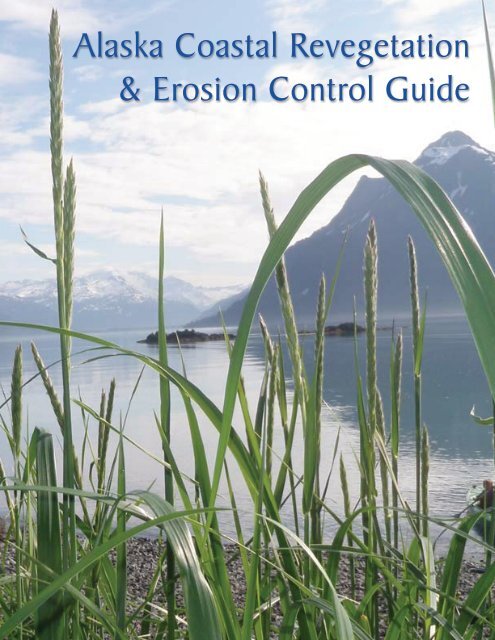
Front Cover: A natural stand of Beach Wildrye in southeastern Prince William Sound<br />
Photo: Brennan Veith Low (AK PMC)
Any use of trade, firm, or product names is for descriptive purposes<br />
only and does not imply endorsement by any employee or<br />
branch of the State of <strong>Alaska</strong>. Information submitted by private<br />
companies in the case studies section of this document is publicly<br />
available, and presented for educational purposes. All photographs<br />
are copyright of their respective owners.<br />
Published by:<br />
State of <strong>Alaska</strong><br />
Department of Natural Resources<br />
Division of Agriculture<br />
<strong>Plant</strong> Materials Center<br />
5310 South Bodenburg Spur<br />
Palmer, AK 99645<br />
This publication was funded<br />
in part by a grant from the<br />
United States Department of<br />
Agriculture, Natural Resource<br />
Conservation Service.<br />
<strong>Plant</strong> Materials Center logo: ‘Germinate’ - Original artwork by Sheila Wyne, used with permission
Foreword<br />
i
Author’s Preface<br />
Aerial photo: ShoreZone (NOAA)<br />
A narrow strip of sand, called a tombolo, connects two islands in this photograph from western Prince William Sound<br />
I have always been fascinated with coastal areas. They are a magical area<br />
where the sea (or in some cases large freshwater lakes) meets land. That interest<br />
matured fully in 1995, during a seed collection project in an area near the Port<br />
Clarence LORAN Station in northwest <strong>Alaska</strong>. Traveling south from the station on<br />
a 4-wheeler, the peninsula narrowed to the point that both the left and right tires<br />
were in sea water. This was my first encounter with a tombolo, a depositional land<br />
form that is created when waves refract around an island to create a spit, tieing<br />
the island to the shore. Ahead of the tombolo, I could just make out additional<br />
above-water portions of the peninsula.<br />
The lure of collecting additional seed to the south kept me inching ahead, even as<br />
the water was getting deeper and the sides of the tombolo were getting narrower.<br />
Looking around in a complete circle, I saw only water, and the 4-wheeler looked<br />
very small. I felt even smaller as I looked at a land vehicle in a watery world. As<br />
I put the machine in reverse and started to back out of the area, I saw the sand<br />
of the tombolo begin to slide laterally, and the front of the 4-wheeler begin to sink<br />
deeper. Fear took over. I’d never before realized just how fast a 4-wheeler could<br />
go in reverse, or how high those tires could throw water into the air! A charging<br />
bear could not have caused the adrenaline to flow through my body any faster.<br />
What a truly fascinating place - that area where land meets water.<br />
ii
This guide is intended for use in coastal areas of <strong>Alaska</strong>, specifically the<br />
areas designated by the <strong>Alaska</strong> Inland <strong>Coastal</strong> Zone Boundaries. <strong>Coastal</strong> areas<br />
have been my primary focus with regard to revegetation and erosion control<br />
activities during the past 32 years. Consolidating and publishing the research<br />
and information gathered during that period motivated the development of this<br />
document.<br />
The guide is divided into sections detailing steps that should be followed for a<br />
successful revegetation project. The guide is dedicated to the Great Land and its<br />
immense and fragile coastal region. It is my intent to raise awareness across the<br />
state of the need to protect and restore coastal environments as necessary in the<br />
land we call <strong>Alaska</strong>.<br />
Researchers and environmental professionals from across <strong>Alaska</strong> were invited<br />
to share case studies for this publication, to showcase some outstanding<br />
revegetation and erosion control projects, as well as alternative approaches and<br />
ideas in restoration. These case studies demonstrate what can be accomplished<br />
or learned by recreating vegetation communities, landforms or controlling erosion<br />
using vegetation. The guide also provides an overview of work performed in<br />
<strong>Alaska</strong>’s coastal regions by the <strong>Alaska</strong> <strong>Plant</strong> Materials Center (PMC) during the<br />
past three decades.<br />
In the first section of this guide, the reader will find useful background information.<br />
A short history of the major impacts to the coast of <strong>Alaska</strong> is presented, along<br />
with an introduction to the principles of revegetation. A primer on coastline types<br />
and terminology, as defined by coastal geomorphologists is also included.<br />
The Project Implementation section will guide the reader through the basics of<br />
the entire process of a revegetation project, from the initial project planning phase<br />
to obtaining necessary permits, seeding, and mulching. This section includes an<br />
introduction to soil science and planting methods, as well as other forms of planting<br />
stock used in <strong>Alaska</strong>. Information about seed quality and specifications is also<br />
presented. The Project Implementation section details various techniques used<br />
to prepare the planting surface, as well as other specialized planting methods.<br />
As many sites require additional protection to preserve important land features or<br />
critical habitats, conservation and protection methods are also covered.<br />
Section 3, Species Selection, consists of a survey of available plant species<br />
appropriate for revegetation across <strong>Alaska</strong>. A description of vegetation communities<br />
in each region is included, along with lists of primary and secondary species<br />
adapted to that region. A table for each region will guide the reader in determining<br />
what species mixture will work best in the area. Each individual species is<br />
color-coded to the regions of <strong>Alaska</strong> to which is adapted, and this information is<br />
presented along with details of its growth habit and tolerances in the <strong>Plant</strong> Species<br />
chapter.<br />
The Case Studies section consists of reports from past revegetation and restoration<br />
projects, provided by researchers and environmental professionals across<br />
the state. These projects, conducted in each region of <strong>Alaska</strong>, will expose readers<br />
to the realities of revegetation in the field; successes, challenges, and lessons<br />
learned. It is our hope that the case study section will become a useful resource<br />
for future projects. These reports are available on the web, at plants.alaska.gov.<br />
iii
The final section of the manual lists the work cited, as well as a list of agencies<br />
and organizations that have an interest or statutory responsibility related to the<br />
coastal zone is also provided. We chose to include a reprint of the 1994 Beach<br />
Wildrye <strong>Plant</strong>ing <strong>Guide</strong> for <strong>Alaska</strong> as an appendix. This publication, though out<br />
of print, has continued to generate interest, warranting its inclusion. Also included<br />
as appendices are the amended State of <strong>Alaska</strong> seed regulations, and descriptions<br />
of other other publications of interest.<br />
I hope you find this guide worthwhile and informative.<br />
Stoney J. Wright<br />
iv
Acknowledgements<br />
This guide was written to assist land owners, land managers, engineers<br />
and environmental professionals in making decisions regarding revegetation<br />
and the use of vegetation in soil erosion control and soil conservation.<br />
The information contained in the guide builds upon past revegetation<br />
manuals including:<br />
Wright, Stoney J. (1994) - Beach Wildrye <strong>Plant</strong>ing <strong>Guide</strong> for <strong>Alaska</strong>.<br />
State of <strong>Alaska</strong>. <strong>Alaska</strong> Department of Natural Resources, <strong>Plant</strong><br />
Materials Center. 28 pp.<br />
Wright, Stoney J. and Moore, Nancy J. (1994) - <strong>Revegetation</strong><br />
Manual for Eareckson Air Force Station Shemya, <strong>Alaska</strong>. State of<br />
<strong>Alaska</strong>, Division of Agriculture, <strong>Plant</strong> Materials Center. 34 pp.<br />
Moore, Nancy J. and Wright, Stoney J. (1994) - <strong>Revegetation</strong> Manual<br />
for King Salmon Air Force Base, King Salmon, <strong>Alaska</strong>. State of<br />
<strong>Alaska</strong>, Division of Agriculture, <strong>Plant</strong> Materials Center. 51 pp.<br />
2001 <strong>Alaska</strong> Highway Drainage Manual (2001) - Chapter 16: <strong>Erosion</strong><br />
and Sediment <strong>Control</strong>. State of <strong>Alaska</strong>, Department of Transportation<br />
and Public Facilities.<br />
Wright, Stoney J. (2008) - A <strong>Revegetation</strong> Manual for <strong>Alaska</strong>. Edited<br />
by Peggy Hunt. State of <strong>Alaska</strong>, Department of Natural Resources,<br />
Division of Agriculture, <strong>Plant</strong> Materials Center.<br />
The authors would like to thank the individuals named below for their participation<br />
in this project.<br />
Harvey Smith, Ruth Carter, James Bowers and Janet Hall-Shempf at<br />
the <strong>Alaska</strong> Department of Transportation, Carrie Bohan and Marty Rutherford<br />
with the <strong>Alaska</strong> Department of Natural Resources, and John Whitney<br />
at the National Oceanic and Atmospheric Administration.<br />
v
Table of Contents<br />
<strong>Alaska</strong> <strong>Coastal</strong> <strong>Revegetation</strong> & <strong>Erosion</strong> <strong>Control</strong> <strong>Guide</strong><br />
Beach Wildrye, Leymus mollis and Lyngbyei sedge, Carax lyngbyei dominate<br />
this road berm and coastal wetland at Boat Launch Road, Kenai<br />
Section 1: Background<br />
1. Introduction<br />
• Geography<br />
• History<br />
• Impacts<br />
• Purpose<br />
• Method<br />
2. Coastlines<br />
• <strong>Coastal</strong> Glossary<br />
• Coastline Types<br />
........................... 2<br />
.......................................<br />
.......................................<br />
.......................................<br />
.......................................<br />
.......................................<br />
........................... 8<br />
.......................................<br />
.......................................<br />
vi
Section 2: Project Implementation<br />
1. Planning<br />
• Goal Setting & Preparation<br />
• Identify Site Conditions<br />
• Construction Site <strong>Revegetation</strong><br />
• <strong>Revegetation</strong> Objectives<br />
• Seeding Methods<br />
• <strong>Plant</strong>ing Time<br />
• Selection of Species<br />
• <strong>Plant</strong>ing Methods<br />
• Mulch & <strong>Erosion</strong> Matting<br />
2. Wild Seed Collection<br />
3. Techniques<br />
• Charged Overburden Veneer<br />
• Sod Clumps<br />
• Vegetation Mats<br />
• Enhanced Natural Reinvasion<br />
• Imprinting<br />
• Scarification<br />
• Dormant Seeding<br />
4. Conservation & Protection<br />
• Preventing Damage to Dunes<br />
• Protection of Eelgrass<br />
• Protection of Estuarine Habitats<br />
Section 3: Species Selection<br />
1. Adapted <strong>Plant</strong>s<br />
• <strong>Coastal</strong> Regions of <strong>Alaska</strong><br />
• Vegetation Communities<br />
• <strong>Revegetation</strong> Suggestions<br />
2. <strong>Plant</strong> Species<br />
Section 4: Case Studies<br />
1. Arctic Region<br />
• Arctophila fulva, Kuparuk<br />
• Vegetation Study, Sagavanirktok River<br />
• Project Chariot Site, Ogotoruk Valley<br />
2. Western Region<br />
• Red Dog Mine Site, NW <strong>Alaska</strong><br />
• M/V All <strong>Alaska</strong>n Cleanup, St. Paul<br />
..........................16<br />
.......................................<br />
.......................................<br />
.......................................<br />
.......................................<br />
.......................................<br />
.......................................<br />
.......................................<br />
.......................................<br />
.......................................<br />
..........................27<br />
..........................32<br />
.......................................<br />
.......................................<br />
.......................................<br />
.......................................<br />
.......................................<br />
.......................................<br />
.......................................<br />
..........................44<br />
.......................................<br />
.......................................<br />
.......................................<br />
..........................50<br />
.......................................<br />
.......................................<br />
.......................................<br />
..........................69<br />
........................106<br />
.......................................<br />
.......................................<br />
.......................................<br />
........................116<br />
.......................................<br />
.......................................<br />
vii
Section 4: Case Studies<br />
Section 5: Additional Information<br />
Appendices<br />
3. Southwest Region<br />
• Lateral Clear Zone, Shemya<br />
• Natural Reinvasion, Shemya<br />
• <strong>Coastal</strong> Dune Restoration, Adak<br />
• Pringle Hill Sand Quarry, Adak<br />
• Landfill Restoration, Adak<br />
• Wetland <strong>Revegetation</strong>, Kodiak<br />
4. Southcentral Region<br />
• Sedge Restoration, Girdwood Area<br />
• Chester Creek Restoration, Anchorage<br />
• Fish Creek Wetland, Anchorage<br />
• Jet Fuel Pipeline Restoration, Anchorage<br />
5. Southeast Region<br />
• Jordan Creek Wetland, Juneau<br />
• Nancy Street Wetland, Juneau<br />
• Airport Estuary Restoration, Gravina<br />
1. Works Cited<br />
2. Partner Agencies<br />
A: Beach Wildrye <strong>Plant</strong>ing <strong>Guide</strong><br />
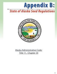
B: State of <strong>Alaska</strong> Seed Regulations<br />
C: Other Publications of Interest<br />
........................121<br />
.......................................<br />
.......................................<br />
.......................................<br />
.......................................<br />
.......................................<br />
.......................................<br />
........................139<br />
..........................................<br />
..........................................<br />
..........................................<br />
..........................................<br />
........................155<br />
.......................................<br />
.......................................<br />
.......................................<br />
........................170<br />
........................175<br />
........................A.1<br />
........................B.1<br />
........................C.1<br />
viii
Background<br />
Photo: Benjamin Jones (USGS)<br />
A disused cabin falls into the Beaufort Sea in this photograph, victim to climate-driven coastal erosion<br />
Section 1:<br />
1. Introduction<br />
• Geography<br />
• History<br />
• Impacts<br />
• Purpose<br />
• Method<br />
2. Coastlines<br />
• <strong>Coastal</strong> Glossary<br />
• Coastline Types<br />
1
Introduction<br />
<strong>Coastal</strong> <strong>Revegetation</strong> & <strong>Erosion</strong> <strong>Control</strong> <strong>Guide</strong><br />
Photo: Harvey Smith (AK DOT)<br />
Melting permafrost is a natural coastal erosion process, shown in this photograph of the Beaufort Sea coast.<br />
This guidebook will address methods using vegetation to mitigate and reduce erosion caused by human activity.<br />
<strong>Alaska</strong> is known as a land of superlatives. It is the northernmost state,<br />
the westernmost state and by some definitions, the easternmost state (the<br />
Near Islands and the Rat Islands being west of the 180 th Meridian). The<br />
state’s name is derived from the Aleut word “Alyeska”, translated as “the<br />
object towards which the action of the sea is directed”, and generally taken<br />
to mean “Mainland” or “The Great Land”.<br />
<strong>Alaska</strong> is by far the largest state within the United States of America; having<br />
more than twice the area of the next largest. Indeed, <strong>Alaska</strong> by itself<br />
covers 1% of the land mass on Earth, and is larger than all but 19 countries<br />
on the planet. Its massive land mass notwithstanding, <strong>Alaska</strong> is first and<br />
always a coastal state.<br />
2
<strong>Alaska</strong> has more miles of coastline than the contiguous United States<br />
Photo: Phil Czapla (AK PMC)<br />
The coastal community of Seldovia, on Kachemak Bay,<br />
is bordered by intertidal mud flats<br />
Graphic: US ACE, <strong>Alaska</strong> District<br />
GEOGRAPHY<br />
The <strong>Alaska</strong> Department of Natural<br />
Resources estimated the <strong>Alaska</strong><br />
coastline to be 44,500 miles long,<br />
as measured on the most detailed<br />
maps available. <strong>Alaska</strong>’s coastline<br />
is larger than the remainder of the<br />
United States’ combined coastline.<br />
Nearly three quarters of the<br />
<strong>Alaska</strong>’s population live in communities<br />
along this coastline. The<br />
coastal region supports industries<br />
like commercial fishing, logging,<br />
tourism, and oil and gas production.<br />
Production industries, though<br />
responsible for a large portion of<br />
<strong>Alaska</strong>’s economic product, can<br />
have significant impact on coastal<br />
areas, and any adverse effects<br />
should be mitigated.<br />
HISTORY<br />
<strong>Alaska</strong> has been peopled for several<br />
thousand years. Humans entered<br />
<strong>Alaska</strong> from Asia, either by<br />
walking over the Bering Strait or by<br />
boat (Mason et al, 1997). Although the earliest known archeological remains<br />
in <strong>Alaska</strong> are just 12,000 years old, radiocarbon dating of a peat bed<br />
150 feet below the surface of the Chukchi Sea show that the land bridge<br />
remained exposed until 11,000 years ago; plenty of time for a land crossing<br />
(Mason et al, 1997). Complex societies first developed in the Bering<br />
Straits region, on Kodiak Island, and in Southeast <strong>Alaska</strong>, 2000 years ago.<br />
<strong>Alaska</strong> remains home to several indigenous cultures & tribes, such as the<br />
Athabascan, Eyak, Haida, Tlingit, Tshimian, Yupik & Inupiat Eskimo, and<br />
Aleut peoples.<br />
The area now known as <strong>Alaska</strong> was first colonized by Tsarist Russia,<br />
beginning in 1732. The basic shape of <strong>Alaska</strong> was established by treaty<br />
between Britain and Russia in 1825. Exploitation of <strong>Alaska</strong>’s natural resources<br />
was almost exclusively restricted to the coastline until 1867, when<br />
the territory was sold to the United States, by Alexander II. A border dispute<br />
with Canada over the southeastern portion of the territory was resolved in<br />
1908, when a treaty between the USA and Britain finalized the border.<br />
The 1867 purchase of the territory of <strong>Alaska</strong>, instigated by Secretary of<br />
State William H. Seward, was criticized by contemporaries, and commonly<br />
referred to as ‘Seward’s Folly’ or ‘Seward’s Icebox’. Despite this derision,<br />
3
4<br />
1867 U.S. Treasury warrant for the purchase of <strong>Alaska</strong> from Russia<br />
IMPACTS<br />
Image: US National Archives<br />
a $7.2 million treasury warrant was<br />
issued, and the purchase made.<br />
The United States received the<br />
586,412 square miles, or approximately<br />
365 million acres of land,<br />
to be known as the Department of<br />
<strong>Alaska</strong>. <strong>Alaska</strong> would be classified<br />
twice more, as a district and as a<br />
territory, before becoming a state.<br />
<strong>Alaska</strong>’s constitution was ratified in<br />
1956; “The Great Land” became a<br />
state on January 3 rd , 1959.<br />
Many natural events have impacted <strong>Alaska</strong>’s dynamic coastal environment.<br />
Impacts such as the 1964 Good Friday Earthquake can cause upheaval<br />
on an unprecedented scale, though very little can be done to correct or<br />
restore uplift or subsidence of land. Volcanic eruptions, glacial advance<br />
and tsunamis can also massively disrupt existing coastlines. These<br />
processes are part of the natural progression of landforms, and it is unlikely<br />
that human intervention to correct or reverse the resulting changes will<br />
ever be effective or practical.<br />
Human caused impacts, both accidental and intentional, have also disrupted<br />
natural ecosystems in <strong>Alaska</strong>. During the early 1940s, the Aleutian<br />
Islands were host to a number of military actions and battles associated<br />
with World War II. The legacy and impact of this conflict remains today; not<br />
only in the lost lives, destroyed villages, and acres of war debris, but also<br />
in the form of actual scars on the land surface. These reminders of past<br />
actions remain, a lasting impact that has affected generations of coastal<br />
residents.<br />
Even after the Second World War, other threats to peace caused the<br />
coastline of <strong>Alaska</strong> to take center-stage. In the Cold War drama that began<br />
in the 1950s and continued for decades, the Defense Early Warning System<br />
was established at several locations in the Aleutian Islands, and along<br />
the Western and Arctic coastlines of <strong>Alaska</strong>. These ‘D.E.W. Line’ sites were<br />
not in themselves detrimental, but what was left behind often was. Debris,<br />
petroleum contamination, and toxic substances all contributed to coastal<br />
impact. Environmental remediation and cleanup activities at many of these<br />
remote sites was undertaken by the Department of Defense in the 1980s<br />
and 1990s. Federal legislation, notably the Comprehensive Environmental<br />
Response, Compensation, and Liability Act of 1980 (CERCLA) and its subsequent<br />
amendment, the Superfund Amendments and Reauthorization Act<br />
of 1986 (SARA), was instrumental in accomplishing the cleanup.<br />
Construction impacts associated with industrial progress and commerce<br />
are expected with a growing society and its communities. One example of<br />
this is the construction of the Valdez Marine Terminal, the southern terminus<br />
of the Trans <strong>Alaska</strong> Pipeline System (TAPS). This 1,000 acre terminal was
Photo: Lawrence Livermore<br />
National Laboratory - llnl.gov<br />
Cannakin nuclear warhead being lowered<br />
into position on Amchitka Island in 1971<br />
The quest to use nukes on coastal <strong>Alaska</strong> actually<br />
started earlier than the Amchitka exercises, with the 1958 Project Chariot<br />
study near Point Hope. Project Chariot was a part of a national effort<br />
known as Operation Plowshare, an attempt to use the nuclear arsenal for<br />
peaceful projects like construction. While the intended goal of the project,<br />
the excavation of a harbor using nuclear detonations, never came pass,<br />
the environmental impacts of the study remained until the site was rehabilitated<br />
in the 1990s.<br />
Impacts to the coastal environment continued with the development of<br />
the <strong>Alaska</strong>n economy. These impacts, though not as large as the events<br />
previously mentioned, were expected and often mitigated. As oil development<br />
on the Arctic Coast ramped up in the 1970s and 1980s, impacts to<br />
the coastline were managed, and lasting disturbances minimized. Methods<br />
have been developed to mitigate these impacts, such as limiting travel<br />
along the arctic coastal plain to the winter months, when snowpack protects<br />
the fragile tundra. These techniques reinforce the age-old maxim that<br />
an ounce of prevention is worth a<br />
pound of cure.<br />
Photo: US Navy -<br />
dodmedia.osd.mil<br />
Cleanup efforts underway in Prince William Sound in May of 1989.<br />
carved out of a mountainside, allowing tanker ships<br />
to load north slope crude oil for transport to market.<br />
Before the first drop of oil was transported through<br />
the TAPS, the coastal impact of this development was<br />
considerable.<br />
On occasion, progress can seem to take a step backward.<br />
<strong>Alaska</strong>’s coastline witnessed the underground<br />
detonation of three nuclear devices between 1965 and<br />
1971, in the western Aleutians. These three events<br />
were collaborative efforts between the Atomic Energy<br />
Commission and the Department of Defense. Amchitka<br />
Island, in 1965, saw the detonation of an 80 kiloton<br />
device, followed by a 1 megaton blast in 1969, and in<br />
1971, the detonation of the largest nuclear weapon<br />
ever on US soil, under Project Cannikin. Amchitka Island<br />
was selected as the test site because the warhead<br />
was too large to be safely detonated in Nevada. The<br />
continued impact is only now being determined.<br />
<strong>Alaska</strong>ns’ view of their coastline<br />
was changed forever, just a few<br />
minutes into the morning of March<br />
24, 1989. Residents awoke to<br />
the news that the oil tanker Exxon<br />
Valdez was hard aground on the<br />
largest charted reef adjacent to<br />
the shipping lanes near the port of<br />
Valdez. The tanker was leaking its<br />
load of crude oil into Prince William<br />
5
6<br />
Photo: US Coast Guard<br />
Two halves of the freighter Selendang Ayu, adrift<br />
north of Unalaska Island - December, 2004<br />
Sound. Eventually, 1,300 miles of pristine coastline was covered with a 30<br />
million gallons of crude oil (AK DOL, 1990; Ott, 1996). This single occurrence<br />
is widely viewed as the most significant event to impact the <strong>Alaska</strong><br />
coastline, severely affecting beaches, wildlife, plant communities, and the<br />
region’s industries. Paradoxically, in some areas more damage may have<br />
resulted from misguided cleanup efforts than the oil itself.<br />
In a 2005 assessment of remaining impacts, the National Oceanic and<br />
Atmospheric Administration’s Office of Response and Restoration made<br />
the following observation: “..rocky sites ... stripped of heavy plant cover by<br />
high-pressure, hot-water cleaning remain mostly bare<br />
rock” (NOAA, 2005). As the nation continues to deal<br />
with the ongoing impacts from the oil disaster in the<br />
Gulf of Mexico, the lessons learned from the Exxon<br />
Valdez Spill are taking center stage.<br />
Photo: AK DEC Incident Response<br />
A rocky beach on Unalaska Island coated with spilled<br />
soybean cargo from the wrecked Selendang Ayu<br />
The 1989 spill, though the largest, was by no means<br />
the last maritime event to strongly impact the Coast<br />
of <strong>Alaska</strong>. In late 2004, a freighter laden with over 60<br />
tonnes of soybeans, en route from Seattle, Washington<br />
to Xiamen, China, suffered engine problems near<br />
Dutch Harbor. Heavy seas and a strong wind complicated<br />
rescue efforts, pushing the stricken vessel<br />
towards the coast of Unalaska Island. The ship subsequently<br />
broke in two, spilling its cargo, along with<br />
350,000 gallons of bunker oil and diesel fuel (PAME,<br />
ongoing). Wave action deposited large quantities of<br />
the cargo onto the north coast of Unalaska Island. In<br />
2006, the <strong>Alaska</strong> Department of Environmental Conservation<br />
determined that the decomposing beans<br />
presented no danger to human health, and all incident<br />
response activities were suspended.<br />
PURPOSE<br />
This guidebook was developed to aid in the<br />
process of coastal revegetation. The intended<br />
audience is private property owners, as<br />
well as state and local government.<br />
For the purpose of this document, revegetation<br />
is defined as:<br />
The re-establishment of plant cover by<br />
means of seeding or transplanting on a<br />
site disturbed by natural or man-caused<br />
actions.<br />
Impacts, both large and small, will continue<br />
to disrupt the coastal regions of <strong>Alaska</strong>. The<br />
coasts experience natural soil erosion caused
y water (fluvial), wind (eolian), and gravity. Combinations of waves, frost<br />
heaving and unobstructed fetch along miles of coastline present ample<br />
opportunities for soil loss. Removal of vegetation and soils proceeds at<br />
unsustainable rates in some areas, changing the dynamics of natural ecosystems.<br />
Recovery (defined as the presence of self-sustaining vegetation<br />
cover, and limited erosion) of most sites will require human intervention to<br />
correct limitations and guide the ecosystem towards a desired end state.<br />
Material presented in this manual focuses on the “soft approach” to erosion<br />
control, using vegetation. While the “hard approach” (i.e. the use of rip-rap)<br />
is an effective means of stabilizing an area, these non-vegetative methods<br />
will be left to <strong>Coastal</strong> Engineers.<br />
Numerous approaches are available for reintroducing vegetation on a site.<br />
This manual details a logical sequence of surface preparation, fertilization,<br />
and seeding. When followed on a site, this sequence will usually result in a<br />
self-sustaining native plant community that requires minimal management<br />
input. When conditions allow, most disturbed sites will naturally be re-colonized<br />
with plants from the surrounding area. This “do-nothing” approach<br />
is rarely used, however, as it does not provide aesthetic cover quickly<br />
enough for highly visible areas. Natural Reinvasion, as this technique is<br />
known, is effective, but it may take years for a plant community to become<br />
established. As nearly three quarters of the state’s population lives in communities<br />
along the coast, political and aesthetic consideration frequently<br />
preclude this option.<br />
METHOD<br />
The sheer size of the state, along with considerable differences in climate<br />
and vegetation in different areas, necessitated the division of <strong>Alaska</strong> into<br />
five coastal regions: Arctic, Western, Southwest, Southcentral, and Southeast<br />
<strong>Alaska</strong>. Vegetation communities present in each region are described<br />
in detail, and a list of appropriate revegetation species for the region is<br />
included in the Adapted <strong>Plant</strong>s section.<br />
A map of <strong>Coastal</strong> Zone boundaries, included on the inside front cover, is<br />
used to define what is ‘<strong>Coastal</strong>’. These zones vary in size considerably,<br />
depending on the terrain and elevation. <strong>Coastal</strong> zones can extend inland<br />
over several atlas quads in western <strong>Alaska</strong>, or stop very near the coastline<br />
in southcentral parts of the state.<br />
A sizable portion of this manual is dedicated to case studies, highlighting<br />
past revegetation projects that have occurred on coastal sites in each<br />
region of <strong>Alaska</strong>. These case studies can also be found online, at plants.<br />
alaska.gov.<br />
7
Coastlines<br />
Photo: Janet Hall-Schempf (AK DOT)<br />
Steep, vegetated cliffs dominate this beach on Walrus Island, near Togiak, <strong>Alaska</strong><br />
<strong>Alaska</strong> has a long and diverse coastline, representing several unique<br />
eco-regions. An eco-region can be defined as a large area of land and<br />
waters containing vegetation communities that share ecological dynamics,<br />
environmental conditions, and interactions that are critical for their longterm<br />
persistence (Nowacki, et al, 2001). It is necessary to address the<br />
issue of revegetation in the context of an eco-region, as this will effect species<br />
selection and other planting requirements.<br />
Within each eco-region, and across <strong>Alaska</strong>, several different types of<br />
coastline exist. In this section, you will find a short description of several<br />
coastline types and the geomorphic factors that influence each.<br />
8
<strong>Coastal</strong> Glossary:<br />
Fetch:<br />
An extent of open water across which the wind is blowing (Bird, 2008).<br />
Beach:<br />
The area between high tide and the coastline. The beach is defined as an accumulation<br />
of loose sediment, sand, gravel, or boulders (Bird, 2008).<br />
Shore Zone:<br />
The area influenced by tidal forces. Stops at the border with the coastline.<br />
Coastline:<br />
The edge of the land at highest tides, at the upper limit of the shore platform.<br />
Frequently indicated by the seaward boundary of terrestrial vegetation.<br />
Intertidal Zone:<br />
The area between high tide and low tide, below the beach.<br />
Shore Line:<br />
The edge of the waterline, moving as the tide rises and falls. Typically measured<br />
at low, mid, and high tides (Bird, 2008).<br />
Shore Platform:<br />
The shore platform includes the area defined by the tidal range, up to the coast<br />
line, typically demarcated by a cliff or steep slope.<br />
Intertidal Mud Flats:<br />
Mud flats consist of sediment built up along coastlines. Mud Flats are found in<br />
sheltered areas such as bays, lagoons and estuaries, near salt marshes.<br />
9
Coastline Types:<br />
Graphic: Eric Bird: <strong>Coastal</strong> Geomorphology, 2nd Edition. © J. Wiley & Sons, Ltd.<br />
Figure 1: <strong>Coastal</strong> Terminology<br />
Figure 2: Diagram of barrier island, tidally influenced areas<br />
Graphic: Nate Dibble (University of Rhode Island, <strong>Coastal</strong> Institute)<br />
10
Coastline Types:<br />
Photo: Janet Hall-Schempf (AK DOT)<br />
Mendenhall Wetlands State Game Refuge<br />
Intertidal Wetlands:<br />
Intertidal wetlands refer to a range<br />
of the shore between high and low<br />
tides. This zone experiences regular<br />
tidal inundation, and is typically cut by<br />
meandering channels branching out<br />
to the ocean.<br />
This type of coast occurs predominantly<br />
in Southern <strong>Alaska</strong>.<br />
<strong>Coastal</strong> Lagoons:<br />
<strong>Coastal</strong> lagoons are areas of relatively<br />
shallow water that have been<br />
separated from the sea by coastal<br />
barriers. These areas can exhibit<br />
high variability in salinity, changing<br />
from brackish to hypersaline (Davis,<br />
Fitzgerald, 2004).<br />
Like estuaries, these areas have a<br />
mixture of fresh and sea water (Bird,<br />
2008). Species diversity is typically<br />
low, although the hardy species that<br />
can tolerate the high salinity are found<br />
in abundance.<br />
Lagoons occur across <strong>Alaska</strong>, especially<br />
in the northwestern region.<br />
Aerial photo: <strong>Alaska</strong> DEC | Spill Prevention and Response section<br />
James Lagoon, McCarty Fjord, near Seward, Southcentral <strong>Alaska</strong><br />
Aerial photo: ShoreZone (NOAA)<br />
Chickimin River estuary, Southeast <strong>Alaska</strong><br />
Estuary:<br />
An estuary is a zone where freshwater<br />
from rivers and streams meets the<br />
sea, mixing with salt water from the<br />
ocean. Estuaries are among the most<br />
productive ecosystems, harboring<br />
unique plant communities, specially<br />
adapted to this brackish mix of waters<br />
(NOAA, 2007).<br />
Gradual elevation gains in these<br />
areas can extend the coastal habitat<br />
range inland for several miles. Saline<br />
tolerant species should be selected<br />
for an estuarine vegetation mixture.<br />
11
Coastline Types:<br />
Deltas:<br />
Deltas form at the mouths of large<br />
rivers. Sediment deposition creates<br />
enlarged intertidal areas, making the<br />
shore-zone shallower.<br />
Silts and clay soils are prevalent in<br />
Deltas. On cold and arid coasts, delta<br />
vegetation is sparse and sediments<br />
are coarse with large amounts of sand<br />
and gravel (Bird, 2008).<br />
Satellite Photo: NASA Multimedia Gallery<br />
Yukon River delta, Western <strong>Alaska</strong>. Note sediment fan.<br />
Sheer Cliffs:<br />
Sheer cliffs are areas where the<br />
coastline rises steeply from the end of<br />
the shoreline. Vertical cliffs occur in<br />
homogenous geologic strata, such as<br />
sandstone and limestone (Bird, 2008).<br />
In <strong>Alaska</strong>, the major river deltas are<br />
the Yukon-Kuskokwim, the Copper<br />
River, and the Colville, on the north<br />
slope.<br />
Photo: Janet Hall-Schempf (AK DOT)<br />
The shore zone may be all but nonexistent<br />
in Fjords. When a cliff rises<br />
500 meters vertically within 50 meters<br />
of the shore line, the coastal vegetation<br />
can be very different from that<br />
which is present on the shore.<br />
A sheer cliff rises from the shore in the McNeil<br />
River State Game Refuge, Southwest <strong>Alaska</strong><br />
Rocky Beaches:<br />
Rocky Beaches are the norm in <strong>Alaska</strong>.<br />
These beaches have low erosion<br />
potential, and low dynamics.<br />
Aerial photo : Shorezone (NOAA)<br />
Rocky Coastline in Prince William Sound, near Whittier<br />
Sparse vegetation cover and gravelly<br />
soils typify these areas. Pebbles and<br />
rocks dominate the shore zone. Terrain<br />
tends to be stony right up to the<br />
coastline, where terrestrial vegetation<br />
begins.<br />
12
Photo: Harvey Smith (AK DOT)<br />
Atsakirak Mound, a coastal barrier island northwest of Kivalina<br />
Coastline Types:<br />
<strong>Coastal</strong> Barriers:<br />
<strong>Coastal</strong> barriers and barrier islands<br />
are elongated land forms formed by<br />
the deposition of beach materials<br />
offshore. Barriers consist of sand or<br />
gravel deposited by long-shore drifting<br />
or carried in from the sea floor<br />
(Bird, 2008). The landward side of<br />
these features often enclose lagoons<br />
and wetlands. <strong>Coastal</strong> barriers are<br />
a prevalent geomorphic feature in<br />
north-west <strong>Alaska</strong>.<br />
Typically, grassy vegetation is prevalent<br />
on these coastlines.<br />
<strong>Coastal</strong> Dunes:<br />
<strong>Coastal</strong> dunes are characterized by<br />
high quantities of sand and exist in a<br />
place of significant tidal action. Dunes<br />
have a very dynamic and transitional<br />
nature.<br />
Typically, dunes support Beach<br />
Wildrye communities. This species<br />
is uniquely able to tie together loosegrained,<br />
sandy soil. <strong>Coastal</strong> dunes<br />
provide critical protection for beaches<br />
and inland areas against storm<br />
surges.<br />
Photo: Phil Czapla (AK PMC)<br />
<strong>Coastal</strong> dunes on the Kenai peninsula. Note stabilizing vegetation.<br />
Photo: US Army Corps of Engineers<br />
The Homer Spit protrudes 4.5 miles into<br />
Kachemak Bay, about 19 feet above sea level<br />
Spits:<br />
Spits are beaches built up above<br />
the high tide level, protruding into<br />
the water, usually ending in one or<br />
more landward hooks or recurves<br />
(Schwartz, 1972). Spits are deposition<br />
landforms, caused when waves<br />
hit the coast at oblique angles, moving<br />
sediment down the beach. As spits<br />
grow, a salt marsh is likely to develop<br />
behind them, in the area sheltered<br />
from the wind and waves.<br />
The Homer spit and the Port Clarence<br />
spit are examples of this geomorphic<br />
feature in <strong>Alaska</strong>.<br />
13
Coastline Types:<br />
Aerial photo: ShoreZone (NOAA)<br />
A sandy beach in Prince William Sound<br />
Sandy Beaches:<br />
Sandy beaches can be found in<br />
<strong>Alaska</strong>. This one is from the western<br />
edge of Prince William Sound, at the<br />
edge of the Chugach National Wildlife<br />
Refuge.<br />
Sandy beaches form by accretion of<br />
sediment. Species that thrive in these<br />
areas must be adapted to loosegrained<br />
soils. Notable examples include<br />
Beach Wildrye (Leymus mollis)<br />
and Bering Hairgrass (Deschampsia<br />
beringensis).<br />
Tidal Mudflats:<br />
Mudflats form when fine sediments<br />
such as silts and clays are deposited<br />
along the shoreline. These areas can<br />
extend the intertidal zone significantly.<br />
Vegetation is limited in tidal mud flats,<br />
due to the tidal fluctuations and salinity.<br />
Species most adapted to this type<br />
of coast include Seashore Alkaligrass<br />
(Puccinellia sp.), Seaside Arrowgrass<br />
(Triglochin sp.), and Seaside <strong>Plant</strong>ain<br />
(<strong>Plant</strong>ago maritima).<br />
Aerial photo: ShoreZone (NOAA)<br />
Vegetation along a tidal mudflat in Cook Inlet<br />
High Energy Coasts:<br />
High energy coasts are those with very little natural protection<br />
from the ocean’s waves. The continental slope tends<br />
to drop off sharply in these areas. A long fetch means that<br />
high energy coasts are subjected to strong wave action and<br />
erosive influences.<br />
These beaches are characterized by large rocks and very<br />
little vegetation growth. Some high-energy beaches can<br />
be sandy, however, such as those in the western Aleutians.<br />
Photo: Janet Hall-Schempf (AK DOT)<br />
A high energy beach in the Walrus<br />
Islands State Game Sanctuary<br />
High energy coasts are sometimes characterized by rugged<br />
cliffs and long, curving beaches. The long, curving type<br />
of high energy beaches are generally found where the continental<br />
slope is shallower. (Bird, 2008)<br />
14
Project Implementation<br />
Photo: Phil Czapla (AK PMC)<br />
<strong>Erosion</strong> control fabric supporting willow stakes and seeded plants, along the banks of the Matanuska River<br />
Section 2:<br />
1. Planning<br />
• Goal Setting & Preparation<br />
• Identify Site Conditions<br />
• Construction Site <strong>Revegetation</strong><br />
• <strong>Revegetation</strong> Objectives<br />
• Seeding Methods<br />
• <strong>Plant</strong>ing Time<br />
• Selection of Species<br />
• <strong>Plant</strong>ing Methods<br />
• Mulch & <strong>Erosion</strong> Matting<br />
2. Wild Seed Collection<br />
3. Techniques<br />
• Charged Overburden Veneer<br />
• Sod Clumps<br />
• Vegetation Mats<br />
• Enhanced Natural Reinvasion<br />
• Imprinting<br />
• Scarification<br />
• Dormant Seeding<br />
4. Conservation & Protection<br />
• Preventing Damage to Dunes<br />
• Protection of Eelgrass<br />
• Protection of Estuarine Habitats<br />
15
Planning<br />
Photo: Ruth Carter (AK DOT)<br />
A constructed berm at Fishing Hole Inlet on the Homer Spit awaits revegetation in this 1999 photograph.<br />
The establishment of vegetation is a practical and effective means of maintaining a constructed grade.<br />
Planning should be the first step for any<br />
project. The revegetation/restoration process<br />
requires careful planning and management, as<br />
the designer is working with biological processes<br />
that have specific timing and environmental requirements.<br />
When multiple stakeholders are involved<br />
in a restoration project, design decisions<br />
should be coordinated. This allows restoration<br />
goals to be implemented effectively.<br />
Goal-Setting and Preparation<br />
The planning phase of a restoration project encompasses<br />
several steps. These include<br />
• gathering baseline data<br />
• identifying site problems<br />
• collecting reference plot information<br />
• setting goals<br />
Goals tell managers about the desired state of<br />
the ecosystem, as compared to a reference ecosystem.<br />
Objectives are measures taken to attain<br />
the goals, and are evaluated on the basis of performance<br />
standards (SER, 2002). Without clear<br />
goals, objectives and performance standards, a<br />
restoration project should not move forward.<br />
Performance standards come from an understanding<br />
of the reference ecosystem and the realization<br />
that the trajectory of the degraded site<br />
should progress towards the desired state of recovery<br />
comparative to the reference site.<br />
If data collected and interpreted during monitoring<br />
shows that performance standards have<br />
been met, then project objectives have been<br />
reached. <strong>Revegetation</strong> goals may include erosion<br />
control, visual enhancement, weed control,<br />
or other desired outcomes. Often, in coastal areas,<br />
the goal is erosion control.<br />
Baseline Environmental Data Collection<br />
After determining the revegetation objectives,<br />
take note of factors influencing the site. These<br />
16
include climate, soils and vegetation. Climate includes<br />
temperature, precipitation, and wind, plus<br />
other factors. Climate records can be obtained<br />
online, through resources such as the National<br />
Oceanographic and Atmospheric Administration’s<br />
National Climate Data Center, at www.<br />
ncdc.noaa.gov/.<br />
A soils inventory involves identification of soil<br />
types and characterization of the soil types, as<br />
well as distribution. Soil surveys have been<br />
completed by the Natural Resource Conservation<br />
Service (NRCS) and are accessible online<br />
at soils.usda.gov/. If feasible, a sample of soil<br />
from the site should be sent to a soil testing lab.<br />
There, a lab analysis will check the physical (texture,<br />
density), chemical (pH, salts, organic matter)<br />
and biotic (activities of organisms) characteristics<br />
of the soil. All of this information aids in<br />
developing a seed and fertilizer mix.<br />
Mapping of vegetation types and characterization<br />
of the vegetation types in regards to production,<br />
cover and density will be part of an in-depth<br />
vegetation analysis. Review available data for<br />
your region prior to creating a revegetation plan.<br />
Reference Sites<br />
A reference ecosystem serves as a model for<br />
planning a revegetation/restoration project, allowing<br />
for measurement of the progression of an<br />
ecosystem towards its desired end-state (SER,<br />
2002). It’s important to note that a restored ecosystem<br />
can never be identical to the reference<br />
site. A reference system is best assembled from<br />
multiple reference sites to account for the possibility<br />
that one particular site may be biased.<br />
Many sources of information are useful in describing<br />
a reference site, such as lists of species<br />
present, maps of the site prior to damage,<br />
and aerial and ground-level photography (SER,<br />
2002). Reference ecosystems should have high<br />
production and species composition in order for<br />
managers to evaluate the progress of the ecosystems<br />
towards its desired state of recovery.<br />
Eventually, the restored ecosystem should emulate<br />
the reference site (SER, 2002).<br />
Collecting information from a reference site can<br />
quickly become expensive, and is often limited<br />
by available funds .<br />
Permitting<br />
Permits are required for some projects. Projects<br />
that disturb an acre or more, discharge<br />
storm water into a municipal separate storm<br />
sewer system (MS4), or into the surface waters<br />
of the United States require an <strong>Alaska</strong> Pollutant<br />
Discharge Elimination System (APDES) Permit.<br />
This permit is issued by the <strong>Alaska</strong> Department<br />
of Environmental Conservation (DEC), in accordance<br />
with the Federal Clean Water Act. AP-<br />
DES permits are issued as either a phase one<br />
or phase two permit depending on the size of<br />
the area disturbed and nearby population. More<br />
information about the APDES program can be<br />
found at the DEC website, at dec.alaska.gov/water/npdes/.<br />
A dewatering permit is necessary if the total discharge<br />
volume is equal to or greater than 250,000<br />
gallons and wastewater discharge is located less<br />
than one mile from a contaminated site. Other<br />
permits are necessary for projects that affect fish<br />
habitat, historic properties, endangered species,<br />
and other concerns.<br />
Identify Site Conditions and<br />
Develop Mitigation Measures<br />
Potential limiting factors that will affect revegetation<br />
establishment are extensive, and a complete<br />
discussion is beyond the scope of this<br />
guide. This publication is focused is on the limiting<br />
factors that have been observed regularly<br />
on coastal sites in <strong>Alaska</strong>, and other parameters<br />
important for revegetation success.<br />
<strong>Plant</strong> growth depends on water availability. The<br />
amount of water a type of soil can hold and how<br />
easily roots can penetrate the soil depend on the<br />
texture and structure of the soil.<br />
Soil Texture<br />
Soil is made up of mineral particles, organic<br />
matter, air, and water. Soil texture is determined<br />
by the composition of soil, expressed as % sand,<br />
% silt, and % clay. Seven classes of particle size<br />
are acknowledged with sands being the largest<br />
(2.0-.05 mm), silts (.05-.002 mm) intermediate in<br />
size, and clays (
18<br />
Figure 3: USDA Agronomic Soil Textural Triangle<br />
GRAPHIC: USDA, SoilSensor.com,<br />
adaptated by editor<br />
The Agronomic Soil Textural<br />
Triangle (Figure 3,<br />
Figure 4) is a tool used to<br />
determine the textural type<br />
of a soil. Field analysis of<br />
soil texture can also be<br />
done using the “By Feel<br />
Method” (Figure 5). This<br />
qualitative method is quick,<br />
easy, and fairly reliable.<br />
Testing procedure involves<br />
wetting a sample of the soil<br />
and working the soil between<br />
one’s fingers. Water<br />
is often used to moisten<br />
the soil, but saliva is also<br />
suitable. Texture cannot<br />
be determined accurately<br />
when the soil is dry. Quantitative<br />
measures to determine soil texture are<br />
also available. Contact the <strong>Alaska</strong> <strong>Plant</strong> Materials<br />
Center for more information about testing<br />
and analysis of soils.<br />
Some characteristics of clay soils are that they<br />
restrict air and water flow, have high shrink-swell<br />
potential, and are highly absorptive. Sand, in<br />
GRAPHIC: US Department of Agriculture,<br />
adapted by SoilSensor.com, 2008<br />
Figure 4: Soil Triangle usage example<br />
In the example above, the soil consisted of<br />
40% Sand (red line), 30% Clay (blue line),<br />
and 30% Silt (green line). Thus, the soil is<br />
classified as clay loam, as indicated by the<br />
intersection of the three lines.<br />
contrast, has a low water<br />
holding capacity, due to<br />
large pore spacing, and<br />
has limited absorptive<br />
capability for substances in<br />
solution.<br />
Soil Structure<br />
The aggregation of mineral<br />
soil particles (sand, silt,<br />
clay) is referred to as soil<br />
structure. The arrangement<br />
of soil particles create<br />
varying pore spaces allowing<br />
different quantities<br />
of moisture to be retained.<br />
This is referred to as the<br />
porosity of the soil, and will<br />
be noted on a soils test. A<br />
reduction in the pore space<br />
of the soil by pressure applied<br />
to the soil surface<br />
initiates soil compaction.<br />
Compaction compresses<br />
micropores and macropores,<br />
destroying the soil<br />
structure. This affects the<br />
uptake and movement of<br />
water and can inhibit plant<br />
and microbial growth.<br />
Breaking up compacted<br />
layers can be accomplished<br />
by mechanical tillage.<br />
Equipment should be<br />
operated along the contour<br />
to reduce the potential of<br />
water entering furrows and<br />
creating soil erosion problems.<br />
Nutrients<br />
In most forms of revegetation,<br />
the application of fertilizer<br />
at the time of seeding<br />
is necessary. Most commercial fertilizers meet<br />
minimum standards for quality. When problems<br />
do arise, they can usually be traced to the product<br />
becoming wet during storage or shipment.<br />
Fertilizer is described by a three number designator,<br />
referred to as N-P-K. These numbers<br />
refer to the percentages of three elements: ni-
Chart: NRCS Irrigation <strong>Guide</strong>, USDA Natural Resources Conservation Service, 1997.<br />
If possible, fertilizer should be applied concurrent<br />
with or prior to seeding. Once the seed has<br />
been applied, no additional traffic should be allowed<br />
on the site, to avoid compaction and unnecessary<br />
disturbance of the seed bed.<br />
Topsoil<br />
The topsoil layer in undisturbed areas in <strong>Alaska</strong><br />
is often very thin, and therefore expensive and<br />
impractical to salvage. However, this layer is a<br />
source of native seed, plant propagules, organic<br />
matter, and soil microbes which can enhance the<br />
quality of the substrate being revegetated. Top<br />
soil is a valuable resource in revegetation, and<br />
should be preserved or salvaged when possible.<br />
Many construction sites in <strong>Alaska</strong> have exposed<br />
surfaces of gravel or gravely soils. Gravelly sites<br />
tend not to be highly erodible. If some fine particles<br />
are present in the gravelly soil, adapted<br />
species will grow without additional topsoil. In<br />
fact, the addition of a layer of topsoil on a gravel<br />
surface can increase erosion potential.<br />
Photo: Stoney Wright (AK PMC)<br />
Figure 5: The ‘By Feel’ Texture Classification Method<br />
Photo: Roadside <strong>Revegetation</strong> (Steinfeld et al., 2007)<br />
Figure 6: Heavily compacted soil; Note platy structure.<br />
Water flow through this soil is poor.<br />
trogen, phosphorus, and potassium, respectively.<br />
Therefore, 20-20-10 fertilizer contains<br />
20% nitrogen, 20% phosphorus, and 10% potassium<br />
by weight.<br />
Figure 7: Arctic Bluegrass, Poa arctica, established on a<br />
gravelly coastal spit near Port Clarance LORAN station<br />
19
Construction Site<br />
<strong>Revegetation</strong><br />
Construction and mining<br />
sites rarely have intact soil<br />
horizons. The preceding<br />
discussion on soil profiles<br />
does not apply to most disturbed<br />
land. More basic<br />
measures of soil particle<br />
size, elasticity, and water<br />
holding capacity are usually<br />
applied to construction<br />
and mining sites. The<br />
uniform soil classification<br />
table is the best means of<br />
determining soil characteristics<br />
for revegetation purposes.<br />
The Unified Soil Classification System<br />
(USCS) describes both the texture and grain size<br />
of a soil. Symbols are composed of two letters;<br />
the first represents primary grain size division<br />
(>50% of soil). The second letter refers to the<br />
uniformity or plasticity of a soil, or to a second<br />
major soil type (>12% fines present). A complete<br />
symbol chart is included as Figure 8.<br />
<strong>Revegetation</strong> Objectives<br />
After receiving a project contract, immediately<br />
purchase seed and plant materials. This ensures<br />
that the revegetation portion of the project<br />
can be completed while equipment and personnel<br />
are available. Seed and plant materials must<br />
be properly stored in a dry, cool environment to<br />
prevent loss of viability.<br />
Site Preparation<br />
Figure 8: Unified Soil Classification System (USCS)<br />
The surface of the prepared seedbed should be<br />
relatively smooth for drilling and rough for broadcasting.<br />
Germination and survival increase<br />
with proper site preparation. An ideal seedbed<br />
should:<br />
1. Be free of construction debris.<br />
2. Have relatively few large rocks or objects.<br />
3. Be free of ruts or gullies.<br />
4. Have the top two inches in a friable, noncompacted<br />
condition (allowing a heel to<br />
make a 1 /4 inch depression).<br />
5. Be scarified to a depth of 6 to 8 inches if<br />
heavily compacted.<br />
6. Devoid of non-native weeds.<br />
(To determine which non-native weeds<br />
are of concern, refer to Invasive <strong>Plant</strong>s<br />
of <strong>Alaska</strong>, produced by the USDA, in<br />
cooperation with the <strong>Alaska</strong> Soil and Water<br />
Conservation District, or refer to plants.<br />
alaska.gov/invasives/).<br />
If traditional surface preparation equipment such<br />
as disks and/or chisel plows are available, the<br />
conditions required for adequate surface preparation<br />
are the same as previously noted.<br />
Chart: American Society for Testing & Materials D 2487-83<br />
20<br />
Seedbed preparation is the primary concern of<br />
most revegetation projects, since it is the most<br />
labor-intensive, energy consumptive, and often<br />
determines success or failure (Vallentine, 1989).<br />
The objectives of site preparation are to create<br />
environments that provide conditions favorable<br />
for seed germination and seedling growth.<br />
Note: If hydroseeding is chosen as a method<br />
of seed application, surface preparation as described<br />
in this section may not be applicable.<br />
Seeding Methods<br />
The objective of seeding is to place the seed<br />
where it is needed and in proper contact with the<br />
soil. The method used depends upon the plant
species being seeded and<br />
the characteristics of the<br />
site, such as soil type and<br />
topography.<br />
Drill Seeding<br />
Drill seeding is a method<br />
whereby the seed is placed<br />
in a soil furrow and covered<br />
with a relatively precise amount of<br />
soil. Drill seeders are used most<br />
often in agricultural settings. One<br />
type of drill seeder, the Brillion-style,<br />
is often used for revegetation of mine<br />
and construction sites (Figure 9).<br />
This seeder has been successfully<br />
used on most soil types, except very<br />
gravelly soils.<br />
Fertilizer cannot be applied with all drill seeders,<br />
however. The drill seeder delivers the seed<br />
into the soil, packs the seed in place, and applies<br />
seed with high accuracy. This method is considered<br />
by many to be the best method of distributing<br />
seed, however the need for specialized<br />
equipment may be impractical at many remote<br />
sites in <strong>Alaska</strong>.<br />
Broadcast Seeding<br />
The broadcast method scatters seed on the soil<br />
surface and relies on natural processes or harrowing<br />
to cover the seed. The recommended<br />
seeding rate for broadcasting<br />
is double that of drilling<br />
due to the lack of application<br />
control, seed predation,<br />
and the potential for<br />
reduced seed establishment<br />
and germination<br />
rates.<br />
Broadcasting includes aerial<br />
seeding, hydroseeding,<br />
and hand-held methods.<br />
Hand-held and hand-oper-<br />
ated spreaders (Figure 10) are commonly used<br />
on coastal sites due to their portability, speed,<br />
low cost and because they can be used for both<br />
seed and fertilizer application.<br />
Hydroseeding<br />
Figure 9: Brillion ® tow-behind drill seeder<br />
Figure 10:<br />
Handheld broadcast<br />
seeder<br />
Figure 11: A truck-mounted hydroseeder<br />
applies a seed mixture<br />
ers come in truck-mounted<br />
and trailer forms. Major<br />
contractors either have a<br />
hydroseeder or can easily<br />
subcontract one.<br />
Hydroseeders are well suited for seeding steep<br />
slopes and rocky areas, as they apply mulch,<br />
seed, and fertilizer in a single step. Hydroseed-<br />
Hydroseeder manufacturers<br />
have claimed that hydroseeding<br />
promotes more<br />
vigorous plant growth, but that claim<br />
has not been proven. In fact, grass<br />
growth can be inhibited if too much<br />
mulch is applied.<br />
The primary disadvantage of hydroseeding<br />
is the requirement for large<br />
quantities of water, which can result<br />
in numerous passes across land that<br />
is being revegetated. The equipment<br />
is complex, and potential mechanical problems<br />
can cause costly delays.<br />
Hydroseeders are also useful as supplemental<br />
watering trucks once seed has been applied.<br />
Additional applications of water increase project<br />
costs, and are not always necessary to produce<br />
a good stand of vegetation. Even without additional<br />
water application, seed will remain dormant<br />
until rainfall provides sufficient moisture for<br />
germination.<br />
A hydroseeding contract should state that seed<br />
will not remain in the hydroseeder<br />
for more than<br />
one hour. This will prevent<br />
seed from absorbing<br />
excess water and being<br />
damaged by the dissolved<br />
fertilizer.<br />
Transplanting<br />
Photo G.E. Hubbard Transplants, cuttings, and<br />
sprigs are all a form of<br />
planting where some portion<br />
of a live plant is placed<br />
directly into the soil. This is a labor intensive<br />
process, however there are times when it is the<br />
most appropriate revegetation method. <strong>Plant</strong>ing<br />
transplants, sprigs or cuttings is a way to jumpstart<br />
vegetation growth, as the transplanted<br />
species has already reached a certain state of<br />
development.<br />
21
94, 10)<br />
<strong>Plant</strong>ing Time<br />
Timing is crucial to revegetation success. The<br />
optimum planting season is just before the<br />
longest period of favorable conditions. In <strong>Alaska</strong>,<br />
spring planting is optimum where the primary<br />
growing season occurs in the late spring and/or<br />
summer. The following table approximates the<br />
end of planting season across several regions<br />
of <strong>Alaska</strong>. The earliest time to plant is when the<br />
snow melts and the site is accessible.<br />
Latest Date to Seed:<br />
Arctic Coast July 15<br />
Western <strong>Alaska</strong> August 15<br />
Southcentral region August 31<br />
Southeast <strong>Alaska</strong> & Aleutian Islands Sept. 15<br />
If you are planning a revegetation project after<br />
the end of the planting season, refer to the dormant<br />
seeding section of the Techniques chapter<br />
for further information.<br />
Selection of Species<br />
One of the most important criteria for successful<br />
revegetation is species selection. A restoration<br />
project seldom relies on a single species, however.<br />
A classic definition states:<br />
“Species selection strategies that emphasize<br />
diversity assume species-rich ecosystems are<br />
more stable and less susceptible to damage<br />
from unusual climactic events, disease, or insects.”<br />
(Whisenant, 2005)<br />
Several characteristics are important in choosing<br />
a seed mixture, including reliable establishment,<br />
the ability to survive changing conditions,<br />
and ease of propagation (Coppin & Stiles, 1995).<br />
The <strong>Alaska</strong> <strong>Plant</strong> Materials Center recommends<br />
including at least three species in a planting mixture.<br />
<strong>Plant</strong> species should be chosen based on<br />
their adaptation to the project site and whether<br />
or not it is native to the area being revegetated.<br />
Species is Adapted to site<br />
The harsh environments of <strong>Alaska</strong> limit species<br />
growth and production potentials. It is imperative<br />
that chosen species are able to survive and<br />
thrive in the local environment. Climatic, topo-<br />
graphic, and soil conditions all influence plant<br />
performance, and should all be taken into account<br />
when selecting species.<br />
Species is Native to the area<br />
Native species, already adapted to <strong>Alaska</strong>, generally<br />
perform better than introduced materials.<br />
However, prices may be higher for native plants<br />
or seed. Availability is currently the primary obstacle<br />
to using native species for revegetation in<br />
<strong>Alaska</strong>. In-state production of native plants is increasing,<br />
however, due in part to state and federal<br />
mandates requiring the use of these species.<br />
A list of potential commercially available native<br />
species is listed in the Native <strong>Plant</strong> Directory, a<br />
publication of the <strong>Alaska</strong> <strong>Plant</strong> Materials Center,<br />
available at plants.alaska.gov.<br />
<strong>Plant</strong>ing Methods<br />
After a species or species mixture has been<br />
selected, a decision needs to be made about<br />
which form of plant to use. <strong>Revegetation</strong> objectives,<br />
cost, and the availability of equipment<br />
are a few of the factors that influence this decision<br />
(Whisenhant, 2005). Refer to Figure 15, on<br />
page 24, to determine which planting procedures<br />
are most appropriate for your site.<br />
Seed<br />
Seed is the most commonly used plant material<br />
for revegetating disturbed areas, because it<br />
is easy to collect, clean, store, transport, mix and<br />
apply to the site using drill or broadcast methods.<br />
Grass and forb species are usually directly<br />
seeded onto disturbed sites.<br />
Seed Specifications<br />
Quality seed is critical to success. Specifying<br />
“certified” seed assures quality because the<br />
seed must meet certain standards for germination<br />
and purity; certification also provides some<br />
assurance of genetic quality.<br />
Some native seed species are not available as<br />
certified seed. Seed quality can still be ascertained<br />
by examining percent germination and<br />
percent purity; information that will be clearly labeled<br />
for any seed sold in <strong>Alaska</strong>. This labeling<br />
is required by 11 AAC, chapter 34: Seed Regulations<br />
(included as Appendix B).<br />
22
The true cost of seed can be determined by the<br />
Pure Live Seed calculation. To calculate Pure<br />
Live Seed (PLS), use the equation:<br />
The true price of seed, then, can be determined<br />
using the equation:<br />
These calculations can increase the accuracy<br />
of bid comparisons. PLS price is a good method<br />
of comparing different seed lots at time of purchase.<br />
All seed sold or used in the state of <strong>Alaska</strong> must<br />
also be free of noxious weeds, under 11 AAC<br />
34.075. This is noted on seed tags, along with<br />
germination and purity.<br />
The seed mixes presented in this manual have<br />
been carefully developed and are based on results<br />
from trials throughout the state. Give careful<br />
prior consideration to any deviation from the<br />
suggestions. If problems occur or questions<br />
arise regarding seed, call the <strong>Alaska</strong> <strong>Plant</strong> Materials<br />
Center at (907) 745-4469.<br />
Seed stored on site should be kept cool, dry,<br />
and in rodent-free areas. Remember seed is a<br />
living commodity. A bag may contain seed; however<br />
some percentage may be dead husks - the<br />
equivalent of cadavers. Always buy seed based<br />
on the PLS Calculation.<br />
Certified Seed<br />
The term “certified seed” can cause confusion<br />
because it is used to describe two different issues:<br />
The official use of the term Certified seed (with<br />
a capital C) is to describe seed that has been<br />
grown under the rules of the Seed Certification<br />
Program. Certified seed is the usual commercial<br />
category of seed. Its ancestry can be traced back<br />
to Registered Class or Foundation Class seed.<br />
In addition, the Certified seed must meet variable<br />
standards of purity and germination. These<br />
standards are a means of verifying authenticity<br />
of a seed source. All the <strong>Alaska</strong> developed seed<br />
varieties or cultivars can be sold as either Certified<br />
or common.<br />
Figure 12: <strong>Alaska</strong> Certified seed tags<br />
Seed can also be certified (without a capital C)<br />
to be free of weeds or as meeting a minimum<br />
germination standard (11 AAC 34.075). This has<br />
nothing to do with variety identification - it simply<br />
indicates the quality of the seed. In other words,<br />
the buyer knows quality, but has no assurance of<br />
type (other than species).<br />
Certified seed should be used when available.<br />
Seed produced in <strong>Alaska</strong> is easy to trace to its<br />
origin. It may be common (uncertified) ‘Arctared’,<br />
but it is still ‘Arctared’. Minimum purities<br />
and germination should always be stated with<br />
orders. Common seed is a usable product and<br />
may be used to meet demands. Common seed<br />
should meet Certified standards with regard to<br />
germination and purity, although these standards<br />
may need to be relaxed to acquire sufficient material<br />
for a large job. Lower germination rates<br />
can be overcome by increasing the seeding rate.<br />
Lower purities should be avoided, as weeds can<br />
become a problem.<br />
Other Certification Classes<br />
Many new native seed sources are being developed<br />
in <strong>Alaska</strong>. For the most part, these will not<br />
Figure 13: Pre-certified class seed tags<br />
23
e sold as Certified seed.<br />
They may carry the following<br />
designations: ‘Source<br />
Identified’, ‘Tested’, or ‘Selected’.<br />
These classes will<br />
be in keeping with the certification<br />
system and standards<br />
of germination and<br />
purity will be enforced, but<br />
the term ‘Certified seed’<br />
will not apply. These classes<br />
are referred to as being<br />
‘Pre-certified’ class.<br />
Transplants<br />
<strong>Plant</strong>ing Procedure Selection Chart<br />
24<br />
Transplants are plants<br />
growing in their native<br />
habitat that are transplanted<br />
directly into a restoration<br />
site, or into a nursery to<br />
be cultured for future use.<br />
Large transplants are able<br />
to establish and spread<br />
more quickly than other<br />
planting methods, and<br />
have a more immediate<br />
effect on visual aesthetics<br />
(Hoag, 2003).<br />
Transplanting shock is a<br />
problematic and common<br />
occurrence, whereby the<br />
transplanted species fails<br />
to become established, for<br />
any number of reasons.<br />
These include lack of moisture<br />
or nutrients and stresses<br />
to the root system. Care<br />
should be taken to prevent<br />
transplant shock.<br />
Sprigs<br />
Sprigging is a method of<br />
transplanting whereby a<br />
plant clump is divided into<br />
individual sprigs, each of<br />
which is capable of growing<br />
into a new plant (Figure<br />
14). On sites where coastal<br />
erosion is a concern,<br />
sprigging is an excellent<br />
means of reinforcement,<br />
Photo: Stoney Wright (AK PMC)<br />
Figure 14: A clump of Beach Wildrye suitable<br />
for division into sprigs. This plant could<br />
create three or four viable transplants.<br />
The use of Beach Wildrye on sandy and<br />
gravelly coastal areas is a proven practice. To<br />
learn more about Beach Wildrye transplants<br />
and erosion control, refer to Appendix A:<br />
Beach Wildrye <strong>Plant</strong>ing <strong>Guide</strong>.<br />
Figure 15: <strong>Plant</strong>ing procedure<br />
selection chart seeds vs. sprigs<br />
as the roots of the transplanted<br />
species will create<br />
a rhizomatic web that<br />
ties together loose grained<br />
soils (Ffolliott et al., 1994).<br />
Sprigs can be harvested<br />
from wild stands of<br />
vegetation, and planted<br />
without special equipment.<br />
A sprig does not need to<br />
have well-developed roots<br />
at planting time, only a<br />
portion of the below ground<br />
crown. The above ground<br />
portion of a sprig may die<br />
back after transplanting,<br />
however this is not cause<br />
for concern. New growth<br />
will start from the below<br />
ground portion. Sprigs<br />
become established faster
than seeded grass.<br />
The planting procedure<br />
selection chart (Figure 15)<br />
may be used to decide<br />
which planting methods to<br />
use in a given situation.<br />
Bare-root stock<br />
Bare–root stock is<br />
commonly used to establish<br />
woody plants. Seedlings<br />
are grown in outdoor<br />
nurseries, lifted from the<br />
soil when dormant, and<br />
then stored in a cool and<br />
moist environment until<br />
transplanted (Munshower,<br />
1994). Hardening, which<br />
induces dormancy, is often<br />
done in a 6-8 week period<br />
prior to transplanting,<br />
in order to expose the<br />
seedlings to conditions<br />
similar to the planting site.<br />
Container – grown stock<br />
Container stock is grown<br />
in artificial growing media in a controlled environment,<br />
usually a greenhouse. When harvested,<br />
the root system forms a cohesive plug (Steinfeld,<br />
et al., 2007). Containers come in a variety of<br />
sizes and shapes. Container grown plants are<br />
able to tolerate harsh conditions more easily than<br />
bare-root transplants (Eliason & Allen, 1997).<br />
Cuttings<br />
The use of willow cuttings is the most commonly<br />
used method of vegetative planting in <strong>Alaska</strong>,<br />
both historically and today. The use of willow<br />
cuttings has proven successful in all areas of<br />
<strong>Alaska</strong> where willow occurs naturally. Because<br />
timing is critical to both collection and planting,<br />
prior planning is an absolute necessity.<br />
For detailed instructions on the use of<br />
willow cuttings, please refer to Streambank<br />
<strong>Revegetation</strong> and Protection, published by<br />
the <strong>Alaska</strong> Department of Fish & Game. This<br />
publication is online, at www.adfg.alaska.gov/<br />
index.cfmadfg=fishingSport.main.<br />
Photo: Stoney Wright (AK PMC)<br />
Figure 16: A clam-gun is an effective<br />
means of harvesting sprigs of sedge<br />
Figure 17: Trimming guide<br />
for vegetative cuttings<br />
Graphic: Nancy Moore (AK PMC)<br />
Photo: Nancy Moore (AK PMC)<br />
Figure 18: Willow cuttings were used to re-establish<br />
vegetative cover on the banks of the Kenai River<br />
25
Mulch & <strong>Erosion</strong> Matting<br />
When deciding a soil cover method to use<br />
(i.e. mulch or erosion matting), several factors<br />
should be considered. <strong>Erosion</strong> potential due to<br />
wind or water is the primary consideration. If the<br />
soil does not have a high erosion potential, then<br />
mulch and/or matting may be skipped. The second<br />
consideration is cost. Application of mulch<br />
and matting add significant costs to a project;<br />
not only in materials, but also in labor. The third<br />
consideration is safety. Sections of netting may<br />
come loose and cause hazards to wildlife and<br />
property. A final concern is that straw may introduce<br />
unwanted weeds.<br />
The above concerns do not apply to wood and<br />
paper fiber or similar products used in hydroseeders.<br />
When hydroseeders are used, mulch<br />
is obligatory. The mulch fiber forms a slurry that<br />
acts as a carrier for the seed and fertilizer. Without<br />
mulch, seed and fertilizer would not suspend<br />
properly or efficiently in solution, and uniform<br />
distribution would be impossible. Mulch also<br />
serves as a visual indicator of areas that have<br />
been treated.<br />
Photo: Phil Czapla (AK PMC)<br />
26<br />
Figure 19: <strong>Erosion</strong> <strong>Control</strong> matting can stabilize a cut slope while seed or transplants become established
Wild Seed Collection<br />
Photo: Phil Czapla (AK PMC)<br />
A pull-type seed stripper is an effective means of harvesting collections of wild seed<br />
An alternative to obtaining seed commercially is to collect seed from the wild.<br />
Wild seed can be harvested from native grass, forbs, shrubs, and trees found<br />
at or near the project site (Steinfeld, et al, 2007). If seed collection occurs at a<br />
considerable distance from the project site, make sure the species is adapted to<br />
the site conditions before using it in a revegetation project. For an example of<br />
wildland seed collection, review the Girdwood Sedge Restoration case study in<br />
this manual.<br />
Collection of wildland seed is a lengthy process that benefits from prior planning.<br />
The steps in this process are seed collection, processing, and increase. Seed<br />
collection includes locating donor plant communities, collecting seed, and choosing<br />
a method of harvest. When determining where to harvest, remember that there<br />
is no un-owned land in <strong>Alaska</strong>; collecting seed from any property, unless it is your<br />
own, requires the permission of the owner. If the potential seed collection site<br />
is state, federal, or tribally owned land, permits may be required. For a list of<br />
agencies and large land holders in <strong>Alaska</strong>, refer to the Partner Agencies section.<br />
27
Photo: Stoney Wright (AK PMC)<br />
Figure 20: A tractor mounted potato harvester<br />
being used to harvest Beach Wildrye<br />
Photo: USDA Forest Service<br />
Figure 21: When harvesting<br />
by hand, cut the stem just<br />
below the seed-head<br />
Proper timing in the season is critical for<br />
successful seed collection. A number of field<br />
visits may be required in order to collect seed that<br />
is ripe and mature. Seeds go through different<br />
stages of maturity; being able to recognize<br />
these stages allows one to collect seed in the<br />
proper ripening window. This collection window<br />
may vary from a few days to several weeks.<br />
Additional collection trips in the following year<br />
may be required if this window is missed. Also,<br />
some species may not produce enough seed in<br />
a single year, requiring multiple collection trips<br />
before planting can commence.<br />
Methods of recognizing seed maturity differ<br />
for grasses, trees, and shrubs. Color, taste,<br />
and hardness are factors to consider when<br />
determining if a seed is mature. <strong>Plant</strong>s with<br />
fruits start green and change to red, blue, white,<br />
or other colors with maturity. A sour or bitter taste in fruits indicates<br />
a immature plant. With time, higher sugar content in the fruit signals<br />
maturity, giving it a sweet taste when eaten. Also, the hardness of the<br />
fruit will change when mature. When the fruit becomes soft and pulpy,<br />
it is usually mature.<br />
Seed pods are another indication of maturity. If rattling can be heard<br />
when the pod is shaken, then the seeds are ready to collect. Cracks<br />
or breakage of the seed pod is another indicator of readiness. Lupine<br />
is a species that displays these traits.<br />
Grass seed maturity can be determined by how the seed responds<br />
when it is pressed between the fingers. The stages of grass seed<br />
maturity are best expressed by Steinfeld, et al.<br />
• Milk stage: A milky substance is secreted when pressure is applied,<br />
indicating an immature seed lacking viability.<br />
• Soft-dough stage: Seed has a doughy texture, indicating it will have<br />
low germination and viability if collected.<br />
• Hard-dough stage: No excretion of dough or milky substance when<br />
squeezed. Seeds are collected at this stage. Seeds can be collected at<br />
the transition between soft-dough and hard-dough stages. If collection<br />
occurs between these stages, seed should not be stripped from the<br />
plant. Instead, seed heads should be cut and placed in collection bags<br />
where seeds will continue to mature.<br />
• Mature: Seed in this stage are usually too hard to bite. Collection<br />
should begin immediately, because the seeds can dislodge from the<br />
stem at any time.<br />
Weather conditions at the collection site are another variable to consider. Seed<br />
collection should commence during dry weather with little wind. High wind can<br />
blow the seed off site and make collection difficult.<br />
Seed collection methods are dependent upon the species being collected, where<br />
28
Photo: Stoney Wright (AK PMC)<br />
Terrain is another factor that<br />
determines how the seed is collected.<br />
Steep slopes may limit access by<br />
Figure 22: A Woodward Flail-Vac © seed stripper attachment is<br />
mechanical equipment, requiring<br />
used to collect large amounts of wild seed, such as fireweed<br />
alternate means of collection. For<br />
Photo: Stoney Wright (AK PMC)<br />
large, flat sites a combine (Figure 30) or Flail-Vac © type<br />
seed stripper (Figures 22 - 25) can be used. A pull type seed<br />
stripper can be mounted to an All Terrain Vehicle, facilitating<br />
collection on less flat ground.<br />
Figure 23: Collected fireweed stays in the<br />
seed stripper until removed for processing<br />
Diagram courtesy of Aaron Beisel.<br />
Figure 24: Schematic of a Woodward Flail-Vac © seed stripper<br />
collection occurs, and the scale of the<br />
project. Grass seed is often harvested<br />
by hand, usually by shaking it off the<br />
stem or cutting off the seed head<br />
with a knife or scissors (Figure 21).<br />
Shrub seed can be picked by hand or<br />
lightly shaken into a tarp or bucket for<br />
collection. Large-scale harvesting is<br />
usually accomplished by mechanical<br />
means. Collection bags should allow<br />
airflow; cloth bags are often used.<br />
Project scale is another consideration when collecting<br />
seed. The quantity of seed needed will often determine<br />
how seed is collected. Small quantities can be collected by<br />
hand, but large-scale projects requiring large amounts of<br />
seed will benefit from using mechanical implements.<br />
For inaccessible sites that are too large for hand harvesting,<br />
a portable seed collector, such as a hand-held seed stripper<br />
(Figure 27) or a commercial leaf vacuum (Figure 28) can be<br />
utilized. A push-type chipper/shredder can also be used to<br />
collect seed (Figure 26), however some damage to the seed<br />
may occur, due to the nature of the equipment. Regardless<br />
of the method of collection, processing is required before<br />
the seed can be used for revegetation.<br />
Seed processing involves separating weeds, chaff, dirt,<br />
stems, and other inert matter from the seed. This is generally<br />
done using specialized equipment, but seeds can also<br />
be processed by hand for smaller field<br />
collections. After cleaning, the seed<br />
is tested at a seed lab for purity and<br />
germination.<br />
Seed increase involves taking<br />
cleaned wild seed and planting it in a<br />
nursery field. The field is then cultured<br />
for heavy seed production, which<br />
involves weeding and fertilization,<br />
amongst other treatments. When<br />
sufficient quantities of seed are<br />
available, the increased seed must<br />
then be collected and processed, as<br />
29
Photo: Brennan V. Low (AK PMC)<br />
Figure 25: Using a seed stripper leaves the inflorescence (seed-head) intact, allowing for multiple equipment passes<br />
previously described, before planting can begin.<br />
Harvested seeds from tree and shrubs species are often started at a nursery and<br />
grown in nursery beds (bare-root stock) or containers (container-grown stock) in a<br />
green-house. Seedlings are then transplanted to the site when ready.<br />
Photo:<br />
Prairie Habitats Inc.<br />
Figure 27: A Hand-held seed stripper is<br />
an effective solution for medium volume<br />
collections in inaccessible sites<br />
Photo: Troy-Bilt USA<br />
Figure 26: A chipper shredder with a vacuum used to harvest seeds<br />
Photo: Phil Czapla (AK PMC)<br />
Figure 28: A leaf blower with a vacuum<br />
function can be used to collect seeds<br />
30
No<br />
Have you located<br />
Donor <strong>Plant</strong> Communities<br />
Locate a suitable<br />
donor plant community.<br />
Check with<br />
the <strong>Plant</strong> Materials<br />
Center or Cooperative<br />
Extension<br />
Service.<br />
Yes<br />
Investigate land<br />
ownership - check with<br />
Partner Agencies.<br />
Has land ownership<br />
been<br />
determined<br />
No<br />
Yes<br />
No<br />
No<br />
Can you wait until<br />
seed is ready to<br />
be collected<br />
Wait until<br />
seed is<br />
mature.<br />
Is seed mature<br />
enough to be<br />
harvested<br />
Yes<br />
Yes<br />
Will land owner grant<br />
permission to harvest<br />
seed<br />
Choose a method of seed collection.<br />
Is the collection area larger than<br />
can be hand-harvested with<br />
available time and personnel<br />
Does the terrain limit<br />
access for mechanical<br />
harvesting equipment<br />
Yes<br />
Yes<br />
No<br />
No<br />
No<br />
Yes<br />
Proceed<br />
with handharvesting.<br />
Proceed<br />
with mechanical<br />
harvesting.<br />
Figure 29: Wild seed harvest decision chart<br />
Figure 30: Combine harvesting a wild Bluejoint Reedgrass (Calamagrostis canadensis) stand<br />
31
Techniques<br />
Photo: Nancy Moore (AK PMC)<br />
Many techniques exist for revegetation, including pre-prepared vegetation mats<br />
In a number of situations, revegetation through seeding is not practical.<br />
There are several alternative methods that can be used to revegetate<br />
an area, in place of seeding. The different approaches highlighted in this<br />
chapter provide for greater flexibility to various site conditions and available<br />
materials.<br />
32
Charged Overburden Veneer:<br />
The charged overburden veneer technique promotes growth by spreading overburden<br />
(usually topsoil taken from a nearby work site) over the area to be revegetated.<br />
Seed and roots already present in the soil constitute the ‘charge’, and<br />
are relied upon to establish vegetation. The term “charged overburden veneer”<br />
was coined during the Shemya Island road close-out project included in the case<br />
study section. The drawback to this revegetation technique is that it may involve<br />
placing an erodible material on the site.<br />
Special measures must be taken if the overburden material has the potential<br />
to be transported into storm sewer systems and / or surface waters. Numerous<br />
Best Management Practices (BMPs) exist to limit soil sediment transport.<br />
For more information, view appendix F of the <strong>Alaska</strong> Storm Water Pollution Prevention<br />
Plan <strong>Guide</strong>, available at dot.alaska.gov/stwddes/desenviron/resources/<br />
stormwater.shtml<br />
Photos:James Bowers (AK DOT)<br />
Spreading charged overburden - May, 2006<br />
Topsoil being gathered onsite - November, 2005<br />
Vegetation growth after 2 seasons - August, 2008<br />
Heavy equipment used to spread topsoil - May, 2006<br />
Vegetation cover fully established, using charged overburden technique - August, 2008<br />
33
Sod Clumps:<br />
The use of sod clumps is a form of transplanting whereby natural vegetation<br />
stands are harvested in block form. Dimensions of these blocks vary from one<br />
to several feet square (Muhlberg & Moore, 1998). Using sod clumps provides<br />
immediate vegetative cover on a site, and species are able to establish on a<br />
large area more quickly than with other forms of transplanting (i.e., using sprigs<br />
or individual plants).<br />
Photo: Pentec Environmental / Hart Crowser Inc.<br />
Clumps of sod deposited near an estuary to promote quick vegetation establishment<br />
Photo: Nancy Moore (AK PMC)<br />
A prepared grass roll, consisting of sod clumps<br />
wrapped in an biodegradable fabric, with slits cut in<br />
the top for the shoots<br />
Sod clumps are also used in the restoration<br />
of erodible stream banks. Grass rolls use<br />
sod clumps wrapped in biodegradable fabric<br />
to stabilize river banks and quickly establish<br />
vegetation cover.<br />
For further explanation of this technique,<br />
refer to the ADF&G publication: ‘Streambank<br />
<strong>Revegetation</strong> and Protection, a <strong>Guide</strong> for<br />
<strong>Alaska</strong>’, available at www.adfg.alaska.gov/index.<br />
cfmadfg=streambankprotection.<br />
34
Vegetation Mats:<br />
If clumps of sod are not readily available, a vegetative mat can be prepared in a<br />
nursery or greenhouse, and later transported to the site. In this technique, plantings<br />
are grown in a controlled environment until roots and rhizomes have become<br />
established.<br />
Vegetation mats provide many of the same benefits of a sod clump, though at a<br />
greater cost in time, materials and labor. Prior planning is necessary when using<br />
vegetation mats, as the preparation of a mat will take at least one growing season.<br />
Some seeds may require stratification, while others may require scarification. All<br />
of these factors should be taken into account if you are using this technique.<br />
Photos: Nancy Moore (AK PMC)<br />
Soil spread on erosion control fabric provides a binding medium for roots<br />
Seeds in flats for cold / moist<br />
stratification over the winter.<br />
During the stratification process,<br />
seeds are placed in cloth<br />
bags, with a layer of peat beneath<br />
and above them. The<br />
cloth around the seeds provide<br />
a steady source of moisture.<br />
10’ x 3’ constructed mats framed with dimensional lumber, with thick plastic and erosion control matting<br />
used for the base. Only the biodegradable erosion control matting will remain once the mat is deployed.<br />
35
Stratified seeds are sown on a vegetation mat, using hand seeders<br />
and a constructed grid to seed at a rate of 1 seed per 2 inch square<br />
Photos: Nancy Moore (AK PMC)<br />
Germinated seeds take root in the constructed vegetation mats<br />
In situ irrigation allows wetland species to<br />
thrive in the constructed vegetation mat<br />
Underside of vegetation mat, showing<br />
developed roots intertwined<br />
with erosion control fabric<br />
Established water sedge mats ready for transport to site<br />
36
Vegetation mats should be sized to fit available methods of transportation<br />
Heavy plastic sheeting facilitates on-site transport of<br />
the vegetation mats<br />
A line of vegetation mats, ready for placement<br />
Photos: Nancy Moore (AK PMC)<br />
Vegetation mats being installed along the waters edge<br />
Vegetation mats, one year after transplanting<br />
37
Enhanced Natural Reinvasion:<br />
Natural reinvasion can be assisted or enhanced with any combination of surface<br />
preparation or modification techniques, fertilizers, and soil amendments. This<br />
technique is infrequently used in the field, as few sites offer ideal conditions. Additionally,<br />
the regulatory process precludes methods that cannot give specifics of<br />
final vegetative cover and/or composition.<br />
The enhanced natural reinvasion method of revegetation is dependent upon<br />
seed arriving at the site by natural processes. This method is faster than natural<br />
reinvasion, but still has a relatively low success rate. Anyone wishing to apply<br />
this technique must understand the potential for failure, and be willing to move to<br />
an active form of revegetation if problems emerge.<br />
Photo: Phil Czapla (AK PMC)<br />
Using a tow-behind broadcast seeder to apply fertilizer can ensure uniform distribution<br />
Photo: Stoney Wright (AK PMC)<br />
38<br />
Photo: Stoney Wright (AK PMC)<br />
Fertilizer should be applied to edge of existing vegetation<br />
The effect of surface scarification on plant<br />
establishment and growth after two growing<br />
seasons. No seed was applied to the<br />
site, but it was fertilized with 20N-20P-10K<br />
fertilizer at a rate of 500 pounds per acre.
Imprinting:<br />
Land imprinting is a method of seedbed preparation that uses heavy rollers<br />
to make a depression in the soil surface, creating basins in the soil that reduce<br />
erosion, increase water infiltration and capture runoff (Dixon, 1990). Imprinting<br />
can be accomplished with heavy equipment such as a compactor with a ‘sheepsfoot’<br />
attachment. A broadcast seeder is often attached to the back of an imprinter<br />
to apply seed.<br />
When the soil has been imprinted, uncovered seeds in the basin areas will tend<br />
to be covered by natural processes such as wind and rain. Imprinting creates<br />
micro-climates suitable for plant germination and growth. ‘Track-walking’ is a<br />
method of imprinting whereby the cleats on a track leave depressions on a soil<br />
surface. This technique is commonly used on sloping sites, before seeding.<br />
Photo: Stoney Wright (AK PMC)<br />
Aerial Photo: Bill Quirk<br />
The wheels of this landfill compactor imprint the surface area,<br />
creating basins of micro relief in the seedbed<br />
Photo: Stoney Wright (AK PMC)<br />
A striated pattern is still visible<br />
one year after the above site<br />
was imprinted. Vegetative<br />
cover is a result of natural reinvasion;<br />
no seeding or fertilization<br />
occurred.<br />
Imprinting creates pockets in the soil, each with<br />
a favorable micro-climate for vegetation growth<br />
39
Imprinting:<br />
Photo: Stoney Wright (AK PMC)<br />
Photo: Phil Czapla (AK PMC)<br />
Surface imprinting accomplished using<br />
the ‘track-walking’ technique<br />
Vegetation grows in the depressions<br />
created by the cleats of a tracked vehicle<br />
Photo: Stoney Wright (AK PMC)<br />
Alkaligrass grows in the depressions created by bulldozer tracks<br />
40
Scarification:<br />
Soil is scarified on almost all sites in preparation for seeding and fertilizer.<br />
A harrow is a tool used to roughen the soil surface and kill shallow-rooted weeds.<br />
This process, called harrowing, can also break the compaction layer within the<br />
first few inches of the surface. When used after broadcast seeding, a harrow will<br />
help to cover the seed with soil.<br />
Heavy equipment, such as graders and front-end loaders, are frequently used<br />
for scarification on highly compacted rocky soils. A dozer blade can be modified<br />
with ‘tiger teeth’ at regular intervals and used for scarification.<br />
Photos: Stoney Wright (AK PMC)<br />
Deep scarification of the soil<br />
surface can be accomplished<br />
with a grader with a ‘ripper<br />
shanks’ tool bar<br />
A bulldozer, modified with ‘tiger-teeth’ attached to the blade,<br />
is an effective means of surface modification that promotes<br />
root growth by reducing soil compaction<br />
41
Dormant Seeding:<br />
Dormant seeding is the process of planting seed during late fall or early winter<br />
when soil temperatures become too low for seed germination to occur so that<br />
seed germination occurs the following spring.<br />
Facts to consider when choosing Dormant Seeding:<br />
Choosing dormant seeding as a revegetation approach will allow for an extended<br />
planting season. The planting window for revegetation projects can be<br />
extended by several months when dormant seeding is incorporated into a revegetation<br />
plan.<br />
Seeds in flats for cold / moist stratification over the winter. During<br />
the stratification process, seeds are placed in cloth bags, with a layer<br />
of peat beneath and above them. The cloth around the seeds provide<br />
a steady source of moisture.<br />
<strong>Plant</strong>ing seed later in the season can<br />
naturally overcome seed dormancy<br />
mechanisms. Some native species<br />
require exposure to cold and moisture<br />
(overwintering) to break internal and<br />
external dormancy. In these species,<br />
the winter season allows for stratification<br />
and scarification processes to<br />
take place. Breaking seed dormancy<br />
in a spring/summer planting schedule<br />
may require that these winter conditions<br />
be artificially recreated in a controlled<br />
environment. Most grasses<br />
used for revegetation in <strong>Alaska</strong> do not<br />
require this treatment. Forbs are more<br />
likely to require stratification.<br />
Another benefit of dormant seeding is the head-start against weeds. Seed present<br />
in the soil at the start of the growing season will face less competition with<br />
weeds for resources like oxygen and water.<br />
Dormant seeding can also result in significant and unanticipated problems. Unseasonably<br />
warm temperatures after seed placement can trigger germination,<br />
and the possible failure of the seeding effort due to seedling mortality. Also, seed<br />
predation by rodents or birds can become a concern if seed was not adequately<br />
protected. Seed can also be transported away from the intended site by wind<br />
during the winter, or by water erosion during spring break-up.<br />
Remember that dormant seeding cannot be counted as an active measure on<br />
the Storm Water Pollution Prevention Plan (SWPPP) without some other physical<br />
measure that protects the soil surface overtop of the seed bed. Dormant seeding<br />
is not an immediately effective Best Management Practice (BMP).<br />
Site Preparation & <strong>Plant</strong>ing<br />
Seeding methods become more limited with dormant seeding. The ground<br />
should be frozen with a soil temperature below 40 degrees so that the seed will<br />
not germinate. Seeds must remain un-germinated and in place until after the next<br />
growing season starts.<br />
42
Late season planting restricts the type of site preparation equipment that can be<br />
used, as well as the method used to apply the seed mix. Frozen soil on a project<br />
site is harder to manipulate, and this can affect the viability of the seedbed. A<br />
mechanical implement such as a drill seeder is not as adaptable to frozen soil.<br />
Broadcasting and hydroseeding are effective methods for distributing seed on<br />
frozen ground. If hydroseeding, a dark colored much should not be used in the<br />
slurry. Dark mulches may raise the soil temperature promoting early germination.<br />
Dormant seeding is a roll<br />
of the dice and requires a<br />
high degree of confidence.<br />
The user is essentially becoming<br />
a farmer.<br />
<strong>Plant</strong>ing Time & Rate<br />
As a general rule dormant seeding should only be undertaken after<br />
the first hard killing frost, but not after four inches of snow. This will<br />
prevent premature germination and allow good seed-to-soil contact.<br />
Dormant seeding should never be attempted on crested snow.<br />
Mulch application may necessary for unprotected and windy sites, to<br />
protect the seed and prevent it from blowing offsite. The type of mulch<br />
used and application rates will be determined by the project engineer<br />
or Storm Water Pollution Prevention Plan (SWPPP) for the project site.<br />
Application rates are usually in accordance with manufacturer specifications.<br />
Higher application rates are recommended for dormant seeding because seed<br />
mortality rate is higher. A 15-25% increase is appropriate. Dormant seeding is not<br />
temporary seeding and should include both annual and perennial species.<br />
Seeding schedules tend to be agency specific. As rule of thumb, seed as soon<br />
as you can in the spring (i.e. when no crusty snow remains on the ground). Temperature<br />
in the spring has no effect on seed dormancy.<br />
43
Conservation & Protection<br />
Aerial Photo: ShoreZone (NOAA)<br />
Eelgrass beds near Craig, <strong>Alaska</strong><br />
<strong>Coastal</strong> landforms and vegetation communities are especially vulnerable<br />
to damage, and care should be exercised to minimize impacts to<br />
these areas. Areas that need particular attention are coastal dunes, eelgrass<br />
beds, and estuarine habitats. This chapter will address protection<br />
methods and regulations that affect these resources.<br />
Preventing Damage to Dunes:<br />
<strong>Coastal</strong> dunes are a dynamic landform consisting of fine-grained material,<br />
such as sand, bound together with vegetation. The rhizomes and roots<br />
of dune adapted species hold the loose soil together. A unique coastal<br />
feature, dunes are susceptible to erosion caused by natural and human<br />
sources. Wind is the main transport mechanism for sand. Vegetation<br />
serves to protect sand dunes, preventing movement and stabilize soil.<br />
(Maia, et al., 2007). If erosion processes are allowed to continue, a loss<br />
44
Photos: Brennan V. Low (AK PMC)<br />
of plants and animal habitat, and / or, damage to scenic beauty could<br />
occur. Restoration and conservation of dunes will ensure continued<br />
protection from damage arising from natural and human forces.<br />
For the purposes of this guide, dune restoration will focus on the “soft”<br />
(vegetative) approach, as an alternative to engineered structures. The<br />
soft approach relies on biodegradable erosion control blankets, native<br />
plant materials and / or seed for dune stabilization. Engineered structures<br />
such as stone and concrete walls are often not an acceptable approach,<br />
because of public opposition. Dune restoration activities should<br />
be undertaken for the purpose of reestablishment of dunes and vegetative<br />
cover, as well as controlling human impacts that can destabilize dunes<br />
(Rooney, 2007).<br />
<strong>Coastal</strong> dunes can be damaged by foot and vehicle traffic, wave action, and<br />
extreme winds. Limiting traffic to a threatened area is a very effective way<br />
to preserve dune formations. This may be achieved by walkways through<br />
the dune area, access barriers (fencing), laws (fines), and informative<br />
signage. Dune degradation from wind and wave action can be mitigated<br />
with vegetation that provides the structural integrity for soil fixation and<br />
retention. A revegetation<br />
plant species with<br />
this characteristic is<br />
Beach Wildrye. More<br />
information about this<br />
species can be found<br />
in Appendix A: Beach<br />
Wildrye <strong>Plant</strong>ing <strong>Guide</strong>.<br />
Dune protection measures in place<br />
near the mouth of the Kenai River<br />
There are presently no<br />
regulations in <strong>Alaska</strong><br />
prohibiting activities that<br />
may damage dunes. The<br />
city of Kenai has adopted<br />
an ordinance limiting<br />
access to dune environments<br />
and establishing<br />
fines. A physical barrier<br />
has also been constructed<br />
to protect threatened<br />
dunes. Previously, coastal dunes at the<br />
mouth of the Kenai River were routinely being<br />
damaged by camping and fishing traffic.<br />
The success of this approach is evident;<br />
dune formation is widespread and vegetation<br />
is well established.<br />
Protection of Eelgrass:<br />
Eelgrass is a sea grass primary found in shallow<br />
nearshore waters along coastlines. Its preferred<br />
habitat is 3 to 12 feet below the surface of<br />
the water, a zone with abundant light. Eelgrass<br />
45
Photo: NOAA Fisheries Service - www.fakr.noaa.gov<br />
Eelgrass is a sea grass that is a protected fish habitat;<br />
impacts to eelgrass beds must be mitigated in <strong>Alaska</strong><br />
beds provide habitat for invertebrates<br />
and are utilized by a variety of fish<br />
species for spawning, rearing, and<br />
feeding. Eelgrass is also valuable in<br />
protecting the shoreline from erosion<br />
and wave action. The species has<br />
a narrow tolerance for turbidity, sediment<br />
disturbance, and eutrophication<br />
(McCracken, 2007). Eutrophication<br />
refers to high nutrient levels in the<br />
water depleting oxygen available for<br />
marine species, a process associated<br />
with algal blooms. The vulnerability<br />
of eelgrass to shoreline development<br />
warrants the protection of this coastal<br />
habitat.<br />
There are numerous regulations and<br />
permits concerning habitat restoration<br />
projects. Some federal regulations of<br />
note are the Clean Water Act and the<br />
Magnuson-Stevens Fishery Conser-<br />
vation and Management Act. Section 404 of the Clean Water Act requires prior<br />
approval for any discharge of dredge or fill material, and prohibits discharge or<br />
filling if a practicable alternative exists. Dredging and filling activities represent a<br />
known threat to eelgrass habitat in <strong>Alaska</strong>. Good water quality and circulation are<br />
necessary for healthy eelgrass populations.<br />
The Magnuson-Stevens Act requires the development of fishery management<br />
plans (FMPs) which include descriptions of Essential Fish Habitat (EFH) for documented<br />
species, and measures that can be taken to conserve and enhance<br />
these habitats. Eelgrass beds are protected because of the importance of this<br />
type of habitat for fish rearing. The National Marine Fisheries Service (NMFS),<br />
part of National Oceanic and Atmospheric Administration (NOAA), is tasked with<br />
implementing the Magnuson-Stevens Act.<br />
NOAA’s Office of Habitat Conservation conducts environmental reviews of nonfishing<br />
activities, and supports habitat restoration efforts through the Habitat Restoration<br />
Center. The goal of the Office of Habitat Conservation is to minimize<br />
impacts to marine resources; including eelgrass beds and estuaries.<br />
Eelgrass beds are threatened by excessive sediment deposition, which can<br />
be a result of soil erosion. Strategies for erosion control include revegetation<br />
(detailed in this guide) and streambank restoration. The latter topic is covered in<br />
detail in ‘Streambank <strong>Revegetation</strong> and Protection’, published by the <strong>Alaska</strong> Department<br />
of Fish & Game. This document is available at www.adfg.alaska.gov/<br />
index.cfmadfg=streambankprotection.main. NOAA fisheries will have additional<br />
recommendations for the conservation of sea grasses.<br />
Within <strong>Alaska</strong>, the ‘special aquatic site’ designation affords additional protection<br />
and consideration to sensitive habitats, including eelgrass beds (Harris, 2008).<br />
Proposed development projects that may have an impact on these sites are reviewed<br />
by permitting agencies.<br />
46
Protection of Estuarine Habitats:<br />
An estuary is a body of water that is found along the coast and is formed when<br />
freshwater from a river flows into the salt water of the ocean. The mixing of nutrients<br />
from fresh and salt water supports an environment teeming with life. These<br />
areas provides food and shelter for wildlife and plant species. Estuaries also<br />
provide recreational opportunities, fishing and tourism jobs, aesthetic value, and<br />
food. Estuarine habitats include mudflats, salt marshes, wetlands, and eelgrass<br />
beds.<br />
Years of disregard for estuaries has resulted in habitat loss, diminished economic<br />
opportunities for fishing and tourism, and negatively impacted the quality<br />
of life for coastal communities.<br />
Estuaries throughout <strong>Alaska</strong> are quite healthy, and have seen with minimal development<br />
(Nature Conservancy, 2010). Potential threats include oil spills, sedimentation<br />
from erosion, dredging and filling activities, as well as pollution.<br />
Laws and regulations exist for the protection of estuaries and the habitats they<br />
provide. One such law is the Estuary Restoration Act (ERA) of 2000. This act<br />
enhanced federal monitoring and research capabilities, provided funds for financial<br />
and technical assistance in estuarine habitat restoration, and established an<br />
Estuary Habitat Restoration Council, charged with coordinated federal restoration<br />
efforts. This Council is comprised of the National Oceanic and Atmospheric<br />
Administration (NOAA), Environmental Protection Agency (EPA), Department of<br />
the Interior (U.S. Fish and Wildlife Service), Department of Agriculture (Natural<br />
Resources Conservation Service), and the Department of Army.<br />
An estuary in the Copper River delta<br />
Aerial Photo: ShoreZone (NOAA)<br />
Amendments were made<br />
to the ERA in 2007. One notable<br />
amendment was the<br />
delegation of small projects<br />
(less than $1,000,000) to<br />
NOAA, USFWS, EPA, and<br />
NRCS by the Secretary of<br />
Army. Also, NOAA, US-<br />
FWS, EPA, and NRCS receive<br />
$2.5 million per fiscal<br />
year through 2012 to carry<br />
out restoration projects.<br />
Section 320 of the Estuary<br />
Restoration Act directs the<br />
Environmental Protection<br />
Agency to administer a<br />
National Estuary Program,<br />
and assist states in developing<br />
a ‘Comprehensive<br />
Conservation and Management<br />
Plan’ (CCMP). As of<br />
2011, there is no CCMP for<br />
<strong>Alaska</strong>.<br />
47
Species Selection<br />
Photo: Stoney Wright (AK PMC)<br />
A lone specimen of Beach Fleabane (Senecio psuedoarnica) on a gravelly beach site in northwest <strong>Alaska</strong>, near Nome<br />
Section 3:<br />
1. Adapted <strong>Plant</strong>s<br />
• <strong>Coastal</strong> Regions of <strong>Alaska</strong><br />
• Vegetation Communities<br />
• <strong>Revegetation</strong> Suggestions<br />
2. <strong>Plant</strong> Species<br />
49
Adapted <strong>Plant</strong>s<br />
Selecting an appropriate species mixture<br />
Photo: Phil Czapla (AK PMC)<br />
Reedgrass, Hairgrass, Alpine Bluegrass, and Red Fescue are present in this St. Lawrence Island plant community<br />
50<br />
Species diversity is a critical component of true revegetative success. Predicting<br />
which species will become established at a site is an inexact science.<br />
However, selecting native plant varieties which are adapted to the region<br />
and the specific characteristics of the site is key. The use of several different<br />
plant species increases diversity of the stand and increases the ability of the<br />
vegetated area to withstand unforeseen complications or changing site conditions.<br />
It is always prudent to use more than one species in a seed mix. The<br />
charts within this section can be used to develop adapted planting mixtures<br />
appropriate for each region of <strong>Alaska</strong>.
<strong>Alaska</strong> contains thirty-one unique ecoregions,<br />
defined as large areas of land and<br />
waters containing vegetation communities<br />
that share ecological dynamics, environmental<br />
conditions, and interactions that are critical<br />
for their long-term persistence. (Nowaki<br />
et al, 2001). Nineteen of these regions are<br />
coastal, and fall into five major zones. Each<br />
<strong>Coastal</strong> Regions of <strong>Alaska</strong>:<br />
region of <strong>Alaska</strong> has a dominant vegetation<br />
community, and it is necessary to address<br />
the issue of revegetation in the context of<br />
these communities, as this will effect species<br />
selection and other planting requirements.<br />
The species suggestions in this section are<br />
color-coded by region, as indicated below.<br />
Map adapted from work by Nowaki, et al, 2001<br />
51
Uniform Soil Classification Table<br />
Symbol<br />
Soil Type<br />
GW well-graded gravel<br />
GP poorly-graded gravel<br />
GM silty gravel<br />
GC clayey gravel<br />
SW well-graded sand<br />
SP poorly-graded sand<br />
SM silty sand<br />
SC clayey sand<br />
ML silt<br />
MH elastic silt<br />
CL lean clay<br />
CH flat clay<br />
OL organic clay/silt - low plasticity<br />
OH organic clay/silt -high plasticity<br />
PT peat - high organic<br />
<strong>Revegetation</strong> Suggestions:<br />
How to use the Species Chart :<br />
1. Estimate soil moisture conditions. (Saturated, Average, Very Dry)<br />
2. Select the soil type based on the Uniform Soil Classification engineering<br />
soil classification table.<br />
3. Select an effective seed mix from the of primary<br />
and secondary species lists for the region.<br />
Primary Species, selected from the primary<br />
species list for the region, should account for<br />
80–100% of the seed mix. (relative weighting<br />
indicated by a ‘1’ or ‘2’ preceding the<br />
species name on chart for the region). If soil<br />
conditions at the site are uniform, a two or<br />
three species mix composed of exclusively<br />
primary species will suffice. Conversely, if<br />
soil conditions vary considerably, secondary<br />
species should be included as well.<br />
Secondary Species represent the smallest<br />
percentage of a seed mix, often species<br />
that are costly or in short supply. (indicated<br />
by a ‘3’ on chart for the region). Secondary<br />
material adds a degree of variability to<br />
the mix and is recommended to address<br />
special environmental concerns such as stream crossings. Material<br />
for a given secondary species should not exceed 5% of the total mix.<br />
4. Seeding rates for the entire mix are listed in the column “Seed Rate.”<br />
This number is interchangeable for either lbs / acre or kg / hectare.<br />
5. If the site is determined to be an erosion hazard, add no more than<br />
10% Annual Ryegrass to the previously developed mix. This species,<br />
while giving temporary erosion protection, competes for nutrients with<br />
long-term perennial species. Also, Annual Ryegrass is a highly palatable<br />
forage species that can attract herbivores (i.e. moose and deer).<br />
Annual ryegrass cannot be used in conjunction with Alpine Bluegrass<br />
(Poa alpina). The allelopathic effects of Annual Ryegrass will kill Alpine<br />
Bluegrass.<br />
<strong>Revegetation</strong> Suggestion Chart Structure<br />
52
Vegetation Communities:<br />
ARCTIC REGION<br />
Photo: Stoney Wright (AK PMC)<br />
Above:<br />
Thermal degradation, caused<br />
by melting permafrost, is<br />
evident within this sedgegrassland<br />
community in arctic<br />
<strong>Alaska</strong><br />
Left:<br />
Carex aquatilis (Water<br />
sedge), and Saxifraga cernua<br />
(Drooping Saxifrage) on<br />
the arctic coastal plain<br />
Next Page:<br />
Leymus mollis (Beach<br />
Wildrye) colonizes a dune<br />
in the Prudhoe Bay oilfield<br />
Photo: D A Walker<br />
53
<strong>Revegetation</strong> Suggestions:<br />
ARCTIC REGION<br />
Primary Species:<br />
• ‘Gruening’ Alpine Bluegrass, Poa alpina<br />
• ‘Egan’ American Sloughgrass, Beckmannia syzigachne<br />
• ‘Norcoast’ Bering Hairgrass, Deschampsia beringensis<br />
• ‘Tundra’ Glaucous Bluegrass, Poa glauca<br />
• ‘Alyeska’ Polargrass, Arctagrostis latifolia<br />
• ‘Arctared’ Red Fescue, Festuca rubra<br />
• ‘Nortran’ Tufted Hairgrass, Deschampsia caespitosa<br />
Secondary Species:<br />
• Council Arctic Bluegrass, Poa arctica<br />
• Tin City Arctic Bluegrass (viviparous form), Poa arctica<br />
• Annual Ryegrass, Lolium multiflorum<br />
• Kotzebue Arctic Wild Chamomile, Tripleurospermum maritima<br />
• ‘Sourdough’ Bluejoint Reedgrass, Calamagrostis canadensis<br />
• Black Rapids’ Field Oxytrope, Oxytropis campestris<br />
• Franklin Bluffs Nodding Locoweed, Oxytropis deflexa<br />
• ‘Caiggluk’ Tilesius’ Wormwood, Artemisia tilesii<br />
• Safety Viviparous Fescue, Festuca viviparoidea<br />
Photo: Stoney Wright (AK PMC)<br />
54
<strong>Revegetation</strong> Suggestions:<br />
ARCTIC REGION<br />
The northern portion of <strong>Alaska</strong> consists of the Beaufort <strong>Coastal</strong> Plain, Kobuk Ridges<br />
and Hills, and the Brooks Range Foothills eco-regions. The climate is dry, and experiences<br />
extremes of sunlight. During the growing season, the arctic sun does not<br />
set for several weeks. Summers are short and cool, and winters are long and cold.<br />
Continuous permafrost often results in saturated organic soils.<br />
Arctic <strong>Alaska</strong> supports a mixed shrub-sedge tussock plant community. Vegetation<br />
communities have low species diversity, low plant biomass & slow rates of growth,<br />
which results in a delayed recovery from disturbance (Oceanographic Institute of<br />
Washington, 1979). Many grasses are available in ‘hardy’ varieties that are best<br />
suited for the harsh conditions on the North Slope of <strong>Alaska</strong>.<br />
55
Vegetation Communities:<br />
WESTERN REGION<br />
Photo: Andy Nolan<br />
Above: Typical Beach Wildrye community, adapted<br />
to the sandy and gravelly soils of Safety Sound<br />
Right: Ligusticum scotium (Beach Lovage)<br />
Below: Both Honckenya peploides (Sandwort) and<br />
Leymus mollis (Beach Wildrye) are adapted to sandy<br />
environs, such as this beach near Nome<br />
Photo: Stoney Wright (AK PMC)<br />
56<br />
Photo: Stoney Wright (AK PMC)
<strong>Revegetation</strong> Suggestions:<br />
WESTERN REGION<br />
The western <strong>Alaska</strong> region stretches from the Kotzebue Sound lowlands to the Bristol<br />
Bay lowlands, encompassing the Seward Peninsula, the Yukon-Kuskokwim Delta,<br />
and the Bering Sea islands. Bering tundra is present at Kotzebue, transitioning to a<br />
subarctic tundra plant community all the way south to Bristol Bay.<br />
Primary Species:<br />
• ‘Gruening’ Alpine Bluegrass, Poa alpina<br />
• ‘Egan’ American Sloughgrass, Beckmannia syzigachne<br />
• ‘Norcoast’ Bering Hairgrass, Deschampsia beringensis<br />
• ‘Tundra’ Glaucous Bluegrass, Poa glauca<br />
• ‘Alyeska’ Polargrass, Arctagrostis latifolia<br />
• ‘Kenai’ Polargrass, Arctagrostis latifolia<br />
• ‘Arctared’ Red Fescue, Festuca rubra<br />
• ‘Boreal’ Red Fescue, Festuca rubra<br />
• Wainwright Slender Wheatgrass, Elymus trachycaulus<br />
• ‘Nortran’ Tufted Hairgrass, Deschampsia caespitosa<br />
Secondary Species:<br />
• Teller Alpine Bluegrass, Poa alpina<br />
• Paxson Alpine Sweetvetch, Hedysarum alpinum<br />
• Annual Ryegrass, Lolium multiflorum<br />
• Council Arctic Bluegrass, Poa arctica<br />
• Tin City Arctic Bluegrass (vivparous form), Poa arctica<br />
• Kotzebue Arctic Wild Chamomile, Tripleurospermum maritima<br />
• Clam Lagoon Beach Fleabane, Senecio pseudoarnica<br />
• Casco Cove Beach Lovage, Ligusticum scoticum<br />
• ‘Sourdough’ Bluejoint Reedgrass, Calamagrostis canadensis<br />
• Twenty Mile Boreal Yarrow, Achillea millefolium<br />
• Kobuk Dwarf Fireweed, Chamerion latifolium<br />
• Black Rapids Field Oxytrope, Oxytropis campestris<br />
• Nome Glaucous Bluegrass, Poa glauca<br />
• Lowell Point Meadow Barley, Hordeum brachyantherum<br />
• Franklin Bluffs Nodding Locoweed, Oxytropis deflexa<br />
• Ninilchik‘ Nootka Alkaligrass, Puccinellia nutkaensis<br />
• Pioneer Peak Nootka Reedgrass, Calamagrostis nutkaensis<br />
• Nelchina Spike Trisetum, Trisetum spicatum<br />
• ‘Caiggluk’ Tilesius’ Wormwood, Artemisia tilesii<br />
• Safety Viviparous Fescue, Festuca viviparoidea<br />
• Knik Wild Iris, Iris setosa<br />
57
<strong>Revegetation</strong> Suggestions:<br />
WESTERN REGION<br />
Western <strong>Alaska</strong> has a polar climate. Summer temperatures are moderated by the<br />
Bering Sea, but winter temperatures are more continental in nature due to sea ice<br />
that forms in the winter. Precipitation is light in the region, averaging between 12 and<br />
24 inches per annum. (WRCC, ongoing). Dominant plant species include sedges,<br />
forbs, and low-shrubs.<br />
58
Vegetation Communities:<br />
SOUTHWEST REGION<br />
Photo: Stoney Wright (PMC)<br />
Above: Hypermaritime meadow environment,<br />
characteristic of southwestern<br />
<strong>Alaska</strong> and the Aleutian Islands<br />
Left: Adak island grassland community<br />
Below: Beach Wildrye is a large component<br />
of this hypermaritime grassland on<br />
Adak Island<br />
Photo: Karen Boylan (USFWS)<br />
Photos: (top, bottom of page): Stoney Wright (AK PMC)<br />
59
<strong>Revegetation</strong> Suggestions:<br />
SOUTHWEST REGION<br />
The area of southwest <strong>Alaska</strong> is vast, stretching from Kodiak Island to the island<br />
of Attu at the end of the Aleutian Chain. This area also encompasses the southern<br />
edge of Bristol Bay, and is home to several distinct eco-regions, including Bristol<br />
Bay, the <strong>Alaska</strong> Peninsula, the Aleutian Islands, and Kodiak Island. The southwest<br />
region has a maritime climate with seasonal temperatures of 34 to 41 degrees. Climatically,<br />
the Aleutian islands are classified as arctic environment, based on the 10˚<br />
C isotherm, defined as a region where the mean temperature does not go above<br />
50˚ degrees Fahrenheit in July. Precipitation is abundant and these eco-regions<br />
are void of permafrost.<br />
Primary Species:<br />
• ‘Gruening’ Alpine Bluegrass, Poa alpina<br />
• ‘Norcoast’ Bering Hairgrass, Deschampsia beringensis<br />
• ‘Kenai’ Polargrass, Arctagrostis latifolia<br />
• ‘Arctared’ Red Fescue, Festuca rubra<br />
• ‘Boreal’ Red Fescue, Festuca rubra<br />
• ‘Caiggluk’ Tilesius’ Wormwood, Artemisia tilesii<br />
• ‘Nortran’ Tufted Hairgrass, Deschampsia caespitosa<br />
Secondary Species:<br />
• Teller Alpine Bluegrass, Poa alpina<br />
• Annual Ryegrass, Lolium multiflorum<br />
• Adak (viviparous form) Arctic Bluegrass, Poa arctica<br />
• Council Arctic Bluegrass, Poa arctica<br />
• Clam Lagoon Beach Fleabane, Senecio pseudoarnica<br />
• Casco Cove Beach Lovage, Ligusticum scoticum<br />
• ‘Benson’ Beach Wildrye, Leymus mollis<br />
• ‘Reeve’ Beach Wildrye, Leymus arenarius<br />
• ‘Sourdough’ Bluejoint Reedgrass, Calamagrostis canadensis<br />
• Twenty Mile Boreal Yarrow, Achillea millefolium<br />
• Shemya Dusty Miller Artemisia, Artemisia stelleriana<br />
• Nome Glaucous Bluegrass, Poa glauca<br />
• Andrew Bay Large-glume Bluegrass, Poa macrocalyx<br />
• Attu Longawn Sedge, Carex macrochaeta<br />
• Lowell Point Meadow Barley, Hordeum brachyantherum<br />
• Pioneer Peak Nootka Reedgrass, Calamagrostis nutkaensis<br />
• Henderson Ridge Red Fescue, Festuca rubra<br />
• Safety Viviparous Fescue, Festuca viviparoidea<br />
• Knik Wild Iris, Iris setosa<br />
60
<strong>Revegetation</strong> Suggestions:<br />
SOUTHWEST REGION<br />
Shrub communities of willow, birch, and alder are present along coastlines in the<br />
eastern portions of the Aleutian island chain (Nowacki, et Al, 2001). Lichen and<br />
grass communities are also interspersed throughout the region. Moist tundra is<br />
found along the lower elevations of the <strong>Alaska</strong> Peninsula. Mixed forests of spruce,<br />
Balsam Poplar, cottonwood, Quaking Aspen, and Paper Birch are also present.<br />
Kodiak Island has trees of Sitka Spruce and Black Cottonwood. Shrubs of willow<br />
and alder thickets as well as forb/grass meadows predominate most of the island.<br />
61
Vegetation Communities:<br />
SOUTHCENTRAL REGION<br />
Photo: Josh Brekken (Oasis Environmental)<br />
Above: A vegetation community, consisting<br />
of Puccinellia, Deschampsia, and<br />
Leymus species on the coastal mud flats,<br />
near the Port of Anchorage on Cook<br />
Inlet<br />
Right: A spruce - alder community along<br />
the southern coast of Homer. Note the<br />
steeply sloping terrain and the Cow<br />
parsnip in the foreground<br />
Below: Hairgrass, Fescue, Alkaligrass<br />
and Beach Wildrye are present in this<br />
Kenai Peninsula vegetation community<br />
Photo: Stoney Wright (AK PMC)<br />
Photo: Stoney Wright (AK PMC)<br />
62
<strong>Revegetation</strong> Suggestions:<br />
SOUTHCENTRAL REGION<br />
Aerial Photo: ShoreZone (NOAA)<br />
<strong>Coastal</strong> species visible in this photo of the upper Cook Inlet include spruce, mosses and sedges and grass<br />
Primary Species:<br />
Graphic: Conrad Field - www.cookinletwetlands.info<br />
• ‘Gruening’ Alpine Bluegrass, Poa alpina<br />
• ‘Egan’ American Sloughgrass, Beckmannia syzigachne<br />
• ‘Norcoast’ Bering Hairgrass, Deschampsia beringensis<br />
• ‘Alyeska’ Polargrass, Arctagrostis latifolia<br />
• ‘Kenai’ Polargrass, Arctagrostis latifolia<br />
• Wainwright Slender Wheatgrass, Elymus trachycaulus<br />
• ‘Boreal’ Red Fescue, Festuca rubra<br />
• ‘Nortran’ Tufted Hairgrass, Deschampsia caespitosa<br />
63
<strong>Revegetation</strong> Suggestions:<br />
SOUTHCENTRAL REGION<br />
Southcentral <strong>Alaska</strong> is classified as a temperate coastal hypermaritime forest, although<br />
the northern portions of Cook Inlet are best described as a continental boreal<br />
forest. Eco-regions found in southcentral are the <strong>Alaska</strong> Range, Cook Inlet Basin,<br />
Chugach-St. Elias mountains and the Gulf of <strong>Alaska</strong> coast. This region is generally<br />
free of permafrost, but it does exist in portions of the <strong>Alaska</strong> Range and Cook Inlet<br />
basin.<br />
Willow, birch, and alder occupy the lower valleys of the <strong>Alaska</strong> Range. Forests of<br />
spruce can be found growing in the wet organic soils of Cook Inlet with aspen and<br />
birch growing on less waterlogged soils. Willow and alder communities grow along<br />
the basin slopes.<br />
Secondary Species:<br />
• Teller Alpine Bluegrass, Poa alpina<br />
• Paxson Alpine Sweetvetch, Hedysarum alpinum<br />
• Annual Ryegrass, Lolium multiflorum<br />
• Adak (viviparous form) Arctic Bluegrass, Poa arctica<br />
• Council Arctic Bluegrass, Poa arctica<br />
• Clam Lagoon Beach Fleabane, Senecio pseudoarnica<br />
• Casco Cove Beach Lovage, Ligusticum scoticum<br />
• ‘Benson' Beach Wildrye, Leymus mollis<br />
• ‘Reeve' Beach Wildrye, Leymus arenarius<br />
• Butte Beautiful Jacob’s Ladder, Polemonium pulcherrimum<br />
• ‘Sourdough’ Bluejoint Reedgrass, Calamagrostis canadensis<br />
• Twenty Mile Boreal Yarrow, Achillea millefolium<br />
• Kobuk Dwarf Fireweed, Chamerion latifolium<br />
• Nome Glaucous Bluegrass, Poa glauca<br />
• Tok Jakutsk Snow Parsley, Cnidium cnidiifolium<br />
• Andrew Bay Large-glume Bluegrass, Poa macrocalyx<br />
• Attu Longawn Sedge, Carex macrochaeta<br />
• Lowell Point Meadow Barley, Hordeum brachyantherum<br />
• Ninilchik Nootka Alkaligrass, Puccinellia nutkaensis<br />
• Pioneer Peak Nootka Reedgrass, Calamagrostis nutkaensis<br />
• Nelchina Spike Trisetum, Trisetum spicatum<br />
• ‘Caiggluk’ Tilesius’ Wormwood, Artemisia tilesii<br />
• Safety Viviparous Fescue, Festuca viviparoidea<br />
• Knik Wild Iris, Iris setosa<br />
64
<strong>Revegetation</strong> Suggestions:<br />
SOUTHCENTRAL REGION<br />
The Gulf of <strong>Alaska</strong> eco-region is a temperate rainforest of spruce and hemlock with<br />
wetland sedge and grass communities growing along. Snow is abundant in this region.<br />
The Chugach-St. Elias mountains are part of a transitional zone, from maritime<br />
to continental. Alder shrublands grow in the lower elevations with Sitka Spruce and<br />
Mountain Hemlock growing in the valleys. Temperatures in southcentral <strong>Alaska</strong> are<br />
moderated by the Pacific Ocean.<br />
Grass / sedge meadows are prevalent at low elevations along the coasts (Selkregg,<br />
1977). Cordova and Valdez, situated along the eastern edge of Prince William Sound,<br />
hold records for the highest recorded rainfall and snowfall in <strong>Alaska</strong>, respectively<br />
(WRCC, ongoing).<br />
Soils in the Anchorage basin consist largely of glacial silt, with peat bogs existing<br />
in lowland areas. Mud-flats are prevalent in the intertidal zone in upper Cook Inlet,<br />
while rocky and sandy beaches define most of Prince William Sound’s coastline.<br />
65
Vegetation Communities:<br />
SOUTHEAST REGION<br />
Above:<br />
Honckenya peploides<br />
(Sandwort), Leymus mollis<br />
(Beach Wildrye), and Deschampsia<br />
sp. (Hairgrass) on<br />
a beach near Petersburg<br />
Left:<br />
Characteristic understory<br />
vegetation in southeast<br />
<strong>Alaska</strong>’s coastal temperate<br />
rainforest<br />
66<br />
Photos: Andy Nolan
<strong>Revegetation</strong> Suggestions:<br />
SOUTHEAST REGION<br />
Southeast <strong>Alaska</strong> has a maritime climate, with cool summers, warm winters and<br />
annual precipitation rates reaching 200 inches per year (WRRC, ongoing). The region<br />
includes the Alexander Archipelago eco-region consisting of large, mountainous<br />
islands, alluvial fans, uplifted estuaries, and old-growth forests.<br />
Soils in this region fall into three broad groups: well-drained soils (largely consisting<br />
of stones), mineral soils of impeded drainage, and organic soils such as peat and<br />
loam. The mineral soils of impeded drainage tend to occur in drainage ways, outwash<br />
plains, and the sidewalls of sloping valleys (Selkregg, 1977).<br />
Southeast <strong>Alaska</strong> is part of the coastal temperate rain forest. Dominant conifer<br />
tree species are Sitka Spruce, Western Hemlock, Mountain Hemlock, Western Red<br />
Cedar and <strong>Alaska</strong>n Yellow Cedar. Alder, cottonwood, and birch are dominant in low<br />
lying areas and major river channels. Tree species diversity diminishes as latitude<br />
increases (Strittholt et al, 2006).<br />
Primary Species:<br />
• ‘Gruening' Alpine Bluegrass, Poa alpina<br />
• ‘Egan’ American Sloughgrass, Beckmannia syzigachne<br />
• ‘Norcoast' Bering Hairgrass, Deschampsia beringensis<br />
• ‘Kenai’ Polargrass, Arctagrostis latifolia<br />
• ‘Boreal’ Red Fescue, Festuca rubra<br />
• ‘Nortran' Tufted Hairgrass, Deschampsia caespitosa<br />
Secondary Species:<br />
• Annual Ryegrass, Lolium multiflorum<br />
• Clam Lagoon Beach Fleabane, Senecio pseudoarnica<br />
• Casco Cove Beach Lovage, Ligusticum scoticum<br />
• ‘Benson’ Beach Wildrye, Leymus mollis<br />
• ‘Reeve’ Beach Wildrye, Leymus arenarius<br />
• ‘Sourdough’ Bluejoint Reedgrass, Calamagrostis canadensis<br />
• Twenty Mile Boreal Yarrow, Achillea millefolium<br />
• Andrew Bay Large-glume Bluegrass, Poa macrocalyx<br />
• Lowell Point Meadow Barley, Hordeum brachyantherum<br />
• Ninilchik Nootka Alkaligrass, Puccinellia nutkaensis<br />
• Pioneer Peak Nootka Reedgrass, Calamagrostis nutkaensis<br />
• ‘Caiggluk’ Tilesius’ Wormwood, Artemisia tilesii<br />
• Knik Wild Iris, Iris setosa<br />
67
<strong>Revegetation</strong> Suggestions:<br />
SOUTHEAST REGION<br />
Wetlands are prevalent across the region. <strong>Coastal</strong> areas support willows, sedges,<br />
and mosses. Understory vegetation includes shrubs and young conifers. Shrub species<br />
include Sitka Alder, Rusty Menziesia, Devils Club, salmonberry, huckleberry,<br />
and currant. Meadows are found at low elevations along the coast, and consist of<br />
grasses such as Beach Wildrye, Fescue, and Bluejoint Reedgrass, as well as sedges<br />
and Arrowgrass (Selkregg, 1977).<br />
68
<strong>Plant</strong> Species<br />
for use in <strong>Coastal</strong> <strong>Revegetation</strong> & <strong>Erosion</strong> <strong>Control</strong><br />
<strong>Plant</strong> species listed in this section are known to be useful in revegetation.<br />
Each species is listed with the most commonly available varieties<br />
and cultivars. Primary species - those which should compose the bulk<br />
of a seed mixture - are also labeled. Tabs at the bottom and top of each<br />
page indicate the regions of <strong>Alaska</strong> to which a species is adapted. If not<br />
all varieties will grow in that region, the variety or varieties that will are<br />
listed above the tab at the bottom portion of the page.<br />
69
Boreal Yarrow,<br />
Achillea millefolium<br />
Boreal Yarrow does well in coastal settings, but<br />
has sufficient adaptability to be useful in inland<br />
areas also. Yarrow has the ability to create<br />
the appearance of a natural meadow stand in<br />
reseeded areas; the presence of the white/cream<br />
flowers breaks up the usual homogeneity of grass<br />
plantings.<br />
Boreal Yarrow is a colonizer, found in meadows<br />
and fields, in both wet and dry areas. It grows on<br />
soil and gravel. It is a long lived perennial.<br />
ADAPTED COMMERCIAL VARIETIES OR RELEASES:<br />
Twenty Mile selected class germplasm<br />
Twenty Mile Boreal Yarrow, Achillea millefolium<br />
Availability Growth Form Average<br />
Height<br />
pH Range<br />
Saline<br />
Tolerance<br />
Drought<br />
Tolerance<br />
Wet Soil<br />
Tolerance<br />
Competitiveness<br />
Poor Sod 24 in. 6.0-8.0 Poor Good Good Strong<br />
70
Polargrass,<br />
Arctagrostis latifolia<br />
Polargrass is a species that is ideal for forage<br />
and revegetation in <strong>Alaska</strong> (Mitchell, 1987). Polargrass<br />
is adapted to moderately wet areas (Wright,<br />
1992). It is tolerant of low temperatures and acidic<br />
soils. Polargrass is a pioneer species in disturbed<br />
areas, especially those that are moist and acidic<br />
(Walkup, 1991). Polargrass does not grow well<br />
with fertilization or competition.<br />
ADAPTED COMMERCIAL VARIETIES OR RELEASES:<br />
‘Kenai’ is from southern <strong>Alaska</strong>, and should be<br />
planted appropriately.<br />
‘Alyeska’ is suitable for revegetation in western<br />
and arctic <strong>Alaska</strong> (Mitchell, 1980).<br />
Primary<br />
'Alyeska' Polargrass, Arctagrostis latifolia<br />
Availability Growth Form Average<br />
Height<br />
pH Range<br />
Saline<br />
Tolerance<br />
Drought<br />
Tolerance<br />
Wet Soil<br />
Tolerance<br />
Competitiveness<br />
Fair Sod 24 in. 4.9-6.8 Poor Poor Good Weak<br />
‘Alyeska’<br />
‘Alyeska’<br />
‘Kenai’<br />
‘Kenai’<br />
‘Kenai’<br />
71
Dusty Miller,<br />
Artemisia stelleriana<br />
Dusty Miller can be used in landscape<br />
applications throughout <strong>Alaska</strong> where the<br />
species does well. The best performance can<br />
be expected on sandy to gravelly soils (Wright,<br />
2007). Artemisia stelleriana grows naturally in<br />
sunny, sandy conditions. It is found in coastal<br />
areas and is tolerant of ocean spray.<br />
Artemesia stellerania is an interesting species<br />
because it is native to North America only on<br />
the western-most Aleutian Islands, including<br />
Shemya Island. The concept of Dusty Miller being<br />
native to such a limited region of North America<br />
discounts the fact that the original Aleut population<br />
conducted trade with societies in Asia, where the<br />
species is native and widespread. Other common<br />
names for this plant are Old Woman, Beach<br />
Wormwood, and Hoary Sagebrush - all referring<br />
to the characteristics of it leaves.<br />
ADAPTED COMMERCIAL VARIETIES OR RELEASES:<br />
Shemya selected class germplasm<br />
Shemya Dusty Miller, Artemisia stelleriana<br />
Availability Growth Form Average<br />
Height<br />
pH Range<br />
Saline<br />
Tolerance<br />
Drought<br />
Tolerance<br />
Wet Soil<br />
Tolerance<br />
Competitiveness<br />
Poor Stolons 12 in. 5.0-7.5 Good Good Good Strong<br />
72
Tilesius’ Wormwood,<br />
Artemisia tilesii<br />
Tilesius’ Wormwood is a broadleaf forb with a<br />
wide range of adaptations throughout <strong>Alaska</strong><br />
(Wright, 1992). Tilesius’ Wormwood is a perennial,<br />
non-woody sagebrush species. It has been found<br />
on many different soil types. Tilesius’ Wormwood<br />
prefers sun. The common name, stinkweed, refers<br />
to its smell when the leaves are crushed.<br />
ADAPTED COMMERCIAL VARIETIES OR RELEASES:<br />
‘Caiggluk’<br />
'Caiggluk' Tilesius’ Wormwood, Artemisia tilesii<br />
Availability Growth Form Average<br />
Height<br />
pH Range<br />
Saline<br />
Tolerance<br />
Drought<br />
Tolerance<br />
Wet Soil<br />
Tolerance<br />
Competitiveness<br />
Poor Bunch 20 in. 4.0-8.5 Poor Excellent Good Strong<br />
73
American Sloughgrass,<br />
Beckmannia syzigachne<br />
American Sloughgrass has a high potential for wetland reclamation.<br />
Additionally, the species benefits wildlife by providing forage and seed<br />
for waterfowl. <strong>Revegetation</strong> and erosion control plantings in seasonally<br />
wet places between 60 degrees north latitude and the Arctic Circle will<br />
benefit from including Sloughgrass as part of the seed mix.<br />
ADAPTED COMMERCIAL VARIETIES OR RELEASES:<br />
‘Egan’<br />
Primary<br />
'Egan' American Sloughgrass, Beckmannia syzigachne<br />
Availability Growth Form Average<br />
Height<br />
pH Range<br />
Saline<br />
Tolerance<br />
Drought<br />
Tolerance<br />
Wet Soil<br />
Tolerance<br />
Competitiveness<br />
Good Bunch 18 in. 5.5-7.5 Good Poor Excellent Moderate<br />
74
Bluejoint Reedgrass,<br />
Calamagrostis canadensis<br />
Bluejoint Reedgrass is found throughout <strong>Alaska</strong><br />
on both dry and wet sites. Commercial availability<br />
can be limited, and the seed expensive. Bluejoint<br />
provides good erosion control because of its aggressive<br />
rhizomes and root structure. It can be<br />
used to successfully reclaim strip mine sites and<br />
oil spills. Bluejoint Reedgrass can thrive in very<br />
cold conditions.<br />
ADAPTED COMMERCIAL VARIETIES OR RELEASES:<br />
‘Sourdough’<br />
Primary<br />
'Sourdough' Bluejoint Reedgrass, Calamagrostis canadensis<br />
Availability Growth Form Average<br />
Height<br />
pH Range<br />
Saline<br />
Tolerance<br />
Drought<br />
Tolerance<br />
Wet Soil<br />
Tolerance<br />
Competitiveness<br />
Fair Sod 36 in. 4.5-8.0 Poor Good Good Strong<br />
75
Nootka Reedgrass,<br />
Calamagrostis nutkaensis<br />
Nootka Reedgrass is appropriate for revegetation<br />
throughout southeast and southcentral <strong>Alaska</strong>. Nootka<br />
Reedgrass is a perennial, tufted grass with short rhizomes.<br />
It grows in clumps, and requires wet soil (NRCS, 2007).<br />
This reedgrass species is found in bogs, marshes, and freshwater<br />
swamps.<br />
ADAPTED COMMERCIAL VARIETIES OR RELEASES:<br />
Pioneer Peak selected class germplasm<br />
Availability Growth Form Average<br />
Height<br />
Pioneer Peak Nootka Reedgrass, Calamagrostis nutkaensis<br />
pH Range<br />
Saline<br />
Tolerance<br />
Drought<br />
Tolerance<br />
Wet Soil<br />
Tolerance<br />
Competitiveness<br />
Poor Sod 24 in. 5.5-8.0 Good Poor Excellent Strong<br />
76
Longawn Sedge,<br />
Carex macrochaeta<br />
Longawn sedge is quite common along coastal<br />
areas of <strong>Alaska</strong>, growing in wet places both in the<br />
mountains and along the shore. It is rare inland.<br />
Longawn Sedge is suggested for use in revegetation<br />
if coastal wetlands are impacted. It is best for<br />
revegetating disturbed and eroded coastal grasslands.<br />
ADAPTED COMMERCIAL VARIETIES OR RELEASES:<br />
Attu selected class germplasm<br />
Attu Longawn Sedge, Carex macrochaeta<br />
Availability Growth Form Average<br />
Height<br />
pH Range<br />
Saline<br />
Tolerance<br />
Drought<br />
Tolerance<br />
Wet Soil<br />
Tolerance<br />
Competitiveness<br />
Poor Sod 12 in. 5.0-6.0 Good Poor Excellent Strong<br />
77
Dwarf Fireweed,<br />
Chamerion latifolium<br />
Dwarf Fireweed is a common species found<br />
on river gravel bars throughout <strong>Alaska</strong>; hence<br />
it’s other common name - river beauty. Dwarf<br />
Fireweed grows on sandy river bars, roadsides,<br />
and foothills (Hunt & Moore, 2003). It grows where<br />
the soil is dry to medium-wet. Dwarf Fireweed is<br />
a natural perennial colonizer; it will live for several<br />
years and helps stabilize the soil.<br />
ADAPTED COMMERCIAL VARIETIES OR RELEASES:<br />
Kobuk selected class germplasm<br />
Primary<br />
Kobuk Dwarf Fireweed, Chamerion latifolium<br />
Availability Growth Form Average<br />
Height<br />
pH Range<br />
Saline<br />
Tolerance<br />
Drought<br />
Tolerance<br />
Wet Soil<br />
Tolerance<br />
Competitiveness<br />
Poor Bunch 12 in. 4.8-7.0 Poor Poor Good Weak<br />
78
Bering Hairgrass,<br />
Deschampsia beringensis<br />
Bering Hairgrass is recommended for revegetation use in<br />
coastal regions of western and southwestern <strong>Alaska</strong>, and<br />
in some northern maritime regions (Mitchell, 1985). Bering<br />
Hairgrass is found along muddy shores in southern <strong>Alaska</strong>. It<br />
grows well in waterlogged soils. Bering Hairgrass is tolerant<br />
of moist and salty conditions.<br />
ADAPTED COMMERCIAL VARIETIES OR RELEASES:<br />
‘Norcoast’<br />
Primary<br />
'Norcoast' Bering Hairgrass, Deschampsia beringensis<br />
Availability Growth Form Average<br />
Height<br />
pH Range<br />
Saline<br />
Tolerance<br />
Drought<br />
Tolerance<br />
Wet Soil<br />
Tolerance<br />
Competitiveness<br />
Good Bunch 20 in. 5.5-7.2 Excellent Poor Good Strong<br />
79
Tufted Hairgrass,<br />
Deschampsia caespitosa<br />
Tufted Hairgrass is well adapted to northern<br />
regions of <strong>Alaska</strong> (Mitchell, 1985). Tufted Hairgrass<br />
is a cool season bunch grass. It will grow in most<br />
any soil. In the wild, Tufted Hairgrass is found in<br />
moist or boggy areas. An arctic species, Tufted<br />
Hairgrass is well suited for many of <strong>Alaska</strong>’s<br />
harshest environments. It is not recommended<br />
for revegetation of streambank areas, however,<br />
since the tufted fibrous roots provide limited bank<br />
stabilization (Mitchell, 1986).<br />
ADAPTED COMMERCIAL VARIETIES OR RELEASES:<br />
‘Nortran’<br />
Primary<br />
'Nortran' Tufted Hairgrass, Deschampsia caespitosa<br />
Availability Growth Form Average<br />
Height<br />
PH Range<br />
Saline<br />
Tolerance<br />
Drought<br />
Tolerance<br />
Wet Soil<br />
Tolerance<br />
Competitiveness<br />
Good Bunch 20 in. 4.8-7.2 Poor Good Good Strong<br />
80
Slender Wheatgrass,<br />
Elymus trachycaulus<br />
Slender Wheatgrass is a natural colonizer, adapted to dry<br />
rocky and gravelly soil. Slender Wheatgrass is the largest<br />
commercially produced perennial grass in <strong>Alaska</strong>, both in<br />
volume and in the number of producers. This species can be<br />
found in the wild on moist to dry soils, under trees and in full<br />
sun. Slender Wheatgrass grows on either alkaline or acidic<br />
substrate. Although it is short lived, Slender Wheatgrass can<br />
colonize and stabilize an area, allowing other plants to subsequently<br />
become established.<br />
ADAPTED COMMERCIAL VARIETIES OR RELEASES:<br />
Wainwright selected class germplasm<br />
Primary<br />
Wainwright Slender Wheatgrass, Elymus trachycaulus<br />
Availability Growth Form Average<br />
Height<br />
PH Range<br />
Saline<br />
Tolerance<br />
Drought<br />
Tolerance<br />
Wet Soil<br />
Tolerance<br />
Competitiveness<br />
Excellent Bunch 20 in. 5.6-9.0 Excellent Excellent Good Strong<br />
81
Red Fescue,<br />
Festuca rubra<br />
Red Fescue is outstanding for erosion control, although<br />
the overly aggressive, sod-forming nature of this species<br />
often makes the species unacceptable in reclamation. Red<br />
Fescue’s aggressive nature may be utilized to prevent the<br />
invasion of native shrub species such as alder and willow.<br />
Red Fescue is a colonizer of disturbed areas, and it provides<br />
long-term stabilization as well. It needs little maintenance, establishes<br />
quickly, and survives for many years. Red Fescue<br />
will survive in sun and shade; in cold and hot; in dry and moist;<br />
and in a broad range of pH (in both acidic and alkaline soils).<br />
ADAPTED COMMERCIAL VARIETIES OR RELEASES:<br />
Primary<br />
‘Arctared’ is the most<br />
winter-hardy variety of Red<br />
Fescue. It is especially well<br />
adapted to the harsh arctic<br />
environment.<br />
‘Boreal’ is adapted for use<br />
across <strong>Alaska</strong>, including<br />
western <strong>Alaska</strong> and along<br />
the southern coast.<br />
Henderson Ridge selected<br />
class germplasm is best<br />
adapted to the western<br />
Aleutians. In coastal and<br />
southcentral <strong>Alaska</strong>, Henderson<br />
Ridge can be used<br />
for revegetating mines, highways,<br />
and similar sites.<br />
'Arctared’ Red Fescue, Festuca rubra<br />
Availability Growth Form Average<br />
Height<br />
Poor -<br />
Excellent<br />
pH Range<br />
Saline<br />
Tolerance<br />
Drought<br />
Tolerance<br />
Wet Soil<br />
Tolerance<br />
Competitiveness<br />
Sod 14 - 18 in. 5.0-7.5 Poor Good Good Strong<br />
‘Arctared’<br />
‘Boreal’<br />
‘Arctared’,<br />
‘Boreal’<br />
Henderson<br />
Ridge<br />
‘Arctared’<br />
‘Boreal’<br />
Henderson<br />
Ridge<br />
‘Arctared’<br />
‘Boreal’<br />
‘Arctared’<br />
82
Viviparous Fescue,<br />
Festuca viviparoidea<br />
Viviparous Fescue reproduces by an asexual means called<br />
vivipary. Instead of producing seed, Viviparous Fescue produces<br />
small plantlets where the seed heads would be in<br />
other grasses. When these plantlets are sufficiently developed,<br />
they separate from the parent to fall to the ground. If<br />
the plantlet finds a suitable habitat, it will grow. Viviparous<br />
Fescue is intended for use in arctic, western, southcentral,<br />
and southwest <strong>Alaska</strong>. Viviparous Fescue can be a colonizer<br />
in mountainous country. In the wild, it is found in alpine<br />
tundra and on rocky slopes. If the purpose of a revegetation<br />
project is to stabilize soil in an arctic to sub-arctic area, then<br />
Viviparous Fescue is ideal.<br />
ADAPTED COMMERCIAL VARIETIES OR RELEASES:<br />
Safety selected class germplasm<br />
Safety Viviparous Fescue, Festuca viviparoidea<br />
Availability Growth Form Average<br />
Height<br />
PH Range<br />
Saline<br />
Tolerance<br />
Drought<br />
Tolerance<br />
Wet Soil<br />
Tolerance<br />
Competitiveness<br />
Poor Bunch 6 in. 6.0-7.5 Poor Excellent Poor Strong<br />
83
Alpine Sweetvetch,<br />
Hedysarum alpinum<br />
Alpine Sweetvetch is an easily recognized and<br />
frequently encountered legume. This species is<br />
most often found on dry, gravelly soils, especially<br />
near rivers. It is suspected of being a nitrogen-fixing<br />
species. Alpine Sweetvetch is recommended<br />
for use in southcentral and western <strong>Alaska</strong>.<br />
ADAPTED COMMERCIAL VARIETIES OR RELEASES:<br />
Paxson selected class germplasm<br />
Paxson Alpine Sweetvetch, Hedysarum alpinum<br />
Availability Growth Form Average<br />
Height<br />
pH Range<br />
Saline<br />
Tolerance<br />
Drought<br />
Tolerance<br />
Wet Soil<br />
Tolerance<br />
Competitiveness<br />
Poor Bunch 24 in. 6.0-8.0 Poor Poor Good Strong<br />
84
Meadow Barley,<br />
Hordeum brachyantherum<br />
Meadow Barley is an important coastal grass<br />
species, frequently found in wet areas and often<br />
on fine soils such as clays. Meadow Barley<br />
is not found north of the Brooks Range. At times,<br />
it grows on rocky or gravelly sites, provided adequate<br />
moisture exists. Meadow Barley has a moderate<br />
lifespan, and it propagates well by seed. It<br />
starts growth after snowmelt, with seed maturing<br />
in September. Meadow Barley is competitive with<br />
annual grasses.<br />
ADAPTED COMMERCIAL VARIETIES OR RELEASES:<br />
Lowell Point selected class germplasm<br />
Lowell Point Meadow Barley, Hordeum brachyantherum<br />
Availability Growth Form Average<br />
Height<br />
pH Range<br />
Saline<br />
Tolerance<br />
Drought<br />
Tolerance<br />
Wet Soil<br />
Tolerance<br />
Competitiveness<br />
Poor Bunch 24 in. 6.0-8.5 Good Good Good Weak<br />
85
Wild Iris,<br />
Iris setosa<br />
Wild Iris is best used on wet soil and in seed<br />
mixes with non-competitive grasses. It is best<br />
adapted for southcentral, southeast, and southwest<br />
<strong>Alaska</strong>. Wild Iris can be found throughout<br />
most of <strong>Alaska</strong> in bogs, meadows, and on lake<br />
shores. It is also found in drier areas where the<br />
seed has taken hold.<br />
ADAPTED COMMERCIAL VARIETIES OR RELEASES:<br />
Knik selected class germplasm<br />
Knik Wild Iris, Iris setosa<br />
Availability Growth Form Average<br />
Height<br />
pH Range<br />
Saline<br />
Tolerance<br />
Drought<br />
Tolerance<br />
Wet Soil<br />
Tolerance<br />
Competitiveness<br />
Poor Sod 12 in. 5.0-7.5 Good Poor Excellent Strong<br />
86
Beach Wildrye,<br />
Leymus arenarius<br />
Beach Wildrye has high potential in coastal restoration,<br />
especially in foredunes and other sandy<br />
sites throughout coastal <strong>Alaska</strong> (Wright, 1994).<br />
Beach Wildrye grows wild in <strong>Alaska</strong> mainly along<br />
the coast on sandy beaches. It can successfully<br />
revegetate areas unsuitable for other species.<br />
Prior planning is essential, however, as Beach<br />
Wildrye does not tolerate excessive foot traffic.<br />
Beach Wildrye does not compete well with other<br />
grasses (Wright, 1994).<br />
ADAPTED COMMERCIAL VARIETIES OR RELEASES:<br />
‘Reeve’ is available as seed. This cultivar was developed<br />
from European sources.<br />
'Reeve' Beach Wildrye, Leymus arenarius<br />
Availability Growth Form Average<br />
Height<br />
pH Range<br />
Saline<br />
Tolerance<br />
Drought<br />
Tolerance<br />
Wet Soil<br />
Tolerance<br />
Competitiveness<br />
Poor Sod 24 in. 6.0-8.0 Excellent Good Good Weak<br />
87
Beach Wildrye,<br />
Leymus mollis<br />
Beach Wildrye should be used in sandy areas with<br />
high erosion potential. <strong>Revegetation</strong> with sprigs is<br />
a preferred method of revegetating highly erodible<br />
areas (Wright, 1994). Beach Wildrye sprigs can<br />
effectively and quickly recolonize coastal areas,<br />
especially where there are dunes and blowing<br />
sand conditions. It provides good erosion control<br />
because of its aggressive vegetative growth.<br />
ADAPTED COMMERCIAL VARIETIES OR RELEASES:<br />
‘Benson’ is available only from vegetative cuttings<br />
(sprigs). Seed is not available.<br />
'Benson' Beach Wildrye, Leymus mollis<br />
Availability Growth Form Average<br />
Height<br />
pH Range<br />
Saline<br />
Tolerance<br />
Drought<br />
Tolerance<br />
Wet Soil<br />
Tolerance<br />
Competitiveness<br />
Poor Sod 24 in. 6.0-8.0 Excellent Good Good Weak<br />
88
Beach Lovage,<br />
Ligusticum scoticum<br />
Beach Lovage is in the parsley family. The<br />
species is quite common on coastal sites and is<br />
an important native plant to include in revegetation<br />
seed mixes. Along the sea coast look for Beach<br />
Lovage in crevices where rocks have eroded,<br />
with soils formed. This plant can grow in many<br />
locations, but prefers sunny, well-drained soil. As<br />
its name implies, Beach Lovage can withstand<br />
salt sprays from the ocean.<br />
ADAPTED COMMERCIAL VARIETIES OR RELEASES:<br />
Casco Cove selected class germplasm<br />
Casco Cove Beach Lovage, Ligusticum scoticum<br />
Availability Growth Form Average<br />
Height<br />
pH Range<br />
Saline<br />
Tolerance<br />
Drought<br />
Tolerance<br />
Wet Soil<br />
Tolerance<br />
Competitiveness<br />
Poor Bunch 16 in. 6.0-8.5 Excellent Poor Good Strong<br />
89
Annual Ryegrass,<br />
Lolium multiflorum<br />
Annual Ryegrass provides a quick, temporary cover. It<br />
should be limited to 10% or less of a seed mix, because<br />
Annual Ryegrass uses nutrients intended for the perennial<br />
species in the mix. Also, a heavy plant cover can slow the<br />
growth of perennial species. Annual Ryegrass is also very<br />
attractive to herbivores, which can increase potential vehicle/<br />
animal conflicts.<br />
Annual Ryegrass, Lolium multiflorum<br />
Annual Ryegrass, Lolium multiflorum<br />
Availability Growth Form Average<br />
Height<br />
pH Range<br />
Saline<br />
Tolerance<br />
Drought<br />
Tolerance<br />
Wet Soil<br />
Tolerance<br />
Competitiveness<br />
Excellent Annual 16 in. 5.0-7.9 Excellent Poor Good Moderate<br />
90
Field Oxytrope,<br />
Oxytropis campestris<br />
Field Oxytrope is a legume adapted to rocky and<br />
gravelly dry soils. Field Oxytrope is an early colonizer<br />
of disturbed sites. As with most legumes,<br />
Field Oxytrope fixes nitrogen in the soil, and may<br />
increase soil fertility.<br />
ADAPTED COMMERCIAL VARIETIES OR RELEASES:<br />
Black Rapids selected class germplasm<br />
Black Rapids Field Oxytrope, Oxytropis campestris<br />
Availability Growth Form Average<br />
Height<br />
pH Range<br />
Saline<br />
Tolerance<br />
Drought<br />
Tolerance<br />
Wet Soil<br />
Tolerance<br />
Competitiveness<br />
Poor Bunch 8 in. 5.5-8.5 Poor Excellent Poor Strong<br />
91
Nodding Locoweed,<br />
Oxytropis deflexa<br />
Nodding Locoweed is highly adapted to gravelly<br />
sites, and it is intended for use in reclamation and<br />
revegetation in the northern and western portions<br />
of <strong>Alaska</strong>. Nodding Locoweed is a perennial legume<br />
found growing along riverbanks, meadows,<br />
and waste places in nature (Hulten, 1968). It is a<br />
natural colonizer of dry, rocky soils. Many of its<br />
characteristics are common to many arctic plants;<br />
low-growth habit, taproot, hairy leaves, and prolific<br />
flowering.<br />
Large seeds enable Nodding Locoweed to survive<br />
in inhospitable environments. Since it is a<br />
legume, it adds nitrogen to the soil, helping other<br />
plants to survive and create a healthy ecosystem.<br />
Arctic plant studies of nitrogen fixing plants<br />
in <strong>Alaska</strong> have found that rhizobia are associated<br />
with locoweed (Allen et al., 1995). This indicates<br />
the importance of adding legumes to a revegetation<br />
mix.<br />
ADAPTED COMMERCIAL VARIETIES OR RELEASES:<br />
Franklin Bluffs selected class germplasm<br />
Franklin Bluffs Nodding Locoweed, Oxytropis deflexa<br />
Availability Growth Form Average<br />
Height<br />
pH Range<br />
Saline<br />
Tolerance<br />
Drought<br />
Tolerance<br />
Wet Soil<br />
Tolerance<br />
Competitiveness<br />
Poor Bunch 8 in. 6.5-8.0 Poor Excellent Poor Weak<br />
92
Alpine Bluegrass,<br />
Poa alpina<br />
Alpine Bluegrass is a species widely adapted<br />
throughout <strong>Alaska</strong>. As the name implies, the species<br />
is adapted to high elevation areas. It also<br />
performs well on drier sites. Seed availability is<br />
limited. Availability of seed should be researched<br />
before Alpine Bluegrass is included in a planting<br />
plan.<br />
Alpine Bluegrass grows in a wide range of habitats<br />
and soil conditions in the wild. Some of these are:<br />
dry slopes, gravelly sites, rocky sites, alpine and<br />
sub-alpine sites, and meadows. Poa alpina is a<br />
perennial grass that can serve as the pioneer species<br />
for a revegetation project. Once established,<br />
other plants can follow. Poa alpina is tolerant to<br />
climatic, soil, fire, and drought conditions. This<br />
flexibility makes the species important for high<br />
altitude revegetation. Alpine Bluegrass also has<br />
low nutrient needs.<br />
ADAPTED COMMERCIAL VARIETIES OR RELEASES:<br />
Primary<br />
‘Gruening’ is a variety that<br />
can be established on dry<br />
soil as long as there is some<br />
irrigation.<br />
Teller selected class germplasm<br />
is a native collection<br />
of Poa alpina intended<br />
for general revegetation<br />
projects throughout <strong>Alaska</strong>.<br />
'Gruening' Alpine Bluegrass, Poa alpina<br />
Availability Growth Form Average<br />
Height<br />
pH Range<br />
Saline<br />
Tolerance<br />
Drought<br />
Tolerance<br />
Wet Soil<br />
Tolerance<br />
Competitiveness<br />
Poor - Fair Bunch 6 - 8 in. 5.0-7.2 Poor Good Poor Weak<br />
‘Gruening’<br />
Teller<br />
Teller<br />
‘Gruening’<br />
Teller<br />
‘Gruening’<br />
‘Gruening’<br />
93
Arctic Bluegrass (viviparous form),<br />
Poa arctica<br />
Arctic Bluegrass (viviparous) is unique in that it<br />
reproduces via asexual reproduction. These varieties<br />
produce small plantlets in the seedhead in<br />
place of true seed. These varieties are adapted<br />
to the entire Aleutian Archipelago, performing best<br />
on dry upland sites in the region. Adak and Tin<br />
City Arctic Bluegrass are both the same species<br />
- the difference is the environmental conditions<br />
where they were collected.<br />
In the wild, viviparous Arctic Bluegrass is found as<br />
raised clumps on gravel, wet meadows, and soils<br />
near wetlands. It is a cosmopolitan species, being<br />
able to grow on both acidic outcrops and calcareous<br />
substrate. Viviparous Arctic Bluegrass can be<br />
found on rocks, gravel, soil,<br />
moss, sand, silt, and clay<br />
(Aiken, et al., 1995). Geese<br />
graze specifically on Poa<br />
arctica, which means that, in<br />
terms of restoration, viviparous<br />
Arctic Bluegrass will<br />
attract geese to the projectthus<br />
creating a more diverse<br />
habitat (Aiken et al., 1995).<br />
ADAPTED COMMERCIAL VARI-<br />
ETIES OR RELEASES:<br />
Adak selected class<br />
germplasm<br />
Tin City selected<br />
class germplasm<br />
Tin City Arctic Bluegrass (viviparous form), Poa arctica<br />
Availability Growth Form Average<br />
Height<br />
pH Range<br />
Saline<br />
Tolerance<br />
Drought<br />
Tolerance<br />
Wet Soil<br />
Tolerance<br />
Competitiveness<br />
Poor Bunch 12 in. 5.0-7.8 Good Good Good Strong<br />
94<br />
Adak<br />
Adak<br />
Tin City<br />
Tin City
Arctic Bluegrass,<br />
Poa arctica<br />
Seed producing varieties of Arctic Bluegrass<br />
are available. This species can be used on a wide<br />
variety of soils throughout <strong>Alaska</strong>, but it will work<br />
best in the western and arctic regions. In the wild,<br />
Arctic Bluegrass is found as raised clumps on<br />
gravel, wet meadows, and soils near wetlands.<br />
It is able to grow on both acidic outcrops and<br />
calcareous substrate. It can be found on rocks,<br />
gravel, soil, moss, sand, silt, and clay (Aiken, et<br />
al., 1995). Arctic Bluegrass’s tolerance of acidity is<br />
an important characteristic for mine reclamation.<br />
A wetness loving species, Arctic Bluegrass, can<br />
effectively grow where other grasses might die<br />
due to too much water.<br />
ADAPTED COMMERCIAL VARIETIES OR RELEASES:<br />
Council selected class germplasm produces true<br />
seed.<br />
Council Arctic Bluegrass, Poa arctica<br />
Availability Growth Form Average<br />
Height<br />
pH Range<br />
Saline<br />
Tolerance<br />
Drought<br />
Tolerance<br />
Wet Soil<br />
Tolerance<br />
Competitiveness<br />
Poor Bunch 12 in. 5.0-7.8 Poor Good Good Strong<br />
95
Glaucous Bluegrass,<br />
Poa glauca<br />
Glaucous Bluegrass can be found on many<br />
types of soil - from slightly acidic to slightly basic;<br />
in very dry to slightly moist areas; and on gravel,<br />
sand, or organic matter. It is a pioneer species,<br />
forming tussocks in disturbed areas. This provides<br />
a cover where willows and forbs can become<br />
established (Aiken, et al., 1995). In the extreme<br />
arctic, Glaucous Bluegrass’s growth form is short<br />
and erect. In other areas of <strong>Alaska</strong>, it is more<br />
spreading.<br />
ADAPTED COMMERCIAL VARIETIES OR RELEASES:<br />
‘Tundra’ is a variety best suited for revegetation<br />
in extreme northern areas with severe environmental<br />
conditions (Mitchell, 1980).<br />
Primary<br />
Nome selected class germplasm<br />
is a relatively common<br />
grass on dry mineral<br />
soils in the state. This variety<br />
has a wider use range<br />
than ‘Tundra’; however, it is<br />
not recommended for use in<br />
the arctic region.<br />
‘Tundra’ Glaucus Bluegrass, Poa glauca<br />
Availability Growth Form Average<br />
Height<br />
pH Range<br />
Saline<br />
Tolerance<br />
Drought<br />
Tolerance<br />
Wet Soil<br />
Tolerance<br />
Competitiveness<br />
Poor - Fair Bunch 10 - 12 in. 5.0-8.0 Good Excellent Poor Strong<br />
Nome<br />
Nome<br />
‘Tundra’<br />
Nome<br />
‘Tundra’<br />
96
Large-glume Bluegrass,<br />
Poa macrocalyx<br />
Large-glume Bluegrass is a perennial bunch<br />
grass found along coastlines inland of the primary<br />
coastal dunes and Beach Wildrye communities.<br />
It is found wild in <strong>Alaska</strong> along seashores from<br />
the Panhandle to the Aleutians and along western<br />
<strong>Alaska</strong>n coastlines. For coastal tundra and<br />
seashore revegetation with a native grass, Largeglume<br />
Bluegrass requires very little maintenance.<br />
It grows well on sandy beaches, marshes, slopes,<br />
and medium wet substrate.<br />
ADAPTED COMMERCIAL VARIETIES OR RELEASES:<br />
Andrew Bay selected class germplasm is intended<br />
for use in revegetation and erosion control in<br />
coastal regions of <strong>Alaska</strong> from the Juneau area<br />
westward through the Aleutians, and northward<br />
on the western coast to roughly Scammon Bay.<br />
Andrew Bay Large-glume Bluegrass, Poa macrocalyx<br />
Availability Growth Form Average<br />
Height<br />
pH Range<br />
Saline<br />
Tolerance<br />
Drought<br />
Tolerance<br />
Wet Soil<br />
Tolerance<br />
Competitiveness<br />
Poor Bunch 16 in. 5.0-8.0 Excellent Excellent Good Strong<br />
97
Beautiful Jacob’s Ladder,<br />
Polemonium pulcherrimum<br />
Beautiful Jacob’s Ladder is highly<br />
adapted to gravelly soils. It has a colorful<br />
appearance, and can add to<br />
the visual impact to a revegetation<br />
project. Using this species enhances<br />
diversity, in addition to aesthetic<br />
considerations. It grows in alpine, subalpine,<br />
mid and low elevation sites.<br />
When used in seed mixes at 5% by<br />
weight, Beautiful Jacob’s Ladder performs<br />
vigorously.<br />
ADAPTED COMMERCIAL VARIETIES OR<br />
RELEASES:<br />
Butte selected class germplasm<br />
Butte Beautiful Jacob’s Ladder, Polemonium pulcherrimum<br />
Availability Growth Form Average<br />
Height<br />
pH Range<br />
Saline<br />
Tolerance<br />
Drought<br />
Tolerance<br />
Wet Soil<br />
Tolerance<br />
Competitiveness<br />
Poor Bunch 16 in. 6.5-8.5 Good Excellent Poor Weak<br />
98
Nootka Alkaligrass,<br />
Puccinellia nutkaensis<br />
Nootka Alkaligrass is a species that occupies a<br />
very specific niche in coastal <strong>Alaska</strong>. It is used on<br />
revegetation projects where the site is sometimes<br />
flooded by extremely high tides or storm surges.<br />
This species does best on silty or gravelly coastal<br />
soils and is most often found in southcentral and<br />
southeast <strong>Alaska</strong>. Puccinellia nutkaensis is a<br />
common grass found in the nooks and crannies of<br />
rocks and boulders in the tidal zone.<br />
Since Nootka Alkaligrass is a grass of the seacoast<br />
and salt marshes, it grows naturally in salty soil; it<br />
requires lots of water to grow, but does not like to<br />
be submerged (USDA, 2004). <strong>Plant</strong>s that coexist<br />
with Nootka Alkaligrass, and yet do better in<br />
submerged, more salty areas, are Carex lyngbyei<br />
and Poa eminens (Snow et al., 1984).<br />
ADAPTED COMMERCIAL VARIETIES OR RELEASES:<br />
Ninilchik selected class germplasm<br />
Ninilchik Nootka Alkaligrass, Puccinellia nutkaensis<br />
Availability Growth Form Average<br />
Height<br />
pH Range<br />
Saline<br />
Tolerance<br />
Drought<br />
Tolerance<br />
Wet Soil<br />
Tolerance<br />
Competitiveness<br />
Poor Sod 8 in. 6.0-8.5 Excellent Poor Excellent Weak<br />
99
Beach Fleabane,<br />
Senecio pseudoarnica<br />
Beach Fleabane commonly occurs in coastal<br />
areas of <strong>Alaska</strong>, often in association with<br />
Beach Wildrye (Leymus mollis). Beach<br />
Fleabane is used primarily for revegetation and<br />
erosion control, but may have some secondary<br />
value as an ornamental. This forb is a rhizomatous<br />
perennial in the composite (aster) family. Growing<br />
on gravelly and sandy seashores, Beach Fleabane<br />
withstands the salt spray from the ocean.<br />
ADAPTED COMMERCIAL VARIETIES OR RELEASES:<br />
Clam Lagoon selected class germplasm<br />
Clam Lagoon Beach Fleabane, Senecio pseudoarnica<br />
Availability Growth Form Average<br />
Height<br />
pH Range<br />
Saline<br />
Tolerance<br />
Drought<br />
Tolerance<br />
Wet Soil<br />
Tolerance<br />
Competitiveness<br />
Poor Sod 24 in. 6.0-8.0 Excellent Excellent Good Strong<br />
100
Arctic Wild Chamomile,<br />
Tripleurospermum maritima<br />
Arctic Wild Chamomile, a perennial forb, grows<br />
on <strong>Alaska</strong>’s northwestern seashores and the arctic<br />
coast. This species is used for revegetation,<br />
restoration, and landscape seeding. Arctic Wild<br />
Chamomile seeds are often incorporated into<br />
revegetation mixes for northern <strong>Alaska</strong>. It grows<br />
on most types of soil and drainage. Arctic Wild<br />
Chamomile will add color and beauty to vegetation<br />
establishment.<br />
ADAPTED COMMERCIAL VARIETIES OR RELEASES:<br />
Kotzebue selected class germplasm<br />
Kotzebue Arctic Wild Chamomile, Tripleurospermum maritima<br />
Availability Growth Form Average<br />
Height<br />
pH Range<br />
Saline<br />
Tolerance<br />
Drought<br />
Tolerance<br />
Wet Soil<br />
Tolerance<br />
Competitiveness<br />
Poor Bunch 8 in. 4.0-8.5 Good Excellent Good Strong<br />
101
Spike Trisetum,<br />
Trisetum spicatum<br />
Spike Trisetum is used for revegetation of dry<br />
sites with mineral soils. The species has nearly a<br />
world-wide distribution and is one of the more cosmopolitan<br />
grasses. Trisetum spicatum is a common<br />
grass, found in the wild on disturbed sandy<br />
or silty soils, on both acid and alkaline substrates,<br />
and on rocks, gravel, clay, or tilled earth (Aiken et<br />
al., 1999). Spike Trisetum has a high root / shoot<br />
ratio. This enables it to be useful for soil building<br />
and erosion control (Hardy, 1989).<br />
ADAPTED COMMERCIAL VARIETIES OR RELEASES:<br />
Nelchina selected class germplasm<br />
Availability Growth Form Average<br />
Height<br />
Nelchina Spike Trisetum, Trisetum spicatum<br />
pH Range<br />
Saline<br />
Tolerance<br />
Drought<br />
Tolerance<br />
Wet Soil<br />
Tolerance<br />
Competitiveness<br />
Poor Bunch 18 in. 4.9-7.5 Poor Good Good Strong<br />
102
Case Studies<br />
Photo: Larry Geise<br />
Kongiganak airport apron protected with jute matting, two weeks after seeding with Puccinellia nutkaensis<br />
Section 4:<br />
1. Arctic Region<br />
• Arctophila fulva, Kuparuk<br />
• Vegetation Study, Sagavanirktok River<br />
• Project Chariot Site, Ogotoruk Valley<br />
2. Western Region<br />
• Red Dog mine port site, NW <strong>Alaska</strong><br />
• M/V All <strong>Alaska</strong>n Cleanup, St. Paul<br />
3. Southwest Region<br />
• Lateral Clear Zone, Shemya<br />
• Natural Reinvasion, Shemya<br />
• <strong>Coastal</strong> Dune Restoration, Adak<br />
• Pringle Hill Sand Quarry, Adak<br />
• Landfill Restoration, Adak<br />
• Wetland <strong>Revegetation</strong>, Kodiak<br />
4. Southcentral Region<br />
• Sedge Restoration, Girdwood Area<br />
• Chester Creek Restoration, Anchorage<br />
• Fish Creek Wetland, Anchorage<br />
• Jet Fuel Pipeline Restoration, Anchorage<br />
5. Southeast Region<br />
• Jordan Creek Wetland, Juneau<br />
• Nancy Street Wetland, Juneau<br />
• Airport Estuary Restoration, Gravina<br />
103
Case Studies<br />
Acknowledgements:<br />
The case studies section of this publication would not have been possible<br />
without the participation and involvement of professionals across the state.<br />
Special thanks go to John Hudson and Neil Stichert at the USFWS,<br />
Shannon Seifert & Beverly Schoonover of the Juneau Wetlands<br />
Partnership, Michele Elfers with the City & Borough of Juneau, Dave Ward<br />
with Jacobs Engineering, Estrella Campellone at the US Army Corps<br />
of Engineers - <strong>Alaska</strong> District, Josh Brekken with Oasis Environmental,<br />
Sirena Brownlee of HDR Engineering, Stacy Havron, from <strong>Alaska</strong> Pacific<br />
University, Phil Smith of PSA Inc., Jon Houghton of Pentec Environmental,<br />
and Jane Gendron from the <strong>Alaska</strong> Department of Transportation.<br />
Photo: Stoney Wright (AK PMC)<br />
104<br />
Kongiganak airport apron vegetation growth, six weeks after seeding with Puccinellia nutkaensis
Case Studies<br />
Usage Notes:<br />
The following case studies are grouped by region, organized by the same<br />
color-coded tabs used previously in this guide. The map below shows the<br />
borders of each region. Be aware that vegetation communities and climate<br />
zones do not adhere to cartographic distinctions; it may therefore be helpful<br />
to review case studies from adjacent regions when planning a revegetation<br />
project. Each case study includes an analysis of methods of revegetation,<br />
species used, results, conclusions, and lessons learned.<br />
These case studies are also available on the <strong>Coastal</strong> <strong>Revegetation</strong> & <strong>Erosion</strong><br />
<strong>Control</strong> <strong>Guide</strong> section of the <strong>Alaska</strong> <strong>Plant</strong> Materials Center website:<br />
plants.alaska.gov.<br />
105
Case Studies of <strong>Revegetation</strong> Projects<br />
Arctic <strong>Coastal</strong> Plain<br />
The Arctic coastal plain extends west from the border with Canada, to Cape Krusenstern on<br />
the Bering Sea. Permafrost, tundra, and low elevations are the norm for the North Slope, interrupted<br />
only by the Brooks Range Foothills south of Point Hope.<br />
Projects in this area generally come about because of the resource development industries.<br />
Demonstration projects for oil and gas industry have done much to advance the science of<br />
revegetation in the region.<br />
1. <strong>Revegetation</strong> with Arctophila fulva, Kuparuk<br />
2. Floodplain Vegetation Establishment, Sagavanirktok River<br />
3. Project Chariot Site <strong>Revegetation</strong>, Ogotoruk Valley<br />
2<br />
1<br />
106<br />
3
<strong>Revegetation</strong> with Arctophila fulva, Kuparuk<br />
Introduction / Objective:<br />
From 1985 to 1989, the <strong>Plant</strong> Material Center in<br />
cooperation with Arco <strong>Alaska</strong> conducted studies<br />
investigating techniques for transplanting Arctic<br />
Pendant Grass, Arctophila fulva, in the Kuparuk<br />
Oil Field on the North Slope of <strong>Alaska</strong>. This area<br />
is immediately west of Prudhoe Bay. The study<br />
was primarily focused on the harvest, preparation<br />
and transplanting of Arctic Pendant grass<br />
into natural or man-made lakes primarily for waterfowl<br />
enhancement or habitat mitigation.<br />
Species Used:<br />
The species used was Arctic Pendant Grass, Arctophila<br />
fulva<br />
Coastline Type:<br />
The Kuparuk field is part of the Arctic <strong>Coastal</strong><br />
plain. Vegetation in this area generally consists of<br />
coastal tundra.<br />
Methods of <strong>Revegetation</strong>:<br />
Annual plantings of Pendant grass took place from<br />
1985 -1988. The plantings were made in lake environments<br />
having water depths of 45 centimeters or<br />
less. <strong>Plant</strong>ing and harvesting was conducted both<br />
spring and fall. No plantings were made in 1989<br />
in order to evaluate the success of the previous<br />
years’ plantings.<br />
Two harvesting and planting methods were tried.<br />
The first harvest method used a potato harvest fork<br />
to lift Arctic Pendant Grass sprigs from the collection<br />
site. This effort resulted in an entangled mat<br />
of shoots and roots. This mat was then divided into<br />
planting units (individual sprigs) which consisted of<br />
culm and a new shoot. Separating and preparing<br />
the units took twice as much time as the digging<br />
process. Digging and preparation of 100 planting<br />
units took less than three man-hours.<br />
The second harvesting technique employed a<br />
3-inch, portable water pump. This technique relied<br />
on discharged water to flush the substrate from<br />
the root mass. After hydraulically up-rooting the<br />
clumps of pendant grass they were lifted from the<br />
lake bottom with a potato fork. These clumps were<br />
planted without additional separation, eliminating<br />
the extra step of further dividing the clumps into<br />
sprigs, therefore saving time and making large<br />
scale revegetation more feasible and economical.<br />
Strong wind created considerable wave action<br />
during planting, making it difficult to assure the<br />
pendant grass would remain in place. This was<br />
mitigated by securing the grass to the lake bottom<br />
with six-inch rolled erosion mat staples. Fertilizer<br />
was in the form of 20-10-5 tablets. The tablet was<br />
dropped in the water next to the sprig or clump and<br />
stepped on so it would become embedded in the<br />
lake bottom. <strong>Plant</strong>ing was conducted by two people.<br />
One person would lay a sprig or clump on the<br />
surface of the water while the other would secure it<br />
to the lake bottom with a staple.<br />
Results:<br />
The study identified the most successful transplanting<br />
techniques which had the least impact on<br />
the donor community. The following points summarize<br />
the findings of the study:<br />
1. Arctic Pendant Grass should be harvested<br />
with a potato harvest fork and separated<br />
into clumps consisting of shoots, roots, and<br />
rhizomes.<br />
2. <strong>Plant</strong>ings made with clumps have had higher<br />
survival rates and vigor than plantings with a<br />
smaller, single sprig planting unit.<br />
3. <strong>Plant</strong>ings should occur at sites with minimal<br />
wave energies and preferably at sites with a<br />
relatively firm lake bottom.<br />
4. Each clump should be anchored to the lake<br />
substrate with one or two rolled erosion mat<br />
staples, and fertilized.<br />
5. Harvesting and planting is best conducted by<br />
teams of two.<br />
6. <strong>Plant</strong>ings can occur in either fall or spring,<br />
however, harvesting is easier in the fall.<br />
Roots may still be embedded in ice during the<br />
spring.<br />
Conclusions / Lessons Learned:<br />
The study indicated that transplanting Arctic<br />
Pendent Grass, Arctophila fulva, for revegetation<br />
is feasible from the biological perspective; i.e., it<br />
is possible to successfully transplant the species.<br />
The economic feasibility of transplanting the species<br />
was not determined by the study. However,<br />
the group that funded the project retained the right<br />
107
to determine economic feasibility.<br />
There was no advantage in using either an individual<br />
sprig or a clump of Arctic Pendent Grass<br />
in terms of speed of harvesting and planting. The<br />
primary advantage of the clump, again, appears to<br />
be a higher survival rate and vigor which would allow<br />
clumps to be planted at a lower density than<br />
individual sprigs to provide the same cover per unit<br />
area. Also, clumps are easier to work with because<br />
they require less work to prepare than an individual<br />
sprig which requires careful separation.<br />
References:<br />
Moore, N. J., and Wright, S. J., 1991. <strong>Revegetation</strong><br />
with Arctophila Fulva, a Final Report 1985-1989 for<br />
ARCO, <strong>Alaska</strong> Inc. State of <strong>Alaska</strong>, Division of Agriculture,<br />
<strong>Plant</strong> Materials Center, 50 pp.<br />
Project Location :<br />
Mouth of the Kuparuk River.<br />
North slope of <strong>Alaska</strong><br />
Site Photos :<br />
Individual Arctophila fulva sprig<br />
Uprooting Arctophila fulva root clumps using the<br />
hydraulic extraction method<br />
Photos: Stoney Wright (AK PMC)<br />
Clumps of Arctophila fulva<br />
Collecting root clumps of Arctophila fulva<br />
Transect 2, Nest Lake - July 1, 1985<br />
108<br />
Transect 2, Nest Lake - Mid August, 1985<br />
Arctophila fulva in fall colors - August, 2009
Floodplain Vegetation Establishment, North Slope<br />
Introduction / Objective:<br />
Traditionally, the <strong>Alaska</strong> <strong>Plant</strong> Materials Center<br />
(PMC) did not become involved in transect-oriented<br />
studies. However, this study looked at the three<br />
most important practices associated with revegetation:<br />
seeding, fertilization and scarification. By<br />
contrasting individual processes and combinations<br />
of processes, techniques were evaluated against<br />
each other. This made the study an important resource<br />
for future projects in the region.<br />
The purpose of this study, required by permit conditions<br />
from <strong>Alaska</strong> Department of Fish and Game<br />
and the U.S. Army Corps of Engineers, was to determine<br />
the effectiveness of various treatments in<br />
vegetation establishment and natural reinvasion of<br />
species native to an Arctic floodplain environment:<br />
The following alternatives were considered<br />
1. Natural invasion (no treatment) of newly deposited<br />
gravel resulting from construction of river<br />
training structures in the Sagavanirktok River.<br />
2. Soil amendments (fertilizer)<br />
3. Surface alteration (scarification)<br />
4. Determine the feasibility of a light supplemental<br />
seeding of at least two naturally occurring<br />
floodplain species.<br />
Coastline Type:<br />
The study was located on a gravel bed deposited<br />
on the north side of a river training structure<br />
the Sagavanirktok River, near Trans <strong>Alaska</strong> Pipeline<br />
mile post 22. This study was stipulated in the<br />
permit allowing Alyeska Pipeline Service Company<br />
to construct an overflow channel adjacent to Spur<br />
Dike 3.<br />
Methods of <strong>Revegetation</strong>:<br />
The study plot was approximately one acre in<br />
size, with twelve sub-units representing the various<br />
treatments. Within each sub-unit, twelve long-term<br />
photo plots were established.<br />
Within each sub-unit, a single one-meter squared<br />
photo plot was permanently established and documented.<br />
Annual photos were taken and compared<br />
to evaluate percentage cover. This process continued<br />
for five years starting in 1995. Three photo<br />
points were also established to provide a distant<br />
view of the overall plot.<br />
Five transects were established, traversing each<br />
sub-unit. Species identifications were made and<br />
species variation documented along these paths.<br />
Records were maintained of all vegetation and<br />
cover encountered along the length of each 360-<br />
foot transect. Data collection continued for a total<br />
of five years starting in 1996.<br />
The study culminated in a single report following<br />
the last growing season of the study. The report’s<br />
intent was to document and evaluate the variation<br />
in plant density and plant species diversity on the<br />
sub-plots over the study period.<br />
Species Used:<br />
A minimum of two species were targeted for collection<br />
and, if field conditions permitted, additional<br />
species associated with flood plains would also be<br />
collected. It was anticipated that the two primary<br />
species would be Hedysarum alpinum and Artemisia<br />
arctica.<br />
A seed collection trip occurred during mid August,<br />
1995. Seed collected in 1995 was planted in July<br />
of 1996.<br />
The table below lists the amounts and species<br />
used in the supplemental seeding aspects of the<br />
study. N represents the number of collections, %<br />
G represents the average percentage germination,<br />
and % Mix denotes the percentage of the species<br />
used in the resultant seed mixture<br />
Species<br />
Clean<br />
Seed (g)<br />
N<br />
%<br />
G<br />
%<br />
Mix<br />
Astragalus alpinus 121.7 3 45 8<br />
Hedysarum alpinum 130.5 2 50 9<br />
Hedysarum mackenzii 34.8 1 66 2<br />
Oxytropis campestris 259.3 7 30 17<br />
Oxytropis deflexa 86.0 4 14 6<br />
Oxytropis visicida 475.0 1 79 31<br />
Artemisia arctica 308.8 2 92 21<br />
Artemisia borealis 89.6 2 93 6<br />
Total 1505.7 100<br />
Results:<br />
This study was conducted on a single site without<br />
replication on other gravel bars in the area. Therefore,<br />
all results and conclusions can be viewed<br />
as very site specific. During the study unforeseen<br />
factors became apparent. The first was the grad-<br />
109
110<br />
ual downhill grade leading to the river. Dynamic<br />
change and yearly variation of the physical properties<br />
of the site were expected. However, these<br />
were assumed to be uniform over the entire site.<br />
This presumption proved false. The transects closest<br />
to the river were affected more by erosion than<br />
the more elevated transects. This had an obvious<br />
effect on the data as the study progressed.<br />
Another factor not initially considered was the<br />
stilling affect on flowing water of the existing vegetation<br />
and inanimate objects, such as the rebar<br />
plot corner markers. This stilling affect allowed<br />
for silt and fines to drop out of the water column<br />
during high water periods. This resulted in a tail of<br />
silt down-stream from each rebar post. Therefore<br />
a degree of bias was built into the study, based<br />
on the location and elevation of the plots. These<br />
factors may have influenced the results. Multiple<br />
plots, varied plot location, and varied orientation<br />
would have clarified the issue. Unfortunately, this<br />
was a single plot study.<br />
The most significant oversight in plot design was<br />
the failure to adjust for age of the non-scarified portion.<br />
By whatever measure, the non-scarified portion<br />
of the plot is significantly older than the newly<br />
scarified section. The untreated area represented<br />
a plant community perhaps 25 years old, albeit on<br />
a very dynamic land form. The newly scarified portion<br />
was at most representative of a four-year old<br />
plant community. Expecting them to match in cover<br />
or diversity is questionable.<br />
Conclusions / Lessons Learned:<br />
The study, while somewhat flawed, did lead to<br />
conclusions. Keeping in mind the limited coverage<br />
and lack of sufficient replication inherent in the<br />
study, the following conclusions were reached:<br />
1. Supplemental seeding did increase plant cover<br />
and the number of individual plants encountered<br />
on the transects. The value of this increase could<br />
not be approximated. Nor could the long-term<br />
effects of the increased populations on overall<br />
community health and vigor be determined.<br />
2. Scarification of the soil surface had a more<br />
positive impact on re-establishing the vegetation<br />
community than any other treatments, as<br />
compared to a stand of existing vegetation.<br />
3. Fertilizer application had no positive overall<br />
affect on the results.<br />
4. This study, though valuable, was unfortunately<br />
too small in scale. An expanded, more sophisticated<br />
study could fully answer remaining<br />
questions and verify the conclusions reached.<br />
A more in-depth study could also quantify the basic<br />
question of habitat value. If a habitat value for<br />
the floodplain communities can be established, the<br />
direct habitat improvement values of constructing<br />
river training structures can be quantified and documented.<br />
Improving habitat through terrain modification<br />
is a proven method of aiding waterfowl and<br />
other species. Future river training structures may<br />
serve a two-fold purpose: habitat improvement and<br />
protection of a man-made structure.<br />
References:<br />
Wright, S. J., 2000. Final Report – Mile Post 22 <strong>Revegetation</strong><br />
Study. State of <strong>Alaska</strong>, Division of Agriculture,<br />
<strong>Plant</strong> Materials Center. 24 pp.<br />
Project Location:<br />
Sagavanirktok River,<br />
North Slope. Near milepost<br />
22 of the Trans-<br />
<strong>Alaska</strong> Pipeline System<br />
Site Photos:<br />
Satellite Image:<br />
SDMI | <strong>Alaska</strong>Mapped.org<br />
Photo: Stoney Wright (AK PMC)<br />
Gravel bed along river bank, characteristic of area
Plot 6 - July, 1996<br />
(seeded once, fertilized twice, scarified )<br />
Plot 1 (scarified only ) - September, 1996<br />
Plot 6 - September, 2000<br />
(seeded once, fertilized twice, scarified )<br />
Plot 1 (scarified only) - August, 2000<br />
Plot 10 (seeded, fertilized once ) - July, 1996<br />
Plot 8 (control - no treatment) - September, 1996<br />
Photos: Stoney Wright (AK PMC)<br />
Plot 10 (seeded, fertilized once ) - September, 2000<br />
Plot 8 (control - no treatment) - August, 2000<br />
111
112<br />
Project Chariot Site <strong>Revegetation</strong> Program<br />
Introduction / Objective:<br />
Methods of <strong>Revegetation</strong>:<br />
In April 1993, the <strong>Alaska</strong> Department of Environmental<br />
Conservation (ADEC) and the U.S. Fish<br />
and Wildlife Service (USFWS) requested that the<br />
<strong>Alaska</strong> <strong>Plant</strong> Materials Center (PMC) assist with<br />
the revegetation of the Project Chariot site. The<br />
PMC’s role was limited to developing seed and<br />
fertilizer specifications. The PMC also agreed to<br />
supervise the revegetation work and monitor vegetation<br />
growth following the seeding program.<br />
The 1993 Project Chariot Rehabilitation project<br />
was initiated to remove soils contaminated by radioactive<br />
experiments conducted at the Project<br />
Chariot site in 1959-1962. The clean-up project<br />
was requested by the villages of Point Hope, Kivalina,<br />
Kotzebue, Barrow and others on the North<br />
Slope and Northwest Arctic Boroughs.<br />
In 1957, the Atomic Energy Commission started<br />
the Plowshare Program to study and develop<br />
peaceful uses for nuclear explosives. In 1958,<br />
the Ogotoruk Valley in northwest <strong>Alaska</strong> was selected<br />
for the Project Chariot site. The plan was to<br />
detonate a nuclear device and form a commercial<br />
deep-water harbor in northwest <strong>Alaska</strong>.<br />
The Project Chariot site was in a region that had<br />
no prior nuclear test experimentation, and no scientific<br />
baseline existed to determine environmental<br />
effects or even if the blast or blasts could be safely<br />
conducted. Researchers conducted over 40 environmental<br />
studies on the site during a period from<br />
1959-1962.<br />
These research projects included quantities of<br />
radioactive material and roughly 15 pounds of soil<br />
containing radioactive fallout from other nuclear<br />
tests in Nevada. This contaminated soil material<br />
was buried in the soil mound left on the site after<br />
the experiments were concluded.<br />
Local residents and other groups questioned the<br />
merits of blasting a harbor in the region. The project<br />
was dropped in 1962, due to public pressure<br />
and lack of state support for the plan.<br />
Coastline Type:<br />
The Ogotoruk valley is part of the Arctic <strong>Coastal</strong><br />
plain. Vegetation in this area generally consists of<br />
coastal tundra.<br />
The revegetation and restoration specifications<br />
and suggestions used for on the project were codeveloped<br />
by the PMC and USFWS. The following<br />
practices were employed:<br />
After grading, areas to be seeded were in a<br />
smooth, non-compacted condition. Final contours<br />
and elevations needed to match surrounding undisturbed<br />
tundra as much as possible. Seeding with<br />
native species occurred at a rate of 30 pounds per<br />
acre, followed by application of 20-20-10 fertilizer<br />
at a rate of 600 pounds per acre.<br />
Following the seed and fertilizer application, one<br />
layer of Excelsior blankets was placed over the<br />
disturbed areas and pinned according to manufacturer’s<br />
specifications. In areas where the potential<br />
for severe thermal erosion existed, two layers of<br />
blankets were used.<br />
Seed and fertilizer application was accomplished<br />
using broadcast methods. The primary application<br />
method was to use heavy duty cyclone type<br />
chest seeders. A secondary method was 4-wheeler<br />
mounted, electrical cyclone type seeders. The Excelsior<br />
blankets were placed by hand.<br />
The seed and fertilizer program started on August<br />
27, 1993. Deep mud at the site (over two feet in<br />
some areas) created problems for the labor crew.<br />
When using hand spreaders, maintaining a constant<br />
stride is critical to successful and effective<br />
operation. Application of seed and fertilizer was<br />
less than satisfactory. However, seed and fertilizer<br />
application was completed in one day.<br />
Spreading the excelsior blankets started on the<br />
28th of August. Shortly thereafter, the labor crew<br />
looked back on the previous day’s work with envy.<br />
The excelsior was very difficult to apply in the muddy<br />
conditions. Placement of the excelsior blankets<br />
was completed on the morning of August 29. This<br />
was an operation that was not conducted according<br />
to “text book” standards.<br />
Species Used:<br />
% Common Name Scientific Name<br />
30 ‘Norcoast’<br />
Bering Hairgrass<br />
Deschampsia<br />
beringensis<br />
20 ‘Arctared’ Red Fescue Festuca rubra<br />
20 ‘Alyeska’ Polargrass Arctagrotis latifolia
20 ‘Egan’ American<br />
Sloughgrass<br />
10 ‘Tundra’ Glaucous<br />
Bluegrass<br />
Beckmannia<br />
syzigachne<br />
Poa glauca<br />
The seeded grass mix was applied at a rate of 30<br />
pounds per acre.<br />
Results:<br />
During the initial August 26, 1993 site assessment,<br />
it was noted that the tundra damage was<br />
more severe than anticipated. Frequent passes by<br />
tracked vehicles and four wheelers had churned<br />
the access trail into a muddy strip of land. In an effort<br />
to minimize damage on some areas of the trail,<br />
traffic lanes were widened in an attempt to avoid<br />
creating deeper mud-holes. This action helped to<br />
some extent, although in two areas it simply enlarged<br />
the surface area of the mud-hole.<br />
The extremely muddy condition of the trail was<br />
not anticipated in plan development. In present day<br />
<strong>Alaska</strong>, it is not common to find surface damage to<br />
the degree present at the Project Chariot site. In<br />
fact, the form of overland travel used at the Chariot<br />
site is permitted in very few Arctic areas. The<br />
majority of the surface damage could have been<br />
easily avoided by using the gravel bed and flood<br />
plain of Ogotoruk Creek as an access route for the<br />
mound site.<br />
Two post-restoration evaluations of the site occurred.<br />
The final evaluation was on July 15, 1995.<br />
July is not an optimum time to evaluate an Arctic<br />
plot. Traditionally, by this date very little vegetative<br />
growth has occurred in Arctic areas; however,<br />
the evaluation was conducted in conjunction with<br />
a planned site visit from the <strong>Alaska</strong> DEC and the<br />
U.S. Department of Energy.<br />
The mound area revegetation was found to be<br />
performing well. Most of the seeded grass had not<br />
yet grown above the excelsior blankets by July 15.<br />
When detailed examinations were conducted and<br />
the excelsior moved back, better measurements<br />
were taken. The southwest quadrant of the mound<br />
exhibited the best growth, achieving approximately<br />
70% cover. This was followed by the southeast<br />
quadrant with 20-50% cover, the northwest quadrant<br />
with 25% cover and the northeast quadrant<br />
with approximately 20% cover.<br />
Composition of the seeded grasses was 60%<br />
Hairgrass, Deschampsia beringensis, 20-30%<br />
Red Fescue, Festuca rubra, and 5-10% each of<br />
Sloughgrass, Beckmannia syzigachne, and Po-<br />
largrass, Arctagrostis latifolia. Tundra Bluegrass,<br />
Poa glauca, although seeded, was not observed.<br />
The trail leading to the mound site exhibited areas<br />
of excellent growth and areas of very poor growth.<br />
This was similar to observations made in 1994.<br />
The trail showed signs of reinvasion similar to the<br />
mound site. The ground cover for the trail ranged<br />
from 90% to less than 5%, with an overall cover of<br />
approximately 50%<br />
No large areas of erosion were noted in 1995.<br />
One small area of thermal degradation was noted<br />
on the west side of Snowbank Creek. This may<br />
stabilize with time. Cross flow drainage patterns<br />
seemed to be reestablished.<br />
Decomposition of the excelsior blankets did not<br />
occur at an acceptable rate. The plastic netting<br />
on the blankets tore loose from the excelsior and<br />
created mounds of netting. This plastic material<br />
resembles a gill net lying on the tundra. No wildlife<br />
was observed in the plastic netting, however, a<br />
potential for small animal entanglement did exist.<br />
Conclusions / Lessons Learned:<br />
• Excelsior blankets should be avoided in Arctic<br />
areas.<br />
• The revegetation effort was successful in controlling<br />
erosion and thermal degradation.<br />
• Overall, ground cover achieved by seeding the<br />
site was superior to simply allowing for natural<br />
reinvasion.<br />
• Species used performed as well as expected.<br />
• The revegetation project did not preclude the reinvasion<br />
or establishment of other native species.<br />
• Allowing vehicular travel on the trail caused unnecessary<br />
surface damage.<br />
• Excelsior blankets may have accelerated or encouraged<br />
moss growth on the disturbed soils.<br />
• Tundra damage could have been prevented by<br />
routing overland travel to the mound site along<br />
the Ogotoruk Creek floodplain and riverbed to<br />
prevent tundra damage.<br />
References:<br />
Wright, S. J. 1995. Project Chariot <strong>Revegetation</strong> Program<br />
1993 – 1995 Final Report. State of <strong>Alaska</strong>, Division<br />
of Agriculture, <strong>Plant</strong> Materials Center, Palmer,<br />
<strong>Alaska</strong>. 26 pp.<br />
O’Neill, D. 1994 The Firecracker Boys St. Martin’s<br />
Press, New York. 418 pp.<br />
U.S. Department of Energy 1994. Project Chariot<br />
Site Assessment and Remedial Action Final Re-<br />
113
port. U.S. Dept. of Energy, Nevada Operations<br />
Office, Environmental Restoration Division. DOE/<br />
NV-386 UC70 226 pp.<br />
Project Location:<br />
The site is located in northwestern <strong>Alaska</strong>, four<br />
miles to the southeast of Cape Thompson, and<br />
130 miles northwest of Kotzebue, within the Cape<br />
Thompson subunit of the <strong>Alaska</strong> Maritime National<br />
Wildlife Refuge.<br />
Photos: Stoney Wright (AK PMC)<br />
Single species evaluation plot - August, 1993<br />
Satellite Image:<br />
SDMI | <strong>Alaska</strong>Mapped.org<br />
Site Photos:<br />
Flooded study plots - July, 1995<br />
Trail and mound area, view to the west - August, 1994<br />
114<br />
Graphic: Lawrence Livermore National Laboratory,<br />
United States Department of Energy<br />
Map of proposed harbor. The outer outline shows the<br />
“full scale” plan, with detonations totaling 2.4 megatons.<br />
The inner outline, a scaled down version, would<br />
have required blasts of 460 kilotons.<br />
Close-up of mound area, view to the east - August, 1994
Trail after placement of excelsior mat - August, 1993<br />
Mound area - view to the east - August, 1994<br />
Trail, showing effects of heavy traffic - August, 1994<br />
Mound area - view to the northeast - July, 1995<br />
Photos: Stoney Wright (AK PMC)<br />
Area of massive cross-flow on trail - August, 1993<br />
Cross-flow area of trail, view east - July, 1995<br />
Portion of trail, view to the east - August, 1994<br />
Portion of trail, view to the east - August, 1995<br />
115
Case Studies of <strong>Revegetation</strong> Projects<br />
Western Region<br />
Western <strong>Alaska</strong> stretches from Cape Steppings to Bristol Bay, and encompasses Bering<br />
Sea islands such as St. Lawrence, St. Matthew, and the Pribilofs.<br />
Projects in this area include the cleanup of the MV All <strong>Alaska</strong>n, on St. Paul Island, and an<br />
evaluation of reclamation grasses at the Red Dog Mine port site.<br />
1. Red Dog Mine Port Demonstration Site<br />
2. M/V All <strong>Alaska</strong>n, St. Paul Island<br />
1<br />
2<br />
116
Red Dog Mine Port Demonstration Site<br />
Introduction / Objective:<br />
In 1987 Cominco <strong>Alaska</strong> and the <strong>Plant</strong> Materials<br />
Center entered into a partnership that benefited<br />
both parties. Cominco provided the <strong>Plant</strong> Materials<br />
Center with test plot sites at the Red Dog Mine<br />
and port site for advanced evaluations of potential<br />
and existing reclamation grasses.<br />
In addition, Cominco provided a disposal site for<br />
a demonstration planting. This port site disposal<br />
site is the subject of this case study. During winter<br />
of 1988 the PMC developed a restoration plan for<br />
the solid waste disposal site. This trial intended to<br />
demonstrate methods of restoration and revegetation<br />
using adapted native species.<br />
Coast Type:<br />
The project site can be characterized as a <strong>Coastal</strong><br />
Tundra lagoon. <strong>Coastal</strong> barriers trap water above<br />
the high tide, impounding sea water. This can<br />
create a brackish mix of salt and fresh water.<br />
Methods of <strong>Revegetation</strong>:<br />
Prior to seeding the abandoned disposal site,<br />
the existing berms of spoil along the edges were<br />
pushed back into the pit and the pit was then contoured<br />
to specification. Specifications called for<br />
the site to be blended into the surrounding tundra<br />
landscape.<br />
Following the earth work, the site was fertilized<br />
using shoulder-held, broadcast spreaders. Granular<br />
20-20-20 fertilizer was applied at a rate of 450<br />
pounds per acre. The areas were seeded at a rate<br />
of 40 pounds per acre, followed by raking so that<br />
the seed and fertilizer were incorporated into the<br />
soil.<br />
Species used on the site:<br />
The contoured and graded disposal site was<br />
seeded with three different seed blends to account<br />
for differing levels of moisture in the pit. The project<br />
used the following species native to the region:<br />
• ‘Tundra’ Glaucous Bluegrass, Poa glauca<br />
• ‘Arctared’ Red Fescue, Festuca rubra<br />
• ‘Alyeska’ Polargrass, Arctagrostis latifolia<br />
• ‘Norcoast’ Bering Hairgrass,<br />
Deschampsia beringensis<br />
• ‘Egan’ American Sloughgrass,<br />
Beckmannia syzigachne<br />
• Tilesy Wormwood, Artemisia Tilesii<br />
Results:<br />
After one growing season the disposal pit seedings<br />
were performing well. Roughly 75% of the pit<br />
showed good to excellent stands of grass. This increased<br />
to 90% in 1989, with a final cover estimate<br />
of 95% in 1990. The site continued to be monitored<br />
until 1998. Eventually the site started matching the<br />
surrounding tundra in both appearance and species<br />
composition.<br />
Conclusions / Lessons Learned:<br />
The Cominco/Red Dog Port Disposal Site project<br />
allowed for the evaluation of newly developed native<br />
species cultivars in Northwestern <strong>Alaska</strong>. The<br />
plant material performed well and survived the rigors<br />
of the climate and soil conditions. While a cover<br />
of plants native to the region was established on<br />
the site, they were not necessarily native to the site.<br />
Over time the site did revert to a plant composition<br />
more closely matching the surrounding tundra.<br />
The rate of re-colonization by the surrounding<br />
sedge community was observed to be more rapid<br />
than similar areas where non-native species were<br />
used in revegetation efforts. The use of species not<br />
specifically native to the site did not prevent native<br />
species from reclaiming the disturbance. It can only<br />
be assumed however, that the seeding effort aided<br />
in the process in either reducing the time needed<br />
or actual cover attained by the sedge reinvasion.<br />
References:<br />
Wright, S. J. 1990. Final Report on Data and Observations<br />
Obtained From the Red Dog Mine Evaluation<br />
and Demonstration Plots. State of <strong>Alaska</strong>, Division of<br />
Agriculture, <strong>Plant</strong> Materials Center. 16 pp.<br />
Project Location:<br />
The demonstration plots were located just south of<br />
Point Hope, on the north western coast of <strong>Alaska</strong>.<br />
117
Site Photos :<br />
Disposal area prior to revegetation - July, 1988<br />
Disposal area, view to the east - September, 1989<br />
Photos: Stoney Wright (AK PMC)<br />
Performance of seeded grasses - September, 1990<br />
Stand of native grass near port site - July, 1988<br />
Grass cover estimated at 95% - September, 1990<br />
Seeding site using broadcast method - July, 1988<br />
Disposal area, view to the east - September, 1989 Vegetation fully established - September, 1996<br />
118
M/V All <strong>Alaska</strong>n Cleanup, St. Paul Island<br />
Introduction / Objective:<br />
On March 20th, 1987, a 340 foot long fish processor<br />
became grounded on the north shore of St.<br />
Paul Island, part of the <strong>Alaska</strong> Maritime National<br />
Wildlife Refuge. The ship and cargo became a total<br />
loss, and the wreck was subsequently cut up<br />
and removed.<br />
Immediately after the grounding, the coast guard<br />
began removing volatile POLs – Petroleum, Oil,<br />
and Lubricants, from the ship. Once the immediate<br />
danger of contamination was over, cleanup of the<br />
M/V All <strong>Alaska</strong>n waited several years to commence.<br />
Tanadgusix Corporation (TDX), a local contractor,<br />
was hired to construct roads from the beach where<br />
the shipwreck occurred to the village of St. Paul,<br />
so that the pieces of the ship could be removed by<br />
barge. This necessitated cutting a sizeable hole in<br />
the dune formations on the island, as well as creating<br />
road beds strong enough to bear the weight of<br />
steel sections of the dismantled ship. Road beds<br />
were constructed of sand and scoria, a volcanic<br />
rock.<br />
In 1993, the removal of the M/V All <strong>Alaska</strong>n was<br />
complete, and restoration efforts began on both<br />
the road bed and the damaged coastal dune.<br />
Coast Type:<br />
This cleanup effort took place on St. Paul Island,<br />
in the Bering Sea. St. Paul is the northernmost island<br />
in the Pribilofs, volcanic islands dominated<br />
by tundra and meadow vegetation. The coastline<br />
where the vessel ran aground was sandy, with<br />
large coastal dunes supporting a community of<br />
Beach Wildrye, Elymus arenarius.<br />
Methods of <strong>Revegetation</strong>:<br />
The dune area was reconstructed, and subsequently<br />
revegetated using sprigs of locally harvested<br />
Beach Wildrye. Sprigs were planted on 18’<br />
centers.<br />
Natural reinvasion was the chosen method of revegetation<br />
for the .9 mile access road, augmented<br />
with 20-20-10 fertilizer at a rate of 400 lbs / acre.<br />
Fertilizer was applied using hand-held broadcast<br />
spreaders. Snow drift control fabric was erected<br />
as barrier fencing to prevent vehicular traffic from<br />
interfering with natural reinvasion.<br />
Species used on the site:<br />
Beach Wildrye, Elymus arenarius, was the only<br />
species used on the site.<br />
Results:<br />
The coastal dune along the beach was rebuilt from<br />
each side. Some doubt existed as to whether the<br />
sprigged vegetation would take hold on the beach<br />
side of the dune, and a gap was left in transplanted<br />
vegetation. Upon subsequent examinations, this<br />
was the only area where vegetation did not establish,<br />
underscoring the high saline tolerance of the<br />
species.<br />
Conclusions / Lessons Learned:<br />
Sprigging with Beach Wildrye was an effective<br />
means of restoring coastal dunes.<br />
References:<br />
Smith, Phil. 1993-1994 Personal Communications<br />
Whitney, John. 1987 F/V All <strong>Alaska</strong>n Incident Report.<br />
National Oceanic and Atmospheric Administration.<br />
2pp.<br />
Project Location:<br />
St. Paul Island, Western <strong>Alaska</strong><br />
Site Photos:<br />
Photo: Stoney Wright (AK PMC)<br />
The M/V All <strong>Alaska</strong>n, shipwrecked on St. Paul Island<br />
Photo: Art Sowls (US FWS)<br />
Grounded M/V All <strong>Alaska</strong>n, Beach Wildrye community<br />
119
Photos: Phil Smith (PSA Inc.)<br />
Hairgrass and dunegrass community on St. Paul<br />
Newly sprigged roadway area protected from drifting<br />
sand using snow drift control fabric<br />
Areas damaged in the initial shipwreck response<br />
Sprigged Beach Wildrye along disused roadbed<br />
Beach dune ridge, before construction of roadway<br />
120<br />
20 foot gap in dune ridge, along former roadbed<br />
Overview of project area, after sprigging
Case Studies of <strong>Revegetation</strong> Projects<br />
Southwest / Aleutians Region<br />
The Aleutian Islands and Southwest <strong>Alaska</strong> are filled with history. From the Japanese invasion<br />
of Kiska and Attu during the Second World War, to the US nuclear activities on Amchitka<br />
and throughout the Cold War; this westernmost area of the United States has been a key<br />
strategic outpost. With the advent of long-range weapons radar and weapons systems, much<br />
of the military infrastructure in this region has fallen into disuse. Federal law requires that formerly<br />
used defense sites are restored to their pre-disturbance condition, wherever possible,<br />
and that was the impetus behind several projects reviewed in this section.<br />
Two other projects were necessitated by safety considerations on Shemya and Adak Islands.<br />
Both made use of transplants of Beach Wildrye, a process that can greatly enhance sand retention<br />
on erosion prone beaches. For more in-depth information about sprigging with Beach<br />
Wildrye, please refer to Appendix A: Beach Wildrye <strong>Plant</strong>ing <strong>Guide</strong>.<br />
1. Lateral Clear Zone, Shemya Island<br />
2. Natural Reinvasion of Peat Soils, Shemya Island<br />
3. <strong>Coastal</strong> Dune Restoration, Adak Island<br />
4. Pringle Hill Sand Quarry, Adak Island<br />
5. Landfill Restoration, Adak Island<br />
6. <strong>Coastal</strong> Wetland <strong>Revegetation</strong>, Kodiak Island<br />
3,4,5<br />
6<br />
1,2<br />
121
Lateral Clear Zone (LCZ) , Shemya Island<br />
Introduction / Objective:<br />
Initial Shemya Air Force Base, Lateral Clear Zone<br />
(LCZ) safety enhancement began in 1982. Clearing<br />
and grading of existing vegetated dunes exposed<br />
a sand layer to wind erosion and transport.<br />
Attempting to fix the problem of dunes in the LCZ<br />
created the more severe problem of sand on the<br />
active runway surface. This created a maintenance<br />
problem for Air Force personnel assigned to keep<br />
the runways clear. In addition, mechanical damage<br />
by the sand to aircraft was a concern.<br />
Initial erosion control seeding took place in 1983,<br />
but failed as wind erosion would strip seed beds<br />
prior to establishment. In 1985, the Air Force contracted<br />
the services of the <strong>Plant</strong> Materials Center<br />
so that a revegetation and erosion control plan<br />
could be developed for the LCZ. A Beach Wildrye<br />
sprigging demonstration program was initiated utilizing<br />
Air Force personnel. A major contract was<br />
later awarded to a resident contractor on Shemya.<br />
Typical cross-section of Lateral Clear Zone (LCZ)<br />
A small bulldozer was modified by placing ‘tiger<br />
teeth’ along the bottom of the blade. Back-blading<br />
on float with these teeth welded in place was found<br />
to be an effective means of creating furrows that<br />
met design planting criteria.<br />
Sprigs were planted using the “drop and stomp”<br />
method. The on-site Brillion drill seeder was inoperable<br />
for seed distribution, so the seed mixture<br />
was applied using a broadcast method. Seed was<br />
incorporated into the soil by running the Brillion<br />
seeder over the broadcast seed.<br />
Cross-section of LCZ Beach Wildrye planting plan<br />
Species Used:<br />
Graphic: US Army Corps of Engineers<br />
Beach Wildrye sprigs were planted first, and the<br />
area was subsequently over-seeded with the following<br />
mixture at a rate of 60 lbs / acre.<br />
Coastline Type:<br />
Graphic: US Army Corps of Engineers<br />
Shemya Island receives less than 28 inches of<br />
precipitation per year. Seasonal variations in temperature<br />
are small, with average daily temperatures<br />
ranging from 31 degrees fahrenheit in January to<br />
45 degrees in July. Soils consist of 83% sand, 12%<br />
silt, and 5% clay. The most prevalent climatic factors<br />
are wind and fog.<br />
Severe winds, at times in excess of 70 knots, can<br />
lash the island, easily transporting erodible sands.<br />
The strongest winds occur during late fall, winter,<br />
and early spring.<br />
Methods of <strong>Revegetation</strong>:<br />
Beach Wildrye sprigs were harvested from natural<br />
stands. One harvested clump of grass typically<br />
provided three usable sprigs. Mechanical harvesting<br />
was achieved using a standard track-mounted<br />
backhoe or front-end loader.<br />
122<br />
% Common Name Scientific Name<br />
60 ‘Arctared’ Red Fescue Festuca rubra<br />
35 ‘Norcoast’ Bering<br />
Hairgrass<br />
Deschampsia<br />
beringensis<br />
5 Annual Ryegrass Lolium multiflorum<br />
Fertilizer was applied over the seed mixture at a<br />
rate of 400 lbs / acre. The fertilizer had a composition<br />
of 14-30-14. A single application of ammonium<br />
nitrate was applied 6 weeks after seeding and the<br />
initial fertilizer application.<br />
Results:<br />
The site was monitored from 1986 until 2008. The<br />
east end of the LCZ maintained an effective vegetative<br />
cover, redeveloped an effective and natural<br />
foredune and maintained the desired and designed<br />
ten percent grade. The west end of the LCZ did<br />
not receive the Beach Wildrye treatment and has<br />
reverted to natural dune complex similar to what<br />
existed prior to the safety enhancement project<br />
conducted in 1982.<br />
Species composition, as examined in September<br />
1987, was as follows:
75% Perennial grass, including Beach Wildrye<br />
18% Annual grass<br />
5% Bare ground<br />
2% Invading plants<br />
The overall ground cover was 80-85%, with the<br />
following composition:<br />
41% Beach Wildrye<br />
43% Perennial grass<br />
15% Annual grass<br />
Approximately 90% of the Beach Wildrye sprigs<br />
had become established by September 1987.<br />
The west end of the LCZ continued to perform as<br />
planned up to the last evaluation in 2008. The ten<br />
percent grade has been maintained by the vegetation<br />
cover, the nearly 100 percent vegetative cover<br />
has prevented erosion and Beach Wildrye dominates<br />
the site.<br />
Conclusions / Lessons Learned:<br />
Leymus mollis is an effective species for revegetation<br />
and erosion control on coastal dunes.<br />
• Transplanting the species is cost effective:<br />
350-400 sprigs can be planted per man hour.<br />
• 90% survival can be expected.<br />
• A one-acre natural stand of Beach Wildrye will<br />
provide enough material to plant 7 acres.<br />
• Uniform spacing of planted sprigs produces<br />
uniform sand accumulation.<br />
• Clump planting produced dune or irregular<br />
sand accumulation.<br />
• Leymus can be used as an engineering tool to<br />
control or build dunes.<br />
Beach Wildrye sprigging is a viable method to<br />
control erosion in areas that can support the species.<br />
This technique for dune / coastal restoration<br />
has, as a result of the Shemya and other similar<br />
projects, become a well-established practice, and<br />
the department of defense deserved credit for allowing<br />
this progressive research to continue.<br />
References:<br />
Wright, S. J., 2008. Long-term Monitoring of Dune Stabilization<br />
on the Eareckson AFS Lateral Clear Zone on<br />
Shemya Island, <strong>Alaska</strong>. 2008 Proceedings for American<br />
Society of Agronomy Annual Meeting. Houston, Texas.<br />
Wright, S. J., 1998. Results of a Ten-Year Study of<br />
Beach Wildrye Establishment and Sand <strong>Control</strong> on the<br />
Eareckson AFS Lateral Clear Zone-Shemya Island,<br />
<strong>Alaska</strong> in Abstracts of the 1998 American Society of<br />
Agronomy Annual Meeting. Baltimore, Maryland. 1 pp.<br />
Wright, S. J., 1987. Sand Stabilization Within the Lateral<br />
Clear Zone on Shemya Air Force Base. Abstracts<br />
of the American Society of Agronomy Annual Meeting,<br />
November 30, 1987, Atlanta, GA.<br />
Wright, S. J., 1986. Beach Wildrye (Elymus arenarius)<br />
Sprigging on Shemya Air Force Base, Lateral Clear<br />
Zone – A Qualitative Study in Response to Questions<br />
Arising From Contract DACA 85-86-C-0042. State of<br />
<strong>Alaska</strong>, Division of Agriculture, <strong>Plant</strong> Materials Center,<br />
37 pp.<br />
Wright, S. J., Fanter, L. H. & Ikeda, J. M., 1987. Sand<br />
Stabilization Within the Lateral Clear Zone at Shemya<br />
Air Force Base, <strong>Alaska</strong> Using Beach Wildrye, (Elymus<br />
arenarius). State of <strong>Alaska</strong>, Division of Agriculture,<br />
<strong>Plant</strong> Materials Center and U. S. Army Corps of Engineers,<br />
<strong>Alaska</strong> District. 16 pp.<br />
Project Location:<br />
Shemya Island, Aleutians west region<br />
Aeriel Photo:<br />
Site Photos:<br />
US A.C.E.<br />
Photo: Stoney Wright ( AK PMC)<br />
Mechanical trenching with ‘Tiger Teeth’ - May, 1987<br />
123
Hand-sprigging underway at the LCZ - May, 1987<br />
Photos: Stoney Wright (AK PMC)<br />
‘Drop and Stomp’ planting technique - May, 1987<br />
Beach Wildrye roots and rhizomes stabilize erodible soils<br />
Sprigging of Beach Wildrye completed - May, 1987<br />
Vegetative cover, 20 years after project - June, 2006<br />
Four months after planting - September, 1987<br />
Top of LCZ, abutting runway - September, 2008<br />
124<br />
Vegetation on the LCZ - June, 1995<br />
View of west end of LCZ - September, 2008
Natural Reinvasion of Peat Soils, Shemya Island<br />
Introduction / Objective:<br />
Species Used:<br />
The revegetation effort took place on the island<br />
of Shemya, near the western edge of the Aleutian<br />
Chain. The entire four mile long and two mile wide<br />
island is a U.S Air Force installation.<br />
In 1991, the <strong>Alaska</strong> <strong>Plant</strong> Materials Center received<br />
a request to help the USAF close unnecessary<br />
roads on Eareckson Air Station, Shemya<br />
Island. These roads were deemed to be problematic<br />
because they traversed a watershed area that<br />
supplied water needed to operate facilities. Fuel<br />
spilled from vehicles using these unnecessary<br />
roads would have put the total potable water supply<br />
of the island at risk.<br />
To render the roads impassable, peat blocks from<br />
excavation activities on the island were dumped on<br />
the existing road surfaces. This action made driving<br />
on the roads impossible.<br />
Coastline Type:<br />
Shemya is a small island near the west end of<br />
the Aleutian Island chain with harsh environmental<br />
conditions. The island receives less than 28 inches<br />
of precipitation per year. Seasonal variations in<br />
temperature are small, with average temperatures<br />
ranging from 31 F in January to 45 F in July. The<br />
project area was located in upland sedge and grass<br />
communities.<br />
Methods of <strong>Revegetation</strong>:<br />
The Air Force was presented several options,<br />
including seeding, enhanced natural reinvasion,<br />
sprigging with Beach Wildrye, and charged overburden<br />
veneer.<br />
The option selected was charged overburden<br />
veneer; the spreading of topsoil (containing naturally<br />
occurring seed and other propagules) over the<br />
abandoned roads. No efforts were made to scarify<br />
or otherwise prepare the underlying gravel road<br />
bed; peat from another construction project was<br />
simply dumped into place.<br />
The process was observed for two years before all<br />
the other options previously mentioned were totally<br />
dismissed. At that point the natural reinvasion of<br />
native species was determined to be progressing<br />
at an acceptable rate.<br />
This project relied upon natural reinvasion.<br />
The peat used was neither seeded nor fertilized.<br />
Results:<br />
The following species were first to establish a<br />
presence in the transplanted soils, as observed in<br />
1993:<br />
Beach Wildrye, Leymus mollis,<br />
Spike Bentgrass, Agrostis exarata,<br />
Cow Parsnip, Heracleum lanatum,<br />
Beach Lovage, Ligusticum scoticum,<br />
Kamchatka Thistle, Cirsium kamtschicum<br />
In 1995, vegetative cover was approaching 60%<br />
on approximately 80% of the area. Several new<br />
species had colonized the area, including:<br />
Alpine Timothy, Phleum alpinum,<br />
Large-glume Bluegrass, Poa macrocaylx,<br />
Arctic Rush, Juncus articus,<br />
Pearly Everlast, Anaphalis magaritaceae,<br />
Unalaska Mugwart, Artemisia unalaskensis<br />
By the final evaluation (conducted in 1996), a 90-<br />
95% vegetative cover existed, and species composition<br />
had increased to 31 species:<br />
Scientific Name<br />
Leymus mollis<br />
Poa macrocaylx<br />
Conioselinum chinense<br />
Geranium erianthum<br />
Trisetum spicatum<br />
Lupinus nootkatensis<br />
Carex macrocheta<br />
Luzula multiflora<br />
Lathyrus maritimus<br />
Ligusticum scoticum<br />
Heracleum lanatum<br />
Cacalia auriculata<br />
Taraxicum officinale<br />
Atremisia unalaskensis<br />
Anapholis margenatius<br />
Senecio pseudoarnica<br />
Achillea borealis<br />
Agrostis exarata<br />
Common Name<br />
Beach Wildrye<br />
Big-leaf Bluegrass<br />
Hemlock Parsley<br />
Geranium<br />
Spike Trisetum<br />
Nootka Lupine<br />
Longawn Sedge<br />
Woodrush<br />
Beach Pea<br />
Beach Lovage<br />
Cow Parsnip<br />
Indian <strong>Plant</strong>ain<br />
Dandelion<br />
Unalaska Artemesia<br />
Pearly Everlast<br />
Beach Fleabane<br />
Boreal Yarrow<br />
Spike Bentgrass<br />
125
Juncus arctica<br />
Juncus falcate<br />
Festuca altaica<br />
Festuca rubra<br />
Carex aqutaalis<br />
Taraxacum sp.<br />
Galium sp.<br />
Cardamine sp.<br />
Angelica lucida<br />
Phleum alpine<br />
Equisetum sp.<br />
Epilobium sp.<br />
Mosses<br />
Arctic Rush<br />
Rush<br />
Altai Fescue<br />
Red Fescue<br />
Water Sedge<br />
Dandelion sp.<br />
Bed Straw<br />
Cardamine<br />
Angelica<br />
Alpine Timothy<br />
Horsetail sp.<br />
Fireweed<br />
Wright, S. J. and Moore, N. J., 1994. <strong>Revegetation</strong><br />
Manual for Eareckson Air Force Station Shemya, <strong>Alaska</strong>;<br />
State of <strong>Alaska</strong>, Division of Agriculture, <strong>Plant</strong> Materials<br />
Center, Palmer, <strong>Alaska</strong>. 65 pp + appendices.<br />
Project Location:<br />
Shemya Island,<br />
Aleutians West region.<br />
Site Photos:<br />
Hospital lane with peat overburden - 1992<br />
Photos: Stoney Wright (AK PMC)<br />
The fill material used was taken from a more<br />
upland site, which resulted in a drastically different<br />
species composition, as compared to the surrounding<br />
tundra wetlands. An additional evaluation<br />
in 2008 reported a 100 percent cover on the<br />
former roads and charged overburden veneer.<br />
Conclusions / Lessons Learned:<br />
Allowing natural reinvasion to occur on peat soils<br />
was very successful. Often blocks of material dry<br />
out and become difficult to re-wet, however this<br />
was not a concern on Shemya, due to the island’s<br />
wet climate. This method of restoration should be<br />
considered for use on sites in the Aleutian chain or<br />
areas with climates similar to the Aleutians.<br />
Future users of the charged overburden veneer<br />
technique need to be aware of the potential hydrologic<br />
effects of using fill from different areas, as well<br />
as the likelihood that aggressive invaders may be<br />
present in the species composition of transplanted<br />
soils.<br />
References:<br />
Wright, S. J., 1997. Final Report – Natural <strong>Revegetation</strong><br />
of Peat Soils on Eareckson Air Station, Shemya Island,<br />
<strong>Alaska</strong> – A Qualitative Study of a Natural Process.<br />
State of <strong>Alaska</strong>, Division of Agriculture, <strong>Plant</strong> Materials<br />
Center, Palmer, AK. 21 pp.<br />
Wright, S. J., 1995. Natural <strong>Revegetation</strong> of Peat Soils<br />
on Eareckson AFS, Shemya, <strong>Alaska</strong>, Abstracts of the<br />
1995 American Society of Agronomy Meeting, St. Louis,<br />
MO. Oct. 30-Nov. 3, 1995. 1 pp.<br />
Hospital lane, vegetation cover - 1996<br />
Terminal way, view to the north - 1993<br />
Terminal way, view to the north - 1996<br />
126
Barst lane, view to the north - 1992<br />
Terminal way, vegetation cover - 1996<br />
Barst lane, view to the north - 1994<br />
Terminal way, vegetation cover - 1996<br />
Barst lane, view to the north - 1996<br />
Photos: Stoney Wright (AK PMC)<br />
Area east of Hanger 4 - September, 1992<br />
Area east of Hanger 4 - 1996<br />
Barst lane, vegetation cover - 1996<br />
Barst lane, vegetation cover - 1996<br />
127
128<br />
<strong>Coastal</strong> Dune Restoration, Adak Island<br />
Introduction / Objective:<br />
This dune restoration project was intended to rebuild<br />
and protect a coastal foredune adjacent to a<br />
road on Adak Island. A major storm in 1987 destroyed<br />
most of the existing foredune formation<br />
through wind and wave action, and resulted in<br />
sand blowing onto the roadway.<br />
Coastline Type:<br />
Adak Island is characterized by severe winter<br />
storms and heavy ocean surf. The project site<br />
was on an open bay with significant fetch, allowing<br />
for severe storms to cause direct impact on<br />
the shoreline. During the study period it was determined<br />
the 94% of annual sand accretion or accumulation<br />
occurs between September and May.<br />
Methods of <strong>Revegetation</strong>:<br />
Beach Wildrye was chosen because it is native to<br />
the area, well adapted to sandy soils, and is usually<br />
found on foredunes and active dunes. Its aggressive<br />
growth tendencies and ability to survive<br />
burial by blowing and accumulating sand made it<br />
the best choice to quickly stabilize and re-establish<br />
the foredune.<br />
Sprigs of Beach Wildrye were planted by hand,<br />
in rows spaced between 12 and 18 inches apart.<br />
Sprigging was the chosen method of planting due<br />
to the high likelihood of wind erosion and sand accretion.<br />
Availability also was a factor in the decision<br />
to use Beach Wildrye sprigs; seed of Beach<br />
Wildrye was simply not available.<br />
Height markers were placed into the dune during<br />
re-planting, and used to measure sand accumulation.<br />
In 2009, final dune height measurements<br />
were taken using indirect measurements, as the<br />
fixes elevation markers were removed during metal<br />
clean-up programs.<br />
Species Used:<br />
The only species used on this project was Beach<br />
Wildrye, Leymus mollis. No seeded grasses were<br />
used in the project. The area was fertilized once at<br />
the time of planting with 20-20-10 granular fertilizer<br />
at a rate of 500 pounds per acre.<br />
Results:<br />
The plantings were successful in re-establishing<br />
the coastal foredune. Areas closest to the road<br />
and more distant from the coastline had the highest<br />
initial cover. However, the vegetation began<br />
to advance towards the ocean over time. Most<br />
importantly, the height of the foredune increased<br />
significantly, as shown in the following chart:<br />
(created in 1998, based on 1990-1994 data)<br />
The height of the foredune, when measured in<br />
2009, nearly matched the height predicted in 1998.<br />
Also, the prediction of road inundation did come to<br />
pass and clearing the road of sand is now a constant<br />
maintenance issue.<br />
Conclusions / Lessons Learned:<br />
Long-term revegetation with Beach Wildrye is an<br />
effective and practical means of stabilizing coastal<br />
dunes in sandy soils.<br />
References:<br />
Wright, S. J. 2009., Long-Term Monitoring of Dune<br />
Re-Establishment and Sand Quarry Restoration Utilizing<br />
Beach Wildrye, Leymus mollis On the Former Adak<br />
Naval Air Station On Adak Island, <strong>Alaska</strong>. in Proceedings:<br />
2009 Annual Meeting of the American Society of<br />
Agronomy, Pittsburgh, Pennsylvania.<br />
Wright, S. J., 2007. <strong>Alaska</strong> <strong>Coastal</strong> Dune Restoration<br />
and Stabilization with Beach Wildrye, Leymus mollis. In<br />
Proceedings: International <strong>Coastal</strong> Dune Restoration<br />
Conference, 3-5 October, 2007. Santander, Spain.<br />
Wright, S. J., 1994. Effects of Beach Wildrye on Foredune<br />
Dynamics on Adak Naval Air Station, Adak, <strong>Alaska</strong>.<br />
Abstracts of 1994 American Society of Agronomy<br />
meeting. Seattle, WA. November 13-18, 1 pp.<br />
Wright, S.J., 1989. Sand <strong>Control</strong> on Adak Naval Air<br />
Station. Abstracts of the 1989 Annual Meeting of the<br />
American Society of Agronomy, October 17, 1989, Las<br />
Vegas, Nevada.<br />
Project Location:<br />
Adak Island, West Aleutians
Site Photos:<br />
Photo: US Navy<br />
Photo: US Navy<br />
Foredune after major storm - 1987<br />
Photo: Stoney Wright (AK PMC)<br />
<strong>Coastal</strong> dunes during winter of 1987<br />
Photo: Stoney Wright (AK PMC)<br />
Foredune development - 1992<br />
Sprigs of Beach Wildrye planted - 1989<br />
Photo: Stoney Wright (AK PMC)<br />
Photo: Stoney Wright (AK PMC)<br />
Foredune development - 1994<br />
Photo: Stoney Wright (AK PMC)<br />
Formation of coastal dune - 1994<br />
Photo: Stoney Wright (AK PMC)<br />
Foredune development - 1996<br />
Photo: Stoney Wright (AK PMC)<br />
<strong>Coastal</strong> dune formation - 2008<br />
Foredune development - 2009<br />
129
130<br />
Pringle Hill Sand Quarry, Adak Island<br />
Introduction / Objective:<br />
This project was initially conceived as a standard<br />
erosion control seeding with supplemental Beach<br />
Wildrye sprigging. The project took place at an<br />
abandoned sand quarry on Adak Island, approx.<br />
1200 miles southwest of Anchorage. The quarry<br />
had been in use since World War II. The northern<br />
half of Adak island was at the time an active military<br />
installation, and the fifth largest town in <strong>Alaska</strong>.<br />
The southern half of the island is part of the <strong>Alaska</strong><br />
Maritime National Wildlife Refuge, administered by<br />
the U.S. Fish and Wildlife Service.<br />
The erosion control effort was initiated to closeout<br />
the quarry and prevent the pit from becoming<br />
a source of fugitive sand. Wind transport of sand<br />
was a constant maintenance problem. A more far<br />
reaching goal was the capture and recruitment of<br />
new sand from the windward beach in order to<br />
eventually replenish the sand quarry for future use.<br />
Coastline Type:<br />
The project site is a large coastal dune that has been<br />
mined to near sea-level. Adak Island experiences<br />
severe winds and consistent overcast conditions.<br />
Fog is present for approximately 1/2 of the year.<br />
The climate is moderate, with temperatures ranging<br />
from 20 - 60 degrees Fahrenheit, and 64 inches<br />
of precipitation received each year. Vegetation<br />
consists of mostly grasses and tundra, and is<br />
classified as a hypermaritime meadow.<br />
Methods of <strong>Revegetation</strong>:<br />
The revegetation program at the quarry was a<br />
three-year effort relying on local Navy Sea Bees<br />
as the planting crews. During one week periods<br />
in May 1993-1995 the quarry was fully seeded<br />
and sprigged. Back blading with a loader bucket<br />
created the trenches for the Beach Wildrye sprigs.<br />
The Beach Wildrye sprigs were planted by the<br />
‘drop & stomp’ method.<br />
Each year following the sprigging effort, the newly<br />
planted sprigs were over-seeded with commercially<br />
supplied ‘Norcoast’ Bering Hairgrass and two<br />
varieties of Red Fescue; ‘Boreal’ and ‘Arctared’.<br />
Seed was applied at a rate of 30 pounds per acre<br />
and a ratio of 60% Hairgrass and 20% for each of<br />
the Red Fescue varieties.<br />
Fertilizer was applied once at a rate of 500 pounds<br />
per acre. The locally acquired sprigs of Beach Wildrye<br />
were transplanted uniformly across the area<br />
on 3 to 4 foot centers.<br />
Species Used:<br />
Beach Wildrye, Leymus mollis was the species<br />
of choice. The majority of the revegetation effort<br />
was dedicated to work with this species. All Beach<br />
Wildrye was collected near the planting site. Harvest<br />
areas received an application of fertilizer to<br />
encourage rapid regrowth to replace harvested<br />
transplants.<br />
Commercial seed mix used on the project<br />
consisted of a ratio of 60% ‘Norcoast’ Bering<br />
Hairgrass, Deschampsia beringensis; 20% ‘Boreal’<br />
Red Fescue, Festuca rubra and 20% ‘Arctared’<br />
Red Fescue, Festuca rubra.<br />
Results:<br />
As expected the Beach Wildrye dominated the<br />
project area, a site to which it was highly adapted.<br />
Surprisingly, native species not seeded or sprigged<br />
started invading treated areas immediately after<br />
revegetation. Each year, the frequency and diversity<br />
of invading species increased. Neither the Red<br />
Fescue nor the Beach Wildrye seemed to preclude<br />
the natural reinvasion process. Red Fescue has<br />
often been criticized for being too aggressive and<br />
sod forming to allow the re-establishment of less<br />
aggressive native species.<br />
By 2009, virtually none of the seeded grasses<br />
were observed in the revegetated areas. The<br />
sprigged Beach Wildrye was universally present,<br />
and several native species had colonized the area.<br />
Invading native species consisted primarily of:<br />
Scientific Name<br />
Heracleum lanatum<br />
Senecio pseudoarnica<br />
Honckenya peploides<br />
Calamagrostis<br />
canadensis<br />
Ligusticum scoticum<br />
Lathyrus maritimus<br />
Poa macrocalyx<br />
Festuca vivipara<br />
Common Name<br />
Cow Parsnip<br />
Beach Fleabane<br />
Sea Sandwort<br />
Bluejoint Reedgrass<br />
Beach Lovage<br />
Beach Pea<br />
Big-leaf Bluegrass<br />
Viviparous Fescue
Agrostis exarata<br />
Bromus sitchensis<br />
Luzula multiflora<br />
Spike Bentgrass<br />
Sitka Brome<br />
Woodrush<br />
Conclusions / Lessons Learned:<br />
Long-term revegetation with Beach Wildrye is effective<br />
and practical on dunes and sandy soils. The<br />
seeded grasses, though they did not persist, did<br />
stabilize the planting site in the early stage. Natural<br />
reinvasion of species native to the island could<br />
be attributed to the creation of a favorable microenvironment<br />
suitable for seed catch and germination.<br />
Fertilizer application may also have played a<br />
role in the success of invading species as they only<br />
appear in areas that were fertilized. The latter observation<br />
was clear and striking.<br />
References:<br />
Wright, S. J. 2009. Long-Term Monitoring of Dune Re-<br />
Establishment and Sand Quarry Restoration Utilizing<br />
Beach Wildrye, On the Former Adak Naval Air Station<br />
On Adak Island, <strong>Alaska</strong>. Proceedings for the 2009 Annual<br />
Meeting of the American Society of Agronomy,<br />
Pittsburgh, PA. (Abstract).<br />
Wright, S. J. 1995 Final Report – Pringle Hill Sand<br />
Quarry Restoration Project. <strong>Alaska</strong> Dept. of Natural Resource,<br />
<strong>Plant</strong> Materials Center, Palmer, AK. 36 pp.<br />
Wright, S. J. 1995. Restoration of a Sand Quarry Located<br />
at Adak NAF, Adak, <strong>Alaska</strong>. Abstracts of the 1995<br />
American Society of Agronomy Meeting, St. Louis, MO.<br />
October 30 - November 3, 1995. 1 pp.<br />
Project Location:<br />
Adak Island, Aleutians west region<br />
Pringle Hill sand quarry prior to revegetation - 1993<br />
Quarry area preparation and sprigging - May, 1994<br />
Sprigging the quarry area by hand - May, 1994<br />
Photos: Stoney Wright (AK PMC)<br />
Site Photos:<br />
Beach Wildrye after one seasons growth - May, 1995<br />
131
Area over-seeded with seed mix - September, 1995<br />
September, 1999<br />
Photos: Stoney Wright (AK PMC)<br />
One year after seed mix applied - September, 1996<br />
Seeded grass presence nearly zero - August, 2009<br />
September, 1997<br />
132<br />
September, 1998<br />
Sand quarry species diversity - August, 2009
Landfill Restoration, Adak Island<br />
of 450-500 pounds per acre.<br />
Introduction / Objective:<br />
Results:<br />
In 1997, the <strong>Alaska</strong> <strong>Plant</strong> Materials Center entered<br />
into an agreement with the U.S. Navy to monitor<br />
and assist in the revegetation of four abandoned<br />
landfills on Adak Island. These landfills ranged in<br />
size from 9 acres to 70 acres.<br />
The PMC was tasked with project plan review and<br />
field quality control assessment. This entailed reviewing<br />
project documents and making recommendations<br />
regarding revegetation methods, specifications,<br />
scheduling, and material procurement, as<br />
well as assessing site preparation, application and<br />
execution of the plan, and success of the revegetation<br />
activity.<br />
Coastline Type:<br />
The coastline type on Adak Island varies greatly.<br />
The abandoned landfills were located primarily on<br />
upland coastal areas, though some were on the<br />
coastline or in alpine environments.<br />
Methods of <strong>Revegetation</strong>:<br />
Construction services were contracted for hydroseeding.<br />
All sites were contoured and graded prior<br />
to seeding.<br />
The White Alice and Roberts landfills were<br />
mulched with straw and covered with excelsior<br />
blankets after seeding. This resulted in poor vigor<br />
of the grasses, attributable in part to the insulating<br />
effect of the straw mulch and excelsior blankets.<br />
Species Used:<br />
The native seed mix used for the Palisades, White<br />
Alice, and Roberts’s landfill consisted of:<br />
% Common Name Scientific Name<br />
60<br />
‘Norcoast’<br />
Bering Hairgrass<br />
Deschampsia<br />
beringensis<br />
20 ‘Boreal’ Red Fescue Festuca rubra<br />
15 ‘Arctared’ Red Fescue Festuca rubra<br />
5 Annual Ryegrass Lolium multiflorum<br />
Only erosion prone areas of the Metals Landfill<br />
were seeded. The majority of the site was identified<br />
for natural reinvasion by native species. Seeded areas<br />
received the seed mixture noted above.<br />
The landfills were to be fertilized once at the time<br />
of planting with 20-20-10 granular fertilizer at a rate<br />
The Palisades landfill was revegetated in 1996,<br />
and by 1998 supported nearly a 100% cover of<br />
perennial grasses. Vegetation cover was thriving<br />
and reinvasion by other native species was noted.<br />
There were no signs of erosion.<br />
Slope areas that were revegetated in 1997 at<br />
the Metals landfill supported a cover of 85-90% in<br />
1998. No erosion was observed in these areas. Areas<br />
set aside for natural revegetation showed signs<br />
of initial reinvasion, although very minimal (
References:<br />
Wright, S. J. 1999. Final Report – Landfill Restoration on<br />
Adak Island. State of <strong>Alaska</strong>, Division of Agriculture, <strong>Plant</strong><br />
Materials Center. 31 pp.<br />
Wright, S. J. 1991. Assessment of <strong>Revegetation</strong> on the<br />
Aleutian Islands – Adak, Amchitka, Shemya, and Attu.<br />
State of <strong>Alaska</strong>, Division of Agriculture, <strong>Plant</strong> Materials<br />
Center. 12 pp.<br />
Project Location:<br />
Adak Island, Aleutians west region<br />
Excelsior matting on White Alice landfill - 1997<br />
Photos: Stoney Wright (AK PMC)<br />
\<br />
Satellite Photo: SDMI | <strong>Alaska</strong>Mapped.org<br />
Site Photos:<br />
White Alice landfill after grading - 1997<br />
Budding Annual ryegrass emerging through excelsior<br />
matting, White Alice landfill - Fall, 1997<br />
Annual ryegrass emergence, Roberts landfill - 1998<br />
Unraveling excelsior at White Alice landfill - 1998<br />
Vegetation in decline, Roberts landfill - 1999<br />
134<br />
Excelsior matting bunched up along fence - 1998<br />
Vegetation stand in decline after 1998 seeding, at<br />
Roberts landfill - 1999
<strong>Coastal</strong> Wetland <strong>Revegetation</strong>, Kodiak Island<br />
By Dave Ward (Jacobs Engineering) & Estrella Campellone (USACE, AK District)<br />
Introduction / Objective:<br />
Under the Formerly Used Defense Sites Program,<br />
the U.S. Army Corps of Engineers contracted with<br />
Jacobs Engineering to clean-up and restore the<br />
Asphalt Disposal Area (ADA) located in Kodiak,<br />
<strong>Alaska</strong>. This effort sought to excavate pervasive<br />
heavy petroleum contamination and re-establish<br />
conditions similar to those which may have existed<br />
prior to contamination of the site by Kodiak Naval<br />
Station during or following World War II. The lowest<br />
portion of the 1.6-acre valley was probably a<br />
wetland while higher areas graded toward upland<br />
vegetation (grass, alder, and Sitka spruce).<br />
Coastline Type:<br />
The ADA Valley, located between Buskin Hill and<br />
Artillery Hill about 1 mile north of the Buskin River<br />
and 4 miles south of the city of Kodiak, opens onto<br />
St. Paul Harbor and Chiniak Bay. Although protected<br />
from the open ocean by a series of islands and<br />
reefs, the shingle beach and beach ridge at the<br />
mouth of the valley is occasionally overtopped by<br />
surf and storm surges created by hurricane-force<br />
easterly winds. The valley itself is sheltered by adjacent<br />
hills. Seawater usually seeps through the<br />
beach ridge at high tide, maintaining brackish conditions<br />
in a 0.45-acre pond. Heavy rains can raise<br />
the pond level, reversing the direction of seepage<br />
and thoroughly flushing the pond with fresh water.<br />
Precipitation at the nearby Kodiak Airport averages<br />
over 77 inches per year, with as much as 5 inches<br />
falling in 24 hours.<br />
Methods of <strong>Revegetation</strong>:<br />
In 2005, four years after the ADA valley was excavated<br />
and backfilled with shot rock, the Corps<br />
Environmental Resources Section and Jacobs<br />
Engineering teamed to design and re-establish<br />
emergent wetlands at the site. Work began by<br />
spreading a 6 to 12 inch layer of gravelly silty<br />
sand as subsoil followed, in the wetland area, by<br />
approximately 1 foot of organic-rich sandy silt topsoil.<br />
The topsoil was salvaged from a development<br />
project on Spruce Cape, a few miles to the north,<br />
and probably contained a significant bank of native<br />
seed, which augmented the intentional plantings.<br />
The upland area was hydroseeded with a standard<br />
<strong>Alaska</strong>n mix of equal parts perennial Ryegrass<br />
(Lolium perenne), Arctared Fescue (Festuca rubra),<br />
and Kentucky Bluegrass (Poa pratensis) plus<br />
mulch and fertilizer, applied at a rate of 20 pounds<br />
per 1,000 square feet.<br />
In June 2006, the first attempt to revegetate the<br />
wetland utilized seed and commercially grown<br />
seedlings of species observed in other Kodiak wetlands.<br />
Species were planted in zones around the<br />
pond based on hydrology and soil conditions. The<br />
zones ranged from brackish and waterlogged soils<br />
at the normal pond level to soils saturated with<br />
fresh water during flooding, to well-drained soils<br />
at the edge of the uplands. From pond to upland,<br />
the project planted Lyngbye’s Sedge (Carex lyngbyei,<br />
seedlings), Awl-fruited Sedge (Carex stipata,<br />
seedlings), American Sloughgrass (Beckmannia<br />
syzigachne as seed, 0.7 pounds per 1,000 square<br />
feet), Bering Hairgrass (Deschampsia beringensis,<br />
seedlings), and Large-flower Speargrass (Poa eminens<br />
as seed, 0.2 pounds per 1,000 square feet).<br />
Seedlings were planted on a 1.5 foot grid.<br />
In late August 2006, when it became apparent that<br />
the planting was growing slowly, 20-20-10 fertilizer<br />
was applied at a rate of 13 pounds per 1,000<br />
square feet (2.6 pounds nitrogen per 1,000 square<br />
feet). A gentle 0.5-inch watering followed. Although<br />
a significant portion of the planting appeared to be<br />
established by the end of the growing season in<br />
late September, winter wiped out most of the plants<br />
through frost-kill, ice movement, and heavy rains.<br />
Bare areas were reseeded in June 2007 with a<br />
grass-seed mixture designed to grow over the full<br />
range of conditions ranging from brackish and<br />
palustrine wetlands to uplands. Seed was distributed<br />
at a density of approximately 2 pounds per<br />
1,000 square feet and covered with approximately<br />
1/8 inch of peat moss. In conjunction with reseeding,<br />
six large vegetative plugs from the Monashka<br />
Creek estuary tested the viability of transplantation.<br />
Four plugs of Lyngbye’s Sedge from the upper<br />
intertidal zone were planted at the low-water edge<br />
of the pond, and two plugs of beach wild rye from<br />
the supra-tidal zone were planted at an elevation<br />
approximately 1 foot higher.<br />
After reseeding, 8-32-16 fertilizer was applied to<br />
both uplands and wetlands at a rate of 12 pounds<br />
per 1,000 square feet (1 pound of nitrogen per<br />
1,000 square feet). Although grasses require nitrogen<br />
primarily, this balanced fertilizer should continue<br />
to provide some benefit, especially to non-<br />
135
136<br />
grasses, after the nitrogen is exhausted.<br />
Species Used:<br />
Palustrine-Upland Seed Mix:<br />
% Common Name Scientific Name<br />
40 Arctared Fescue Festuca rubra<br />
25 Wainwright Wheatgrass Elymus trachycaulus<br />
25 Bering Hairgrass<br />
Deschampsia<br />
beringensis<br />
10 Annual Ryegrass Lolium multiflorum<br />
Transplanted Plugs*:<br />
Quantity Common Name Scientific Name<br />
4 Lyngbye’s Sedge Carex lyngbyei<br />
2 Beach Wildrye Leymus mollis<br />
* Each plug consisted of a rootball approximately 8 inches in<br />
diameter, containing a mature clump of the given species.<br />
Results:<br />
Abundance*<br />
Dominant Species after Two Seasons<br />
Common Name<br />
Scientific Name<br />
5 Arctared Fescue Festuca rubra<br />
4<br />
American<br />
Sloughgrass<br />
Beckmannia<br />
syzigachne<br />
3.5 Rough Bentgrass Agrostis scabra<br />
3.5<br />
Moss<br />
(undifferentiated)<br />
—<br />
2<br />
Wainwright<br />
Wheatgrass<br />
Elymus<br />
trachycaulus<br />
1.5 Timothy Phleum pratense<br />
1 Bering Hairgrass<br />
Deschampsia<br />
beringensis<br />
1 Annual Ryegrass Lolium multiflorum<br />
1 Sedge Carex sp.<br />
0.5 Scurvy Grass<br />
Cochlearia<br />
sessifolia<br />
* Five zones; awarded 0, 0.5 or 1 point per zone. 0 = absent or<br />
poor growth, 0.5 = acceptable growth with areas exceeding 25%<br />
cover, 1 = excellent growth with areas exceeding 75% cover.<br />
Mulching, fertilization, irrigation, and wet weather<br />
produced lush growth by August 2007. Seed and<br />
plugs planted in June 2007 grew well along with<br />
American Sloughgrass (a survivor from June 2006<br />
revegetation), Timothy (probably a contaminant in<br />
the seed mix), and Rough Bentgrass and moss<br />
(natural volunteers). Other survivors from 2006<br />
included sedges and Bering Hairgrass. A site visit<br />
in 2008 showed that this assemblage survived the<br />
winter and appeared to be on its way to becoming<br />
naturalized.<br />
Conclusions / Lessons Learned:<br />
Restoration of the ADA wetland accelerated ecological<br />
succession and fostered the establishment<br />
of a diverse and adaptable assemblage of plant<br />
species. This was achieved by planting multiple<br />
species native to the region, each with distinct environmental<br />
preferences. Forage value was also<br />
considered in order to maximize habitat quality.<br />
American Sloughgrass seed is especially attractive<br />
for restoration when conditions vary widely or<br />
are poorly known conditions. From light seeding<br />
in one zone in 2006, American Sloughgrass occurred<br />
in four of the five zones in 2007. Although<br />
the American Sloughgrass that sprouted in 2006<br />
did not produce seed before the onset of winter, a<br />
portion of the seed remained dormant until scarified<br />
and scattered by winter conditions, resulting in<br />
wide distribution in 2007.<br />
The excellent survival and growth of large plugs<br />
of sedges and Beach Wildrye transplanted from<br />
a nearby wetland suggest that a sparse distribution<br />
of such plugs would have revegetated the site<br />
more effectively than the dense planting of bareroot<br />
sprigs. Large plugs could be planted on a 4<br />
or 5 foot grid, and the intervening areas could be<br />
seeded with a suitable mix of grasses.<br />
Commercially grown ecotypes may not be suitable<br />
for local conditions. The seedlings planted in 2006,<br />
obtained from a nursery in Oregon, succumbed at<br />
least in part to an unusually cold winter. Coordination<br />
with local nurseries could yield better results if<br />
the material produced comes from local ecotypes<br />
adapted to harsh winters.<br />
References:<br />
Crayton, W., D.B. Ward, E. Campellone, and M. Te-<br />
Vrucht., 2007 (January). “Wetland Restoration of a Remediated<br />
World War II Dump on Kodiak Island, <strong>Alaska</strong>.”<br />
In Proceedings of the Remediation of Contaminated<br />
Sediments Conference, Atlanta, Georgia, 22-25 January<br />
2007. 8 pp.<br />
U.S. Army Engineer District, <strong>Alaska</strong>, 2008 (January).<br />
2007 Wetlands Monitoring Report, Asphalt Disposal<br />
Area, Kodiak, <strong>Alaska</strong>. Prepared by Jacobs Engineering,<br />
Anchorage, <strong>Alaska</strong>. 59 pp.<br />
Project Location:<br />
Kodiak Island, Southwest <strong>Alaska</strong>
Satellite Image:<br />
SDMI | <strong>Alaska</strong>Mapped.org<br />
Site Photos:<br />
Photo: Jacobs Engineering<br />
Subsoil and topsoil enhancement - August, 2005<br />
Photo: Jacobs Engineering<br />
<strong>Plant</strong>ing seedlings of Bering Hairgrass - June, 2006<br />
Photo: Jacobs Engineering<br />
Project area, view to the west - October, 2006<br />
Photo: Jacobs Engineering<br />
Sedge at end of first season - August, 2006<br />
Photo: Jacobs Engineering<br />
Shot-Rock backfill before restoration - August, 2005<br />
Photo: Estrella Campellone (USACE)<br />
Second season reseeding - 2007<br />
137
Photos: Jacobs Engineering<br />
Transplanted Sedge plug - August, 2007<br />
Transplanted plugs of Rye and Sedge - June, 2007<br />
Transplanted Rye plug - August, 2007<br />
High pond level after heavy rain - July, 2007<br />
138<br />
Second-season growth - August, 2007<br />
Third-season naturalization - June, 2008
Case Studies of <strong>Revegetation</strong> Projects<br />
Southcentral Region<br />
Southcentral <strong>Alaska</strong> is home to the Chugach National Forest, which stretches from the<br />
western Kenai Peninsula to the Copper River Delta, encompassing all of Prince William Sound.<br />
This region is rich with wildlife and plant diversity. Steep mountains and glaciers are prevalent<br />
along the entire south coast, notably along the Turnagain arm of Cook Inlet, and the northern<br />
edge of Prince William Sound. The Kenai Fjords feature rocky cliffs rising straight up from sea<br />
level, covered with vegetation.<br />
This region is also home to two-thirds of the state’s population, including <strong>Alaska</strong>’s largest city,<br />
Anchorage. The infrastructure required to support this population causes this region to experience<br />
significant vegetation disturbance. Many of the projects reviewed in this section were<br />
brought about to mitigate the aesthetic effects of these construction projects. Specifically, revegetation<br />
projects near Girdwood and along the Anchorage coastal mud flats were designed<br />
with aesthetic enhancement in mind.<br />
2,3,4<br />
1. Girdwood Area Sedge Restoration<br />
2. Chester Creek Aquatic Ecosystem Restoration<br />
3. Fish Creek <strong>Coastal</strong> Wetland Restoration<br />
4. Anchorage <strong>Coastal</strong> Mud Flats Restoration<br />
1<br />
139
Girdwood Area Sedge Restoration<br />
Introduction / Objective:<br />
This revegetation project was designed to address<br />
surface damage as a result of transmission<br />
line infrastructure maintenance between Girdwood<br />
and Ingram creek. The disturbed lands were primarily<br />
coastal wetlands.<br />
Chugach Electric Association (CEA) contacted<br />
the <strong>Alaska</strong> <strong>Plant</strong> Material Center to assist in revegetation<br />
of the area. Quickly reducing visual impact<br />
was a major consideration for this project, as the<br />
adjacent Seward highway is heavily travelled by<br />
the general public and visitors to <strong>Alaska</strong>.<br />
Coastline Type:<br />
The eastern edge of Cook Inlet is an intertidal<br />
wetland zone. Soils in the area are composed of<br />
fine silts and clays. The area is also affected by<br />
extreme tidal fluctuations.<br />
Maximum tides in the Turnagain Arm of Cook Inlet<br />
can exceed 42 feet, resulting in periodic flooding<br />
of the project area. The August, 1996 photo of access<br />
point 20-1A shows the effect of this exceptionally<br />
high tide has on the project area.<br />
Methods of <strong>Revegetation</strong>:<br />
Native species growing near the site were harvested<br />
mechanically or by hand, and then processed<br />
at the <strong>Alaska</strong> <strong>Plant</strong> Materials Center. Once<br />
the collected native species seed was cleaned<br />
and tested for both germination and purity, specific<br />
seed mixtures were developed for direct sowing at<br />
the disturbances.<br />
The local availability of wild harvest native seed<br />
was very opportune and greatly enhanced the<br />
chances of successful revegetation. The use of<br />
native species also reduced the visual impact of<br />
introduced species in the more upland sites. Seed<br />
mixes were complemented with commercially produced<br />
native seed.<br />
An error (spilled bag of fertilizer) on another coastal<br />
wetland revealed that unusually large quantities of<br />
fertilizer can be required for vegetation response.<br />
This is due in large part to the tight silty soils and<br />
tidal impact on these areas. The wetland areas received<br />
fertilizer at a rate of 1,000-1,500 lbs / acre.<br />
Both 8-32-16 and 20-20-10 fertilizer formulations<br />
were used on various sites. The 8-32-16 seemed<br />
to be more effective than 20-20-10 fertilizer for the<br />
140<br />
restoration of disturbances in the lower elevation<br />
intertidal wetland areas.<br />
Species Used:<br />
The following locally collected native species were<br />
used on the project:<br />
Lyngbye’s Sedge, Carex lyngbyei<br />
Boreal Yarrow, Achillea borealis<br />
Beach Wildrye, Leymus mollis<br />
Nootka Lupine, Lupinus nootkatensis<br />
Largeflower Speargrass, Poa eminens<br />
Lyngbye’s Sedge was the target species in the<br />
restoration effort. This decision was based upon<br />
the species predominance and endemic distribution<br />
within the project area, especially near Girdwood.<br />
Most Lyngbye’s Sedge seed was used in<br />
single species applications; not in a mix with other<br />
species.<br />
The remainder of the collected species were incorporated<br />
into mixes with commercially acquired<br />
Bering Hairgrass (Deschampsia beringensis),<br />
Bluejoint Reedgrass (Calamagrostis canadensis),<br />
and a portion of the remaining Lyngbye’s Sedge<br />
seed. This mix was reserved for higher elevation<br />
sites within the project area.<br />
Results:<br />
The seeded and fertilized areas performed well<br />
with regard to the restoration effort. All the seeded<br />
and fertilized areas supported strong stands of<br />
Lyngbye’s Sedge one year after the initial seeding.<br />
The seeded sedge accounted for approximately<br />
80% of the observed vegetation. Nearly 20% of the<br />
growth in some areas was Seashore Arrowgrass,<br />
Triglochin maritima, a species which was not seeded.<br />
Those areas not seeded showed poor seedling<br />
growth relative to the seeded areas. Those areas<br />
not receiving fertilizer showed very little growth<br />
even if seeded. This indicated that heavy application<br />
of fertilizer in the area (1000 lbs / acre) was<br />
a crucial component in revegetation success. The<br />
unexpected growth of Seashore Arrowgrass can<br />
be directly tied to fertilizer application.<br />
The access point around the circuit switcher was<br />
initially the least responsive area of the project.<br />
This site was seeded and fertilized twice, however<br />
growth did not recur as quickly at this site as it had
at other areas within the project. Evidence suggests<br />
that equipment induced compaction and tidal<br />
exposure negatively affected plant establishment.<br />
Conclusions / Lessons Learned:<br />
Seeding Lyngbye’s Sedge is practical and effective.<br />
Managing and harvesting natural stands appears<br />
to be the best approach for obtaining significant<br />
quantities of the seed. High rates of fertilizer<br />
(1000-1,500 lbs / acre) produce excellent results.<br />
8-32-16 fertilizer seems to be more effective than<br />
20-20-10 fertilizer for the restoration of disturbed<br />
intertidal wetland areas.<br />
Girdwood switching station - September, 1995<br />
Low impact practices employed by Chugach Electric<br />
Association aided in restoration. Fewer passes<br />
over an area allowed better final results. Rutting<br />
the soil produced the most obvious disturbances<br />
and this was minimized on the project by Chugach<br />
Electric Association’s directive to the contractor.<br />
The low impact seed harvest technique and<br />
equipment used to obtain the seed provided excellent<br />
results both in quality and quantity of seed and<br />
resulted in no harm to the existing vegetation or<br />
environment.<br />
References:<br />
Wright, Stoney J. 1998. Girdwood to Ingram Creek<br />
Restoration. Land and Water, Vol.42, No.4, pp. 26-28.<br />
Vegetative cover completely re-established.<br />
Girdwood switching station - September, 1996<br />
Wright, Stoney J. 1996 Final Report – Chugach Electric<br />
Association, Inc. – Girdwood – Ingram Creek Restoration<br />
Project. State of <strong>Alaska</strong>, Division of Agriculture,<br />
<strong>Plant</strong> Materials Center, Palmer, AK. 39 pp.<br />
Project Location:<br />
Eastern edge of Turnagain arm, Cook Inlet<br />
Access point 21-1A - September, 1994<br />
Site Photos:<br />
Satellite Image:<br />
SDMI | <strong>Alaska</strong>Mapped.org<br />
Access point 21-1A - September, 1996<br />
Photos: Stoney Wright (AK PMC)<br />
141
Access point 20-1A, prior to restoration - July, 1995<br />
Photos: Stoney Wright (AK PMC)<br />
Access point 20-2A - September 1995<br />
Access point 20-1A - September, 1995<br />
Access point 20-2A - September, 1996<br />
Access point 20-1A, at extreme tide - August, 1996<br />
Access point 20-1A - September, 1996<br />
142<br />
Access point 20-2A - September, 1994<br />
Seed stripper harvesting Lyngbye’s sedge - 1995<br />
Note: The flattened sedge in the photograph was due to<br />
construction equipment, not the harvester.
Chester Creek Aquatic Ecosystem Restoration<br />
Introduction / Objective:<br />
Chester Creek was once a productive and diverse<br />
tidal estuary, but development activities (embankment<br />
construction, dam construction, etc.) starting<br />
in the 1930s and continuing until the early 1970s<br />
closed off the natural tidal flow to the area. This<br />
resulted in a loss of species diversity and colonization<br />
by less salt-tolerant plant species. Tidal flushing<br />
had once mitigated colonization attempts by<br />
these ‘weedy’ species. The installation of multiple<br />
culverts and an inoperable fish ladder had restricted<br />
fish passage between Cook Inlet and Chester<br />
Creek. The aforementioned development did, however,<br />
create Westchester Lagoon, a popular recreational<br />
area.<br />
This project is located near the mouth of Chester<br />
Creek in Anchorage. Chester Creek originates<br />
in the Chugach Mountains and passes through a<br />
highly urbanized area, until draining into the Cook<br />
Inlet. The lower portion of the creek at the west end<br />
of Westchester Lagoon where it drains into Cook<br />
Inlet was the focus of restoration efforts.<br />
The habitat restoration project was a collaborative<br />
effort between the Municipality of Anchorage<br />
(MOA), U.S. Army Corps of Engineers (USACE),<br />
MOA Department of Parks and Recreation, and<br />
HDR <strong>Alaska</strong>, Inc. In 2008, a new creek channel<br />
was created to provide fish passage between<br />
Chester Creek and Cook Inlet.<br />
There were two wetland areas disturbed by construction<br />
activities that were the focus of revegetation<br />
efforts. These two areas are the freshwater<br />
wetland community between the <strong>Alaska</strong> Railroad<br />
Corporation and the lagoon and the Cook Inlet tide<br />
flats. The goal was to control erosion and produce<br />
a self-sustaining vegetation community reflecting<br />
the natural conditions of the surrounding undisturbed<br />
community. This was vital because of the<br />
high public usage and exposure of the area.<br />
Coastline Type:<br />
Westchester Lagoon is a tidal influenced freshwater<br />
emergent wetland and tidal flat.<br />
Methods of <strong>Revegetation</strong>:<br />
HDR <strong>Alaska</strong> Inc. surveyed the tide flats and freshwater<br />
wetland areas that were to be disturbed in<br />
Contributor: HDR <strong>Alaska</strong>, Inc<br />
order to define the existing vegetation communities.<br />
Species documented during these surveys<br />
were used to revegetate the areas. Both seeding<br />
and transplant methods were used.<br />
Tide Flats:<br />
Approximately 5 acres of tidal flats were disturbed<br />
during project construction. They were restored to<br />
their pre-disturbed condition by grading, seeding,<br />
sprigging, and fertilizing. The <strong>Alaska</strong> <strong>Plant</strong> Materials<br />
Center (PMC) recommended collecting <strong>Plant</strong>ago<br />
maritima and Triglochin maritima seed for use<br />
revegetating the disturbed area. These species<br />
were harvested in the fall of 2008 from coastal tide<br />
flats near Fish Creek. Collections of Carex lyngbyei<br />
seed were also obtained. Upon collection,<br />
seeds were delivered to the PMC for processing<br />
and winter storage.<br />
A hand operated broadcast spreader was used<br />
for applying the seed and fertilizer. Fertilizer application<br />
was done once at the time of planting with<br />
20-20-10 granular fertilizer at a rate of 800 pounds<br />
per acre.<br />
Seed of <strong>Plant</strong>ago and Triglochin collected in 2008<br />
were propagated at the <strong>Plant</strong> Materials Center,<br />
yielding containerized seedlings. The seedlings<br />
were then transplanted at the site. <strong>Plant</strong>ings were<br />
spaced three feet apart and above mean high tide<br />
line. <strong>Plant</strong>ing was followed by application of the<br />
20-20-10 N:P:K granular fertilizer using broadcast<br />
methods.<br />
Freshwater Wetland:<br />
Grading of the site took place before seeding.<br />
Topsoil was spread evenly over the site with settlement<br />
achieved by rolling the topsoil with a water<br />
filled drum. Seed was applied at a rate of 5 lbs /<br />
1,000 s.f. Straw/coconut erosion control blankets<br />
were placed within forty-eight hours after grading<br />
of the topsoil was completed and the seed mix was<br />
applied. To ensure good soil contact, the surface<br />
was smoothed (all rocks and clods removed) before<br />
the erosion control blankets were applied.<br />
Species used on the site:<br />
Seed mix for tide flat:<br />
Seaside <strong>Plant</strong>ain, <strong>Plant</strong>ago maritima<br />
Seashore Arrowgrass, Triglochin maritima<br />
143
Lyngbye’s Sedge, Carex lyngbyei<br />
Seed mix for freshwater wetland community:<br />
40%<br />
35%<br />
15%<br />
5%<br />
5%<br />
Results:<br />
‘Norcoast’ Bering Hairgrass,<br />
Deschampsia beringensis<br />
‘Egan’ American Sloughgrass,<br />
Beckmannia syzigachne<br />
‘Nortran’ Tufted Hairgrass,<br />
Deschampsia caespitosa<br />
‘Sourdough’ Bluejoint Reedgrass,<br />
Calamagrostis canadensis<br />
‘Reeve’ Beach Wildrye,<br />
Leymus mollis<br />
<strong>Revegetation</strong> took place in summer 2009, and<br />
complete results are not available at the time of<br />
this publication. Monitoring of the tide flats will take<br />
place in summer 2011 and 2012 and include cover<br />
sampling and area-wide observations. Success<br />
criteria for the revegetated tide flats state that total<br />
cover of all vegetation must exceed 30%. Areas<br />
that naturally have less than 30% cover will considered<br />
a success when at least 15% of the total<br />
vegetative cover is native vegetation.<br />
A fish passage channel was constructed to allow<br />
tidal flooding to occur in freshwater wetlands possibly<br />
affecting vegetation communities. Salt intolerant<br />
species will be replaced by more salt-tolerant<br />
species. Freshwater wetland monitoring will occur<br />
for a period of seven years or until success criteria<br />
are met. The objective of this monitoring will be<br />
to evaluate the natural progression of salt-tolerant<br />
and native species and to determine if additional<br />
efforts are needed to establish vegetation in areas<br />
that do not naturally revegetate with native species.<br />
Monitoring will begin in 2010 and end in 2017. Success<br />
will be established for the wetlands when native<br />
vegetation predominantly covers the ground<br />
surface and when there are no “dead” zones.<br />
Conclusions / Lessons Learned:<br />
Initial public reaction to the restored ecosystem<br />
has been positive. Vegetation growth is occurring<br />
at acceptable rates.<br />
References:<br />
Brownlee, Sirena, 2009 Final Chester Creek Aquatic<br />
Ecosystem Restoration <strong>Revegetation</strong> and Monitoring<br />
Plan, HDR <strong>Alaska</strong>, Anchorage AK 22pp.<br />
Project Location:<br />
Tidal flats near<br />
Westchester Lagoon,<br />
Anchorage<br />
Satellite Image: SDMI | <strong>Alaska</strong>Mapped.org<br />
Westchester Lagoon, prior to the reconnection of the<br />
lagoon with Cook Inlet, as detailed in this case study<br />
Site Photos:<br />
Photo: Don C. Knudsen<br />
Mouth of Chester Creek in the 1940s, showing the<br />
newly constructed railway bridge. The man-made<br />
lagoon was constructed in the 1970s.<br />
Photo: Stacie Havron ( APU)<br />
Chester creek spillway at high tide - July, 2009<br />
144
Photo: Stacie Havron (APU) Photo: Stacie Havron (APU)<br />
Transplanted vegetation along bank - July, 2009 Grass cover established along stream outfall - July, 2009<br />
Photo: Phil Czapla (AK PMC)<br />
Transplanted vegetation performance - September, 2010<br />
Photo: Phil Czapla (AK PMC)<br />
Stream outfall vegetation performance - May, 2010<br />
Photo: Phil Czapla (AK PMC)<br />
Vegetated slope, spillway outfall into Cook Inlet tidal<br />
mud flats - September, 2010<br />
Photo: Stacie Havron (APU)<br />
Steep vegetated grade, erosion matting - July, 2009<br />
Photo: Phil Czapla (AK PMC)<br />
Photo: Stacie Havron (APU)<br />
Flooding of spillway during high tide - July, 2009<br />
<strong>Erosion</strong> control matting near view platform - May, 2010<br />
145
Photo: Phil Czapla (AK PMC)<br />
Photo: Sirena Brownlee (HDR Inc.)<br />
<strong>Erosion</strong> control matting near view platform - July, 2009<br />
Vegetation along bank of spillway - May, 2010<br />
Photo: Phil Czapla (AK PMC)<br />
Vegetation along bank of spillway - September, 2010<br />
Photo: Phil Czapla (AK PMC)<br />
Vegetation under view platform , September, 2010<br />
Photo: Phil Czapla (AK PMC)<br />
146<br />
Vegetation fully established between view platforms - September, 2010
Fish Creek <strong>Coastal</strong> Wetland Restoration<br />
Introduction / Objective:<br />
rates (900-1500 pounds per acre) of fertilizer were<br />
applied to selected areas of the project. Both 8-32-<br />
16 and 20-20-10 fertilizers were used. All seeded<br />
areas were hand raked before and after seed application.<br />
Species used on the site:<br />
In 1990 Anchorage Water and Wastewater Utility<br />
requested assistance from the <strong>Plant</strong> Materials<br />
Center for the restoration of a waterline adjacent<br />
to the Tony Knowles <strong>Coastal</strong> Trail and Fish Creek.<br />
Construction activities and additional site modifications<br />
left the area denuded of vegetation.<br />
One feature of the mitigation effort for disturbing<br />
the wetland was a request by an adjacent land<br />
owner. The request was that small levees be constructed<br />
so water from high tides would be retained<br />
for waterfowl after the tide fell. This of course was<br />
problematic as the levees then needed protection<br />
from the erosive forces of the tides.<br />
The <strong>Plant</strong> Materials Center developed a plan to<br />
reintroduce native species on to the disturbed soils<br />
and the newly created berms/levees. In addition,<br />
the PMC monitored the site through 1995.<br />
Coastline Type:<br />
Prior to construction, the site was a tidal influenced<br />
sedge/scirpus wetland common in the Upper<br />
Cook Inlet. The soils were consistent with tidal<br />
areas around Anchorage; tight fine silty-clay.<br />
Methods of <strong>Revegetation</strong>:<br />
Initially the project relied on seeded grasses and<br />
greenhouse grown seedlings for the sedges and<br />
other broadleaf species. Traditional fertilizer rates<br />
and formulations were used during the first phase<br />
(1991) of the Fish Creek Project.<br />
In early 1992 the project was failing and plants<br />
were not surviving or growing well. The condition<br />
of the plants suggested low nutrient levels and<br />
salt/drought stress. However, one area was growing<br />
exceptionally well. That area was where a<br />
forty pound bag of fertilizer had been accidentally<br />
spilled. Normally this would have been a true dead<br />
spot with no vegetation.<br />
On July 13-14, 1992, phase II started with additional<br />
seeding of hairgrass, sprigging of Beach<br />
Wildrye and transplanting container grown sedges<br />
(300 seedlings) and other native broadleaf species<br />
(200 seedlings of Triglochin and 100 <strong>Plant</strong>ago<br />
seedlings) found in the area. In addition a few sedges<br />
were transplanted using a clam-gun to extract<br />
the sedges from adjacent stands. And to break with<br />
all traditional, practical and academic training; high<br />
The Fish Creek project relied on species native<br />
either to the site or region. Those materials native<br />
from the site were:<br />
Lyngbye’s Sedge, Carex Lyngbyei<br />
Bulrush, Scirpus validus<br />
Seaside <strong>Plant</strong>ain, <strong>Plant</strong>ago maritima<br />
Seashore Arrowgrass, Triglochin maritima<br />
Beach Wildrye, Leymus mollis<br />
Bluejoint Reedgrass, Calamagrostis canadensis<br />
Tufted Hairgrass, Deschampsia caespitosa<br />
Results:<br />
By sheer accident this project succeeded. Had<br />
the bag of fertilizer not spilled, the need for the high<br />
fertilizer rates would have likely not been explored<br />
or tried. By September 1995 the area was well vegetated<br />
with in excess of 85% cover. The diversity<br />
reflected what was planted or seeded. The hair<br />
grass however, as expected did not persist in the<br />
lower areas and only remained on the berms.<br />
This was the first project conducted by the <strong>Plant</strong><br />
Materials Center that relied so heavily on greenhouse<br />
produced seedlings. This was also the first<br />
attempt to restore a coastal wetland.<br />
Conclusions / Lessons Learned:<br />
The significant lesson learned on the Fish Creek<br />
project was that the species used did in fact work<br />
as seedling transplants and to a lesser degree direct<br />
seeding. <strong>Coastal</strong> wetlands are capable of being<br />
restored by artificial means. The other major<br />
finding was the interesting observation that the<br />
high rates of fertilizer seemed to aid the revegetation<br />
work. More research needs to be done in this<br />
area before the practice is widely recommended.<br />
Another interesting observation on this project<br />
was the importance of Pucinnella nutkaensis on<br />
tidelands. This species was selected for collection<br />
and study as a result of its active natural colonization<br />
of the site.<br />
References:<br />
147
S.J. Wright, Field Book 1990-1995<br />
Parry, B.L & Seaman, G. 1994 Restoration and enhancement<br />
of aquatic habitats in <strong>Alaska</strong>: case study<br />
reports, policy guidance and recommendation. <strong>Alaska</strong><br />
Department of Fish and Game, Anchorage AK p 51-53<br />
Project Location:<br />
Mouth of Fish Creek,<br />
Anchorage<br />
Photos: Stoney Wright (AK PMC)<br />
Fish creek area, looking inland - June, 1988<br />
Transplanting seedlings, looking inland - June, 1991<br />
Vegetation cover, view to the north - June, 1991<br />
148<br />
Satellite Photo:<br />
SDMI | <strong>Alaska</strong>Mapped.org<br />
Aerial view of the mouth of Fish Creek, Anchorage<br />
Site Photos:<br />
Vegetation cover, looking inland - September, 1995
Transplanting in process - May, 1991<br />
Newly transplanted sprigs along creek - June, 1990<br />
Vegetation cover - October, 1995<br />
Transplanting Beach Wildrye sprigs - May, 1991<br />
Photos: Stoney Wright (AK PMC)<br />
Transplanted sprigs, fertilizer applied - May, 1991<br />
Grass cover, looking seaward - August, 1991<br />
Rock levee during high tide - October, 1992<br />
149
Photo: Stoney Wright (AK PMC)<br />
Photo: Stoney Wright (AK PMC)<br />
Rototilling one of the upland areas - July, 1992<br />
Photo: Stoney Wright (AK PMC)<br />
Waterfowl habitat created by impounded water<br />
Grass cover, looking seaward - September, 1992<br />
Photo: Phil Czapla (AK PMC)<br />
Levee, vegetation cover - September, 2010<br />
Photo: Stoney Wright (AK PMC)<br />
Established plant cover - September, 1994<br />
Photo: Phil Czapla (AK PMC)<br />
Project area, looking upland - September, 2010<br />
Photo: Phil Czapla (AK PMC)<br />
150<br />
Photo: Stoney Wright (AK PMC)<br />
Revegetated creek area - October, 1995<br />
Closeup of rock levee bordering creek - September, 2010
Anchorage <strong>Coastal</strong> Mud Flats Restoration<br />
Introduction / Objective:<br />
In the fall of 1998, a 7.6-mile jet fuel pipeline was<br />
constructed between the Port of Anchorage and the<br />
Anchorage International Airport. A 3.5 mile segment<br />
of this pipeline was buried beneath intertidal mud<br />
flats in Knik Arm of Cook Inlet.<br />
Physical disturbance resulted from construction<br />
activities. Heavy equipment travel created prominent<br />
ruts in the travel corridor, and persistent emergent<br />
vegetation was affected by equipment in the<br />
upper intertidal zone.<br />
Reclamation and monitoring efforts began in June<br />
1999, with the construction of silt dams at the north<br />
end of the corridor to inhibit further erosion. Signs<br />
of natural reinvasion were evident along the entire<br />
pipeline corridor. Seeding of vegetated areas of the<br />
upper intertidal zone began in July, and monitoring<br />
continued until October.<br />
Coastline Type:<br />
The intertidal substrates of upper Cook Inlet are<br />
characterized by silt, sand, and mud deposits. The<br />
silt and mud are primarily of glacial origin, deposited<br />
by ocean currents and tides. Areas crossed<br />
by the pipeline corridor are primarily unvegetated,<br />
although seasonal algal beds become established<br />
during the summer.<br />
Within the project area, most of the persistent<br />
emergent vegetation is found above the mean high<br />
water line and is often associated with fresh water<br />
draining from storm sewers and creek outlets. Persistent<br />
emergent vegetation at the mouth of Fish<br />
Creek was avoided by the pipeline corridor.<br />
Methods of <strong>Revegetation</strong>:<br />
Seed collection occurred in summer 1998 & 1999.<br />
Final Grading and Scarification occurred in Fall<br />
1998. <strong>Revegetation</strong> began in summer 1999.<br />
Seeds of Seashore Arrowgrass, Seaside <strong>Plant</strong>ain,<br />
and Bayonet grass were collected in the summer<br />
of 1998 and 1999. Mature seed and stalk were<br />
collected from the mud flats and placed in paper<br />
bags. The seeds were then removed from the stalk<br />
by hand, and stored in a cool, dry place. Seed was<br />
mixed in five-gallon buckets and distributed using<br />
a hand held spreader.<br />
Contributor: Oasis Environmental, Inc<br />
Due to limited germination and growth of seeded<br />
Alkali Grass at the southwest end of the corridor,<br />
the sprigging (transplanting) method was used.<br />
Transplants were obtained from within the permitted<br />
construction corridor. Field staff scooped entire<br />
blades and root systems from the top one to two<br />
inches of the mud flat surface. Small holes were<br />
dug and root clusters placed directly into mud flats.<br />
Mud was then compacted around the roots, leaving<br />
the blades exposed to the surface. These plantings<br />
occurred in areas where alkali grass was present<br />
prior to construction.<br />
In August, 2000, Approximately 400 Carex plants<br />
were planted in the triangular area offshore and<br />
to the north of AWWU pump house. <strong>Plant</strong>s were<br />
grown in a greenhouse until they had achieved a<br />
height of eight inches, and then transplanted to the<br />
mud flats.<br />
In June, 2001, further planting occurred in the<br />
triangular area offshore from AWWU pump house.<br />
Triglochin and Puccinellia seeds were spread over<br />
the entire triangle, while Carex and Scirpus were<br />
planted in the NE corner of the triangle. <strong>Plant</strong>ago<br />
was seeded in drier areas and near the rocks and<br />
rip-rap close to the <strong>Coastal</strong> Trail.<br />
Species Used:<br />
OASIS Environmental consulted Stoney Wright<br />
of the <strong>Alaska</strong> <strong>Plant</strong> Materials Center for species<br />
recommendations as well as the appropriate fertilizer<br />
type and amount to use. Based on these<br />
suggestions, the following species were selected<br />
for revegetation:<br />
Triglochin maritima, Seashore Arrowgrass<br />
<strong>Plant</strong>ago maritima, Seaside <strong>Plant</strong>ain<br />
Scirpus paludosus, Bayonet Grass<br />
Puccinellia phryganodes, Alkaligrass<br />
Carex sp., sedge<br />
A low-nitrogen (8-16-32) fertilizer mix was applied<br />
evenly across the project area at a rate of approximately<br />
1,300 pounds per acre.<br />
Results:<br />
Pre-construction and post-construction vegetation<br />
cover surveys were conducted by direct visual inspection<br />
of the pipeline route. A botanist inspected<br />
each segment and documented the relative cover<br />
of each habitat type.<br />
151
Between Chester Creek and Hood Creek, a combination<br />
of vehicle ruts and trench subsidence occurred,<br />
causing receding tidewater or upland freshwater<br />
to be retained in construction ruts. Algae<br />
(Vaucheria longicaulis) cover was well established<br />
in pools, both inside and outside the corridor.<br />
Seeding / sprigging of wetlands near the Port of<br />
Anchorage began in July of 1999. By July 2000,<br />
vegetative cover of over 50% was observed. 1999<br />
seeding and sprigging activities were successful in<br />
this section of the corridor.<br />
The 1999 vegetation survey indicated:<br />
• Emergent vegetation occurring mostly at the<br />
north and south ends of the mud flats was<br />
impacted by construction activities including<br />
vehicle travel, trenching, and backfilling.<br />
• The effects included burial, which crushed<br />
most of the vegetation within the corridor.<br />
• In some areas, vegetation survived vehicle<br />
travel and shallow burial. This was most apparent<br />
in the south end where the substrate<br />
was frozen during construction.<br />
• Vegetative reproduction resulted in some<br />
natural re-growth in all previously vegetated<br />
areas, providing a significant amount of<br />
biomass for future growth and reproduction.<br />
This was evident with the Slender Glasswort,<br />
which forms a dense cover throughout<br />
the disturbed areas of the north end.<br />
• Vegetation loss of 75% - 95% total cover,<br />
compared to pre-construction cover, in<br />
northern portion of corridor.<br />
• Vegetation loss of 40% - 65% total cover,<br />
compared to pre-construction cover, in<br />
southern portion of corridor.<br />
The 2000 vegetation survey indicated:<br />
• Vegetative reproduction, which provided<br />
a significant amount of biomass for future<br />
growth, has resulted in substantial plant<br />
cover in the north end of the corridor.<br />
• Seeding, sprigging, fertilizing, and natural<br />
reinvasion have been successful in revegetating<br />
the north and south end of the corridor<br />
to pre-construction cover levels.<br />
• Vegetation is recovering or has recovered<br />
in the northern portion of the corridor, compared<br />
to pre-construction cover.<br />
• Vegetation cover is greater than or within<br />
5% of pre-construction total cover, in southern<br />
portion of corridor. One exception is a<br />
small pond of about 500 square feet in size<br />
that was created next to the bluff in segment<br />
S1 (reduces the available area for vegetation).<br />
Bayonet grass (Scirpus paludosus)<br />
has colonized the pond and is used quite<br />
frequently by resting ducks.<br />
The 2001 vegetation survey indicated:<br />
• Emergent vegetation where algal beds previously<br />
were found has continued to surpass<br />
pre-construction cover in sections of<br />
the construction corridor where drier areas<br />
were created by the ditch spoils.<br />
• Vegetation has recovered or is near recovery<br />
in the northern portion of the corridor.<br />
• Vegetation in the southern portion of the<br />
corridor has recovered or is near recovery.<br />
Plugging of Alkaligrass proved to be the<br />
most successful method of revegetation for<br />
the south end of the construction corridor.<br />
• Ponding of tidal water in the corridor has<br />
eliminated approximately 40% of the available<br />
area for vegetative growth in the north<br />
segments and 30% in segment S1.<br />
• The pioneering plants for the drier portions<br />
of the affected mud flats are Sea Milkwort<br />
(Glaux maritima), Slender Glasswort (Salicornia<br />
europaea) and Seaside <strong>Plant</strong>ain<br />
(<strong>Plant</strong>ago maritima).<br />
Conclusions / Lessons Learned:<br />
The 1999-2001 post-construction monitoring results<br />
indicate that wetland functions had been reclaimed<br />
in all but the north segment, which comprises<br />
20% of the mud flats corridor.<br />
Between the lagoon and Chester Creek, construction<br />
impacts are still visible, but the depth of the<br />
trench is substantially mitigated. South of Chester<br />
Creek, visual effects are minimal. Visible signs of<br />
trench subsidence diminished over three monitoring<br />
seasons and are expected to continue.<br />
<strong>Revegetation</strong> efforts were very successful. Natural<br />
reinvasion is occurring through growth of seeded<br />
and transplanted material, as well as through<br />
colonization in all areas of the corridor. Ponding<br />
of water has limited the area available for plant<br />
colonization, although these effects are minimized<br />
through natural sedimentation.<br />
References:<br />
Athey, Patrick & Brekken, Josh. 2001 Post Construction<br />
Reclamation Monitoring Report. OASIS Environmental,<br />
Inc. 35 pp.<br />
152
Project Location:<br />
Anchorage, <strong>Alaska</strong>.<br />
Coastline & mud flats,<br />
from Port of Anchorage<br />
to near Point Woronzof.<br />
Site Photos:<br />
Triangle area north of AWWU pump house - 2001<br />
Site S2, view to the south - 1998<br />
Site N5, view to the south - 1998<br />
Site N5, view to the south - 2001<br />
Site S2, view to the south - 2001<br />
Photos: Oasis Environmental<br />
Panoramic photo point #8, view to the west. Very little vegetation present prior to construction - 1998<br />
Photo: OASIS Environmental<br />
Panoramic photo point #8, view to the west. Note growth of algae along pipeline corridor - 2001<br />
153
Panoramic photo point #20, view to the west - 2001<br />
Photos: Oasis Environmental<br />
Panoramic photo point #20, view to the west. Vegetation growth on both sides of channel - 2001<br />
Panoramic photo point #21, view to the west - 1998<br />
Panoramic photo point #21, view to the west - 2001<br />
Panoramic photo point #30, view to the west - 1998<br />
154<br />
Panoramic photo point #30, view to the west - 2001
Case Studies of <strong>Revegetation</strong> Projects<br />
Southeast Region<br />
Southeast <strong>Alaska</strong> is one of only six or seven coastal temperate rain forests in the world.<br />
Much of the region is a part of the Tongass National Forest, and is thus closed to development.<br />
<strong>Revegetation</strong> projects in this part of <strong>Alaska</strong> are near cities, and may not always be caused<br />
by a proximate disturbance. Unavoidable impacts to coastal wetlands can be mitigated with<br />
compensatory wetland creation. Improvements to the Nancy Street wetland in Juneau, for example,<br />
came about because of expansion of the airport, some distance away.<br />
Both projects in the Juneau area were designed to enhance or repair existing wetland areas.<br />
The Gravina Island project was a truly massive undertaking, requiring a stream and an estuary<br />
to be moved to facilitate expansion of the Ketchikan Airport.<br />
1,2<br />
3<br />
1. Jordan Creek Wetland Creation, Juneau<br />
2. Nancy Street Wetland Enhancement, Juneau<br />
3. Ketchikan Airport Estuary Restoration, Gravina Island<br />
155
156<br />
Jordan Creek Floodplain Rehabilitation, Juneau<br />
By John Hudson and Neil Stichert (U.S. Fish and Wildlife Service)<br />
Introduction / Objective:<br />
Jordan Creek is an anadromous stream located<br />
on the east side of Mendenhall Valley in Juneau,<br />
<strong>Alaska</strong>. A major tributary, the East Valley Reservoir<br />
(EVR) Tributary, flows into Jordan Creek<br />
near Jennifer Drive. Historically, this tributary had<br />
deposited a large alluvial fan of sediment next to<br />
Jordan Creek. In recent years, the sediment has<br />
encroached upon Jordan Creek filling the channel<br />
with sediment and altering aquatic and riparian<br />
habitat. Of particular concern to the City and Borough<br />
of Juneau and nearby landowners was the<br />
increased flood risk caused by the fan’s damming<br />
effect on streamflow. Eliminating the flood risk and<br />
managing future encroachment of the EVR Tributary<br />
fan provided an opportunity to revegetate the<br />
area with the goal of restoring important instream<br />
habitat and riparian functions.<br />
With funding from the <strong>Alaska</strong> Department of Environmental<br />
Conservation (<strong>Alaska</strong> DEC), the Juneau<br />
Watershed Partnership (JWP) hired Inter-Fluve,<br />
Inc. to study the problem and provide several design<br />
alternatives to meet the project goals. The selected<br />
alternative entailed physically removing the<br />
fan sediment from the creek channel and floodplain<br />
and reconstructing both features. <strong>Revegetation</strong> of<br />
the site was essential to stabilize exposed soil and<br />
create a functional riparian community. Two additional<br />
project elements included the placement of<br />
rootwads in the channel and the construction of<br />
two sediment traps on the EVR Tributary. The root<br />
wads improved channel complexity by creating<br />
scour pools and overhead cover for fishes while<br />
the sediment traps were critical in managing future<br />
sediment transport from the tributary.<br />
Species Used:<br />
The project area soils and hydrology influenced<br />
the selection of plant species. Streambanks and<br />
other areas where the groundwater table was high<br />
were planted with leafed-out Barclay Willow and<br />
Red Osier Dogwood stakes. Live staking is typically<br />
done with dormant stakes collected in late winter<br />
and held in coolers until planting; this project provided<br />
an opportunity to test a simpler technique by<br />
using cuttings obtained on-site. Wetland species<br />
like Small Leaf Bulrush and Sitka Sedge seeds<br />
were broadcast along the stream, drainages, and<br />
the forest edge. Sitka Spruce and Western Hemlock<br />
were collected as young conifers and transplanted<br />
on the site. Lady Fern, Marsh Marigold,<br />
Sitka Sedge, Small Leaf Bulrush, and Skunk Cabbage<br />
from the surrounding area were transplanted<br />
on the site as plugs.<br />
Methods of <strong>Revegetation</strong>:<br />
<strong>Plant</strong>ing was done in three phases. The first phase<br />
involved a day of seed collection in late summer<br />
prior to stream channel construction. Using the<br />
help of local volunteers, seed was collected by<br />
hand, processed to remove impurities and then<br />
stored for use during the following summer.<br />
The second phase involved applying a topsoil layer<br />
over the reconfigured stream channel and floodplain.<br />
A hydro-seeding mixture of Hairgrass, Fescue,<br />
Bluejoint, and Ryegrass was applied at a rate<br />
of 1 pound per 1,000 square feet. The Ryegrass<br />
was added for its fast growth and ability to stabilize<br />
the site. The site was then covered with coir fabric<br />
to protect seedlings and prevent erosion.<br />
Seed mix for Jordan Creek floodplain:<br />
50% Tufted Hairgrass, Deschampsia caespitosa<br />
30% Red Fescue, Festuca rubra<br />
10% Bluejoint Reedgrass, Calamagrostis canadensis<br />
10% Annual Ryegrass, Lolium multiflorum<br />
The final phase involved planting transplanted<br />
plugs along with the willow and dogwood cuttings.<br />
Transplanting was conducted by a SAGA Americorps<br />
crew.<br />
Results:<br />
Removal of the fan sediment from the channel<br />
and floodplain and construction of a new channel<br />
increased conveyance for Jordan Creek flow and<br />
mitigated flood risk. The excavated fan allowed for<br />
the creation of a floodplain adjacent to the channel.<br />
The placement of root wads in the channel created<br />
some channel complexity and provided pool habitat<br />
and overhead cover that was used immediately<br />
by juvenile coho salmon. Survival of rooted transplants<br />
and live stakes was highest in saturated<br />
soils. Growth of seeded grasses was excellent,<br />
with 80% cover achieved 3 months after seeding.
Conclusions / Lessons Learned:<br />
No seed had to be ordered as local seed collection<br />
practices were an effective means of obtaining<br />
adapted seed. Leafed-out willow and dogwood cuttings<br />
from the site can be used as an alternative to<br />
the use of dormant cuttings obtained in late winter.<br />
Care must be taken to place cuttings in saturated<br />
soil and 75% of leaves should be removed to ensure<br />
proper water balance within the cutting.<br />
References:<br />
Inter-Fluve, 2008. Hydrologic and Geomorphic Evaluation<br />
& Alternatives Analysis for Stream Rehabilitation<br />
for East Valley Reservoir Tributary Alluvial Fan on Jordan<br />
Creek, Juneau, <strong>Alaska</strong>. Inter-Fluve Inc. 73pp.<br />
Inter-Fluve, 2008 Plan Documents, Jordan Creek Rehabilitation<br />
– Phase II. Inter-Fluve, Inc 15 pp.<br />
Project Location:<br />
Mendenhall Valley, Juneau, <strong>Alaska</strong>.<br />
Site Photos:<br />
Floodplain seeded, coir fabric applied - July, 2009<br />
<strong>Revegetation</strong> processes complete - August, 2009<br />
Alluvial fan sediment in Jordan Creek - April, 2006<br />
Vegetation cover after 3 months - October, 2009<br />
Photos: John Hudson (USFWS)<br />
Late stage of channel rehabilitation - July, 2009<br />
Seeded grasses after 1 year - August, 2010<br />
157
158<br />
Nancy Street Wetland Enhancement, Juneau<br />
the Highbush Cranberry died in storage.<br />
Introduction / Objective:<br />
A SAGA crew contracted by the US Fish & Wildlife<br />
Service planted 3,600 plugs, shrubs, and small<br />
trees, and also seeded some of the wetland area.<br />
<strong>Plant</strong>s were taken and moved from the source wetland<br />
and replanted on the remediation site.<br />
Species Used:<br />
The Nancy Street wetland enhancement project is<br />
the result of a partnership formed around the need<br />
for a waste disposal site for material extracted<br />
from the Mendenhall Valley high school construction<br />
project at Dimond Park. The City and Borough<br />
of Juneau (CBJ) purchased 6 acres of wetland to<br />
provide a fill disposal site only one mile from the<br />
construction site, satisfying development needs.<br />
Conservation goals from the Juneau Management<br />
Wetland Plan were also met because the fill material<br />
would improve wildlife habitat and water quality<br />
of the Nancy Street Wetland.<br />
The Nancy Creek Wetland is located in Mendenhall<br />
Valley 10 miles northwest of Juneau, <strong>Alaska</strong>.<br />
In the 1950s-60s, the land was dredged for the extraction<br />
of gravel deposits and then left to fill with<br />
groundwater high in iron and low in dissolved oxygen<br />
content. This affected fish and other animals<br />
that require high levels of oxygen for survival. This<br />
contaminated water would eventually flow into the<br />
Mendenhall wetlands. Adding fill material to this<br />
site created a wetland community and provided<br />
plants that filter the water, thereby increasing overall<br />
habitat area for birds and salmon.<br />
The manner in which fill was added to the Nancy<br />
Street wetland determined habitat diversity. Protruding<br />
fingers were created to allow access for<br />
equipment dumping the fill material in the middle of<br />
the wetland. The fingers became the low and high<br />
marsh habitat zones. Hauling and placing of fill material<br />
took place in September 2005. The fingers<br />
then received 6 to 8 inches of low organic rock/<br />
cobble topsoil to aid revegetation efforts.<br />
Dam and channel outlet construction began in<br />
July 2006. Fill material was placed, the stream<br />
channel excavated, and the dam shaped in less<br />
than 2 weeks.<br />
Methods of <strong>Revegetation</strong>:<br />
Volunteers, members of the Southeast <strong>Alaska</strong><br />
Guidance Association (SAGA), and Trail mix workers<br />
all participated in the revegetation effort.<br />
Cuttings were taken on April 8. Barclays Willow,<br />
High Bush Cranberry and Black Cottonwood<br />
stakes were collected using hand pruners. These<br />
cuttings were kept in a cold storage facility until<br />
they were planted on June 7. Unfortunately, all of<br />
<strong>Plant</strong>s were selected based on success in previously<br />
constructed wetland sites in the region. The<br />
plants’ ability to be transplanted or seeded, as well<br />
as potential for phyto-remediation of iron was also<br />
considered. Transplanting plugs was the primary<br />
method of revegetation. Cuttings of willow & cottonwood<br />
were also used, with some seeding.<br />
The focus of the revegetation effort was transplanting<br />
local plants to preserve local gene stock<br />
and minimize the need to purchase plants. This is<br />
feasible for a 6 acre site, but for a larger freshwater<br />
wetland, a different strategy may be required.<br />
Availability, accessibility and diversity of source<br />
wetlands determined the species chosen. Acquiring<br />
revegetation material was difficult because source<br />
wetlands were chosen to minimize cost and driving<br />
time. Only wetland accessible by a crew with a<br />
vehicle were considered, and obtaining permission<br />
was a challenge, due to the number of land owners<br />
involved.<br />
<strong>Plant</strong>s were divided into zones based on the depth<br />
of water in which they grow.<br />
Low and High Marsh:<br />
Marsh Marigold, Caltha palustris<br />
Sitka Sedge, Carex sitchensis<br />
Spike Rush, Eleocharis palustris<br />
Small Leaved Bulrush, Scirpus microcarpus<br />
Lyngbye’s Sedge, Carex lyngbyei<br />
Wet Meadow :<br />
Western Columbine, Aquilegia formosa<br />
Bluejoint Reedgrass, Calamagrostis canadensis<br />
Tufted Hairgrass, Deschampsia caespitosa<br />
Chocolate Lily, Frittilaria camschatcensis<br />
Wild Iris, Iris setosa<br />
Nootka Lupine, Lupinus nootkatensis<br />
Sweet Grass, Hierochloe odorata<br />
Upland Shrub :<br />
Sitka Alder, Alnus viridus,<br />
Goat’s Beard, Aruncus dioicus<br />
Red Twig Dogwood, Cornus stolonifera,
Salmonberry, Rubus spectabilis<br />
Barclay’s Willow, Salix barclayi<br />
Red Fescue, Festuca rubra<br />
Thimbleberry, Rubus parviflorus<br />
Red Alder, Alnus rubra<br />
Upland :<br />
Red Alder, Alnus rubra,<br />
Sitka Alder, Alnus viridus<br />
Red Twig Dogwood, Cornus stolonifera<br />
Sitka Spruce, Picea sitchensis<br />
Black Cottonwood, Populus balsamifera<br />
Salmonberry, Rubus spectabilis<br />
Barclay’s Willow, Salix barclayi<br />
Thimbleberry, Rubus parviflorus<br />
Red Fescue, Festuca rubra<br />
Cornus stolonifera plugs were purchased by CBJ<br />
and planted. The species was chosen because it<br />
grows rapidly, provides berries for birds, and controls<br />
erosion.<br />
CBJ also purchased and spread seed throughout<br />
the five month period of revegetation for erosion<br />
control and habitat enhancement.<br />
Results:<br />
At the end of the 2006 planting season there was<br />
approximately 70% survival rate of transplanted<br />
species.<br />
Conclusions / Lessons Learned:<br />
Community involvement showed great support<br />
and enthusiasm for the creation of a wetland. Local<br />
volunteers and community groups donated their<br />
time and money. Nearby property owners and the<br />
community at large have expressed appreciation<br />
for the completed wetland.<br />
Choosing to fill and complete each finger and<br />
section of wetland individually allowed the species<br />
habitat to thrive. The other option; filling the entire<br />
site and returning to dredge the stream channel later<br />
would have resulted in less diversity of habitat.<br />
A dry sunny period in June almost resulted in<br />
failure of the newly transplanted plants. The soil<br />
dried and cracked around the plantings. An irrigation<br />
plan would help to mitigate similar events that<br />
may arise at the site. Delaying the transplanting to<br />
a period of more favorable conditions (July), would<br />
assure more frequent precipitation. Applying topsoil<br />
with higher organic matter content will also<br />
help with moisture retention.<br />
Lack of proper gear & equipment for the crew<br />
made harvesting and planting more difficult. Waterproof<br />
gloves, waders, rubber boots, and bigger<br />
buckets for transporting plants would have allowed<br />
the revegetation effort to progress more efficiently.<br />
References:<br />
Michele Elfers, 2006,Nancy Street Wetland Enhancement:<br />
Assessment of Design and Construction. City and<br />
Borough of Juneau, Engineering Department, 69pp.<br />
Project Location:<br />
The Nancy Street wetland<br />
is located in the Mendenhall<br />
Valley, in the city and<br />
borough of Juneau, <strong>Alaska</strong>.<br />
Existing Vegetation<br />
Upland 30’ - 33’<br />
Upland Shrub 29’ - 30’<br />
Wet Meadow 28’ - 29’<br />
High Marsh 27.5’ - 28’<br />
Low Marsh 27’ - 27.5’<br />
Deep Water 24’ - 27’<br />
Site Photos:<br />
Photo: Michele Elfers (CBJ)<br />
Nancy Street Pond 2005, prior to reclamation<br />
159
Photo: Michele Elfers (CBJ)<br />
<strong>Plant</strong>ing willow & cottonwood cuttings - June, 2006<br />
Aerial view of Nancy Street wetland area.<br />
Photo: Michele Elfers (CBJ)<br />
Leaves emerge from cuttings - August, 2006<br />
Photo: Neil Stichert (USFWS)<br />
Early stages of filling - November, 2005<br />
Photo: Michele Elfers (CBJ)<br />
Sedges being extracted from nearby wetland - 2006<br />
160<br />
Photo: Michele Elfers (CBJ)<br />
Digging outlet stream channel - July, 2006<br />
Photo: Michele Elfers (CBJ)<br />
Volunteers planting wet meadow grasses - 2006
Alders transplanted along stream channel - 2006<br />
Transplanted cuttings bordering trail - October, 2006<br />
Created fingers, view to the south - October, 2006<br />
Low marsh & high marsh sedges, bulrushes - 2006<br />
Photos: Michele Elfers (CBJ)<br />
Wetland vegetation establishment - October, 2006<br />
Finished observation deck & gathering area - 2006<br />
161
162<br />
Government Creek Relocation, Gravina Island<br />
Introduction / Objective:<br />
Coastline Type:<br />
In 2007, the <strong>Alaska</strong> Department of Transportation<br />
and Public Facilities (DOT) began construction at<br />
the Ketchikan International Airport (KTN) to meet<br />
Federal Aviation Administration (FAA) design and<br />
safety standards. These improvements included<br />
expanding the Runway Safety Area (RSA) approximately<br />
2000 feet to the southeast; which required<br />
the relocation of Government Creek. The creek<br />
was rerouted into a created stream channel, 1,250<br />
feet in length, which enters the Tongass narrows<br />
along the previous alignment of Boulder Creek<br />
(modified to handle additional flow volume). Flow<br />
was diverted into the newly constructed channel on<br />
August 15, 2007.<br />
The North Tributary to Government Creek was<br />
also impacted by the RSA improvements, and was<br />
subsequently rerouted into an 800-foot-long new<br />
channel that flows into the Government Creek<br />
channel at the upper limit of construction disturbance.<br />
Flow was diverted into the constructed<br />
North Tributary channel of Government Creek on<br />
June 1, 2008. Previously, flow from the North Tributary<br />
was delivered to the main creek via a pipe.<br />
Additionally, the existing 0.7 acres of estuarine<br />
wetlands at the mouth of Boulder Creek<br />
was expanded to 1.6 acres, to replace the estuarine<br />
habitat lost due to the placement of<br />
fill for the RSA in the historical Government<br />
Creek estuary and to provide protection of marine<br />
resources including marshes and eelgrass.<br />
Project goals included the following requirements:<br />
• At least two pioneering species of trees or<br />
shrubs established within cut slopes and overbank<br />
areas by 2010, and at least four species<br />
of native trees or shrubs established by 2012.<br />
• Stability of upper intertidal areas, such that<br />
these areas are not subject to wave erosion.<br />
• Cut slopes will not display excessive gullying<br />
or erosion.<br />
• The new estuarine area will have at least<br />
4,000 square feet (0.1 acre) of salt-marsh area<br />
with at least 25 percent coverage by saltmarsh<br />
species by 2010.<br />
• Monitor construction impacts on eelgrass<br />
adjacent to the project.<br />
This area of <strong>Alaska</strong>, bordering the Tongass national<br />
forest, is characterized as temperate coastal<br />
rainforest. The estuary area is typified by salt<br />
marsh vegetation and eelgrass. The tidal area is<br />
rich in aquatic resources, including clam beds and<br />
fish habitat.<br />
Methods of <strong>Revegetation</strong>:<br />
During construction of the estuary, sod-like clumps<br />
of existing salt marsh vegetation were spread<br />
throughout each of three distinct areas, at different<br />
densities. Vegetation, applied as sod, was also<br />
placed on the cut slopes of the North Tributary during<br />
channel construction.<br />
As part of the adaptive management associated<br />
with the creek reroute, seven vegetation islands<br />
were constructed in the Government Creek floodplain<br />
during the summer of 2008. The vegetation<br />
islands consisted of soil and large clumps of native<br />
vegetation placed within an armored protective<br />
barrier of logs and/or boulders, or placed in areas<br />
where erosive forces were not a concern.<br />
Additional work was conducted in August 2008 to<br />
place pockets of topsoil in the floodplain. Topsoil<br />
placement took advantage of higher elevation locations<br />
and included some light armoring, such as<br />
anchored trees, to allow vegetation to establish. After<br />
construction, hydroseeding occurred, followed<br />
by erosion control blanket placement on the majority<br />
of cut slopes.<br />
Species Used:<br />
Salt Marsh Vegetation (Estuary):<br />
Pacific Silverweed, Argentina egedii<br />
Tufted Hairgrass, Deschampsia caespitosa<br />
Lyngbye’s Sedge, Carex lyngbyei<br />
Rushes, including Juncus effuses, J. balticus<br />
Constructed Vegetation Islands:<br />
The clumps of vegetation used in construction of<br />
the islands were taken from nearby stockpiles of<br />
undisturbed vegetation left after initial clearing.<br />
Alder, Alnus sp.<br />
Hemlock, Tsuga sp.<br />
Salmonberry, Rubus spectabilis<br />
Labrador tea, Ledum sp.<br />
Huckleberry, Vaccinium sp.
Results:<br />
In general, the rerouted Government Creek and<br />
the associated expanded estuary appeared to be<br />
performing as designed and expected immediately<br />
after construction, and in September 2009.<br />
The sod clumps of vegetation continued to appear<br />
healthy and were exhibiting signs of spreading,<br />
particularly Pacific Silverweed, which continued<br />
to send off very long runners, often greater than 5<br />
feet. The original sod species likely have played a<br />
key role spreading seed and rhizomes for desired<br />
salt-marsh species, including Tufted Hairgrass,<br />
Lyngbye’s Sedge, and the two dominant Rushes.<br />
Estuary:<br />
Vegetation in the recently expanded estuary has<br />
become substantially established. A number of<br />
colonizing species have become widespread, particularly<br />
alder. Several of the salt-marsh species<br />
transplanted during construction have expanded<br />
into the bare ground between the original sod<br />
placements.<br />
The inner estuary and the upper portion of the<br />
outer bench exhibited similar vegetative characteristics,<br />
with species generally associated with<br />
freshwater riparian conditions interspersed with<br />
the transplanted salt marsh sod and expanding<br />
salt-marsh vegetation.<br />
The upper portion of the inner estuary is the highest<br />
in elevation, and hence is inundated with saltwater<br />
less frequently than other portions of the estuary.<br />
This portion of the estuary also received the<br />
fewest salt marsh plants during construction. The<br />
area supported Tufted Hairgrass, Lyngby Sedge,<br />
and other native grasses, as noted during 2009<br />
monitoring.<br />
The lower portion of the inner estuary has an increased<br />
density of plants spreading from the initial<br />
sod transplants, compared to the upper portion.<br />
The vegetation consisted of 8- to 12-inch diameter<br />
plugs of sod (at approximately 5-foot spacing) of<br />
Tufted Hairgrass, Lyngbye’s Sedge, Pacific Silverweed,<br />
and Rushes. <strong>Plant</strong> vigor, as observed<br />
in 2009, was generally good in this portion of the<br />
estuary.<br />
The outer bench not immediately adjacent to the<br />
low tide portion of the rerouted channel had the<br />
greatest density of transplanted sod. The vegetation<br />
in this area also appeared the healthiest at<br />
least along the lower half of the outer bench area.<br />
The vegetation consisted of Sedges and Hairgrass<br />
at 1- to 2-foot spacing with woody debris and a few<br />
shrubs interspersed between.<br />
During the 2009 monitoring, it was apparent from<br />
the presence of recent algal deposition, that the<br />
lower portions of this area are routinely inundated<br />
with salt water. At higher elevation sections of the<br />
estuary, some upland or riparian vegetation was<br />
beginning to colonize, such as salmonberry and<br />
horsetails.<br />
Constructed Vegetation Islands:<br />
Vegetation on these islands generally consisted of<br />
individual trees and/or shrubs and associated soil<br />
and ground cover species. Observed plant species<br />
included: trees, such as alder, hemlock, and Sitka<br />
Spruce (Picea sitchensis); a variety of shrubs,<br />
such as willows (Salix sp.), Salmonberry, Labrador<br />
tea, Red Huckleberry (Vaccinium parvifolium), and<br />
Salal (Gaultheria shallon); and numerous ground<br />
cover species, such as fireweed (Epilobium spp.),<br />
horsetails (Equisetum sp.), clubmoss (Lycopodium<br />
sp.), and several fern species.<br />
The hydroseeded grass seed had become well<br />
established in locations where suitable topsoil existed.<br />
Stability of the vegetation islands appeared<br />
to be good, with all but one island maintaining their<br />
original soil, with minimal erosion, as observed in<br />
September 2009.<br />
In 2009, no significant vegetation growth or establishment<br />
was observed in the Government Creek<br />
floodplain. The floodplain consisted of bare glacial<br />
till soils and bedrock. As such, soil is lacking, and<br />
the mineral nature of the soils that do exist is not<br />
conducive to vegetation growth. A few plants have<br />
been observed in rocky portions of the floodplain,<br />
growing from soil trapped in crevices in the bedrock.<br />
An additional concern is the water height during<br />
large storm events, which inundates almost the<br />
entire floodplain and can scour away any topsoil or<br />
seedlings.<br />
The hydroseeding and erosion control blankets<br />
worked well. Some erosion and gully formation<br />
on cut slopes was noted during initial monitoring<br />
in 2008. During subsequent site visits, additional<br />
locations of erosion were noted along the slopes,<br />
though erosion was minimal. Side channel slopes<br />
of the North Tributary, cut into bedrock, did not experience<br />
any significant erosion or accretion.<br />
The majority of the eelgrass observed in 2006,<br />
where the low tide channel of Boulder Creek en-<br />
163
tered Tongass Narrows, is no longer present. Of<br />
the nearly 8,000 square feet of eelgrass, only<br />
about 600 square feet remained in 2008, and this<br />
had diminished to only 350 square feet by 2009.<br />
Conclusions / Lessons Learned:<br />
The hydroseeding and erosion control blankets<br />
placed on cut slopes performed well. Hydro seeded<br />
areas exhibit a nearly continuous grass cover.<br />
Vegetation islands appear to be an adequate solution<br />
for the lack of vegetation in the floodplain,<br />
and have the potential to become a seed source<br />
for adjacent areas.<br />
As of September 2009, the lower intertidal zone<br />
did not meet the project goals in two areas: existing<br />
eelgrass resources were negatively impacted,<br />
and significant erosion had occurred. The extent of<br />
erosion and the overall area of impact are greater<br />
than initially estimated. It is expected that the low<br />
tide channel will stabilize over time and eelgrass<br />
beds will colonize the new delta. Loss of eelgrass<br />
in this area was anticipated prior to construction<br />
and is reflected in the Monitoring Plan and success<br />
criteria.<br />
The loss of the eelgrass patches has resulted<br />
from a combination of channel erosion and new<br />
sediment deposition. Uniformly sandy substrate in<br />
the delta area suggests that eelgrass will become<br />
re-established in this area once the low tide portion<br />
of the creek and delta become more stable.<br />
The transplanted salt marsh vegetation in the estuary<br />
appeared to be in good health shortly after<br />
construction. Some areas had greater coverage<br />
of transplanted vegetation than others, but it is assumed<br />
that the remaining areas will become colonized<br />
over time. The constructed elevation of some<br />
of the intended salt marsh areas may be too high to<br />
allow regular inundation by saltwater. It is likely that<br />
upland or riparian vegetation may establish over<br />
portions of the intended salt marsh.<br />
Salt-marsh vegetation has become more established<br />
since monitoring began in 2008, however riparian<br />
vegetation has flourished in areas originally<br />
intended to provide salt-marsh cover. Future monitoring<br />
will determine which of these two somewhat<br />
competing interests will dominate.<br />
Substantial portions of the floodplain continue to<br />
receive routine overbank flows that scour many areas<br />
and hinder the formation of topsoil. The placement<br />
of additional boulders and large logs in selected<br />
overbank areas has improved the situation,<br />
but riparian vegetation cover adjacent to the creek<br />
remains sparse. Over time, perennials like alder or<br />
willows that can withstand the overbank flows may<br />
become rooted in the fractured rock and begin to<br />
accumulate soil so other plants can grow.<br />
References:<br />
Pentec Environmental / Hart Crowser Inc., 2009.<br />
Ketchikan International Airport Runway Overlay and<br />
Safety Area Upgrade Government Creek Relocation<br />
Year 0 and Post-High Flow Mitigation Monitoring Report.<br />
Prepared for <strong>Alaska</strong> Department of Transportation<br />
and Public Facilities. 78pp.<br />
Pentec Environmental / Hart Crowser, Inc., 2010.<br />
Ketchikan Airport Runway Upgrade and Safety Area<br />
Upgrade Government Creek Relocation Year 2 Monitoring<br />
Report. Prepared for <strong>Alaska</strong> Department of Transportation<br />
and Public Facilities. 62pp + Appendices<br />
Houghton, J., Cherry, S., Ormerod, D., Mearig, L.,<br />
2010. Re-inventing Government Creek - lessons from<br />
a successful salmon stream and estuary relocation on<br />
Gravina Island. Abstract of Oral Presentation at 2010<br />
<strong>Alaska</strong> Marine Science Symposium, Anchorage AK.<br />
Project Location:<br />
Ketchikan International Airport, Gravina Island, AK<br />
Low Tide Channel Alignment: Changes in the<br />
alignment of the new Government Creek channel<br />
exposed during low tide caused erosion of adjacent<br />
intertidal areas and the deposition of channel<br />
sediments on the adjacent eelgrass beds. <strong>Erosion</strong><br />
and deposition have impacted eelgrass that was<br />
previously in the footprint of the low-tide delta, although<br />
the situation is improving.<br />
Site Photos:<br />
164
Aerial view of site showing runway expansion,<br />
rerouted Government Creek Channel (foreground)<br />
Satellite Image : SDMI | <strong>Alaska</strong>Mapped.org<br />
Aerial view of site in pre-disturbance condition<br />
Clumps of sod on outer salt marsh area - July, 2007<br />
Photos: Pentec Environmental / Hart Crowser Inc.<br />
165
Cut slopes across from photo point 2 - August, 2008<br />
Photo point 4, view downstream - September, 2007<br />
Photos: Pentec Environmental / Hart Crowser Inc.<br />
Cut slopes across from photo point 2; Vegetation island,<br />
installed in summer ‘08 - September, 2009<br />
Photo point 4, view downstream - August, 2008<br />
Photo point N4 (North Tributary) - August, 2008<br />
166<br />
Photo point N4 (North Tributary) - September, 2009<br />
Photo point 4. Note performance of vegetation island,<br />
installed in summer ‘08 - September, 2009
Photo point 5, view downstream - August, 2007<br />
Constructed channel, looking upstream - July, 2007<br />
Photo point 5, view downstream - September, 2009<br />
View of estuary from photo point 8 - August, 2007<br />
Photos: Pentec Environmental / Hart Crowser Inc.<br />
Across from photo point 8 - August, 2007<br />
Across from photo point 8 - September, 2009<br />
View of estuary from photo point 8 - August, 2008<br />
View of estuary from photo point 8 -September, 2009<br />
167
168
Further Information<br />
Photo: Stoney Wright (AK PMC)<br />
A lagoon on the Baldwin Peninsula, south of Kotzebue, bordered by a gravel bar supporting stands of<br />
Beach Wildrye (Leymus mollis) and Seaside Sandplant (Honckenya peploides)<br />
Section 5:<br />
1. Works Cited<br />
2. Partner Agencies<br />
169
Works Cited<br />
<strong>Coastal</strong> <strong>Revegetation</strong> & <strong>Erosion</strong> <strong>Control</strong> <strong>Guide</strong><br />
Aiken, S.G., Consaul, L.L., Dallwitz, M.J. (1995 onwards) Paoace of the<br />
Canadian Arctic Archipelago, Descriptions, Illustrations, Identification, and<br />
Information Retrieval.<br />
Link: www.mun.ca/biology/delta/arcticf/<br />
Aiken, S.G., Dallwitz, M.J., Consaul, L.L., McJannet, C.L., Gillespie, L.J.,<br />
Boles, R.L. Argus, G.W., Gillett, J.M., Scott, P.J., Elven, R., LeBlanc,<br />
M.C., Brysting, A.K., and Solstad H. ,(1999 onwards). Flora of the<br />
Canadian Arctic Archipelago: Descriptions, Illustrations, Identification, and<br />
Information Retrieval.<br />
Link: www.mun.ca/biology/delta/arcticf/<br />
AK Department of Law. (1990). Report on the EVOS quantity. In Files on<br />
‘ACE’ Investigation, ACE 10864138–10864143. ARLIS, Anchorage, AK.<br />
Allen, E. K., Allen, O.N., Klebesadel, L. J. (1995) An Insight into Symbiotic<br />
Nitrogen-Fixing <strong>Plant</strong> Associations in <strong>Alaska</strong>. In Dahlgren, G. Science<br />
in <strong>Alaska</strong>, proceedings of the 14th <strong>Alaska</strong>n Science Conference p. 54-63<br />
Bird, E.C.F. (2008), <strong>Coastal</strong> Geomorphology, An Introduction. John Wiley<br />
and Sons. Chichester, England.<br />
Burton, C.M. & Burton P.J. (2003), A Manual for Growing and Using Seed<br />
from Herbaceous <strong>Plant</strong>s Native to the Northern Interior, British Columbia.<br />
Symbios Research and Restoration; Smithers, BC. p- 63-66<br />
Coppin, N. & Stiles, R. (1995) Ecological principles for vegetation<br />
establishment and maintenance. In Slope Stabilization and Runoff <strong>Control</strong>:<br />
A Bioengineering Approach. p. 59-93. New York, E & FN Spon.<br />
Davis, R.A., & Fitzgerald, D.M. (2004), Beaches and Coasts. Blackwell<br />
Science Ltd. Malden, MA.<br />
Dewald, C.L. & Beisel, A. (1983). The Woodward Flail-Vac Seed Stripper.<br />
in Transactions of the ASAE 26:1027-1029.<br />
Eliason, S.A., & Allen, E.B., 1997 Exotic Grass competition in suppressing<br />
native shrubland reestablishment, in Restoration Ecology, 5. p. 245 255<br />
170
Ffolliolt, P.F., K.N. Brooks, H.M. Gregersen & A.L. Lundgren. (1994). Dryland<br />
Forestry: Planning and Management. New York: John Wiley & Sons.<br />
Hardy, B. (1989), Manual of <strong>Plant</strong> Species Suitability for Reclamation in<br />
Alberta, Second Edition, RRTAC Report # 89-4. Alberta Land Conservation<br />
& Reclamation Counil. Edmonton, Alberta.<br />
Harris, P. M. (2008, onwards) Habitat Assessment & Marine Chemistry:<br />
Eelgrass Monitoring <strong>Alaska</strong> Fisheries Science Center - NOAA Fisheries<br />
Juneau, AK [online]<br />
Link: www.afsc.noaa.gov/ABL/Habitat/ablhab_eelgrass.htm<br />
Hoag, J.C. (2003). Willow Clump <strong>Plant</strong>ings in <strong>Plant</strong> Materials Technical Note<br />
No. 42. USDA National Resource Conservation Service. Boise ID. 8p<br />
Holten E. (1968) Flora of <strong>Alaska</strong> and Neighboring Territories. Leland<br />
Stanford Junior University, Stanford University Press, Stanford, CA .<br />
Hunt, M. and Moore, N.J. (2003), Propagation protocol for production of<br />
container Chamerion latifolium (L.) Holub plants; State of <strong>Alaska</strong>, Dept.<br />
of Natural Resources, Div. of Agriculture, Palmer, <strong>Alaska</strong>. In: Native <strong>Plant</strong><br />
Network. Moscow (ID): University of Idaho, College of Natural Resources,<br />
Forest Research Nursery. [online]<br />
Link: www.nativeplantnetwork.org.<br />
Jones, B. M., C. D. Arp, M. T. Jorgenson, K. M. Hinkel, J. A. Schmutz, and<br />
P. L. Flint (2009), Increase in the rate and uniformity of coastline erosion in<br />
Arctic <strong>Alaska</strong>, in Geophysical Reseach. Letters., 36<br />
Maia, P. L., Herrmann, H., Drude de Lacerda, L. Modeling Dune Reactivation<br />
as a Tool for Assessing Climate Changes and Environmental Implications of<br />
the Aeolian Sand Encroachment in the Coast of Northeastern of Brazil. In<br />
proceedings of the International Conference on Management and Restoration<br />
of <strong>Coastal</strong> Dunes, Santander Spain, 3-5 October, 2007. 2 pp.<br />
Mason, O., Neal, W. J., Pilkey, O. H. (1997), Living with the Coast of <strong>Alaska</strong>.<br />
Duke University Press Durham, NC.<br />
McCracken, B. W. (2007). Aquatic resources implementation plan for<br />
<strong>Alaska</strong>’s Comprehensive Wildlife Strategy, Appendix 5.4<br />
<strong>Alaska</strong> Department of Fish and Game. Anchorage.AK<br />
Mitchell, W. (1985), Notice of Release of Nortran Tufted Hairgrass, in<br />
Agroborealis, July 1986. AF School of Natural Resources & Agricultural<br />
Sciences. AFES Publications, Fairbanks AK.<br />
171
Mitchell, W. (1985), Registration of Norcoast Bering Hairgrass, in Crop<br />
Science, Vol. 25, July-Aug, 1985. p.708-709<br />
Mitchell, W. (1980), Registraion in Alyeska Polargrass, in Crop Science vol.<br />
20 p.671<br />
Mitchell, W. (1987), Notice of Release of Kenai Polargrass, in Agroborealis,<br />
Vol. 19, number 1. p.5 UAF School of Natural Resources & Agricultural<br />
Sciences. AFES Publications, Fairbanks AK.<br />
Mitchell, W. (1980), Registration of Tundra Bluegrass. in Crop Science 20<br />
[5] p.669<br />
Moore, N. J., Walter, J., Hughes, D., Muhlberg, G. 2005. Streambank<br />
<strong>Revegetation</strong> and Protection, A <strong>Guide</strong> for <strong>Alaska</strong>, <strong>Alaska</strong> Department of Fish<br />
& Game, Division of Sport Fish. 91pp.<br />
Link: www.sf.adfg.state.ak.us/saff/restoration/techniques/techniques.cfm<br />
Munshower, F.F. (1994), Practical Handbook of Disturbed Land <strong>Revegetation</strong>.<br />
Lewis Publishers, Boca Raton, FL.<br />
National Oceanic and Atmospheric Administration (NOAA) (2005),<br />
Remaining Impacts | Assessing Environmental Harm. [online]<br />
Link: response.restoration.noaa.gov/<br />
NOAA Ocean Service Education (2007, ongoing), Estuaries Tutorial.<br />
Link: oceanservice.noaa.gov/education/tutorial_estuaries/<br />
Natural Resource Conservation Service (NRCS) (1997), NRCS Irrigation<br />
<strong>Guide</strong>. US Department of Agriculture.<br />
Natural Resource Conservation Service (NRCS) (2000), USDA National<br />
<strong>Plant</strong> Data Center. [online]<br />
Link: plants.usda.gov/<br />
Natural Resource Conservation Service (NRCS) (2004), The <strong>Plant</strong>s<br />
Database. [online] US Department of Agriculture, National <strong>Plant</strong> Data<br />
Center, Baton Rouge, LA.<br />
Link: plants.usda.gov/<br />
Natural Resource Conservation Service (NRCS) (2007), The <strong>Plant</strong>s<br />
Database. [online] US Department of Agriculture, National <strong>Plant</strong> Data<br />
Center, Baton Rouge, LA.<br />
Link: plants.usda.gov/<br />
Nature Conservancy (2010) Estuaries are ‘Nursuries of the Sea’ [online]<br />
Link: www.nature.org/wherewework/northamerica/<br />
states/alaska/preserves/art27140.html<br />
172
Nowacki, G., Spencer, P., Fleming, M., Brock, T., & Jorgenson,<br />
T. (2001), Ecoregions of <strong>Alaska</strong>: U.S. Geological Survey, U.S.<br />
Forest Service, National Parks Service, & The Nature Conservancy.<br />
Link: agdc.usgs.gov/data/usgs/erosafo/ecoreg/<br />
Pye K., and Neal, A (1994) <strong>Coastal</strong> dune erosion at Formby Point,<br />
Mereseyside, England: Causes and mechanisms, in Marine Geology vol.<br />
119 pp-39-56<br />
Oceanographic Institute of Washington. (1979), <strong>Alaska</strong> north slope<br />
wetlands study. Prepared for USACE, <strong>Alaska</strong> District. Contract DACW85-<br />
79-C-0007<br />
Ott, R. (1996) Sound Truths and Exxon Myths--The 15 Year Dark Anniversary of<br />
the Exxon Valdez Oil Spill and Beyond - Information Sheet Prepared by <strong>Alaska</strong><br />
Forum for Environmental Responsibility and <strong>Alaska</strong> Community Action on Toxics.<br />
Protection of the Arctic Marine Environment Working Group [PAME] (ongoing)<br />
The Selendang Ayu Disaster in the <strong>Alaska</strong> Arctic in Focus [online]. Nordurslod,<br />
Iceland<br />
Link: www.pame.is/amsa/on-focus/49-the-selendang-ayu-disaster-in-the-alaskaarctic<br />
Ransom, J. E. (1940) Derivation of the Word ‘<strong>Alaska</strong>’ in American<br />
Anthropologist n.s., 42: pp. 550-551<br />
Rooney, J. P. Dune Restoration in Britain: moving forward looking forward.<br />
In Proceedings of the International Conference on Management and<br />
Restoration of <strong>Coastal</strong> Dunes, Santander Spain, 3-5 October, 2007. 2 pp.<br />
Schwartz, M.L. (1972) Spits and bars. Dowden, Hutchinson, and Ross,<br />
Publishers. Stroudsburg, PA.<br />
Selkregg, L. L. (1977) <strong>Alaska</strong> Regional Profiles | Southeast <strong>Alaska</strong>. University<br />
of <strong>Alaska</strong> | Arctic Environmental Information Data Center. 233pp.<br />
Society for Ecological Restoration Science & Policy Working Group.<br />
(2002), The SER Primer on Ecological Restoration.<br />
Link: ser.org/<br />
Steinfeld, D.E., Riley, S.A., Wilkinson K.M., Landis, T.D., Riley, L.E.<br />
(2007), Roadside <strong>Revegetation</strong>, An Integrated Approach to Establishing<br />
Native <strong>Plant</strong>s. Federal Highway Administration | Western Federal Lands<br />
Highway Division. Vancouver, WA; 424 pp.<br />
173
Strittholt, J., Nogueron, R., Bergquist, J., Alvarez, M. (2006), Mapping<br />
Undisturbed Landscapes in <strong>Alaska</strong> – Overview Report. World Resources<br />
Institute Washington, D.C. 78 pp.<br />
Link: pdf.wri.org/gfw_alaska_final.pdf<br />
Sullivan, J. (1993), Elymus Macrourous in Fire Effects Information Systems<br />
[online] United States Department of Agriculture.<br />
Link: www.fs.fed.us/database/feis/<br />
U. S. Dept. of Interior. Environmental Assessment of Proposed Radioactive<br />
Soil Removal from the Project Chariot Site at Cape Thompson. (1993) USDI,<br />
Fish and Wildlife Service, <strong>Alaska</strong> Maritime National Wildlife Refuge, Homer,<br />
AK.<br />
Vallentine, J.F. (1989), Range Developments and Improvements. New York:<br />
Academic Press<br />
Walkup, C. (1991), Arctagrostis latifolia in Fire Effects Information System<br />
[online] USDA, Forest Service, Rocky Mountain Research Station, Fire<br />
Sciences Laboratory.<br />
Link: www.fs.fed.us/database/feis/<br />
Western Regional Climate Center (WRCC) 1986, ongoing [online]<br />
Link: www.wrcc.dri.edu/narratives/ALASKA.htm<br />
Whisenant, S. G. (2005) Repairing Damaged Wildlands, A Process<br />
Orientated, Landscape Scale Approach. Cambridge University Press, New<br />
York<br />
174
Partner Agencies<br />
in <strong>Coastal</strong> <strong>Revegetation</strong> & <strong>Erosion</strong> <strong>Control</strong><br />
Seldom does a revegetation or restoration project occur in a vacuum.<br />
The following list includes state and federal agencies that may need to be<br />
consulted. Academic and private organizations are also listed.<br />
<strong>Alaska</strong> Department of Fish & Game<br />
adfg.alaska.gov/<br />
The mission of the <strong>Alaska</strong> Department of Fish & Game (ADF&G) is to protect,<br />
maintain, and improve the fish, game, and aquatic plant resources of the state,<br />
and manage their use and development in the best interest of the economy and<br />
the well-being of <strong>Alaska</strong>ns.<br />
<strong>Alaska</strong> Department of Natural Resources<br />
dnr.alaska.gov/<br />
The Department of Natural Resources (DNR) has a mission to develop, conserve,<br />
and enhance <strong>Alaska</strong>'s natural resources for the benefit of all <strong>Alaska</strong>ns.<br />
DNR manages all state-owned land, water and natural resources, except for fish<br />
and game, on behalf of the people of <strong>Alaska</strong>.<br />
Division of Agriculture<br />
dnr.alaska.gov/ag/<br />
The Division of Agriculture works with local producers to promote and support<br />
<strong>Alaska</strong>'s agricultural industry through financing for farmers and processors, plant<br />
material development, conservation education, marketing assistance, inspection<br />
and farm product certification. The Division of Agriculture houses the <strong>Alaska</strong> <strong>Plant</strong><br />
Materials Center.<br />
Division of Mining, Land, and Water<br />
dnr.alaska.gov/mlw/<br />
The Division of Mining, Land, and Water (DMLW) is the primary manager of <strong>Alaska</strong>'s<br />
land holdings. Responsibilities include preparing land-use plans and easement<br />
atlases; classifying, leasing and permitting state land for recreation, commercial<br />
and industrial uses, as well as coordinating and overseeing water rights.<br />
175
<strong>Alaska</strong> Department of Environmental Conservation<br />
dec.alaska.gov/<br />
The Department of Environmental Conservation (DEC) has the mission of conserving,<br />
improving and protecting <strong>Alaska</strong>’s natural resources and environment<br />
to enhance the health, safety, economic and social well being of <strong>Alaska</strong>ns. The<br />
DEC houses the divisions of Air Quality, Environmental Health, Water, and Spill<br />
Prevention and Response.<br />
US Army Corps of Engineers, <strong>Alaska</strong> District<br />
www.poa.usace.army.mil/<br />
The US Army Corps of Engineers, <strong>Alaska</strong> District provides a full spectrum of<br />
quality engineering, technical, and construction support services in support of<br />
peacetime and contingency operations in <strong>Alaska</strong> and throughout the Pacific Region.<br />
Major programs focus on military construction, civil works and environmental<br />
cleanup.<br />
National Climatic Data Center<br />
www.ncdc.noaa.gov/oa/ncdc.html<br />
The National Climate Data Center (NCDC) develops both national and global<br />
data sets used by both government and the private sector to maximize the resource<br />
provided by our climate and minimize the risks of climate variability and<br />
weather extremes. The Center has a statutory mission to describe the climate of<br />
the United States and the NCDC keeps track of trends and anomalies of weather<br />
and climate. The NCDC maintains the world’s largest archive of climate data.<br />
National Oceanic and Atmospheric Administration<br />
www.noaa.gov/<br />
The National Oceanic and Atmospheric Administration (NOAA) has responsibilities<br />
that include daily weather forecasts, severe storm warnings and climate<br />
monitoring, as well as fisheries management, coastal restoration and supporting<br />
marine commerce.<br />
National Marine Fisheries Service, AK Regional Office<br />
www.fakr.noaa.gov/<br />
NOAA’s National Marine Fisheries Service (NMFS) is dedicated to the stewardship<br />
of living marine resources through science-based conservation and management,<br />
and the promotion of healthy ecosystems. The <strong>Alaska</strong> Region of NOAA<br />
Fisheries works to protect and enhance <strong>Alaska</strong>’s marine habitat, and has responsibilities<br />
covering 842,000 square nautical miles off <strong>Alaska</strong>.<br />
176
NMFS Habitat Conserveration Divison<br />
alaskafisheries.noaa.gov/habitat/<br />
NMFS’ Habitat Conservation Division (HCD) works to avoid, minimize, or offset<br />
the adverse effects of human activities on Essential Fish Habitat (EFH) and living<br />
marine resources in <strong>Alaska</strong>. This work includes conducting and/or reviewing<br />
environmental analyses for activities ranging from commercial fishing to coastal<br />
development to large transportation and energy projects. HCD identifies technically<br />
and economically feasible alternatives and offers realistic recommendations<br />
for the conservation of valuable living marine resources. The Habitat Conservation<br />
Division also maintains the ShoreZone mapping system, which combines<br />
low-tide oblique angle aerial imagery with geomorphic and biological data.<br />
ShoreZone is located at:<br />
alaskafisheries.noaa.gov/shorezone/<br />
NMFS Habitat Restoration Center<br />
alaskafisheries.noaa.gov/habitat/restoration.htm<br />
The NOAA Fisheries (NMFS) Restoration Center restores coastal habitats and<br />
provides technical restoration expertise on restoration planning, implementation<br />
and monitoring, as well as financial assistance through various grant programs.<br />
Since 1996, the NMFS Restoration Center has supported nearly 70 community<br />
restoration projects in <strong>Alaska</strong>, benefiting more than 560 acres of estuarine and<br />
riparian habitat.<br />
Natural Resource Conservation Service<br />
www.nrcs.usda.gov/<br />
The Natural Resource Conservation Service (NRCS) is a program of the U.S.<br />
Department of Agriculture (USDA). NRCS works with landowners through conservation<br />
planning and assistance designed to benefit the soil, water, air, plants,<br />
and animals that result in productive lands and healthy ecosystems. NRCS works<br />
at the local level, maintaining field offices at 12 locations across <strong>Alaska</strong>. To find<br />
the closest service center for your region, refer to the map at: www.ak.nrcs.usda.<br />
gov/technical/fo.html. The Natural Resource Conservation Service provided the<br />
funding to produce this publication.<br />
NRCS Soils Website<br />
soils.usda.gov/<br />
This NRCS soils website is part of the National Cooperative Soil Survey, an effort<br />
of Federal and State agencies, universities, and professional societies to deliver<br />
science-based soil information.<br />
177
US Forest Service<br />
www.fs.fed.us/<br />
The U.S. Forest Service (USFS) is an agency of the U.S. Department of Agriculture.<br />
The Forest Service manages public lands in national forests and grasslands.<br />
<strong>Alaska</strong> has two National Forests managed by the USFS; the Chugach, in<br />
Southcentral <strong>Alaska</strong>, and the Tongass, in Southeast <strong>Alaska</strong>. These forests total<br />
nearly 22 million acres, including over 7 million acres of wetlands.<br />
US Fish & Wildlife Service<br />
fws.gov/<br />
The U.S. Fish and Wildlife Service works to conserve, protect, and enhance fish,<br />
wildlife, plants, and their habitats. The USFWS is the only agency in the federal<br />
government whose primary responsibility is management of these important<br />
natural resources for the American public. USFWS is responsible for implementing<br />
and enforcing some important environmental laws, such as the Endangered<br />
Species Act, Migratory Bird Treaty Act, & Marine Mammal Protection.<br />
US Bureau of Land Management<br />
blm.gov/<br />
In <strong>Alaska</strong>, the Bureau of Land Management administers approximately 75 million<br />
surface acres of federal public land - an area larger than the State of New Mexico.<br />
The Bureau has an active program of soil and watershed management on 86<br />
million acres in <strong>Alaska</strong>. BLM encourages practices such as revegetation, protective<br />
fencing, and water development that are designed to conserve and enhance<br />
public land, including soil and watershed resources.<br />
Western Regional Climate Center<br />
www.wrcc.dri.edu/<br />
The Western Regional Climate Center (WRCC) consolidates delivery of climate<br />
services at national, regional and state levels, working with the National Climatic<br />
Data Center, National Weather Service, the American Association of State Climatologists,<br />
and NOAA Research Institutes.<br />
<strong>Alaska</strong> State Climate Center<br />
climate.uaa.alaska.edu/<br />
The <strong>Alaska</strong> State Climate Center, an effort of the University of <strong>Alaska</strong>, provides<br />
climatological information and official weather data to the public. The climate<br />
center library contains a wide variety of publications of climatologically interest.<br />
178
<strong>Alaska</strong> Climate Research Center<br />
climate.gi.alaska.edu/<br />
The <strong>Alaska</strong> Climate Research Center is a research and service organization at<br />
the Geophysical Institute, University of <strong>Alaska</strong> Fairbanks. The group conducts<br />
research focusing on <strong>Alaska</strong> and polar regions climatology and maintains an archive<br />
of climatological data for <strong>Alaska</strong>.<br />
Juneau Watershed Partnership<br />
www.juneauwatersheds.org/<br />
The Juneau Watershed Partnership (JWP) promotes watershed integrity in the<br />
City and Borough of Juneau through education, research and communication<br />
while encouraging sustainable use and development.<br />
Kenai Watershed Forum<br />
www.kenaiwatershed.org/<br />
The Kenai Watershed Forum (KWF) is a 501(c)(3) non-profit organization<br />
dedicated to maintaining the health of the watersheds on the Kenai Peninsula.<br />
KWF is active in education, restoration, and research.<br />
<strong>Alaska</strong> Association of Conservation Districts<br />
www.alaskaconservationdistricts.org/<br />
<strong>Alaska</strong> Association of Conservation Districts' (AACD) mission is to actively support<br />
12 statewide Soil and Water Conservation Districts, while providing other<br />
services such as education programs, information, meetings and conferences.<br />
The <strong>Alaska</strong> district works as a community-based organization, serves as a nonregulatory<br />
agency, maintains strong partnerships with other agencies and becomes<br />
involved only at the land users' request.<br />
179
180
Appendix A:<br />
Beach Wildrye <strong>Plant</strong>ing <strong>Guide</strong><br />
Photo: Stoney Wright (AK PMC)<br />
Abandoned sand quarry on Adak Island, revegetated with Beach Wildrye<br />
Beach Wildrye is a native species that is highly adapted for revegetation<br />
and erosion control on sandy and/or gravelly coastal areas, river and lake<br />
banks, and unstable dune areas.<br />
This guide is intended to give the user ideas and techniques for using<br />
Beach Wildrye through a series of flow charts from which actual need and<br />
method of use can be determined. If Beach Wildrye has a place in your<br />
revegetation plan and you require additional information, please contact<br />
the <strong>Alaska</strong> <strong>Plant</strong> Materials Center at (907) 745-4469. Alternatively, visit the<br />
<strong>Plant</strong> Materials Center’s website, at plants.alaska.gov/.<br />
A.1
BEACH WILDRYE<br />
<strong>Plant</strong>ing <strong>Guide</strong> for <strong>Alaska</strong><br />
By Stoney Wright<br />
Originally Published in 1994<br />
Reprinted in 2013<br />
ALASKA DEPT. OF NATURAL RESOURCES<br />
DIVISION OF AGRICULTURE<br />
PLANT MATERIALS CENTER<br />
PALMER, ALASKA<br />
UNITED STATES NAVY<br />
ENGINEERING FIELD ACTIVITY NORTHWEST<br />
POULSBO, WASHINGTON<br />
A.2
Acknowledgements:<br />
This publication was prepared and published through a grant from the<br />
U.S. Navy Engineering Field Activity Northwest. The publication is the<br />
culmination of ten years of active research by the <strong>Alaska</strong> <strong>Plant</strong> Materials<br />
Center, <strong>Alaska</strong> Department of Natural Resources. Support for the research<br />
presented herein has been provided by the following groups:<br />
US. ARMY CORPS OF ENGINEERS<br />
ALASKA DISTRICT<br />
US. AIR FORCE<br />
ALASKAN COMMAND<br />
ELMENDORF AIR FORCE BASE, ALASKA<br />
US. NAVY, NAVAL FACILITIES<br />
ENGINEERING COMMAND WESTERN DIVISION<br />
SAN BRUNO, CALIFORNIA<br />
U.S. COAST GUARD<br />
17TH COAST GUARD DISTRICT<br />
JUNEAU, ALASKA<br />
A.3
WHAT'S IN A NAME<br />
Beach Wildrye is an easily identifiable grass species common throughout<br />
coastal and insular <strong>Alaska</strong>. This species (or subspecies) has been called<br />
by a number of common and scientific names. (Klebesadel 1985) listed no<br />
less than 12 common names including: dune grass, American dune grass,<br />
Iyme grass, beach ryegrass, sea Iymegrass, Siegle de mer, strand wheat,<br />
strand oats, wild wheat, sand-meal grass, dune wildrye, and beach wildrye.<br />
The scientific names applied to this species are nearly as confusing as<br />
the common names. Presently, Leymus mollis is being used as the scientific<br />
name of the species. It has also been called Elymus mollis, Leymus<br />
arenarius and Elymus arenarius. Leymus mollis is the third scientific name<br />
the <strong>Plant</strong> Materials Center has used since starting to work with Beach Wildrye.<br />
To further muddle the issue of nomenclature, species of Amomophilia<br />
are at times confused with Beach Wildrye because of that genus' common<br />
name “beach grass”.<br />
Photo: Stoney Wright (AK PMC)<br />
FIGURE a.1: Typical stand of Beach Wildrye on a gravel beach.<br />
A.4
WHERE DOES IT GROW<br />
Beach Wildrye is the North American species or variety of the Elymus arenarius<br />
complex. The range of Beach Wildrye is described as being along<br />
the coast of <strong>Alaska</strong> to Greenland, south to Long Island, New York and central<br />
California, along lakes Superior and Michigan, also eastern Siberia to<br />
Japan (Hitchcock 1950). Within this range, the species occupies a specific<br />
niche, most often on sandy beaches forming belts along the shore (Hulten<br />
1968). This includes sandy beaches along the north shore of Lake Superior<br />
(Dore 1980). The species habitat is further defined as being spits, sea<br />
beaches, tidal flats, sea cliffs and lakeshores (Welsh 1974). While usually<br />
associated with coastal dunes, the species can be found along large land<br />
lakes occupying the same relative shoreline areas as in the marine coastal<br />
areas (Klebesadel 1985).<br />
FIGURE a.2:<br />
Typical coastal band community<br />
of Beach Wildrye<br />
Photos: Stoney Wright (AK PMC)<br />
FIGURE a.3: Rock-based Beach Wildrye community in Prince William Sound<br />
A.5
THE FIRST DECISION:<br />
DO YOU NEED BEACH WILDRYE<br />
If you wish to revegetate or control erosion on a coastal site or foredune<br />
area where drifting sand is a concern, Beach Wildrye may be the preferred<br />
species. If a pre-existing stand of Beach Wildrye needs to be recreated, it<br />
is the only solution.<br />
FIGURE a.4: Do you need or want Beach Wildrye<br />
A.6
WHAT TO PLANT: THE SECOND DECISION<br />
Usually when planning a revegetation or erosion control project, seed<br />
comes to mind. Beach Wildrye may require a different approach. At the<br />
time of this publication’s printing, Beach Wildrye seed is not commercially<br />
available. However, in 1991, two cultivars of Beach Wildrye were released<br />
for commercial production. One was developed for vegetative reproduction<br />
or transplanting (sprigging) the other for seed production.<br />
To date, the most common method of using Beach Wildrye has been<br />
sprigging. As seed becomes commercially available, more projects will use<br />
standard seeding methods.<br />
SEED vs. SPRIGS<br />
ADVANTAGES<br />
ADVANTAGES<br />
Reduced cost<br />
Readily available<br />
Low manpower requirements<br />
Standard method can be used<br />
Can be used on erosive sites<br />
High degree of success<br />
Allows for layout design<br />
Can tolerate flooding by high tides or<br />
storm surges soon after planting<br />
DISADVANTAGES<br />
Slow growth<br />
Low vigor<br />
Short supply<br />
Not adapted for all sites<br />
DISADVANTAGES<br />
Higher manpower requirement<br />
Higher costs<br />
Table a.1: Seed/Sprig comparisons<br />
Once it has been determined that Beach Wildrye will be used for a revegetation<br />
project, Figure a.6 can guide the process for selecting a planting<br />
technique and address additional considerations important for planting the<br />
project.<br />
A.7
WHAT TO PLANT: THE SECOND DECISION<br />
FIGURE a.5:<br />
Procedure Selection Chart:<br />
Seed vs. Sprigs<br />
A.8
SPRIGGING: A.K.A. TRANSPLANTING<br />
What is a sprig<br />
Basically, a sprig of Beach Wildrye is the smallest division taken from a<br />
live Beach Wildrye plant that can be used to grow a new plant.<br />
Photo: Stoney Wright (AK PMC)<br />
FIGURE a.6:<br />
Clump of Beach Wildrye, prior to division<br />
Does the sprig need to have well developed roots attached<br />
No. A Beach Wildrye sprig will rapidly regenerate new roots.<br />
Does the sprig need to have green leaves<br />
No. The above ground portion of the sprig may be dormant when transplanted.<br />
Also, if the leaves are green when transplanted, they die back after<br />
transplanting. This is not reason for concern. New growth will start from the<br />
below ground portion.<br />
Is it necessary to trim either the leaves or the below ground<br />
portion of a sprig<br />
No. Simply transplant the entire sprig.<br />
How many times can a clump of Beach Wildrye be divided<br />
A clump can be divided to a point where only a portion of the below ground<br />
crown and above ground leaf mass exists.<br />
A.9
SPRIGGING: A.K.A. TRANSPLANTING<br />
Photo: Brennan Veith Low (AK PMC)<br />
FIGURE a.7:<br />
Sprigs of Beach Wildrye, one year after planting at the mouth of the Kenai River<br />
A.10
FIGURE a.8: Excavator used to harvest Beach Wildrye<br />
Photos: Stoney Wright (AK PMC)<br />
FIGURE a.9: Loader used to harvest sprigs<br />
A.11
HOW ARE SPRIGS HARVESTED<br />
Several tools can be used to harvest Beach Wildrye sprigs. Shovels are<br />
an appropriate tool for harvesting small quantities of sprigs or for harvest<br />
in sensitive areas.<br />
When possible, a backhoe, excavator, or front-end loader (Figures a.9<br />
- a.10) provides a very efficient harvesting tool. With this equipment, sod<br />
blocks are dug and moved to a site where workers can easily remove<br />
sprigs by hand. The vibration and force exerted by the equipment on the<br />
sod loosens the soils, usually sand, and allows large undamaged clumps<br />
to be removed easily by hand. These are then further divided into individual<br />
sprigs for planting.<br />
At the <strong>Alaska</strong> <strong>Plant</strong> Materials Center, Beach Wildrye is harvested with a<br />
potato digger (Figure a.11). This specialized tool is fragile and is more appropriate<br />
for use in the commercial production of Beach Wildrye than for<br />
wild harvested plants.<br />
Photos: Stoney Wright (AK PMC)<br />
FIGURE a.10:<br />
Loader preparing to lift a natural stand<br />
of Beach Wildrye for sprig harvest<br />
A.12<br />
FIGURE a.11: A potato digger used to harvest Beach Wildrye at the<br />
<strong>Alaska</strong> <strong>Plant</strong> Materials Center
SITE PREPARATION & PLANTING<br />
<strong>Plant</strong>ing can be accomplished with shovels or construction equipment. If a<br />
shovel or spade is used, simply drive the point four to six inches in the soil.<br />
Push the handle forward and slip the sprig into the slit behind the shovel.<br />
Note this is done without withdrawing the shovel or spade (Figure a.14).<br />
It is more efficient to use machinery to open trenches, as shown in figures<br />
a.12 and a.13.<br />
FIGURE a.12:<br />
Modified dozer blade<br />
with ‘tiger teeth’<br />
Photos: Stoney Wright (AK PMC)<br />
FIGURE a.13: A site prepared with tiger teeth<br />
4 to 6”<br />
depth<br />
FIGURE a.14: Shovel method of planting<br />
A.13
PLANTING<br />
The actual planting technique is referred to as the "drop and stomp method".<br />
This technique is not described in any landscape or horticulture text,<br />
however, the technique has been proven at both Shemya AFB and Adak<br />
NAF.<br />
The use of mechanical tree planters (Figure a.17) can be used on production<br />
ground with good results. It is unlikely that a contractor will use this<br />
type of equipment. Instead, they will rely on standard construction equipment<br />
or manual methods.<br />
Photos: Stoney Wright (AK PMC)<br />
FIGURES a.15 AND a.16:<br />
Drop (above) & stomp (below) planting method<br />
FIGURE a.17:<br />
Mechanical tree planters can be<br />
used to plant Beach Wildrye<br />
A.14
PLANTING<br />
Do the sprigs need to be planted vertically<br />
No. Beach Wildrye sprigs can be placed in any position and will resume<br />
growth, thereby eliminating the need for careful upright planting (Wright<br />
1990a). Negative geotropic growth resumes quickly from inverted seed blocks<br />
(Amundsen 1986) indicating haphazard and rough treatment of the sprigs is<br />
acceptable. This was verified on Shemya.<br />
When can the sprigs be transplanted<br />
One major drawback usually pointed out for this species is that the window<br />
or time period for successful planting is very limited. Carlson (1991) states<br />
"American dunegrass (Beach Wildrye) must be planted when dormant". This<br />
point has been dismissed in <strong>Alaska</strong>. Table a.2 lists various planting times<br />
attempted by the <strong>Plant</strong> Materials Center. High success rates have been reported<br />
at all sites from mid May to mid September. This may be in part due<br />
to the relatively cool temperatures and cloudy conditions typical of all of the<br />
planting sites in <strong>Alaska</strong>. As a general rule in <strong>Alaska</strong>, try to complete all transplanting<br />
prior to September 1 south of the Arctic Circle, and prior to August 1<br />
north of the Arctic Circle.<br />
LOCATION PLANTING DATE SUCCESS RATE after 1 year<br />
Shemya 5/15 98% 1<br />
Red Dog 6/15 99% 2<br />
Adak 6/23 93% 3<br />
Shemya 7/12 98% 1<br />
Adak 7/18 99% 3<br />
Port Clarence 7/20 70% 2<br />
Kuparuk 8/16 96% 4<br />
Adak 8/17 98% 3<br />
Fish Creek<br />
(Anchorage) 8/23 60% 5<br />
Adak 9/15 99% 3<br />
1<br />
Based on 3 replications of 300 sprigs<br />
2<br />
Based on 2 replications of 50 sprigs<br />
3<br />
Based on 3 replications of 100 sprigs<br />
4<br />
Based on 25 sprigs, no replication<br />
5<br />
Based on 50 sprigs, no replication<br />
TABLE a.2:<br />
Percent survival of locally collected Beach Wildrye sprigs related to time of planting<br />
(Wright et al 1987, Wright 1980a, 1990b).<br />
A.15
Photos: Stoney Wright (AK PMC)<br />
FIGURE a.18: A site on Shemya sprigged in May 1987<br />
A.16<br />
FIGURE a.19: Same Shemya site in September 1989
PLANTING<br />
What spacing should be used for transplants<br />
In general, a 3-4 foot on center spacing is adequate. If the site is subject<br />
to severe erosion, 18 inches may be needed.<br />
FIGURE a.20: Typical planting layout<br />
Photos: Stoney Wright (AK PMC)<br />
FIGURE a.21:<br />
A planting site on Adak in<br />
June 1989<br />
FIGURE a.22: The Adak planting site in August 1991<br />
A.17
PLANTING<br />
How long will it take to plant an acre<br />
The time required depends on the spacing between sprigs and how many<br />
are planted per acre.<br />
Projects at Shemya, Port Clarence, Kasilof and Adak indicated that 400<br />
sprigs could be dug and prepared per man-hour relatively easily and that<br />
350 sprigs could be planted per man-hour using the drop and stomp method.<br />
What should I expect for survival<br />
A well planned project planted with reasonable care can be expected to<br />
have a sprig survival rate of 90%. Figures a.18 - a.19, and a.21 - a.24 show<br />
successful plantings at three sites in <strong>Alaska</strong>.<br />
Photos: Stoney Wright (AK PMC)<br />
FIGURE a.23:<br />
Adak dune restoration project<br />
in 1989, 3 months after<br />
sprigging<br />
A.18<br />
FIGURE a.24: Same Adak dune area in 1994, 5 years after sprigging
USING SEED TO ESTABLISH BEACH WILDRYE<br />
Beach Wildrye as a species is notorious for not producing seed. The <strong>Plant</strong><br />
Materials Center has expended a great deal of effort in finding a collection<br />
of Beach Wildrye that would produce commercially viable amounts of seed.<br />
By 1991 these efforts resulted in the release of 'Reeve' Beach Wildrye, a<br />
collection from Norway. This release is classified as Leymus arenarius. The<br />
demand for seed should be strong if it becomes commercially available,<br />
and Leymus arenarius can be substituted for Leymus mollis.<br />
What is Beach Wildrye seed like<br />
Beach Wildrye seed is very large when compared to other grasses. There<br />
are 33,000 seeds per pound. For comparison, Kentucky bluegrass averages<br />
1,500,000 seeds per pound and Red fescue averages 365,000 seeds<br />
per pound.<br />
How is the germination & vigor<br />
Beach Wildrye is not known for being a species with either high seedling<br />
vigor or exceptional germination percentages for its seed. Fifty percent germination<br />
for the seed should be considered acceptable.<br />
How about a seeding rate<br />
Based on the seed size and evaluation of plantings throughout <strong>Alaska</strong>,<br />
a seeding rate of 60 pounds per acre should provide an adequate stand.<br />
Remember that this is a large-seeded species, so the rate per acre may<br />
appear excessive. It is not.<br />
When should I sow the seed<br />
In general, use the standard seeding recommendations as presented in<br />
Table a.3.<br />
REGION SOWING DATES<br />
Southwest <strong>Alaska</strong> May 1 - September 30<br />
Southeast <strong>Alaska</strong> May 1 - September 30<br />
Southcentral <strong>Alaska</strong> May 15 - September 1<br />
Western <strong>Alaska</strong> June 1 - August 15<br />
Arctic <strong>Alaska</strong> July 1 - August 1<br />
TABLE a.3: Standard seeding dates in <strong>Alaska</strong><br />
A.19
ADDITIONAL FACTS ABOUT BEACH WILDRYE<br />
Beach Wildrye responds to high nitrogen fertilizers. When planting sprigs<br />
or seed, rates of 500 to 600 pounds of 20% nitrogen, 20% phosphorus, and<br />
10% potassium fertilizer give good results.<br />
No other soil amendments are necessary.<br />
This species will not tolerate excessive traffic (Wright 1990c). This includes<br />
foot traffic. Both natural and artificially established stands can be<br />
severely damaged by traffic that causes soil compaction.<br />
Beach Wildrye works best in sandy or gravelly soils. Performance in organic,<br />
silt and clay soils tends to be poor.<br />
<strong>Plant</strong>ing patterns must be planned. Irregular spacing can result in dunes.<br />
Uniform spacing tends to promote uniform sand deposition and therefore<br />
uniform build-up of sand.<br />
This species does not tolerate strong competition from other grasses.<br />
Avoid using strongly rhizomatous species with Beach Wildrye sprigs. Avoid<br />
any other grass when using Beach Wildrye seed. If a grass species is used<br />
with Beach Wildrye, use light rates of Hairgrass (Deschampsia sp.) (less<br />
than ten pounds per acre). Broadleaf material such as Tilesy sagebrush<br />
(Artemisia tilesii) can be used with either seed or sprigged Beach Wildrye.<br />
A one-acre natural stand can produce enough sprigs to establish a sevenacre<br />
site with sprigs on two - to three-foot centers.<br />
A.20<br />
Photo: Stoney Wright (AK PMC)<br />
FIGURE a.25: Beach Wildrye roots and rhizomes stabilize sandy soils
COMMERCIAL AVAILABILITY OF SPRIGS & SEED<br />
Two cultivars, 'Reeve' and 'Benson', have been released by the <strong>Alaska</strong><br />
<strong>Plant</strong> Materials Center (Wright 1991a, 1991b). Reeve is a seed producing<br />
cultivar of L. arenarius, while Benson, L. mollis, is intended to be sold as<br />
sprigs. Presently, availability of both is limited. Contact the <strong>Plant</strong> Materials<br />
Center if you are interested in commercially producing either cultivar. If<br />
you are searching for seed for plants to use on projects, contact your local<br />
Cooperative Extension Service Office or the <strong>Alaska</strong> <strong>Plant</strong> Materials Center.<br />
Photo: Phil Czapla (AK PMC)<br />
Figure a.26: Beach Wildrye along the Kenai Peninsula<br />
A.21
CLOSING STATEMENT ABOUT USING BEACH WILDRYE<br />
& WHERE TO GET MORE INFORMATION<br />
Beach Wildrye is an extremely effective species for use in coastal revegetation,<br />
restoration and erosion control. Due to the dynamic nature of most<br />
shorelines, prior planning is needed if planting efforts using Beach Wildrye<br />
are to succeed. Before undertaking a Beach Wildrye planting program, a<br />
call to the <strong>Alaska</strong> <strong>Plant</strong> Materials Center may prevent unnecessary surprises,<br />
(907) 745-4469.<br />
Photo: Brennan Veith Low (AK PMC)<br />
Figure a.27:<br />
Beach Wildrye is very susceptible to damage by uncontrolled foot traffic.<br />
In this photograph, an eroded coastal dune has been used for a fire-pit.<br />
Protective fencing and access controls can help limit human causes of erosion.<br />
A.22
REFERENCES<br />
Amundsen, C.C. 1986. Central Aleutian Tundra. Ecological Manifestations of<br />
Maritime Tundra Landscapes in the Central Aleutian Islands (Amchitka. Adak),<br />
<strong>Alaska</strong>. DOE-AS05-76EV04180. University of Tennessee, Knoxville TN.<br />
Carlson, J, F. Reckendorf and W. Ternyik. 1991. Stabilizing <strong>Coastal</strong> Sand<br />
Dunes in the Pacific Northwest. Agriculture Handbook 687. United States Department<br />
of Agriculture, Washington, D.C.<br />
Dore, W.G. and McNeill. 1980. Grasses of Ontario. Monograph 26, Agriculture<br />
Canada, Ottawa, Ontario, Canada.<br />
Hitchcock, A.S. 1950. Manual of Grasses of the United States. United States<br />
Government Printing Office. Washington, D.C.<br />
Hulten, E. 1968. Flora of <strong>Alaska</strong> and Neighboring Territories. Stanford University<br />
Press, Stanford, California<br />
Klebesadel, L.J. 1985. Beach Wildrye Characteristics and uses of a Native <strong>Alaska</strong>n<br />
Grass of Uniquely <strong>Coastal</strong> Distribution. Agroborealis. 17:31-38.<br />
Welch, S.L. 1974. Anderson’s Flora of <strong>Alaska</strong> and Adjacent Parts of Canada.<br />
Brigham Young University Press, Provo, Utah.<br />
Wright, S.J., L.H. Fanter, and J.M. Ikeda. 1987. Sand Stabilization Within the<br />
Lateral Clear Zone at Shemya Air Force Base. <strong>Alaska</strong> Using Beach Wildrye, Elymus<br />
arenarius. State of <strong>Alaska</strong>, Division of Agriculture, <strong>Plant</strong> Materials Center<br />
and U.S, Army Corps of Engineers, <strong>Alaska</strong> District.<br />
Wright. S.J. 1990a. Final Report of Data and Observations Obtained From the<br />
Adak Naval Air Station Evaluation Plot Network. 1988-1990. State of <strong>Alaska</strong>, Division<br />
of Agriculture, <strong>Plant</strong> Materials Center.<br />
Wright, S.J. 1990b. Final Report of Data and Observations Obtained From the<br />
Red Dog Mine Evaluation and Demonstration Plots. State of <strong>Alaska</strong>, Division of<br />
Agriculture, <strong>Plant</strong> Materials Center.<br />
Wright, SJ. 1990c. An Overview of the <strong>Alaska</strong> <strong>Plant</strong> Materials Center’s Work with<br />
Beach Wildrye, Elymus arenarius (E. mollis). Proceedings of the Public Symposium.<br />
Restoration Following the Exxon Valdez Oil Spill. March 26-27, 1990.<br />
Restoration Planning Work Group. Anchorage, <strong>Alaska</strong>.<br />
Wright, S.J. 1991 a. Release Notice - ‘Reeve’ Beach Wildrye. State of <strong>Alaska</strong>,<br />
Division of Agriculture, <strong>Plant</strong> Materials Center.<br />
Wright, S.J. 1991 b. Release Notice - ‘Benson’ Beach Wildrye. State of <strong>Alaska</strong>,<br />
Division of Agriculture, <strong>Plant</strong> Materials Center.<br />
A.23
A.24
Appendix B:<br />
State of <strong>Alaska</strong> Seed Regulations<br />
<strong>Alaska</strong> Administrative Code:<br />
Title 11, Chapter 34<br />
B.1
Title 11, <strong>Alaska</strong> Administrative Code,<br />
Chapter 34: <strong>Plant</strong> Health and Quarantine<br />
Article 1:<br />
10. Labeling<br />
20. Prohibited and restricted noxious weeds<br />
30. Weed seed as agricultural seed<br />
40. Sampling procedure for purity and germination tests<br />
45. Duties and authority of the director<br />
50. Germination and purity tests<br />
60. Laboratory fees and schedule<br />
70. Code of Federal Regulations<br />
75. Prohibited acts<br />
77. Weed seeds in shipment<br />
80. Penalties<br />
85. When penalties not applicable<br />
90. Records<br />
100. Expense of treatments<br />
B.2
Article 2:<br />
105. Quarantine officers<br />
110. Pest certificate fees<br />
115. Appeals from director’s decision<br />
120. Federal-state cooperation<br />
125. Inspection stations<br />
130. Quarantine regulations; inspections<br />
135. Form of certain regulations<br />
140. New pests<br />
145. Permits for pest shipment<br />
150. Notification of quarantined articles<br />
155. Release from inspection<br />
160. Right to inspect<br />
165. Labeling and certificates<br />
170. Destruction or treatment of pests<br />
180. Treatment of appliances<br />
Article 4:<br />
400. Definitions<br />
11 AAC 34.010.<br />
Labeling<br />
SEED REGULATIONS: 11 AAC 34.010<br />
(a) Each lot or package of agricultural seed sold or offered for sale within the state<br />
must bear on it or have attached to it in a conspicuous place, a legibly written or<br />
printed label or tag, in English, providing the following information:<br />
(1) the commonly accepted name of the kind and variety of the seed;<br />
(2) the country or state where the seed was grown;<br />
(3) the total percentage by weight of pure seed;<br />
(4) the total percentage by weight of all weed seed;<br />
B.3
(5) the total percentage by weight of inert matter;<br />
(6) the total percentage by weight of other crop seed;<br />
(7) the name and approximate number per pound of each kind of restricted<br />
noxious weed seed, as listed in 11 AAC 34.020;<br />
(8) the percentage of germination of the agricultural seed, together with the<br />
month and year the seed was tested;<br />
(9) the percentage of hard seed, if any is present;<br />
(10) the name and address of the person labeling the seed or selling, offering,<br />
or exposing the seed for sale within the state; and<br />
(11) the lot number or other lot identification.<br />
(b) Each lot of mixed agricultural seed sold or offered for sale within the state<br />
must bear on it or have attached to it in a conspicuous place, a legibly written or<br />
printed label or tag, in English, providing the following information:<br />
(1) that the seed is a mixture;<br />
(2) the name and variety and total percentage by weight of each kind of agricultural<br />
seed present in order of predominance;<br />
(3) the total percentage by weight of other crop seed less than five percent of<br />
the mixture; and<br />
(4) the information listed in (a)(4), (a)(5), (a)(7), (a)(8), (a)(10), and (a)(11) of<br />
this section.<br />
(c) Vegetable seed in a container of one-half pound or more sold or offered for<br />
sale within the state must bear on the container or have attached to the container<br />
in a conspicuous place, a legibly written or printed label or tag, in English, providing<br />
the following information:<br />
(1) the name of the kind and the variety and total percentage by weight; and<br />
(2) the information listed in (a)(4) - (a)(8), (a)(10), and (a)(11) of this section.<br />
(d) Vegetable seed in a container of less than one-half pound sold or offered for<br />
sale within the state and which meets the germination standards and tolerances<br />
in 7 U.S.C. 1551 - 1611 (Federal Seed Act) must bear on the container or have<br />
attached to the container in a conspicuous place, a legibly written or printed label<br />
or tag, in English, providing the following information:<br />
(1) the name of the kind and variety of the seed;<br />
(2) the name and address of the person or firm labeling the seed, or selling,<br />
offering, or exposing the seed for sale within the state;<br />
(3) the year the seed was packed; and<br />
(4) the lot number or other identification.<br />
SEED REGULATIONS: 11 AAC 34.010<br />
(e) Vegetable seed in a container of less than one-half pound sold or offered for<br />
sale within the state and which does not meet the germination standards and tolerances<br />
in 7 U.S.C. 1551 - 1611 (Federal Seed Act) must be labeled, in English,<br />
B.4
to provide the information required by (d) of this section and the following:<br />
(1) percentage of germination;<br />
(2) percentage of hard seed, if applicable; and<br />
(3) the phrase “substandard germination” in not less than eight-point type.<br />
(f) Any agricultural or vegetable seed treated with toxic substances must be labeled<br />
to provide the information required by (a) - (e) of this section and the following:<br />
(1) a word or statement, in type no less than eight points, that the seed has<br />
been treated;<br />
(2) the commonly accepted coined or chemical name of the applied substances;<br />
and<br />
(3) a caution statement and appropriate poison symbol if the applied substance<br />
presents a hazard to human or animal health.<br />
(g) Seed packed in hermetically sealed containers must be labeled to provide the<br />
information required by (a) - (f) of this section and the following:<br />
(1) that the container is hermetically sealed;<br />
(2) that the seed has been preconditioned as to moisture content;<br />
(3) that the germination test is valid for a period of not more than 24 months<br />
from the date of germination test for seed offered for sale on a wholesale basis,<br />
and for a period of not more than 36 months for seed offered for sale at retail;<br />
and<br />
(4) that the germination of seeds at the time of packaging was equal to or<br />
above standards and tolerances prescribed in the 7 U.S.C. 1551 - 1611 (Federal<br />
Seed Act).<br />
(h) Agricultural seeds, mixed agricultural seeds, or bulk vegetable seeds, are<br />
exempt from the provisions of this section when<br />
(1) the seeds are grown in or sold within the state to be recleaned before being<br />
sold, exposed, or offered for sale for seeding purposes;<br />
(2) the seeds are held for purposes of recleaning; or<br />
(3) the seeds are held or sold for milling for food or for feeding purposes only.<br />
(i) Tetrazolium viability test results are not considered valid germination tests for<br />
the purposes of labeling as required by this section.<br />
(j) Hybrid seed, as defined in 7 C.F.R. 201.2(y), must be labeled in accordance<br />
with provisions of 7 C.F.R. 201.11(a).<br />
Authority:<br />
AS 03.05.010 , AS 03.05.030 , AS 44.37.030<br />
SEED REGULATIONS: 11 AAC 34.010<br />
History: In effect before 7/28/59;<br />
am 3/2/78, Register 65;<br />
am 10/28/83, Register 88<br />
B.5
11 AAC 34.020.<br />
SEED REGULATIONS: 11 AAC 34.020 - 34.030<br />
Prohibited and restricted noxious weeds<br />
(a) The following are prohibited noxious weeds:<br />
(1) Bindweed, field (Convolvulus arvensis);<br />
(2) Fieldcress, Austrian (Rorippa austriaca);<br />
(3) Galensoga (Galensoga parviflora);<br />
(4) Hempnettle (Galeopsis tetrahit);<br />
(5) Horsenettle (Solanum carolinense);<br />
(6) Knapweed, Russian (Centaurea repens);<br />
(7) Lettuce, blue-flowering (Lactuca puichella);<br />
(8) Orange Hawkweed (Hieracium aurantiacum);<br />
(9) Purple Loosestrife (Lythrum salicaria);<br />
(10) Quackgrass (Agropyron repens);<br />
(11) Sowthistle, perennial (Sonchus arvensis);<br />
(12) Spurge, leafy (Euphorbia esula);<br />
(13) Thistle, Canada (Cirsium arvense);<br />
(14) Whitetops and its varieties (Cardaria drabe, C. pubescens, Lepidium<br />
latifolium).<br />
(b) The following are restricted noxious weeds, with their maximum allowable<br />
tolerances:<br />
(1) Annual bluegrass (Poa annua), 90 seeds per pound;<br />
(2) Blue burr (Lappula echinatat), 18 seeds per pound;<br />
(3) Mustard (Brassica kaber, juncea), 36 seeds per pound;<br />
(4) Oats wild (Avena fatua), seven seeds per pound;<br />
(5) <strong>Plant</strong>ain, buckhorn (<strong>Plant</strong>ago sp.), 90 seeds per pound;<br />
(6) Radish (Raphanus raphanistrum), 27 seeds per pound;<br />
(7) Toadflax, yellow (Linaria vulgaris), one seed per pound;<br />
(8) Vetch, tufted (Vicia cracca), two seeds per pound;<br />
(9) Wild Buckwheat (Polygonum convovulus), two seeds per pound.<br />
Authority:<br />
AS 03.05.010 , AS 03.05.030 , AS 44.37.030<br />
History: In effect before 7/28/59;<br />
am 3/2/78, Register 65;<br />
am 10/28/83, Register 88;<br />
am 7/28/2007, Register 183<br />
11 AAC 34.030.<br />
Weed seed as agricultural seed<br />
B.6
SEED REGULATIONS: 11 AAC 34.030 - 34.045<br />
The following seeds, when occurring incidentally in agricultural and vegetable<br />
seeds, are classed as weed seeds, except when sold alone or as a specific constituent<br />
of a definite seed mixture:<br />
• Black Medic (Medicago lupulina);<br />
• Cardoon (Cynara cardunculus);<br />
• Dandelion (Taraxacum species);<br />
• Lupine (Lupinus species);<br />
• Pigweed (Amaranthus species);<br />
• Radish (Raphanus sativus);<br />
• Rape (Brassica campestris and napus);<br />
• Sunflower (Helianthus annuus);<br />
• Yarrow (Achillea millefolium); and<br />
• Tufted Vetch (Vicia cracca).<br />
Authority:<br />
AS 03.05.010 , AS 03.05.030 , AS 44.37.030<br />
History: In effect before 7/28/59;<br />
am 3/2/78, Register 65;<br />
am 10/28/83, Register 88<br />
11 AAC 34.040.<br />
Sampling procedure for purity and germination tests<br />
(a) A sample of seed chosen by an authorized agent of the division of agriculture<br />
for the purpose of determining whether or not the seed meets the requirements<br />
of this chapter is known as an “official sample,” and must be drawn in a manner<br />
to represent as nearly as possible the entire lot from which it is taken.<br />
(b) Official samples of seed shall be taken according to procedures which<br />
conform as nearly as practicable to those used by the United States Department<br />
of Agriculture pursuant to 7 C.F.R. 201.39 - 201.44.<br />
Authority:<br />
AS 03.05.010 , AS 03.05.030 , AS 44.37.030<br />
History: In effect before 7/28/59;<br />
am 3/2/78, Register 65<br />
11 AAC 34.045.<br />
Duties and authority of the director<br />
(a) The duty of enforcing this chapter and of carrying out its provisions and requirements<br />
is vested in the director. The duties and authority of the director include<br />
the following:<br />
B.7
SEED REGULATIONS: 11 AAC 34.045<br />
B.8<br />
(1) to sample, inspect, make analyses of, and test any agricultural or vegetable<br />
seed held, transported, sold, offered, or exposed for sale within the state for<br />
planting purposes, at the time, place, and to the extent the director finds necessary<br />
to determine whether the seed is in compliance with this chapter;<br />
(2) to sample, inspect, make analyses of any tree, shrub, or flower seed held,<br />
transported, sold, offered, or exposed for sale within the state for planting purposes,<br />
at the time, place, and the extent as the director may find necessary to<br />
determine whether the seed is in compliance with this chapter;<br />
(3) to issue and enforce a written stop sale order or to issue a violation notice,<br />
whichever the director determines applicable, to the possessor or owner of any<br />
lot of agricultural, vegetable, tree, shrub, or flower seed which is found to be in<br />
violation of this chapter; and<br />
(4) to prohibit the further sale, processing, or movement of seed, except on<br />
approval of the director, until evidence is obtained that shows that the requirements<br />
of this chapter have been complied with and a release from the stop sale<br />
order has been issued for the seed.<br />
(b) When seed is denied further sale, processing, or movement under (a)(3) and<br />
(a)(4) of this section, the owner or processor of the seed has the right to appeal<br />
to a court of competent jurisdiction in the locality in which the seeds were found<br />
in violation, asking for a judgment as to the justification of the order and for the<br />
discharge of the seed from the order prohibiting the sale, processing, or movement,<br />
in accordance with the findings of the court.<br />
(c) The provisions of (a)(3) and (a)(4) of this section do not limit the right of the<br />
director to proceed as authorized by other sections of this chapter.<br />
(d) For the purpose of carrying out the provisions of this chapter, the director or<br />
his authorized agents, may<br />
(1) enter upon any public or private premises during regular business hours in<br />
order to access seeds and associated records maintained under this chapter,<br />
and any truck or other conveyer by land, water, or air at any time when the<br />
conveyer is accessible, for the same purposes; and<br />
(2) either alone or in the presence of a representative or employee of the person<br />
whose premises are entered, examine and inspect any agricultural, vegetable,<br />
tree, shrub, or flower seed in possession, offered, or exposed for sale<br />
for planting purposes in this state, for compliance with this chapter.<br />
(e) A sample taken under this section, and the report showing the results of the<br />
official test made on a sample, is prima facie evidence of the true condition of the<br />
entire lot from which the sample was taken.<br />
(f) A copy of the results of any seed test from a sample taken under this section<br />
may be mailed to any person or his authorized representative, known to own,<br />
possess, or hold the seed from which the sample was taken.<br />
History: Eff. 10/28/83, Register 88<br />
Authority:<br />
AS 03.05.010 , AS 03.05.030 , AS 03.05.040 , AS 03.05.050 , AS 44.37.030
11 AAC 34.050.<br />
Germination and purity tests<br />
SEED REGULATIONS: 11 AAC 34.050 - 34.070<br />
Germination and purity tests of seeds must be conducted according to procedures<br />
which conform as nearly as practicable to those used by the United States<br />
Department of Agriculture pursuant to 7 C.F.R. 201.59 - 201.66.<br />
Authority: AS 03.05.010 , AS 03.05.030 , AS 44.37.030<br />
11 AAC 34.060.<br />
Laboratory fees and schedule<br />
(a) Germination and purity tests are performed at the <strong>Alaska</strong> Seed Testing Laboratory.<br />
(b) State residents may submit seed samples for routine testing free of charge<br />
if the samples are limited to three per year per person and are submitted before<br />
April 15 of the year.<br />
(c) Samples submitted by residents in excess of three per year or after April 15,<br />
or submitted by nonresidents will be charged a service fee as determined by the<br />
director.<br />
(d) Samples submitted by residents and nonresidents for germination tests requiring<br />
tetrazolium procedures will be charged a service fee to be determined by<br />
the director according to a fee schedule based upon the difficulty of the species<br />
being tested.<br />
Authority:<br />
AS 03.05.010 , AS 03.05.030 , AS 44.37.030<br />
History: Eff. 3/2/78, Register 65<br />
11 AAC 34.070.<br />
Code of Federal Regulations<br />
Except where in conflict with specific provisions of this chapter, the rules, regulations<br />
and recommendations pertaining to sampling procedures and germination<br />
and purity testing procedures and standards contained in 7 C.F.R. 201.39<br />
- 201.44 and 201.59 - 201.66 are adopted by reference and made part of this<br />
chapter. Copies of these provisions may be obtained from the U.S. Government<br />
Printing Office, Washington, D.C. 20250. Any reference in these provisions to<br />
U.S. Government officials and agencies shall be construed to refer to the corresponding<br />
officials and agencies of the State of <strong>Alaska</strong>.<br />
Authority:<br />
AS 03.05.010 , AS 03.05.030 , AS 44.37.030<br />
History: Eff. 3/2/78, Register 65<br />
B.9
SEED REGULATIONS: 11 AAC 34.070 - 34. 075<br />
Editor’s note: These regulations are adopted by reference. The official Rules<br />
and Regulations under the Federal Seed Act are published by the U.S. Department<br />
of Agriculture and are available from the Superintendent of Documents,<br />
U.S. Government Printing Office, Washington, D.C. 20250<br />
11 AAC 34.075.<br />
Prohibited acts<br />
(a) No person may sell, offer for sale, expose for sale, or transport for use in<br />
planting in the state any agricultural or vegetable seed that<br />
(1) unless exempt under 11 AAC 34.010(h) , has not been labeled as required<br />
by 11 AAC 34.010;<br />
(2) bears a false or misleading label;<br />
(3) contains any prohibited noxious weed seed, except as allowed in (g) of this<br />
section;<br />
(4) contains any restricted noxious weed seed in excess of the permissible<br />
tolerance per pound established under 11 AAC 34.020(b) , except as allowed<br />
in (g) of this section; or<br />
(5) has not been tested within the 18 months preceding the sale, offering, or<br />
exposure for sale, or transportation, not including the calendar month in which<br />
the test was completed, except for hermetically sealed containers under 11<br />
AAC 34.010(g) (3), and except that<br />
(A) the director will, in his discretion, allow a shorter period for kinds of seed<br />
which he finds, under ordinary conditions of handling, will not maintain a germination<br />
within the established limits of tolerance during the prescribed time<br />
period, or a longer period for kinds of seed which are packaged in a container<br />
and under conditions the director determines will, during the longer period,<br />
maintain the viability of the seed under ordinary conditions of handling;<br />
(B) a person in possession of seed shall keep on file, available for department<br />
inspection, the original or duplicate copy of the latest test made of the<br />
seed which must show, in addition to the information required by this chapter,<br />
the date and name of the person making the test.<br />
(b) No person may substitute uncertified seed for certified seed.<br />
(c) No person may use tags or seals indicating certification other than as prescribed<br />
by the authorized certification agency unless the tuber, horticultural,<br />
vegetable, tree, shrub, flower, or cereal grain seed has been produced, tested,<br />
examined, and labeled in accordance with this chapter or the official certification<br />
agency of another state, territory, or country. No person may<br />
(1) sell, offer for sale, expose for sale, advertise, or transport any tuber, plant,<br />
or seed, falsely representing it to be certified; or<br />
(2) use in connection with a tuber, plant, or seed any tags or seals similar to<br />
B.10
those used in official certification as established by this chapter.<br />
(d) No person may hinder or obstruct in any way, any authorized person in the<br />
performance of his duties under this chapter.<br />
(e) No person may sell, offer, or expose for sale, plant, transport or process any<br />
seed that is under a stop sale order issued under 11 AAC 34.045(a) (3) or that is<br />
in violation of this chapter, without express approval of the director.<br />
(f) No person may plant in this state any agricultural, vegetable, tree, shrub, or<br />
flower seed containing any prohibited noxious weeds listed in 11 AAC 34.020(a)<br />
or any restricted noxious weeds in excess of the maximum allowable tolerances<br />
listed in 11 AAC 34.020(b) , except as provided in 11 AAC 34.030, without express<br />
written approval of the director, or as provided in (g) of this section.<br />
(g) No person may use, sell, offer, expose for sale, give away, or transport for<br />
feeding, seeding, or mulching purposes any seed or grain screenings containing<br />
any prohibited noxious weed seed listed in 11 AAC 34.020(a) or any restricted<br />
noxious weeds in excess of the maximum allowable tolerances listed in 11 AAC<br />
34.020(b), except as provided in 11 AAC 34.030, and except that the director may<br />
allow sale or transport of screenings for<br />
(1) complete destruction;<br />
SEED REGULATIONS: 11 AAC 34.075 - 34.077<br />
(2) removal outside of the boundaries of the state;<br />
(3) recleaning to the point of being in compliance with 11 AAC 34.020(a) and<br />
(b); or<br />
(4) processing to make the weed seed nonviable.<br />
(h) No person may sell, offer, or expose for sale for seeding purposes, seed containing<br />
more than one and one-half percent by weight of all weed seed.<br />
(i) No person may sell, offer, expose for sale or transportation, or transport a<br />
container or package of seed within this state unless the container or package<br />
of seed is labeled with a net contents statement, expressed by either weight,<br />
volume, or numerical count, except for seed being transported from an owner’s<br />
field to a warehouse for storage, cleaning, or processing.<br />
(j) No person may sell, offer for sale, or represent potatoes as seed potatoes unless<br />
the potatoes have been certified by the official seed certifying agency of the<br />
state or country of origin.<br />
Authority:<br />
AS 03.05.010, AS 03.05.030, AS 44.37.030<br />
History: Eff. 10/28/83, Register 88;<br />
am 10/28/87, Register 104<br />
11 AAC 34.077.<br />
Weed seeds in shipment<br />
Whenever anything brought into a part of the state from another part of the state<br />
B.11
or from any other state or foreign country is found to be infested with the seed<br />
of any prohibited noxious weed, the director will notify the owner or bailee of the<br />
shipment to return it to the point of shipment within 48 hours, and the owner or<br />
bailee of the shipment shall return it. If the director determines that the seeds<br />
can be destroyed by treatment, the shipment may, at the option and expense of<br />
the owner or bailee, be treated under the supervision of the director, and may be<br />
released after treatment.<br />
Authority:<br />
AS 03.05.010 , AS 03.05.030 , AS 44.37.030<br />
11 AAC 34.080.<br />
Penalties<br />
SEED REGULATIONS: 11 AAC 34.077 - 34.085<br />
History: Eff. 10/28/83, Register 88<br />
Penalties for violation of this chapter are as provided in AS 03.05.090.<br />
Authority: AS 03.05.010 , AS 03.05.030 , AS 03.05.090<br />
11 AAC 34.085.<br />
When penalties not applicable<br />
No person may be subjected to the penalties of AS 03.05.090 for selling, offering,<br />
exposing for sale, or transporting in this state any agricultural or vegetable seed<br />
that;<br />
(1) is incorrectly labeled or represented as to kind and variety or origin, and which<br />
cannot be identified except by a field test, when that person<br />
(A) obtains an invoice or grower’s declaration stating the kind, or kind and variety,<br />
and origin, if required;<br />
(B) takes the invoice or grower’s declaration in good faith; and<br />
(C) takes other precautions as are reasonable to insure the identity of the seeds<br />
to be as stated;<br />
(2) does not conform to the label on the container, but is within the tolerances<br />
authorized by the director under this chapter; or<br />
(3) is in violation of this chapter, but is allowed sale or movement under specific<br />
written permission of the director.<br />
History: Eff. 10/28/83, Register 88<br />
Authority:<br />
AS 03.05.010 , AS 03.05.030 , AS 44.37.030<br />
B.12
11 AAC 34.090.<br />
Records<br />
SEED REGULATIONS: 11 AAC 34.090 - 34.105<br />
Each person whose name appears on the label as handling agricultural or vegetable<br />
seed subject to this chapter shall keep for two years a complete record of<br />
each lot of agricultural or vegetable seed handled, and shall keep for two years<br />
a file sample of each lot of seed after final disposition of the lot. All records and<br />
samples pertaining to the shipment or shipments involved must be accessible for<br />
inspections by the director or his designated agent during customary business<br />
hours.<br />
Authority:<br />
AS 03.05.010 , AS 03.05.030 , AS 44.37.030<br />
History: Eff. 10/28/83, Register 88<br />
11 AAC 34.100.<br />
Expense of treatments<br />
Any treatment which may be required under the provisions of this chapter shall be<br />
at the risk and at the expense of the owner or persons in charge or in possession<br />
thereof at the time of treatment unless otherwise provided.<br />
Authority:<br />
AS 03.05.010 , AS 03.05.030 , AS 44.37.030<br />
History: In effect before 7/28/59<br />
11 AAC 34.105.<br />
ARTICLE 2<br />
Quarantine officers<br />
(a) The director is an enforcing officer of all laws, rules and regulations relative to<br />
the prevention of the introduction into, or the spread within the state of pests.<br />
(b) The director and such inspectors as he may appoint, holding valid certificates<br />
of eligibility for the office to which they have been appointed, are hereby<br />
designated State <strong>Plant</strong> Quarantine officers for the purpose of certifying to the<br />
pest condition or pest treatment of shipments, when certification as a condition<br />
of movement is officially required, and for the purpose of enforcing of laws, rules<br />
and regulations, relative to plant quarantine.<br />
Authority:<br />
AS 03.05.010 , AS 03.05.030 , AS 44.37.030<br />
History: In effect before 7/28/59<br />
B.13
11 AAC 34.110.<br />
SEED REGULATIONS: 11 AAC 34.110 - 34.120<br />
Pest certificate fees<br />
The director may establish a schedule of fees for any or all classes of certificates<br />
to be paid by shippers requesting such certificates. Upon receipt of such scheduled<br />
fee, or in the event no schedule has been established, then upon request of the<br />
shipper it is the duty of the director to make such inspection as may be necessary<br />
to determine the facts required by the state or country of intended destination<br />
and to issue a certificate stating the facts determined; provided, that no fee shall<br />
be charged for certification required by any law, regulation, or requirement of the<br />
United States or of this state. The schedule of fees established for such certificates<br />
shall be based upon the approximate cost of the inspection made therefor.<br />
Authority:<br />
AS 03.05.010, AS 03.05.030, AS 44.37.030<br />
History: In effect before 7/28/59<br />
11 AAC 34.115.<br />
Appeals from director’s decision<br />
(a) In cases relative to the prevention of the introduction into, or the dissemination<br />
within the state of pests, any interested person aggrieved by any action or order of<br />
the director may appeal in writing to the office of the director within five days after<br />
notice of action or order where there is no time limit upon such action or order, and<br />
in cases where a time limit is fixed, within such time limit. In cases where the director<br />
is empowered to, and does take summary action, no appeal may be taken.<br />
(b) Appeals will be heard by the director within 10 days after receipt thereof upon<br />
notice to all interested parties and his decision shall be final.<br />
Authority:<br />
AS 03.05.010, AS 03.05.030, AS 44.37.030<br />
History: In effect before 7/28/59<br />
11 AAC 34.120.<br />
Federal-state cooperation<br />
B.14<br />
Whenever quarantine regulations are established under this chapter, if there are<br />
any authorities or officers of the United States having authority to act in such matter,<br />
or any part thereof, the director shall notify such authorities or officers and seek their<br />
cooperation as far as possible. When any article is found to have been transported<br />
into this state from any other state, or district of the United States, in violation of the<br />
provisions of a quarantine established by the Secretary of Agriculture of the United<br />
States, such article shall be subject to seizure, destruction or other disposition to<br />
the same extent and in the same manner as if such article had originated in this<br />
state and was in violation of a provision of this chapter.
SEED REGULATIONS: 11 AAC 34.125 - 34.135<br />
Authority:<br />
AS 03.05.010, AS 03.05.030, AS 44.37.030<br />
History: In effect before 7/28/59<br />
11 AAC 34.125.<br />
Inspection stations<br />
To prevent the introduction into, or the spread within this state, of pests, the director<br />
may maintain at such places within this state as he deems necessary quarantine<br />
inspection stations for the purpose of inspecting all conveyances which might<br />
carry plants or other things which are or are liable to be infested or infected with<br />
pests.<br />
Authority:<br />
AS 03.05.010 , AS 03.05.030 , AS 44.37.030<br />
History: In effect before 7/28/59<br />
11 AAC 34.130.<br />
Quarantine regulations; inspections<br />
(a) The director may establish, maintain and enforce such quarantine regulations<br />
as he deems necessary to protect the agricultural industry of this state from pests,<br />
by establishing quarantine at the boundaries of this state or elsewhere within the<br />
state. He may make and enforce such rules and regulations as are necessary<br />
to prevent any plant or thing which is or is liable to be infested or infected by or<br />
which might act as a carrier of any pest, from passing over any quarantine line<br />
established and proclaimed pursuant to this chapter. The person conducting the<br />
inspection shall not permit any such plant or thing to pass over the quarantine<br />
line during quarantine, except upon a certificate of inspection and release signed<br />
by him.<br />
(b) No person shall conceal from plant quarantine officers any plant or fail to<br />
present the same or any quarantined article for inspection at the request of such<br />
officer.<br />
Authority:<br />
AS 03.05.010, AS 03.05.030, AS 44.37.030<br />
History: In effect before 7/28/59<br />
11 AAC 34.135.<br />
Form of certain regulations<br />
All quarantine regulations involving another state, district, or foreign country will<br />
be adopted by the commissioner and will be approved and proclaimed by the<br />
B.15
SEED REGULATIONS: 11 AAC 34.135 - 34.150<br />
governor. A proclamation will be signed in duplicate. The original proclamation<br />
will be filed in the office of the lieutenant governor and a copy in the office of the<br />
director before it takes effect.<br />
Authority:<br />
AS 03.05.010, AS 03.05.030, AS 44.37.030<br />
History: In effect before 7/28/59;<br />
am 10/28/83, Register 88<br />
11 AAC 34.140.<br />
New pests<br />
Upon information received by the director of the existence of any pest not generally<br />
distributed within this state he shall thoroughly investigate the existence and<br />
probability of the spread thereof. He may also establish, maintain and enforce<br />
quarantine and such other regulations as are in his opinion necessary to circumscribe<br />
and exterminate or prevent the spread of such pest. The director may<br />
disinfect, or take such other action with reference to, any plants or things infested<br />
or infected with, or which in his opinion may have been exposed to infection or<br />
infestation by, any such pest, as in his discretion shall seem necessary.<br />
Authority:<br />
AS 03.05.010, AS 03.05.030, AS 44.37.030<br />
History: In effect before 7/28/59<br />
11 AAC 34.145.<br />
Permits for pest shipment<br />
No pest, live insect or disease may be imported into or shipped or transported<br />
within the state except for the purpose of identification, unless such shipment or<br />
transportation is authorized under written permit and the regulations of the director<br />
or the United States Department of Agriculture. Any unauthorized shipment<br />
shall be returned to the point or origin, shipped out of the state, or destroyed<br />
within 48 hours at the expense of the owner or bailee.<br />
Authority:<br />
AS 03.05.010 , AS 03.05.030 , AS 44.37.030<br />
History: In effect before 7/28/59<br />
11 AAC 34.150.<br />
Notification of quarantined articles<br />
Any person who transports, receives or imports into the state any things, or any<br />
B.16
SEED REGULATIONS: 11 AAC 34.150 - 34.165<br />
plants against which quarantine has been established and who fails immediately<br />
after the arrival thereof to notify the director of their arrival, and to hold them for<br />
immediate inspection by the director, without unnecessarily moving them, or placing<br />
them where they may be harmful, is in violation of this section.<br />
Authority: AS 03.05.010, AS 03.05.030, AS 44.37.030<br />
History: In effect before 7/28/59<br />
11 AAC 34.155.<br />
Release from inspection<br />
The director may designate certain plants arriving from certain areas not for planting,<br />
propagation or ornamental purposes within this State which may be released<br />
without inspection, if he finds upon investigation that such plants from such areas<br />
are not liable to cause the introduction of pests into the state.<br />
Authority: AS 03.05.010, AS 03.05.030, AS 44.37.030<br />
History: In effect before 7/28/59<br />
11 AAC 34.160.<br />
Right to inspect<br />
The officer making the inspection may enter at any time into any conveyance or<br />
place within the state where the said plants or things are located, to ascertain<br />
whether they are or are liable to be infested or infected with any pest.<br />
Authority: AS 03.05.010 , AS 03.05.030 , AS 44.37.030<br />
History: In effect before 7/28/59<br />
11 AAC 34.165.<br />
Labeling and certificates<br />
Each shipment of plants, brought into this state, shall have legibly marked thereon<br />
in a conspicuous manner and place the name and address of the shipper or<br />
owner, the name of the person to whom the same is forwarded or shipped, or his<br />
agents, the name of the country or state where the contents were grown, and a<br />
statement of the contents therein. Also each shipment of plants, grown in a country<br />
or state which maintains inspection of plants, shall be accompanied by a copy<br />
of a current inspection certificate from such country or state.<br />
Authority: AS 03.05.010, AS 03.05.030, AS 44.37.030<br />
History: In effect before 7/28/59<br />
B.17
11 AAC 34.170.<br />
SEED REGULATIONS: 11 AAC 34.170 - 34.400<br />
Destruction or treatment of pests<br />
When any shipment of plants brought into this state is found infested or infected<br />
or there is reasonable cause to presume that it may be so infested or infected<br />
with any pest, the shipment shall be immediately destroyed by, or under the such<br />
pest may be exterminated by treatment or processing prescribed by the director,<br />
and it is determined by the inspecting officer that the nature of the pest is such<br />
that no damage can be caused to agriculture in this state through such treatment<br />
or processing, or procedure incidental thereto. In such case, the shipment may<br />
be so treated or processed at the expense of the owner or bailee in the manner,<br />
and within the time specified by the inspecting officer, under his supervision, and<br />
if so treated or processed, upon determination by the enforcing officer that the<br />
pest has been exterminated, the shipment may be released.<br />
Authority: AS 03.05.010 , AS 03.05.030 , AS 44.37.030<br />
History: In effect before 7/28/59<br />
11 AAC 34.180.<br />
Treatment of appliances<br />
(a) To prevent the dissemination of pests through the agency of appliances, the<br />
director will, in his discretion, publish a list of pests that can be carried that way<br />
and designating the appropriate treatment for appliances.<br />
(b) No person may ship or move any used appliances unless he furnishes to<br />
the director proof satisfactory to the director that the appliances have not been<br />
exposed to infestation or infection by any pests, or that the appliances have been<br />
treated immediately before shipment or movement in the manner designated by<br />
the director.<br />
Authority: AS 03.05.010, AS 03.05.030, AS 44.37.030<br />
History: In effect before 7/28/59;<br />
am 10/28/83, Register 88<br />
11 AAC 34.400.<br />
Definitions<br />
Definitions<br />
B.18<br />
The terms used in this chapter are construed to conform insofar as possible with<br />
the terms used in the Federal Seed Act (7 U.S.C. 1551 et seq.) and the regulations<br />
issued under that Act. Unless the context indicates otherwise, in this chapter<br />
(1) “advertisement” means representation other than on labels, disseminated in
SEED REGULATIONS: 11 AAC 34.400<br />
any manner or by any means relating to seed within the scope of these regulations;<br />
(2) “agricultural seeds” means the seeds of all domesticated grasses and cereals,<br />
and of all legumes and other plants grown as turf, cover crops, forage crops, fiber<br />
crops or field crops and mixtures of the seeds;<br />
(3) “appliance” means box, tray, container, ladder, tent, vehicle, implement, or<br />
any other article which is or may be used in connection with the planting, growing,<br />
harvesting, handling, or transportation of an agricultural commodity;<br />
(4) “bailee” means a person who, by warehouse receipt, bill of lading, or other<br />
document of title, acknowledges possession of goods and contracts to deliver<br />
them;<br />
(5) “certified,” as applied to bulblets, tuber, or horticultural plants or to agricultural,<br />
vegetable, tree, shrub, flower, or cereal grain seed, means inspected and labeled<br />
by and in accordance with the standards and rules and regulations of the official<br />
certification agency or in accordance with similar standards established by a similar<br />
authority in another state, country, or territory;<br />
(6) “certified seed potatoes” means potatoes used for planting a crop, that have<br />
been officially certified as “foundation seed” or “certified seed” by an authorized<br />
inspector, in a manner approved by the director, or, in the case of seed imported<br />
into the state, meets the certification standards of the Association of Official Seed<br />
Certifying Agencies;<br />
(7) “commercial production” means products not grown exclusively for use or<br />
consumption by the producer;<br />
(8) “director” means the director of the division of agriculture, Department of Natural<br />
Resources, or the director’s authorized agent;<br />
(9) “flower seed” includes seed of herbaceous plants grown for their blooms,<br />
ornamental foliage, or other ornamental parts which is commonly sold under the<br />
name of flower seed in the state;<br />
(10) “labeling” means all labels and other written, printed, or graphic representations<br />
in any form whatsoever, whether attached to, or accompanying and pertaining<br />
to any seed, whether in bulk or in containers and includes invoices;<br />
(11) “lot” means a definite quantity of seed identified by a lot number or other<br />
mark, every portion of which is uniform within the recognized tolerances for the<br />
factors which appear in the labeling;<br />
(12) “mixed agricultural seeds” means any lot of seeds that contains five percent<br />
or more by weight of each of two or more kinds of agricultural seeds;<br />
(13) “noxious weed” means any species of plants, either annual, biennial, or perennial,<br />
reproduced by seed, root, underground stem, or bulblet, which when established<br />
is or may become destructive and difficult to control by ordinary means<br />
of cultivation or other farm practices; or seed of such weeds that is considered<br />
commercially inseparable from agricultural or vegetable seed;<br />
(14) “nursery stock” means any plant for planting, propagation or ornamental<br />
use;<br />
B.19
(15) “other crop seed” means that part of a lot or sample of seed that consists of<br />
the seed of cereal grain and agricultural and vegetable seeds other than those<br />
named on the label;<br />
(16) “packer” means the person or firm putting the seed into its final container in<br />
preparation for sale as seed;<br />
(17) “person” means a individual, partnership, corporation, company, society, association,<br />
or cooperative;<br />
(18) “pest” means a form of animal life, plant life, or infectious, transmissible, or<br />
contagious disease of plants, that is or is liable to be dangerous or detrimental to<br />
the agricultural industry of the state;<br />
(19) “plant” means a whole or part of a plant, tree, shrub, vine, fruit, vegetable,<br />
seed, bulb, stolon, tuber, corm, pip, cutting, scion, bud, graft, or fruit pip, and<br />
includes an article made from a plant;<br />
(20) “pure seed,” “germination,” and other seed labeling and testing terms in common<br />
use are defined as the terms are defined in the Rules for Seed Testing (Volume<br />
6, #2, 1981) published by the Association of Official Seed Analysts, Stone<br />
Printing Company, Lansing, Michigan, and in the Federal Seed Act (7 U.S.C.<br />
1551 et seq.) and the regulations promulgated under it (7 C.F.R. 201 et seq.);<br />
(21) “restricted noxious weed seed” means the seed of weeds which are very objectionable<br />
in fields, lawns, and gardens of this state, but which can be controlled<br />
by good cultural practices;<br />
(22) “shipment” means an article or thing, which may be, is being, or has been<br />
transported from one place to another place;<br />
(23) “tree and shrub seed” means seed of woody plants commonly known and<br />
sold as tree and shrub seeds in this state;<br />
(24) “vegetable seeds” means the seeds of all crops which are being grown or<br />
which may be grown in gardens, privately or commercially, and which are generally<br />
known and sold under the name of vegetable seeds; and<br />
(25) “weed seed” means a restricted noxious weed seed and any seed not included<br />
in the definition of agricultural seed when it occurs incidentally in agricultural<br />
or vegetable seeds.<br />
History:<br />
In effect before 7/28/59;<br />
am 3/2/78, Register 65;<br />
am 10/28/83, Register 88<br />
Authority: AS 03.05.010, AS 03.05.030, AS 44.37.030<br />
SEED REGULATIONS: 11 AAC 34.400<br />
B.20
Appendix C:<br />
Other Publications of Interest<br />
Gathering information from a variety of reference materials can be helpful when<br />
approaching a revegetation or erosion control project. The publications listed in<br />
this section are particularly relevant to the topics covered in the <strong>Alaska</strong> <strong>Coastal</strong><br />
<strong>Revegetation</strong> and <strong>Erosion</strong> <strong>Control</strong> <strong>Guide</strong>.<br />
A Field <strong>Guide</strong> to <strong>Alaska</strong> Grasses<br />
Quentin A. Skinner, Stoney J. Wright, Robert J. Henszey, JoAnn L. Henszey<br />
& Sandra K. Wyman<br />
A Field <strong>Guide</strong> to <strong>Alaska</strong> Grasses has the most complete inventory of<br />
<strong>Alaska</strong>n grass species to date. It covers 167 grass species, providing<br />
detailed taxonomic descriptions, distribution maps, a comprehensive<br />
glossary and hundreds of a full-color photographic plates.<br />
The book’s lead author is Dr. Quentin Skinner, Professor Emeritus of the<br />
University of Wyoming. Stoney Wright, manager of the <strong>Plant</strong> Materials<br />
Center, is a co-author, along with Sandra Wyman of the U.S. Bureau of<br />
Land Management, Robert Henszey of the U.S. Fish & Wildlife Service,<br />
and JoAnn Henszey of the University of <strong>Alaska</strong> Fairbanks.<br />
A Field <strong>Guide</strong> to <strong>Alaska</strong> Grasses was funded through a partnership with<br />
the <strong>Alaska</strong> Department of Natural Resources, the Natural Resources<br />
Conservation Service, the U.S. Forest Service, the U.S. Bureau of Land<br />
Management and the U.S. Fish & Wildlife Service. A Field <strong>Guide</strong> to<br />
<strong>Alaska</strong> Grasses is available from the <strong>Alaska</strong> <strong>Plant</strong> Materials Center, and<br />
is linked at plants.alaska.gov.<br />
Size: 6 x 9 inches, 380 pages.<br />
ISBN: 978-0-615-64886-6;<br />
Published by: Education Resources Publishing.<br />
Interior <strong>Alaska</strong> <strong>Revegetation</strong> & <strong>Erosion</strong> <strong>Control</strong> <strong>Guide</strong><br />
Phil K. Czapla and Stoney J. Wright<br />
The Interior <strong>Alaska</strong> <strong>Revegetation</strong> & <strong>Erosion</strong> <strong>Control</strong> <strong>Guide</strong> complements<br />
the <strong>Alaska</strong> <strong>Coastal</strong> <strong>Revegetation</strong> & <strong>Erosion</strong> <strong>Control</strong> <strong>Guide</strong>, focusing<br />
on the unique aspects of construction or cleanup activities in<br />
Interior <strong>Alaska</strong>. The guide includes information on planting techniques,<br />
the protection of wetlands and permafrost, and the mitigation of negative<br />
human and natural impacts to the environment.<br />
This publication contains species suggestions and a step-by-step<br />
guide to planning a revegetation project. Several case-studies examine<br />
past reclamation and restoration projects in the region, serving as<br />
a useful reference for future revegetation activities.<br />
C.1
The Interior <strong>Alaska</strong> <strong>Revegetation</strong> & <strong>Erosion</strong> <strong>Control</strong> <strong>Guide</strong> was funded in part<br />
by a grant from the USDA Natural Resource Conservation Service, and was published<br />
by the <strong>Alaska</strong> Department of Natural Resources. The guide was awarded<br />
a 2012 Extension Education Award Materials Award from the American Society<br />
of Agronomy, and is available from the <strong>Alaska</strong> <strong>Plant</strong> Materials Center. The book is<br />
available online, at plants.alaska.gov.<br />
Size: 8.5 x 11 inches, 138 pages.<br />
Published by: <strong>Alaska</strong> DNR, Division of Agriculture, <strong>Plant</strong> Materials Center<br />
Wildflowers and other <strong>Plant</strong> Life of the Kodiak Archipelago<br />
A Field <strong>Guide</strong> for the Flora of Kodiak and Southcentral <strong>Alaska</strong><br />
by Stacy Studebaker<br />
The first comprehensive field guide to cover the flora of this unique<br />
region of <strong>Alaska</strong>. This book contains illustrations and descriptions of<br />
365 species of vascular plants, with over 650 full color photographs.<br />
The plants are organized by flower color in an easy-to-use format<br />
and is full of information on habitats, uses, folklore, and other natural<br />
history information. In addition to wildflowers, the book also includes<br />
ferns, horsetails, clubmosses, shrubs, trees, grasses, sedges, rushes<br />
and aquatic plants that are found throughout Southcentral AK.<br />
The book contains information about geology, glacial history, soils, the<br />
Kodiak glacial refugium, the recovery of plant life after the ice age, and<br />
notable <strong>Alaska</strong>n botanists. The author has researched, documented,<br />
and photographed the flora of coastal <strong>Alaska</strong> since 1973 and lived in<br />
Kodiak since 1980.<br />
Size: 6 x 9 inches, 224 pages. $25.00<br />
Published by: Sense of Place Press, Kodiak AK. kodiakwildflowers.com<br />
Familiar <strong>Plant</strong>s of <strong>Coastal</strong> <strong>Alaska</strong><br />
A <strong>Guide</strong> to Identification<br />
by Stephen MacLean<br />
This full color plant guide features the most common and familiar<br />
plants of <strong>Alaska</strong>’s coastal environments as well as the ferns, mosses,<br />
lichens and trees. The book explains how the temperate rainforest<br />
“works” with detailed descriptions of the climate and major habitats<br />
such as the forest, forest edge, coastal meadows, and muskeg bog.<br />
Designed for both the beginner and advanced learner, this book features<br />
large oversize photos to aid identification and handy tables that<br />
let you quickly find your plant by looking at habitat, color, counting the<br />
number of petals and other shortcuts. Author Stephen MacLean is a<br />
retired professor from the University of <strong>Alaska</strong> and works as a naturalist<br />
on board cruise ships in the Inside Passage during the summer.<br />
Size: 6.5 x 9 inches, 224 pages.<br />
ISBN 978-0-9821896-7-2 $19.95<br />
Published by: Greatland Graphics, Anchorage, AK. alaskacalendars.com<br />
C.2
Field <strong>Guide</strong> to Seaweeds of <strong>Alaska</strong><br />
Mandy R. Lindeberg and Sandra C. Lindstrom<br />
This book is the first and only field guide to more than 100 common<br />
seaweeds, seagrasses, and marine lichens of <strong>Alaska</strong>. Filled with color<br />
photos and clearly written descriptions, and printed on water-resistant<br />
paper, it is a must-have addition to the reference collections of any scientist,<br />
coastal monitor, naturalist, educator, student, or beachcomber<br />
interested in <strong>Alaska</strong>’s coastal ecosystems.<br />
Author Mandy Lindeberg is a biologist with the National Oceanic and<br />
Atmospheric Administration in Juneau, <strong>Alaska</strong>. In 2006 she discovered<br />
a new genus of kelp, golden V (depicted on the cover), in the Aleutian<br />
Islands. Coauthor Sandra Lindstrom is a professor at the University of<br />
British Columbia and has published many journal articles and books<br />
on algae.<br />
Size: 6.5 x 9 inches, 192 pages.<br />
ISBN: 978-1-56612-156-9; $30.00<br />
Published by: <strong>Alaska</strong> Sea Grant Program. seaweedsofalaska.com<br />
Invasive <strong>Plant</strong>s of <strong>Alaska</strong><br />
Edited by Matt Carlson, Jeff Heys, Michael Shepard and Jamie Snyder<br />
In recent years, biologists, ecologists, and land managers have become<br />
acutely aware of the global threats posed by invasive species.<br />
Invasive species can include plants, animals, fungi, insects, and other<br />
organisms that have overcome previously limiting geographical barriers<br />
through deliberate or inadvertent human activity.<br />
This guide is intended for use by anyone interested in learning more<br />
about the invasive non-native plants moving into <strong>Alaska</strong>. Some of the<br />
plants described have been here for many years; some are common,<br />
others are rare and just now spreading, and still others have not yet<br />
shown up here but are likely to arrive soon. Some species in this guide<br />
are known to be serious problems in <strong>Alaska</strong> and elsewhere, while others<br />
are quite ubiquitous except in remote places.<br />
Size: 5.5 x 8.5 inches, 294 pages.<br />
Produced by: U.S. Department of the Interior, the U.S. Department of<br />
Agriculture, The <strong>Alaska</strong> Soil and Water Conservation District, the University<br />
of <strong>Alaska</strong> Fairbanks Cooperative Extension Service, and the <strong>Alaska</strong> Natural<br />
Heritage Program.<br />
www.fs.usda.gov/main/r10/forest-grasslandhealth/<br />
C.3
The <strong>Alaska</strong> <strong>Coastal</strong> <strong>Revegetation</strong> & <strong>Erosion</strong> <strong>Control</strong> <strong>Guide</strong> was<br />
released by the <strong>Alaska</strong> <strong>Plant</strong> Materials Center, a part of the<br />
Department of Natural Resources, Division of Agriculture.<br />
This publication is intended for use by the general public and<br />
environmental professionals in the protection of coastal <strong>Alaska</strong>.<br />
It was produced at a cost of $20.93 per copy, and printed in<br />
Anchorage, <strong>Alaska</strong>. This publication is also available online, at<br />
plants.alaska.gov.<br />
Photo: Stoney Wright (AK PMC)<br />
Beach Wildrye covers a sandy beach in Southeast <strong>Alaska</strong><br />
Back Cover: Honckenya peploides and Leymus mollis community on a beach in Safety Sound<br />
Photo: Stoney Wright (AK PMC)