GTM Research Reserve Office - Florida Department of ...
GTM Research Reserve Office - Florida Department of ...
GTM Research Reserve Office - Florida Department of ...

Create successful ePaper yourself
Turn your PDF publications into a flip-book with our unique Google optimized e-Paper software.
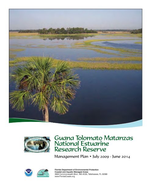
Guana Tolomato Matanzas<br />
National Estuarine<br />
<strong>Research</strong> <strong>Reserve</strong><br />
Management Plan • July 2009 - June 2014<br />
<strong>Florida</strong> <strong>Department</strong> <strong>of</strong> Environmental Protection<br />
Coastal and Aquatic Managed Areas<br />
3900 Commonwealth Blvd., MS #235, Tallahassee, FL 32399<br />
www.<strong>Florida</strong>Coasts.org
Guana Tolomato Matanzas<br />
National Estuarine <strong>Research</strong> <strong>Reserve</strong><br />
Environmental Education Center<br />
505 Guana River Road<br />
Ponte Vedra Beach, FL 32082<br />
(904) 823-4500 • Fax (904) 825-6829<br />
Marineland <strong>Office</strong><br />
9741 Ocean Shore Blvd<br />
St. Augustine, FL 32080<br />
(904) 461-4054 • Fax (904) 461-4056<br />
This management plan has been developed in<br />
accordance with National Oceanic and Atmospheric<br />
Administration regulations, including all provisions<br />
for public involvement. It is consistent with the<br />
congressional intent <strong>of</strong> Section 315 <strong>of</strong> the Coastal<br />
Zone Management Act <strong>of</strong> 1972, as amended, and the<br />
provisions <strong>of</strong> the <strong>Florida</strong> Coastal Management Program.<br />
This publication funded in part through a grant<br />
agreement from the <strong>Florida</strong> <strong>Department</strong> <strong>of</strong><br />
Environmental Protection, <strong>Florida</strong> Coastal Management<br />
Program by a grant provided by the <strong>Office</strong> <strong>of</strong> Ocean<br />
and Coastal Resource Management under the Coastal<br />
Zone Management Act <strong>of</strong> 1972, as amended, National<br />
Oceanic and Atmospheric Administration Award No.<br />
NA05NOS4191074-CZ625, NA06NOS4190129-CZ709,<br />
NA06NOS4190129-CZ726, and NA07NOS4190071-<br />
CZ823. The views, statements, finding, conclusions,<br />
and recommendations expressed herein are those <strong>of</strong><br />
the author(s) and do not necessarily reflect the views <strong>of</strong><br />
the State <strong>of</strong> <strong>Florida</strong>, National Oceanic and Atmospheric<br />
Administration, or any <strong>of</strong> its sub-agencies.<br />
July 2009 - June 2014<br />
Guana Tolomato Matanzas<br />
National Estuarine<br />
<strong>Research</strong> <strong>Reserve</strong><br />
Management Plan • July 2009 - June 2014<br />
Includes:<br />
• Guana-Tolomato-Matanzas National Estuarine <strong>Research</strong> <strong>Reserve</strong><br />
• Guana River Marsh Aquatic Preserve<br />
• Pellicer Creek Aquatic Preserve<br />
<strong>Florida</strong> <strong>Department</strong> <strong>of</strong> Environmental Protection<br />
Coastal and Aquatic Managed Areas<br />
3900 Commonwealth Blvd., MS #235, Tallahassee, FL 32399<br />
www.aquaticpreserves.org
Mission Statements<br />
<strong>Office</strong> <strong>of</strong> Coastal and Aquatic Managed Areas / The mission <strong>of</strong> the <strong>Office</strong> <strong>of</strong> Coastal and Aquatic<br />
Managed Areas in relation to <strong>Florida</strong>’s 41 aquatic preserves, three National Estuarine <strong>Research</strong> <strong>Reserve</strong>s,<br />
National Marine Sanctuary, and Coral Reef Conservation Program is to protect <strong>Florida</strong>’s coastal and<br />
aquatic resources.<br />
National Estuarine <strong>Research</strong> <strong>Reserve</strong>s (NERR) / The NERR System mission is the establishment and<br />
management, through Federal-state cooperation, <strong>of</strong> a national system <strong>of</strong> Estuarine <strong>Research</strong> <strong>Reserve</strong>s<br />
representative <strong>of</strong> the various regions and estuarine types in the United States. Estuarine <strong>Research</strong><br />
<strong>Reserve</strong>s are established to provide opportunities for long-term research, education, and interpretation.<br />
Guana Tolomato Matanzas National Estuarine <strong>Research</strong> <strong>Reserve</strong> / The <strong>GTM</strong> <strong>Research</strong> <strong>Reserve</strong> mission<br />
is to achieve the conservation <strong>of</strong> natural biodiversity and cultural resources by using the results <strong>of</strong> research<br />
and monitoring to guide science-based stewardship and education strategies.<br />
CAMA/BTIITF Approval<br />
CAMA approval date: December 30, 2008 BTIITF approval date: May 13, 2009<br />
ARC approval date: April 3, 2009 NOAA approval date: July 1, 2009<br />
:
Executive Summary<br />
In 1999, the Guana Tolomato Matanzas National Estuarine <strong>Research</strong> <strong>Reserve</strong> (<strong>GTM</strong> <strong>Research</strong> <strong>Reserve</strong>)<br />
was designated in St. Johns and Flagler counties, <strong>Florida</strong> as a part <strong>of</strong> the National Oceanic and<br />
Atmospheric Administration (NOAA) National Estuarine <strong>Research</strong> <strong>Reserve</strong> (NERR) system because <strong>of</strong><br />
its outstanding representation <strong>of</strong> the east <strong>Florida</strong> sub-region <strong>of</strong> the Carolinian bioregion and its unique<br />
combination <strong>of</strong> natural and cultural resources. The hallmark <strong>of</strong> the NERR program is that each reserve’s<br />
management efforts are in direct response to, and designed for unique local and regional issues. The<br />
purpose <strong>of</strong> this plan is to incorporate, evaluate, and prioritize all relevant information about the <strong>GTM</strong><br />
<strong>Research</strong> <strong>Reserve</strong> into management strategies, allowing for compatible public access to the managed<br />
areas while sustaining the long-term quality <strong>of</strong> its ecosystems and cultural resources.<br />
This management plan is an update to the previous five-year <strong>GTM</strong> <strong>Research</strong> <strong>Reserve</strong> plan approved<br />
on November 10, 1998. In addition to the existing NERR plan, both aquatic preserves managed by the<br />
<strong>GTM</strong> <strong>Research</strong> <strong>Reserve</strong> previously had individual management plans. The Guana River Marsh Aquatic<br />
Preserve (GRMAP) management plan was approved December 17, 1991 and the Pellicer Creek Aquatic<br />
Preserve (PCAP) management plan was approved July 9, 1991. Uplands along the Guana River that are<br />
currently managed as part <strong>of</strong> the <strong>GTM</strong> <strong>Research</strong> <strong>Reserve</strong> were previously managed as the Guana River<br />
State Park (management plan approved March 26, 1999). The inclusive management <strong>of</strong> these sites as the<br />
<strong>GTM</strong> <strong>Research</strong> <strong>Reserve</strong> represents a significant enhancement <strong>of</strong> the purpose <strong>of</strong> the property as a platform<br />
for research and education.<br />
The diversity <strong>of</strong> communities present in the 64,487 acre <strong>GTM</strong> <strong>Research</strong> <strong>Reserve</strong> provides habitat for a wide<br />
variety <strong>of</strong> fish and wildlife. A species list recently compiled for the GRMAP indicates the presence <strong>of</strong> at least<br />
44 mammal, 358 bird, 41 reptile, 21 amphibian, 303 fish, and 580 plant species. Many more species are<br />
expected to occur in the entire <strong>GTM</strong> <strong>Research</strong> <strong>Reserve</strong>. These habitats are essential to many protected<br />
species (eight plants and forty-eight animals) including the Anastasia Island beach mouse (Peromyscus<br />
polionotus phasma), gopher tortoise (Gopherus polyphemus), least tern (Sterna antillarum), marine turtles:<br />
loggerhead (Caretta caretta), leatherback (Dermochelys coriacia) and green turtle (Chelonia mydas), and<br />
North Atlantic right whale (Eubalaena glacialis). In addition, the striped newt (Notopthalmus perstriatus),<br />
one <strong>of</strong> <strong>Florida</strong>’s rarest vertebrate species, occurs within the <strong>GTM</strong> <strong>Research</strong> <strong>Reserve</strong>. Some <strong>of</strong> the many rare<br />
listed birds <strong>of</strong> the <strong>GTM</strong> <strong>Research</strong> <strong>Reserve</strong> include: great egret (Ardea alba), white ibis (Eudocimus albus),<br />
black-crowned night heron (Nycticorax nyticorax), least tern (Sterna antillarum), bald eagle (Haliaeetus<br />
leucocephalus), tricolored heron (Egretta tricolor), wood stork (Mycteria americana) and roseate spoonbill<br />
(Ajaia ajaja). The rare Atlantic geoduck (Panopea bitruncata) has also been recorded in the <strong>GTM</strong> <strong>Research</strong><br />
<strong>Reserve</strong>. With this plan the <strong>GTM</strong> <strong>Research</strong> <strong>Reserve</strong> will continue to expand its role to facilitate and conduct<br />
research and monitoring, stewardship and education strategies designed to enhance our ability to monitor<br />
the condition <strong>of</strong> these species and to conserve their habitats.<br />
Many species <strong>of</strong> commercial value are also known to use the <strong>GTM</strong> <strong>Research</strong> <strong>Reserve</strong>’s estuaries<br />
for all or part <strong>of</strong> their life cycle. These species include oysters (Crassostrea virginica), quahog clams<br />
(Mercenaria spp.), blue crabs (Callinectes sapidus), stone crabs (Menippe mercenaria), white shrimp<br />
(Penaeus setiferus), brown shrimp (Penaeus aztecus), striped and white mullet (Mugil cephalus and<br />
M. curema), gag grouper (Myctoperca microlepis), black sea bass (Centropristis striata), gray snapper<br />
(Lutjanus griseus), lane snapper (L. synagris), flounder (Paralichthys lethostigma and P. dentatus),<br />
bluefish (Pomatomus saltatrix), menhaden (Brevoortia tyrannus) and thread herring (Opisthonema<br />
oglinum). Management strategies to conserve and restore natural habitats supporting sustainable<br />
populations <strong>of</strong> these species are an important management priority for the <strong>GTM</strong> <strong>Research</strong> <strong>Reserve</strong>.<br />
Recreationally valuable species provide a valuable economic incentive for long-term conservation <strong>of</strong><br />
the <strong>GTM</strong> <strong>Research</strong> <strong>Reserve</strong>’s natural resources. Species important to the local sports fishery that are<br />
found in the <strong>GTM</strong> <strong>Research</strong> <strong>Reserve</strong> include tarpon (Tarpon atlanticus), spotted sea trout (Cynoscion<br />
nebulosus), weakfish (C. regalis), snook (Centropomus undecimalis), red drum (Sciaenops ocellata),<br />
black drum (Pogonias cromis), spot (Leiostomous xanthurus), croaker (Micropogon undulatus),<br />
sheepshead (Archosargus probatocephalus), crevalle jack (Carynx hippos), gag grouper (Myctoperca<br />
microlepis), black sea bass (Centropristis striata), gray snapper (Lutjanus griseus), lane snapper (L.<br />
synagris), <strong>Florida</strong> pompano (Trachinotus carolinus), flounder (Paralichthys sp.), striped mullet (Mugil<br />
cephalus), and sailor’s choice (Haemulon parri). Habitat and species management based on the best<br />
available scientific information is required to sustain this valuable resource.<br />
In addition to these natural resources the <strong>GTM</strong> <strong>Research</strong> <strong>Reserve</strong> contains a unique array <strong>of</strong> cultural<br />
resources. This ecosystem has been used by humans for over 5,000 years. Artifacts found in the <strong>GTM</strong>
<strong>Research</strong> <strong>Reserve</strong> area range from an arrowhead from the late Archaic (2500-1000 BC) to pottery from<br />
the 19th century. There are currently 115 recorded archaeological sites within its boundary. Known sites<br />
include a burial mound, numerous shell middens, a Spanish mission, and homestead sites from the<br />
British, Second Spanish and Territorial time periods. Culture resource interpretation and protection is<br />
given special consideration in this plan.<br />
The <strong>GTM</strong> <strong>Research</strong> <strong>Reserve</strong> also contains extensive public use amenities directly managed by the<br />
reserve staff including an extensive trail system, beaches with parking access and dune boardwalks, the<br />
Guana Lake Dam, and an Environmental Education Center that welcomes approximately 20,000 visitors<br />
per year including 2,500 students and teachers. Public use <strong>of</strong> the beaches and trail system is estimated<br />
to accommodate an additional 170,000 visitors per year. Based on local community support and public<br />
input, this management plan’s public use strategies emphasize high quality and sustainable natural<br />
resource experiences.<br />
Included in the boundary <strong>of</strong> the <strong>GTM</strong> <strong>Research</strong> <strong>Reserve</strong> are numerous conservation areas including<br />
the Guana River Wildlife Management Area, Deep Creek State Forest, Stokes Landing Conservation<br />
Area, Fort Matanzas National Monument , Washington Oaks Gardens State Park, Faver-Dykes State<br />
Park , Moses Creek Conservation , Pellicer Creek Conservation Area, Princess Place Preserve, and the<br />
River to Sea Preserve. Following the designation <strong>of</strong> the <strong>GTM</strong> <strong>Research</strong> <strong>Reserve</strong> a twenty-one member<br />
Management Advisory Group (MAG) was established. Representation consists <strong>of</strong> citizens, local<br />
government <strong>of</strong>ficials, managers <strong>of</strong> the public lands included in the boundary, private property owners,<br />
scientists and environmental educators. This advisory group provides a unique opportunity to enhance<br />
cooperative management for the conservation <strong>of</strong> this ecosystem.<br />
This revised management plan also identifies additional facilities, staffing, and boundary expansions<br />
compatible and needed for the <strong>GTM</strong> <strong>Research</strong> <strong>Reserve</strong> to continue its mission. The proposed boundary<br />
expansion includes approximately sixty-one acres <strong>of</strong> fee-simple acquisition and annexation <strong>of</strong> eightthousand-eight-hundred-sixty-five<br />
acres <strong>of</strong> public lands within or immediately adjacent to the <strong>GTM</strong><br />
<strong>Research</strong> <strong>Reserve</strong>’s existing boundary. There are no plans to change the management authority <strong>of</strong> the<br />
annexed properties. The proposed expanded boundary will enhance the <strong>GTM</strong> <strong>Research</strong> <strong>Reserve</strong>’s<br />
partnerships with key stakeholders and provide additional opportunities to restore or maintain cultural<br />
resources, natural biodiversity, and important watershed water-quality buffers and flow-ways.<br />
The management challenges affecting the <strong>GTM</strong> <strong>Research</strong> <strong>Reserve</strong> can be categorized within the<br />
following topics: Public Use, Habitat and Species Management, Watershed Landuse, Cultural Resource<br />
Preservation and Interpretation, and Global Processes. Incompatible public use and lack <strong>of</strong> a scientifically<br />
defined carrying capacity, habitat fragmentation and loss, point and non-point source pollution, protection<br />
and interpretation <strong>of</strong> cultural resources and assessing the impact <strong>of</strong> global processes are management<br />
priorities. These issues can be indirectly or directly linked to anthropogenic landuse <strong>of</strong> increasing<br />
population densities accompanied by increasing development, recreation, and economic pressures.<br />
These potential impacts to resources can affect the productivity and function <strong>of</strong> coastal ecosystems,<br />
requiring active management to restore and sustain the condition <strong>of</strong> these resources.<br />
<strong>GTM</strong> <strong>Research</strong> <strong>Reserve</strong> Management Goals<br />
Public Use<br />
Ensure user experiences are sustainable and consistent with natural and cultural resource protection for<br />
the benefit <strong>of</strong> existing and future generations.<br />
Habitat and Species Management<br />
Improve the conservation <strong>of</strong> natural biodiversity by implementing the principles <strong>of</strong> adaptive management<br />
and ecosystem science.<br />
Watershed Landuse<br />
Reduce the impact <strong>of</strong> watershed landuse on coastal resources by identifying priority pollutants and<br />
encouraging best management practices.<br />
Cultural Resource Preservation and Interpretation<br />
Enhance understanding, interpretation, and preservation <strong>of</strong> the <strong>GTM</strong> <strong>Research</strong> <strong>Reserve</strong>’s cultural resources.<br />
Global Processes<br />
Serve as a clearinghouse <strong>of</strong> information concerning global and meteorological processes and as a<br />
demonstration site for green building technologies and practices.
Table <strong>of</strong> Contents<br />
Part One / Basis for Management<br />
Chapter One<br />
1.1 / Introduction .................................................................................................................................. 1<br />
1.2 / Management Plan Purpose and Scope ...................................................................................... 4<br />
1.3 / Public Involvement ...................................................................................................................... 5<br />
Chapter Two / National Estuarine <strong>Research</strong> <strong>Reserve</strong> System (NERR)<br />
2.1 / Introduction .................................................................................................................................. 7<br />
2.2 / NERR System Mission and Goals ............................................................................................... 7<br />
2.3 / Biogeographic Regions ............................................................................................................. 13<br />
2.4 / <strong>Reserve</strong> Designation and Operation ......................................................................................... 13<br />
2.5 / Administrative Framework ......................................................................................................... 14<br />
Chapter Three / <strong>Florida</strong> <strong>Department</strong> <strong>of</strong> Environmental Protection’s <strong>Office</strong> <strong>of</strong> Coastal<br />
and Aquatic Managed Areas<br />
3.1 / Introduction ................................................................................................................................ 15<br />
3.2 / State Management Authority ..................................................................................................... 16<br />
3.3 / State Statutory Authority ............................................................................................................ 17<br />
3.4 / State Administrative Rules ......................................................................................................... 18<br />
Chapter Four / The Guana Tolomato Matanzas National Estuarine <strong>Research</strong> <strong>Reserve</strong><br />
(<strong>GTM</strong> <strong>Research</strong> <strong>Reserve</strong>)<br />
4.1 / Acquisition and Designation History <strong>of</strong> the <strong>GTM</strong> <strong>Research</strong> <strong>Reserve</strong> ....................................... 21<br />
4.2 / Resource Description ................................................................................................................ 22<br />
4.2.1 / <strong>GTM</strong> <strong>Research</strong> <strong>Reserve</strong> Mission ......................................................................................... 22<br />
4.2.2 / International/National/State/Regional Significance ............................................................ 22<br />
4.2.3 / Location/Boundaries ........................................................................................................... 23<br />
4.2.4 / Adjacent Public Lands and Conservation Areas ................................................................ 23<br />
4.2.5 / Surrounding Demographic Data and Future Projections ................................................... 26<br />
4.2.6 / Topography and Geomorphology ...................................................................................... 26<br />
4.2.7 / Geology ............................................................................................................................... 27<br />
4.2.8 / Hydrology ............................................................................................................................ 29<br />
4.2.9 / Climate ................................................................................................................................ 31<br />
4.2.10 / Natural Communities ........................................................................................................ 32<br />
4.2.11 / Listed Species ................................................................................................................... 41<br />
4.2.12 / Invasive Species ................................................................................................................ 41<br />
4.2.13 / Problem/Nuisance Species ............................................................................................... 42<br />
4.2.14 / Forest Resources .............................................................................................................. 42<br />
4.2.15 / Archaeological and Historical Resources ......................................................................... 42<br />
4.3 / Compatible and Traditional Uses .............................................................................................. 45<br />
4.4 / Non-CAMA Managed Public Lands within the <strong>GTM</strong> <strong>Research</strong> <strong>Reserve</strong> Boundary ................. 49<br />
Part Two / Management Programs and Issues<br />
Chapter Five / Program Accomplishments<br />
5.1 / Ecosystem Science ................................................................................................................... 55<br />
5.2 / Resource Management ............................................................................................................. 58<br />
5.3 / Education and Outreach ........................................................................................................... 61<br />
Chapter Six / Management Issues<br />
6.1 / Introduction to Issue-Based Management ................................................................................ 69<br />
6.2 / Public Use ................................................................................................................................. 70<br />
6.3 / Habitat and Species Management ............................................................................................ 81
6.4 / Watershed Landuse ................................................................................................................... 96<br />
6.5 / Cultural Resources .................................................................................................................... 99<br />
6.6 / Global Processes .................................................................................................................... 102<br />
Part Three / Additional Plans<br />
Chapter Seven / Administrative Plan ................................................................................................ 105<br />
Chapter Eight / Facilities Plan ........................................................................................................... 113<br />
Chapter Nine / <strong>GTM</strong> <strong>Research</strong> <strong>Reserve</strong> Boundary Expansion and Land Acquisition Plan ........ 119<br />
9.1 / Scope and Purpose ................................................................................................................. 119<br />
9.2 / Key Plan Elements ................................................................................................................... 121<br />
9.2.1 / Annexation <strong>of</strong> Existing Public Lands with No Change in Management Designation ....... 121<br />
9.2.2 / Fee Simple Acquisitions .................................................................................................... 122<br />
9.3 / Potential Funding Sources and other Conservation and Acquisition Efforts ......................... 123<br />
List <strong>of</strong> Tables<br />
Table 1 / C-CAP and FNAI habitat classification ............................................................................... 32<br />
Table 2 / Compatible public use ........................................................................................................ 48<br />
Table 3 / Numbers <strong>of</strong> individuals reached with on-site education and outreach programs. ............ 62<br />
Table 4 / Citizen support group membership and volunteers .......................................................... 63<br />
Table 5 / Numbers <strong>of</strong> participants in coastal training program workshops ...................................... 67<br />
Table 6 / Invasive non-native species .............................................................................................. 159<br />
Table 7 / Native nuisance/problem species .................................................................................... 160<br />
Table 8 / Established invasive and non-native mosquitoes ............................................................ 160<br />
Table 9 / Burn history ....................................................................................................................... 170<br />
Table 10 / Strategies: estimated timeline and cost ......................................................................... 173<br />
Table 11 / Potential for outsourcing <strong>of</strong> services .............................................................................. 193<br />
Table 12 / Management advisory group .......................................................................................... 263<br />
Table 13 / Public meetings .............................................................................................................. 264<br />
Table 14 / Recorded archaeological sites ..........................................................................................xx<br />
List <strong>of</strong> Figures<br />
Figure 1 / Boundary and location <strong>of</strong> the <strong>GTM</strong> <strong>Research</strong> <strong>Reserve</strong> indicating the area directly<br />
managed by CAMA. ............................................................................................................................ 2<br />
Figure 2 / CAMA state-wide managed resources ............................................................................... 3<br />
Figure 3 / Biogeographic regions <strong>of</strong> the NERR system ...................................................................... 8<br />
Figure 4 / Designated or proposed NERR’s ....................................................................................... 9<br />
Figure 5 / Federal management structure for the NERR system ...................................................... 14<br />
Figure 6 / Adjacent public lands and resources (northern component) .......................................... 23<br />
Figure 7 / Adjacent public lands and resources (southern component) .......................................... 24<br />
Figure 8 / Projected adjacent future land use ................................................................................... 25<br />
Figure 9 / Topography ....................................................................................................................... 26<br />
Figure 10 / Geomorphology .............................................................................................................. 27<br />
Figure 11 / Soil types (northern component ) ................................................................................... 28<br />
Figure 12 / Soil Types (southern component) ................................................................................... 28<br />
Figure 13 / Hydrology (northern component) ................................................................................... 30<br />
Figure 14 / Hydrology (southern component) .................................................................................. 31<br />
Figure 15 / Habitats ........................................................................................................................... 33<br />
Figure 16 / Cultural resources (northern component) ...................................................................... 43<br />
Figure 17 / Cultural (southern component) ....................................................................................... 44<br />
Figure 18 / Northern component public access points .................................................................... 45<br />
Figure 19 / Southern component public access points .................................................................... 46
Figure 20 / Current public use ........................................................................................................... 47<br />
Figure 21 / Issue-based adaptive management ............................................................................... 70<br />
Figure 22 / Facilities and improvements (including managed access) .......................................... 114<br />
Figure 23 / Proposed public lands annexation ............................................................................... 120<br />
Figure 24 / Proposed land acquisition (northern component) ....................................................... 121<br />
Figure 25 / Proposed land acquisition (southern component) ....................................................... 122<br />
Figure 26 / Timber assessment Letter ............................................................................................. 163<br />
Figure 27 / Prescribed fire burn units .............................................................................................. 169<br />
Figure 28 / Maintained prescribed fire lines .................................................................................... 171<br />
Figure 29 / Estimated programming costs for full implementation ................................................ 172<br />
Figure 30 / Estimated personnel needs for full implementation ..................................................... 172<br />
List <strong>of</strong> Appendices<br />
Appendix A / Additional Acquisition and Restoration Council Requirements<br />
A.1 / Executive Summary (ARC Table Format) ............................................................................... 126<br />
A.2 / Management Plan Compliance Checklist GRMAP Uplands .................................................. 127<br />
A.3 / FNAI Natural Communities (Rank and Status) ....................................................................... 129<br />
A.4 / FNAI Natural Communities Acreage ....................................................................................... 130<br />
A.5 / Species List ............................................................................................................................. 130<br />
A.6 / Designated and Listed Species (Rank and Status) ................................................................ 155<br />
A.7 / Nuisance and Invasive Species Control Plan ......................................................................... 159<br />
A.8 / Timber Resources ................................................................................................................... 163<br />
A.9 / Prescribed Fire Plan ................................................................................................................ 163<br />
A.10 / Potential Surplus Lands ........................................................................................................ 172<br />
A.11 / Budget Summary Table......................................................................................................... 172<br />
A.12 / Analysis <strong>of</strong> Contracting Potential .......................................................................................... 193<br />
A.13 / Land Management Review Team Recommendations and Management Response ........... 194<br />
A.14 / Recorded Archaeological Sites ........................................................................................... 202<br />
Appendix B / Legal Documents<br />
B.1 / Code <strong>of</strong> Federal Regulations .................................................................................................. 205<br />
B.2 / State Legal Requirements ....................................................................................................... 230<br />
B.3 / Aquatic Preserve Resolution ................................................................................................... 230<br />
B.4 / <strong>Florida</strong> Statutes (F.S.) .............................................................................................................. 231<br />
B.5 / <strong>Florida</strong> Administrative Code (F.A.C.) ....................................................................................... 231<br />
B.6 / Memorandums <strong>of</strong> Understanding ........................................................................................... 232<br />
B.7 / Trustees Lease Agreement ..................................................................................................... 267<br />
B.8 / Letter <strong>of</strong> Compliance <strong>of</strong> the Management Plan with the Local Government<br />
Comprehensive Plan ....................................................................................................................... 271<br />
Appendix C / Reference Materials<br />
C.1 / Acronym List ........................................................................................................................... 271<br />
C.2 / References ............................................................................................................................. 273<br />
Appendix D / Public Involvement<br />
D.1 / Citizen Support Organization (CSO) ...................................................................................... 276<br />
D.2 / Management Advisory Group ................................................................................................ 276<br />
D.3 / Public Meetings, Minutes and Comments .............................................................................. 277<br />
D.3.1 / First Management Advisory Group Meeting .................................................................... 277<br />
D.3.2 / First Set <strong>of</strong> General Public Meetings and Management Response ................................. 280<br />
D.3.3 / Second Management Advisory Group Meeting ............................................................... 313<br />
D.3.4 / Second Set <strong>of</strong> General Public Meetings .......................................................................... 315
Natural coquina rock formations like these found at the beach and nearshore environment at Marineland<br />
provide unique and valuable habitat and buffer shorelines from erosion by storms.<br />
Part One<br />
Basis for Management<br />
Chapter One<br />
. / Introduction<br />
The National Estuarine <strong>Research</strong> <strong>Reserve</strong> (NERR) System is a network <strong>of</strong> protected areas established<br />
for long-term research, education, and stewardship. Section 315 <strong>of</strong> the Coastal Zone Management<br />
Act (CZMA) <strong>of</strong> 1972, as amended, established the National Estuarine <strong>Research</strong> <strong>Reserve</strong> System to be<br />
administered by the National Oceanic and Atmospheric Administration (NOAA) in cooperation with the<br />
coastal states in which the NERRs are designated. Under the system, healthy estuarine ecosystems<br />
which typify different regions <strong>of</strong> the U.S. are designated and managed as sites for long-term research<br />
and are used as a base for estuarine education and interpretation programs. The system also provides a<br />
framework through which research results and techniques for estuarine education and interpretation can<br />
be shared throughout the region and across the nation.<br />
This partnership program between NOAA and the coastal states protects more than one million<br />
acres <strong>of</strong> estuarine land and water, which provide essential habitat for wildlife; <strong>of</strong>fer educational<br />
opportunities for students, teachers and the public; and serve as living laboratories for scientists.<br />
The Guana Tolomato Matanzas National Estuarine <strong>Research</strong> <strong>Reserve</strong> (<strong>GTM</strong> <strong>Research</strong> <strong>Reserve</strong>,<br />
Figure 1) was designated in St. Johns and Flagler counties, <strong>Florida</strong> as a part <strong>of</strong> this system because<br />
<strong>of</strong> its outstanding representation <strong>of</strong> the east <strong>Florida</strong> sub-region <strong>of</strong> the Carolinian bioregion and its<br />
unique combination <strong>of</strong> natural and cultural resources. The site selection process for this the <strong>GTM</strong><br />
<strong>Research</strong> <strong>Reserve</strong> began in September <strong>of</strong> 1991. The present day <strong>GTM</strong> <strong>Research</strong> <strong>Reserve</strong> was<br />
selected by a committee <strong>of</strong> scientists, environmental educators and coastal managers because it met<br />
the overall needs <strong>of</strong> a relatively pristine habitat for scientific research and environmental education<br />
opportunities. The selection was supported by citizens and legislators <strong>of</strong> St. Johns and Flagler<br />
counties. The Governor and Cabinet <strong>of</strong> the State <strong>of</strong> <strong>Florida</strong> then nominated the estuaries comprising
St. Augustine<br />
§¨¦ 95<br />
Ponte<br />
Vedra<br />
Beach<br />
£¤<br />
0 2 4<br />
Miles<br />
^_<br />
Æ· A1A<br />
Palm<br />
Coast<br />
Æ· A1A<br />
St. Augustine Inlet<br />
^_<br />
Matanzas<br />
Inlet<br />
<strong>GTM</strong> <strong>Research</strong> <strong>Reserve</strong> Boundary<br />
CAMA Managed Lands<br />
Gulf <strong>of</strong> Mexico<br />
±<br />
Atlantic Ocean<br />
Guana River Marsh Aquatic Preserve<br />
Pellicer Creek Aquatic Preserve<br />
<strong>GTM</strong> <strong>Research</strong> <strong>Reserve</strong> Southern Component<br />
^ <strong>GTM</strong> <strong>Research</strong> <strong>Reserve</strong> <strong>Office</strong>s<br />
May 2008<br />
Figure / Boundary and location <strong>of</strong> the <strong>GTM</strong><br />
<strong>Research</strong> <strong>Reserve</strong> indicating the area directly<br />
managed by CAMA.<br />
the Guana, Tolomato and Matanzas including<br />
the Pellicer Creek Aquatic Preserve (PCAP)<br />
and Guana River Marsh Aquatic Preserve<br />
(GRMAP) as the now existing <strong>GTM</strong> <strong>Research</strong><br />
<strong>Reserve</strong>. The final <strong>GTM</strong> <strong>Research</strong> <strong>Reserve</strong><br />
designation was made in August, 1999. In<br />
January 2004, management authority <strong>of</strong> Guana<br />
River State Park was conveyed to the DEP,<br />
<strong>Office</strong> <strong>of</strong> Coastal and Aquatic Managed Areas<br />
(CAMA). Within the <strong>GTM</strong> <strong>Research</strong> <strong>Reserve</strong>,<br />
CAMA directly manages the PCAP, portions <strong>of</strong><br />
the GRMAP including the lands that formerly<br />
made up the Guana River State Park, and other<br />
state sovereign submerged lands within the<br />
Matanzas River and its tributaries inside the<br />
<strong>GTM</strong> <strong>Research</strong> <strong>Reserve</strong> designated boundary<br />
that were classified as Class II or Outstanding<br />
<strong>Florida</strong> Waters as <strong>of</strong> 1998 (<strong>Florida</strong> <strong>Department</strong><br />
<strong>of</strong> Environmental Protection, 1998). This area<br />
includes tidally submerged state sovereign<br />
adjacent to and within the Intracoastal Waterway<br />
and its tributaries, excluding the Treasure Beach<br />
Canal System - From Intracoastal Waterway<br />
marker number 29, south to an east-west line<br />
through marker number 109).<br />
The <strong>Florida</strong> NERRs are administered on behalf<br />
<strong>of</strong> the State by the DEP <strong>Office</strong> <strong>of</strong> CAMA as part<br />
<strong>of</strong> a network (Figure 2) that includes forty-one<br />
aquatic preserves, three NERRs, a National<br />
Marine Sanctuary (NMS), the Coral Reef<br />
Conservation Program (CRCP), and the <strong>Florida</strong><br />
Oceans and Coastal Council. This provides<br />
for a system <strong>of</strong> significant protections to<br />
ensure that our most popular and ecologically<br />
important underwater ecosystems are cared<br />
for in perpetuity. Each <strong>of</strong> these special places<br />
is managed with strategies based on local<br />
resources, issues, and conditions.<br />
Our expansive coastline and wealth <strong>of</strong> aquatic<br />
resources have defined <strong>Florida</strong> as a subtropical<br />
oasis, attracting millions <strong>of</strong> residents and<br />
visitors, and the businesses that serve them.<br />
<strong>Florida</strong>’s submerged lands play important roles<br />
in maintaining good water quality, hosting a<br />
diversity <strong>of</strong> wildlife and habitats (including<br />
economically and ecologically valuable nursery<br />
areas), and supporting a treasured quality <strong>of</strong><br />
life for all. In the 1960s, it became apparent<br />
that the ecosystems that had attracted so<br />
many people to <strong>Florida</strong> could not support<br />
rapid growth without science-based resource<br />
protection and management. To this end, state<br />
legislators provided extra protection for certain<br />
exceptional aquatic areas by designating them<br />
as aquatic preserves.<br />
Title to submerged lands not previously conveyed<br />
to private landowners is held by the Board <strong>of</strong><br />
Trustees <strong>of</strong> the Internal Improvement Trust Fund
Santa Rosa<br />
Escambia<br />
Okaloosa Walton<br />
Yellow River<br />
Marsh<br />
Fort Pickens<br />
±<br />
Alabama<br />
Rocky<br />
Bayou<br />
Holmes<br />
Washington<br />
Bay<br />
St. Andrews<br />
December, 2006<br />
Aquatic Preserves<br />
St.<br />
Joseph<br />
Bay<br />
Jackson<br />
Calhoun<br />
Gulf<br />
Liberty<br />
Franklin<br />
Apalachicola<br />
Bay<br />
Gulf <strong>of</strong> Mexico<br />
Gadsden<br />
Wakulla<br />
Alligator<br />
Harbor<br />
Apalachicola<br />
National Estuarine <strong>Research</strong> <strong>Reserve</strong>s<br />
0 25 50 100 150<br />
Miles<br />
Lake<br />
Jackson<br />
Leon Jefferson Madison<br />
Big Bend<br />
Seagrasses<br />
Taylor<br />
Aquatic Preserves layer maintained by: <strong>Office</strong> <strong>of</strong> Coastal and<br />
Aquatic Managed Areas, 3900 Commonwealth Blvd, MS 235,<br />
Tallahassee, FL 32399-3000, 850-245-2094<br />
Map Figure 2 / CAMA / CAMA System state-wide Map managed resources.<br />
Suwannee<br />
Columbia<br />
Rainbow<br />
Marion<br />
Springs<br />
Wekiva<br />
Volusia<br />
Citrus<br />
River<br />
Lake<br />
Sumter<br />
Seminole<br />
(the Trustees). The Governor and Cabinet, sitting as the Trustees, act as guardians for the people <strong>of</strong> the<br />
State <strong>of</strong> <strong>Florida</strong> (§253.03, <strong>Florida</strong> Statutes [F.S.]) and regulate the use <strong>of</strong> these public lands. Through<br />
statute, the Trustees have the authority to adopt rules related to the management <strong>of</strong> sovereignty (<strong>Florida</strong><br />
Aquatic Preserve Act <strong>of</strong> 1975). A higher layer <strong>of</strong> protection is afforded to aquatic preserves which include<br />
areas <strong>of</strong> sovereignty lands that have been “set aside forever as aquatic preserves or sanctuaries for the<br />
benefit <strong>of</strong> future generations” due to “exceptional biological, aesthetic, and scientific value” (<strong>Florida</strong><br />
Aquatic Preserve Act <strong>of</strong> 1975, §258.36, F.S.).<br />
Georgia<br />
Lafayette<br />
Dixie<br />
Hamilton<br />
Gilchrist<br />
St. Martins<br />
Marsh<br />
Pinellas<br />
County<br />
Boca Ciega<br />
Bay<br />
Levy<br />
Terra Ceia<br />
Baker<br />
Union<br />
Clay<br />
Bradford<br />
Alachua<br />
Oklawaha<br />
River<br />
Hernando<br />
Pasco<br />
Hillsborough<br />
PinellasCockroach<br />
Bay<br />
Manatee<br />
Sarasota<br />
Nassau<br />
Duval<br />
Putnam<br />
Rookery Bay<br />
Polk<br />
Hardee<br />
DeSoto<br />
St. Johns<br />
Flagler<br />
Orange<br />
Collier<br />
Osceola<br />
Highlands<br />
Lemon Bay<br />
Cape Haze<br />
Charlotte Glades<br />
Gasparilla Sound -<br />
Charlotte Harbor<br />
Matlacha Pass<br />
Pine<br />
Island<br />
Sound<br />
Lee<br />
Hendry<br />
Estero Bay<br />
Rookery Bay<br />
Cape Romano -<br />
Ten Thousand Islands<br />
<strong>Florida</strong> Keys National Marine Sanctuary<br />
Southeast <strong>Florida</strong> Coral Reef Initiative<br />
Fort Clinch<br />
Nassau River -<br />
St. Johns<br />
River Marshes<br />
Guana River Marsh<br />
Guana - Tolomato - Matanzas<br />
Pellicer Creek<br />
Tomoka<br />
Marsh<br />
Brevard<br />
Indian River<br />
Martin<br />
Palm Beach<br />
Broward<br />
Monroe<br />
Miami-Dade<br />
Lignumvitae Key<br />
Coupon Bight<br />
Mosquito<br />
Lagoon<br />
Banana River<br />
Okeechobee St. Lucie<br />
North Fork,<br />
St. Lucie<br />
Atlantic Ocean<br />
Indian River -<br />
Malabar to<br />
Vero Beach<br />
Indian River -<br />
Vero Beach<br />
to Fort Pierce<br />
Jensen Beach<br />
to Jupiter Inlet<br />
Loxahatchee<br />
River - Lake<br />
Worth Creek<br />
Biscayne Bay -<br />
Cape <strong>Florida</strong><br />
to Monroe<br />
County Line<br />
Biscayne Bay<br />
Aquatic Preserves include all the state-owned submerged<br />
lands within their boundaries. This map is not intended<br />
for use for determination <strong>of</strong> wetlands or land ownership.
Recreation is an important ecological service provided by <strong>GTM</strong> <strong>Research</strong> <strong>Reserve</strong>.<br />
. / Management Plan Purpose and Scope<br />
The NOAA requirements for the preparation <strong>of</strong> management plans are outlined in the National Estuarine<br />
<strong>Research</strong> <strong>Reserve</strong> Program Regulations (CZMA section 315, and 15 Code <strong>of</strong> Federal Regulations<br />
(CFR) Part 921). The federal regulations ensure that NERR management programs are consistent<br />
with the goals, objectives, and policies <strong>of</strong> the NERR System. The mandate for developing aquatic<br />
preserve management plans is outlined in Rule 18-20.013 and Subsection 18-18.013(2) <strong>of</strong> the <strong>Florida</strong><br />
Administrative Code (F.A.C.).<br />
Management plan development and review begins with collecting resource information from historical<br />
data, research and monitoring and includes input from individual CAMA managers and staff, area<br />
stakeholders, and members <strong>of</strong> the general public. The statistical data, public comment, and cooperating<br />
agency information, is then used to identify management issues and threats affecting the present<br />
and future integrity <strong>of</strong> the site, its boundaries, and adjacent areas. This information is utilized in the<br />
development and review <strong>of</strong> the management plan, which is examined for consistency with the statutory<br />
authority and intent <strong>of</strong> the aquatic preserve and NERR programs. Each management plan is evaluated<br />
periodically and revised as necessary to allow for strategic improvements. Intended to be used by site<br />
managers and other agencies or private groups involved with maintaining the natural integrity <strong>of</strong> these<br />
resources, the plan includes scientific information about the existing conditions <strong>of</strong> the site and the<br />
management strategies developed to respond to those conditions.<br />
This management plan is an update to the previous five-year <strong>GTM</strong> <strong>Research</strong> <strong>Reserve</strong> plan approved on<br />
November 10, 1998. In addition to the existing NERR plan, both aquatic preserves managed by the <strong>GTM</strong><br />
<strong>Research</strong> <strong>Reserve</strong> previously had individual management plans. The GRMAP management plan was<br />
approved December 17, 1991 and the PCAP management plan was approved July 9, 1991. Uplands<br />
along the Guana River that are currently managed as part <strong>of</strong> the <strong>GTM</strong> <strong>Research</strong> <strong>Reserve</strong> were previously<br />
managed as the Guana River State Park (management plan approved March 26, 1999). The management<br />
<strong>of</strong> these sites as the <strong>GTM</strong> <strong>Research</strong> <strong>Reserve</strong> represents a significant enhancement <strong>of</strong> the purpose <strong>of</strong> the<br />
property as a platform for research and education.
. / Public Involvement<br />
CAMA recognizes the importance <strong>of</strong> stakeholder participation and encourages their involvement in the<br />
management plan development process. CAMA is also committed to meeting the requirements <strong>of</strong> the<br />
Sunshine Law, §286.011, F.S. and federal regulations 15 CFR 921.33:<br />
• Meetings <strong>of</strong> public boards or commissions must be open to the public;<br />
• Reasonable notice <strong>of</strong> such meetings must be given; and<br />
• Minutes <strong>of</strong> the meetings must be recorded.<br />
• NOAA may require public notice, including notice in the Federal Register and an opportunity for<br />
public comment before approving a boundary or management plan change.<br />
Several key steps have been taken during the development <strong>of</strong> this management plan. First, staff<br />
organized an advisory committee comprised <strong>of</strong> key stakeholders. Next, staff advertised and conducted<br />
public meetings to receive input from stakeholders on the concerns and perceived issues affecting the<br />
<strong>GTM</strong> <strong>Research</strong> <strong>Reserve</strong>. This input was utilized in the development <strong>of</strong> a draft management plan that was<br />
reviewed by CAMA staff, the advisory committee, and NOAA. After the initial reviews, the staff advertised<br />
and conducted, in conjunction with the advisory committee, a second public meeting to engage the<br />
stakeholders for feedback on the draft plan and the development <strong>of</strong> the final draft <strong>of</strong> the management<br />
plan. For additional information about the advisory committee and the public meetings refer to Appendix<br />
D / Public Involvement. All public meeting notices were posted on the property, electronically mailed to<br />
a large recipient list, placed on the DEP Associated Press wire, announced at a scheduled governmental<br />
meeting and advertised in the <strong>Florida</strong> Administrative Weekly.
Marshes provide nutrients, filter pollutants and serve as habitats to conserve natural biodiversity that<br />
is necessary to sustain recreational and commercially important species.<br />
Chapter Two<br />
National Estuarine <strong>Research</strong> <strong>Reserve</strong> System<br />
. / Introduction<br />
The National Estuarine <strong>Research</strong> <strong>Reserve</strong> (NERR) System was created by the Coastal Zone Management<br />
Act (CZMA) <strong>of</strong> 1972, as amended, 16 U.S.C. Section 1461, to augment the Federal Coastal Zone<br />
Management (CZM) Program. The CZM Program is dedicated to comprehensive, sustainable<br />
management <strong>of</strong> the nation’s coasts.<br />
The <strong>Reserve</strong> system is a network <strong>of</strong> protected areas established to promote informed management <strong>of</strong> the<br />
Nation’s estuaries and coastal habitats. The <strong>Reserve</strong> system currently consists <strong>of</strong> 27 reserves in 22 states<br />
and territories, protecting over one million acres <strong>of</strong> estuarine lands and waters.<br />
. / NERR System Mission and Goals<br />
NERR Mission - As stated in the NERR regulations, 15 Code <strong>of</strong> Federal Regulations (CFR) Part 921.1(a),<br />
the NERR System mission is:<br />
“the establishment and management, through Federal-state cooperation, <strong>of</strong> a national system <strong>of</strong><br />
Estuarine <strong>Research</strong> <strong>Reserve</strong>s representative <strong>of</strong> the various regions and estuarine types in the United<br />
States. Estuarine <strong>Research</strong> <strong>Reserve</strong>s are established to provide opportunities for long-term research,<br />
education, and interpretation.”<br />
NERR System Goals - Federal regulations, 15 CFR Part 921.1(b), provide five specific goals for the<br />
NERR System:<br />
1. Ensure a stable environment for research through long-term protection <strong>of</strong> NERR resources;<br />
2. Address coastal management issues identified as significant through coordinated estuarine research<br />
within the System;
3. Enhance public awareness and understanding <strong>of</strong> estuarine areas and provide suitable opportunities<br />
for public education and interpretation;<br />
4. Promote federal, state, public and private use <strong>of</strong> one or more reserves within the System when such<br />
entities conduct estuarine research; and<br />
5. Conduct and coordinate estuarine research within the System, gathering and making available<br />
information necessary for improved understanding and management <strong>of</strong> estuarine areas.<br />
Similar to other NERR sites, the <strong>GTM</strong> <strong>Research</strong> <strong>Reserve</strong> serves as a platform for research and education<br />
and as a clearinghouse for science based information to guide the conservation <strong>of</strong> natural and cultural<br />
resources within the region. This is accomplished by conducting and facilitating scientific studies and<br />
symposia which in turn are used to guide the <strong>GTM</strong> <strong>Research</strong> <strong>Reserve</strong>’s environmental education and<br />
stewardship programs. This process <strong>of</strong> adaptive management ensures that the best available information<br />
is provided to citizens, coastal managers and elected <strong>of</strong>ficials making decisions affecting coastal habitats.<br />
These activities also provide a mechanism for coordinated ecosystem management <strong>of</strong> lands within the<br />
<strong>GTM</strong> <strong>Research</strong> <strong>Reserve</strong> boundary and its watershed.<br />
NERR System Strategic Goals 2005 to 2010 - The NERR System began a strategic planning process in<br />
1994 in an effort to help NOAA achieve its environmental stewardship mission to “sustain healthy coasts.”<br />
In conjunction with the strategic planning process, Estuarine <strong>Reserve</strong>s Division (ERD) and <strong>Reserve</strong> staff<br />
has conducted a multi-year action planning process on an annual basis since 1996. The resulting threeyear<br />
action plan provides an overall vision and direction for the <strong>Reserve</strong> system. As part <strong>of</strong> this process,<br />
the <strong>Reserve</strong> system developed a vision: Healthy estuaries and watersheds where coastal communities<br />
and ecosystems thrive; and mission: To practice and promote coastal and estuarine stewardship through<br />
innovative research and education, using a system <strong>of</strong> protected areas. The following three goals are<br />
outlined in the 2005-2010 Strategic Plan.<br />
1. Strengthen the protection and management <strong>of</strong> representative estuarine ecosystems to advance<br />
estuarine conservation, research and education.<br />
Californian<br />
Columbian<br />
17<br />
16<br />
15<br />
18<br />
14<br />
19<br />
Sub-Arctic<br />
26<br />
25<br />
Insular:<br />
Fjord<br />
24<br />
27. Hawaiian Islands<br />
28.Western Pacific Island<br />
29.Eastern Pacific Island<br />
Key:<br />
Figure / Biogeographic regions <strong>of</strong> NERR.<br />
13<br />
20<br />
12<br />
Louisianan<br />
Contains reserve<br />
No reserve, unrepresented region<br />
No reserve, represented region<br />
<strong>Reserve</strong><br />
Proposed reserve<br />
Great Lake s<br />
11<br />
21<br />
22<br />
10<br />
23<br />
7<br />
8<br />
9<br />
6<br />
5<br />
Carolinian<br />
4<br />
3<br />
West India n<br />
2<br />
1<br />
Virginian<br />
Acadian
Figure / NERR systems. (* designates proposed site)<br />
. Wells, Maine<br />
. North Carolina<br />
. Great Bay, New Hampshire<br />
. Waquoit Bay, Massachusetts<br />
. Narragansett Bay, Rhode Island<br />
. Connecticut*<br />
6. Hudson River, New York<br />
. Jacques Cousteau, New Jersey<br />
. Delaware<br />
. Chesapeake Bay, Maryland<br />
0. Chesapeake Bay, Virginia<br />
. North Inlet-Winyah Bay, South Carolina<br />
. ACE Basin, South Carolina<br />
. Sapelo Island, Georgia<br />
. Guana Tolomato Matanzas, <strong>Florida</strong><br />
6. Rookery Bay, <strong>Florida</strong><br />
. Apalachicola, <strong>Florida</strong><br />
. Weeks Bay, Alabama<br />
. Grand Bay, Mississippi<br />
0. Mission-Aransas, Texas<br />
. Tijuana River, California<br />
. Elkhorn Slough, California<br />
. San Francisco, California<br />
. South Slough, Oregon<br />
. Padilla Bay, Washington<br />
6. Wisconsin*<br />
. Old Woman Creek, Ohio<br />
. St. Lawrence River, New York*<br />
. Kachemak Bay, Alaska<br />
0. Jobos Bay, Puerto Rico<br />
2. Increase the use <strong>of</strong> <strong>Reserve</strong> science and sites to address priority coastal management issues.<br />
. Enhance peoples’ ability and willingness to make informed decisions and take responsible actions<br />
that affect coastal communities and ecosystems.<br />
The <strong>GTM</strong> <strong>Research</strong> <strong>Reserve</strong> is managed compatibly with the NERR’s Program vision and 2005-2010<br />
Strategic Goals.<br />
The issue topic areas <strong>of</strong> the <strong>GTM</strong> <strong>Research</strong> <strong>Reserve</strong>’s management plan (Watershed Landuse,<br />
Cultural Resource Preservation and Interpretation, Public Use, Habitat and Species Management and<br />
Global Processes) have a direct linkage with the National Program’s priority management issues <strong>of</strong><br />
land use and population growth, habitat loss and alteration, water quality degradation and changes<br />
in biological communities.
0<br />
The <strong>GTM</strong> <strong>Research</strong> <strong>Reserve</strong> and other <strong>Reserve</strong>s share the National Program’s 2005- 2010 Strategic Plan<br />
- guiding Principles (http://www.nerrs.noaa.gov/Background_StrategicPlan.html):<br />
• Strong partnerships between NOAA, state agencies and universities, and other local partners are<br />
critical to the success <strong>of</strong> the reserve system.<br />
• The reserve system integrates science, education and stewardship on relevant topics to maximize the<br />
benefits to coastal management.<br />
• <strong>Reserve</strong>s serve as a catalyst and a focal point for demonstrating and facilitating objective problem<br />
solving and best management practices.<br />
• <strong>Reserve</strong>s engage local communities and citizens to improve stewardship <strong>of</strong> coastal areas.<br />
• <strong>Reserve</strong>s implement an ecosystem-based management approach.<br />
NERR System National Programs<br />
The three major elements <strong>of</strong> the <strong>Reserve</strong> System are:<br />
(1) <strong>Research</strong> on estuarine habitats and processes,<br />
(2) Education and interpretation <strong>of</strong> estuarine processes and<br />
(3) Resource stewardship.<br />
NERR System <strong>Research</strong> and Monitoring Program<br />
The <strong>Reserve</strong> System provides a mechanism for addressing scientific and technical aspects <strong>of</strong> coastal<br />
management problems through a comprehensive, interdisciplinary, and coordinated approach. <strong>Research</strong><br />
and monitoring programs, including the development <strong>of</strong> baseline information, form the basis <strong>of</strong> this<br />
approach. <strong>Reserve</strong> research and monitoring activities are guided by national plans that identify goals,<br />
priorities, and implementation strategies for these programs. This approach, when used in combination<br />
with the education and outreach programs, will help ensure the availability <strong>of</strong> scientific information that<br />
has long-term, system-wide, consistency and utility for managers and members <strong>of</strong> the public to use in<br />
protecting or improving natural processes in their estuaries.<br />
NERR System <strong>Research</strong> Funding Priorities<br />
Federal regulations 15 C.F.R. 921.50(a) specify the purposes for which research funds are to be used:<br />
• Support management-related research that will enhance scientific understanding <strong>of</strong> the <strong>Reserve</strong><br />
ecosystem;<br />
• Provide information needed by reserve managers and coastal ecosystem policy makers, and;<br />
• Improve public awareness and understanding <strong>of</strong> estuarine ecosystems and estuarine management<br />
issues.<br />
The <strong>Reserve</strong> System has identified the following five priority research areas to complement the funding<br />
priorities outlined above:<br />
1. Habitat and ecosystem processes<br />
2. Anthropogenic influences on estuaries<br />
3. Habitat conservation and restoration<br />
4. Species management<br />
5. Social science and economics<br />
NERR System <strong>Research</strong> Goals<br />
The <strong>Reserve</strong> System research goals are embedded in Goal 2 <strong>of</strong> the <strong>Reserve</strong> System Strategic Plan 2005-<br />
2010, ‘Increase the use <strong>of</strong> reserve science and sites to address priority coastal management issues,’ and<br />
are outlined in the 2006-2011 <strong>Reserve</strong> System <strong>Research</strong> and Monitoring Plan. They include:<br />
• Biological, chemical, physical, and ecological conditions <strong>of</strong> reserves are characterized and monitored<br />
to describe reference conditions and to quantify change.<br />
• Scientists conduct research at reserves that is relevant to coastal management needs and increases<br />
basic understanding <strong>of</strong> estuarine processes.
• Scientists have access to NERRS datasets, science products and results.<br />
• The scientific, coastal management and education communities, as well as the general public, use<br />
data, products tools, and techniques generated at the NERRS.<br />
There are two reserve system efforts to fund research on the previously described areas.<br />
The Graduate <strong>Research</strong> Fellow (GRF) Program supports students to produce high quality research in<br />
the reserves. The fellowship provides graduate students with funding for one to three years to conduct<br />
their research, as well as an opportunity to assist with the research and monitoring program in a<br />
reserve. Projects must address coastal management issues identified as having regional or national<br />
significance, relate them to the <strong>Reserve</strong> System research focus areas, and be conducted at least<br />
partially within one or more designated reserve sites. Students work with the research coordinator<br />
or manager at the host reserve to develop a plan to participate in the reserve’s research and/or<br />
monitoring program. Students are asked to provide up to 15 hours per week <strong>of</strong> research and/or<br />
monitoring assistance to the reserve. This training may take place throughout the school year or may<br />
be concentrated during a specific season.<br />
Secondly, research is funded through the Cooperative Institute for Coastal and Estuarine Environmental<br />
Technology (CICEET), a partnership between NOAA and the University <strong>of</strong> New Hampshire (UNH).<br />
CICEET uses the capabilities <strong>of</strong> UNH, the private sector, academic and public research institutions<br />
throughout the U.S., as well as the 27 reserves in the reserve system, to develop and apply new<br />
environmental techniques.<br />
NERR System-Wide Monitoring Program (SWMP)<br />
It is the policy <strong>of</strong> the <strong>GTM</strong> <strong>Research</strong> <strong>Reserve</strong> to implement each phase <strong>of</strong> the System-wide Monitoring<br />
Plan initiated by ERD in 1989, and as outlined in the reserve system regulations and strategic plan:<br />
• Phase I: Environmental Characterization, including studies necessary for inventory and<br />
comprehensive site descriptions;<br />
• Phase II: Site Pr<strong>of</strong>ile, to include a synthesis <strong>of</strong> data and information; and<br />
• Phase III: Implementation <strong>of</strong> the System-wide Monitoring Program.<br />
The System-wide Monitoring Program provides standardized data on national estuarine environmental<br />
trends while allowing the flexibility to assess coastal management issues <strong>of</strong> regional or local concern.<br />
The principal mission <strong>of</strong> the monitoring program is to develop quantitative measurements <strong>of</strong> short-term<br />
variability and long-term changes in the integrity and biodiversity <strong>of</strong> representative estuarine ecosystems<br />
and coastal watersheds for the purposes <strong>of</strong> contributing to effective coastal zone management. The<br />
program is designed to enhance the value and vision <strong>of</strong> the reserves as a system <strong>of</strong> national reference<br />
sites. The program currently has three main components and the first is in operation.<br />
1. Abiotic Variables: The monitoring program currently measures pH, conductivity, salinity, temperature,<br />
dissolved oxygen, turbidity, water level and atmospheric conditions. In addition the program collects<br />
monthly nutrient and chlorophyll A samples and monthly diel samples at one SWMP data logger<br />
station. Each reserve uses a set <strong>of</strong> automated instruments and weather stations to collect these data<br />
for submission to a centralized data management <strong>of</strong>fice.<br />
2. Biotic Variables: The reserve system will incorporate monitoring <strong>of</strong> organisms and habitats into the<br />
monitoring programs as funds become available. The first aspects likely to be incorporated will<br />
quantify vegetation (e.g., marsh vegetation, submerged aquatic vegetation) patterns and their change<br />
over space and time. Other aspects that could be incorporated include monitoring infaunal benthic,<br />
nekton and plankton communities.<br />
3. Landuse, Habitat Mapping and Change: This component will be developed to identify changes in<br />
coastal ecological conditions with the goal <strong>of</strong> tracking and evaluating changes in coastal habitats and<br />
watershed landuse/cover. The main objective <strong>of</strong> this element will be to examine the links between<br />
watershed land use activities and coastal habitat quality.<br />
These data are compiled electronically at a central data management “hub”, the Centralized Data<br />
Management <strong>Office</strong> (CDMO) at the Belle W. Baruch Institute for Marine Biology and Coastal <strong>Research</strong><br />
<strong>of</strong> the University <strong>of</strong> South Carolina. They provide additional quality control for data and metadata and<br />
they compile and disseminate the data and summary statistics via the Web (http://cdmo.baruch.sc.edu)<br />
where researchers, coastal managers and educators readily access the information. The metadata<br />
meets the standards <strong>of</strong> the Federal Geographical Data Committee.
NERR System Education Program<br />
The <strong>Reserve</strong> System provides a vehicle to increase understanding and awareness <strong>of</strong> estuarine<br />
systems and improve decision-making among key audiences to promote stewardship <strong>of</strong> the nation’s<br />
coastal resources. Education and interpretation in the reserves incorporate a range <strong>of</strong> programs and<br />
methodologies that are systematically tailored to key audiences around priority coastal resource issues<br />
and incorporates science-based content. <strong>Reserve</strong> staff members work with local communities and<br />
regional groups to address coastal resource management issues, such as non-point source pollution,<br />
habitat restoration and invasive species. Through integrated research and education programs, the<br />
reserves help communities develop strategies to deal successfully with these coastal resource issues.<br />
Formal and non-formal education and training programs in the NERRS target K-12 students, teachers,<br />
university and college students and faculty, as well as coastal decision-maker audiences such as<br />
environmental groups, pr<strong>of</strong>essionals involved in coastal resource management, municipal and county<br />
zoning boards, planners, elected <strong>of</strong>ficials, landscapers, eco-tour operators and pr<strong>of</strong>essional associations.<br />
K-12 and pr<strong>of</strong>essional development programs for teachers include the use <strong>of</strong> established coastal and<br />
estuarine science curricula aligned with state and national science education standards and frequently<br />
involve both on-site and in-school follow-up activity. <strong>Reserve</strong> education activities are guided by national<br />
plans that identify goals, priorities, and implementation strategies for these programs. Education and<br />
training programs, interpretive exhibits and community outreach programs integrate elements <strong>of</strong> NERRS<br />
science, research and monitoring activities and ensure a systematic, multi-faceted, and locally focused<br />
approach to fostering stewardship.<br />
NERR System Education Goals<br />
The National Estuarine <strong>Research</strong> <strong>Reserve</strong> System’s mission includes an emphasis on education,<br />
interpretation and outreach. Education policy at the <strong>GTM</strong> <strong>Research</strong> <strong>Reserve</strong> is designed to fulfill the<br />
reserve system goals as defined in the regulations 15 C.F.R. 921.1(b). Education goals include:<br />
1. Enhance public awareness and understanding <strong>of</strong> estuarine areas and provide suitable opportunities<br />
for public education and interpretation;<br />
2. Conduct and coordinate estuarine research within the system, gathering and making available<br />
information necessary for improved understanding and management <strong>of</strong> estuarine areas.<br />
NERR system Education Objectives<br />
Education-related objectives in the <strong>Reserve</strong> System Strategic Plan 2005-2010 include:<br />
1. People are aware <strong>of</strong> the ecological, economic, historical, and cultural importance <strong>of</strong> estuarine resources.<br />
2. People understand how human choices and natural disturbances impact social, economic, and<br />
estuarine ecological systems.<br />
3.People apply science-based information when making decisions that could impact coastal and<br />
estuarine resources.<br />
NERR System Coastal Training Program<br />
The Coastal Training Program (CTP) provides up-to-date scientific information and skill-building<br />
opportunities to coastal decision-makers who are responsible for making decisions that affect coastal<br />
resources. Through this program, National Estuarine <strong>Research</strong> <strong>Reserve</strong>s can ensure that coastal<br />
decision-makers have the knowledge and tools they need to address critical resource management<br />
issues <strong>of</strong> concern to local communities.<br />
Coastal training programs <strong>of</strong>fered by reserves relate to coastal habitat conservation and restoration,<br />
biodiversity, water quality and sustainable resource management and integrate reserve-based research,<br />
monitoring and stewardship activities. Programs target a range <strong>of</strong> audiences, such as land-use planners,<br />
elected <strong>of</strong>ficials, regulators, land developers, community groups, environmental non-pr<strong>of</strong>its, business<br />
and applied scientific groups. These training programs provide opportunities for pr<strong>of</strong>essionals to network<br />
across disciplines and develop new collaborative relationships to solve complex environmental problems.<br />
Additionally, the CTP provides a critical feedback loop to ensure that pr<strong>of</strong>essional audiences inform local<br />
and regional science and research agendas. Programs are developed in a variety <strong>of</strong> formats ranging<br />
from seminars, hands-on skill training, participatory workshops, lectures and technology demonstrations.<br />
Participants benefit from opportunities to share experiences and network in a multidisciplinary setting,<br />
<strong>of</strong>ten with a reserve-based field activity.
Partnerships are important to the success <strong>of</strong> the Program. <strong>Reserve</strong>s work closely with state coastal<br />
programs, Sea Grant College extension and education staff, and a host <strong>of</strong> local partners in determining<br />
key coastal resource issues to address, as well as the identification <strong>of</strong> target audiences. Partnerships with<br />
local agencies and organizations are critical in the exchange and sharing <strong>of</strong> expertise and resources to<br />
deliver relevant and accessible training programs that meet the needs <strong>of</strong> specific groups.<br />
The Coastal Training Program requires a systematic program development process, involving periodic<br />
review <strong>of</strong> the reserve niche in the training provider market, audience assessments, and development <strong>of</strong><br />
a three to five year program strategy, a marketing plan and the establishment <strong>of</strong> an advisory group for<br />
guidance, program review and perspective in program development. The CTP implements a performance<br />
monitoring system, wherein staff report data in operations progress reports according to a suite <strong>of</strong><br />
performance indicators related to increases in participant understanding, applications <strong>of</strong> learning and<br />
enhanced networking with peers and experts to inform programs.<br />
. / Biogeographic Regions<br />
NOAA has identified eleven distinct biogeographic regions and 29 subregions in the U.S., each <strong>of</strong> which<br />
contains several types <strong>of</strong> estuarine ecosystems (15 CFR Part 921, for NERR typology system, Figure 3).<br />
The <strong>GTM</strong> <strong>Research</strong> <strong>Reserve</strong> is within the Carolinian biogeographic region within the east <strong>Florida</strong><br />
subregion. The location’s relatively pristine condition and unique climate and biodiversity are well suited<br />
to being designated as a <strong>Research</strong> <strong>Reserve</strong>. Community leaders along with state, federal and local<br />
governments have preserved extensive areas in the watershed <strong>of</strong> the <strong>GTM</strong> <strong>Research</strong> <strong>Reserve</strong> resulting<br />
in some <strong>of</strong> the country’s most pristine freshwater, tidal creek and estuarine habitats. Consequently, the<br />
<strong>GTM</strong> <strong>Research</strong> <strong>Reserve</strong> provides a unique setting to conduct research and monitoring and to set goals for<br />
protecting and restoring other estuaries in the region.<br />
Many species <strong>of</strong> subtropical and temperate plants and animals co-inhabit the <strong>GTM</strong> <strong>Research</strong> <strong>Reserve</strong><br />
making it an ideal location to study climate change and other global ecological processes. The <strong>GTM</strong><br />
<strong>Research</strong> <strong>Reserve</strong> also serves as an important habitat for migrating species including calving North<br />
American right whales and serves as a critical feeding and resting location for migrating shorebirds<br />
along the North American Atlantic flyway. In addition, the <strong>GTM</strong> <strong>Research</strong> <strong>Reserve</strong> is located in a<br />
region with the oldest record <strong>of</strong> European occupation and has a rich assortment <strong>of</strong> cultural resources<br />
dating to the pre-Columbian era, thereby providing a valuable resource for archaeological research<br />
and interpretation.<br />
When complete, the NERR System will contain examples <strong>of</strong> estuarine hydrologic and biological types<br />
characteristic <strong>of</strong> each biogeographic region. As <strong>of</strong> 2007, the NERR System included 27 reserves and<br />
three reserves in the process <strong>of</strong> designation (Figure 4).<br />
. / <strong>Reserve</strong> Designation and Operation<br />
Under Federal law (16 United States Code (U.S.C.) Section 1461), a state can nominate an estuarine<br />
ecosystem for <strong>Research</strong> <strong>Reserve</strong> status so long as the site meets the following conditions:<br />
• The area is representative <strong>of</strong> its biogeographic region, is suitable for long-term research and<br />
contributes to the biogeographical and typological balance <strong>of</strong> the System;<br />
• The law <strong>of</strong> the coastal State provides long-term protection for the proposed <strong>Reserve</strong>’s resources to<br />
ensure a stable environment for research;<br />
• Designation <strong>of</strong> the site as a <strong>Reserve</strong> will serve to enhance public awareness and understanding <strong>of</strong><br />
estuarine areas, and provide suitable opportunities for public education and interpretation; and<br />
• The coastal State has complied with the requirements <strong>of</strong> any regulations issued by the Secretary<br />
[<strong>of</strong> Commerce].<br />
<strong>Reserve</strong> boundaries must include an adequate portion <strong>of</strong> the key land and water areas <strong>of</strong> the natural<br />
system to approximate an ecological unit and to ensure effective conservation.<br />
If the proposed site is accepted into the <strong>Reserve</strong> system, it is eligible for NOAA financial assistance<br />
on a cost-share basis with the state. The state exercises administrative and management control,<br />
consistent with its obligations to NOAA, as outlined in a memorandum <strong>of</strong> understanding. A <strong>Reserve</strong><br />
may apply to NOAA’s ERD for funds to help support operations, research, monitoring, education/<br />
interpretation, stewardship, development projects, facility construction, and land acquisition.
. / Administrative Framework<br />
The National Estuarine <strong>Research</strong> <strong>Reserve</strong> System is a federal-state partnership program. The ERD <strong>of</strong><br />
the <strong>Office</strong> <strong>of</strong> Ocean and Coastal Resource Management (OCRM) administers the reserve system. The<br />
OCRM is part <strong>of</strong> NOAA’s National Ocean Service (NOS) (Figure 5). The Division establishes standards<br />
for designating and operating reserves,<br />
provides support for <strong>Reserve</strong> operations<br />
and system-wide programming,<br />
undertakes projects that benefit<br />
the reserve system, and integrates<br />
information from individual reserves<br />
to support decision-making at the<br />
national level. As required by Federal<br />
regulation, 15 CFR Part 921.40, OCRM<br />
(CZMA Section 312) periodically<br />
evaluates reserves for compliance with<br />
Federal requirements and with the<br />
individual <strong>Reserve</strong>’s Federally-approved<br />
management plan.<br />
The ERD currently provides support<br />
for four system-wide programs: the<br />
System-Wide Monitoring Program,<br />
UNITED STATES DEPARTMENT OF COMMERCE<br />
National Oceanic and<br />
Atmospheric Administration<br />
National Ocean Service<br />
Estuarine <strong>Reserve</strong>s Division<br />
Guana-Tolomato-Matanzas National<br />
Estuarine <strong>Research</strong> <strong>Reserve</strong><br />
Figure 5 / Federal structure for managing national estuarine<br />
reseach reserves.<br />
the Graduate <strong>Research</strong> Fellowship Program, the K-12 Education Program, and the Coastal Training<br />
Program. They also provide support for <strong>Reserve</strong> initiatives on restoration science, invasive species,<br />
K-12 education, and <strong>Reserve</strong> specific research, monitoring, education, and resource stewardship<br />
initiatives and programs.<br />
The state interest is represented through one or more state agencies, typically agencies charged with<br />
environmental, wildlife or coastal management responsibilities. States usually administer <strong>Reserve</strong><br />
personnel and day-to-day <strong>Reserve</strong> management. For <strong>Florida</strong>, the agency that manages the NERRs is the<br />
<strong>Florida</strong> <strong>Department</strong> <strong>of</strong> Environmental Protection’s <strong>Office</strong> <strong>of</strong> Coastal and Aquatic Managed Areas.
Aesthetics value, although hard to quantify, provides unique experiences supporting local tourism.<br />
Chapter Three<br />
The <strong>Florida</strong> <strong>Department</strong> <strong>of</strong> Environmental Protection’s<br />
<strong>Office</strong> <strong>of</strong> Coastal and Aquatic Managed Areas<br />
. / Introduction<br />
The DEP protects, conserves, and manages <strong>Florida</strong>’s natural resources and enforces the State’s<br />
environmental laws. The DEP is the lead agency in state government for environmental management<br />
and stewardship and commands one <strong>of</strong> the broadest charges <strong>of</strong> all the state agencies, protecting<br />
<strong>Florida</strong>’s air, water, and land. The DEP is divided into three primary areas: Regulatory Programs, Land and<br />
Recreation, and Planning and Management. <strong>Florida</strong>’s environmental priorities include restoring America’s<br />
Everglades; improving air quality; restoring and protecting the water quality in our springs, lakes, rivers<br />
and coastal waters; conserving environmentally-sensitive lands; and providing citizens and visitors with<br />
recreational opportunities, now and in the future.<br />
Coastal and Aquatic Managed Areas (CAMA) is the unit within the DEP that manages more than four<br />
million acres <strong>of</strong> submerged lands and select coastal uplands. This includes three National Estuarine<br />
<strong>Research</strong> <strong>Reserve</strong>s (NERRs), forty-one aquatic preserves, the <strong>Florida</strong> Keys National Marine Sanctuary<br />
(FKNMS) and the Coral Reef Conservation Program (CRCP). The three NERRs, the Sanctuary, and the<br />
CRCP are managed in cooperation with the National Oceanic and Atmospheric Administration (NOAA).<br />
CAMA manages sites in <strong>Florida</strong> for the conservation and protection <strong>of</strong> natural and historical resources<br />
and resource-based public use that is compatible with the conservation and protection <strong>of</strong> these lands.<br />
CAMA is a strong supporter <strong>of</strong> the NERR system and its approach to coastal ecosystem management.<br />
The State <strong>of</strong> <strong>Florida</strong> has three designated NERR sites, each encompassing at least one aquatic<br />
preserve within its boundaries. Rookery Bay NERR includes Rookery Bay Aquatic preserve and Cape<br />
Romano – Ten Thousand Islands Aquatic preserve; Apalachicola NERR includes Apalachicola Bay
6<br />
Aquatic preserve; and Guana Tolomato Matanzas NERR includes Guana River Marsh Aquatic preserve<br />
and Pellicer Creek Aquatic preserve. These aquatic preserves provide discrete areas designated for<br />
additional protection beyond that <strong>of</strong> the surrounding NERR and may afford a foundation for additional<br />
protective zoning in the future.<br />
Each <strong>of</strong> the <strong>Florida</strong> NERR managers serves as a regional manager overseeing multiple aquatic preserves<br />
in their region. This management structure advances CAMA’s ability to manage its sites as a part <strong>of</strong> the<br />
larger statewide system.<br />
. / State Management Authority<br />
Established by law, aquatic preserves are submerged lands <strong>of</strong> exceptional beauty that are to be<br />
maintained in their natural or existing conditions. The intent was to forever set aside submerged lands<br />
with exceptional biological, aesthetic, and scientific values as sanctuaries, called aquatic preserves, for<br />
the benefit <strong>of</strong> future generations.<br />
The laws supporting aquatic preserve management are the direct result <strong>of</strong> the public’s awareness <strong>of</strong> and<br />
interest in protecting <strong>Florida</strong>’s aquatic environment. The rampant dredge and fill activities that occurred<br />
in the late 1960s spawned this widespread public concern. In 1966, the Trustees created the first aquatic<br />
preserve, Estero Bay, in Lee County.<br />
In 1967, the <strong>Florida</strong> Legislature passed the Randall Act (Chapter 67-393, Laws <strong>of</strong> <strong>Florida</strong>), which<br />
established procedures regulating previously unrestricted dredge and fill activities on state-owned<br />
submerged lands. That same year, the legislature provided the statutory authority (§253.03, <strong>Florida</strong><br />
Statutes (F.S.)) for the Trustees to exercise proprietary control over state-owned lands. Also in 1967,<br />
government focus on protecting <strong>Florida</strong>’s productive water bodies from degradation due to development<br />
led the Trustees to establish a moratorium on the sale <strong>of</strong> submerged lands to private interests. An<br />
Interagency Advisory Committee (IAC) was created to develop strategies for the protection and<br />
management <strong>of</strong> state-owned submerged lands.<br />
In 1968, the <strong>Florida</strong> Constitution was revised to declare in Article II, Section 7, the state’s policy <strong>of</strong><br />
conserving and protecting natural resources and areas <strong>of</strong> scenic beauty. That constitutional provision<br />
also established the authority for the legislature to enact measures for the abatement <strong>of</strong> air and water<br />
pollution. Later that same year, the IAC issued a report recommending the establishment <strong>of</strong> twenty-six<br />
aquatic preserves.<br />
The Trustees acted on this recommendation in 1969 by establishing sixteen aquatic preserves and<br />
adopting a resolution for statewide system <strong>of</strong> such preserves. In 1975 the state legislature passed the<br />
<strong>Florida</strong> Aquatic preserve Act <strong>of</strong> 1975 (Act) that was enacted as Chapter 75-172, Laws <strong>of</strong> <strong>Florida</strong>, and later<br />
became Chapter 258, Part II, F.S. This Act codified the already existing aquatic preserves and established<br />
standards and criteria for activities within those preserves. Additional aquatic preserves were individually<br />
adopted at subsequent times up through 1989.<br />
Originally adopted by the Trustees in 1981, the Conceptual State Lands Management Plan also<br />
provides essential guidance concerning the management <strong>of</strong> sovereignty lands and aquatic preserves<br />
and their important resources, including unique natural features, seagrasses, endangered species,<br />
and archaeological and historical resources. CAMA’s management plans must be consistent with the<br />
Conceptual State Lands Management Plan.<br />
Through delegation <strong>of</strong> authority from the Trustees, the DEP and CAMA have proprietary authority to<br />
manage the sovereignty lands, the water column, spoil islands (which are merely deposits on sovereignty<br />
lands), and some <strong>of</strong> the natural islands and select coastal uplands to which the Trustees holds title.<br />
NERR sites include state-owned uplands in addition to sovereignty lands. <strong>Florida</strong>’s first acquisition<br />
program was born in 1963 as the Land Acquisition Trust Fund (LATF), which funded the Outdoor<br />
Recreation and Conservation Program to purchase park and other recreational areas. The<br />
Environmentally Endangered Lands (EEL) program was created in 1972.<br />
In 1979, the current Division <strong>of</strong> State Lands (DSL) was created within the <strong>Florida</strong> <strong>Department</strong> <strong>of</strong> Natural<br />
Resources, a predecessor agency to the DEP. The same year the legislature substantially amended<br />
Chapter 253, F.S., pertaining to the use and management <strong>of</strong> state lands and created the Conservation<br />
and Recreation Lands (CARL) program to replace EEL. CARL and its successors were eventually<br />
codified in Chapter 259, F.S. 1981 saw the establishment <strong>of</strong> the Save Our Coast (SOC) program, which<br />
augmented the LATF to focus on coastline purchases. CARL eventually subsumed the responsibilities<br />
<strong>of</strong> both SOC and LATF.
Preservation 2000 Program commenced in 1990 to fund CARL and other acquisition initiatives.<br />
Preservation 2000 was intended as a ten-year program and was succeeded by <strong>Florida</strong> Forever Program<br />
at the end <strong>of</strong> its course. <strong>Florida</strong> Forever has replaced CARL and continues to provide for the evaluation <strong>of</strong><br />
land for acquisition and inclusion within the boundaries <strong>of</strong> <strong>Florida</strong>’s three NERRs.<br />
Enforcement <strong>of</strong> state statutes and rules relating to criminal violations and non-criminal infractions rests<br />
with the <strong>Florida</strong> Fish and Wildlife Conservation Commission (FWC) Marine Patrol, DEP law enforcement,<br />
and local law enforcement agencies. Enforcement <strong>of</strong> administrative remedies rests with CAMA, the DEP<br />
Districts, and Water Management Districts (WMD).<br />
. / State Statutory Authority<br />
The fundamental laws providing management authority for the aquatic preserves are contained in<br />
Chapters 258 and 253, F.S. These statutes establish the proprietary role <strong>of</strong> the Governor and Cabinet,<br />
sitting as the Board <strong>of</strong> Trustees <strong>of</strong> the Internal Improvement Trust Fund (the Trustees), as Trustees over<br />
all sovereignty lands. In addition, these statutes empower the Trustees to adopt and enforce rules and<br />
regulations for managing all sovereignty lands, including aquatic preserves. The <strong>Florida</strong> Aquatic preserve<br />
Act was enacted by the <strong>Florida</strong> Legislature in 1975 and is codified in Chapter 258, F.S.<br />
The legislative intent for establishing aquatic preserves is stated in Section 258.36, F.S.: “It is the intent<br />
<strong>of</strong> the Legislature that the state-owned submerged lands in areas which have exceptional biological,<br />
aesthetic, and scientific value, as hereinafter described, be set aside forever as aquatic preserves<br />
or sanctuaries for the benefit <strong>of</strong> future generations.” This statement, along with the other applicable<br />
laws, provides a foundation for the management <strong>of</strong> aquatic preserves. Management will emphasize<br />
the preservation <strong>of</strong> natural conditions and will include only sovereignty or state-owned lands that are<br />
specifically authorized for inclusion as part <strong>of</strong> an aquatic preserve.<br />
Management responsibilities for aquatic preserves may be fulfilled directly by the Trustees or by staff <strong>of</strong> the<br />
DEP through delegation <strong>of</strong> authority. Other governmental bodies may also participate in the management<br />
<strong>of</strong> aquatic preserves under appropriate instruments <strong>of</strong> authority issued by the Trustees. CAMA staff serves<br />
as the primary managers who implement provisions <strong>of</strong> the management plans and rules applicable to the<br />
aquatic preserves. CAMA does not “regulate” the lands per se; rather, that is done primarily by the DEP<br />
Districts (in addition to the Water Management Districts (WMD) and the Division <strong>of</strong> Aquaculture in the <strong>Florida</strong><br />
<strong>Department</strong> <strong>of</strong> Agriculture and Consumer Services (FDACS)), which grant regulatory permits and--through<br />
delegated authority from the Trustees--proprietary authorizations for certain public and private uses within<br />
the aquatic preserves. Staff evaluates proposed uses or activities in the aquatic preserve and assesses the<br />
possible impacts on the natural resources. Project reviews are primarily evaluated in accordance with the<br />
criteria in the Act, Chapter 18-20, F.A.C., and this management plan.<br />
Staff comments and those <strong>of</strong> the public are submitted to the appropriate permitting staff for consideration<br />
in their issuance <strong>of</strong> any delegated authorizations in aquatic preserves or in developing recommendations<br />
to be presented to the Trustees. This mechanism provides a basis for the Trustees to evaluate public<br />
interest and the merits <strong>of</strong> any project while also considering potential environmental impacts to the<br />
aquatic preserves. Any activity located on sovereignty lands will require a letter <strong>of</strong> consent, a lease, an<br />
easement, or other approval from the Trustees.<br />
The same authorities in Chapters 258 and 253, F.S., discussed above, provide management directives<br />
relevant to the NERRs. Of critical importance, Section 253.86 grants CAMA the explicit authority to<br />
promulgate rules for the management <strong>of</strong> uplands assigned to its management. Additionally, NERR<br />
management must take into account Chapter 259, F.S., which authorizes and governs acquisition and<br />
use <strong>of</strong> lands to conserve and protect important habitats, wildlife, water resources, and archaeological<br />
sites in accordance with the Land Conservation Act <strong>of</strong> 1972. Land managing agencies must prepare<br />
management plans in compliance with guidelines established in Chapter 259, F.S. Once again,<br />
the Trustees fulfill the proprietary management overview role for the NERRs, with management<br />
responsibilities assigned to staff acting as “agents” <strong>of</strong> the Trustees, pursuant to delegations <strong>of</strong> authority,<br />
management agreements, and other legal mechanisms. Typically, a lease agreement with the Trustees<br />
delegates management authority for the uplands assigned to the DEP and CAMA. Leases for Trustees<br />
lands within this NERR are included in Appendix B 7.<br />
Many provisions <strong>of</strong> the <strong>Florida</strong> Statutes that empower non-CAMA programs within DEP or other agencies<br />
may be important to the management <strong>of</strong> CAMA sites. For example, Chapter 403, F.S., authorizes DEP<br />
to create rules concerning the designation <strong>of</strong> “Outstanding <strong>Florida</strong> Waters,” a designation program<br />
that provides aquatic preserves with additional regulatory protection. Chapter 370, F.S, regulates
saltwater fisheries and provides enforcement authority and powers for law enforcement <strong>of</strong>ficers within<br />
the <strong>Florida</strong> Fish and Wildlife Conservation Commission (FWC). Chapter 597 F.S. regulates the use <strong>of</strong><br />
submerged lands for aquaculture. Likewise, Chapter 372, F.S., provides similar powers relating to wildlife<br />
management. Because the NERR boundaries encompass areas directly managed by other state and<br />
federal agencies, interested parties should refer to the management plans produced by the relevant<br />
agencies for those parcels for a discussion <strong>of</strong> their legal authorities. The sheer number <strong>of</strong> statutes that<br />
affect NERR management prevents an exhaustive list <strong>of</strong> all such laws from being provided here.<br />
. / State Administrative Rules<br />
Chapters 18-18, 18-20 and 18-21, F.A.C., are the three administrative rules directly applicable to the uses<br />
allowed in aquatic preserves specifically and sovereignty lands generally. These rules are intended to be<br />
cumulative, meaning that Chapter 18-21, F.A.C., should be read together with Chapter 18-18, F.A.C., or<br />
Chapter 18-20, F.A.C., to determine what activities are permissible within an aquatic preserve. If Chapter<br />
18-18, F.A.C., or Chapter 18-20, F.A.C., are silent on an issue, Chapter 18-21, F.A.C., will control; if a<br />
conflict is perceived between the rules, the stricter standards <strong>of</strong> Chapter 18-18, F.A.C., or Chapter 18-20,<br />
F.A.C., supersede those <strong>of</strong> Chapter 18-21, F.A.C. Because Chapter 18-21, F.A.C. concerns all sovereignty<br />
lands, it is logical to discuss its provisions first.<br />
Originally codified in 1982, Chapter 18-21, F.A.C., is meant “to aid in fulfilling the trust and fiduciary<br />
responsibilities <strong>of</strong> the Board <strong>of</strong> Trustees <strong>of</strong> the Internal Improvement Trust Fund for the administration,<br />
management and disposition <strong>of</strong> sovereignty lands. The intent <strong>of</strong> this legislation is 1) to ensure maximum<br />
benefit and use <strong>of</strong> sovereignty lands for all the citizens <strong>of</strong> <strong>Florida</strong>; 2) to manage, protect, and enhance<br />
sovereignty lands so that the public may continue to enjoy traditional uses including, but not limited to,<br />
navigation, fishing, and swimming; to manage and provide maximum protection for all sovereignty lands,<br />
especially those important to public drinking water supply, shellfish harvesting, public recreation, and fish<br />
and wildlife propagation and management; 3) to ensure that all public and private activities on sovereignty<br />
lands which generate revenues or exclude traditional public uses provide just compensation for such<br />
privileges; and 4) to aid in the implementation <strong>of</strong> the State Lands Management Plan.”<br />
To that end, Chapter 18-21, F.A.C., contains provisions on general management policies, forms <strong>of</strong><br />
authorization for activities on sovereignty lands, and fees applicable for those activities. “Activity,” in the<br />
context <strong>of</strong> the rule, includes “construction <strong>of</strong> docks, piers, boat ramps, board walks, mooring pilings,<br />
dredging <strong>of</strong> channels, filling, removal <strong>of</strong> logs, sand, silt, clay, gravel or shell, and the removal or planting<br />
<strong>of</strong> vegetation.” (Rule 18-21.003, F.A.C.) To be authorized on sovereignty lands, activities must be not<br />
contrary to the public interest. (Rule 18-21.004, F.A.C.)<br />
Chapter 18-21, F.A.C., also sets policies on aquaculture, geophysical testing, and special events related<br />
to boat shows and boat displays. Of particular importance to CAMA site management, it additionally<br />
addresses spoil islands, preventing their development in most cases.<br />
Chapters 18-18 and 18-20, F.A.C., apply standards and criteria for activities in the aquatic preserves<br />
that are stricter than those <strong>of</strong> Chapter 18-21, F.A.C. Chapter 18-18, F.A.C., is specific to the Biscayne<br />
Bay Aquatic preserve and is more extensively described in that site’s management plan. Chapter<br />
18-20, F.A.C., is applicable to all other aquatic preserves. It further restricts the type <strong>of</strong> activities for<br />
which authorizations may be granted for use <strong>of</strong> sovereignty lands and requires that structures that are<br />
authorized be limited to those necessary to conduct water dependent activities. Moreover, for certain<br />
activities to be authorized, “it must be demonstrated that no other reasonable alternative exists which<br />
would allow the proposed activity to be constructed or undertaken outside the preserve.” (Paragraph<br />
18-20.004(1)(g), F.A.C.)<br />
Chapter 18-20, F.A.C., expands on the definition <strong>of</strong> “public interest” by outlining a balancing test that is<br />
to be used to determine whether benefits exceed costs in the evaluation <strong>of</strong> requests for sale, lease, or<br />
transfer <strong>of</strong> interest <strong>of</strong> sovereignty lands within an aquatic preserve. The rule also provides for the analysis<br />
<strong>of</strong> the cumulative impacts <strong>of</strong> a request in the context <strong>of</strong> prior, existing, and pending uses within the aquatic<br />
preserve, including both direct and indirect effects.<br />
Chapter 18-20, F.A.C., directs management plans and resource inventories to be developed for every<br />
aquatic preserve. Further, the rule provides provisions specific to certain Aquatic preserves and indicates<br />
the means by which the Trustees can establish new or expand existing Aquatic preserves.<br />
NERRs, because they manage uplands in addition to their oversight <strong>of</strong> sovereignty lands within Aquatic<br />
preserves, must follow the provisions <strong>of</strong> Chapter 18-2, F.A.C., Chapter 18-23, F.A.C., and Chapter 18-24,<br />
F.A.C. Chapter 18-2, F.A.C., establishes policies concerning use <strong>of</strong> uplands owned by the Trustees and
managed by state entities. Originally codified in 1996, this rule expands upon the guidelines set forth in<br />
the Conceptual State Lands Management Plan. It requires that uses <strong>of</strong> the uplands be not contrary to the<br />
public interest and mandates that direct and indirect impacts and cumulative effects be considered as<br />
part <strong>of</strong> the public interest determination.<br />
Chapter 18-23, F.A.C., supplements Chapter 18-2, F.A.C., by establishing guidelines and criteria<br />
specifically for uplands managed by CAMA. It limits certain activities on these uplands, such as hunting<br />
and admission <strong>of</strong> pets, “to conserve, preserve and restore the natural and cultural resources and ensure<br />
the safety and enjoyment <strong>of</strong> visitors.” (Subsection 18-23.007(2), F.A.C.) The rule provides a schedule <strong>of</strong><br />
fines for violations <strong>of</strong> these policies, which are considered non-criminal infractions.<br />
Chapter 18-24, F.A.C., delineates procedures specific to the use <strong>of</strong> monies from the <strong>Florida</strong> Forever<br />
Trust Fund for the acquisition and restoration <strong>of</strong> uplands. It also prescribes the procedures that are to be<br />
followed by the Acquisition and Restoration Council in advising the Trustees in administering the <strong>Florida</strong><br />
Forever Program.<br />
As with statutes, Aquatic preserve management relies on the application <strong>of</strong> many other DEP and outside<br />
agency rules. Perhaps most notably, Chapter 62-302, F.A.C., concerns the classification <strong>of</strong> surface<br />
waters, including criteria for “Outstanding <strong>Florida</strong> Waters” (OFW), a designation that provides for the<br />
State’s highest level <strong>of</strong> protection for water quality. An Outstanding <strong>Florida</strong> Water, (OFW), is a water body<br />
designated worthy (under authority <strong>of</strong> Section 403.061 (27), F.S.) <strong>of</strong> special protection because <strong>of</strong> its<br />
natural attributes and is intended to protect existing good water quality. All Aquatic preserves contain<br />
OFW designations. No activity may be permitted within an OFW that degrades ambient water quality<br />
unless the activity is determined to be in the public interest.
Natural lighting is essential for conserving natural biodiversity and also benefits photographers and<br />
other artists.<br />
Chapter Four<br />
The Guana Tolomato Matanzas<br />
National Estuarine <strong>Research</strong> <strong>Reserve</strong> (<strong>GTM</strong> <strong>Research</strong> <strong>Reserve</strong>)<br />
. / Acquisition and Designation History <strong>of</strong> the <strong>GTM</strong> <strong>Research</strong> <strong>Reserve</strong><br />
In 1957, the state <strong>of</strong> <strong>Florida</strong>, through the <strong>Florida</strong> Game and Fresh Water Fish Commission, leased<br />
approximately 12,000 acres, the bulk <strong>of</strong> the Guana River peninsula, from several investment companies.<br />
In 1982 the property was purchased by Gate Petroleum from Stockton, Whatley, Davin & Co., which was<br />
then owned by Phillips Petroleum Company.<br />
Two years later, in 1984, the state <strong>of</strong> <strong>Florida</strong> purchased through its Conservation and Recreation Lands and<br />
Save Our Coast programs approximately 12,000 acres <strong>of</strong> the Guana River peninsula for $48 million dollars.<br />
The Guana River system was designated an aquatic preserve in 1985 for the primary purpose <strong>of</strong> preserving<br />
the biological resources in the area and maintaining these resources in thier essentially natural condition.<br />
Under the state’s ownership, on January 8, 1988, BTIITF conveyed management authority <strong>of</strong> Guana River<br />
State Park (approximately 2,488.98) acres to the <strong>Department</strong> <strong>of</strong> Environmental Protection (DEP), Division <strong>of</strong><br />
Recreation and Parks (DRP) under Lease No. 3462.<br />
The site selection process for <strong>Florida</strong>’s east coast <strong>Research</strong> <strong>Reserve</strong> began in September <strong>of</strong> 1991, with the<br />
identification <strong>of</strong> candidate estuaries in the <strong>Florida</strong> East Coast Carolinian and West Indian biogeographic<br />
regions identified by the National Estuarine <strong>Research</strong> <strong>Reserve</strong> (NERR) System. The Guana Tolomato Matanzas<br />
ecosystem was selected as the preferred alternative by a committee <strong>of</strong> scientists, environmental educators,<br />
and coastal managers on the basis <strong>of</strong> its overall potential for scientific research and environmental education<br />
opportunities and because <strong>of</strong> its relative pristine condition. The <strong>GTM</strong> <strong>Research</strong> <strong>Reserve</strong>’s ultimate purpose is<br />
to serve as a platform for research that guides environmental education and stewardship programs focused on<br />
the conservation <strong>of</strong> northeast <strong>Florida</strong>’s unique natural and cultural resources.<br />
After obtaining support from the citizens and legislators <strong>of</strong> St. Johns and Flagler counties, the Governor<br />
and Cabinet <strong>of</strong> the State <strong>of</strong> <strong>Florida</strong> nominated the estuarine ecosystem composed <strong>of</strong> the Guana,<br />
Tolomato, and Matanzas Rivers for designation as a NERR. The <strong>GTM</strong> <strong>Research</strong> <strong>Reserve</strong> was <strong>of</strong>ficially<br />
designated on August 19, 1999. Presently this designation includes 12 distinct management units; two<br />
<strong>of</strong> these are directly managed by the <strong>Office</strong> <strong>of</strong> Coastal and Aquatic Managed Areas (CAMA) (Pellicer
Creek Aquatic Preserve (PCAP) and portions <strong>of</strong> the Guana River Marsh Aquatic Preserve (GRMAP).<br />
On December 15, 2003 the BTIITF assigned, transferred and conveyed 100% <strong>of</strong> the title and interest <strong>of</strong><br />
Lease No. 3462 (formally DEP/DRP’s Guana River State Park) to DEP/CAMA for the remainder <strong>of</strong> the<br />
terms <strong>of</strong> the lease. This lease will expire on January 8, 2038.<br />
In addition, the <strong>GTM</strong> <strong>Research</strong> <strong>Reserve</strong> is also responsible for managing State sovereign submerged<br />
lands within the Matanzas River and its tributaries inside the <strong>GTM</strong> <strong>Research</strong> <strong>Reserve</strong> designated boundary<br />
(<strong>Florida</strong> <strong>Department</strong> <strong>of</strong> Environmental Protection, 1998). This plan is the first update to the <strong>GTM</strong> <strong>Research</strong><br />
<strong>Reserve</strong> management plan (BTIITF Approved November 10 th , 1998).<br />
. / Resource Description<br />
. . / <strong>GTM</strong> <strong>Research</strong> <strong>Reserve</strong> Mission<br />
The <strong>GTM</strong> <strong>Research</strong> <strong>Reserve</strong>’s mission is to achieve the conservation <strong>of</strong> natural biodiversity and cultural<br />
resources by using the results <strong>of</strong> research and monitoring to guide science-based stewardship and<br />
education strategies.<br />
. . / International/National/State/Regional Significance<br />
The diversity <strong>of</strong> communities present in the <strong>GTM</strong> <strong>Research</strong> <strong>Reserve</strong> provides habitat for a wide variety<br />
<strong>of</strong> fish and wildlife. A species list recently compiled for the GRMAP indicates the presence <strong>of</strong> at least 44<br />
mammal, 358 bird, 41 reptile, 21 amphibian, 303 fish, and 580 plant species. Many more species are<br />
expected to occur in the <strong>GTM</strong> <strong>Research</strong> <strong>Reserve</strong>.<br />
The <strong>GTM</strong> <strong>Research</strong> <strong>Reserve</strong> contains habitats essential to many protected species (eight plants and<br />
forty-eight animals) including the Anastasia Island beach mouse (Peromyscus polionotus phasma),<br />
gopher tortoise (Gopherus polyphemus), least tern (Sterna antillarum), marine turtles: loggerhead<br />
(Caretta caretta), leatherback (Dermochelys coriacia) and green turtle (Chelonia mydas), and North<br />
Atlantic right whale (Eubalaena glacialis). In addition, the striped newt (Notopthalmus perstriatus), one<br />
<strong>of</strong> <strong>Florida</strong>’s rarest vertebrate species, occurs within the <strong>GTM</strong> <strong>Research</strong> <strong>Reserve</strong>. Some <strong>of</strong> the many rare<br />
listed birds <strong>of</strong> the <strong>GTM</strong> <strong>Research</strong> <strong>Reserve</strong> include: great egret (Ardea alba), white ibis (Eudocimus albus),<br />
black-crowned night heron (Nycticorax nyticorax), least tern (Sterna antillarum), bald eagle (Haliaeetus<br />
leucocephalus), tricolored heron (Egretta tricolor), wood stork (Mycteria americana) and roseate spoonbill<br />
(Ajaia ajaja). The rare Atlantic geoduck (Panopea bitruncata) has also been recorded in the <strong>GTM</strong> <strong>Research</strong><br />
<strong>Reserve</strong>. The <strong>GTM</strong> <strong>Research</strong> <strong>Reserve</strong> continues to expand its role to facilitate and conduct research<br />
and monitoring, stewardship and education strategies designed to enhance our ability to monitor the<br />
condition <strong>of</strong> these species and to conserve their habitats.<br />
Many species <strong>of</strong> commercial value are known to use the <strong>GTM</strong> <strong>Research</strong> <strong>Reserve</strong>’s estuary for all or part<br />
<strong>of</strong> their life cycle. These species include oysters (Crassostrea virginica), quahog clams (Mercenaria spp.),<br />
blue crabs (Callinectes sapidus), stone crabs (Menippe mercenaria), white shrimp (Penaeus setiferus),<br />
brown shrimp (Penaeus aztecus), striped and white mullet (Mugil cephalus and M. curema), gag grouper<br />
(Myctoperca microlepis), black sea bass (Centropristis striata), gray snapper (Lutjanus griseus), lane<br />
snapper (L. synagris), flounder (Paralichthys lethostigma and P. dentatus), bluefish (Pomatomus saltatrix),<br />
menhaden (Brevoortia tyrannus) and thread herring (Opisthonema oglinum). Management strategies<br />
to conserve and restore natural habitats supporting sustainable populations <strong>of</strong> these species are an<br />
important management priority for the <strong>GTM</strong> <strong>Research</strong> <strong>Reserve</strong>.<br />
Recreationally valuable species provide a valuable economic incentive for long-term conservation <strong>of</strong><br />
the <strong>GTM</strong> <strong>Research</strong> <strong>Reserve</strong>’s natural resources. Species important to the local sports fishery that are<br />
found in the <strong>GTM</strong> <strong>Research</strong> <strong>Reserve</strong> include tarpon (Tarpon atlanticus), spotted sea trout (Cynoscion<br />
nebulosus), weakfish (C. regalis), snook (Centropomus undecimalis), red drum (Sciaenops ocellata),<br />
black drum (Pogonias cromis), spot (Leiostomous xanthurus), croaker (Micropogon undulatus),<br />
sheepshead (Archosargus probatocephalus), crevalle jack (Carynx hippos), gag grouper (Myctoperca<br />
microlepis), black sea bass (Centropristis striata), gray snapper (Lutjanus griseus), lane snapper (L.<br />
synagris), <strong>Florida</strong> pompano (Trachinotus carolinus), flounder (Paralichthys sp.), striped mullet (Mugil<br />
cephalus), and sailor’s choice (Haemulon parri). Habitat and species management based on the best<br />
available scientific information is required to sustain this valuable resource.<br />
In addition to these natural resources the <strong>GTM</strong> <strong>Research</strong> <strong>Reserve</strong> contains a unique array <strong>of</strong> cultural<br />
resources. This ecosystem has been used by humans for over 5,000 years (Baker, 1988; Newman, 1995).<br />
Artifacts found in the <strong>GTM</strong> <strong>Research</strong> <strong>Reserve</strong> area range from an arrowhead from the late Archaic (2500-<br />
1000 BC) to pottery from the 19th century.
. . / Location/Boundaries<br />
The <strong>GTM</strong> <strong>Research</strong> <strong>Reserve</strong> is located south <strong>of</strong> the City <strong>of</strong> Jacksonville (Duval County) in St.<br />
Johns County and Flagler County on the northeast coast <strong>of</strong> <strong>Florida</strong>. The <strong>GTM</strong> <strong>Research</strong> <strong>Reserve</strong><br />
is geographically separated into a northern and southern component, separated by the City <strong>of</strong> St.<br />
Augustine (Figure 1, Page 2). The northern component (referred to locally as Guana) is associated<br />
with the Tolomato and Guana River estuaries<br />
and the southern component is associated with<br />
the Matanzas River. The northern component<br />
consists <strong>of</strong> GRMAP, Guana River Wildlife<br />
Management Area (GRWMA), Stokes Landing<br />
Conservation Area and Deep Creek State Forest.<br />
The <strong>GTM</strong> Environmental Education Center<br />
(EEC) is located in the northern component<br />
<strong>of</strong> the <strong>GTM</strong> <strong>Research</strong> <strong>Reserve</strong> ten miles north<br />
<strong>of</strong> St. Augustine on State Road A1A in Ponte<br />
Vedra Beach, and serves as the administrative,<br />
education, research, and stewardship facilities<br />
for the northern component <strong>of</strong> the <strong>GTM</strong> <strong>Research</strong><br />
<strong>Reserve</strong>. The southern component <strong>of</strong> the <strong>GTM</strong><br />
<strong>Research</strong> <strong>Reserve</strong> consists <strong>of</strong> PCAP, Faver-Dykes<br />
State Park, Washington Oaks Gardens State<br />
Park, Moses Creek Conservation Area, Pellicer<br />
Creek Conservation Area, Fort Matanzas National<br />
Monument, Princess Place Preserve, The<br />
River to Sea Preserve at Marineland, and other<br />
State sovereign submerged lands within the<br />
Matanzas River and its tributaries inside the <strong>GTM</strong><br />
<strong>Research</strong> <strong>Reserve</strong> designated boundary that<br />
were classified as Class II or Outstanding <strong>Florida</strong><br />
Waters as <strong>of</strong> 1998 (Chapter 17-302.600(3)(b)55<br />
and 17-302.600(3)(b)18 F.A.C.; <strong>Florida</strong><br />
Æ·<br />
<strong>Department</strong> <strong>of</strong> Environmental Protection, 1998).<br />
This area includes tidally submerged State<br />
sovereign adjacent to and within the Intracoastal<br />
Waterway and its tributaries, excluding the<br />
Treasure Beach Canal System - from Intracoastal<br />
Waterway marker number 29, south to an eastwest<br />
line through marker number 109). The<br />
Board <strong>of</strong> Trustees <strong>of</strong> the Internal Improvement<br />
Trust Fund (the Trustees) has designated CAMA<br />
to manage the GRMAP (excluding the Guana<br />
River Wildlife Management Area) and the PCAP.<br />
Copies <strong>of</strong> the management lease agreement can CAMA Managed Lands (Northern)<br />
be seen by contacting the <strong>Research</strong> <strong>Reserve</strong>, the ^_ <strong>GTM</strong> <strong>Research</strong> <strong>Reserve</strong> <strong>Office</strong>s<br />
<strong>Office</strong> <strong>of</strong> Coastal and Aquatic Managed Areas, or<br />
<strong>GTM</strong> <strong>Research</strong> <strong>Reserve</strong> Boundary<br />
DEP’s Division <strong>of</strong> State Lands.<br />
A1A<br />
£¤ 1<br />
§¨¦ 95<br />
. . / Adjacent Public Lands<br />
and Conservation Areas<br />
Northern Component<br />
Adjacent to and within the watershed <strong>of</strong> GRMAP<br />
are significant public lands managed by various<br />
state and local agencies (Figure 6). Adjacent<br />
public lands include GRWMA, Deep Creek State<br />
Forest, Stokes Landing Conservation Area,<br />
Nocatee Preserve, Davis Park, and a portion<br />
<strong>of</strong> the Twelve Mile Swamp Tract including the<br />
Twelve Mile Swamp Wildlife Management Area<br />
and Conservation Area.<br />
Guana River Marsh Aquatic Preserve<br />
Adjacent Conservation Lands (Northern)<br />
Anastasia & Ft. Mose State Parks<br />
12-Mile Swamp/WMA<br />
Deep Creek State Forest<br />
^_<br />
Guana River Wildlife Management Area<br />
Pa<br />
lm<br />
Stokes Landing Conservation Area Co<br />
ast<br />
Nocatee Preserve (Private)<br />
0 1 2 Miles<br />
±<br />
May 2008<br />
Figure 6 / Adjacent public lands and resources <strong>of</strong><br />
the <strong>GTM</strong> <strong>Research</strong> <strong>Reserve</strong>’s northern component.
Nocatee Preserve is a 2,400 acre parcel <strong>of</strong> salt marsh, floodplain forest, and silviculture donated to St<br />
Johns County by the PARC Corporation, developers <strong>of</strong> the town <strong>of</strong> Nocatee. The purpose <strong>of</strong> this parcel<br />
is to provide conservation <strong>of</strong> wildlife and passive recreation. The preserve is adjacent to the northwestern<br />
boundary <strong>of</strong> the GRMAP providing three miles <strong>of</strong> natural shoreline and serving as a buffer to the<br />
developments <strong>of</strong> Nocatee.<br />
§¨¦ 95<br />
^_<br />
£¤ 1<br />
Æ· A1A<br />
CAMA Managed Lands (Southern)<br />
<strong>GTM</strong> <strong>Research</strong> <strong>Reserve</strong> Boundary<br />
^_<br />
P alm<br />
C oast<br />
±<br />
<strong>GTM</strong> <strong>Research</strong> <strong>Reserve</strong> Southern Component<br />
Pellicer Creek Aquatic Preserve<br />
<strong>GTM</strong> <strong>Research</strong> <strong>Reserve</strong> <strong>Office</strong> (Marineland)<br />
Adjacent Conservation Lands (Southern)<br />
River To Sea Preserve<br />
Faver-Dykes State Park<br />
Ft. Matanzas National Monument<br />
Matanzas State Forest<br />
Moses Creek Conservation Area<br />
Pellicer Creek Conservation Area<br />
Princess Place Preserve<br />
Washington Oaks Gardens State Park<br />
Greenberg Property<br />
0 1 2<br />
Miles<br />
Æ· A1A<br />
May 2008<br />
Figure / Adjacent public lands and resources <strong>of</strong><br />
the <strong>GTM</strong> <strong>Research</strong> <strong>Reserve</strong>’s southern component.<br />
Davis Park is a 138 acre county park located<br />
west <strong>of</strong> the GRMAP along County Road (CR)<br />
210, (Palm Valley) road. This park is developed<br />
for recreational activities including baseball<br />
fields, soccer fields, s<strong>of</strong>tball fields, and football<br />
fields. The natural portions <strong>of</strong> the park include<br />
freshwater wetlands and pine silviculture.<br />
Twelve Mile Swamp tract is comprised <strong>of</strong><br />
the 21,898 acre Twelve Mile Swamp Wildlife<br />
Management Area and the 378 acre Twelve Mile<br />
Swamp Conservation Area. This entire tract is<br />
currently under a long-term timber reservation.<br />
Approximately 700 acres <strong>of</strong> this tract lie within<br />
the watershed <strong>of</strong> the GRMAP.<br />
Stokes Landing Conservation Area is 274.04acres.<br />
The conservation area is located in St.<br />
Johns County, approximately 3 miles north <strong>of</strong><br />
downtown St. Augustine. This area is open to the<br />
public for recreational activities such as hiking,<br />
bicycling, wildlife viewing, and fishing.<br />
Southern Component<br />
The immediate watershed <strong>of</strong> PCAP is composed<br />
almost entirely <strong>of</strong> conservation lands including<br />
Matanzas State Forest, Faver Dykes State Park,<br />
Pellicer Creek Conservation Area, and the<br />
Princess Place Preserve.<br />
This PCAP is bounded almost entirely by<br />
conservation lands (Figure 7). On the north<br />
bank from Faver Dykes State Park to I-95, and<br />
between I-95 and US-1 upland property is<br />
owned by local residents. At this point in time,<br />
limited upland development and low usage <strong>of</strong><br />
Pellicer Creek have minimized existing humanassociated<br />
disturbance.<br />
Fort Matanzas National Monument is located about<br />
15 miles south <strong>of</strong> the historic district <strong>of</strong> St.<br />
Augustine, <strong>Florida</strong> on SR A1A. Fort Matanzas<br />
guarded the southern inlet leading to the first<br />
permanent European settlement in continental<br />
United States. As such, Fort Matanzas represents<br />
one <strong>of</strong> the oldest and most well preserved historical<br />
structures within <strong>GTM</strong> <strong>Research</strong> <strong>Reserve</strong>. The<br />
original national monument site consisted <strong>of</strong> only<br />
the fort on Rattlesnake Island. Through the years,<br />
however, the National Park Service has been able<br />
to acquire additional land both on Rattlesnake and<br />
on Anastasia Island to set aside a slice <strong>of</strong> an intact<br />
barrier island ecosystem. The river and ocean<br />
beaches as well as the .6 mile nature trail <strong>of</strong>fer<br />
visitors the opportunity to view a variety <strong>of</strong> plants<br />
and wildlife native to this ecosystem.
Washington Oaks Gardens State Park is located in Flagler County about 20 miles south <strong>of</strong> the City<br />
<strong>of</strong> St. Augustine. The park is bordered by the Atlantic Ocean on the east and the Atlantic Intracoastal<br />
Waterway (AIWW) on the west and consists <strong>of</strong> 423.31 acres. In the management <strong>of</strong> Washington Oaks<br />
Gardens State Park emphasis is placed on the natural and cultural resources and the maintenance and<br />
enhancement <strong>of</strong> the gardens. Recreational uses are passive. Development in the park has been limited<br />
to the gardens, picnicking, nature trails and necessary support facilities. Park programs emphasize<br />
interpretation <strong>of</strong> the park’s natural and cultural attributes.<br />
Faver-Dykes State Park is located in St. Johns County and is bordered east, north and south with<br />
conservation lands. Although some <strong>of</strong> this property was logged prior to state purchase and is being<br />
restored, the overall significance <strong>of</strong> this property remains. At Faver-Dykes State Park, public outdoor<br />
recreation and conservation is the designated use <strong>of</strong> the property. Faver-Dykes State Park contains<br />
6,045.89 acres.<br />
Moses Creek Conservation Area is located<br />
in St. Johns County south <strong>of</strong> St. Augustine<br />
and is within the Northern Coastal Basin.<br />
The property lies in the area <strong>of</strong> confluence<br />
<strong>of</strong> Moses Creek and the Matanzas River.<br />
The property is bounded to the north<br />
by a housing development, to the west<br />
by schools, and to the south by small<br />
neighborhoods and SR 206. The eastern<br />
boundary <strong>of</strong> the property is the Matanzas<br />
River. Moses Creek Conservation Area<br />
comprises approximately 2,173 acres.<br />
Pellicer Creek Conservation Area is<br />
located in northeastern Flagler County,<br />
lies along the southern shoreline <strong>of</strong><br />
Pellicer Creek and contains approximately<br />
2,997 acres. The site has about 6.3 miles<br />
<strong>of</strong> frontage along Pellicer Creek and is<br />
located approximately 1.5 miles west <strong>of</strong><br />
the Matanzas River, which is part <strong>of</strong> the<br />
Intracoastal Waterway.<br />
The Princess Place Preserve, managed<br />
by Flagler County, is located on a knoll<br />
overlooking the confluence <strong>of</strong> Pellicer<br />
Creek and the Intracoastal Waterway,<br />
the estate was once home to a Russian<br />
Princess. It was built as a hunting lodge<br />
in 1886 by Henry Cutting and is the oldest<br />
standing structure in the county. Princess<br />
Place has a rich history and contains 1500<br />
pristine acres.<br />
The River to Sea Preserve, also managed<br />
by Flagler County, is located on both<br />
sides <strong>of</strong> SR A1A in Marineland. It is jointly<br />
owned by Flagler County and the Town<br />
<strong>of</strong> Marineland. Beginning at the beach <strong>of</strong><br />
the Atlantic Ocean and reaching west to<br />
the Matanzas River (Atlantic Intracoastal<br />
Waterway), the River to Sea Preserve<br />
protects a rapidly disappearing maritime<br />
scrub environment. The 90 acre preserve<br />
<strong>of</strong>fers walking trails nature vistas,<br />
ecological education opportunities as well<br />
as public access to the beach.<br />
<strong>GTM</strong> <strong>Research</strong><br />
<strong>Reserve</strong> Boundary<br />
Watershed Boundary<br />
Future Land Use Classification<br />
Agricultural<br />
Timberlands<br />
Conservation<br />
Recreation<br />
Residential<br />
Mixed Commercial/Residential<br />
Commercial<br />
Municipal<br />
Public/Institutional<br />
Industrial<br />
Airport<br />
Misc<br />
Data Sources: St. Johns County,<br />
Flagler County, & City <strong>of</strong> Palm Coast<br />
Planning <strong>Department</strong>s.<br />
Classification methodology differs<br />
between planning departments.<br />
±<br />
0 2.5 5<br />
Miles<br />
May 2008<br />
Figure / Projected future land use adjacent to the<br />
<strong>GTM</strong> <strong>Research</strong> <strong>Reserve</strong>.
6<br />
. . / Surrounding Demographic Data and Future Projections<br />
The populations <strong>of</strong> St. Johns County and the adjacent Flagler, Putnam, and Volusia counties have grown<br />
25 percent since 1990, and are projected to grow an additional 20 percent by 2010 (BEBR, University <strong>of</strong><br />
<strong>Florida</strong>, 2002; Figure 8). As <strong>of</strong> 2000, 17 percent <strong>of</strong> residents in these counties were in the 0-14 age group,<br />
36.4 percent in the 15-44 age group, 25.6 percent in the 45-64 age group, and 21 percent were aged 65<br />
and over, which is a higher state average for the 45<br />
and older groupings (BEBR, University <strong>of</strong> <strong>Florida</strong>,<br />
2002). Nearly 1,339,800 people reside within<br />
Ponte<br />
Vedra<br />
Beach<br />
^_<br />
St. Augustine<br />
<strong>GTM</strong> <strong>Research</strong><br />
<strong>Reserve</strong> <strong>Office</strong>s<br />
<strong>GTM</strong> <strong>Research</strong><br />
<strong>Reserve</strong><br />
^_<br />
<strong>GTM</strong> <strong>Research</strong><br />
<strong>Reserve</strong> Watershed<br />
Highways<br />
Æ· A1A<br />
§¨¦ 95<br />
£¤<br />
Sea Level<br />
Data Source: St Johns County<br />
0 2.5 5 Miles<br />
St. Augustine Inlet<br />
Matanzas<br />
Inlet<br />
^_<br />
Palm<br />
Coast<br />
Elevation in feet<br />
5 - 7<br />
7 - 11<br />
11 - 14<br />
14 - 16<br />
16 - 19<br />
19 - 21<br />
21 - 22<br />
Figure / Topography <strong>of</strong> the watershed <strong>of</strong> the<br />
<strong>GTM</strong> <strong>Research</strong> <strong>Reserve</strong>.<br />
Æ· A1A<br />
±<br />
22 - 24<br />
24 - 26<br />
26 - 29<br />
29 - 31<br />
31 - 33<br />
33 - 34<br />
34 - 39<br />
39 - 70<br />
No Data<br />
June 2007<br />
50 miles <strong>of</strong> the <strong>GTM</strong> <strong>Research</strong> <strong>Reserve</strong>, which<br />
includes the cities <strong>of</strong> Jacksonville, St. Augustine,<br />
Palatka, Daytona and New Smyrna (U.S. Bureau <strong>of</strong><br />
the Census, 2000).<br />
Increasing development will most likely affect the<br />
timing, quantity and quality <strong>of</strong> freshwater entering<br />
the PCAP. More than 1 million people live within<br />
a 60 mile radius <strong>of</strong> Pellicer Creek. The northeast<br />
<strong>Florida</strong> region (Baker, Clay, Duval, Flagler, Nassau,<br />
Putnam and St. Johns counties) is one <strong>of</strong> the fastest<br />
growing regions in the state. It has experienced a 22<br />
percent increase in population between 1990 and<br />
2000. By 2015, the region is expected to grow by<br />
an additional 20 percent. In addition, over 3 million<br />
tourists visited the region in 2006.<br />
According to the US Census Bureau, Flagler<br />
County’s population increased 53 percent over a<br />
five-year period from 2001-2006. The population<br />
<strong>of</strong> St. Johns County grew by 47 percent between<br />
1990 and 2000. Residential development<br />
and the infrastructure necessary to support<br />
these developments will impact the amount <strong>of</strong><br />
impervious surface in the watershed and adversely<br />
affect the levels <strong>of</strong> nonpoint source pollutants<br />
entering the aquatic preserve.<br />
To meet the challenges associated with<br />
increased development and population the <strong>GTM</strong><br />
<strong>Research</strong> <strong>Reserve</strong> must work cooperatively<br />
with local, state and national partners to ensure<br />
the best available science-based information<br />
is used to make decisions affecting coastal<br />
resources. The goal <strong>of</strong> the research with respect<br />
to watershed issues is to reduce the impact <strong>of</strong><br />
watershed landuse on coastal resources by<br />
identifying priority pollutants and encouraging<br />
best management practices in partnership<br />
with state, federal and local agencies, colleges<br />
and universities, private industry and citizens.<br />
Specific research, stewardship and education<br />
strategies will be presented in the issue<br />
characterization section <strong>of</strong> this plan.<br />
. .6 / Topography and Geomorphology<br />
The <strong>GTM</strong> <strong>Research</strong> <strong>Reserve</strong>’s coastal estuaries<br />
are bounded to the west by the Pamlico Terrace,<br />
which has an elevation <strong>of</strong> 5 to 25 feet above sea<br />
level. The topography present today was formed<br />
over the last 10,000 years and is composed<br />
<strong>of</strong> remnant beach and dune ridges, swamps,<br />
marshes, tidal flats, creeks, rivers, and estuarine
lagoon bottoms (Figure 9). The elevation within the <strong>GTM</strong> <strong>Research</strong> <strong>Reserve</strong> ranges from sea level to<br />
40 feet on the dunes within its northern component and in the central regions <strong>of</strong> the Pellicer Creek<br />
Conservation Area.<br />
The <strong>GTM</strong> <strong>Research</strong> <strong>Reserve</strong> is located in the lower part <strong>of</strong> the Atlantic Coastal Plain. The coastal region<br />
occupies a physiographic division known as the Coastal Lowlands. This region <strong>of</strong> the <strong>Florida</strong> Plateau is<br />
described by Cooke (1945) as a belt <strong>of</strong> land along<br />
the coast, extending 30 to 60 miles inland, that<br />
is flat, poorly drained, and characterized by the<br />
ancient marine terraces and dune ridges.<br />
There are seven or possibly eight marine terraces,<br />
each formed at different sea levels during the<br />
Pleistocene epoch (White, 1970). These terraces<br />
were formed prehistorically by waves, currents,<br />
and the rise and fall <strong>of</strong> sea levels. When the sea<br />
level remained stationary for long periods, the<br />
waves and currents would erode the sea floor to<br />
form a fairly level surface. Each time the sea level<br />
dropped, a part <strong>of</strong> the sea floor was exposed<br />
as a level plain or terrace. The terraces tend to<br />
be parallel to the present Atlantic shoreline and<br />
become progressively higher from east to west<br />
(Kojima and Hunt, 1980; Figure 10). Over time<br />
the level plains <strong>of</strong> the terraces were modified or<br />
destroyed by stream erosion.<br />
As with all <strong>of</strong> coastal <strong>Florida</strong>, changes in sea level<br />
and climate can have significant impacts on salt<br />
water intrusion, storm surge, coastal erosion and<br />
habitat loss. The <strong>GTM</strong> <strong>Research</strong> <strong>Reserve</strong> is well<br />
suited to serve as a clearinghouse <strong>of</strong> information<br />
concerning global and meteorological processes<br />
affecting coastal habitats <strong>of</strong> northeast <strong>Florida</strong><br />
through partnerships with state, federal and local<br />
agencies, academic institutions, private industry<br />
and citizens.<br />
. . / Geology<br />
The <strong>GTM</strong> <strong>Research</strong> <strong>Reserve</strong> overlies typical<br />
Floridian coastal geologic strata. The ground<br />
is covered with Holocene epoch sediments (<<br />
10,000 years old) including sand, clay and shell<br />
fragments. Older limestone from the Anastasia<br />
formation is exposed on the southern beach in<br />
the GRMAP (east <strong>of</strong> Sombrero Creek). These<br />
rocks date from the Pleistocene epoch, which<br />
occurred from 1.8 million years ago (MYA) to<br />
10,000 years ago (<strong>Florida</strong> Geological Survey<br />
(FGS) Lithologic Database).<br />
Beneath these surface sediments lies the<br />
Hawthorn group (Miocene epoch, 24-5.3 MYA).<br />
The Hawthorn group is made up <strong>of</strong> clays and<br />
dolomite, and acts as a semi-confining layer<br />
atop the <strong>Florida</strong>n aquifer. The Hawthorn group is<br />
thickest under the GRMAP, ranging in depth from<br />
130 to 300 feet. It is thinner to the south, where<br />
it ranges in depth from 99 to 137 feet under the<br />
southern portion <strong>of</strong> the <strong>GTM</strong> <strong>Research</strong> <strong>Reserve</strong><br />
(<strong>Florida</strong> Geological Survey Lithologic Database).<br />
Ponte<br />
Vedra<br />
Beach<br />
^_<br />
^_<br />
St. Augustine<br />
§¨¦ 95<br />
Æ· A1A<br />
£¤<br />
<strong>GTM</strong> <strong>Research</strong> <strong>Reserve</strong><br />
<strong>Office</strong>s<br />
<strong>GTM</strong> <strong>Research</strong> <strong>Reserve</strong><br />
Boundary<br />
<strong>GTM</strong> <strong>Research</strong> <strong>Reserve</strong><br />
Watershed<br />
Highways<br />
St. Augustine Inlet<br />
Matanzas<br />
Inlet<br />
^_<br />
Palm<br />
Coast<br />
Æ· A1A<br />
Palmlico Terrace<br />
Silver Bluff Terrace<br />
Talbot Terrace<br />
±<br />
0 2.5 5<br />
Miles<br />
Data Source: St Johns River Water Management District June 2007<br />
Figure 0 / Geomorphology <strong>of</strong> the watershed <strong>of</strong> the<br />
<strong>GTM</strong> <strong>Research</strong> <strong>Reserve</strong>.
Minerals<br />
No deposits <strong>of</strong> commercially valuable minerals have been found within the <strong>GTM</strong> <strong>Research</strong> <strong>Reserve</strong>.<br />
Soils<br />
There are a total <strong>of</strong> 42 soil types occurring in the boundaries <strong>of</strong> the <strong>GTM</strong> <strong>Research</strong> <strong>Reserve</strong> (Figures 11,<br />
12). The varying depth <strong>of</strong> the water table within the soils at the <strong>GTM</strong> <strong>Research</strong> <strong>Reserve</strong> limits the land<br />
use abilities. While the region is relatively flat, the soils types are influenced by surface water flow, waves,<br />
currents and tidal forces. Relief is not pronounced, yet a few feet can mean the difference between dry,<br />
habitable, cultivable land and freshwater swamp or coastal marsh.<br />
The soils <strong>of</strong> the uplands within the <strong>GTM</strong> <strong>Research</strong> <strong>Reserve</strong> are primarily derived from sandy marine<br />
sediments. There are five general soil map units outlined by the Soil Conservation Service (SCS). The<br />
sand ridges, coastal dunes and flatwoods areas <strong>of</strong> the Guana peninsula consist <strong>of</strong> the Astatula-Tavares<br />
soils. These soils are nearly level to sloping, excessively drained and moderately well-drained soils that<br />
±<br />
<strong>GTM</strong> <strong>Research</strong> <strong>Reserve</strong> -- North<br />
Soil Classifications<br />
PELLICER<br />
MYAKKA<br />
ASTATULA<br />
TURNBULL<br />
TAVARES<br />
MOULTRIE<br />
CASSIA<br />
ORSINO<br />
ADAMSVILLE<br />
SMYRNA<br />
ST. AUGUSTINE<br />
TISONIA<br />
FRIPP<br />
PLACID<br />
IMMOKALEE<br />
PAOLA<br />
Other<br />
Source: U.S. <strong>Department</strong> <strong>of</strong> Agriculture,<br />
Natural Resources Conservation Service.<br />
0 1 2<br />
Miles<br />
May 2008<br />
±<br />
<strong>GTM</strong> <strong>Research</strong> <strong>Reserve</strong> -- South<br />
Figures , / Soil types <strong>of</strong> the northern component (left) and watershed <strong>of</strong> the southern component<br />
(right) <strong>of</strong> the <strong>GTM</strong> <strong>Research</strong> <strong>Reserve</strong>.<br />
Soil Classif<br />
PELLIC<br />
MYAKK<br />
ASTAT<br />
TURNB<br />
TAVAR<br />
MOULT<br />
CASSIA<br />
ORSIN<br />
ADAMS<br />
SMYRN<br />
ST. AU<br />
TISON<br />
FRIPP<br />
PLACID<br />
IMMOK<br />
PAOLA<br />
Other<br />
Source: U.S. Departm<br />
Natural Resources C<br />
0 1
are sandy throughout. They are located throughout the hammock-sand ridge and flatwoods areas west <strong>of</strong><br />
Lake Ponte Vedra and extend to the estuarine marshes.<br />
The Holopaw-Riviera-Pompano soils are represented on a small area along the north GRWMA boundary<br />
west <strong>of</strong> Lake Ponte Vedra. They are nearly level and poorly drained; some types are sandy to a depth <strong>of</strong><br />
20 to 40 inches or more and loamy below, while others are sandy throughout. They provide fair conditions<br />
for growth <strong>of</strong> grasses, legumes, herbaceous plants, hardwoods and pines.<br />
The coastal dunes along State Road (SR) A1A are made up <strong>of</strong> the Fripp-Satellite-Paola map unit. This unit<br />
consists <strong>of</strong> soils on narrow, rolling sandy ridges interspersed with narrow swales. These soils are excessively<br />
drained sandy soils in the primary and secondary dunes and somewhat poorly drained in the swales<br />
The Riviera-Holopaw-Winder association is found on a small portion <strong>of</strong> the GRWMA area in the northwest<br />
section bordering the AIWW. These soils are nearly level and poorly drained; some are sandy to a depth<br />
<strong>of</strong> 20 to 40 inches or more and loamy below, while others are sandy to a depth <strong>of</strong> fewer than 20 inches<br />
and loamy below. They are considered “fair” producers <strong>of</strong> open land, woodland and wetland wildlife<br />
habitat and migratory bird species utilize these areas extensively.<br />
The Pellicer-Tisonia soils are derived from the deposition <strong>of</strong> estuarine clay sediment and organic detritus,<br />
and are found along the boundary <strong>of</strong> the Tolomato River and the AIWW (i.e., estuarine tidal marshes).<br />
They are nearly level, very poorly drained soils subject to frequent tidal flooding; some are loamy, while<br />
others are organic, underlain by clays. These soils are rated as fair producers <strong>of</strong> wetland wildlife habitat.<br />
Resident and migratory bird species utilize these wetlands extensively<br />
The <strong>GTM</strong> <strong>Research</strong> <strong>Reserve</strong>’s beaches consist <strong>of</strong> quartz sand, shells, shell fragments, and pebbles<br />
derived from exposures <strong>of</strong> the Anastasia Formation (Tanner, 1960). This formation consists <strong>of</strong> a sandy<br />
coquina held together by calcareous cement, and obtained its name from Anastasia Island opposite St.<br />
Augustine (Cooke, 1945).<br />
Throughout the <strong>GTM</strong> <strong>Research</strong> <strong>Reserve</strong>, soil erosion is most evident along the AIWW and the <strong>GTM</strong><br />
<strong>Research</strong> <strong>Reserve</strong>’s ocean shoreline. Hydrodynamic and sediment transport models are needed to<br />
understand these processes and work toward sustainable solutions. In addition, the management <strong>of</strong><br />
Lake Ponte Vedra within the GRWMA must be studied to understand the potential impact on nearby soil<br />
grain size, geochemistry, hydrology and deposition rates. The <strong>GTM</strong> <strong>Research</strong> <strong>Reserve</strong>’s education and<br />
stewardship programs will be guided by this information.<br />
. . / Hydrology<br />
Surface Water<br />
The <strong>GTM</strong> <strong>Research</strong> <strong>Reserve</strong> is located in the Upper East Coast Drainage Basin (part <strong>of</strong> the <strong>Florida</strong> East<br />
Coast Basin) which covers 467,196 acres. The basin has been further divided into two major drainage<br />
sub-basins: the Tolomato River (53,802 acres) and, the Matanzas River (167,599 acres) drainage basins.<br />
The natural hydrodynamics <strong>of</strong> this system has been altered by water control structures, such as the AIWW<br />
which runs through it, dikes, inland wells, drainage ditches and a dam placed across the headwaters <strong>of</strong><br />
the Guana River Estuary.<br />
The Tolomato, Guana and Matanzas River estuaries form a system <strong>of</strong> “bar-bounded” estuaries that<br />
extend south from Jacksonville in Duval County to below Marineland in Flagler County behind the barrier<br />
island system. The Guana River estuary runs parallel to the Tolomato River estuary on the seaward side,<br />
with the two lagoons joining just north <strong>of</strong> the St. Augustine Inlet. Oceanic exchange occurs through<br />
the St. Johns River Inlet, a major navigational channel to the north, and the St. Augustine Inlet to the<br />
South. The Matanzas River estuary extends approximately 20 miles south from the St. Augustine Inlet<br />
to about eight miles south <strong>of</strong> the Matanzas Inlet. These tidal inlets form the oceanic exchange for the<br />
estuarine ecosystem. The St. Augustine Inlet has been stabilized with north and south jetties and is the<br />
major entrance to the AIWW which runs through the Matanzas estuary. Matanzas Inlet is one <strong>of</strong> the last<br />
“natural” inlets on <strong>Florida</strong>’s east coast. It has no dredged channel and has limited armoring along its<br />
southern shoreline. The Matanzas inlet is characterized by a transitory <strong>of</strong>fshore bar and inner shoal with<br />
high tidal currents. This inlet system is ideally suited to serve as a comparison site for other more altered<br />
inlets to examine physical and biological processes such as sediment transport, species migration, and<br />
larval recruitment.<br />
Surface waters within the GRMAP were designated as “Outstanding <strong>Florida</strong> Waters (OFW) on May 14,<br />
1986. Because <strong>of</strong> their natural attributes, these waters are assigned additional protection through the DEP.<br />
The northern extent <strong>of</strong> the <strong>GTM</strong> <strong>Research</strong> <strong>Reserve</strong> consists <strong>of</strong> the GRMAP that encompasses the Atlantic<br />
Ocean, estuarine (tidal) waters <strong>of</strong> the Tolomato and Guana River, interior impoundments, marshes,
0<br />
swamps and five artesian wells (Figure 13). Surface waters within the GRMAP are further classified as<br />
Class III and Class II. Class III waters are designated for recreation and the propagation and maintenance<br />
<strong>of</strong> a healthy, well-balanced population <strong>of</strong> fish and wildlife. Class II waters are designated for shellfish<br />
propagation or harvesting.<br />
Ponte<br />
Vedra<br />
Beach<br />
]\<br />
&><br />
&><br />
]\<br />
&><br />
]\<br />
&><br />
]\<br />
]\<br />
&> &><br />
]\ &><br />
&><br />
^_<br />
]\<br />
Hydrologic Features<br />
&> Artesian Wells<br />
]\ Water Control Structures<br />
^_<br />
£¤<br />
Æ· A1A<br />
Tolomato River<br />
Guana Lake<br />
Æ· A1A<br />
<strong>GTM</strong> <strong>Research</strong> <strong>Reserve</strong> <strong>Office</strong>s<br />
<strong>GTM</strong> <strong>Research</strong> <strong>Reserve</strong> Boundary (North)<br />
Highways<br />
±<br />
0 1 2 Miles<br />
Data Source: Guana River Wildlife Management Area<br />
Atlantic<br />
Ocean<br />
May 2008<br />
Figure / Hydrology <strong>of</strong> the northern component <strong>of</strong><br />
the <strong>GTM</strong> <strong>Research</strong> <strong>Reserve</strong>.<br />
The southern component <strong>of</strong> the <strong>GTM</strong> <strong>Research</strong><br />
<strong>Reserve</strong> is comprised <strong>of</strong> Pellicer Creek, Moses<br />
Creek, and the Matanzas River (Figure 14).<br />
The Pellicer Creek was designated as an<br />
“Outstanding <strong>Florida</strong> Water” (OFW), on March<br />
1, 1979. National, state and county conservation<br />
areas surround Pellicer Creek making it one <strong>of</strong><br />
the last undisturbed tidal marsh creek systems<br />
along the east coast <strong>of</strong> <strong>Florida</strong>. Moses Creek<br />
Conservation Area (2,173 acres) provides<br />
water quality protection to Moses Creek, the<br />
Matanzas River, and associated tidal marshes.<br />
Both water bodies are designated Class II<br />
shellfish waters by DEP and Moses Creek is<br />
one <strong>of</strong> a few undisturbed tidal creeks within the<br />
Northern Coastal Basin. In addition, Pellicer<br />
Creek Conservation Area, Princess Place<br />
Preserve, Matanzas State Forest, Fort Matanzas<br />
National Monument, The River to Sea Preserve,<br />
Washington Oaks Gardens State Park and Faver<br />
Dykes State Park provide over 15,000 acres<br />
<strong>of</strong> watershed buffer protection to the aquatic<br />
resources <strong>of</strong> the <strong>GTM</strong> <strong>Research</strong> <strong>Reserve</strong>.<br />
Consolidating research and monitoring information<br />
from a variety <strong>of</strong> local, state and national<br />
programs is needed to produce a comprehensive<br />
watershed plan for sustainable protection <strong>of</strong><br />
the water quality and coastal habitats <strong>of</strong> the<br />
<strong>GTM</strong> <strong>Research</strong> <strong>Reserve</strong>. The <strong>Research</strong> <strong>Reserve</strong><br />
designation facilitates the coordination <strong>of</strong> efforts<br />
to build consensus among local, state and federal<br />
partners to implement a science-based approach<br />
to prioritize land acquisition, conservation, and<br />
restoration efforts and to identify the research,<br />
stewardship and educational programming<br />
needed to support this planning process.<br />
Groundwater<br />
Two aquifers are found in the region <strong>of</strong> the <strong>GTM</strong><br />
<strong>Research</strong> <strong>Reserve</strong> (Hyde 1965). The shallow<br />
aquifer, which is non-artesian, consists primarily<br />
<strong>of</strong> Pleistocene and more recent deposits <strong>of</strong> sand<br />
and shell, but in some areas it extends down<br />
to Miocene or Pliocene deposits. This shallow<br />
aquifer recharges mainly from local rainfall.<br />
The <strong>Florida</strong>n aquifer along the east coast is<br />
highly mineralized and is thus a less used water<br />
source in this area. Recharge to the <strong>Florida</strong>n<br />
aquifer in the area is minimal (Fernald and<br />
Patton 1984). The top <strong>of</strong> the Floridian aquifer<br />
consists <strong>of</strong> the Ocala group (Eocene epoch,<br />
40-28 MYA). The <strong>Florida</strong>n Aquifer System is a<br />
layer <strong>of</strong> carbonate rock (e.g., limestone) that lies<br />
under most <strong>of</strong> the state <strong>of</strong> <strong>Florida</strong> and spreads
throughout the southeast (generally referred to as the “principle artesian aquifer” in Georgia, Alabama<br />
and South Carolina) (Miller, 1986). Being porous, this rock holds tremendous amounts <strong>of</strong> groundwater<br />
that has seeped from the surface over millennia.<br />
In the <strong>GTM</strong> <strong>Research</strong> <strong>Reserve</strong>, the depth <strong>of</strong> the top <strong>of</strong> the <strong>Florida</strong>n aquifer is shallowest in the south (175 ft.,<br />
PCAP) and gradually deepens towards the north<br />
(350 ft., GRMAP) (Scott and Hajishafie, 1980).<br />
The aquifer has a thickness <strong>of</strong> approximately<br />
2,000 feet throughout the <strong>GTM</strong> <strong>Research</strong> <strong>Reserve</strong><br />
(Miller, 1986). There is a submarine spring <strong>of</strong>f the<br />
coast <strong>of</strong> Crescent Beach, just outside <strong>of</strong> PCAP<br />
that originates from this aquifer (Kinnaman, 2006).<br />
The influence <strong>of</strong> anthropogenic water diversions<br />
from aquifers for drinking water, irrigation and lake<br />
management on the <strong>GTM</strong> <strong>Research</strong> <strong>Reserve</strong>’s<br />
natural resources requires further study.<br />
Dependence on aquifers for regional drinking<br />
water supplies is not sustainable based on<br />
current water supply projections. Alternative<br />
sources <strong>of</strong> water including ocean desalinization<br />
and surface water will require careful planning to<br />
ensure coastal resources are protected.<br />
. . / Climate<br />
The climate <strong>of</strong> northeast <strong>Florida</strong> is classified<br />
as sub-tropical marine, characterized by long,<br />
warm, humid summers and mild winters. Average<br />
annual precipitation is about 55 inches, with<br />
approximately 56 percent occurring from June<br />
through mid-October as afternoon and evening<br />
thundershowers. Relative humidity ranges from 40<br />
to 50 percent in the afternoon to 90 or 95 percent<br />
in the early morning. Temperatures are moderated<br />
by close proximity to the ocean. Summer<br />
afternoon temperatures regularly reach 90°F or<br />
higher and nighttime temperatures drop to the<br />
low 70s. Average winter temperatures range from<br />
morning lows in the 30s to afternoon highs in the<br />
70s. Prevailing winds are easterly, but northwest or<br />
southwest winds are common. Summer westerly<br />
winds can last for several days, particularly during<br />
the early morning hours.<br />
Storm events at <strong>GTM</strong> <strong>Research</strong> <strong>Reserve</strong><br />
include thunderstorms and hurricanes. With<br />
the exception <strong>of</strong> the September 9, 1964 landfall<br />
<strong>of</strong> category 2 hurricane Dora in St. Augustine,<br />
the areas now comprising the <strong>GTM</strong> <strong>Research</strong><br />
<strong>Reserve</strong> have not experienced a hurricane’s<br />
eye wall landfall (Winsberg, 2003). Storms are<br />
<strong>of</strong>ten the cause <strong>of</strong> major shoreline changes,<br />
exacerbating the impact <strong>of</strong> other factors, such<br />
as sea level rise, inlet management, beach<br />
renourishment and channel dredging, on natural<br />
sediment dynamics (Michener 1997). The<br />
influence <strong>of</strong> global warming on sea level rise and<br />
the <strong>GTM</strong> <strong>Research</strong> <strong>Reserve</strong>’s habitat and species<br />
composition will need to be monitored closely to<br />
guide future long-term management strategies.<br />
§¨¦ 95<br />
j<br />
j<br />
!(<br />
£¤<br />
Matanzas River<br />
j<br />
j<br />
!(<br />
Pellicer Creek<br />
!(<br />
Æ·A1A<br />
!( Non-ASR Class V Injection Well<br />
^_<br />
<strong>GTM</strong> <strong>Research</strong> <strong>Reserve</strong> <strong>Office</strong>s<br />
<strong>GTM</strong>NERR<br />
Highways<br />
Hydrologic Features<br />
Atlantic<br />
Ocean<br />
±<br />
Crescent Beach<br />
Submarine Spring<br />
^_<br />
0 1 2<br />
Miles<br />
May 2008<br />
Figure / Hydrology <strong>of</strong> the southern component <strong>of</strong><br />
the <strong>GTM</strong> <strong>Research</strong> <strong>Reserve</strong>.
. . 0 / Natural Communities<br />
The natural community classification system used in the text <strong>of</strong> this plan was developed by the <strong>Florida</strong><br />
Natural Areas Inventory (FNAI) and the DEP. In order to achieve consistency with NOAA/NERRS classification<br />
standards the habitat map provided in this plan is based on the Coastal Change and Analysis Program<br />
(C-CAP) scheme (Figure 15). C-CAP is a nationally standardized database <strong>of</strong> land cover and land change<br />
information, developed using remotely sensed imagery, for the coastal regions <strong>of</strong> the U.S. C-CAP products<br />
inventory coastal intertidal areas, wetlands, and adjacent uplands with the goal <strong>of</strong> monitoring these habitats<br />
by updating the land cover maps every five years. The development <strong>of</strong> standardized, regional land cover<br />
information enables managers to coordinate the planning <strong>of</strong> shared resources, facilitating an ecosystem<br />
approach to environmental issues that transcends local and state regulatory boundaries. A C-CAP/FNAI<br />
crosswalk table is provided to explain the relationship between these two classification systems (Table 1.).<br />
Table / Coastal change analysis program (C-CAP) and the <strong>Florida</strong> natural areas inventory habitat<br />
classification crosswalk.<br />
CCAP Classification FNAI Classification<br />
Mixed Forest Upland Mixed Forest<br />
Deciduous Forest Upland Hardwood Forest<br />
Evergreen Forest Xeric Hammock<br />
Evergreen Forest Maritime Hammock<br />
Evergreen Forest Sandhill<br />
Evergreen Forest Mesic Flatwoods<br />
Evergreen Forest Scrubby Flatwood<br />
Scrub/Shrub Scrub<br />
Scrub/Shrub Coastal Strand<br />
Scrub/Shrub Coastal Berm<br />
Palustrine Forested Wetland Floodplain Swamp<br />
Palustrine Forested Wetland Dome Swamp<br />
Palustrine Scrub/Shrub Wetland Floodplain Swamp<br />
Palustrine Emergent Wetland Basin Marsh<br />
Palustrine Emergent Wetland Coastal Interdunal Swale<br />
Palustrine Emergent Wetland Depression Marsh<br />
Palustrine Emergent Wetland Flatwoods/Prairie/Marsh Lake<br />
Estuarine Forested Wetland Tidal Swamp<br />
Estuarine Scrub/Shrub Wetland Tidal Swamp<br />
Estuarine Emergent Wetland Tidal Marsh<br />
Unconsolidated Shore Marine Unconsolidated Substrate<br />
Unconsolidated Shore Mollusk Reef<br />
Unconsolidated Shore Estuarine Unconsolidated Substrate<br />
Unconsolidated Shore Marine Consolidated Substrate<br />
Barren Land Shell Mound<br />
Barren Land Beach Dune<br />
Water Open Water<br />
Water Blackwater Stream<br />
High Intensity Developed Ruderal<br />
Medium Intensity Developed Ruderal<br />
Low Intensity Developed Ruderal<br />
Developed Open Space Ruderal<br />
Cultivated Ruderal<br />
Pasture/Hay Ruderal<br />
Grassland Ruderal
The community types are defined by a variety <strong>of</strong> factors, such as vegetation structure and<br />
composition, hydrology, fire regime, topography and soil type. The community types are named<br />
for the most characteristic biological or physical feature (FNAI and DEP, 1990). Since boundaries<br />
between habitats tend to be more gradual than those typically defined in habitat maps all acreage<br />
estimates are approximate.<br />
The <strong>GTM</strong> <strong>Research</strong> <strong>Reserve</strong> contains twenty-three<br />
distinct FNAI natural communities in addition to<br />
ruderal areas. FNAI status and rankings for these<br />
habitats and specific acreages can be found in<br />
Appendix A. Specific natural communities and<br />
management recommendations are provided<br />
in Chapter six and Appendices A 7 and A 9.<br />
Temporally replicated species inventory and<br />
habitat mapping to support change detection are<br />
essential needs for managing these ecosystems.<br />
Ultimately, habitat suitability modeling or similar<br />
efforts should be implemented as a predictive<br />
tool to guide management decisions affecting<br />
natural biodiversity.<br />
Sandhill - (synonyms: Longleaf Pine-Turkey Oak,<br />
Longleaf Pine-Xerophytic Oak, Longleaf Pine-<br />
Deciduous Oak, High Pine). Sandhill habitats are<br />
characterized as a forest <strong>of</strong> widely spaced pine<br />
trees with a sparse understory <strong>of</strong> deciduous oaks<br />
and a fairly dense ground cover <strong>of</strong> grasses and<br />
herbs on rolling hills <strong>of</strong> sand.<br />
Fire is a dominant factor in the ecology <strong>of</strong> this<br />
community. Sandhills are a fire climax community,<br />
being dependent on frequent ground fires to<br />
reduce hardwood competition and to perpetuate<br />
pines and grasses. The natural fire frequency<br />
appears to be every 2 to 5 years. Without frequent<br />
fires, Sandhills may eventually succeed to<br />
Xeric Hammock. Unburned Sandhills may be<br />
dominated by turkey oak.<br />
Scrub - (synonyms: Sand Pine Scrub, <strong>Florida</strong><br />
Scrub, Sand Scrub, Rosemary Scrub, Oak<br />
Scrub). Scrub occurs in many forms, but is<br />
<strong>of</strong>ten characterized as a closed to open canopy<br />
forest <strong>of</strong> sand pines with dense clumps or<br />
vast thickets <strong>of</strong> scrub oaks and other shrubs<br />
dominating the understory.<br />
Scrub is essentially a fire maintained community.<br />
Ground vegetation is extremely sparse and<br />
leaf fall is minimal, thus reducing the chance <strong>of</strong><br />
frequent ground fires. As the sand pines mature,<br />
however, they retain most <strong>of</strong> their branches<br />
and build up large fuel supplies in their crowns.<br />
When a fire does occur, this fuel supply, in<br />
combination with the resinous needles and high<br />
stand density, ensures a hot, fast burning fire.<br />
Such fires allow for the regeneration <strong>of</strong> the Scrub<br />
community which might otherwise succeed to<br />
Xeric Hammock. The minerals in the vegetation<br />
are deposited on the bare sand as ashes, and the<br />
heat <strong>of</strong> the fire generally facilitates the release <strong>of</strong><br />
pine seeds. As discerned from the life histories<br />
<strong>of</strong> the dominant plants, scrub probably burns<br />
St.Johns<br />
County<br />
^_<br />
0 3 6 Miles<br />
High Intensity Developed<br />
Medium Intensity Developed<br />
Low Intensity Developed<br />
Developed Open Space<br />
Cultivated<br />
Pasture/Hay<br />
Grassland<br />
Deciduous Forest<br />
Evergreen Forest<br />
Mixed Forest<br />
St. Augustine<br />
Inlet<br />
Flagler<br />
County<br />
Data Source: 2001 NOAA Coastal Change Analysis Program<br />
Matanzas<br />
Inlet<br />
^_<br />
±<br />
Scrub/Shrub<br />
Palustrine Forested Wetland<br />
Palustrine Scrub/Shrub Wetland<br />
Palustrine Emergent Wetland<br />
Estuarine Forested Wetland<br />
Estuarine Scrub/Shrub Wetland<br />
Estuarine Emergent Wetland<br />
Unconsolidated Shore<br />
Bare Land<br />
Water<br />
June 2007<br />
Figure / Habitats <strong>of</strong> the <strong>GTM</strong> <strong>Research</strong> <strong>Reserve</strong>.
Isolated freshwater depression marshes are a critically endangered habitat and vital for recharging<br />
groundwater aquifers with clean freshwater.<br />
catastrophically once every 20 to 80 years or longer. Scrub is also readily damaged by <strong>of</strong>f-road vehicle<br />
traffic or even foot traffic, which destroys the delicate ground cover and allows the loose sand to erode.<br />
Once disturbed, ground lichens may require 50 years or more to recover.<br />
Xeric Hammock - (synonyms: Xeric Forest, Sand Hammock, Live Oak Forest, Oak Woodland, Oak<br />
Hammock). Xeric Hammock is characterized as either a scrubby, dense, low canopy forest with little<br />
understory other than palmetto, or a multi-storied forest <strong>of</strong> tall trees with an open or closed canopy.<br />
Xeric Hammock is an advanced successional stage <strong>of</strong> Scrub or Sandhill. The variation in vegetation<br />
structure is predominantly due to the original community from which it developed. In all cases, however,<br />
the soils consist primarily <strong>of</strong> deep, well-drained sands that were derived from old dune systems. The<br />
sparsity <strong>of</strong> herbs and the relatively incombustible oak litter preclude most fires from invading Xeric<br />
Hammock. When fire does occur, it is nearly always catastrophic and may revert Xeric Hammock into<br />
another community type. Xeric Hammock only develops on sites that have been protected from fire for 30<br />
or more years.<br />
Beach Dune - (synonyms: Sand Dunes, Pioneer Zone, Upper Beach, Sea Oats Zone, Coastal Strand).<br />
Beach Dune is characterized as a wind-deposited, foredune and wave-deposited upper beach that are<br />
sparsely to densely vegetated with pioneer species, especially sea oats.<br />
Plants <strong>of</strong> the Beach Dunes are extremely vulnerable to human impacts particularly soil compaction.<br />
A footpath or <strong>of</strong>f-road vehicle trail over the beach dunes damages the vegetation, increasing erosion<br />
by wind and water. Once begun, gaps continually widen unless they are revegetated and stabilized.<br />
The sand from the gap moves inland, and rapidly buries vegetation, destabilizing the beach dunes<br />
and disturbing adjacent communities. Gaps also increase erosion caused by storms. Because <strong>of</strong> their<br />
vulnerability, Beach Dunes require protection from trampling (i.e., boardwalks for beach access) and <strong>of</strong>froad<br />
vehicles.<br />
Coastal Berm - (synonyms: Shell Ridge, Coastal Levee, Coastal Forest, Buttonwood Embankment,<br />
Mangrove Hammock). Coastal Berm applies to a variety <strong>of</strong> plant associations that develop on ridges <strong>of</strong><br />
storm deposited sand, shells, and debris. These associations include dense thickets <strong>of</strong> large shrubs and<br />
small trees, hammocks, or sparse shrubby vegetation with spiny xerophytic plants. Coastal Berm habitats<br />
are similar to Coastal Strand habitats in their physiography and resilience.
Coastal Strand - (synonyms: Shrub Zone, Maritime Thicket, Coastal Scrub). Coastal Strand is<br />
characterized as stabilized, wind-deposited coastal dunes that are vegetated with a dense thicket <strong>of</strong> salttolerant<br />
shrubs.<br />
Coastal Strand dunes are generally quite stable but are susceptible to severe damage if the vegetation is<br />
disturbed. Shrubs in the Coastal Strand are frequently dwarfed and pruned as a result <strong>of</strong> the salt sprayladen<br />
winds that kill twigs on the seaward side, producing a smooth, dense upward-slanting canopy<br />
resembling a sheared hedge. Coastal Strand is actually an ecotonal community that generally lies<br />
between Beach Dune and Maritime hammock. It may also grade into Scrub, and it <strong>of</strong>ten shares many <strong>of</strong><br />
the same species that occur in Coastal Berm. Fire may reduce succession towards Maritime Hammock.<br />
However, maritime landuse alone will <strong>of</strong>ten suffice to inhibit succession to forest.<br />
Coastal Strand is one <strong>of</strong> the most rapidly disappearing community types in <strong>Florida</strong>. It is most extensive<br />
along the Atlantic Coast where, being elevated and next to the coast, it is prime resort or residential<br />
property. Coastal Strand originally occurred as a nearly continuous band along the Atlantic shorelines.<br />
Now it occurs largely as broken and isolated small stretches. Along with other coastal communities,<br />
Coastal Strand protects inland communities from the severe effects <strong>of</strong> storms.<br />
Coastal Interdunal Swale - Habitats that occur where 1) dune and swale topography has developed<br />
within the past 5000 years, 2) a lens <strong>of</strong> groundwater intersects the bottom <strong>of</strong> the swales, and 3) extensive<br />
flooding by saltwater is infrequent. Critical to the existence <strong>of</strong> this habitat is a subsurface hydraulic<br />
connection with the barrier island’s water table. The water levels in the interdunal wetlands are strongly<br />
tied to local rainfall events. Consequently, the community varies from flooded to completely dry<br />
depending on rainfall, as well as area and elevation <strong>of</strong> the surrounding dunes.<br />
Little in the way <strong>of</strong> active management is required other than to prevent disruption by vehicles or<br />
excessive foot traffic or disruption <strong>of</strong> natural hydrology. Fires occasionally burn through the swales but the<br />
dominant factor in this community’s development and maintenance is hydrology.<br />
Maritime Hammock - (synonyms: Coastal Hammock, Maritime Forest, Tropical Hammock). Maritime<br />
Hammock is characterized as a narrow band <strong>of</strong> hardwood forest lying just inland <strong>of</strong> the Coastal Strand<br />
community.<br />
The generally mesic conditions and insular locations <strong>of</strong> well-developed Maritime Hammock communities<br />
inhibit natural fires, which occur no more frequently than once every 26 to 100 years. In mature Maritime<br />
Hammock, fire may alter the original appearance, obscuring former beach ridge vegetation patterns and<br />
creating a diversity <strong>of</strong> plant sub-associations. Nutrient recycling is generally accomplished by biological<br />
based processes instead <strong>of</strong> by fire.<br />
Maritime Hammock is the terminal stage <strong>of</strong> succession in coastal areas. Maritime Hammock is prime<br />
resort and residential property because <strong>of</strong> its relatively protected location along the coast. Although<br />
it originally occurred in virtually continuous bands with Coastal Strand, Maritime Hammock is now<br />
dissected into fragments by development and is rapidly disappearing. Maritime Hammock is reasonably<br />
resilient so long as the canopy remains intact and the landform stable.<br />
Shell Mound - (synonyms: Midden, Indian Mound, Tropical Hammock, Maritime Hammock, Coastal<br />
Hammock). Shell Mound is unusual among the biological communities in that it is largely a result <strong>of</strong> the<br />
activities <strong>of</strong> Native Americans, instead <strong>of</strong> natural physical factors. Shell Mound is generally characterized<br />
as an elevated mound <strong>of</strong> mollusk shells and aboriginal refuse on which a hardwood, closed-canopy forest<br />
develops.<br />
Being constructed <strong>of</strong> archaeological remains, Shell Mounds are vulnerable to damage by artifact-seekers<br />
and archaeological excavations. Sites where visitor use is not monitored should not be publicized and<br />
public access should be discouraged. Archaeological investigations should be conducted with care to<br />
protect important unique botanical features.<br />
Mesic Flatwoods - (synonyms: Pine Flatwoods, Pine Savannahs, Pine Barrens). Mesic Flatwoods are<br />
characterized as an open canopy forest <strong>of</strong> widely spaced pine trees with little or no understory but a<br />
dense ground cover <strong>of</strong> herbs and shrubs.<br />
Mesic Flatwoods occur on relatively flat, moderately to poorly drained terrain. The soils typically consist<br />
<strong>of</strong> 1-3 feet <strong>of</strong> acidic sands generally overlying an organic hardpan or clayey subsoil. The hardpan<br />
substantially reduces the percolation <strong>of</strong> water below and above its surface. During the rainy seasons,<br />
water frequently stands on the hardpan’s surface and briefly inundates much <strong>of</strong> the flatwoods; while<br />
during the drier seasons, ground water is unobtainable for many plants whose roots fail to penetrate the<br />
hardpan. Thus, many plants are under the stress <strong>of</strong> water saturation during the wet seasons and under<br />
the stress <strong>of</strong> dehydration during the dry seasons.
6<br />
Another important physical factor in Mesic Flatwoods is fire, which probably naturally occurred every 1<br />
to 8 years. Nearly all plants and animals inhabiting this community are adapted to periodic fires; several<br />
species depend on fire for their continued existence. Without relatively frequent fires, Mesic Flatwoods<br />
succeed into hardwood-dominated forests whose closed canopy can essentially eliminate the ground<br />
cover herbs and shrubs. Additionally, the dense layer <strong>of</strong> litter that accumulates on unburned sites can<br />
eliminate the reproduction <strong>of</strong> pines which require a mineral soil substrate for proper germination. Thus,<br />
the integrity <strong>of</strong> the Mesic Flatwoods community is dependent on periodic fires. However, fires that are<br />
too frequent or too hot would eliminate pine recruitment and eventually transform Mesic Flatwoods into<br />
Dry Prairie.<br />
Scrubby Flatwood - (synonyms: Xeric Flatwoods, Dry Flatwoods). Scrubby Flatwoods are characterized<br />
as an open canopy forest <strong>of</strong> widely scattered pine trees with a sparse shrubby understory and numerous<br />
areas <strong>of</strong> barren white sand. The vegetation is a combination <strong>of</strong> Scrub and Mesic Flatwoods species;<br />
Scrubby Flatwoods <strong>of</strong>ten occupy broad transitions or ecotones between these communities.<br />
Scrubby Flatwoods generally occur intermingled with Mesic Flatwoods along slightly elevated relictual<br />
sandbars and dunes. The white sandy soil is several feet deep and drains rapidly. However, the water<br />
table is unlikely to be very deep. Scrubby Flatwoods normally do not flood even under extremely wet<br />
conditions. The temperature and humidity <strong>of</strong> air and soil in Scrubby Flatwoods fluctuate substantially<br />
more than in most other communities because the scattered overstory, sparse understory, and barren<br />
sands <strong>of</strong> Scrubby Flatwoods do not buffer daily and seasonal changes very well.<br />
Although the elevated, deeper sandy soils <strong>of</strong> scrubby flatwoods engender a drier environment than the<br />
surrounding mesic flatwoods, the general sparsity <strong>of</strong> ground vegetation and the greater proportion <strong>of</strong><br />
relatively incombustible scrub-oak leaf litter reduce the frequency <strong>of</strong> naturally occurring fires. Only after<br />
a long absence <strong>of</strong> fire and during periods <strong>of</strong> drought does the leaf litter become sufficiently combustible<br />
and concentrated enough to support an ecological burn. Several species <strong>of</strong> plants in Scrubby Flatwoods<br />
are typical scrub plants which endure only when long intervals between fires occur. Thus, a periodicity <strong>of</strong><br />
approximately 8 to 25 years between fires appears to be natural for this community.<br />
Upland Mixed Forest - Upland Hardwood Forest and Upland Mixed Forest - (synonyms: Mesic<br />
Hammock, Climax Hardwoods, Upland Hardwoods, Beech-Magnolia Climax, Oak-Magnolia Climax, Pine-<br />
Oak Hickory Association, Southern Mixed Hardwoods, Clay Hills Hammocks, Piedmont Forest).<br />
Upland Mixed Forests are characterized as well-developed, closed canopy forests <strong>of</strong> upland hardwoods<br />
on rolling hills.<br />
Soils <strong>of</strong> Upland Mixed Forests are generally sandy-clays or clayey sands with substantial organic and<br />
<strong>of</strong>ten calcareous components. The topography and clayey soils increase surface water run<strong>of</strong>f, although<br />
this is counterbalanced by the moisture retention properties <strong>of</strong> clays and by the <strong>of</strong>ten thick layer <strong>of</strong> leaf<br />
mulch which helps conserve soil moisture and create mesic conditions. Furthermore, the canopy is<br />
densely closed, except during winter in areas where deciduous trees predominate. Thus, air movement<br />
and light penetration are generally low, making the humidity high and relatively constant. Because <strong>of</strong><br />
these conditions Upland Mixed Forests rarely burn.<br />
Upland Mixed Forests are climax communities for their respective geographic locations. They are <strong>of</strong>ten<br />
associated with and grade into Upland Pine Forest, Slope Forest or Xeric Hammock. Occasionally,<br />
Upland Mixed Forests may also grade into Maritime Hammock or Prairie Hammock. During early stages<br />
<strong>of</strong> succession, Upland Mixed Forest may be difficult to distinguish from Upland Pine Forests that have not<br />
been burned for several years. Disturbed sites may require hundreds <strong>of</strong> years to reach full development<br />
with species compositions representative <strong>of</strong> climax conditions.<br />
Silvicultural, agricultural, industrial, and residential developments have already eliminated the vast bulk <strong>of</strong><br />
these communities. These activities are continuing at an accelerated pace in many areas, such that the<br />
few remnant mature examples are in urgent need <strong>of</strong> protection and proper management.<br />
Depression Marsh - synonyms: Isolated Wetland, Flatwoods Pond, St. John’s Wort Pond, Pineland<br />
Depression, Ephemeral Pond, Seasonal Marsh). Depression Marsh is characterized as a shallow, usually<br />
rounded depression in sand substrate with herbaceous vegetation <strong>of</strong>ten in concentric bands.<br />
Depression Marshes occur where sand has slumped and created a conical depression subsequently<br />
filled by direct rain fall, run<strong>of</strong>f, or seepage from surrounding uplands. The substrate is usually acid sand<br />
with deepening peat toward the center. Some depressions may have developed or be maintained by a<br />
subsurface hardpan. Hydrological conditions vary, with most Depression Marshes drying in most years.<br />
Hydroperiods range widely from as few as 50 days or less to more than 200 days per year.
<strong>Research</strong> and monitoring is essential for guiding, prioritizing, and assessing <strong>GTM</strong> <strong>Research</strong> <strong>Reserve</strong>’s<br />
management strategies.<br />
Fire is important to maintaining this community type by restricting invasion <strong>of</strong> shrubs and trees and the<br />
formation <strong>of</strong> peat. Fire frequency is <strong>of</strong>ten greatest around the periphery <strong>of</strong> the marsh and least toward<br />
the center. Severe peat fire can lower the ground surface and create a pond at the center <strong>of</strong> the marsh.<br />
Hydrologic conditions and species composition must be monitored and used assess ecological targets to<br />
guide fire management.<br />
Dome Swamp - (synonyms: Isolated Wetland Cypress Dome, Cypress Pond, Gum Pond, Bayhead,<br />
Cypress Gall, Pine Barrens Pond). Dome Swamps are characterized as shallow, forested, usually circular<br />
depressions that generally present a domed pr<strong>of</strong>ile because smaller trees grow in the shallower waters at<br />
the outer edge, while bigger trees grow in the deeper water in the interior. Pond cypress, swamp tupelo,<br />
and slash pine are common plants.<br />
Dome Swamps typically develop in sandy flatwoods areas where sand has slumped creating a conical<br />
depression. Soils are composed <strong>of</strong> peat, which becomes thickest toward the center <strong>of</strong> the dome, and are<br />
generally underlain with acidic sands and then limestone, although other subsoils may also occur. Some<br />
domes have a clay lens that helps retain water levels.<br />
Dome Swamps <strong>of</strong>ten derive much <strong>of</strong> their water through run<strong>of</strong>f from surrounding uplands, but they may<br />
also be connected with underground channels, in which case subterranean flows would dominate the<br />
hydrological regime. Dome Swamps generally function as reservoirs that recharge the aquifer. The normal<br />
hydroperiod for Dome Swamps is 200 to 300 days per year with water being deepest and remaining<br />
longest near the center <strong>of</strong> the dome.<br />
Fire is essential for the maintenance <strong>of</strong> a cypress dome community. Without periodic fires, hardwood<br />
invasion and peat accumulation would convert the dome to Bottomland Forest or Bog. Dome Swamps<br />
dominated by bays are close to this transition. Fire frequency is greatest at the dryer periphery <strong>of</strong> the<br />
dome and least in the interior where long hydroperiods and deep peat maintain high moisture levels for<br />
most <strong>of</strong> the year. The normal fire cycle might be as short as 3 to 5 years along the outer edge and as long<br />
as 100 to 150 years towards the center. The pr<strong>of</strong>ile <strong>of</strong> a Dome Swamp (i.e., smaller trees at the periphery<br />
and largest trees near the center) is largely attributable to this fire regime. The shorter hydroperiods along<br />
the periphery permit fires to burn into the edge more <strong>of</strong>ten, occasionally killing the outer trees. Cypress<br />
is very tolerant <strong>of</strong> light surface fires, but muck fires burning into the peat can kill them, lower the ground<br />
surface, and transform the dome into a pond.
Floodplain Swamp - (synonyms: River Swamp, Bottomland Hardwoods, Seasonally Flooded Basins or<br />
Flats, Oak-Gum-Cypress, Cypress-Tupelo, Slough, Oxbow, Back Swamp). Floodplain Swamps occur on<br />
flooded soils along stream channels and in low spots and oxbows within river floodplains.<br />
Soils <strong>of</strong> Floodplain Swamps are highly variable mixtures <strong>of</strong> sand, organic, and alluvial materials, although<br />
some sites, especially within sloughs or on smaller streams, may have considerable peat accumulation.<br />
Floodplain Swamps are flooded for most <strong>of</strong> the year, with sites along channels inundated by aerobic<br />
flowing water while those <strong>of</strong> sloughs and backswamps are naturally flooded with anaerobic water for<br />
extensive periods <strong>of</strong> time. Soils and hydroperiods determine species composition and community<br />
structure. Seasonal and <strong>of</strong>ten prolonged inundations restrict the growth <strong>of</strong> most shrubs and herbs,<br />
leaving most <strong>of</strong> the ground surface open or thinly mantled with leaf litter. Floods redistribute detritus to<br />
other portions <strong>of</strong> the floodplain or into the main river channel. This rich organic debris is essential to the<br />
functional integrity <strong>of</strong> downriver ecosystems such as estuaries. These swamps are usually too wet to<br />
support fire.<br />
Alteration <strong>of</strong> the hydroperiod by impoundments, canals or river diversions and the disruption <strong>of</strong> floodplain<br />
communities by forestry residential development or agriculture have consequences to the entire river and<br />
bay system. Many plant and animal species, both onsite and down river, depend upon the presence and<br />
natural fluctuations <strong>of</strong> these swamps for survival and reproduction.<br />
Flatwoods/Prairie/Marsh Lake - (synonyms: Flatwoods Pond, Ephemeral Pond, Grass Pond, St. John’s<br />
Wort Pond, Freshwater Lake, Pineland Depression, Swale, Prairie Pond). The distinctions between<br />
these communities, and from Depression Marsh, are <strong>of</strong>ten quite subtle, because <strong>of</strong> their successional<br />
interrelationships.<br />
Water for this habitat is derived mostly from run<strong>of</strong>f from the immediately surrounding uplands. This habitat<br />
functions as aquifer recharge areas by acting as reservoirs. Water generally remains throughout the year<br />
in a Flatwoods/Prairie Lake or a Marsh Lake, although water levels may fluctuate substantially. Alterations<br />
in natural hydrologic conditions and water quality are the primary disturbances to this habitat.<br />
Blackwater Stream - (synonyms: Blackwater River, Blackwater Creek). Blackwater Streams are<br />
characterized as perennial or intermittent seasonal watercourses originating deep in sandy lowlands<br />
where extensive wetlands with organic soils function as reservoirs, collecting rainfall and discharging it<br />
slowly to the stream. The tea-colored waters <strong>of</strong> Blackwater Streams are laden with tannins, particulates,<br />
and dissolved organic matter and iron derived from drainage through swamps and marshes.<br />
Blackwater Streams are the most widely distributed and numerous Riverine systems in the southeast<br />
Coastal Plain. Very few, however, have escaped major disturbances and alteration. Clearcutting adjacent<br />
forested lands and disruptions to natural hydrology are two <strong>of</strong> the more devastating alterations for<br />
this community. Additionally, limited buffering <strong>of</strong> Blackwater Streams from development intensifies the<br />
detrimental impacts <strong>of</strong> agricultural, residential and industrial polluted run<strong>of</strong>f.<br />
Estuarine Tidal Marsh - (synonyms: Saltmarsh, Brackish Marsh, Coastal Wetlands, Coastal Marshes, Tidal<br />
Wetlands). Marine and Estuarine Tidal Marshes are Floral Based Natural Communities generally characterized<br />
as expanses <strong>of</strong> grasses, rushes and sedges along coastlines <strong>of</strong> low wave energy and river mouths.<br />
Adverse impacts <strong>of</strong> urban development <strong>of</strong> Tidal Marshes include degradation <strong>of</strong> water quality, filling <strong>of</strong><br />
marshes, increased erosion, and other alterations such as bulkheading, dock construction and beach<br />
renourishment. Offshore and watershed based pollution from oil spills, litter and polluted storm-water<br />
run<strong>of</strong>f can also have detrimental impacts to Estuarine Tidal Marsh habitats.<br />
Estuarine Unconsolidated Substrate - (synonyms: Beach, Shore, Sand Bottom, Shell Bottom, Sand Bar,<br />
Mud Flat, Tidal Flat, S<strong>of</strong>t Bottom, Coralgal Substrate, Marl, Gravel, Pebble, Calcareous Clay). The <strong>GTM</strong><br />
<strong>Research</strong> <strong>Reserve</strong>’s estuarine unconsolidated substrate supports salt marshes that are rich in estuarine<br />
invertebrates. While these areas may seem relatively barren, the densities <strong>of</strong> infaunal organisms in<br />
subtidal zones can reach the tens <strong>of</strong> thousands per meter square, making these areas important feeding<br />
grounds for many bottom feeding fish, such as redfish, flounder, spot, and sheepshead.<br />
This habitat is vulnerable to compaction associated with vehicular traffic on beaches and disturbances<br />
from dredge and fill activities and low dissolved oxygen levels, all <strong>of</strong> which can cause infaunal organisms<br />
to be destroyed or to migrate out <strong>of</strong> the area. Generally these areas are easily recolonized either by<br />
the same organisms or a series <strong>of</strong> organisms which eventually results in the community returning to its<br />
original state once the disturbance has ceased. In extreme examples, significant alterations <strong>of</strong> elevation or<br />
sediment grain size distribution can also cause long-term impacts to this habitat.<br />
This habitat is also susceptible to the accumulation <strong>of</strong> toxic levels <strong>of</strong> heavy metals, oils, and pesticides<br />
associated with fine-grained sediments and organic matter. Significant amounts <strong>of</strong> these compounds
Archaeological resources provide valuable insight into past cultures and enhance visitor experiences at<br />
the <strong>GTM</strong> <strong>Research</strong> <strong>Reserve</strong>.<br />
in the sediments will harm the infaunal organisms, thereby eliminating or contaminating a food source<br />
for certain fishes, birds, and other organisms. Such problems occur in some <strong>of</strong> the major cities, in areas<br />
where there is heavy industrial development, near sewage treatment plant outfalls, and along major<br />
shipping channels where oil spills are more likely to occur. Improperly treated stormwater run<strong>of</strong>f from<br />
residential areas is becoming a progressively more important source <strong>of</strong> pollutants as human population<br />
densities increase along the coast.<br />
Estuarine Mollusk Reef - (synonyms: Oyster Bar, Oyster Reef, Oyster Bed, Oyster Rock, Oyster<br />
Grounds, Mussel Reef, Worm Shell Reef, Vermetid Reef). Marine and Estuarine Mollusk Reefs are Faunal<br />
Based Natural Communities typically characterized as expansive concentrations <strong>of</strong> sessile mollusks<br />
occurring in intertidal and subtidal zones.<br />
The most common type <strong>of</strong> Mollusk Reef in the <strong>GTM</strong> <strong>Research</strong> <strong>Reserve</strong>, oyster mollusk reefs, occur<br />
in water salinities from just above fresh water to just below full strength sea water, but develop most<br />
frequently in estuarine water with salinities between 15 and 30 ppt. Their absence in marine water is<br />
largely attributed to the many predators, parasites, and diseases <strong>of</strong> oysters that occur in higher salinities.<br />
Prolonged exposure to low salinities (less than 2 ppt.) is also known to be responsible for massive<br />
mortality <strong>of</strong> oyster reefs. Thus, significant increases or decreases in salinity levels through natural or<br />
unnatural alterations <strong>of</strong> freshwater inflow can be detrimental to oyster Mollusk Reef communities. The<br />
condition <strong>of</strong> this community provides a valuable performance indicator for restoring natural freshwater<br />
inflows to altered estuarine habitats.<br />
Mollusk Reefs occupy a unique position among estuarine invertebrates and have been an important<br />
human food source since prehistoric times. They present a dynamic community <strong>of</strong> estuarine ecology,<br />
forming refugia, nursery grounds, and feeding areas for a myriad <strong>of</strong> other estuarine organisms.<br />
The major threats to mollusk reefs continue to be pollution and substrate degradation due, in large part,<br />
to upland development. Mollusks are filter feeders, filtering up to 100 gallons <strong>of</strong> water a day. In addition to<br />
filtering food, they also filter and accumulate toxins from polluted waters. Sources <strong>of</strong> these pollutants can<br />
be from considerably distant areas, but are <strong>of</strong>ten more damaging when nearby. Substrate degradation<br />
occurs when silts, sludge and dredge spoils cover and bury the Mollusk Reefs. Declining oyster and<br />
other Mollusk Reef populations can be expected in coastal waters that are being dredged or are receiving
0<br />
Upland habitats, like hardwood hammock forests, serve as efficient buffers that filter pollutants from<br />
stormwater and also provide important wildlife habitat for migrating songbirds.<br />
chemicals mixed with rainwater flowing <strong>of</strong>f the land, or from drainage <strong>of</strong> untreated residential or industrial<br />
sewage systems.<br />
Marine Consolidated Substrate - (synonyms: Hard Bottom, Rock Bottom, Limerock Bottom, Coquina<br />
Bottom, Relic Reef). This community is represented by an outcrop <strong>of</strong> coquina rock called the Anastasia<br />
Formation that is supratidal to subtidal. Zonation <strong>of</strong> the plants and animals is driven by the tides, with<br />
the supratidal zone labeled the black zone, followed by the yellow zone, the green zone, and the red<br />
zone. Colors are the result <strong>of</strong> the dominant alga. Well over 100 species <strong>of</strong> plants and animals have<br />
been identified from this formation in Washington Oaks State Garden. The resilience <strong>of</strong> this habitat to<br />
anthropogenic disturbance requires further study.<br />
Marine Unconsolidated Substrate - (synonyms: Beach, Shore, Sand Bottom, Shell Bottom, Sand Bar,<br />
Mud Flat, Tidal Flat, S<strong>of</strong>t Bottom, Coralgal Substrate, Marl, Gravel, Pebble, Calcareous Clay). The portion<br />
<strong>of</strong> the beach, which lies seaward <strong>of</strong> the beach dune community, is categorized as marine unconsolidated<br />
substrate. This community is largely devoid <strong>of</strong> plant species. Marine unconsolidated substrate is critical<br />
habitat for shorebirds (for breeding, resting, and feeding), and nesting/hatching sea turtles.<br />
Marine Unconsolidated Substrates are also sensitive to disturbances from coastal erosion, dredging<br />
activities and low dissolved oxygen levels. Generally these areas are also easily recolonized once<br />
the disturbance has ceased. Toxic levels <strong>of</strong> heavy metals, oils, and pesticides can accumulate within<br />
Unconsolidated Marine Substrates particularly smaller grain sized substrates.<br />
Open Water - This is a non-FNAI categorized marine habitat consisting <strong>of</strong> pelagic water areas <strong>of</strong><br />
marine habitat within state waters that extend three nautical miles <strong>of</strong>f <strong>of</strong> the <strong>Florida</strong> east coast. The<br />
subtidal oceanic portion <strong>of</strong> the Guana River Marsh Aquatic Preserve is an example <strong>of</strong> this habitat type.<br />
This location has been identified as an important habitat for the endangered North Atlantic right whale<br />
(Eubalaena glacialis).<br />
Ruderal - Natural ground cover severely disturbed by human influence. Developed land within the <strong>GTM</strong><br />
<strong>Research</strong> <strong>Reserve</strong> consists <strong>of</strong> the maintenance and <strong>of</strong>fice facilities, parking lots, trails, roads, nature
centers, restrooms and other structures found within the boundary. To minimize the environmental impact<br />
<strong>of</strong> these structures careful planning is needed to limit impervious surfaces, select environmentally friendly<br />
landscaping, construction and maintenance materials and monitor the surrounding natural environment<br />
for unintentional harm.<br />
. . / Listed Species<br />
Listed species are those which are listed by the FNAI, U.S. Fish and Wildlife Service (USFWS), <strong>Florida</strong><br />
Fish and Wildlife Conservation Commission (FWC) and the <strong>Florida</strong> <strong>Department</strong> <strong>of</strong> Agriculture and<br />
Consumer Services (FDACS) as endangered, threatened or <strong>of</strong> special concern. Specific management<br />
strategies will be addressed later in this plan. All management actions will be in compliance with the<br />
recovery plans for these species. Eight plant and forty-eight animal species inhabiting the <strong>GTM</strong> <strong>Research</strong><br />
<strong>Reserve</strong> have been listed as endangered, threatened or <strong>of</strong> special concern (Appendix A 6).<br />
The <strong>GTM</strong> <strong>Research</strong> <strong>Reserve</strong> contains approximately 13 miles <strong>of</strong> beachfront property including nearly<br />
five miles <strong>of</strong> virtually undeveloped Atlantic Ocean beach dune habitat. This unique habitat has some <strong>of</strong><br />
the highest dunes in <strong>Florida</strong>. Beach dunes in Northeast <strong>Florida</strong> are potential habitat for the endangered<br />
Anastasia Island beach mouse (Peromyscus polionotus phasma). Monitoring <strong>of</strong> this habitat for these<br />
species has been a priority for the <strong>GTM</strong> <strong>Research</strong> <strong>Reserve</strong>’s resource management program. The<br />
Anastasia Island beach mouse was reintroduced to the <strong>GTM</strong> <strong>Research</strong> <strong>Reserve</strong>’s beach dunes in 1992<br />
as part <strong>of</strong> the recovery plan (USFWS 1993). The founder population consisted <strong>of</strong> 55 individuals. <strong>GTM</strong><br />
<strong>Research</strong> <strong>Reserve</strong> staff continues to monitor for the presence <strong>of</strong> this species although recent catch<br />
results suggest the reintroduction was unsuccessful. Further assessment is needed to determine<br />
if prescribed fire or other compatible management techniques might restore more suitable habitat<br />
conditions for this species.<br />
The <strong>GTM</strong> <strong>Research</strong> <strong>Reserve</strong>’s beach habitats also provide sites for the threatened nesting least<br />
terns and for three listed species <strong>of</strong> sea turtles: the loggerhead (Caretta caretta), the leatherback<br />
(Dermochelys coriacia) and the green turtle (Chelonia mydas). Sea turtles use the sandy beach<br />
between the high tide line and the base <strong>of</strong> the dunes for nesting, with nesting occurring between May<br />
and October. The <strong>GTM</strong> <strong>Research</strong> <strong>Reserve</strong> staff monitors sea turtle nesting activity. The <strong>GTM</strong> <strong>Research</strong><br />
<strong>Reserve</strong>’s beach habitat is an active nesting beach that is part <strong>of</strong> the statewide Index Nesting Beach<br />
Survey compiled annually by the FWC. Most <strong>of</strong> the nests are deposited by loggerhead sea turtles,<br />
but nests <strong>of</strong> the endangered green and leatherback sea turtles have also been documented. Nests<br />
are marked and, after hatching, are excavated for evaluation <strong>of</strong> hatching success and hatchling<br />
emergence. Least tern nesting areas along the <strong>GTM</strong> <strong>Research</strong> <strong>Reserve</strong>’s beaches are also posted to<br />
alert people using the beach <strong>of</strong> this important habitat.<br />
West Indian manatees (Trichechus manatus latirostris) are occasionally observed in the Guana River<br />
and Pellicer Creek during their seasonal migrations along the AIWW. The gopher tortoise (Gopherus<br />
polyphemus), a keystone species and a species listed as threatened, lives in several habitats in the <strong>GTM</strong><br />
<strong>Research</strong> <strong>Reserve</strong>. There are also several active bald eagle (Haliaeetus leucocephalus) nests within the<br />
<strong>GTM</strong> <strong>Research</strong> <strong>Reserve</strong>. Gopher frogs (Rana capito), diamondback terrapins (Malaclemys terrapin) and<br />
striped newts (Notophthalmus perstriatus) also occur within the <strong>GTM</strong> <strong>Research</strong> <strong>Reserve</strong>. In addition,<br />
the <strong>GTM</strong> <strong>Research</strong> <strong>Reserve</strong>’s open-water oceanic habitat is identified as a critical calving habitat for the<br />
endangered North Atlantic right whale (Eubalaena glacialis).<br />
The FWC has proposed that the wetlands <strong>of</strong> east St. Johns County be considered a Strategic Habitat<br />
Conservation Area for rare wading birds (e.g. wood stork (Mycteria americana), little blue heron<br />
(Egretta caerulea)). The Twelve Mile Swamp and Snowden Bay drainage basins (located in GRWMA<br />
as well as the uplands directly managed by the <strong>GTM</strong> <strong>Research</strong> <strong>Reserve</strong>) also constitute a Strategic<br />
Habitat Conservation Area due to their populations <strong>of</strong> <strong>Florida</strong> black bear (Ursus americanus floridanus),<br />
American swallow-tailed kite (Elanoides forficatus), eastern indigo snake (Drymarchon corais couperi),<br />
Bartram’s ixia (Sapingostylis coelestinum) and rare wading birds including wood storks and little blue<br />
herons (Cox et al., 1994).<br />
. . / Invasive Species<br />
Invasive species, also known as exotic species, are those wild or feral plants or animals that are not native<br />
to <strong>Florida</strong>, but were introduced as a result <strong>of</strong> human-related activities. Exotic species typically have fewer<br />
natural enemies and may have a higher survival rate than do native species. They may harbor diseases<br />
or parasites that significantly affect non-resistant native species. All invasive exotic species are a threat to<br />
the integrity <strong>of</strong> the <strong>GTM</strong> <strong>Research</strong> <strong>Reserve</strong>’s natural communities and are in direct conflict with its mission
to encourage sustainable conservation <strong>of</strong> natural biodiversity. The degree <strong>of</strong> threat posed by these<br />
species differs within managed areas comprising the <strong>GTM</strong> <strong>Research</strong> <strong>Reserve</strong>. Therefore, the policy <strong>of</strong> the<br />
<strong>GTM</strong> <strong>Research</strong> <strong>Reserve</strong> and its partners is to remove exotic species incompatible with each location’s<br />
management goals.<br />
Prevention is the best strategy to protect the <strong>GTM</strong> <strong>Research</strong> <strong>Reserve</strong>’s natural resources from damage<br />
by invasive exotic species. Many <strong>of</strong> these species are introduced to the <strong>GTM</strong> <strong>Research</strong> <strong>Reserve</strong> by well<br />
intentioned individuals, are escaped pets, or are carried on boats or in ballast water. The threats caused<br />
by exotic species and prevention strategies must be continually included in educational materials to<br />
emphasize the severity <strong>of</strong> this issue and to promote voluntary action. In addition, stewardship and<br />
research strategies are needed to quickly identify new invasions and assess the impact to native flora<br />
and fauna. Climate change and its impact on range extension <strong>of</strong> exotic species from south <strong>Florida</strong> is an<br />
increasing topic <strong>of</strong> concern for the <strong>GTM</strong> <strong>Research</strong> <strong>Reserve</strong>.<br />
A majority <strong>of</strong> the past focus <strong>of</strong> the <strong>GTM</strong> <strong>Research</strong> <strong>Reserve</strong> has been on terrestrial exotic species;<br />
however, estuarine, oceanic and freshwater invasive species are equally damaging. Recent invasions<br />
by Asian green mussels (Perna viridis) and titan acorn barnacles (Megabalanus coccopoma) have been<br />
documented in the <strong>GTM</strong> <strong>Research</strong> <strong>Reserve</strong>. As with many aquatic managed areas a comprehensive<br />
management strategy to quickly detect estuarine invasive species and, when feasible, to control new<br />
introductions does not exist. The <strong>GTM</strong> <strong>Research</strong> <strong>Reserve</strong> will continue to serve as a clearinghouse for<br />
science-based trends in detection and control methods for terrestrial and estuarine invasive species.<br />
Details <strong>of</strong> the <strong>GTM</strong> <strong>Research</strong> <strong>Reserve</strong> invasive and nuisance species management issues and strategies<br />
can be found in Appendix A 7.<br />
. . / Problem/Nuisance Species<br />
Problem species are defined as native species that cause specific management problems or concerns.<br />
Occasionally, problem species are also a listed species, such as alligators. The <strong>GTM</strong> <strong>Research</strong><br />
<strong>Reserve</strong> and its partners will consult and coordinate with appropriate federal, state and local agencies<br />
for management <strong>of</strong> listed species that are considered a threat or problem. Raccoons (Procyon lotor)<br />
are problem species in the picnic grounds and refuse collection points within the <strong>GTM</strong> <strong>Research</strong><br />
<strong>Reserve</strong> where they scavenge for food. Education <strong>of</strong> the <strong>GTM</strong> <strong>Research</strong> <strong>Reserve</strong> visitors related to the<br />
consequences <strong>of</strong> feeding wildlife will continue.<br />
Outbreaks <strong>of</strong> mosquitoes and other biting flies are perceived as a problem by some <strong>GTM</strong> <strong>Research</strong><br />
<strong>Reserve</strong> visitors. The marshes and freshwater wetlands can be breeding sites for mosquitoes. The <strong>GTM</strong><br />
<strong>Research</strong> <strong>Reserve</strong> is partnering with the Anastasia Mosquito Control District to explore creating a c<strong>of</strong>unded<br />
biologist position to study the non-target impact <strong>of</strong> mosquito control techniques and to guide<br />
the development <strong>of</strong> strategies to selectively control mosquitoes in areas with high human use while<br />
minimizing damage to the <strong>GTM</strong> <strong>Research</strong> <strong>Reserve</strong>’s natural biodiversity.<br />
. . / Forest Resources<br />
Forest resources vary within the management units that comprise the <strong>GTM</strong> <strong>Research</strong> <strong>Reserve</strong>. State<br />
agency specific information is available within each unit’s Acquisition and Restoration Council (ARC)<br />
approved management plan. The most practical application <strong>of</strong> silviculture within the CAMA managed<br />
lands <strong>of</strong> the <strong>GTM</strong> <strong>Research</strong> <strong>Reserve</strong> is as a tool in achieving restoration objectives and for reducing<br />
wildfire hazards. In the best case scenario the revenue potential <strong>of</strong> timber harvest in the <strong>GTM</strong> <strong>Research</strong><br />
<strong>Reserve</strong> is low to average (Appendix A 8).<br />
. . / Archaeological and Historical Resources<br />
Modern northeast <strong>Florida</strong>’s appearance is the result <strong>of</strong> a long interaction <strong>of</strong> humans and nature. The<br />
region is <strong>of</strong> special interest because <strong>of</strong> the comprehensive documentary record <strong>of</strong> human settlement and<br />
landscape modifications beginning at an early date. The detailed records <strong>of</strong> the mid-sixteenth century,<br />
Native American, Spanish, French, British and American inhabitants indicate that these cultures adapted<br />
in very different ways. Burning, clear cutting, plowing, dredging, filling, ditching and drainage are all<br />
evident throughout the historical record.<br />
The first inhabitants <strong>of</strong> northeast <strong>Florida</strong> adapted to Late Glacial conditions with a technology and<br />
settlement pattern suited to the hunting <strong>of</strong> scarce and large animals in a dry climate. Even at quite<br />
low population densities the environmental landuse <strong>of</strong> these Paleo Native Americans may have<br />
included hunting to extinction a number <strong>of</strong> large vertebrate species (Miller, 1991). Between 10,000<br />
and 5,000 years ago, the most fundamental changes to the environment were natural in origin. As
sea level rise slowed to its pre-industrial rate, water resources, small game, and plant resources<br />
became more accessible. This condition enhanced settlement in coastal locations. By about 5,000<br />
years ago the coastal environment <strong>of</strong> <strong>Florida</strong> had become similar to the present day situation. Native<br />
Americans living on the coast took advantage <strong>of</strong> the relatively stable and abundant seafood, an<br />
important source <strong>of</strong> protein. As human populations became more sedentary in response to stable<br />
conditions, opportunities for specialized collection and domestication <strong>of</strong> plants increased along with<br />
the duration <strong>of</strong> settlements.<br />
There are currently 61 recorded archaeological sites within the boundaries <strong>of</strong> the area directly managed<br />
by the <strong>GTM</strong> <strong>Research</strong> <strong>Reserve</strong> (Figure 16). Known sites include a burial mound, numerous shell middens,<br />
a Spanish mission (probably La Natividad de Nuestra Senora de Tolomato), and homestead sites from the<br />
British, Second Spanish and Territorial Periods (Newman 1995).<br />
Some <strong>of</strong> the major prehistoric and historic cultural sites in the <strong>GTM</strong> <strong>Research</strong> <strong>Reserve</strong> include:<br />
Northern Component (Figure 16)<br />
SJ00032 Shell Bluff Landing - This is an<br />
extensive midden site located on the west side<br />
<strong>of</strong> the Guana peninsula long the shoreline <strong>of</strong><br />
the Tolomato River. Artifacts representing the<br />
cultures <strong>of</strong> the area from the Orange Period<br />
(ca. 2500 BC) to recent times have been<br />
found at the site. A 19th century Minorcan<br />
well, constructed <strong>of</strong> coquina blocks, was<br />
discovered at the site and dated to about the<br />
1800-1820 period. On February 8, 1991, the<br />
<strong>Florida</strong> Register Review Board approved the<br />
nomination <strong>of</strong> Shell Bluff Landing for listing in<br />
the National Register <strong>of</strong> Historic Places.<br />
SJ02554 Guana River Shell Ring - This large,<br />
100 meter diameter shell ring is made up <strong>of</strong><br />
oyster, clam, and coquina shells on the east<br />
side <strong>of</strong> the Guana peninsula adjacent to Lake<br />
Ponte Vedra (formerly part <strong>of</strong> the Guana River).<br />
Artifacts found at the site indicate a late Archaic<br />
Period (ca. 500-1000 BC) date for the ring's<br />
construction. This is the only Archaic shell<br />
ring reported to date in the state <strong>of</strong> <strong>Florida</strong>. It<br />
is considered eligible for listing in the National<br />
Register <strong>of</strong> Historic Places.<br />
SJ02463 Guana River Site - This extensive<br />
shell midden extends over 100 meters along<br />
a ridge overlooking Lake Ponte Vedra. The<br />
midden is made up <strong>of</strong> layers <strong>of</strong> zones believed<br />
to date from the preceramic Archaic Period<br />
(prior to 2500 BC) in the lowest zone to historic<br />
European occupation, Spanish or British (ca.<br />
AD 1763-1900), in the upper zone.<br />
SJ00004 Sanchez Mound - An earthen mound<br />
<strong>of</strong> stone celts, whetstones and human bundle<br />
burials on the Guana Peninsula. There has been<br />
no formal archaeological survey <strong>of</strong> this site.<br />
SJ02548 Little Orange Site - A small shell<br />
midden located on the western shoreline <strong>of</strong> the<br />
Guana River. Shells, as well as fire-tempered<br />
shards (ca. 2500 BC) and a Strombus pick were<br />
collected at this site.<br />
Tolomato<br />
Bar<br />
Anchorage<br />
Site<br />
On the<br />
Line<br />
Stokes<br />
Creek<br />
Barges<br />
^_<br />
Guana 4<br />
Guana<br />
Ruins<br />
Vilano<br />
Beach<br />
Rudder<br />
The data compiled<br />
for this map excludes<br />
any sites with<br />
Native American<br />
artifacts.<br />
±<br />
<strong>GTM</strong> <strong>Research</strong> <strong>Reserve</strong> Northern Component<br />
Guana River Marsh Aquatic Preserve<br />
Guana River Marsh AP Sites<br />
^_ <strong>GTM</strong> <strong>Research</strong> <strong>Reserve</strong> <strong>Office</strong><br />
0 2 4<br />
Miles May 2008<br />
^_<br />
St. Augustine<br />
Inlet<br />
Data Source: <strong>Florida</strong> <strong>Department</strong> <strong>of</strong> Historical Resources<br />
Figure 6 / Cultural resources <strong>of</strong> the <strong>GTM</strong> <strong>Research</strong><br />
<strong>Reserve</strong>’s northern component excluding sites with<br />
known native american artifacts.
Southern Component (Figure 17)<br />
SJ00046 Summer Haven Site - A late Orange Period archaeological site. Archaeological digs at this<br />
site found tools, fiber tempered pottery, and other evidence indicating that Native Americans used water<br />
transportation and engaged in fishing in the area.<br />
Faver-Dykes State Park has five identified sites with artifacts from the full range <strong>of</strong> cultural periods:<br />
Orange, St. Johns, Saint Augustine and Second Spanish from the Hepworth Carter Plantation site.<br />
Washington Oaks Gardens State Park has several nineteenth and early twentieth century sites<br />
associated with the Bella Vista Plantation, as well as sites associated with the ornamental gardens dating<br />
from the late 1930s - 1950s. In addition the area has several middens in fair to good condition.<br />
Princess Place Preserve has <strong>Florida</strong>’s oldest commercial orange groves planted in the early 1800’s.<br />
The land is part <strong>of</strong> the original land grant from the Spanish Government in the late 1700’s; it may be the<br />
only contiguous land grant remaining from that time period. The site contains one <strong>of</strong> <strong>Florida</strong>’s first inground<br />
pools.<br />
SJ00044 Matanzas Inlet, at Fort Matanzas National Monument, was the scene <strong>of</strong> crucial events in<br />
Spanish colonial history. The defeat <strong>of</strong> French soldiers here in 1565 initiated Spain’s establishment <strong>of</strong> its<br />
first permanent colony in <strong>Florida</strong>. The construction <strong>of</strong> Fort Matanzas in 1740-42 was Spain’s attempt to<br />
stop British encroachments on St. Augustine (Smith 2006).<br />
^_<br />
Archaeological Sites<br />
Within <strong>GTM</strong> <strong>Research</strong> <strong>Reserve</strong> (South)<br />
^_ <strong>GTM</strong> <strong>Research</strong> <strong>Reserve</strong> <strong>Office</strong><br />
Pellicer Creek AP<br />
0 0.75 1.5<br />
Miles<br />
Cluster 1<br />
Data Source: <strong>Florida</strong> <strong>Department</strong> <strong>of</strong> Historical Resources<br />
Ft. Matanzas<br />
National Monument<br />
Princess Place<br />
Manor House<br />
Figure / Cultural resources <strong>of</strong> the <strong>GTM</strong> <strong>Research</strong> reserve’s southern component excluding sites<br />
containing known native american artifacts.<br />
^_<br />
±<br />
May 2008
Although likely to be significant, much less is known about underwater archaeological resources in the<br />
<strong>GTM</strong> <strong>Research</strong> <strong>Reserve</strong>. The <strong>GTM</strong> <strong>Research</strong> <strong>Reserve</strong> recently cosponsored, along with the Lighthouse<br />
Archaeological Maritime Program (LAMP) in St. Augustine, a symposium on underwater archaeology<br />
to bring together experts in this field and to promote collaboration on future research and educational<br />
initiatives within the <strong>GTM</strong> <strong>Research</strong> <strong>Reserve</strong>. It is one <strong>of</strong> the <strong>GTM</strong> <strong>Research</strong> <strong>Reserve</strong>’s goals to enhance<br />
regional understanding, interpretation and preservation <strong>of</strong> cultural resources by proactively working<br />
with state, federal and local agencies, academic institutions, private industry and citizens.<br />
. / Compatible and Traditional Uses<br />
Community leaders along with state, federal and<br />
local governments have preserved extensive<br />
areas within the watershed <strong>of</strong> the <strong>GTM</strong> <strong>Research</strong><br />
<strong>Reserve</strong>. This opportunity provides a unique<br />
setting for ecosystem level scientific research and<br />
monitoring necessary to study and set restoration<br />
goals for conserving the natural biodiversity in<br />
the region. Serving as a living laboratory and<br />
classroom, the <strong>GTM</strong> <strong>Research</strong> <strong>Reserve</strong> is well<br />
suited to encourage compatible use by present<br />
and future generations.<br />
Compatible consumptive and nonconsumptive<br />
use <strong>of</strong> the <strong>GTM</strong> <strong>Research</strong> <strong>Reserve</strong>’s natural<br />
resources provides a valuable resource for the<br />
local community. Ecotourism and recreational<br />
uses within the <strong>GTM</strong> <strong>Research</strong> <strong>Reserve</strong><br />
including boating, picnicking, swimming, sport<br />
fishing, cast netting, hunting, group camping,<br />
primitive camping, hiking, biking, horseback<br />
riding, canoeing, kayaking and nature study<br />
are outstanding. There are ample public<br />
access points (Figures 18, 19). Currently there<br />
are eleven boat ramps, four picnic areas,<br />
twelve parking lots, eight trail heads and three<br />
designated camping areas in the <strong>GTM</strong> <strong>Research</strong><br />
<strong>Reserve</strong> with many public access sites serving<br />
multiple functions.<br />
The <strong>GTM</strong> <strong>Research</strong> <strong>Reserve</strong> also contains<br />
magnificent vistas and photographic<br />
opportunities across expansive salt marshes<br />
and miles <strong>of</strong> undeveloped beaches. Wildlife<br />
viewing, especially birds, is excellent.<br />
Washington Oaks Gardens State Park has<br />
an extensive plant garden for viewing along<br />
the Matanzas River and a unique coquina<br />
rock outcrop, the Anastasia Formation. Fort<br />
Matanzas National Monument provides exhibits<br />
and tours <strong>of</strong> historical significance. Faver-<br />
Dykes State Park provides for nature study,<br />
camping, picnicking and canoeing. Princess<br />
Place Preserve has many unique cultural<br />
features and is managed by Flagler County<br />
for its historical preservation and recreational<br />
value. The GRWMA provides outstanding<br />
resources for hunters and nature enthusiasts.<br />
Sport fishing for estuarine species includes<br />
drum, menhaden, spotted sea trout, weakfish,<br />
spot and flounder. Oceanic sport fishing species<br />
include blue fish, sharks, wahoo, barracuda,<br />
!y<br />
!B<br />
!y<br />
!5<br />
!B<br />
!i<br />
!y<br />
!i<br />
!i<br />
!B !y<br />
!i<br />
Properties Within <strong>GTM</strong>NERR (North)<br />
<strong>GTM</strong> <strong>Research</strong> <strong>Reserve</strong> Boundary<br />
Deep Creek State Forest<br />
Guana River Wildlife Management Area<br />
Stokes Landing Conservation Area<br />
Guana River Uplands<br />
!y Boat Ramp<br />
!9 Camp Sites<br />
!j Parking<br />
!5 Picnic Area<br />
!B Trailhead<br />
Note: Boat Ramps<br />
and Trailheads<br />
also include Parking.<br />
P alm<br />
C oast<br />
±<br />
0 1 2 Miles Sept 2008<br />
Figure / Public access points within the northern<br />
component <strong>of</strong> the <strong>GTM</strong> <strong>Research</strong> <strong>Reserve</strong>.
6<br />
mackerel, mahi mahi, cobia, snapper and grouper. Limited recreational oyster and hard clam harvesting<br />
throughout the estuary occurs as well. The natural resources <strong>of</strong> the <strong>GTM</strong> <strong>Research</strong> <strong>Reserve</strong> are also<br />
valued commercially through aquaculture (oyster and clam leases), ecotourism, fishing charters, tackle<br />
shops and other marine trade businesses.<br />
!B<br />
!j<br />
!9<br />
!y<br />
!9!5<br />
!9<br />
!B !B<br />
!y !y<br />
!y<br />
!y<br />
!5 !y !9<br />
!j !B<br />
!j<br />
!j<br />
!9!y !j<br />
!B<br />
Properties Within <strong>GTM</strong>NERR (South)<br />
<strong>GTM</strong> <strong>Research</strong> <strong>Reserve</strong> Boundary<br />
River To Sea Preserve<br />
Pellicer Creek AP Unit<br />
Faver-Dykes State Park<br />
Ft. Matanzas National Monument<br />
Matanzas State Forest<br />
Moses Creek Conservation Area<br />
Pellicer Creek Conservation Area<br />
Princess Place Preserve<br />
Washington Oaks Gardens State Park<br />
!y Boat Ramp<br />
!9 Camp Sites<br />
!j Parking<br />
!5 Picnic Area<br />
!B Trailhead<br />
Note: Boat Ramps<br />
and Trailheads<br />
also include Parking.<br />
!j<br />
!j<br />
!j<br />
!5<br />
Palm<br />
Coast<br />
±<br />
0 1 2 Miles Sept 2008<br />
Figure / Public access points in the southern<br />
component <strong>of</strong> the <strong>GTM</strong> <strong>Research</strong> <strong>Reserve</strong>.<br />
There are currently six aquaculture leases within<br />
the <strong>GTM</strong> <strong>Research</strong> <strong>Reserve</strong> totaling 42 acres.<br />
Other consumptive commercial resource use in<br />
the estuarine system include fishing for penaeid<br />
shrimp, blue crabs, clams, scallops, oysters,<br />
and various finfish species. Of these, blue<br />
crabs and shrimp are the most predominant.<br />
Sustainability <strong>of</strong> the habitats that support these<br />
resources is a management priority for the <strong>GTM</strong><br />
<strong>Research</strong> <strong>Reserve</strong>.<br />
The beaches along the Atlantic Ocean are one <strong>of</strong><br />
the main reasons that tourists are attracted to the<br />
area. CAMA directly manages nearly five miles <strong>of</strong><br />
virtually undeveloped Atlantic coastal beachfront.<br />
The beach dunes are some <strong>of</strong> the highest in<br />
<strong>Florida</strong>. Combined with the availability <strong>of</strong> platform<br />
overlooks, these beach dunes accommodate<br />
tens <strong>of</strong> thousands <strong>of</strong> visitors each year with grand<br />
vistas <strong>of</strong> some <strong>of</strong> <strong>Florida</strong>’s last remaining barrier<br />
island scenery. The dune system represents<br />
some <strong>of</strong> the last undisturbed high dune habitat<br />
along the Atlantic coast. Additionally, there are<br />
numerous historical attractions and cultural<br />
resources which must be carefully studied<br />
and interpreted, some <strong>of</strong> which have yet to<br />
be discovered. A scientific means to define<br />
sustainable carrying capacity is essential to<br />
ensure long-term conservation <strong>of</strong> these habitats.<br />
Another identified need is to conduct a scientific<br />
evaluation <strong>of</strong> the economic relevance <strong>of</strong> coastal<br />
resource protection for the region to evaluate the<br />
costs and benefits <strong>of</strong> conservation efforts.<br />
<strong>GTM</strong> <strong>Research</strong> <strong>Reserve</strong> staff recently<br />
completed a year-long Visitor Use Survey<br />
to document relative frequencies <strong>of</strong> various<br />
types <strong>of</strong> recreational public use, including<br />
the Guana Dam, the trail system, and the<br />
Atlantic beaches (Figure 20). The survey<br />
was administered to visitors randomly over a<br />
variety <strong>of</strong> time periods from January through<br />
December 2006.<br />
The Visitor Survey also provided an opportunity<br />
for visitors to provide recommendations<br />
for improvements to the visitor experience.<br />
Some <strong>of</strong> these recommendations were readily<br />
implemented when determined to be consistent<br />
with the <strong>GTM</strong> <strong>Research</strong> <strong>Reserve</strong>’s resource<br />
protection goals. Such recommendations<br />
included additional benches and picnic tables at<br />
the dam and on the trail system, and additional<br />
interpretive kiosks on the trail system.<br />
The visitors survey identified the need for<br />
additional signage for visitors at the four beach<br />
dune crossovers, including interpretive signage
egarding the North Atlantic right whale, nesting shorebirds, and general public information. Stewardship<br />
staff has initiated work to meet these needs and will continue to do so as needed.<br />
The visitor survey also suggests that fishing is the single most frequent public use <strong>of</strong> the surveyed<br />
areas. The Guana Dam is the most popular location for fishing, crabbing and shrimping, and is open<br />
to the public from 4:00 AM to 11:00 PM daily. Fishing pressure at the dam can be intense during peak<br />
conditions, and may be applying excessive pressure on the natural resources there. As Guana Lake<br />
is managed by FWC, discussions with the staff <strong>of</strong> the Guana River Wildlife Management Area might<br />
provide some guidance on gamefish stocks there. Access to the dam and lake shore is managed by <strong>GTM</strong><br />
<strong>Research</strong> <strong>Reserve</strong>, so any changes in management <strong>of</strong> this public opportunity would need to be resolved<br />
cooperatively between the two agencies.<br />
<strong>GTM</strong> <strong>Research</strong> <strong>Reserve</strong> staff has occasionally received requests from the public for overnight access to<br />
the dam. These requests are primarily from fishermen and shrimpers, but also include astronomy clubs<br />
wishing to take advantage <strong>of</strong> the dark skies <strong>of</strong> the <strong>GTM</strong> <strong>Research</strong> <strong>Reserve</strong>. The <strong>GTM</strong> <strong>Research</strong> <strong>Reserve</strong><br />
may wish to explore the need to issue special permits for overnight access to the dam, but any decision<br />
regarding that would need to include the elements <strong>of</strong> public security and resource protection.<br />
<strong>GTM</strong> <strong>Research</strong> <strong>Reserve</strong> staff recently concluded a pilot project for expanded equestrian opportunities.<br />
Based on the lack <strong>of</strong> evidence <strong>of</strong> bacteriological contamination, horseback riding on the beach will be<br />
allowed to continue. Horseback riding on the beach is allowed with the following conditions: horses are<br />
allowed only below mean high tide, within 3 hours <strong>of</strong> daily low tide. These restrictions are necessary for<br />
resource protection. The trail system will also remain open for equestrian user groups seven days per<br />
week. Additional restrictions may be necessary but only if scientifically-based monitoring results indicate<br />
natural resource damage.<br />
<strong>GTM</strong> <strong>Research</strong> <strong>Reserve</strong> staff work cooperatively with several local Boy Scouts <strong>of</strong> America (BSA) troops<br />
and 4-H clubs to provide public use amenities and resource restoration projects. A new interpretive<br />
Number <strong>of</strong> people<br />
350<br />
300<br />
250<br />
200<br />
150<br />
100<br />
50<br />
0<br />
Canoe<br />
Uses <strong>of</strong> <strong>GTM</strong>NERR Resources - January thru December, 2006<br />
Kayak<br />
Powerboat<br />
Fish<br />
View Birds<br />
View Plants<br />
View Wildlife<br />
Activity<br />
Figure 0 / Relative public use by type based on a one-year survey conducted at the <strong>GTM</strong> <strong>Research</strong><br />
<strong>Reserve</strong> from January through December <strong>of</strong> 00 .<br />
Horseback Riding<br />
Historical/Cultural Study<br />
Hike<br />
Bike<br />
Photography<br />
Wilderness Experience<br />
Jogging<br />
Classroom Study<br />
Organized Event<br />
Beach Activities
kiosk was constructed and installed by BSA at Shell Bluff Landing in 2006. This kiosk provides<br />
interpretive information on some aspects <strong>of</strong> the cultural significance <strong>of</strong> the Guana peninsula. Additional<br />
interpretive kiosks on the trail system are needed to provide information on the rich archaeological and<br />
cultural history <strong>of</strong> this site.<br />
Table / Compatible public use within the <strong>GTM</strong> <strong>Research</strong> <strong>Reserve</strong>.<br />
Analysis <strong>of</strong> Multiple-Use Potential for the <strong>GTM</strong> <strong>Research</strong> <strong>Reserve</strong><br />
Activity Approved Conditional Rejected<br />
Protection <strong>of</strong> endangered and threatened species X<br />
Ecosystem maintenance X<br />
Soil and water conservation X<br />
Hunting<br />
Fishing X<br />
Wildlife observation X<br />
Hiking X<br />
Bicycling X<br />
Horseback riding X<br />
Timber harvest X<br />
Cattle grazing X<br />
Camping X<br />
Apiaries X<br />
Linear facilities<br />
Off road vehicle use X<br />
Environmental education X<br />
Citriculture or other agriculture X<br />
Preservation <strong>of</strong> archaeological and historical sites X<br />
(Other uses as determined on an individual basis) X<br />
Most <strong>of</strong> the waters <strong>of</strong> <strong>GTM</strong> <strong>Research</strong> <strong>Reserve</strong> are currently managed for multi-use functions,<br />
including research, education, and public recreation. The waters <strong>of</strong> the GRMAP and the PCAP<br />
are classified as Outstanding <strong>Florida</strong> Waters (OFW). The submerged lands within the northern<br />
component <strong>of</strong> the <strong>GTM</strong> <strong>Research</strong> <strong>Reserve</strong> and along populated shorelines <strong>of</strong> the Matanzas River are<br />
mainly classified as conditionally restricted with regards to shellfish harvesting. Submerged lands<br />
within PCAP are unclassified therefore shellfish harvesting is not permitted pending bacteriological<br />
and sanitary surveys. The most extensive area <strong>of</strong> conditional approved shellfish harvesting occurs<br />
along the western shore <strong>of</strong> the Matanzas River just south <strong>of</strong> the CR206 Bridge. More detailed and<br />
up-to-date information concerning shellfish harvesting can be found at www.floridaaquaculture.com/<br />
SEAS/SEASmngmt.htm.<br />
Alternative uses <strong>of</strong> properties within <strong>GTM</strong> <strong>Research</strong> <strong>Reserve</strong> have on several occasions been proposed<br />
by sectors <strong>of</strong> the public. Proposals for alternative use have involved various public infrastructure<br />
projects, including a public high school, highway lane expansions, and a cell phone tower. <strong>GTM</strong><br />
<strong>Research</strong> <strong>Reserve</strong> staff refrained from support <strong>of</strong> these projects as the best available information<br />
indicated that these activities were inconsistent with the mission <strong>of</strong> the NERRS and the conservation/<br />
recreation goals <strong>of</strong> state acquisition.<br />
Fee based public recreation that is consistent with resource protection continues to <strong>of</strong>fer the preferred<br />
revenue generation opportunity <strong>of</strong> the <strong>GTM</strong> <strong>Research</strong> <strong>Reserve</strong>. An automatic pay entry station was<br />
installed by <strong>GTM</strong> <strong>Research</strong> <strong>Reserve</strong> staff as part <strong>of</strong> the parking lot improvement project at the dam in<br />
2005. Entry fees to the Guana Dam and public trails are collected at this station and have significantly<br />
enhanced revenue generation versus the former honor system <strong>of</strong> payment.
Natural dunes protect inland areas from storm damage, serve as wildlife habitats, and support beach<br />
processes resulting in outstanding recreational opportunities.<br />
. / Non-CAMA Managed Public Lands within the <strong>GTM</strong> <strong>Research</strong> <strong>Reserve</strong> Boundaries<br />
Northern Component<br />
FWC’s Guana River Wildlife Management Area<br />
(myfwc.com/RECREATION/guana_river/default.asp)<br />
The GRWMA is located about 15 miles south <strong>of</strong> the Jacksonville metropolitan area and 13 miles north <strong>of</strong><br />
St. Augustine. It is within the northern component <strong>of</strong> the <strong>GTM</strong> <strong>Research</strong> <strong>Reserve</strong>. The southern boundary<br />
is shared with the CAMA managed unit, and the western boundary connects to the Tolomato River. This<br />
area consists <strong>of</strong> central and northern marshes, interior uplands and Lake Ponte Vedra and is composed<br />
primarily <strong>of</strong> coastal maritime ecosystems. It is uniquely situated to afford recreational opportunities to a<br />
large segment <strong>of</strong> <strong>Florida</strong>’s population, as well as to tourists who traditionally visit the area.<br />
Water resources on GRWMA are among the most prominent features in the area, and include estuarine<br />
(tidal) waters <strong>of</strong> the Tolomato River, interior impoundments, marshes, swamps and five artesian wells.<br />
These waters are currently designated as OFW under section 17-3.041(c), <strong>Florida</strong> Administrative Code.<br />
The GRWMA is unique in that it contains a vast diversity <strong>of</strong> natural, cultural and recreational<br />
resources. There is an extensive area <strong>of</strong> undisturbed scrub vegetation; a large maritime hammock<br />
containing an unusual natural association <strong>of</strong> mature trees; extensive estuarine wetlands; extensive<br />
areas <strong>of</strong> pine flatwoods; bird rookeries, including a sizable population <strong>of</strong> the endangered wood stork;<br />
and extensive aboriginal middens, aboriginal burial mounds and artifacts <strong>of</strong> aboriginal and Spanish<br />
colonial origin.<br />
The diversity <strong>of</strong> the vegetative communities on GRWMA is one <strong>of</strong> the <strong>GTM</strong> <strong>Research</strong> <strong>Reserve</strong>’s most<br />
striking features. These communities, which are highly influenced by coastal maritime conditions, are<br />
also characteristic <strong>of</strong> the Sea Island Coastal Region <strong>of</strong> southern Georgia. A formal survey <strong>of</strong> vegetative<br />
species composition, density and frequency <strong>of</strong> occurrence within plant communities was initiated in
0<br />
the spring <strong>of</strong> 1989. The purpose was to develop a characterization <strong>of</strong> vegetative communities within<br />
GRWMA. There are approximately 1,918 acres <strong>of</strong> pine stands <strong>of</strong> various ages and densities on Guana<br />
GRWMA. Approximately 779 acres <strong>of</strong> the pine area is comprised <strong>of</strong> commercial plantations, with the<br />
remainder comprising natural stands <strong>of</strong> various densities. Scenic features include upland vegetation<br />
characteristic <strong>of</strong> mature maritime forest hammocks.<br />
<strong>Florida</strong> Division <strong>of</strong> Forestry’s Deep Creek State Forest<br />
(www.fl-d<strong>of</strong>.com/state_forests/)<br />
These lands are managed for multiple uses including, but not limited to, timber management and<br />
restoration, low impact recreational opportunities, and protection <strong>of</strong> archaeological and historic sites.<br />
St. Johns River Water Management District’s Stokes Landing Conservation Area<br />
(www.sjrwmd.com/recreationguide/n15/l)<br />
This conservation area is located in St. Johns County, approximately 3 miles north <strong>of</strong> downtown St.<br />
Augustine. Stokes Landing Conservation Area is open to the public for recreational activities such as<br />
hiking, bicycling, wildlife viewing, and fishing.<br />
The Stokes Landing Conservation Area is composed <strong>of</strong> approximately 226.78 acres (75%) <strong>of</strong> uplands and<br />
74.39 acres (25%) <strong>of</strong> wetlands. The property encompasses five different natural communities: tidal marsh;<br />
depression marsh; maritime hammock; flatwoods; and scrubby flatwoods. The property adjoins the tidal<br />
marshes <strong>of</strong> the Tolomato River. Stokes Landing Conservation Area is a key tract in linking several other<br />
public lands in Eastern <strong>Florida</strong>. The conservation area is adjacent to the Northeast <strong>Florida</strong> Blueway Phase<br />
II <strong>Florida</strong> Forever Project.<br />
Southern Component<br />
National Park Service’s Fort Matanzas National Monument<br />
(www.nps.gov/foma/)<br />
Fort Matanzas National Monument is located about 15 miles south <strong>of</strong> the historic district <strong>of</strong> St. Augustine,<br />
<strong>Florida</strong> with access via an entrance on SR A1A. Fort Matanzas guarded the southern inlet leading to the<br />
first permanent European settlement in the continental United States. As such, Fort Matanzas, built in<br />
1741, represents one <strong>of</strong> the oldest and most well preserved historical structures within <strong>GTM</strong> <strong>Research</strong><br />
<strong>Reserve</strong>. Fort Matanzas was designated as a National Historic Site in 1924.<br />
The original national monument site consisted <strong>of</strong> only the fort on Rattlesnake Island. Through the years,<br />
however, the National Park Service has been able to acquire additional land both on Rattlesnake and on<br />
adjacent Anastasia Island to conserve a portion <strong>of</strong> an intact barrier island ecosystem. The river and ocean<br />
beaches as well as the 0.6 mile nature trail <strong>of</strong>fer visitors the opportunity to view a variety <strong>of</strong> plants and<br />
wildlife native to this ecosystem.<br />
The distinct habitats located within Fort Matanzas National Monument harbor a number <strong>of</strong> species,<br />
several <strong>of</strong> which are listed as endangered or threatened. From May to August, the ocean beach is the<br />
nesting site for sea turtles, including the threatened loggerhead and the green and leatherback, both<br />
<strong>of</strong> which are endangered. The beach is also home to the least tern, and presumably the endangered<br />
Anastasia Island beach mouse.<br />
The gopher tortoise, a species <strong>of</strong> special concern in <strong>Florida</strong>, is found in the scrub habitat along with the<br />
endangered eastern indigo snake and five-lined skink. Herons, egrets, and endangered wood storks feed<br />
on the mud flats which are also the home <strong>of</strong> fiddler and hermit crabs. Ospreys, bald eagles, skimmers,<br />
pelicans, terns, and gulls can be seen flying over the Matanzas River, and it is not unusual to sight<br />
dolphins or manatees.<br />
Fort Matanzas National Monument is an important historical location in northeast <strong>Florida</strong>. Initial<br />
construction at Fort Matanzas started in 1569 with a wooden watchtower and thatched hut. These<br />
structures were later replaced with a coquina fort. The fort was critically important in guarding Matanzas<br />
Inlet, which was the key to guarding St. Augustine. Ownership <strong>of</strong> St. Augustine was constantly contested<br />
between the British and Spanish empires, and the fort was a witness to important historical battles. This<br />
included the blockade <strong>of</strong> St. Augustine by James Oglethorpe in 1740. The fort helps to ensure that the<br />
history and importance <strong>of</strong> this area will continue to be known and understood.
Forests are needed for clean air and water, to cycle and move nutrients, maintain biodiversity, and<br />
moderate the impact <strong>of</strong> climate change by storing atmospheric carbon.<br />
<strong>Florida</strong> Park Service’s <strong>Florida</strong> Division <strong>of</strong> Recreation and Parks<br />
(Washington Oaks Gardens State Park)<br />
(www.floridastateparks.org/washingtonoaks/)<br />
Washington Oaks Gardens State Park is located in Flagler County about 20 miles south <strong>of</strong> the City <strong>of</strong><br />
St. Augustine. The park is bordered by the Atlantic Ocean on the east and the AIWW on the west and<br />
consists <strong>of</strong> 423.31 acres. In the management <strong>of</strong> Washington Oaks Gardens State Park emphasis is placed<br />
on the natural and cultural resources and the maintenance and enhancement <strong>of</strong> the historic gardens.<br />
Recreational uses are passive. Activities in the park have been limited to the gardens, picnicking, nature<br />
trails and necessary support facilities. Park programs emphasize interpretation <strong>of</strong> the park’s natural and<br />
cultural resources.<br />
The park contains nine distinct natural communities in addition to ruderal and developed areas; beach<br />
dune; coastal strand; maritime hammock; mesic flatwoods; scrubby flatwoods; shell mound; estuarine<br />
tidal marsh; marine consolidated substrate; and marine unconsolidated substrate. The hammock, scrub,<br />
and coastal strand communities and the rock outcroppings on the beach provide habitat for a variety <strong>of</strong><br />
wildlife. A total <strong>of</strong> 45 listed species have been documented in or over the park. Their occurrences range<br />
from full-time residences breeding in the park to casual visitors. Two species <strong>of</strong> marine turtles have been<br />
documented nesting on the park beach, the loggerhead (Caretta caretta) and the green turtle (Chelonia<br />
mydas). Gopher tortoises are found throughout the park and <strong>Florida</strong> scrub-jays were once residents as<br />
well. The park also contains a rare Anastasia Formation outcrop on the beach. This outcrop provides an<br />
important source <strong>of</strong> hard bottom substrate that is colonized by a large number <strong>of</strong> unique plants and animals.<br />
There are many opportunities for visitors to observe a wide variety <strong>of</strong> plant and animal species in the park.<br />
East central <strong>Florida</strong> has a rich cultural prehistory and history. The area that today is Washington Oaks<br />
Gardens State Park saw occupation and/or utilization by a cultural sequence <strong>of</strong> Archaic, Mount Taylor,<br />
Orange, Transitional, St. Johns, First Spanish Period, British Period, Second Spanish Period, Territorial<br />
and Seminole (Milanich 1980).
Washington Oaks contains evidence <strong>of</strong> prehistoric occupation as well as historic use. Washington Oaks<br />
also has a substantial historic component. This includes nineteenth- and early twentieth century sites<br />
associated with the Bella Vista Plantation, as well as sites associated with the ornamental gardens dating<br />
from the late 1930s - 1950s.<br />
Access to the AIWW bordering the western shoreline <strong>of</strong> the park is available for fishing and scenery<br />
appreciation. The Atlantic beachfront contains unique natural coquina rock outcroppings. This park<br />
provides quality visual resources. The ornamental gardens are particularly attractive, as are the<br />
hammock, coastal strand, scrub, and beach communities. Scenic vistas are available from both shoreline<br />
areas <strong>of</strong> the park.<br />
<strong>Florida</strong> Park Service’s Faver-Dykes State Park<br />
(www.floridastateparks.org/faver-dykes/)<br />
Faver-Dykes State Park is located in St. Johns County and is bordered east, north and south with<br />
conservation lands. Although some <strong>of</strong> this property was logged prior to state purchase and is being<br />
restored, the overall significance <strong>of</strong> this property remains. At Faver-Dykes State Park, public outdoor<br />
recreation and conservation is the designated use <strong>of</strong> the property. Faver-Dykes State Park contains<br />
6,045.89 acres.<br />
The park contains thirteen natural communities in addition to ruderal and developed areas: coastal<br />
berm; mesic flatwoods; sandhill; scrubby flatwoods; upland mixed forest; basin swamp; depression<br />
marsh; dome swamp; floodplain swamp; flatwoods lake; blackwater stream; and estuarine tidal marsh.<br />
The variety <strong>of</strong> plant communities accounts for the abundant wildlife present. Pellicer Creek is home<br />
to waterfowl, alligators, otters and raccoons. Deer, turkey, hawks, owls, squirrels, bobcats, foxes and<br />
opossums range throughout the uplands. Ten listed plant species and 26 listed animal species occur at<br />
Faver-Dykes. The park records occasional sightings <strong>of</strong> <strong>Florida</strong> black bear (Ursus americanus floridanus).<br />
Gopher tortoises (Gopherus polyphemus), gopher frogs (Rana capito), and striped newts (Notophthalmus<br />
perstriatus) also occur within the unit. There is a bald eagle (Haliaeetus leucocephalus) nest within the<br />
park and three more within five miles <strong>of</strong> the park.<br />
Northeast and East Central <strong>Florida</strong> have a rich cultural prehistory and history. The area around Pellicer<br />
Creek was occupied and utilized by Native Americans during the full sequence <strong>of</strong> Precolumbian cultural<br />
periods, beginning with the Paleo Indian, and continuing through the Archaic, Mount Taylor, Orange,<br />
Transitional and St. Johns Periods. Technological changes observed in the archaeological record, and<br />
evidence <strong>of</strong> increasing populations, marked each progressive period. The list <strong>of</strong> Native American cultures<br />
also includes the Seminole, although they are descended from Lower Creeks who fled from Georgia and<br />
Alabama to north <strong>Florida</strong> in the 18th century (Milanich and Fairbanks 1980, Milanich 1994, Milanich 1995,<br />
Stanton 2001).<br />
The park contains magnificent vistas across expansive salt marsh along both Pellicer Creek and the<br />
Matanzas River. The salt marsh is <strong>of</strong> high quality, reflected in the variety <strong>of</strong> fish and wildlife resources that<br />
occur at this site. Wildlife viewing, especially birds, is particularly good. The expanse <strong>of</strong> marsh, the quiet<br />
waters <strong>of</strong> Pellicer Creek and the changing banks <strong>of</strong> the blackwater stream are significant.<br />
St. Johns River Water Management District’s Moses Creek Conservation Area<br />
(www.sjrwmd.com/recreationguide/n10/)<br />
Moses Creek Conservation Area is located in St. Johns County south <strong>of</strong> St. Augustine and is within the<br />
Northern Coastal Basin. The property lies in the area <strong>of</strong> confluence <strong>of</strong> Moses Creek and the Matanzas<br />
River. The property is bounded to the north by a housing development, to the west by schools, and to the<br />
south by small neighborhoods and SR 206. The entire eastern boundary <strong>of</strong> the property is the Matanzas<br />
River. Moses Creek Conservation Area comprises approximately 2,173 acres.<br />
Moses Creek contains thirteen natural communities: flatwoods; slope forest; sandhill; scrub; tidal marsh;<br />
blackwater stream; freshwater tidal swamp; upland mixed forest; tidal flats; depression marsh; basin<br />
swamp; dome swamp; and floodplain swamp.<br />
The diversity <strong>of</strong> natural communities at Moses is so great that the creek itself runs through three separate<br />
communities within the conservation area boundary. Slope forest grades into the creek as it enters the<br />
property. The slope forest community then gives way to tidal swamp Finally the creek winds through tidal<br />
marsh for a majority <strong>of</strong> the its route through the conservation area. Other communities represented on<br />
the conservation area include flatwoods, sandhill, scrub, depression marsh, upland mixed forest, strand<br />
swamp, and tidal flats.
The Anastasia Island beach mouse is one <strong>of</strong> many rare or endangered resident species that depend on<br />
the conservation <strong>of</strong> natural lands within the <strong>GTM</strong> <strong>Research</strong> <strong>Reserve</strong>.<br />
Moses Creek Conservation Area surrounds one <strong>of</strong> the last undisturbed tidal marsh creek systems<br />
along the east coast <strong>of</strong> <strong>Florida</strong>. Additionally, the property has a diverse system <strong>of</strong> upland and<br />
wetland communities.<br />
St. Johns River Water Management District’s Pellicer Creek Conservation Area<br />
(www.sjrwmd.com/recreationguide/nc07/)<br />
Pellicer Creek Conservation Area is located in northeastern Flagler County, lies along the southern<br />
shoreline <strong>of</strong> Pellicer Creek and contains approximately 2,997 acres. The site has about 6.3 miles <strong>of</strong><br />
frontage along Pellicer Creek and is located approximately 1.5 miles west <strong>of</strong> the Matanzas River, which is<br />
part <strong>of</strong> the Atlantic Intracoastal Waterway.<br />
The District and the FWC have worked together to establish a Fish Management Area within the<br />
conservation area.<br />
Approximately 34 percent <strong>of</strong> the Pellicer Creek Conservation Area is wetland and 66 percent is<br />
upland. Much <strong>of</strong> the vegetation present on the property reflects its previous management as a pine<br />
plantation. The area contains ten natural communities: tidal marsh; blackwater stream; upland mixed<br />
forest; sandhill; pine flatwoods; scrubby flatwoods; floodplain swamp; dome swamp; depression<br />
marsh; and scrub.<br />
An extensive network <strong>of</strong> public land surrounds Pellicer Creek Conservation Area. Collectively, these lands<br />
make up the Pellicer Creek Conservation Corridor.<br />
Flagler County’s Princess Place Preserve<br />
(www.flaglerparks.com/princess/preserve.htm)<br />
The Princess Place Preserve is located on a knoll overlooking the confluence <strong>of</strong> Pellicer Creek and the<br />
AIWW, the estate was once home to a Russian Princess. It was built as a hunting lodge in 1886 by Henry<br />
Cutting and is the oldest standing structure in the county. Princess Place has a rich history and contains<br />
1500 pristine acres.
The preserve is an important component <strong>of</strong> Flagler County’s system <strong>of</strong> parks. There are many<br />
opportunities for wildlife viewing. For more information on Princess Place Preserve, its resources, and<br />
how it is managed, please refer to that site’s management plan which can be acquired by contacting<br />
Flagler County.<br />
The preserve attracts nature enthusiasts from near and far. Visitors can enjoy the environment using<br />
the many hiking trails, fishing in the salt marshes along the Matanzas River and Pellicer Creek, or by<br />
camping. The preserve is also a popular spot for equestrian enthusiasts.<br />
Flagler County’s River to Sea Preserve<br />
(www.flaglerparks.com/riversea/preserve.htm)<br />
The River to Sea Preserve is located on both sides <strong>of</strong> SR A1A in Marineland. It is jointly owned by<br />
Flagler County and the Town <strong>of</strong> Marineland. Beginning at the beach <strong>of</strong> the Atlantic Ocean and reaching<br />
west to the Matanzas River, the River to Sea Preserve protects a rapidly disappearing maritime scrub<br />
environment. The 90 acre preserve <strong>of</strong>fers walking trails, nature vistas, ecological education opportunities<br />
as well as public access to the beach.<br />
Oak scrub and hardwood hammock cover the preserve on the west side <strong>of</strong> SR A1A, and beach<br />
environments can be found east <strong>of</strong> SR AIA. Bird and plant life abound.
The <strong>GTM</strong> <strong>Research</strong> <strong>Reserve</strong> is habitat to migrating species such as loggerhead sea turtles, North Atlantic right<br />
whales, and peregrine falcons.<br />
Part Two<br />
Management Programs and Issues<br />
Chapter Five<br />
Program Accomplishments<br />
. / Current Status <strong>of</strong> the Ecosystem Science Program at the <strong>GTM</strong> <strong>Research</strong> <strong>Reserve</strong><br />
The role <strong>of</strong> the <strong>GTM</strong> <strong>Research</strong> <strong>Reserve</strong> Ecosystem Science Program is (in order <strong>of</strong> a logical progression) to:<br />
1. Provide logistic support for visiting scientists toward expanding our understanding <strong>of</strong> basic and<br />
applied ecological processes related to the reserve and its watershed,<br />
2. Summarize existing scientific information with the purpose <strong>of</strong> communicating the status and trends<br />
in pollutants, habitats, and biological diversity <strong>of</strong> the reserve’s ecosystems and to identify additional<br />
research needs to obtain this information,<br />
3. Initiate new research initiatives and monitoring projects to fill gaps in our understanding key<br />
ecosystem functions and services pertaining to pollutants, habitats, and biological diversity, and<br />
4. Develop and guide best management practices as solutions to harmful trends in pollutants, habitats,<br />
and biological diversity as detected by scientific research. To date, most <strong>of</strong> the activities <strong>of</strong> the <strong>GTM</strong><br />
<strong>Research</strong> <strong>Reserve</strong> estuarine research program have focused on logistic support <strong>of</strong> visiting scientists<br />
to understand ecological processes related to the reserve and its watershed. The goals, strategies,<br />
and objectives <strong>of</strong> this management plan (Ecosystem Science Strategies Chapter 6) represent a<br />
significant enhancement <strong>of</strong> the reserve’s ability to prioritize research needs and integrate the results<br />
into its education and resource management programs.<br />
Development <strong>of</strong> the facilities and acquisition <strong>of</strong> equipment needed to support research and monitoring<br />
activities has been a major part <strong>of</strong> implementing the <strong>GTM</strong> <strong>Research</strong> <strong>Reserve</strong> ecosystem science
6<br />
<strong>Research</strong> is necessary to follow trends and sustain local recreational and commercial fisheries.<br />
program. Particular effort has been devoted to bringing the various elements <strong>of</strong> the National Estuarine<br />
<strong>Research</strong> <strong>Reserve</strong>s’ System Wide Monitoring Program (SWMP) into operational status in compliance<br />
with the national directives. This program now includes four water quality monitoring stations at which<br />
YSI 6600 datasondes are deployed and collect a suite <strong>of</strong> abiotic parameters at 15 minute intervals,<br />
a weather station that collects a variety meteorological data at 15 minute intervals and nutrient plus<br />
chlorophyll analyses <strong>of</strong> water samples collected monthly at each <strong>of</strong> the water quality stations in addition<br />
to a diel sampling regime carried out once a month at the Pellicer Creek site. Both the weather station<br />
and the water quality station at Pellicer Creek have satellite telemetry which provides near real-time<br />
data availability.<br />
Beyond the SWMP initiatives, a range <strong>of</strong> mapping, research, monitoring and modeling activities prior<br />
to and following establishment <strong>of</strong> the <strong>GTM</strong> <strong>Research</strong> <strong>Reserve</strong> in 1999 have helped provide important<br />
information on several aspects <strong>of</strong> its estuarine systems and associated issues <strong>of</strong> concern. Much <strong>of</strong> the<br />
work has been pioneering for this relatively unstudied region <strong>of</strong> northeast <strong>Florida</strong>, affording important<br />
baseline information and understanding for a broad array <strong>of</strong> the complex natural systems and processes<br />
<strong>of</strong> the <strong>GTM</strong> estuaries. These studies have ranged from hydrodynamic modeling to fisheries and microbial<br />
investigations, performed chiefly by various agencies or students and researchers from academia. A lead<br />
role on many <strong>of</strong> these efforts has been taken by the NCB Program <strong>of</strong> the SJRWMD, <strong>of</strong>ten in partnership with<br />
the <strong>GTM</strong> <strong>Research</strong> <strong>Reserve</strong>. It is also noteworthy that several projects have been performed by graduate<br />
students supported through the NERR’s Graduate <strong>Research</strong> Fellowship (GRF) Program, an initiative that<br />
provides master’s degree students and Ph.D. candidates with an opportunity to conduct research <strong>of</strong> local<br />
and national significance that focuses on enhancing coastal zone management. Together, the knowledge<br />
gained from these diverse studies has importantly contributed to a foundation upon which future ecosystem<br />
science initiatives can build and has served as a vital part <strong>of</strong> the platform from which informational gaps and<br />
issues have been identified in the formulation and focus <strong>of</strong> this management plan.<br />
A comprehensive summary <strong>of</strong> all past and ongoing research, monitoring and mapping activities for<br />
the <strong>GTM</strong> <strong>Research</strong> <strong>Reserve</strong> is provided in its site pr<strong>of</strong>ile. This document also reiterates many <strong>of</strong> the<br />
research/monitoring informational gaps and needs that are addressed in the goals, objectives and<br />
strategies <strong>of</strong> this management plan. Selected examples <strong>of</strong> past and present ecosystem science<br />
activities are briefly summarized below to illustrate the range <strong>of</strong> work that has contributed to our
understanding <strong>of</strong> different elements <strong>of</strong> the <strong>GTM</strong> estuarine system. The reader is referred to the Site<br />
Pr<strong>of</strong>ile for a more detailed discussion and bibliography.<br />
1. A three-year fisheries monitoring project initiated in November <strong>of</strong> 2001 focusing on surveying<br />
the distribution and abundance <strong>of</strong> fish species as a function <strong>of</strong> habitat and season within the<br />
<strong>GTM</strong> <strong>Research</strong> <strong>Reserve</strong> south to Ponce Inlet. It was funded and managed through the Northern<br />
Coastal Basin (NCB) Program <strong>of</strong> the St. Johns River Water Management District in conjunction<br />
with the USGS Biological Resources Division, and involved cooperation with a number <strong>of</strong> partner<br />
agencies in terms <strong>of</strong> resources and field assistance. This was the first survey <strong>of</strong> its kind within the<br />
<strong>GTM</strong> <strong>Research</strong> <strong>Reserve</strong>’s estuaries, and yielded important insights on the seasonal diversity and<br />
distribution <strong>of</strong> fish species.<br />
2. Development <strong>of</strong> a 2-dimensional hydrodynamic model <strong>of</strong> the <strong>GTM</strong> <strong>Research</strong> <strong>Reserve</strong>; again, funded<br />
through the NCB program. A work in progress, it can be used to predict changes in water level and<br />
velocity for specific ocean tides and wind conditions. This effort has contributed to a fundamental<br />
understanding <strong>of</strong> circulation patterns within the <strong>GTM</strong> system.<br />
3. Delineation <strong>of</strong> emergent marsh vegetation within the <strong>GTM</strong> <strong>Research</strong> <strong>Reserve</strong>. This recently completed<br />
GIS-based project was a partnership study with the SJRWMD funded in part by the <strong>GTM</strong> <strong>Research</strong><br />
<strong>Reserve</strong>. This work was a pilot “bio-monitoring” study to map marsh vegetation as a step towards<br />
assessing historical differences and future change.<br />
4. Guana, Tolomato, Matanzas Shellfish Task Force Report. Generated prior to the <strong>GTM</strong> <strong>Research</strong><br />
<strong>Reserve</strong> designation, this report by a multi-agency and university task force was an analysis<br />
<strong>of</strong> fecal coliform levels in shellfish harvesting waters. The task force was assembled to identify<br />
potential sources <strong>of</strong> fecal coliform that led to re-classification <strong>of</strong> shellfish harvesting waters in St.<br />
Johns County.<br />
5. A GRF project to understand the southerly fall migration <strong>of</strong> bluefish to over wintering grounds. The<br />
study examined the abundance and distribution patterns <strong>of</strong> this species during the fall and winter<br />
months in the vicinity <strong>of</strong> both the St. Augustine and Matanzas Inlets. The project analyzed aspects<br />
<strong>of</strong> distribution, essential habitat, diet and condition. The work yielded detailed information on use<br />
patterns <strong>of</strong> the Matanzas River estuary by bluefish during the winter.<br />
6. Development <strong>of</strong> molecular tools for measuring levels <strong>of</strong> Vibrio vulnificus (a food borne pathogenic<br />
microorganism) in estuarine waters. Infections from this bacterium are most frequently contracted<br />
after raw oyster consumption. Real-time PCR assays were developed that are sensitive, specific and<br />
quantitative for V. vulnificus in water samples and oyster tissue. The assays may therefore be useful<br />
tools for rapid detection <strong>of</strong> the pathogen in shellfish and estuarine waters.<br />
7. A long-term project to understand and document calving behavior and population dynamics <strong>of</strong> the<br />
critically endangered right whale. From December through March researchers fly aerial surveys<br />
to locate right whale mothers as they migrate to the waters <strong>of</strong>f <strong>Florida</strong> and Georgia to have their<br />
calves. The ability to identify individual whales through photo identification allows researchers to<br />
collect an entire life history <strong>of</strong> each right whale and to track their movements and associations with<br />
other whales.<br />
8. Use <strong>of</strong> the <strong>GTM</strong> <strong>Research</strong> <strong>Reserve</strong> as a model system for comparing the effects <strong>of</strong> different nutrient<br />
load scenarios in highly flushed estuaries. The objective <strong>of</strong> this in-progress GRF project is to<br />
determine the differences in the response <strong>of</strong> selected components <strong>of</strong> the benthic and attached biota<br />
to nutrient load pr<strong>of</strong>iles.<br />
9. A project to assess the response <strong>of</strong> the <strong>GTM</strong> <strong>Research</strong> <strong>Reserve</strong> to extreme events (i.e., tropical<br />
cyclones, strong coastal upwelling events, northeasters). This ongoing GRF project uses numerical<br />
models <strong>of</strong> estuarine hydrodynamics, calibrated and verified by field measurements, to synthesize<br />
data and assess this ecosystem response.<br />
10. Development <strong>of</strong> a multi-channel handheld analyzer to detect estuarine microbial contaminants based<br />
upon Nucleic Acid Sequence Based Amplification. This CICEET funded, technology-development<br />
project has the objective <strong>of</strong> generating a faster, more sensitive method <strong>of</strong> detecting harmful algal<br />
blooms in coastal waters.<br />
The <strong>GTM</strong> <strong>Research</strong> <strong>Reserve</strong>’s GIS program has experienced increasing demands to support its<br />
research, education, and stewardship programs with mapping products. The GIS lab has been<br />
established within the southern wing <strong>of</strong> the Environmental Education Center. The <strong>GTM</strong> <strong>Research</strong><br />
<strong>Reserve</strong>’s Biological Scientist and Information Technology Specialist provide the technical expertise<br />
for this program. Additional advanced training has been completed in recent months by staff to remain
abreast <strong>of</strong> current technology. The <strong>GTM</strong> <strong>Research</strong> <strong>Reserve</strong> has hosted an advanced GIS training class<br />
available to cooperating agencies in the area to help improve GIS capabilities for these partners.<br />
As the ecosystem science program has grown, efforts have been made to support science<br />
information transfer for use by the <strong>GTM</strong> <strong>Research</strong> <strong>Reserve</strong> education sectors. These have included,<br />
for example, assistance in the development <strong>of</strong> Coastal Training Program (CTP) activities and<br />
workshops, guidance <strong>of</strong> a teacher intern in the development <strong>of</strong> a curriculum based on the SWMP<br />
data, contributing to the seminar programs, and developing informational posters on research<br />
activities for the Environmental Education Center (EEC). Similarly, cooperative efforts <strong>of</strong> research<br />
and resource management staff have emerged on various fronts, particularly for sea turtle nest<br />
monitoring and invasive species mapping and monitoring.<br />
. / The Current Status <strong>of</strong> the Resource Management Program at the <strong>GTM</strong> <strong>Research</strong> <strong>Reserve</strong><br />
The Resource Management Program addresses how CAMA manages the <strong>GTM</strong> <strong>Research</strong> <strong>Reserve</strong> and its<br />
resources. The <strong>GTM</strong> <strong>Research</strong> <strong>Reserve</strong> accomplishes resource management by physically conducting<br />
management activities on the resources for which it has direct management responsibility, and by<br />
influencing the activities <strong>of</strong> others within and adjacent to its managed areas and within its watershed.<br />
Watershed and adjacent area management activities, and the resultant changes in environmental<br />
conditions, affect the condition and management <strong>of</strong> the resources within our boundaries. CAMA<br />
managed areas are especially sensitive to upstream activities affecting water quality and quantity. CAMA<br />
works to ensure that the most effective and efficient techniques used in management activities are utilized<br />
consistently within our sites, throughout our program, and when possible, throughout the state. The<br />
strongly integrated Ecosystem Science, Education and Outreach, and Public Use Programs, provide<br />
guidance and support to the Resource Management Program. These programs work together to provide<br />
direction to the various agencies that manage adjacent properties, our partners and our stakeholders.<br />
The <strong>GTM</strong> <strong>Research</strong> <strong>Reserve</strong> also collaborates with these groups by reviewing various protected area<br />
management plans. The sound science provided by the Ecosystem Science Program is critical in the<br />
development <strong>of</strong> effective management projects and decisions. The nature and condition <strong>of</strong> natural and<br />
cultural resources within <strong>GTM</strong> <strong>Research</strong> <strong>Reserve</strong> are diverse. This section explains the history and current<br />
status <strong>of</strong> our resource management efforts.<br />
Since its designation as a NERR in 1999, resource management has focused on the following areas:<br />
listed species monitoring and protection, reintroduction <strong>of</strong> prescribed fire as a restoration tool to<br />
appropriate upland communities within the watershed, control <strong>of</strong> invasive and nuisance species,<br />
protection <strong>of</strong> non-listed species, habitat restoration, land acquisition within the <strong>GTM</strong> <strong>Research</strong> <strong>Reserve</strong><br />
watershed, cultural resource protection, and shoreline erosion control.<br />
Past and ongoing resource management activities include:<br />
1. <strong>GTM</strong> <strong>Research</strong> <strong>Reserve</strong> stewardship staff has assumed responsibility as primary permit holder for<br />
Marine Turtle Permit #140, in cooperation with the <strong>Florida</strong> Fish and Wildlife Conservation Commission<br />
(FWC). Under authority <strong>of</strong> this permit, the staff has lead responsibility for daily monitoring <strong>of</strong> 1<br />
state index nesting beach covering 5.2 miles <strong>of</strong> Atlantic beach. The permit authorizes specific <strong>GTM</strong><br />
<strong>Research</strong> <strong>Reserve</strong> staff and volunteers to conduct daily activities related to nest monitoring, stranding<br />
and salvage incidents <strong>of</strong> sea turtles on these beaches.<br />
2. <strong>GTM</strong> <strong>Research</strong> <strong>Reserve</strong> stewardship staff has reintroduced prescribed fire as a management and<br />
public safety tool for appropriate fire dependent natural communities within the CAMA managed<br />
uplands <strong>of</strong> the <strong>GTM</strong> <strong>Research</strong> <strong>Reserve</strong>. <strong>GTM</strong> <strong>Research</strong> <strong>Reserve</strong> Prescribed Plan has been recently<br />
updated and revised. Included within the plan are 20 acres <strong>of</strong> mesic flatwoods, 45 acres <strong>of</strong> freshwater<br />
marsh, 15 acres <strong>of</strong> oak scrub, 2 acres <strong>of</strong> sand pine scrub, and 677 acres <strong>of</strong> coastal strand. Specific<br />
details <strong>of</strong> the <strong>GTM</strong> <strong>Research</strong> <strong>Reserve</strong> Prescribed Fire Plan (Appendix A 9).<br />
3. <strong>GTM</strong> <strong>Research</strong> <strong>Reserve</strong> staff has detected the presence <strong>of</strong> several invasive exotic species in its waters<br />
and on its uplands in recent years. The predicted temperature increase associated with climate<br />
change is likely to increase the <strong>GTM</strong> <strong>Research</strong> <strong>Reserve</strong>’s susceptibility to invasion by exotic species<br />
that have overwhelmed the south <strong>Florida</strong> landscape. <strong>Research</strong> indicates that rapid detection and<br />
eradication <strong>of</strong> initial recruits is the most cost-effect method to deal with this problem.<br />
4. <strong>GTM</strong> <strong>Research</strong> <strong>Reserve</strong> staff has confirmed isolated cases <strong>of</strong> harm or harassment <strong>of</strong> non-listed plant<br />
and wildlife species within <strong>GTM</strong> <strong>Research</strong> <strong>Reserve</strong> boundaries. These cases are most evident on<br />
the CAMA managed uplands <strong>of</strong> The Guana River Marsh Aquatic Preserve. All plants and animals<br />
within the CAMA managed uplands are protected and cannot be collected without permission or a
Real-time monitoring <strong>of</strong> weather conditions contribute to a nationwide network <strong>of</strong> climate change information<br />
being compiled by the National Estuarine <strong>Research</strong> <strong>Reserve</strong> Program.<br />
permit. The prevention <strong>of</strong> illegal removal <strong>of</strong> the natural resources <strong>of</strong> <strong>GTM</strong> <strong>Research</strong> <strong>Reserve</strong> requires a<br />
cooperative effort involving staff, local law enforcement, and the public.<br />
5. The natural communities <strong>of</strong> <strong>GTM</strong> <strong>Research</strong> <strong>Reserve</strong> are subject to a variety <strong>of</strong> pressures, including<br />
local development, watershed impacts, climate change, invasive species, and unauthorized<br />
recreational use. <strong>GTM</strong> <strong>Research</strong> <strong>Reserve</strong> staff is actively restoring this degraded mesic flatwoods<br />
through prescription burning with a goal <strong>of</strong> increased biodiversity <strong>of</strong> its uplands and enhance<br />
buffering to the watershed <strong>of</strong> the Guana and Tolomato rivers. <strong>GTM</strong> <strong>Research</strong> <strong>Reserve</strong> staff is<br />
coordinating with the Division <strong>of</strong> Forestry regarding an assessment <strong>of</strong> an additional 50 acres <strong>of</strong> slash<br />
pine that have invaded a freshwater marsh on the Guana Peninsula. <strong>GTM</strong> <strong>Research</strong> <strong>Reserve</strong> staff<br />
has determined that removal <strong>of</strong> this timber would be consistent with resource management goals<br />
including hydrological restoration <strong>of</strong> this marsh. The DOF assessment will determine if the timber is<br />
<strong>of</strong> commercially viable quantity and quality (Appendix A 8). DOF works exclusively with contractors<br />
who are experienced in timber removal on environmentally sensitive lands in order to insure minimal<br />
disruption to resources.<br />
6. Recent property acquisitions have added several parcels within the boundaries <strong>of</strong> <strong>GTM</strong> <strong>Research</strong><br />
<strong>Reserve</strong>. Several parcels were recently acquired either by fee simple purchase on the east shore <strong>of</strong><br />
the Matanzas River one mile north <strong>of</strong> Matanzas inlet. A conservation easement was acquired for a<br />
seven acre parcel located immediately north <strong>of</strong> Fort Matanzas National Monument, which the U.S.<br />
National Park Service has agreed to manage. Two smaller parcels were purchased immediately to<br />
the north, which St. John’s County has agreed to manage. All three parcels provide physical buffers<br />
to the Matanzas River and its marshes. They also provide added protection to the view shed <strong>of</strong> Fort<br />
Matanzas National Monument.<br />
7. The Northeast <strong>Florida</strong> Blueways (NEFB) program, a component <strong>of</strong> the <strong>Florida</strong> Forever Program,<br />
has served as the primary instrument for identifying potential parcels for acquisition within the <strong>GTM</strong><br />
<strong>Research</strong> <strong>Reserve</strong> watershed. The majority <strong>of</strong> the parcels that were originally identified through NEFB<br />
have been developed, removed from consideration by the landowner, or acquired by the State <strong>of</strong><br />
<strong>Florida</strong>. Two parcels, the Rogers Parcel and Hat Island remain within the <strong>GTM</strong> <strong>Research</strong> <strong>Reserve</strong>’s
60<br />
Conservation <strong>of</strong> natural biodiversity depends on science-based management the <strong>GTM</strong> <strong>Research</strong><br />
<strong>Reserve</strong>’s natural resources.<br />
boundary. The <strong>GTM</strong> <strong>Research</strong> <strong>Reserve</strong> should also pursue a boundary expansion that reflects the<br />
growth <strong>of</strong> public lands adjacent to its boundary. Specifically, memoranda <strong>of</strong> understanding with<br />
Faver Dykes State Park and the Matanzas State Forest should be updated to reflect recent changes.<br />
Future plans for purchase or annexation <strong>of</strong> lands for inclusion into the <strong>GTM</strong> <strong>Research</strong> <strong>Reserve</strong> will be<br />
described in more detail in the <strong>GTM</strong> <strong>Research</strong> <strong>Reserve</strong> Acquisition Plan (Chapter 9).<br />
8. With the rising prices for coastal property, the <strong>GTM</strong> <strong>Research</strong> <strong>Reserve</strong> may now need to focus on<br />
conservation easements and less than fee simple options for privately owned parcels as the best<br />
option for long-term watershed protection. In addition to the NEFB program, the <strong>GTM</strong> <strong>Research</strong><br />
<strong>Reserve</strong> is obligated to form partnerships to support watershed scale planning beyond its immediate<br />
boundaries to ensure flow-ways and appropriate buffers are identified and conserved.<br />
9. Current records indicate at least 25 known archaeological sites at <strong>GTM</strong> <strong>Research</strong> <strong>Reserve</strong>, located<br />
primarily on the CAMA managed uplands <strong>of</strong> the Guana Peninsula. Among the more significant known<br />
sites are Sanchez Mound, Wright’s Landing and Shell Bluff Landing. Measures have recently been<br />
implemented to protect Sanchez Mound, a pre-Columbian burial mound, from feral hog damage by<br />
replacing 400 feet <strong>of</strong> hog fence around the perimeter <strong>of</strong> the site. Human looting <strong>of</strong> <strong>GTM</strong> <strong>Research</strong><br />
<strong>Reserve</strong> archaeological sites is not known to be a significant problem currently.<br />
10. Shoreline erosion appears to be a significant issue at several locations, including the western<br />
shoreline <strong>of</strong> Guana Peninsula and on the Atlantic beaches. Erosion on the eastern shore <strong>of</strong> the<br />
Guana River was stabilized in 2006 with the Environmental Education Center Dock and Shoreline<br />
Stabilization Project, in which 900 feet <strong>of</strong> shoreline was stabilized with a demonstration project that<br />
included revegetation with native north <strong>Florida</strong> coastal plant species.<br />
11. Shoreline erosion on the eastern shore <strong>of</strong> the Tolomato River presents a threat to several cultural sites,<br />
including Shell Bluff Landing and Wright’s Landing. Shell Bluff Landing is listed on the National Register<br />
<strong>of</strong> Historic Places. It consists <strong>of</strong> a large pre-Columbian shell midden and a coquina well whose origins<br />
have been dated to the early 19th century. Wright’s Landing is the site <strong>of</strong> an historic wharf used during<br />
the English occupation (1764-1789) <strong>of</strong> the region and is also believed to be the site <strong>of</strong> a 17th century<br />
Spanish mission, the Nativity <strong>of</strong> Our Lady <strong>of</strong> Tolomato. There is also a prehistoric earthen burial ground<br />
located at the Wright’s Landing site. The site has been nominated as a National Historic Site. Marsh<br />
restoration might be a viable strategy for protecting Wright’s Landing from future deterioration.
. / Current Status <strong>of</strong> the Education and Outreach Program <strong>of</strong> the <strong>GTM</strong> <strong>Research</strong> <strong>Reserve</strong><br />
The Education and Outreach Program components are essential management tools used to increase<br />
public awareness and promote informed stewardship by local communities. Programs include on<br />
and <strong>of</strong>f-site education and training activities. These activities include: field studies for students and<br />
teachers; the development and distribution <strong>of</strong> media; the dissemination <strong>of</strong> information at local events;<br />
the recruitment and management <strong>of</strong> volunteers; and, training workshops for local citizens and decisionmakers.<br />
The design and implementation <strong>of</strong> education programs incorporates the strategic targeting<br />
<strong>of</strong> select audiences. These audiences include all ages and walks <strong>of</strong> life; however, each represents key<br />
stakeholders and decision-makers. These efforts by the Education and Outreach Program allow the<br />
<strong>GTM</strong> <strong>Research</strong> <strong>Reserve</strong> to build relationships and convey knowledge to the community; invaluable<br />
components to successful management. The Education and Outreach Program encompasses the<br />
components <strong>of</strong> the NERR System K-12 Estuarine Education Program and Coastal Training Program.<br />
Education programs are <strong>of</strong>fered at the <strong>GTM</strong> <strong>Research</strong> <strong>Reserve</strong> Marineland <strong>of</strong>fice at the River to Sea<br />
Preserve and the Environmental Education Center. The opening <strong>of</strong> the <strong>GTM</strong> <strong>Research</strong> <strong>Reserve</strong>’s<br />
Environmental Education Center in Ponte Vedra Beach on September 2005 has provided a state <strong>of</strong> the<br />
art facility that lead to a significant expansion <strong>of</strong> education and interpretive programs in the northern<br />
component <strong>of</strong> the <strong>GTM</strong> <strong>Research</strong> <strong>Reserve</strong>. Demand for programs at all levels continues to increase.<br />
New programs are developed as a result <strong>of</strong> informal market analysis, needs assessments and public<br />
requests for topics and type <strong>of</strong> programs. During the next phase <strong>of</strong> the Education Program development,<br />
program evaluations will be designed and implemented to determine program impact and discern any<br />
tangible results gained by program participants. Programs will then be adjusted to improve desired results.<br />
The <strong>GTM</strong> <strong>Research</strong> <strong>Reserve</strong> Education Team strives to meet the needs <strong>of</strong> a variety <strong>of</strong> audiences.<br />
There are three major components <strong>of</strong> the Education Program at the <strong>GTM</strong> <strong>Research</strong> <strong>Reserve</strong>: K-12 and<br />
Pr<strong>of</strong>essional Teacher Development, Adult and Community Education, and the CTP.<br />
Past and ongoing education and outreach activities include:<br />
K -12 and Pr<strong>of</strong>essional Teacher Development - Students and Teachers Program:<br />
1. Students have the opportunity to visit the Environmental Education Center and the GRMAP as an<br />
extension <strong>of</strong> their classroom learning. The grade specific curriculum teaches the importance and<br />
interconnectedness <strong>of</strong> <strong>Florida</strong>’s coastal resources, identifies the uniqueness <strong>of</strong> estuaries and provides<br />
students with the tools and increased knowledge needed to make difficult decisions about the future<br />
<strong>of</strong> these valuable coastal resources. The curriculum is correlated to the Sunshine State Standards in<br />
Science, and when feasible Math, Social Studies, and Language Arts. Pre and post visit lesson plans<br />
are available for use by the classroom educators. A High School Water Quality Curriculum has been<br />
written that uses <strong>GTM</strong> SWMP water quality data. This curriculum is available in hardcopy or CD upon<br />
request. Currently guided field trip programs have been developed for 4th grade, 7th grade (Living in<br />
<strong>Florida</strong>’s Environment or LIFE Program) and high school. Fourth grade focuses on the estuary food<br />
web; 7th grade focuses on estuarine interactions and beach connections; and high school students<br />
study water quality. All students depart from the <strong>GTM</strong> <strong>Research</strong> <strong>Reserve</strong> knowing that they have<br />
a <strong>Research</strong> <strong>Reserve</strong> in their area, the importance <strong>of</strong> habitats, and what an estuary is. Curriculum<br />
for other grades may be developed in the future based on need and staffing levels. Additionally<br />
programs will also be <strong>of</strong>fered in the southern component <strong>of</strong> the <strong>GTM</strong> <strong>Research</strong> <strong>Reserve</strong> as staffing<br />
and funding allow. The <strong>GTM</strong> <strong>Research</strong> <strong>Reserve</strong> school programs are <strong>of</strong>fered at no charge which helps<br />
to keep programs attractive to teachers and students who may have financial constraints. However,<br />
diminishing school budgets have the potential to impact school visits. A shift in program focus to<br />
Teacher Trainings will allow teachers to take their students to closer field trip locations or conduct<br />
virtual field trips while still teaching about estuaries.<br />
2. The LIFE Program establishes a series <strong>of</strong> field-based, environmental-science, education programs<br />
around the state. This program is a partnership between the <strong>GTM</strong> <strong>Research</strong> <strong>Reserve</strong>/DEP and<br />
Sebastian Middle School /St. Johns County School District. The goal <strong>of</strong> the LIFE Program is increased<br />
student achievement and teacher pr<strong>of</strong>essional development in 7th grade science. The LIFE Program<br />
is a multi-day, field experience emphasizing current technologies for environmental science. The<br />
program emphasizes observation and inference as critical components <strong>of</strong> the scientific method, and<br />
integrates all subject areas by connecting field experiences with pre- and post- classroom lessons.<br />
3. Self guided programs are available for the other grades that wish to visit the EEC. Teacher training<br />
workshops are being developed to enhance the self guided programs.<br />
6
6<br />
4. Workshops are <strong>of</strong>fered to teachers and other pr<strong>of</strong>essional educators. These pr<strong>of</strong>essional teacher<br />
development programs promote the use <strong>of</strong> the <strong>GTM</strong> <strong>Research</strong> <strong>Reserve</strong> as a place for field trip/field<br />
study opportunities. These experiences also provide teachers with information and activities that<br />
they can use in the classroom or other field locations that may be closer to their school. In the<br />
future, these teacher trainings will instruct teachers on how to access SWMP data and use the<br />
CDMO website. In addition, the <strong>GTM</strong> <strong>Research</strong> <strong>Reserve</strong> partners with environmental education<br />
agencies and organizations throughout <strong>Florida</strong> to provide educators with a variety <strong>of</strong> pr<strong>of</strong>essional<br />
development and training opportunities.<br />
Adult and Community Education Program<br />
1. A variety <strong>of</strong> educational activities are available at the <strong>GTM</strong> <strong>Research</strong> <strong>Reserve</strong>. Activities emphasize<br />
knowledge <strong>of</strong>, appreciation for and interaction with natural resources, such as seining, lectures,<br />
nature walks, and marsh ecology, along with nature movies, laboratory and exhibit hall experiences<br />
and craft sessions.<br />
2. Outreach presentations are available to the general public and outside organizations. These<br />
presentations may include but are not limited to such topics as the <strong>GTM</strong> <strong>Research</strong> <strong>Reserve</strong> itself,<br />
volunteer opportunities, environmental and research topics, and coastal issues. A wide variety <strong>of</strong><br />
groups such as Elderhostel, garden clubs, civic organizations, church groups and others request<br />
education programs <strong>of</strong>fered by the <strong>GTM</strong> <strong>Research</strong> <strong>Reserve</strong>. The <strong>GTM</strong> <strong>Research</strong> <strong>Reserve</strong> also<br />
participates in many community events such as Earth Day, Estuaries Day, Beach Cleanups, Photo<br />
and Nature Festivals.<br />
3. Tours <strong>of</strong> the <strong>GTM</strong> <strong>Research</strong> <strong>Reserve</strong> property emphasize natural and cultural resources. Self-guided<br />
walking tours are available to all during regular public-access hours. Guided walks, bicycle tours and<br />
kayak tours are scheduled throughout the year.<br />
4. All programs for the general public are scheduled on a monthly basis and published in the <strong>GTM</strong><br />
<strong>Research</strong> <strong>Reserve</strong>’s email newsletter and website. The calendar announcements are also given to<br />
the local press for publication. The public programs can also be specially scheduled for large groups<br />
upon request and depending upon staff availability.<br />
Partnering to <strong>of</strong>fer education programs and information is a very effective strategy in times <strong>of</strong> tighter<br />
budgets. The <strong>GTM</strong> <strong>Research</strong> <strong>Reserve</strong> has formed extensive partnerships with local, State and Federal<br />
agencies and organizations. A few examples <strong>of</strong> the <strong>GTM</strong> <strong>Research</strong> <strong>Reserve</strong> working with partners at the<br />
national level are: Sea Grant to <strong>of</strong>fer an Exploring our Environment class for adults that focuses on coastal<br />
conservation issues; the National Marine Fisheries Service on the protection <strong>of</strong> right whales; and the<br />
National Weather Service on lectures about hurricanes and climate change. Many additional partnership<br />
opportunities are built into our strategies over the next 5 years.<br />
In addition to the onsite programs (Table 3) the <strong>GTM</strong> <strong>Research</strong> <strong>Reserve</strong> also has a very active outreach<br />
program. Outreach activities have focused on increasing public awareness about the <strong>GTM</strong> <strong>Research</strong><br />
<strong>Reserve</strong> and involve the public in stewardship through the volunteer program, Friends <strong>of</strong> the <strong>GTM</strong> <strong>Research</strong><br />
<strong>Reserve</strong> and community projects such as annual beach cleanups. Since many outreach activities take place<br />
at community fairs and festivals, it is difficult to estimate the # <strong>of</strong> citizens impacted. The <strong>GTM</strong> <strong>Research</strong><br />
<strong>Reserve</strong> is working on a way to determine the impact and benefit <strong>of</strong> effort put into outreach activities.<br />
Table / Numbers <strong>of</strong> individuals reached with on-site education programs.<br />
State Fiscal Year<br />
(July-June)<br />
K-12<br />
Students<br />
Teachers/<br />
Chaperones<br />
Non-K-12 Program<br />
Attendees<br />
Environmental Education<br />
Center Visitors<br />
2005-2006 1015 258 888 16,073<br />
2006-2007 2694 568 1200 14,993<br />
2007-2008 2304 360 3360 15,490<br />
One way is to look at the effectiveness <strong>of</strong> outreach programming is to examine the increase in volunteer<br />
numbers (Table 4.). <strong>Reserve</strong> volunteers are active in every aspect <strong>of</strong> reserve operations - stewardship,<br />
research, education and administration. The 2008 International Coastal Clean-up attracted 75<br />
volunteers collecting close to 600 lbs. <strong>of</strong> trash from the 5 miles <strong>of</strong> coastline spanning the Guana and<br />
Marineland beaches.
Table / Volunteers.<br />
Year Active volunteers Hours served<br />
2005 128 4900<br />
2006 143 10700<br />
2007 141 10454<br />
2008 258 7322 and counting<br />
Coastal Training Program Workshops<br />
1. Get Ready, Get SET; Your Stormwater Education Toolkit Training: MRI, Inc. developed a toolkit<br />
to assist agencies that fall under the NPDES permit requirements for a stormwater education<br />
component. DEP NPDES regulatory <strong>of</strong>fice gave a presentation on the National Pollutant Discharge<br />
Elimination System (NPDES). Four case studies were conducted by teams in the workshop to discuss<br />
who the target audience should be for each case and how the training should be conducted.<br />
2. River to Sea Preserve at Marineland Coastal Habitat Restoration Public Meeting/Workshop:<br />
General fire ecology and river to sea coastal strand restoration plan and public input taken. Many<br />
meetings were held to resolve the issue <strong>of</strong> restoring coastal scrub habitat, ranging from stakeholder<br />
meetings to public meetings to consultations with environmental experts. Restoration options for<br />
the coastal scrub portion <strong>of</strong> the preserve were discussed with Flagler County Parks and Recreation<br />
resource managers, and a plan was designed in a February 2005 governmental agency stakeholders<br />
planning meeting. This plan was presented to the March 2005 workshop audience.<br />
3. Energy and Resource Efficient Landscape Design: The <strong>GTM</strong> <strong>Research</strong> <strong>Reserve</strong> partnered with<br />
University <strong>of</strong> <strong>Florida</strong>’s (UF) St. Johns County IFAS Extension to <strong>of</strong>fer an Energy and Resource Efficient<br />
Landscape Design Workshop on May 28, 2005 to improve the watershed and the surrounding<br />
Northeast <strong>Florida</strong> ecosystems by improving water quality. Carol Bennett from St. Johns County IFAS<br />
Extension’s Horticulture program taught local residents about the importance <strong>of</strong> conserving energy<br />
and water in yards and how to create space for wildlife.<br />
4. Marine Invasive Species: Whitman Miller, Assistant Director, Invasion Ecology <strong>Research</strong> Program<br />
Smithsonian Environmental <strong>Research</strong> Center presented an evening at Whitney sponsored by the<br />
<strong>GTM</strong> <strong>Research</strong> <strong>Reserve</strong>. (June 2003)<br />
5. <strong>Florida</strong> Fire Ecology/<strong>Florida</strong> Firewise Program Workshop: As a follow-up to the March 2005<br />
workshop, a Fire Ecology and <strong>Florida</strong> Firewise Program Seminar was <strong>of</strong>fered in July 2005 to teach<br />
the public, planners, emergency management and elected <strong>of</strong>ficials about prescribed burning and<br />
the River to Sea Preserve restoration plan. The <strong>GTM</strong> <strong>Research</strong> <strong>Reserve</strong> partnered with the <strong>Florida</strong><br />
Division <strong>of</strong> Forestry to <strong>of</strong>fer the Fire Ecology and <strong>Florida</strong> Firewise Program. This workshop helped to<br />
improve ability <strong>of</strong> coastal decision makers to understand prescribed fire management within the <strong>GTM</strong><br />
<strong>Research</strong> <strong>Reserve</strong>, to value the benefits <strong>of</strong> prescribed fire, and comprehend <strong>Florida</strong> fire regulations.<br />
6. Water Quality and Citizen Involvement Workshop: In August 2005 The <strong>GTM</strong> <strong>Research</strong> <strong>Reserve</strong><br />
partnered with the St. Johns River Water Management District and the Flagler County Sportsfishing<br />
Club to <strong>of</strong>fer the Water Quality and Citizen Involvement Workshop. Citizens and county staff learned<br />
about water quality monitoring in Flagler County, about groups that they can join to help improve<br />
water issues, and participated in focus group sessions to identify issues that should be addressed in<br />
their county.<br />
7. DEP and Stormwater Academy NPDES Phase II Stormwater Education Workshop: In September<br />
2005 The <strong>GTM</strong> <strong>Research</strong> <strong>Reserve</strong> hosted the <strong>Department</strong> <strong>of</strong> Environmental Protection Stormwater<br />
Academy NPDES Phase II Stormwater Education Workshop. The workshop served county <strong>of</strong>ficials in<br />
the Northeast <strong>Florida</strong> area, discussed the requirements to obtain permits and provided examples <strong>of</strong><br />
local storm water education programs.<br />
8. Stormwater, Erosion and Sedimentation Inspector Training Class: The <strong>GTM</strong> <strong>Research</strong> <strong>Reserve</strong><br />
hosted a Stormwater, Erosion and Sedimentation Inspector Training class for 36 Environmental<br />
Pr<strong>of</strong>essionals. The goal <strong>of</strong> the program was to increase the proper design, construction, and<br />
maintenance <strong>of</strong> erosion and sediment controls during construction and to assure the proper longterm<br />
operation and maintenance <strong>of</strong> stormwater systems after construction is completed. The<br />
program curriculum was developed to educate the inspector on proper installation, inspection and<br />
maintenance <strong>of</strong> Best Management Practices (BMPs) for use during and after construction to minimize<br />
erosion and sedimentation and to properly manage run<strong>of</strong>f for both stormwater quantity and quality.<br />
6
6<br />
9. Southeast Implementation Team for the North Atlantic Right Whale Meeting: The Southeast<br />
Implementation Team (SEIT) for the Recovery <strong>of</strong> the North Atlantic Right Whale Conference was<br />
held at the <strong>GTM</strong> <strong>Research</strong> <strong>Reserve</strong> as right whale scientists on the Nation’s east coast prepare for<br />
the year’s calving season. SEIT is a multi-agency and citizen advisory group. The team develops<br />
management and research recommendations and assists in implementing the recovery plan. This<br />
conference is reoccurring once a year since 2005.<br />
10. DEP Train the Trainer Erosion and Sediment Control: In November 2005 Train the Trainer<br />
workshops were <strong>of</strong>fered by the DEP in order to prepare new instructors for implementation <strong>of</strong> the<br />
inspector’s training program. The workshop covered the guidelines that instructors were required<br />
to follow in order to teach the class, plus also it allowed instructors the time to work on both their<br />
teaching skills and speaking abilities.<br />
11. Utilizing Science in Estuarine Management: The <strong>GTM</strong> <strong>Research</strong> <strong>Reserve</strong> hosted University <strong>of</strong><br />
<strong>Florida</strong> Estuarine Extension Agent Dr. Charles Jacoby for the Coastal Science Seminar on Thursday,<br />
November 17, 2005 “Utilizing Science in Estuarine Management: A Case Study from Australia.”<br />
12. Prescribed Fire Workshop: Prescribed Fire Workshop was held to share information about<br />
upcoming prescribed fire activities at the <strong>GTM</strong> <strong>Research</strong> <strong>Reserve</strong>. <strong>GTM</strong> staff, Partner Agencies<br />
and local citizens were involved in this workshop that explained logistics involved in performing a<br />
prescribed burn. (February 2006)<br />
13. <strong>Florida</strong> Landscaping Industry BMP: Landscaping BMP workshop (February 2006) was <strong>of</strong>fered<br />
to the landscaping and pest management industries in St Johns County. The primary goals <strong>of</strong> this<br />
workshop were to teach best management practices and increase awareness and compliance with<br />
the St Johns County Fertilizer ordinance. Topics included turf management, irrigation, landscape<br />
design, and pesticide BMP.<br />
14. Sea Turtle Patrol Coordination Training: NE FL Sea Turtle Patrol Coordination meeting: The <strong>GTM</strong><br />
<strong>Research</strong> <strong>Reserve</strong> staff coordinated a gathering <strong>of</strong> all Duval, St Johns and Flagler County sea turtle<br />
patrol organizations. This meeting helped to increase communication amongst patrol organizations,<br />
and provide for networking and additional training. (annually since April 2006)<br />
15. Southeast Regional Fire Learning Network: The <strong>GTM</strong> <strong>Research</strong> <strong>Reserve</strong> hosted and participated in<br />
the First Southeast Regional Fire Learning Network lead by the Nature Conservancy. The vision <strong>of</strong> this<br />
network is to develop partnerships which will work to enhance ecosystem restoration, conservation<br />
and risk reduction through the successful application <strong>of</strong> prescribed fire, foster innovation, and transfer<br />
lessons learned to other projects, scientists, and key decision-makers. NGOs, local, state and federal<br />
agencies were in attendance at this meeting. (April 2006)<br />
16. Managing the Impacts <strong>of</strong> Residential Docks & Piers in <strong>Florida</strong><br />
Day 1: Regulatory staff <strong>of</strong> DEP NED, CAMA AP Managers and other State agencies.<br />
Day 2: Targeted local planners, regulators, natural resource managers, marine contractors,<br />
construction companies, non-pr<strong>of</strong>it agencies, and homeowners.<br />
The <strong>GTM</strong> <strong>Research</strong> <strong>Reserve</strong> partnered with NOAA’s Coastal Service Center (CSC), Rookery Bay<br />
National Estuarine <strong>Research</strong> <strong>Reserve</strong> (RBNERR) & Apalachicola National Estuarine <strong>Research</strong> <strong>Reserve</strong><br />
(ANERR) to bring the workshop to the state, this workshop provided information on the construction<br />
and permitting <strong>of</strong> private docks and piers as well as, skills and tools to evaluated and manage<br />
environmental, visual, navigational and public access aspects.<br />
17. Green Lodging Workshop 2006: Through this rapidly growing program DEP encourages the<br />
lodging industry to conserve and protect <strong>Florida</strong>’s natural resources. The <strong>Florida</strong> Green Lodging<br />
Program is unique in that it covers an all-inclusive list <strong>of</strong> environmental initiatives that are specific to<br />
protecting and preserving <strong>Florida</strong>’s environment<br />
18. Law Enforcement Cultural Resource Training: The Training on Archaeological Resource Protection<br />
is a six hour course designed to familiarize state, federal, and county law enforcement agencies with<br />
archaeological resources and the laws that protect them. Agenda Highlights: Introduction to Cultural<br />
Resource Management, Archaeology and the Law, Responding to Archaeological Resource Crimes<br />
and “real-life” Scenario Discussion and Conclusions.<br />
19. Volunteer Cultural Resource Training: This training was provided in a cooperative effort with <strong>Florida</strong><br />
<strong>Department</strong> <strong>of</strong> Historical Resources staff. This was a two day training course was designed to train<br />
<strong>GTM</strong> <strong>Research</strong> <strong>Reserve</strong> volunteers to assist the stewardship staff meet their legal obligations while<br />
performing routine duties on <strong>Florida</strong> State lands so that the NERR complies with state and federal<br />
cultural resource protection laws.
Science-based education and outreach is a fundamental part <strong>of</strong> the <strong>GTM</strong> <strong>Research</strong> <strong>Reserve</strong>’s<br />
management strategies.<br />
20. Geographical Information System (GIS) Training: This training was a cooperative effort between<br />
St. Johns County and the <strong>GTM</strong> <strong>Research</strong> <strong>Reserve</strong>. This was a six day training session. The first two<br />
day session (1/9/07 -1/10/07) was a beginners’ introduction to ArcGIS. The second two day (1/11/07<br />
-1/12-07) was a second beginners’ course. The third two day session (1/16/07 – 1/17/07) was an<br />
advanced course in ArcGIS.<br />
21. Inaugural Northeast <strong>Florida</strong> Underwater Archaeological Symposium: The <strong>GTM</strong> <strong>Research</strong> <strong>Reserve</strong><br />
in partnership with the St. Augustine Lighthouse Archaeological Maritime Program, Inc. (LAMP), The<br />
National Oceanic and Atmospheric Administration (NOAA), The <strong>Florida</strong> Public Archaeology Network,<br />
<strong>Florida</strong> Division <strong>of</strong> Historical Resources, St. Johns County and the St. Augustine Archaeological<br />
Association. The symposium covered a host <strong>of</strong> topics including pre-historic underwater archaeology,<br />
the archaeology <strong>of</strong> several shipwreck sites in <strong>Florida</strong>, agency jurisdictions <strong>of</strong> submerged cultural<br />
resources, international shipwreck projects and graduate student archaeological research projects<br />
22. Sustainable Development and Environmental Protection a Multi-Regional Project: International<br />
Visitors Corps <strong>of</strong> Jacksonville and the State <strong>Department</strong> requested that we host and put together<br />
a one day workshop on Sustainable Development and Environmental Protection. Representatives<br />
deemed up and coming decision makers from 20 countries spent the day at the <strong>GTM</strong> <strong>Research</strong><br />
<strong>Reserve</strong>. Topics covered at this workshop were: Coastal Restoration – Taylor Engineering (using<br />
case studies), Aquaculture – <strong>Florida</strong> <strong>Department</strong> <strong>of</strong> Agriculture and Consumer Affairs (FDOA&CA),<br />
Cooperative Institute for Coastal and Estuarine Environmental Technology (CICEET) and Surface<br />
Water Improvement Management (SWIM) Program, St. Johns River Water Management District.<br />
23. Pr<strong>of</strong>essional Progress - Environmental Ethics: This course was the last module <strong>of</strong> a 7 module<br />
program called Pr<strong>of</strong>essional Progress put together in a cooperative effort between First Coast<br />
Manufacturer’s Association (FCMA) and DEP called Pr<strong>of</strong>essional Progress. The course included<br />
many environmental pr<strong>of</strong>essionals from many diverse occupations. This full day workshop included<br />
the following subjects on the agenda: Environmental Law Enforcement – DEP Law Enforcement<br />
Division, Stewardship – The Green Trail Team Project, Environmental Law and Ethics associated with<br />
the Timucuan Preserve, the <strong>GTM</strong> <strong>Research</strong> <strong>Reserve</strong> and field components using the trail system.<br />
6
66<br />
Sustaining public use requires careful monitoring to ensure the quality <strong>of</strong> the environment is not degraded.<br />
24. Green Lodging Workshop 2007: (64+ participants) Through this rapidly growing program DEP<br />
encourages the lodging industry to conserve and protect <strong>Florida</strong>’s natural resources. The <strong>Florida</strong><br />
Green Lodging Program is unique in that it covers an all-inclusive list <strong>of</strong> environmental initiatives<br />
that are specific to protecting and preserving <strong>Florida</strong>’s environment. This became a high priority<br />
item when <strong>Florida</strong> Governor Crist issued EXECUTIVE ORDER 07-126: “Leadership by Example:<br />
Immediate Actions to Reduce Greenhouse Gas Emissions from <strong>Florida</strong> State Government”. Section<br />
4 <strong>of</strong> Executive Order 07-126 states: “Effective January 1, 2008, state agencies and departments<br />
under the direction <strong>of</strong> the Governor may not contract for meeting and conference space with hotels<br />
or conference facilities that have not received the DEP’s ‘Green Lodging’ program designation<br />
for best practices in water, energy, and waste efficiency standards, except when certified to the<br />
Governor by the responsible agency head that no other viable alternative exists.<br />
25. The Northeast <strong>Florida</strong> Coastal Habitat Restoration Workshop: (67 participants) The <strong>GTM</strong> <strong>Research</strong><br />
<strong>Reserve</strong> in partnership with NOAA, St. Johns River Water Management District, U.S. Fish and Wildlife<br />
Service, <strong>Florida</strong> Inland Navigation District, <strong>Florida</strong> Fish and Wildlife Conservation Commission and the<br />
Nature Conservancy for a one day workshop on Wednesday October 17, 2007. Agencies on the federal,<br />
state and local level presented on: available grant funding opportunities, technical resources, and<br />
coastal restoration capabilities.<br />
26. PRIMER-6 S<strong>of</strong>tware Package Training: PRIMER 6 (Plymouth Routines In Multivariate Ecological<br />
<strong>Research</strong>) consists <strong>of</strong> a wide range <strong>of</strong> univariate, graphical and multivariate routines for analyzing<br />
the species/samples abundance (or biomass) matrices that arise in biological monitoring <strong>of</strong><br />
environmental impact and more fundamental studies in community ecology, together with associated<br />
physicochemical data.<br />
27. Matanzas Inlet Workshop: (97 participants) The <strong>GTM</strong> <strong>Research</strong> <strong>Reserve</strong>, in partnership<br />
with NOAA, St. Johns River Water Management District, <strong>Florida</strong> Inland Navigation District, The<br />
University <strong>of</strong> <strong>Florida</strong> and the South Anastasia Communities Association hosted a one day workshop<br />
on Wednesday November 14, 2007. This workshop brought diverse expertise together for a<br />
comprehensive discussion <strong>of</strong> the Matanzas Inlet System (the last natural inlet in northeast <strong>Florida</strong>) in
terms <strong>of</strong> the physical and biological state <strong>of</strong> knowledge (and gaps therein) related to understanding<br />
the implications <strong>of</strong> dredging operations in the vicinity by the <strong>Florida</strong> Inland Navigation District.<br />
28. 2nd Annual Northeast <strong>Florida</strong> Symposium on Maritime Archaeology: (Averaged approximately<br />
80 participants per day) Hosted by the <strong>GTM</strong> <strong>Research</strong> <strong>Reserve</strong> in partnership with the St.<br />
Augustine Lighthouse Archaeological Maritime Program, Inc. (LAMP), NOAA, The <strong>Florida</strong> Public<br />
Archaeology Network, <strong>Florida</strong> Division <strong>of</strong> Historical Resources, St. Johns County and the St.<br />
Augustine Archaeological Association. The symposium covered a host <strong>of</strong> topics including maritime<br />
archaeological sites in the <strong>GTM</strong> <strong>Research</strong> <strong>Reserve</strong>, pre-historic underwater archaeology, the<br />
archaeology <strong>of</strong> several shipwreck sites in <strong>Florida</strong>, agency jurisdictions <strong>of</strong> submerged cultural<br />
resources, international shipwreck projects and graduate student archaeological research projects.<br />
29. National Heritage Area Public Workshop and Public Meeting: This meeting was conducted<br />
in coordination <strong>of</strong> the NHA local partners, the <strong>GTM</strong> <strong>Research</strong> <strong>Reserve</strong>, St. Augustine Lighthouse<br />
and Museum, Lighthouse Archaeological and Maritime Program (LAMP) and St. Johns County. A<br />
“national heritage area” is a place designated by the United States Congress where natural, cultural,<br />
historic and recreational resources combine to form a cohesive, nationally-distinctive landscape<br />
arising from patterns <strong>of</strong> human activity shaped by geography.<br />
The <strong>GTM</strong> <strong>Research</strong> <strong>Reserve</strong>’s Coastal Training Program has had a significant increase in participants<br />
since its inception (Table 5.). Future Coastal Training Program development and direction will be based<br />
on the program’s strategic documents which include issue/topic based needs assessments, Planning<br />
documents and the evaluations <strong>of</strong> CTP will inform reserve staff <strong>of</strong> the priority issues, technology needs,<br />
and preferred training delivery and logistics <strong>of</strong> coastal decision makers.<br />
Table / Numbers <strong>of</strong> participants in coastal training program workshops.<br />
Fiscal year Participants in CTP<br />
2005 - 2006 342<br />
2006 - 2007 235<br />
2007- 2008 718<br />
6
The <strong>GTM</strong> <strong>Research</strong> <strong>Reserve</strong> is actively monitoring exotic non-native invasive species and managing through<br />
practices <strong>of</strong> eradication to ensure biological diversity.<br />
Chapter Six<br />
Issues<br />
<strong>GTM</strong> <strong>Research</strong> <strong>Reserve</strong> Mission Statement: To achieve the conservation <strong>of</strong> natural biodiversity and<br />
cultural resources by using the results <strong>of</strong> research and monitoring to guide science-based stewardship<br />
and education strategies.<br />
6. / Introduction to Issue-Based Management<br />
The hallmark <strong>of</strong> the National Estuarine <strong>Research</strong> <strong>Reserve</strong> (NERR) program is that each reserve’s<br />
management efforts are in direct response to, and designed for unique local and regional issues. The<br />
issues most relevant to the <strong>GTM</strong> <strong>Research</strong> <strong>Reserve</strong> can be categorized under five topic headings:<br />
1) Public Use, 2) Habitat and Species Management, 3) Watershed Landuse, 4) Cultural Resource<br />
Preservation and Interpretation, and 5) Global Processes. These topics were identified based on<br />
input from the <strong>Reserve</strong>’s Management Advisory Group, staff, volunteers, the general public, and other<br />
stakeholders over the two-year planning process leading to this plan.<br />
To meet the challenges <strong>of</strong> an identified issue a research reserve integrates ecosystem science, education<br />
and outreach, and resource management strategies to achieve measurable objectives (Figure 21). For<br />
example, a reserve may address declines in water clarity (issue) by first setting a measurable objective<br />
(improve water clarity), then studies are used to identify causes and potential solutions (e.g., ascertain links<br />
between stormwater run<strong>of</strong>f and water clarity; an ecosystem science strategy), planting eroded shorelines<br />
with marsh vegetation to create a natural buffer (a resource management strategy), creating a display<br />
or program on using native landscaping to encourage reduced fertilize use (an education and outreach<br />
strategy). Continued monitoring <strong>of</strong> water clarity allows the reserve to evaluate progress toward the objective<br />
(performance measures) and, if needed, adaptively adjust the strategies to achieve this objective.<br />
Management strategies in this plan have been categorized as either core or secondary. Core strategies<br />
are those for which the <strong>GTM</strong> <strong>Research</strong> <strong>Reserve</strong> staff will actively devote existing resources, and pursue<br />
additional funding and partnerships to accomplish. Secondary strategies are beyond our current abilities<br />
but will be accomplished as partnerships or other opportune funding sources become available.<br />
6
0<br />
Introduction to Issue-Based Adaptive Management<br />
Natural resource management efforts<br />
are in direct response to, and designed<br />
for, unique local and regional issues.<br />
Challenges <strong>of</strong> an identified issue are<br />
met by integrating research, education<br />
and stewardship strategies.<br />
Objectives are measurable.<br />
Continued monitoring allows the reserve<br />
to evaluate progress and, if needed,<br />
adaptively adjust strategies to achieve<br />
the desired objective.<br />
Figure / Issue-based adaptive management.<br />
To be successful the objectives identified in this plan will be accomplished in partnership with<br />
local citizens, city, county, state, and federal <strong>of</strong>ficials, college and university students and faculty,<br />
nongovernmental organizations, and the business community. Strategies are linked to these objectives<br />
through performance measures. Strategies can be viewed as tools in a toolbox. It is not necessary to<br />
fully implement every strategy as long as the performance measures indicate an objective has been<br />
accomplished. Implementation <strong>of</strong> the strategies identified in this management plan is also dependent<br />
upon administrative support for reassigning or otherwise acquiring staff, volunteers, contract services,<br />
equipment, training, and supplies. (figure 21)<br />
6. / Public Use<br />
Issues<br />
Goals & Objectives<br />
Strategies<br />
Annual Assessment<br />
Goal: Ensure user experiences are sustainable and consistent with natural and cultural resource<br />
protection for the benefit <strong>of</strong> existing and future generations.<br />
Introduction: Encouraging public use that is compatible with natural and cultural resource protection<br />
is a priority <strong>of</strong> the <strong>GTM</strong> <strong>Research</strong> <strong>Reserve</strong>. The natural and cultural resources <strong>of</strong> the <strong>GTM</strong> <strong>Research</strong><br />
<strong>Reserve</strong> provide a unique user experience unavailable elsewhere. Consistent with public expectations<br />
and the <strong>GTM</strong> <strong>Research</strong> <strong>Reserve</strong>’s mission, sustainability will be used as a guiding principle for decisions<br />
affecting natural and cultural resources.<br />
The changing demographics <strong>of</strong> coastal <strong>Florida</strong> threaten the sustainability <strong>of</strong> natural resources. The<br />
<strong>GTM</strong> <strong>Research</strong> <strong>Reserve</strong> must work cooperatively with stakeholders to ensure information regarding the<br />
condition <strong>of</strong> the resources is known and that this information is used proactively to support compatible<br />
public use. Public users <strong>of</strong> the <strong>GTM</strong> <strong>Research</strong> <strong>Reserve</strong> are considered key stakeholders and primary<br />
stewards <strong>of</strong> its resources. Existing levels <strong>of</strong> use will be maintained unless research clearly identifies<br />
resource damage can be avoided. More intensive or novel activities will be limited to those activities<br />
that have a carrying capacity established using scientifically valid methods and to those that can be<br />
demonstrated not to conflict with existing user experiences.
Issue One: Need to proactively respond to multiple user conflicts associated with the trail system while<br />
sustaining habitat quality<br />
Introduction: In order for the quality <strong>of</strong> the trail experience to be sustained, the <strong>GTM</strong> <strong>Research</strong> <strong>Reserve</strong><br />
must manage public use to address the needs <strong>of</strong> the existing and growing human population within its<br />
watershed. The <strong>GTM</strong> <strong>Research</strong> <strong>Reserve</strong> is also obliged to anticipate and reduce avoidable user group<br />
conflicts and resource damage.<br />
Objective One: Improve trail user satisfaction and sustain habitat quality by anticipating and reducing<br />
conflicts between trail users and tracking habitat condition.<br />
Integrated Strategies<br />
Ecosystem Science Strategies:<br />
Core Strategies<br />
1. Summarize carrying capacity research and user survey results for integration into the <strong>GTM</strong><br />
<strong>Research</strong> <strong>Reserve</strong>’s education and stewardship programs.<br />
2. Monitor change in habitat condition immediately adjacent to the trails to detect impacts to natural<br />
biodiversity.<br />
Resource Management Strategies:<br />
Core Strategies<br />
1. Work cooperatively with specific user groups to develop and implement a comprehensive trail<br />
use plan.<br />
2. Encourage and facilitate additional staff and law enforcement presence on the trails.<br />
3. Develop and install signs to direct different user types to the most appropriate trails.<br />
Secondary Strategies<br />
1. Explore and, if feasible, install traffic calming techniques for the dam and trails used by vehicles to<br />
enhance public safety.<br />
2. Explore and, if feasible, develop a trail map that links trails between management units within the<br />
<strong>GTM</strong> <strong>Research</strong> <strong>Reserve</strong>.<br />
Education and Outreach Strategies:<br />
Core Strategies<br />
1. Provide part-time seasonal staff to guide and welcome users to enhance the appreciation <strong>of</strong> the<br />
resource and promote stewardship.<br />
2. Design all future signs and brochures using universal symbols.<br />
3. Periodically conduct pr<strong>of</strong>essionally developed trail user satisfaction surveys.<br />
Secondary Strategies<br />
1. Train staff, volunteers and trail users by conducting a workshop focused on “Reducing User<br />
Conflicts within Multiuse Public Lands”.<br />
2. Develop and install trail etiquette signs.<br />
3. Publish trail educational opportunities in the local media.<br />
Performance Measures:<br />
1. Trends in trail user satisfaction.<br />
2. Trends in law enforcement citations/incidents.<br />
3. Trends in sensitive species or habitats immediately adjacent to the trails as compared to control sites.<br />
4. Trends in user patterns to assess the number <strong>of</strong> users by trail type and to detect changes to the<br />
distribution <strong>of</strong> user types.
Issue Two: Need to enhance access on the trail system for users with special needs<br />
Introduction: The natural and cultural resources experience <strong>of</strong> the <strong>GTM</strong> <strong>Research</strong> <strong>Reserve</strong> should be<br />
made more available to users with special needs. Following the lead <strong>of</strong> other managed natural areas the<br />
<strong>GTM</strong> <strong>Research</strong> <strong>Reserve</strong> should strive to enhance accessibility.<br />
Objective Two: Improve accessibility to the trail system and improve educational opportunities for user<br />
groups with special needs.<br />
Integrated strategies<br />
Ecosystem Science Strategies:<br />
Core Strategies<br />
1. Maintain and summarize database <strong>of</strong> visitor use surveys for integration into the <strong>GTM</strong> <strong>Research</strong><br />
<strong>Reserve</strong>’s stewardship and education program.<br />
Resource Management Strategies:<br />
Core Strategies<br />
1. Evaluate existing boardwalk design and, if feasible, retr<strong>of</strong>it to improve amenities for users with<br />
special needs.<br />
Secondary Strategies<br />
1. Evaluate and, if feasible, allow low impact vehicles, such as <strong>of</strong>f-road segways on designated trails.<br />
2. Evaluate and, if feasible, obtain kiosk designs that accommodate users with special needs.<br />
Education and Outreach Strategies:<br />
Core Strategies<br />
1. Assess methods used by other “park” and wildlife management areas to improve interpretation<br />
programming for users with special needs.<br />
2. In partnership with other environmental educational organizations and agencies, increase<br />
educational programming for users with special needs.<br />
Performance Measures:<br />
1. Trends in the use <strong>of</strong> the trails by visitors with special needs.<br />
2. Results <strong>of</strong> trail user surveys.<br />
Issue Three: Enhancing compatible use at the dam and the surrounding area<br />
Introduction: The <strong>GTM</strong> <strong>Research</strong> <strong>Reserve</strong> is committed to sustaining the quality <strong>of</strong> the experience<br />
presently realized by all users <strong>of</strong> this resource. One <strong>of</strong> the most effective methods <strong>of</strong> discouraging<br />
incompatible use is to encourage compatible use. The <strong>GTM</strong> <strong>Research</strong> <strong>Reserve</strong> will implement strategies<br />
to encourage compatible use.<br />
Objective Three: Enhance the amenities associated with compatible public use <strong>of</strong> the dam and<br />
surrounding estuaries.<br />
Integrated Strategies<br />
Ecosystem Science Strategies:<br />
Core Strategies<br />
1. Summarize user survey information on amenities for integration into the stewardship and education<br />
program.<br />
Secondary Strategies<br />
1. Establish photo-points to evaluate boat ramp erosion and other infrastructure damage.<br />
Resource Management Strategies:<br />
Core Strategies<br />
1. Design and, if feasible, implement a solution to boat ramp and walkway erosion.<br />
2. Maintain two weekend year-round gate keepers on staff to increase staff member presence at the<br />
dam, to directly communicate with recreational users <strong>of</strong> this portion to the <strong>GTM</strong> <strong>Research</strong> <strong>Reserve</strong>, to
collect use data for performance measures, to ensure access is not dependent on gate function, and<br />
to alert users <strong>of</strong> parking lot capacity.<br />
Secondary Strategies<br />
1. Identify, implement and maintain paddling trails (guided and self-guided).<br />
2. Use the results <strong>of</strong> the user survey to prioritize stewardship activities associated with adding<br />
amenities to users <strong>of</strong> the dam and surrounding area.<br />
3. Explore and, if feasible, establish primitive camping sites on spoil islands <strong>of</strong> the <strong>GTM</strong> <strong>Research</strong><br />
<strong>Reserve</strong> associated with the paddling trail experience.<br />
Education and Outreach Strategies:<br />
Core Strategies<br />
1. Provide a weekend part-time naturalist to conduct guided marsh and trail programs during peak<br />
tourist season.<br />
2. Design and conduct a user survey to prioritize implementation <strong>of</strong> resource compatible amenities<br />
and gauge satisfaction.<br />
Secondary Strategies<br />
1. In coordination with the Friends <strong>of</strong> the <strong>GTM</strong> <strong>Research</strong> <strong>Reserve</strong> conduct outreach programs<br />
targeting users <strong>of</strong> the dam area.<br />
2. Offer training workshops for ecotour operators.<br />
3. Continue to support locally sponsored catch and release kayak fishing tournaments within the <strong>GTM</strong><br />
<strong>Research</strong> <strong>Reserve</strong> boundaries.<br />
4. Conduct multicultural and multilingual conservation workshops.<br />
5. In cooperation with FWC, conduct a locally sponsored kid’s fishing tournament (to teach<br />
conservation).<br />
6. Evaluate and, if feasible, initiate a compatible food/bait concession at the dam.<br />
Performance Measures:<br />
1. Trends in user satisfaction surveys.<br />
2. Trends in attendance at events.<br />
3. Trends in user numbers accessing the dam and trails.<br />
Issue Four: Need to increase public awareness <strong>of</strong> the <strong>GTM</strong> <strong>Research</strong> <strong>Reserve</strong><br />
Introduction: In order to be most effective at achieving conservation <strong>of</strong> coastal resources, the<br />
community surrounding the <strong>GTM</strong> <strong>Research</strong> <strong>Reserve</strong> must be aware <strong>of</strong> and supportive <strong>of</strong> its mission.<br />
Education and outreach strategies must be dynamic and respond correctly to the changing<br />
demographics <strong>of</strong> the surrounding watersheds. Community feedback and support is an essential<br />
component <strong>of</strong> <strong>GTM</strong> <strong>Research</strong> <strong>Reserve</strong> management. Marketing strategies must emphasize the unique<br />
resources <strong>of</strong> the <strong>GTM</strong> <strong>Research</strong> <strong>Reserve</strong>, promoting sustainable use through stewardship.<br />
Objective Four: Increase public awareness <strong>of</strong> the <strong>GTM</strong> <strong>Research</strong> <strong>Reserve</strong> and support <strong>of</strong> its mission.<br />
Integrated Strategies<br />
Ecosystem Science Strategies:<br />
Core Strategies<br />
1. Develop a <strong>GTM</strong> <strong>Research</strong> <strong>Reserve</strong> Site Pr<strong>of</strong>ile to summarize existing research information and to<br />
identify additional research needs for students and visiting investigators.<br />
2. Provide input into the <strong>GTM</strong> <strong>Research</strong> <strong>Reserve</strong> user guide and an annual “State <strong>of</strong> the <strong>GTM</strong><br />
<strong>Research</strong> <strong>Reserve</strong>” workshop.<br />
Resource Management Strategies:<br />
Core Strategies<br />
1. Provide input into the <strong>GTM</strong> <strong>Research</strong> <strong>Reserve</strong> user guide and an annual “State <strong>of</strong> the <strong>GTM</strong><br />
<strong>Research</strong> <strong>Reserve</strong>” workshop.
Education and Outreach Strategies:<br />
Core Strategies<br />
1. Develop a <strong>GTM</strong> <strong>Research</strong> <strong>Reserve</strong> user guide highlighting recreational and educational opportunities<br />
within the <strong>GTM</strong> <strong>Research</strong> <strong>Reserve</strong>’s entire boundary (partnering and coordinating with all agencies<br />
managing natural recreational lands within and adjacent to the <strong>GTM</strong> <strong>Research</strong> <strong>Reserve</strong> boundaries).<br />
2. In partnership with all agencies managing land within the <strong>GTM</strong> <strong>Research</strong> <strong>Reserve</strong>’s boundary<br />
organize and conduct annual “State <strong>of</strong> the <strong>GTM</strong> <strong>Research</strong> <strong>Reserve</strong>” workshop providing information<br />
to newspapers and other media to inform the local citizenry <strong>of</strong> the status and trends in species<br />
biodiversity, public use, pollution, and habitat conservation.<br />
3. Develop and update a formal marketing plan for the <strong>GTM</strong> <strong>Research</strong> <strong>Reserve</strong><br />
4. Correct all traffic signs and maps locating the <strong>GTM</strong> <strong>Research</strong> <strong>Reserve</strong> and specific resources.<br />
5. Enhance and update all <strong>GTM</strong> <strong>Research</strong> <strong>Reserve</strong> affiliated Websites (local, State and NERR) as<br />
needed.<br />
6. Organize and implement events to highlight the <strong>GTM</strong> <strong>Research</strong> <strong>Reserve</strong>’s 10 year anniversary in<br />
2009.<br />
7. Continue to host annual National Estuaries Day and <strong>Florida</strong>’s Birding and Foto Fest.<br />
8. Work in cooperation with St. Johns County Government Television to develop programming that<br />
highlights the <strong>GTM</strong> <strong>Research</strong> <strong>Reserve</strong>’s resources and issues.<br />
Performance Measures:<br />
1. Completed <strong>GTM</strong> <strong>Research</strong> <strong>Reserve</strong> site pr<strong>of</strong>ile.<br />
2. “State <strong>of</strong> the <strong>GTM</strong> <strong>Research</strong> <strong>Reserve</strong>” workshops conducted and attendance.<br />
3. Completed <strong>GTM</strong> <strong>Research</strong> <strong>Reserve</strong> user guide.<br />
4. Correct on signs and publications identifying or describing the <strong>GTM</strong> <strong>Research</strong> <strong>Reserve</strong>.<br />
5. Development and implementation <strong>of</strong> a formal marketing plan.<br />
6. Attendance at the 10 year anniversary events, Estuaries Day and the Birding and Foto Fest.<br />
7. Hours <strong>of</strong> government television programming developed.<br />
Issue Five: Need for up-to-date issue-based beach information kiosks and signage<br />
Introduction: The majority <strong>of</strong> the public visiting the <strong>GTM</strong> <strong>Research</strong> <strong>Reserve</strong> are accessing the beaches.<br />
The beach parking lots and access points provide a unique and valuable opportunity for public outreach<br />
and education. The <strong>GTM</strong> <strong>Research</strong> <strong>Reserve</strong> will develop and implement strategies to make better use <strong>of</strong><br />
these locations for future educational programming.<br />
Objective Five: Enhance issue based information at the beach parking lots highlighting the <strong>GTM</strong><br />
<strong>Research</strong> <strong>Reserve</strong>’s mission, current resource information (e.g., whale sightings, turtle nests etc) and<br />
recreational opportunities.<br />
Integrated Strategies<br />
Ecosystem Science Strategies:<br />
Core Strategies<br />
1. Summarize beach species monitoring data for integration into the parking lot kiosks and beach<br />
nature walks.<br />
Resource Management Strategies:<br />
Core Strategies<br />
1. Explore, and if feasible, conduct native plant dune restoration projects in coordination with<br />
educational programming.<br />
Education and Outreach Strategies:<br />
Core Strategies<br />
1. Review existing signage and design new signs and kiosks allowing for dynamic resource updates<br />
that provide information on Environmental Education Center (EEC) location, resource issues, and<br />
current events within the <strong>GTM</strong> <strong>Research</strong> <strong>Reserve</strong>.
Sustaining habitats and natural biodiversity to support recreational fishing is a high priority for the <strong>GTM</strong><br />
<strong>Research</strong> <strong>Reserve</strong>.<br />
2. Design and conduct user surveys incorporating resource specific questions to test user knowledge<br />
<strong>of</strong> beach habitats and the mission <strong>of</strong> the <strong>GTM</strong> <strong>Research</strong> <strong>Reserve</strong>.<br />
Secondary Strategies<br />
1. Provide seasonal guided nature walks starting at the beach parking lots.<br />
Performance Measures:<br />
1. Increasing trends in user knowledge <strong>of</strong> beach habitats and the <strong>GTM</strong> <strong>Research</strong> <strong>Reserve</strong>’s mission<br />
based on user survey responses.<br />
2. Decreasing trends in unauthorized dune crossovers, beach litter, and sea turtle/bird nest<br />
disturbance by humans and their pets.<br />
Issue Six: Unauthorized activities (e.g., artifact collection, plant harvesting, poaching, fishing violations)<br />
associated with the trail system<br />
Introduction: Being remote, yet easily accessible, the <strong>GTM</strong> <strong>Research</strong> <strong>Reserve</strong> has an elevated potential<br />
for unauthorized artifact collection and plant and animal harvesting. In order to sustain a high quality<br />
public use experience and protect the <strong>GTM</strong> <strong>Research</strong> <strong>Reserve</strong>’s resources unauthorized activities must<br />
be curtailed.<br />
Objective Six: Reduce unauthorized activities associated with the trail system.<br />
Integrated Strategies<br />
Ecosystem Science Strategies:<br />
Core Strategies<br />
1. Monitor and record data regarding the disturbance <strong>of</strong> sentinel habitats and cultural resource sites.<br />
2. Summarize disturbance monitoring research results for integration into the <strong>GTM</strong> <strong>Research</strong><br />
<strong>Reserve</strong>’s education and stewardship programs.
6<br />
Resource Management Strategies:<br />
Core Strategies<br />
1. Encourage additional law enforcement patrols.<br />
2. Increase staff time in the vicinity <strong>of</strong> cultural resources and sensitive natural resources at peak visitor<br />
use times.<br />
3. Install enforceable signage to educate trail users <strong>of</strong> the significance <strong>of</strong> the area’s natural and<br />
cultural resources and up-to-date regulations.<br />
Secondary Strategies<br />
1. Explore and, if feasible, initiate the use <strong>of</strong> remote cameras to monitor sensitive habitats or sites that<br />
show signs <strong>of</strong> unauthorized activities.<br />
Education and Outreach Strategies:<br />
Core Strategies<br />
1. Conduct annual Cultural and Natural Resources Law Enforcement workshops targeting the <strong>GTM</strong><br />
<strong>Research</strong> <strong>Reserve</strong> staff, volunteers, law enforcement <strong>of</strong>ficials, and trail users.<br />
2. Develop enforceable signage to educate trail users <strong>of</strong> the significance <strong>of</strong> the area’s natural and<br />
cultural resources and up-to-date regulations.<br />
3. When feasible, include a natural and cultural resources section to trail etiquette signs.<br />
4. Submit information to newspaper and other public media on the topic <strong>of</strong> cultural and natural<br />
resource stewardship and the trail experience.<br />
Secondary Strategies<br />
1. Provide natural resource educational experiences and materials designed for the cultural diversity<br />
<strong>of</strong> our user groups.<br />
Performance Measures:<br />
1. Trends in law enforcement activities and citations.<br />
2. Trends in site disturbance.<br />
3. Trends in user behavior patterns within the trail system.<br />
Issue Seven: Littering and unauthorized paths in the marsh adjacent to the dam<br />
Introduction: Litter and unauthorized trails adversely affect aesthetics and damage marsh habitats.<br />
Hooks, broken bottles, mon<strong>of</strong>ilament fishing line, fish bones and other trash is also dangerous to people,<br />
their pets and wildlife. Resiliency studies have shown that foot traffic can cause long-term damage<br />
to marsh habitats. Promoting a “leave no trace” ethic will ensure sustainability <strong>of</strong> the recreational<br />
experience <strong>of</strong> this area.<br />
Objective Seven: Reduce the daily accumulation <strong>of</strong> litter at the dam to quantities that can be collected<br />
by volunteers and staff to improve public and wildlife safety.<br />
Integrated Strategies<br />
Ecosystem Science Strategies:<br />
Core Strategies<br />
1. Periodically generate and summarize a dataset that identifies the amount and type <strong>of</strong> litter<br />
generated.<br />
Secondary Strategies<br />
1. Maintain a database <strong>of</strong> wildlife injury/mortality rates associated with mon<strong>of</strong>ilament.<br />
2. Establish fixed photo points in locations subject to excessive littering or marsh habitat damage.<br />
3. Summarize ecosystem science strategies results for integration into the <strong>GTM</strong> <strong>Research</strong> <strong>Reserve</strong>’s<br />
education and stewardship program.
Resource Management Strategies:<br />
Core Strategies<br />
1. Enforcement <strong>of</strong> anti-litter laws and habitat protection rules.<br />
2. Increase staff member presence at this high use recreational location.<br />
3. Conduct community/volunteer cleanup days.<br />
4. Maintain mon<strong>of</strong>ilament recycling stations.<br />
5. Install signage using universal symbols to ensure clear communication with all user groups.<br />
6. Install wildlife pro<strong>of</strong> trash bins to prevent raccoons from pulling trash out <strong>of</strong> containers at night.<br />
7. Empty trash containers more frequently to prevent containers from filling.<br />
Secondary Strategies<br />
1. Explore and, if feasible, work with <strong>Florida</strong> Fish and Wildlife Conservation Commission (FWC) to<br />
modify the dam spillway to lessen mon<strong>of</strong>ilament line snags.<br />
2. Replant and install interpretive signs in marsh habitat damaged by unauthorized access.<br />
Education and Outreach Strategies:<br />
Core Strategies<br />
1. Design signage using universal symbols to ensure clear communication to all user groups.<br />
2. Staff a part-time naturalist specially trained in rules and common violations to be at the dam during<br />
peak fishing times.<br />
Secondary Strategies<br />
1. Develop and implement an outreach program targeting the local fishing community emphasizing<br />
the need to “leave no trace”.<br />
2. Develop and implement an “Adopt-a-lot” program for the parking area surrounding the dam.<br />
3. Help to promote/increase awareness <strong>of</strong> the mon<strong>of</strong>ilament recycling program.<br />
Performance Measures:<br />
1. Decreasing trend in litter generated at the dam.<br />
2. Increasing trend in the amounts <strong>of</strong> voluntarily collected mon<strong>of</strong>ilament.<br />
Issue Eight: Need for consistent enforcement <strong>of</strong> fishing regulations at the dam<br />
Introduction: The <strong>GTM</strong> <strong>Research</strong> <strong>Reserve</strong> will continue the existing hours <strong>of</strong> public entry into the dam<br />
fishing area. Law enforcement records and staff observations indicate that fishing violations increase<br />
after sunset. In order to protect the <strong>GTM</strong> <strong>Research</strong> <strong>Reserve</strong>’s natural resources additional scrutiny <strong>of</strong> the<br />
nighttime activities at this location is necessary.<br />
Objective Eight: Reduce the number <strong>of</strong> fishing regulation violations at the dam between sunset and closing.<br />
Integrated Strategies<br />
Ecosystem Science Strategies:<br />
Core Strategies<br />
1. Obtain law enforcement activity reports and create a database <strong>of</strong> fishing regulation violations for<br />
integration into the <strong>GTM</strong> <strong>Research</strong> <strong>Reserve</strong>’s stewardship and education program.<br />
Resource Management Strategies:<br />
Core Strategies<br />
1. Increased ranger and law enforcement presence between sunset and closing, and document<br />
number <strong>of</strong> patrols in area for performance measuring.<br />
2. Increase ranger interaction with recreational users between sunset and closing to promote<br />
compliance <strong>of</strong> rules.
Education and Outreach Strategies:<br />
Core Strategies<br />
1. In cooperation with FWC, conduct fishing clinics that emphasize conservation messages targeting<br />
users between sunset and closing.<br />
Secondary Strategies<br />
1. Provide up-to-date fishing limits on signs and distribute information to users (e.g., <strong>Florida</strong><br />
Sportsman’s LAWSTICK) that reflect current regulations.<br />
Performance Measures:<br />
1. Decreasing trend in the number <strong>of</strong> law enforcement citations versus patrols conducted between<br />
sunset and closing.<br />
Issue Nine: Beach litter<br />
Introduction: Beach litter is more than aesthetically undesirable; it can actually lead to serious injury<br />
<strong>of</strong> wildlife and beach goers. Unfortunately, as the coastal population grows the amount <strong>of</strong> beach litter<br />
is likely to increase. The user groups, issues and solutions associated with beach litter are significantly<br />
different than those associated with the trails and therefore require different strategies. The <strong>GTM</strong><br />
<strong>Research</strong> <strong>Reserve</strong> will work cooperatively with its partners and volunteers to proactively address the<br />
beach litter issue.<br />
Objective Nine: Reduce the amount <strong>of</strong> beach litter and identify the source<br />
Integrated Strategies<br />
Ecosystem Science Strategies:<br />
Core Strategies<br />
1. In coordination with community clean-up events and the International Coastal Clean-up conduct an<br />
assessment <strong>of</strong> litter by type and amount.<br />
2. Summarize the results <strong>of</strong> these ecosystem science strategies for integration into the <strong>GTM</strong> <strong>Research</strong><br />
<strong>Reserve</strong>’s education and stewardship program.<br />
3. Maintain and summarize a beach wildlife injury database.<br />
Resource Management Strategies:<br />
Core Strategies<br />
1. Continue to maintain trash containers and mon<strong>of</strong>ilament recycling stations in beach parking lots.<br />
2. Provide additional raccoon-pro<strong>of</strong> trash containers on the beach side <strong>of</strong> boardwalks to increase<br />
likelihood <strong>of</strong> users to dispose <strong>of</strong> trash properly.<br />
3. Increase weekend ranger and volunteer presence on the beach to improve compliance and<br />
cleanup during patrols.<br />
4. Establish volunteer ranger positions to patrol beaches in morning to pick up trash.<br />
Secondary Strategies<br />
1. Support initiatives to require helium filled balloons to be made <strong>of</strong> biodegradable plastic and to<br />
prohibit intentional open-air releases.<br />
Education and Outreach Strategies:<br />
Core Strategies<br />
1. In cooperation with Flagler and St. Johns counties support an “Adopt a Beach” program.<br />
2. Host community beach clean-up events.<br />
3. Highlight the danger <strong>of</strong> litter to wildlife in education programs with beach kiosks.<br />
4. Update parking lot signage to reflect the “leave no trace” theme.<br />
Performance Measures:<br />
1. Reducing trends in the quantity the most damaging and preventable beach litter.<br />
2. Reducing trends in the number <strong>of</strong> litter-associated wildlife injuries.
Issue Ten: Unauthorized beach parking beyond hours <strong>of</strong> operation having negative effects on sensitive<br />
wildlife habitats and public safety<br />
Introduction: It is in the best interest <strong>of</strong> public safety and habitat conservation to discourage public<br />
access to the <strong>GTM</strong> <strong>Research</strong> <strong>Reserve</strong>’s beaches outside the normal hours <strong>of</strong> operation. Due to reduced<br />
visibility and remoteness, public safety cannot be ensured after closing. In addition, it is also important to<br />
reduce nighttime disturbance <strong>of</strong> nesting sea turtles, birds, and other species that use the <strong>GTM</strong> <strong>Research</strong><br />
<strong>Reserve</strong>’s beaches as critical habitats.<br />
Objective Ten: Reduce disturbance <strong>of</strong> nocturnal species and sensitive habitats and improve public<br />
safety by discouraging parking beyond the hours <strong>of</strong> operation at the beach parking lots.<br />
Integrated Strategies<br />
Ecosystem Science Strategies:<br />
Core Strategies<br />
1. Maintain a database <strong>of</strong> parking violations to track repeat <strong>of</strong>fenders, the numbers <strong>of</strong> vehicles parked<br />
beyond hours <strong>of</strong> operations by parking lot, overnight habitat damage and law enforcement citations.<br />
2. Summarize data from this database for incorporation into the <strong>GTM</strong> <strong>Research</strong> <strong>Reserve</strong>’s<br />
stewardship program.<br />
Resource Management Strategies:<br />
Core Strategies<br />
1. Issue warning notices for late parkers, issue tickets with fines, and as a last resort tow vehicles <strong>of</strong><br />
repeat violators.<br />
2. Explore feasibility <strong>of</strong> installing automatic gates or pass dispensers at the entrances to the beach<br />
parking lots.<br />
3. Install signs at beachside that clearly state that the lot closes at sunset and the penalties for violations.<br />
Secondary Strategies<br />
1. Explore, and if feasible, contract with a security agency or install monitored security cameras.<br />
Education and Outreach Strategies:<br />
Core Strategies<br />
1. Clearly inform the public <strong>of</strong> the hours <strong>of</strong> operation and consequences <strong>of</strong> remaining in the lot after<br />
hours (e.g., fines).<br />
Performance Measures:<br />
1. Trends in the number <strong>of</strong> cars parked beyond the hours <strong>of</strong> operation and repeat <strong>of</strong>fenders.<br />
2. Trends after hours law enforcement citations at the beach and parking lots.<br />
3. Trends in overnight human disturbance <strong>of</strong> beach habitats and species.<br />
Issue Eleven: Unauthorized docks and structures within the aquatic preserves<br />
Introduction: Aquatic preserves are protected under <strong>Florida</strong> law by having special public interest criteria<br />
that must be considered as a part <strong>of</strong> the permit process for docks and other structures. In addition, the<br />
aquatic preserves within the <strong>GTM</strong> <strong>Research</strong> <strong>Reserve</strong> are designated as Outstanding <strong>Florida</strong> Waters. This<br />
water quality designation discourages human activities that alter ambient conditions. Through education<br />
and outreach the <strong>GTM</strong> <strong>Research</strong> <strong>Reserve</strong> will strive to encourage better stewardship <strong>of</strong> these important<br />
resources and compliance with existing regulations.<br />
Objective Eleven: Improve compliance <strong>of</strong> future docks with Aquatic Preserve rules.<br />
Integrated Strategies<br />
Ecosystem Science Strategies:<br />
Core Strategies<br />
1. Conduct or facilitate and review scientific literature examining the impact <strong>of</strong> docks on benthic<br />
community structure.
0<br />
2. Maintain a database <strong>of</strong> authorized docks and structures in the <strong>GTM</strong> <strong>Research</strong> <strong>Reserve</strong>’s Aquatic<br />
Preserves’ boundaries.<br />
3. Integrate information from literature reviews into the <strong>GTM</strong> <strong>Research</strong> <strong>Reserve</strong>’s education and<br />
stewardship program.<br />
Resource Management Strategies:<br />
Core Strategies<br />
1. Ensure that Aquatic Preserve boundaries are known by dock permit applicants and reviewers.<br />
2. Proactively identify projects for meeting public interest criteria linked to the <strong>Reserve</strong>s<br />
management plan strategies.<br />
3. Wherever practical post the Aquatic Preserve boundary.<br />
4. Use GIS to identify and document existing and new dock locations relative to the <strong>GTM</strong> <strong>Research</strong><br />
<strong>Reserve</strong>’s Aquatic Preserves’ boundaries.<br />
5. Track authorized dock permits within the aquatic preserves’ boundaries.<br />
6. Determine ownership and post CAMA managed spoil islands within the <strong>GTM</strong> <strong>Research</strong> <strong>Reserve</strong>.<br />
7. Promote the use and distribution <strong>of</strong> the Aquatic Preserve Rule training video.<br />
Education and Outreach Strategies:<br />
Core Strategies<br />
1. Conduct periodic Aquatic Preserve Rule training workshops for regulatory staff as requested.<br />
2. Conduct dock builder workshops.<br />
3. Encourage comprehensive marine, mooring and dock planning that considers long-term<br />
cumulative effects.<br />
4. Provide workshops and technical assistance as requested by county and city governments.<br />
Secondary Strategies<br />
1. Develop an Aquatic Preserve Boat Map and User Guide.<br />
2. Conduct a vista ordinance workshop.<br />
Performance Measures:<br />
1. Reducing trends in the number <strong>of</strong> unauthorized structures or docks within the Aquatic Preserves.<br />
2. Trends in the development and implementation <strong>of</strong> comprehensive marina, mooring and dock<br />
planning by local governments.<br />
Issue Twelve: Domestic animals on the beach can negatively impact protected species<br />
Introduction: Unleashed dogs or cats are not allowed on the beaches within the <strong>GTM</strong> <strong>Research</strong> <strong>Reserve</strong><br />
(18-23, F.A.C.). Despite this rule there have been many documented cases where unleashed animals<br />
have been observed harassing wildlife and damaging dune habitats. The <strong>GTM</strong> <strong>Research</strong> <strong>Reserve</strong><br />
will strive to conserve the sustainability <strong>of</strong> the beach and dune habitat by proactively discouraging<br />
unauthorized activities on these beaches.<br />
Objective Twelve: Reduce damage to beach habitats and instances <strong>of</strong> wildlife harassment by unleashed<br />
domestic animals<br />
Integrated Strategies<br />
Ecosystem Science Strategies:<br />
Core Strategies<br />
1. Review and summarize the scientific literature to ascertain the critical alarm distance for nesting<br />
birds for various domestic animal activities.<br />
2. Summarize research results for integration into the <strong>GTM</strong> <strong>Research</strong> <strong>Reserve</strong>’s education and<br />
stewardship program.<br />
3. Maintain and summarize a database <strong>of</strong> wildlife harassment incidents and habitat damage<br />
associated with domestic animals.
Resource Management Strategies:<br />
Core Strategies<br />
1. In cooperation with FWC and other wildlife management agencies encourage consistent enforcement<br />
<strong>of</strong> applicable laws, regulations, and ordinances, particularly during least tern and sea turtle nesting season.<br />
2. Clearly post regulations at all legal crossover locations.<br />
3. Create beach patrol volunteer positions and/or staff to regularly patrol and monitor the beach on<br />
the weekend to encourage proper beach etiquette.<br />
Education and Outreach:<br />
Core Strategies<br />
1. Provide up-to-date information on the sensitivity <strong>of</strong> nesting birds to unleashed dogs and cats<br />
(beach signage, educational programming and outreach) using alarm distance research.<br />
Performance Measures:<br />
1. Reducing trends in the number <strong>of</strong> turtle and least tern nests damaged due to domestic animals.<br />
2. Reducing trends in the number <strong>of</strong> incidents <strong>of</strong> wildlife harmed or harassed by unleashed<br />
domestic animals.<br />
6.3 / Habitat and Species Management<br />
Goal: Improve the conservation <strong>of</strong> natural biodiversity by implementing the principles <strong>of</strong> adaptive<br />
management and ecosystem science.<br />
Introduction: There is an immediate need to evaluate existing ecosystem science information to<br />
establish baseline conditions in order to evaluate and prioritize future management activities. With<br />
the exception <strong>of</strong> nutrients and bacteria and one NOAA National Status and Trends Station, long-term<br />
systematic monitoring <strong>of</strong> pollutants, habitats, and estuarine species has not been initiated in the <strong>GTM</strong><br />
<strong>Research</strong> <strong>Reserve</strong>’s boundaries. The initial Guana River Marsh Aquatic Preserve (GRMAP) and Pellicer<br />
The condition <strong>of</strong> high level predators, such as alligators, provide a useful indicator <strong>of</strong> the health <strong>of</strong> the<br />
surrounding environment.
Creek Aquatic Preserve (PCAP) management plans include habitat and species inventories (1991) that<br />
should be updated. Techniques used for these original inventories are not documented. Because <strong>of</strong> this<br />
the <strong>GTM</strong> <strong>Research</strong> <strong>Reserve</strong>’s initial evaluation <strong>of</strong> changes <strong>of</strong> biodiversity and habitat will be limited to<br />
presence and absence data. It is recommended that subsequent species and habitat data be collected<br />
and analyzed using standardized methods that are well documented to allow for more rigorous methods<br />
<strong>of</strong> change detection.<br />
Long-term standardized monitoring is necessary to assess trends in the condition <strong>of</strong> the <strong>GTM</strong> <strong>Research</strong><br />
<strong>Reserve</strong>’s water quality and biological resources. The initiation <strong>of</strong> the NERR System-wide Monitoring<br />
Program (SWMP) represents a significant accomplishment toward this goal however trends in important<br />
indicators (e.g., duration <strong>of</strong> hypoxia, salinity change, turbidity) requires data analyses and interpretation<br />
on an annual cycle. In order to fully characterize the <strong>GTM</strong> <strong>Research</strong> <strong>Reserve</strong>’s natural resources and<br />
fulfill its mission additional monitoring and modeling capabilities will be necessary. Existing datasets<br />
should be analyzed for trends and used to guide future monitoring locations and protocols.<br />
Ideally, biological monitoring should focus on multiple trophic levels (e.g., phytoplankton,<br />
zooplankton, macroinvertebrates, fishes, and marine mammals) and habitats incorporating<br />
measures <strong>of</strong> both species/habitat biodiversity and condition. Predictive models must also be<br />
developed that link management activities to outcomes in order to guide future decisions. Equally<br />
important is an integrated educational and resource management strategy to interpret the results<br />
<strong>of</strong> research and modeling to coastal decision makers and stakeholders implementing restoration/<br />
conservation planning.<br />
Given appropriate resources, the <strong>GTM</strong> <strong>Research</strong> <strong>Reserve</strong> will strive to initiate and implement a sciencebased<br />
adaptive management strategy consistent with the following process: (1) characterization <strong>of</strong><br />
the problem, (2) diagnosis <strong>of</strong> causes, (3) identification and implementation <strong>of</strong> management strategies,<br />
(4) assessment <strong>of</strong> the effectiveness <strong>of</strong> these strategies, (5) re-evaluation <strong>of</strong> causes, and (6) continued<br />
assurance <strong>of</strong> effectiveness and, if necessary, the refinement <strong>of</strong> strategies. To be successful each step<br />
<strong>of</strong> this process must be fully integrated with the <strong>GTM</strong> <strong>Research</strong> <strong>Reserve</strong>’s education and stewardship<br />
programs. This scheme will create the cycle <strong>of</strong> management necessary to identify, solve, correct, and<br />
follow trends in ecosystem integrity.<br />
Monitoring strategies for listed species will be in accordance with approved recovery plans.<br />
Opportunities for partner agencies within the <strong>GTM</strong> <strong>Research</strong> <strong>Reserve</strong> to coordinate efforts to enhance<br />
limited resources will be actively encouraged.<br />
Submerged and Tidal Communities<br />
The <strong>GTM</strong> <strong>Research</strong> <strong>Reserve</strong> submerged habitats are not well characterized. Lack <strong>of</strong> appropriate baseline<br />
information regarding habitats and species composition (native and exotic) is an overriding issue which<br />
limits the <strong>GTM</strong> <strong>Research</strong> <strong>Reserve</strong>’s effectiveness to manage its resources. Therefore the objectives<br />
listed below prioritize the establishment <strong>of</strong> an up-to-date baseline inventory <strong>of</strong> habitats and species and<br />
development <strong>of</strong> protocols for conducting change analyses and predictive modeling. To complement<br />
these efforts, the <strong>GTM</strong> <strong>Research</strong> <strong>Reserve</strong> will also acquire information concerning the status and trends<br />
in recreational and commercial fisheries within its boundary.<br />
Issue Thirteen: The absence <strong>of</strong> baseline maps for submerged and tidal habitats precludes informed<br />
decisions concerning resource condition or trends<br />
Introduction: Establishing long-term baseline mapping <strong>of</strong> the <strong>GTM</strong> <strong>Research</strong> <strong>Reserve</strong>’s habitats is<br />
necessary to track short-term variability and long-term trends. The ultimate goal <strong>of</strong> this endeavor is to<br />
conduct change analyses. Habitat change monitoring is necessary to set management priorities and to<br />
assess the resiliency <strong>of</strong> the <strong>GTM</strong> <strong>Research</strong> <strong>Reserve</strong>’s habitats.<br />
Objective Thirteen: Develop a habitat map for the <strong>GTM</strong> <strong>Research</strong> <strong>Reserve</strong>’s tidal and submerged<br />
resources to support change analyses.<br />
Integrated Strategies<br />
Ecosystem Science Strategies:<br />
Core Strategies<br />
1. Conduct or facilitate research to map submerged habitat sediment grain size, bathymetry, hardbottom<br />
resources and tidal marsh to serve as baseline for future change analyses and habitat<br />
suitability modeling efforts.
2. Summarize research results for integration into the <strong>GTM</strong> <strong>Research</strong> <strong>Reserve</strong>’s education and<br />
stewardship program.<br />
3. Continue existing and develop new partnerships with other agencies and universities to accomplish<br />
benthic mapping needs <strong>of</strong> this region.<br />
4. Assist the Friends <strong>of</strong> the <strong>GTM</strong> <strong>Reserve</strong> and other partners in pursuit <strong>of</strong> grants to help fund and<br />
administer positions for conducting research and resource management projects.<br />
Resource Management Strategies:<br />
Core Strategies<br />
1. Provide GIS and GPS support for habitat mapping and ground truthing.<br />
2. Use the results <strong>of</strong> habitat change analyses to guide and assess the <strong>GTM</strong> <strong>Research</strong> <strong>Reserve</strong>’s<br />
restoration activities.<br />
Education and Outreach Strategies:<br />
Core Strategies<br />
1. Incorporate habitat change information as it becomes available into educational programming and<br />
outreach materials.<br />
2. Conduct workshops on tidal and submerged habitat mapping and change technologies.<br />
3. Incorporate the results <strong>of</strong> the <strong>GTM</strong> <strong>Research</strong> <strong>Reserve</strong>’s habitat change assessment into an annual<br />
“State <strong>of</strong> the <strong>GTM</strong> <strong>Research</strong> <strong>Reserve</strong>” workshop.<br />
Performance Measures:<br />
1. The percent area mapped by coverage type.<br />
2. An accuracy assessment <strong>of</strong> data generated from mapping effort.<br />
3. Initiation and implementation <strong>of</strong> mapping projects for trend analysis.<br />
Issue Fourteen: Establishing long-term baseline information regarding estuarine and oceanic<br />
species composition<br />
Introduction: Establishing long-term biological monitoring <strong>of</strong> composition <strong>of</strong> estuarine and oceanic<br />
species will allow the <strong>GTM</strong> <strong>Research</strong> <strong>Reserve</strong> to track short-term variability and long-term trends. As<br />
with habitat mapping, the ultimate goal <strong>of</strong> this endeavor is to conduct change analyses and to use the<br />
information to set future management priorities. Initially the scope <strong>of</strong> this activity will be limited to presence<br />
and absence data obtained from existing sources. The <strong>GTM</strong> <strong>Research</strong> <strong>Reserve</strong> will seek opportunities to<br />
expand on this dataset through partnerships that support long-term biological monitoring.<br />
Objective Fourteen: Initiate long-term biological monitoring <strong>of</strong> estuarine species composition (including<br />
nonnative species) to support change analyses <strong>of</strong> the <strong>GTM</strong> <strong>Research</strong> <strong>Reserve</strong> estuarine biodiversity.<br />
Integrated Strategies<br />
Ecosystem Science Strategies:<br />
Core Strategies<br />
1. Facilitate or conduct projects to initiate long-term biological monitoring at multiple trophic levels<br />
within selected habitats.<br />
2. Facilitate or conduct creel census or otherwise obtain data related to the <strong>GTM</strong> <strong>Research</strong> <strong>Reserve</strong>’s<br />
recreational and commercial fisheries productivity to follow and report on trends in species<br />
biodiversity, biomass and abundance.<br />
3. Summarize research results for integration into the <strong>GTM</strong> <strong>Research</strong> <strong>Reserve</strong>’s education and<br />
stewardship program<br />
Secondary Strategies<br />
1. Scuba or remote-sensing based resource inventory <strong>of</strong> <strong>of</strong>fshore area <strong>of</strong> <strong>GTM</strong> <strong>Research</strong> <strong>Reserve</strong> to<br />
document natural communities and species composition.
Resource Management Strategies:<br />
Core Strategies<br />
1. Provide GIS and GPS support for habitat biological monitoring.<br />
Education and Outreach Strategies:<br />
Core Strategies<br />
1. Incorporate biodiversity information as it becomes available into educational programming and<br />
outreach materials.<br />
2. Conduct workshops on GIS modeling to support conservation <strong>of</strong> biodiversity.<br />
3. Provide training opportunities to staff and volunteers for recording, managing and analyzing trends<br />
in ecological datasets.<br />
Performance Measures:<br />
1. Number <strong>of</strong> long-term monitoring projects initiated.<br />
2. Number <strong>of</strong> samples collected or surveys completed.<br />
3. GIS products produced that support habitat change initiatives.<br />
Issue Fifteen: Damage to salt marsh habitats by unauthorized access <strong>of</strong> vehicles along the<br />
Tolomato River<br />
Introduction: Salt marsh habitats are extremely sensitive to <strong>of</strong>f-road vehicle traffic. It takes only one<br />
<strong>of</strong>f-road vehicle incident to cause long-term damage to salt-marsh vegetation. The best strategy for<br />
conservation is prevention, however, once damage has occurred restoration can be used to accelerate<br />
the recovery <strong>of</strong> affected marshes.<br />
Objective Fifteen: Reduce the frequency <strong>of</strong> <strong>of</strong>f-road vehicle damage and restore damaged salt marsh<br />
habitat along the Tolomato River.<br />
Integrated Strategies<br />
Ecosystem Science Strategies:<br />
Core Strategies<br />
1. Facilitate or conduct research and summarize published literature on salt marsh resiliency to<br />
physical damage.<br />
2. Summarize information from <strong>GTM</strong> <strong>Research</strong> <strong>Reserve</strong> affiliated research projects and literature<br />
reviews for integration into its education and stewardship program.<br />
3. Establish a photo-point database <strong>of</strong> <strong>of</strong>f-road vehicle damage and habitat recovery projects by location.<br />
Resource Management Strategies:<br />
Core Strategies<br />
1. Report any unauthorized vehicle activities harming salt marsh habitat within the <strong>GTM</strong> <strong>Research</strong><br />
<strong>Reserve</strong> to the appropriate regulatory and enforcement agency.<br />
2. When feasible, fence, post, and re-vegetate unauthorized access points.<br />
3. Provide GIS support to track damage by unauthorized vehicles.<br />
4. Conduct regular staff or volunteer patrols, including aerial, water, and terrestrial surveys, to monitor<br />
for vehicle and other damage.<br />
Education and Outreach Strategies:<br />
Core Strategies<br />
1. Provide information concerning marsh habitat resiliency through displays, fact-sheets, posters, K-<br />
12 programming, and public outreach activities.<br />
2. Produce press releases for newspapers about the issue and its ecological effects.<br />
3. Partner with homeowners associations and ATV distributors to promote awareness <strong>of</strong> marsh<br />
habitats and their sensitivity to vehicle traffic.
Secondary Strategies<br />
1. Develop posters and kiosks for education centers and parks in communities adjacent to marshes<br />
explaining damage caused by unauthorized vehicles.<br />
Performance Measures:<br />
1. Trends in patterns or frequency <strong>of</strong> salt marsh damage attributed to <strong>of</strong>f-road vehicles.<br />
2. Trends in the number <strong>of</strong> staff/volunteer patrols <strong>of</strong> salt marsh habitat along the Tolomato River.<br />
Issue Sixteen: Sources, biological significance, and status and trends <strong>of</strong> pollutants affecting the <strong>GTM</strong><br />
<strong>Research</strong> <strong>Reserve</strong>’s habitats and water quality require additional examination<br />
Introduction: <strong>Reserve</strong>s are established to serve as platforms for research and education to understand<br />
natural coastal processes and to generate information to enhance our ability to manage natural<br />
resources. Pollutants have a direct and deleterious impact on this purpose. A fundamental need is to<br />
restore and maintain natural estuarine conditions to the fullest extent possible. The <strong>GTM</strong> <strong>Research</strong><br />
<strong>Reserve</strong> will partner to facilitate and conduct research necessary to understand the status, trends and<br />
biological significance <strong>of</strong> pollutants to develop management priorities.<br />
Objective Sixteen: Identify the current status, biological significance, and source <strong>of</strong> water column,<br />
sediment and oyster tissue contaminants to support the tracking <strong>of</strong> long-term changes in the biological<br />
significance, source, and trends in water column, sediment and oyster tissue contaminants.<br />
Integrated Strategies<br />
Ecosystem Science Strategies:<br />
Core Strategies<br />
1. In partnership with State Universities pursue National Science Foundation’s Long-Term<br />
Ecological <strong>Reserve</strong> network status for the <strong>GTM</strong> <strong>Research</strong> <strong>Reserve</strong> to focus additional scientific<br />
resources on this issue.<br />
2. Facilitate or conduct modeling and long-term monitoring to identify the current status, biological<br />
significance, source, and trends in water column nutrient concentrations and sediment and oyster<br />
tissue pesticide, PAH, and heavy metal concentrations.<br />
3. Support continuation and full implementation <strong>of</strong> the NERR System-Wide Monitoring Program (SWMP).<br />
4. Conduct or facilitate monitoring along suspected pollutant gradients affecting the <strong>GTM</strong> <strong>Research</strong><br />
<strong>Reserve</strong> (e.g., Ponte Vedra Lake drainage system, headwaters <strong>of</strong> Pellicer Creek, Tributaries <strong>of</strong> the<br />
Tolomato and Matanzas Rivers).<br />
5. Use SWMP datasets to examine indicators <strong>of</strong> estuarine health such as duration <strong>of</strong> hypoxia, salinity<br />
change, turbidity, and nutrient concentrations.<br />
6. Assist the Friends <strong>of</strong> the <strong>Reserve</strong> and other partners in pursuit <strong>of</strong> grants to help fund research and<br />
monitoring projects.<br />
7. Summarize research results for integration into the <strong>GTM</strong> <strong>Research</strong> <strong>Reserve</strong>’s education and<br />
stewardship program.<br />
Resource Management Strategies:<br />
Core Strategies<br />
1. Provide GIS and GPS support for water quality and contaminant monitoring.<br />
2. Develop trained volunteer based monitoring programs.<br />
3. Partner with DEP’s TMDL (Total Maximum Daily Load) Program, St. Johns River Water Management<br />
District (SJRWMD), <strong>Florida</strong> <strong>Department</strong> <strong>of</strong> Agriculture and Consumer Services (FDACS), and St.<br />
Johns County <strong>Department</strong> <strong>of</strong> Health (DOH) to obtain current data on water body classification<br />
affecting oyster harvesting.<br />
Education and Outreach Strategies:<br />
Core Strategies<br />
1. Incorporate water quality and contaminant information as it becomes available into educational<br />
programming and outreach materials.
6<br />
2. Incorporate information regarding pollutant sources, status and trends and potential solutions into<br />
an annual “State <strong>of</strong> the <strong>GTM</strong> <strong>Research</strong> <strong>Reserve</strong>” workshop.<br />
3. Initiate a volunteer based (e.g., Lakewatch) water quality monitoring program for Pellicer Creek<br />
and Guana River.<br />
Performance Measures:<br />
1. Number <strong>of</strong> monitoring programs initiated by pollutant type.<br />
2. Number <strong>of</strong> biomonitoring tools tested, developed and implemented.<br />
3. Continued implementation <strong>of</strong> the NERR SWMP.<br />
4. Pollutant sources, status and trends are identified and prioritized.<br />
5. Trends in the duration <strong>of</strong> hypoxia, salinity change, turbidity, and nutrient concentrations are<br />
analyzed and interpreted.<br />
Issue Seventeen: Excessive by-catch associated with fishing at the dam<br />
Introduction: Reducing bycatch is one <strong>of</strong> the fundamental principles <strong>of</strong> sustainable fisheries.<br />
Species deemed undesirable by humans are food for other fish and crabs that may be economically<br />
important. Excessive by-catch can also accumulate at the Guana River Dam thereby reducing the<br />
aesthetics <strong>of</strong> the experience for other users. The <strong>GTM</strong> <strong>Research</strong> <strong>Reserve</strong> will implement strategies<br />
to reduce by-catch to protect the sustainability <strong>of</strong> the fisheries at this site and to improve the overall<br />
user experience.<br />
Objective Seventeen: Reduce mortality <strong>of</strong> by-catch associated with fishing activities at the Guana River Dam.<br />
Integrated Strategies<br />
Ecosystem Science Strategies:<br />
Core Strategies<br />
1. Conduct periodic surveys to monitor the amount and type <strong>of</strong> by-catch<br />
2. Summarize by-catch monitoring results for integration into the <strong>GTM</strong> <strong>Research</strong> <strong>Reserve</strong>’s education<br />
and stewardship program.<br />
Resource Management Strategies:<br />
Core Strategies<br />
1. Identify and obtain local sponsorship for circle hook promotions.<br />
2. Estimate and record by-catch disposal at the dam through periodic patrols at the dam and during<br />
clean-ups.<br />
3. Increase staff/volunteer presence at the dam to promote compliance and encourage the release <strong>of</strong><br />
by-catch.<br />
4. Promote catch and release fishing activities.<br />
Secondary Strategies<br />
1. Establish a volunteer ranger program trained in current fishing regulations and catch and release<br />
techniques.<br />
Education and Outreach Strategies:<br />
Core Strategies<br />
1. Provide educational material on the ecological importance <strong>of</strong> by-catch.<br />
2. Promote the use <strong>of</strong> circle hooks in cooperation with FWC.<br />
Secondary Strategies<br />
1. Partner with local fishing groups/Sea Grant/FWC to conduct catch and release fishing clinics.<br />
Performance Measures:<br />
1. Trends in by-catch at the Guana River Dam based on the clean-up dataset.
Prescribed fire is a tool used by the <strong>GTM</strong> <strong>Research</strong> <strong>Reserve</strong>’s Resource Management Team to conserve<br />
natural biodiversity and prevent uncontrolled wildfires.<br />
Issue Eighteen: Sustainability <strong>of</strong> commercial and recreational fisheries resources at the dam<br />
Introduction: The dam across the Guana River has altered this estuarine system. Typically, the upper<br />
reaches <strong>of</strong> an estuary serve as a refuge from predators for juvenile fishes and crabs. Periodic up-river<br />
overflow <strong>of</strong> water at the dam carry juvenile and larval fish, shrimp, and crabs into the impoundment.<br />
During this event, adult fish and crabs previously trapped above the impoundment migrate to the dam to<br />
feed on the migrating prey items.<br />
Although this event produces a desirable fishing opportunity for local anglers, there is no scientific<br />
information regarding the long-term sustainability <strong>of</strong> this phenomenon. The <strong>GTM</strong> <strong>Research</strong> <strong>Reserve</strong> will<br />
strive to facilitate and conduct research to understand this complex interaction and make management<br />
recommendations that will ensure sustainability <strong>of</strong> the fishery while meeting the goals <strong>of</strong> the FWC<br />
managed Wildlife Management Area.<br />
Objective Eighteen: Achieve measurable progress toward resolving issues concerning the sustainability<br />
<strong>of</strong> the commercial and recreational fisheries at the dam to ensure spillway management support the<br />
sustainability <strong>of</strong> the commercial and recreational fisheries at the dam.<br />
Integrated Strategies<br />
Ecosystem Science Strategies:<br />
Core Strategies<br />
1. Facilitate or conduct long-term monitoring <strong>of</strong> the Guana Estuary fish and shellfish populations<br />
and water quality conditions on either side <strong>of</strong> the Guana River Dam especially during spillway water<br />
releases and up-river overflow events.<br />
2. Summarize monitoring results for integration into the <strong>GTM</strong> <strong>Research</strong> <strong>Reserve</strong>’s education and<br />
stewardship program.
3. Obtain summary reports, and if feasible raw data, from all past fisheries monitoring efforts at the<br />
<strong>GTM</strong> <strong>Research</strong> <strong>Reserve</strong>.<br />
Resource Management Strategies:<br />
Core Strategies<br />
1. Encourage enforcement <strong>of</strong> up-to-date fishing regulations by increased patrols <strong>of</strong> ranger and law<br />
enforcement staff.<br />
2. Obtain and maintain records <strong>of</strong> catch statistics <strong>of</strong> commercial species caught at the dam.<br />
Education and Outreach Strategies:<br />
Core Strategies<br />
1. Conduct a workshop on the status and trends <strong>of</strong> local recreational and commercially<br />
important fisheries.<br />
2. Promote catch and release recreational fishing experiences.<br />
Secondary Strategies<br />
1. Partner with local fishing groups/Sea Grant/FWC to conduct catch and release fishing clinics and to<br />
distribute educational information regarding sustainable fisheries.<br />
Performance Measures:<br />
1. Trends in catch rates, size, and biomass by species.<br />
2. Initiation <strong>of</strong> monitoring programs.<br />
3. Species and water quality below and above the dam are not significantly different or altered by<br />
spillway management.<br />
Issue Nineteen: Need for improved public awareness <strong>of</strong> the <strong>GTM</strong> <strong>Research</strong> <strong>Reserve</strong> and its mission<br />
relative to oceanic habitats<br />
Introduction: The <strong>GTM</strong> <strong>Research</strong> <strong>Reserve</strong> has direct management responsibility for twenty-five<br />
thousand acres <strong>of</strong> oceanic habitat as part <strong>of</strong> the GRMAP. Public awareness and involvement in the longterm<br />
management and conservation <strong>of</strong> this resource is fundamental to its protection.<br />
Objective Nineteen: Increase activities to explain the <strong>GTM</strong> <strong>Research</strong> <strong>Reserve</strong>’s mission to the general<br />
public and to pursue partnerships with the <strong>of</strong>fshore recreational and commercial fishing community to<br />
ensure the <strong>GTM</strong> <strong>Research</strong> <strong>Reserve</strong>’s mission is understood and appreciated.<br />
Integrated Strategies<br />
Ecosystem Science Strategies:<br />
Core Strategies<br />
1. Facilitate research to map seafloor habitats.<br />
2. Facilitate right whale research projects.<br />
3. Facilitate underwater archaeological surveys.<br />
4. Summarize research, surveys, and monitoring results for integration into the <strong>GTM</strong> <strong>Research</strong><br />
<strong>Reserve</strong>’s education and stewardship program.<br />
Secondary Strategies<br />
1. Facilitate NOAA monitoring buoy expansion.<br />
2. Staff or volunteers record catch and bycatch as observers aboard recreational or commercial<br />
vessels within the <strong>GTM</strong> <strong>Research</strong> <strong>Reserve</strong>’s oceanic habitat.<br />
Resource Management Strategies:<br />
Core Strategies<br />
1. Confirm the <strong>GTM</strong> <strong>Research</strong> <strong>Reserve</strong> boundaries are accurately depicted on <strong>of</strong>fshore navigational<br />
charts.<br />
2. Increase the <strong>GTM</strong> <strong>Research</strong> <strong>Reserve</strong>’s staff presence within its oceanic habitats.
3. Obtain and maintain records <strong>of</strong> catch statistics <strong>of</strong> commercial species caught within the <strong>Reserve</strong>s<br />
oceanic habitat for use in the <strong>GTM</strong> <strong>Research</strong> <strong>Reserve</strong>’s education and research program.<br />
4. Provide GIS support for ocean mapping projects.<br />
5. Work cooperatively with FWC to report encroachment by shrimp boats within legal state limit<br />
<strong>of</strong>fshore.<br />
Secondary Strategies<br />
1. Identify potential user issues/conflicts relating to the <strong>GTM</strong> <strong>Research</strong> <strong>Reserve</strong>’s ocean habitat.<br />
Education and Outreach Strategies:<br />
Core Strategies<br />
1. Increase the <strong>GTM</strong> <strong>Research</strong> <strong>Reserve</strong>’s involvement with the Clean Boater Program and Clean<br />
Marina partnership program.<br />
2. Increase the <strong>GTM</strong> <strong>Research</strong> <strong>Reserve</strong>’s staff presence at <strong>of</strong>fshore fishing tournaments, boat shows<br />
and similar events.<br />
3. Interpret the <strong>GTM</strong> <strong>Research</strong> <strong>Reserve</strong>’s oceanic habitat and fisheries resources through displays,<br />
fact-sheets, posters, K-12 programming, and public outreach activities.<br />
4. Incorporate Ocean Literacy Standards into education programs.<br />
Secondary Strategies<br />
1. Connect to the fishing community through FWC’s circle hook program.<br />
2. Design and implement user surveys targeting boat shows and fishing tournaments.<br />
Performance Measures:<br />
1. The location and boundaries <strong>of</strong> the <strong>GTM</strong> <strong>Research</strong> <strong>Reserve</strong> are labeled correctly on navigation<br />
charts (including GPS charts).<br />
2. Trends in attendance at <strong>GTM</strong> <strong>Research</strong> <strong>Reserve</strong> hosted functions targeting coastal ocean<br />
audiences and contact hours for <strong>GTM</strong> staff and volunteers at boat shows and fishing tournaments.<br />
3. Oceanic resources are quantified and mapped.<br />
Uplands and Freshwater Communities<br />
The uplands and freshwater habitats <strong>of</strong> the <strong>GTM</strong> <strong>Research</strong> <strong>Reserve</strong> have a long history <strong>of</strong> manipulation<br />
by humans. Despite this disturbance, these habitats are inhabited by a biologically diverse assemblage<br />
<strong>of</strong> flora and fauna. The active management tools available to <strong>GTM</strong> <strong>Research</strong> <strong>Reserve</strong> staff for affecting<br />
the biodiversity <strong>of</strong> these habitats are prescribed fire, mechanical manipulation <strong>of</strong> vegetation, exotic<br />
species control, re-vegetation, and hydrologic restoration.<br />
Details <strong>of</strong> the goals, strategies and objectives <strong>of</strong> the <strong>GTM</strong> <strong>Research</strong> <strong>Reserve</strong>’s CAMA managed lands<br />
prescribed fire program by habitat type and invasive species plan can be found in the appendices. The<br />
<strong>GTM</strong> <strong>Research</strong> <strong>Reserve</strong> will actively pursue opportunities to coordinate partnering agencies within the<br />
<strong>GTM</strong> <strong>Research</strong> <strong>Reserve</strong> to fulfill the resource conservation objectives identified in these plans.<br />
Issue Twenty: Improved integration <strong>of</strong> the <strong>GTM</strong> <strong>Research</strong> <strong>Reserve</strong>’s stewardship, research, and<br />
education teams to support its prescribed fire program<br />
Introduction: Prescribed fire is an important tool that is used by the <strong>GTM</strong> <strong>Research</strong> <strong>Reserve</strong>’s resource<br />
management team to maintain and restore pyrogenic habitats. Public awareness <strong>of</strong> the benefits <strong>of</strong> an<br />
active prescribed fire program is essential to ensure public acceptance <strong>of</strong> the short-term inconveniences<br />
such as smoke and road closure. The <strong>GTM</strong> <strong>Research</strong> <strong>Reserve</strong> staff is also committed to applying<br />
scientific monitoring to understand the implications <strong>of</strong> its fire management program on habitats and<br />
species composition.<br />
Objective Twenty: Achieve measurable progress towards integrating the <strong>GTM</strong> <strong>Research</strong> <strong>Reserve</strong>’s<br />
education, research, and stewardship program to more effectively reduce hazards associated with past<br />
fire suppression, maintain natural fire ecology <strong>of</strong> pyrogenic habitats and to use fire as a tool to restore<br />
the natural succession <strong>of</strong> rare habitats or to support listed species recovery efforts.
0<br />
Integrated Strategies<br />
Ecosystem Science Strategies:<br />
Core Strategies<br />
1. Conduct systematic monitoring <strong>of</strong> species composition (plants and animals) within experimental<br />
plots with an emphasis on the effects <strong>of</strong> fire on listed species and overall biodiversity.<br />
2. Conduct and facilitate research to evaluate methods <strong>of</strong> restoring the natural biodiversity and<br />
microclimate <strong>of</strong> coastal strand habitat.<br />
3. Summarize research results for integration into the <strong>GTM</strong> <strong>Research</strong> <strong>Reserve</strong>’s education and<br />
stewardship program.<br />
4. Repeat the gopher tortoise burrow census and conduct change analyses to document the<br />
distribution and trends in this keystone species.<br />
Resource Management Strategies:<br />
Core Strategies<br />
1. Establish plots within pyrogenic habitats to serve as long-term research sites.<br />
2. Establish mechanical removal versus fire treatment plots within the <strong>GTM</strong> <strong>Research</strong> <strong>Reserve</strong> coastal<br />
strand habitat.<br />
3. Conduct other activities as indicated in the <strong>GTM</strong> <strong>Research</strong> <strong>Reserve</strong>’s prescribed fire plan.<br />
4. Maintain and procure adequate and reliable equipment and ensure staff is adequately trained to<br />
implement the <strong>GTM</strong> <strong>Research</strong> <strong>Reserve</strong>’s prescribed fire program.<br />
5. Pursue continuing staff training on current DEP standards for prescribe fire implementation.<br />
Education and Outreach Strategies:<br />
Core Strategies<br />
1. Interpret the <strong>GTM</strong> <strong>Research</strong> <strong>Reserve</strong>’s prescribe fire program through displays, fact-sheets,<br />
posters, K-12 programming (Fire in <strong>Florida</strong>’s Ecosystem), and public outreach activities.<br />
2. Deliver fire ecology programming to communities in high fire hazard areas adjacent to the <strong>GTM</strong><br />
<strong>Research</strong> <strong>Reserve</strong>.<br />
Performance Measures:<br />
1. Acres <strong>of</strong> fire hazard reduced.<br />
2. Acres <strong>of</strong> habitats restored.<br />
3. Acres <strong>of</strong> habitats sustained in a prescribed successional rotation.<br />
4. Sustained natural biodiversity and enhanced listed species abundance.<br />
Issue Twenty-one: Improved integration <strong>of</strong> the <strong>GTM</strong> <strong>Research</strong> <strong>Reserve</strong>’s stewardship, research, and<br />
education components <strong>of</strong> its invasive species control program<br />
Introduction: Displacement by exotic species is considered to be the second greatest threat to worldwide<br />
natural biodiversity. Lessons learned by exotic species research indicate that the most cost-effective strategies<br />
for responding to this threat are early detection and prevention. Global warming will likely cause a range<br />
expansion <strong>of</strong> tropical and subtropical species. The <strong>GTM</strong> <strong>Research</strong> <strong>Reserve</strong>’s location makes it particularly<br />
vulnerable to invasion by species established in south <strong>Florida</strong>. Several invasive exotic species, such as<br />
Brazilian pepper (Schinus terebinthifolius) and Australian pine (Casuarina sp.), are already found in surrounding<br />
landscapes but not yet established in the <strong>GTM</strong> <strong>Research</strong> <strong>Reserve</strong>. Diligence is necessary to ensure that these<br />
and other invasive exotic species do not become established in the <strong>GTM</strong> <strong>Research</strong> <strong>Reserve</strong>.<br />
Objective Twenty-One: Achieve integration <strong>of</strong> the <strong>GTM</strong> <strong>Research</strong> <strong>Reserve</strong>’s education, research, and<br />
stewardship program to more effectively control and, if possible, to eradicate Exotic Pest Plant Control<br />
Council (EPPC) category I and category II invasive exotic species within CAMA managed lands.<br />
Integrated Strategies<br />
Ecosystem Science Strategies:<br />
Core Strategies<br />
1. Monitor changes in natural biodiversity in sensitive habitats.<br />
2. Monitor for new and established exotic species.
3. Summarize ecosystem science strategy results for integration into the <strong>GTM</strong> <strong>Research</strong> <strong>Reserve</strong>’s<br />
education and stewardship program.<br />
Resource Management Strategies:<br />
Core Strategies<br />
1. Proactively respond to new exotic species invasions.<br />
2. Control existing invasive species consistent with state and federal protocol to minimize nontarget<br />
damage.<br />
3. Build and maintain an exotic species GIS database.<br />
Education and Outreach Strategies:<br />
Core Strategies<br />
1. Interpret the <strong>GTM</strong> <strong>Research</strong> <strong>Reserve</strong>’s invasive species control program through displays, factsheets,<br />
posters, K-12 programming, and public outreach activities.<br />
2. Deliver invasive species ecology programming to communities adjacent to the <strong>GTM</strong> <strong>Research</strong><br />
<strong>Reserve</strong> and encourage native landscaping.<br />
3. Facilitate and support <strong>Florida</strong> Friendly Yards and native plant landscaping programs within the<br />
<strong>GTM</strong> <strong>Research</strong> <strong>Reserve</strong> and surrounding watershed communities.<br />
Secondary Strategies<br />
1. Serve as a clearinghouse concerning information relating to estuarine-based exotic species.<br />
Performance Measures:<br />
1. Area or number <strong>of</strong> non-native species removed.<br />
2. Decreasing trend <strong>of</strong> ecological impact from non-native species as measured by loss <strong>of</strong> sentinel<br />
native species.<br />
3. The <strong>GTM</strong> <strong>Research</strong> <strong>Reserve</strong>’s CAMA managed habitats have fewer invasive species than adjacent<br />
unmanaged landscapes.<br />
Issue Twenty-Two: Dune habitat loss due to illegal crossovers<br />
Introduction: Within the <strong>GTM</strong> <strong>Research</strong> <strong>Reserve</strong>, dune habitats are critical for several listed species.<br />
Dunes not only benefit wildlife, they are essential barriers to storm surge associated with coastal storms.<br />
These habitats are particularly sensitive to foot traffic from humans and pets that access the beach<br />
across unauthorized points along the highway. Once established a crossover can be eroded by winds<br />
and destabilize adjacent areas. The <strong>GTM</strong> <strong>Research</strong> <strong>Reserve</strong> maintains beach access using several<br />
elevated boardwalks that safely allow beachgoers to access the waterfront with minimal disturbance to<br />
the dune system.<br />
Objective Twenty-Two: Reduce illegal dune crossovers and substantially restore impacted dune<br />
vegetation by limiting beach access to authorized dune crossovers and by restoring dunes damaged by<br />
unauthorized access.<br />
Integrated Strategies<br />
Ecosystem Science Strategies:<br />
Core Strategies<br />
1. Establish photo points to document unauthorized dune crossovers and to assess the success <strong>of</strong><br />
dune restoration projects.<br />
2. Summarize research results for integration into the <strong>GTM</strong> <strong>Research</strong> <strong>Reserve</strong>’s stewardship and<br />
education program.<br />
Secondary Strategies<br />
1. Examine trends and patterns in unauthorized dune crossovers.<br />
2. Track restoration progress using photo-points.
The <strong>GTM</strong> <strong>Research</strong> <strong>Reserve</strong> serves as a clearinghouse for science-based information on coastal<br />
processes to guide informed decisions by the local community.<br />
Resource Management Strategies:<br />
Core Strategies<br />
1. Increase staff and law enforcement patrols along State Road (SR) A1A.<br />
2. Fence, re-vegetate, and irrigate all unauthorized dune crossovers until restored to a natural or<br />
stable condition.<br />
3. Provide GIS support for dune restoration and monitoring projects.<br />
Education and Outreach Strategies:<br />
Core Strategies<br />
1. Interpret the <strong>GTM</strong> <strong>Research</strong> <strong>Reserve</strong> dune habitat restoration program through displays, factsheets,<br />
posters, K-12 programming, and public outreach activities.<br />
2. Deliver dune ecology programming to communities adjacent to the <strong>GTM</strong> <strong>Research</strong> <strong>Reserve</strong> and<br />
users <strong>of</strong> the beach.<br />
Performance Measures:<br />
1. Reducing trends in unauthorized dune crossovers as measured by systematic photo point monitoring.<br />
2. Numbers <strong>of</strong> crossovers restored in dune habitats.<br />
Issue Twenty-Three: Fire suppression and hydrologic alterations have reduced natural biodiversity <strong>of</strong><br />
the <strong>GTM</strong> <strong>Research</strong> <strong>Reserve</strong>’s freshwater depression marsh habitat<br />
Introduction: Freshwater depression marshes are a rare habitat in present day <strong>Florida</strong>. The area that<br />
is now the <strong>GTM</strong> <strong>Research</strong> <strong>Reserve</strong> once contained many more acres <strong>of</strong> this habitat. Mosquito ditching<br />
and other hydrological alterations, along with fire suppression, have reduced the extent <strong>of</strong> freshwater<br />
depression marsh habitat. In an effort to conserve natural biodiversity the <strong>GTM</strong> <strong>Research</strong> <strong>Reserve</strong> will<br />
restore this habitat and monitor its recovery.<br />
Objective Twenty-Three: Restore natural hydrologic cycle and fire ecology to the <strong>GTM</strong> <strong>Research</strong><br />
<strong>Reserve</strong>’s depression marsh habitats within the CAMA managed area.
Integrated Strategies<br />
Ecosystem Science Strategies:<br />
Core Strategies<br />
1. Monitor and prepare reports concerning the hydrology <strong>of</strong> the restored freshwater depression<br />
marsh habitat.<br />
2. Monitor and prepare reports relating to biodiversity <strong>of</strong> the restored freshwater depression<br />
marsh habitat.<br />
3. Summarize research results for integration into the <strong>GTM</strong> <strong>Research</strong> <strong>Reserve</strong>’s education and<br />
stewardship program.<br />
Secondary Strategies<br />
1. Facilitate or conduct laboratory studies on the non-target effects <strong>of</strong> mosquito control on non-target<br />
arthropod and amphibian populations within the freshwater depression marsh habitat.<br />
Resource Management Strategies:<br />
Core Strategies<br />
1. Use prescribed fire and vegetation removal to restore depression marsh habitats.<br />
2. In cooperation with FWC, fill ditches and restore hydrologic connectivity <strong>of</strong> the <strong>GTM</strong> <strong>Research</strong><br />
<strong>Reserve</strong>’s freshwater marsh system.<br />
3. In cooperation with the Anastasia Mosquito Control District, ensure wildlife compatible methods <strong>of</strong><br />
mosquito control are incorporated into the restoration plan.<br />
4. If feasible, reintroduce stripped newts and other compatible species to the restored depression<br />
marsh habitat in accordance with approved species recovery plans.<br />
Education and Outreach Strategies:<br />
Core Strategies<br />
1. Interpret the <strong>GTM</strong> <strong>Research</strong> <strong>Reserve</strong>’s depression marsh restoration program through displays,<br />
fact-sheets, posters, K-12 programming, and public outreach activities to highlight its resource<br />
management efforts.<br />
2. Deliver depression marsh ecology and restoration education programs to communities adjacent<br />
to the <strong>GTM</strong> <strong>Research</strong> <strong>Reserve</strong> and users <strong>of</strong> the trail system to promote community restoration and<br />
stewardship projects.<br />
Performance Measures:<br />
1. Results <strong>of</strong> hydrologic and biological monitoring indicate restoration objectives were met.<br />
2. Acres <strong>of</strong> depression marsh habitat restored.<br />
Issue Twenty-Four: Direct human-related disturbance <strong>of</strong> sea turtle and least tern nesting habitats within<br />
beach and dune habitats<br />
Introduction: Unintentional disturbance <strong>of</strong> listed species by human activities requires continual<br />
evaluation. This issue is focused on direct human interactions with listed species and habitats. The<br />
cumulative impact <strong>of</strong> many brief disturbances can cause nesting birds to abandon their nests. Relocating<br />
sea turtle nests associated with beach re-nourishment activities may cause subtle changes in turtle<br />
behavior. The <strong>GTM</strong> <strong>Research</strong> <strong>Reserve</strong> will incorporate existing and future research results into its<br />
stewardship and educational programs to address this issue.<br />
Objective Twenty-Four: Reduce disturbance <strong>of</strong> sea turtle and least tern nesting habitats by<br />
human activities<br />
Integrated Strategies<br />
Ecosystem Science Strategies:<br />
Core Strategies<br />
1. Conduct or facilitate research to establish protocols for evaluating disturbance.<br />
2. Establish baseline conditions for this evaluation protocol.<br />
3. Continued sea turtle and least tern monitoring <strong>of</strong> CAMA managed beaches.
4. Summarize research results for integration into the <strong>GTM</strong> <strong>Research</strong> <strong>Reserve</strong>’s education and<br />
stewardship program.<br />
Secondary Strategies<br />
1. Facilitate or conduct research to investigate the impacts <strong>of</strong> nest relocation on hatchling behavior.<br />
Resource Management Strategies:<br />
Core Strategies<br />
1. Install walkover and parking lot signage at beach access locations.<br />
2. Develop a GIS database that identifies sea turtle and least tern nesting sites.<br />
3. Install updated beach parking lot kiosks that alert beach goers to the current status <strong>of</strong> nesting<br />
turtles and birds.<br />
4. Train volunteers to assist with field monitoring programs and to serve as beach ranger courtesy <strong>of</strong>ficers.<br />
5. In cooperation with FWC and other wildlife management agencies encourage consistent<br />
enforcement <strong>of</strong> applicable laws, regulations, and ordinances affecting nesting, resting or foraging<br />
shorebirds and nesting sea turtles.<br />
6. In cooperation with FWC and other wildlife management agencies develop a plan to coordinate<br />
management <strong>of</strong> nesting, resting or foraging shorebird habitat.<br />
Education and Outreach Strategies:<br />
Core Strategies<br />
1. Interpret beach ecology through displays, fact-sheets, posters, K-12 programming, and public<br />
outreach activities.<br />
2. Initiate beach nature walks on weekends during peak tourist seasons.<br />
3. In cooperation with local property managers and owners, continue to develop and distribute new<br />
owner and tenant beach stewardship packets.<br />
4. Design up-to-date seasonal beach and parking lot educational kiosks.<br />
5. Recruit volunteers to assist with field monitoring programs.<br />
Performance Measures:<br />
1. Increasing trends in the success <strong>of</strong> nesting sea turtle and least tern populations.<br />
2. Decreasing trends in the observations <strong>of</strong> incidents <strong>of</strong> nest site disturbance by humans.<br />
Issue Twenty Five: Excessive beach lighting during sea turtle nesting season<br />
Introduction: Disorientation from artificial lighting can lead to the death <strong>of</strong> sea turtle hatchlings. These<br />
hatchlings have an inborn tendency to move in the brightest horizon. On a natural beach, the brightest<br />
direction is most <strong>of</strong>ten the open view <strong>of</strong> the night sky over, and reflected by, the ocean. Hatchlings also<br />
tend to move away from darkly silhouetted objects associated with the dune pr<strong>of</strong>ile and vegetation.<br />
Because any visible light from an artificial source can cause problems, the most reliable “instruments”<br />
to use when making judgments about problem lighting are the eyes <strong>of</strong> a human observer on the nesting<br />
beach. Any light source producing light that is visible from the beach is likely to cause problems for<br />
nesting sea turtles and their hatchlings.<br />
Objective Twenty-Five: Reduced wildlife impacts due to artificial lighting to non-detectable levels.<br />
Integrated Strategies<br />
Ecosystem Science Strategies:<br />
Core Strategies<br />
1. Summarize research information regarding hatchling disorientation and beach lighting for<br />
integration into the <strong>GTM</strong> <strong>Research</strong> <strong>Reserve</strong>’s stewardship and education program.<br />
Resource Management Strategies:<br />
Core Strategies<br />
1. Support and facilitate local community based beach lighting patrol programs for the beaches<br />
directly managed by CAMA.
Education and Outreach Strategies:<br />
Core Strategies<br />
1. Provide USFWS light switch stickers and other information in new home owner/ renter welcome packets.<br />
Secondary Strategies<br />
1. Support the International Dark Skies Initiative (IDSI) (e.g., host Star Parties for the local chapter).<br />
2. Recruit volunteers to support a community based beach lighting patrol program for the beaches<br />
directly managed by CAMA and in coordination with St Johns County lighting <strong>of</strong>ficer.<br />
3. Offer sample ordinances and workshops for local governments (IDSI).<br />
Performance Measures:<br />
1. Reducing trends in beach lighting violations.<br />
2. Reducing trends in hatchling disorientation due to artificial light.<br />
Issue Twenty-Six: Beach erosion<br />
Introduction: Beach erosion can have a negative effect on beachfront property as well as on wildlife<br />
that depend on beach and dune habitats for survival. In order to understand this issue in an ecosystem<br />
context it is important to consider large-scale processes and to focus beyond specific stretches<br />
<strong>of</strong> coastlines. Ensuring long-term survival <strong>of</strong> dune and beach dependent species requires careful<br />
management <strong>of</strong> beach habitats and careful consideration <strong>of</strong> alternatives for beach habitat management.<br />
Past experience has shown that a “quick fix”, such as shoreline stabilization with jetties, can cause<br />
greater erosion and loss <strong>of</strong> adjacent habitats in the long-term.<br />
Objective Twenty-Six: Serve as a clearinghouse <strong>of</strong> information concerning beach processes to guide<br />
decisions affecting local beach renourishment, inlet management, and stabilization projects.<br />
Integrated Strategies<br />
Ecosystem Science Strategies:<br />
Core Strategies<br />
1. Summarize existing research information regarding coastal processes, inlet management and<br />
beach erosion from <strong>GTM</strong> <strong>Research</strong> <strong>Reserve</strong> affiliated workshops for integration into its education and<br />
stewardship program.<br />
2. Facilitate research to analyze beach pr<strong>of</strong>ile data from the DEP Bureau <strong>of</strong> Beaches and Coastal Systems<br />
and the Army Corps <strong>of</strong> Engineers to determine erosion rates and long-term effects <strong>of</strong> sea level rise.<br />
3. Facilitate research to conduct finer time-scale pr<strong>of</strong>ile measurements <strong>of</strong> the <strong>GTM</strong> <strong>Research</strong><br />
<strong>Reserve</strong> beaches.<br />
Resource Management Strategies:<br />
Core Strategies<br />
1. Report any unauthorized shoreline hardening or construction activities harming dune habitat within<br />
the <strong>GTM</strong> <strong>Research</strong> <strong>Reserve</strong> to the appropriate regulatory agency.<br />
Education and Outreach Strategies:<br />
Core Strategies<br />
1. Interpret beach processes through displays, fact-sheets, posters, K-12 programming, and public<br />
outreach activities.<br />
2. Deliver a coastal processes and beach erosion workshop to communities adjacent to the <strong>GTM</strong><br />
<strong>Research</strong> <strong>Reserve</strong>.<br />
3. Establish a long-term beach pr<strong>of</strong>ile database from the existing <strong>GTM</strong> education activities.<br />
4. Deliver a Matanzas Inlet workshop to highlight the rarity <strong>of</strong> the existence <strong>of</strong> a non-modified inlet and<br />
the dynamic processes that affect this unique inlet.<br />
Performance Measures:<br />
1. Workshop attendance and CTP attendee survey.<br />
2. Beach erosion response plans are based on the best available scientific information.
6<br />
6. / Watershed Landuse<br />
Goal: Reduce the impact <strong>of</strong> watershed landuse on coastal resources by identifying priority pollutants<br />
and encouraging best management practices.<br />
Introduction: To successfully sustain and improve the condition <strong>of</strong> the <strong>GTM</strong> <strong>Research</strong> <strong>Reserve</strong>’s natural<br />
resource management strategies must address watershed-scale issues. The primary objective <strong>of</strong> these<br />
strategies is to reduce or prevent nonpoint source pollution from contaminating the <strong>GTM</strong> <strong>Research</strong><br />
<strong>Reserve</strong>’s habitats. Increasing coastal populations will require novel approaches to managing watershed<br />
landscapes and reducing pollutant loadings to sustain or improve coastal water quality. The <strong>GTM</strong><br />
<strong>Research</strong> <strong>Reserve</strong> will actively encourage, coordinate or facilitate projects that reduce pesticide and<br />
fertilizer use, conserve water, encourage renewable energy technologies, promote native landscaping,<br />
and preserve land buffering wetlands, watershed flow-ways and shorelines. The <strong>GTM</strong> <strong>Research</strong> <strong>Reserve</strong><br />
will also strive to serve as a demonstration site and a clearinghouse for innovative science-based<br />
technologies and methods that support this objective.<br />
Issue Twenty-Seven: There is a need for an improved and coordinated science-based approach to<br />
watershed management<br />
Introduction: Much <strong>of</strong> the <strong>GTM</strong> <strong>Research</strong> <strong>Reserve</strong>’s watershed is likely to be developed over the next few<br />
decades. The window <strong>of</strong> opportunity for wise watershed-scale planning is now. Scientists and engineers<br />
have research techniques and modeling approaches that are useful in predicting the necessary buffers for<br />
protecting water quality and wildlife corridors. The state, county and local agencies have identified impaired<br />
waters, in limited cases have identified probable pollutant sources, and have initiated the development<br />
<strong>of</strong> watershed basin or action plans. Implementation <strong>of</strong> these plans will involve a consolidated effort <strong>of</strong><br />
government agencies, scientists, engineers, non-governmental organizations, private developers and<br />
citizens. Successful strategies must involve these stakeholders and provide solutions that do not infringe<br />
on the rights <strong>of</strong> private property owners or preclude long-term conservation <strong>of</strong> public trust resources.<br />
Objective Twenty-Seven: Facilitate the development <strong>of</strong> watershed management plans for the <strong>GTM</strong><br />
<strong>Research</strong> <strong>Reserve</strong>’s watersheds that use conservation strategies focused on sustainable ecosystems.<br />
Integrated Strategies<br />
Ecosystem Science Strategies:<br />
Core Strategies<br />
1. Facilitate or conduct research that identifies watershed flow-ways and adequate buffers that protect<br />
water quality, link wildlife corridors and greenways, and promote sustainable landuse practices.<br />
2. Ensure the <strong>GTM</strong> <strong>Research</strong> <strong>Reserve</strong>’s monitoring dataset is used by local, regional and State<br />
agencies to identify short-term variability and long-term trends in nutrient concentrations, dissolved<br />
oxygen, salinity, turbidity, and as an index <strong>of</strong> eutrophication.<br />
3. Summarize scientific information from <strong>GTM</strong> <strong>Research</strong> <strong>Reserve</strong> and partner affiliated activities and<br />
research projects for integration into its education and stewardship program.<br />
Resource Management Strategies:<br />
Core Strategies<br />
1. Provide GIS support for education and training programming targeting coastal decision makers to<br />
encourage best management practices for the <strong>GTM</strong> <strong>Research</strong> <strong>Reserve</strong>’s watershed as requested.<br />
2. Serve as a demonstration site and a clearinghouse for new technologies and methods that reduce<br />
pesticide and fertilizer use, conserve water, encourage renewable energy technologies, and promote<br />
native landscaping.<br />
3. Partner with St. Johns County and Flagler County to place signs along highways to identify<br />
the boundary <strong>of</strong> the <strong>GTM</strong> <strong>Research</strong> <strong>Reserve</strong> watershed and to increase public awareness <strong>of</strong> the<br />
connection between landscape and estuary.<br />
4. Partner with St. Johns County, Flagler County and the SJRWMD to map flow-ways, buffers, and<br />
storm water run<strong>of</strong>f entry points into the estuary.<br />
5. Encourage watershed-scale ecosystem management principles are included in the City and<br />
County Comprehensive Planning process.
6. Support and encourage land acquisition and less than fee simple conservation programs to<br />
encourage science-based strategies guided by sustainable land use concepts in <strong>GTM</strong> <strong>Research</strong><br />
<strong>Reserve</strong>’s watershed.<br />
Education and Outreach Strategies:<br />
Core Strategies<br />
1. Deliver a series <strong>of</strong> workshops focused on proactive watershed- scale conservation and<br />
development planning to integrate planning and research efforts by the SJRWMD, DEP, county<br />
planners, city planners, universities, major landowners, and concerned citizens.<br />
2. Incorporate the results <strong>of</strong> these watershed workshops into the <strong>GTM</strong> <strong>Research</strong> <strong>Reserve</strong>’s factsheets,<br />
posters, K-12 programming, and public outreach activities.<br />
3. Explore, and if feasible, implement Non-point Education for Municipal Officials (NEMO) initiatives<br />
for the communities in the <strong>GTM</strong> <strong>Research</strong> <strong>Reserve</strong>’s watershed.<br />
4. Deliver periodic workshops on green building techniques, green lodging, green marina, renewable<br />
energy technologies and other State sponsored programs supporting sustainable landuse practices.<br />
5. Host workshops to encourage land acquisition programs and to explore alternative opportunities<br />
including mitigation banking and conservation easements.<br />
Performance Measures:<br />
1. Positive changes in watershed landuse patterns (i.e., Flow-ways, buffers, and wildlife corridors are<br />
identified and conserved).<br />
2. Ecosystem-science-based watershed management is included in City and County Comprehensive<br />
Plans.<br />
3. The <strong>GTM</strong> <strong>Research</strong> <strong>Reserve</strong>’s monitoring dataset is used by local, regional and State agencies<br />
to identify short-term variability and long-term trends in nutrient concentrations, dissolved oxygen,<br />
salinity, turbidity, and as an index <strong>of</strong> eutrophication.<br />
Issue Twenty-Eight: Providing environmental education for the residents <strong>of</strong> the new town <strong>of</strong> Nocatee<br />
Introduction: The town <strong>of</strong> Nocatee will adjoin the <strong>GTM</strong> <strong>Research</strong> <strong>Reserve</strong>’s northern components<br />
western boundary along the Tolomato River. Nocatee has a 25-year projected build out totaling 30,000<br />
to 35,000 people and 14,200 homes, 5 million square feet <strong>of</strong> commercial and retail space, 270 acres <strong>of</strong><br />
neighborhood and community parks and nine school sites.<br />
This community will also have significant conservation lands including the Nocatee Greenway, a 4,700acre<br />
network <strong>of</strong> upland and wetland habitat that provides and protects important wildlife corridors. The<br />
greenway will connect the St. Johns River, Durbin Creek, Twelve Mile Swamp, Tolomato River Basin and<br />
the Atlantic Ocean and provide migratory corridors for wildlife. It is also planned that this greenway will<br />
provide the public with many recreational opportunities such as bicycling, hiking, bird watching, jogging<br />
and horseback riding. In addition, 2,400 acres <strong>of</strong> waterfront buffer, fronting 3.5 miles <strong>of</strong> the Tolomato<br />
River and immediately adjacent to the <strong>GTM</strong> <strong>Research</strong> <strong>Reserve</strong> will be conserved.<br />
This development will alter the <strong>GTM</strong> <strong>Research</strong> <strong>Reserve</strong>’s ecology on a watershed scale. The <strong>GTM</strong><br />
<strong>Research</strong> <strong>Reserve</strong> will partner with the planners, developers, home owner associations, and residents <strong>of</strong><br />
Nocatee to provide education and outreach opportunities that encourage ecological stewardship.<br />
Objective Twenty-Eight: Proactively improve the environmental awareness and stewardship practices <strong>of</strong><br />
residents <strong>of</strong> the Town <strong>of</strong> Nocatee so it may serve as a model <strong>of</strong> a sustainable coastal community.<br />
Integrated Strategies<br />
Ecosystem Science Strategies:<br />
Core Strategies<br />
1. In cooperation with the Hastings Facility for Sustainability, conduct or facilitate research to examine<br />
technologies and landscaping alternatives to reduce nonpoint source pollutant run<strong>of</strong>f.<br />
2. Summarize scientific information from <strong>GTM</strong> <strong>Research</strong> <strong>Reserve</strong> affiliated workshops and facilitated<br />
research projects for integration into its education and stewardship program.
Resource Management Strategies:<br />
Core Strategies<br />
1. Apply and demonstrate environmentally compatible landscaping practices at the EEC and if<br />
feasible, within the Town <strong>of</strong> Nocatee.<br />
2. Provide feedback and recommendations for the management <strong>of</strong> the Nocatee Preserve.<br />
Education and Outreach Strategies:<br />
Core Strategies<br />
1. Facilitate and integrate <strong>Florida</strong> Native Plant Society and <strong>Florida</strong> Yards and Neighborhoods (FYN)<br />
concepts into the <strong>GTM</strong> <strong>Research</strong> <strong>Reserve</strong>’s EEC and educational programming.<br />
2. Deliver “sustainable living” workshops to Nocatee residents and developers.<br />
3. Develop teaching modules catered to Nocatee residents’ issues and needs as a model for other<br />
communities in northeast <strong>Florida</strong>.<br />
4. Export lessons learned in sustainable living to other communities.<br />
5. In partnership with the University <strong>of</strong> <strong>Florida</strong> Extension program develop a Green-Household and<br />
Landscaper Training Certificate Program.<br />
Secondary Strategies<br />
1. Interpret the effectiveness <strong>of</strong> green practices implemented at the EEC.<br />
Performance Measures:<br />
1. Trends in the number <strong>of</strong> FYN certified yards established or Green-Household Certificates awarded<br />
in the Town <strong>of</strong> Nocatee.<br />
2. Trends in research projects conducted or facilitated with a nonpoint source pollutant reduction focus.<br />
3. Trends in water-use, fertilizer applied and electricity use in Nocatee.<br />
Issue Twenty-Nine: The need to continue to support the communities surrounding the southern<br />
component <strong>of</strong> the <strong>GTM</strong> <strong>Research</strong> <strong>Reserve</strong> as a center for environmental education and research<br />
Introduction: The Town <strong>of</strong> Marineland and surrounding communities have a long history <strong>of</strong> supporting<br />
environmental stewardship, research and education. Guided by the aspirations <strong>of</strong> this community, the<br />
<strong>GTM</strong> <strong>Research</strong> <strong>Reserve</strong> will seek partnerships to foster ecologically sustainable and economically viable<br />
solutions that are compatible with this unique locale.<br />
Objective Twenty-Nine: Increase the <strong>GTM</strong> <strong>Research</strong> <strong>Reserve</strong> education, stewardship and research<br />
programming within its southern component.<br />
Integrated Strategies<br />
Ecosystem Science Strategies:<br />
Core Strategies<br />
1. Explore, and if feasible, coordinate a volunteer water quality monitoring program for Pellicer Creek<br />
linked to the <strong>GTM</strong> <strong>Research</strong> <strong>Reserve</strong>’s SWMP activities.<br />
2. Summarize information from <strong>GTM</strong> <strong>Research</strong> <strong>Reserve</strong>’s southern component affiliated volunteer and<br />
SWMP monitoring projects for integration into its education and stewardship program.<br />
Resource Management Strategies:<br />
Core Strategies<br />
1. Increase staff presence and stewardship activities in the <strong>GTM</strong> <strong>Research</strong> <strong>Reserve</strong>’s southern<br />
component.<br />
Education and Outreach Strategies:<br />
Core Strategies<br />
1. Increase efforts to interpret coastal habitats through displays, fact-sheets, posters, K-12<br />
programming, and public outreach activities in the southern component <strong>of</strong> the <strong>GTM</strong> <strong>Research</strong> <strong>Reserve</strong>.<br />
2. Plan workshops using facilities located in Marineland.<br />
3. Increase Friends <strong>of</strong> the <strong>Reserve</strong>’s presence and activities at the south <strong>of</strong>fice.
Secondary Strategies<br />
1. Partner with <strong>Florida</strong> Audubon and Flagler County to increase opportunity for volunteer monitoring<br />
<strong>of</strong> bird populations and related educational opportunities within the conservation lands <strong>of</strong> the<br />
southern component.<br />
Performance Measures:<br />
1. The number <strong>of</strong> educational programs completed in the southern component <strong>of</strong> the <strong>GTM</strong> <strong>Research</strong><br />
<strong>Reserve</strong>.<br />
2. The number <strong>of</strong> workshops delivered at the Marineland facility and surrounding area.<br />
3. The number <strong>of</strong> research projects initiated in the southern component <strong>of</strong> the <strong>GTM</strong> <strong>Research</strong><br />
<strong>Reserve</strong>.<br />
4. The number <strong>of</strong> stewardship activities accomplished in the southern component <strong>of</strong> the <strong>GTM</strong><br />
<strong>Research</strong> <strong>Reserve</strong>.<br />
6. / Cultural Resources<br />
Goal: Enhance understanding, interpretation and preservation <strong>of</strong> the <strong>GTM</strong> <strong>Research</strong> <strong>Reserve</strong>’s<br />
cultural resources.<br />
Introduction: The lands and waters that make up the <strong>GTM</strong> <strong>Research</strong> <strong>Reserve</strong> have a rich history <strong>of</strong><br />
human occupation. In order to adequately assess and interpret the full range <strong>of</strong> cultural resources the<br />
<strong>GTM</strong> <strong>Research</strong> <strong>Reserve</strong> will facilitate and conduct research to serve as a foundation for developing a<br />
comprehensive cultural resources management plan. All land management activities involving ground<br />
disturbing components will undergo a cultural resources assessment using best management practices<br />
as defined by the <strong>Florida</strong> <strong>Department</strong> <strong>of</strong> State Division <strong>of</strong> Historical Resources.<br />
Local leaders and educators are a primary constituency for environmental workshops and field studies.
00<br />
Issue Thirty: A cultural resources inventory for CAMA managed uplands at <strong>GTM</strong> <strong>Research</strong> <strong>Reserve</strong> has<br />
not been completed<br />
Introduction: CAMA managed lands within the <strong>GTM</strong> <strong>Research</strong> <strong>Reserve</strong> have a rich history <strong>of</strong> human<br />
occupation dating back over 5000 years. In order to better protect these valuable culture resources the<br />
<strong>GTM</strong> <strong>Research</strong> <strong>Reserve</strong> needs a detailed assessment <strong>of</strong> the location and description <strong>of</strong> these resources.<br />
Objective Thirty: Complete Phase I and Phase II archaeological surveys <strong>of</strong> CAMA managed lands on<br />
the Guana Peninsula.<br />
Integrated Strategies<br />
Ecosystem Science Strategies:<br />
Core Strategies<br />
1. Summarize research information regarding cultural resources for integration into the <strong>GTM</strong><br />
<strong>Research</strong> <strong>Reserve</strong>’s education and stewardship programs.<br />
2. Working with partners, pursue grant funding to refine information on known archaeological sites<br />
and identify prehistoric settlement patterns.<br />
Resource Management Strategies:<br />
Core Strategies<br />
1. Complete <strong>Florida</strong> Master Site File forms for all known but unrecorded sites.<br />
2. Plan and initiate a program <strong>of</strong> pr<strong>of</strong>essionally conducted cultural landscape studies throughout<br />
CAMA managed uplands incorporating Phase I and if feasible, Phase II archeological surveys.<br />
3. Provide GIS support for archeological surveys.<br />
Education and Outreach Strategies:<br />
Core Strategies<br />
1. Interpret the results <strong>of</strong> archeological surveys through displays, fact-sheets, posters, K-12<br />
programming, and public outreach activities.<br />
Performance Measures:<br />
1. Number <strong>of</strong> cultural sites surveyed using Phase I criteria.<br />
2. Number <strong>of</strong> cultural sites surveyed using Phase II criteria.<br />
3. Initiation <strong>of</strong> a Cultural Landscape Study for CAMA managed lands on the Guana Peninsula.<br />
4. Number <strong>of</strong> new sites recorded.<br />
5. Percent <strong>of</strong> the Guana Peninsula surveyed using Phase I Criteria.<br />
Issue Thirty-One: There is a need for a consolidated list <strong>of</strong> archeological artifacts collected from CAMA<br />
managed lands <strong>of</strong> the <strong>GTM</strong> <strong>Research</strong> <strong>Reserve</strong><br />
Introduction: Archaeological artifacts have been collected from the <strong>GTM</strong> <strong>Research</strong> <strong>Reserve</strong> since the<br />
late 1800’s. Fortunately these collections have been documented and preserved at reputable institutions.<br />
Nevertheless a comprehensive description <strong>of</strong> the entire collection needs to be compiled and made<br />
accessible to educators and researchers to interpret and study.<br />
Objective Thirty-One: Develop the first complete scope <strong>of</strong> collections for all artifacts collected from<br />
CAMA managed lands.<br />
Integrated Strategies<br />
Ecosystem Science Strategies:<br />
Core Strategies<br />
1. Identify the location, condition and obtain a digital photo and description <strong>of</strong> all artifacts previously<br />
collected by archaeologists.<br />
Resource Management Strategies:<br />
Core Strategies<br />
1. Assemble a “scope <strong>of</strong> collections” statement, including a catalog and inventory <strong>of</strong> all permanent<br />
collections held at the <strong>GTM</strong> <strong>Research</strong> <strong>Reserve</strong> or elsewhere.<br />
2. Provide GIS support for these archaeological inventories.
Education and Outreach Strategies:<br />
Core Strategies<br />
1. Interpret information, photos and collected artifacts through displays, fact-sheets, posters, K-12<br />
programming, and public outreach activities.<br />
Performance Measures:<br />
1. Completion <strong>of</strong> the “scope <strong>of</strong> collections”.<br />
2. The number <strong>of</strong> artifacts cataloged.<br />
Issue Thirty-Two: Lack <strong>of</strong> public awareness relating to the significance <strong>of</strong> the cultural resources within<br />
CAMA managed lands and waters <strong>of</strong> the <strong>GTM</strong> <strong>Research</strong> <strong>Reserve</strong><br />
Introduction: As the <strong>GTM</strong> <strong>Research</strong> <strong>Reserve</strong>’s archaeological surveys and artifact collection inventory<br />
are progressing this information will need to be incorporated into its education and outreach programs.<br />
Objective Thirty-Two: Enhance opportunities for the public to experience the significance <strong>of</strong> the cultural<br />
resources on CAMA managed lands within the <strong>GTM</strong> <strong>Research</strong> <strong>Reserve</strong>.<br />
Integrated Strategies<br />
Ecosystem Science Strategies:<br />
Core Strategies<br />
1. Summarize information regarding cultural resources for integration into the <strong>GTM</strong> <strong>Research</strong><br />
<strong>Reserve</strong>’s education and stewardship programs.<br />
Resource Management Strategies:<br />
Core Strategies<br />
1. Install adaptable-interpretive kiosks and displays to provide up-to-date information on cultural<br />
resources for visitors to the <strong>GTM</strong> <strong>Research</strong> <strong>Reserve</strong>.<br />
2. Work cooperatively with the Lighthouse Archaeological Maritime Program (LAMP) and other<br />
partners to explore and, if feasible, establish a <strong>Florida</strong> National Maritime Heritage Designation for the<br />
<strong>GTM</strong> <strong>Research</strong> <strong>Reserve</strong> and surrounding area.<br />
Education and Outreach Strategies:<br />
Core Strategies<br />
1. Seek training for staff and volunteers in cultural resource interpretation.<br />
2. Host Archaeology Symposia at the <strong>GTM</strong> <strong>Research</strong> <strong>Reserve</strong>.<br />
3. Develop a program involving docents to provide cultural resource information to trail users and<br />
EEC visitors<br />
4. Develop kiosks, displays, fact sheets and brochures to interpret specific cultural artifacts and<br />
resource sites such as Shell Bluff, Wright’s Landing, Sanchez Mound and other significant sites<br />
or artifacts.<br />
5. Include information on cultural resources and history in the <strong>GTM</strong> <strong>Research</strong> <strong>Reserve</strong> K-12 and adult<br />
education programming.<br />
Performance Measures:<br />
1. Trends in user satisfaction survey responses regarding cultural resource interpretation on visitor<br />
use surveys.<br />
2. Increased partnerships with cultural resource based organizations, educators and scientists.<br />
3. Trends in educational opportunities involving the <strong>GTM</strong> <strong>Research</strong> <strong>Reserve</strong>’s archaeological resources<br />
including media coverage and the number <strong>of</strong> new kiosks, fact sheets, displays and brochures.<br />
Issue Thirty-Three: Degradation <strong>of</strong> known cultural sites on the Guana Peninsula<br />
Introduction: Coastal erosion, and to a lesser extent vandalism, threatens the integrity <strong>of</strong> the <strong>GTM</strong><br />
<strong>Research</strong> <strong>Reserve</strong>’s cultural resources. This issue is principally associated with coastal erosion <strong>of</strong> Shell<br />
Bluff and Wright’s Landing sites along the Tolomato River and vandalism or hog damage occurring at<br />
cultural resource sites on the Guana Peninsula. <strong>Research</strong> indicates that the erosion <strong>of</strong> the Tolomato<br />
0
0<br />
shoreline is a combination <strong>of</strong> wave and current energy associated with boat wakes, tides, storms, and<br />
wind. Sea level rise may also be adversely influencing coastal erosion. The <strong>GTM</strong> <strong>Research</strong> <strong>Reserve</strong> will<br />
partner with other governmental agencies, universities, private groups and citizens to seek solutions to<br />
preserving the cultural heritage <strong>of</strong> the Guana Peninsula.<br />
Objective Thirty-Three: Develop an effective approach to maintain and conserve known<br />
archaeological sites and their associated artifact assemblage from vandalism, erosion and other<br />
forms <strong>of</strong> degradation.<br />
Integrated Strategies<br />
Ecosystem Science Strategies:<br />
Core Strategies<br />
1. Monitor the condition <strong>of</strong> sites through the use <strong>of</strong> photo points.<br />
2. Summarize information from surveys and photo points for integration into the <strong>GTM</strong> <strong>Research</strong><br />
<strong>Reserve</strong>’s education and stewardship programs.<br />
Resource Management Strategies:<br />
Core Strategies<br />
1. Regularly assess the condition <strong>of</strong> recorded and unrecorded cultural resources.<br />
2. Document vandalism and hog disturbance.<br />
3. Discourage vandalism and hog disturbance through fencing and other means as<br />
deemed necessary.<br />
4. Seek pr<strong>of</strong>essional archaeological assessments to document and determine feasibility <strong>of</strong> relocation,<br />
re-creation and repair <strong>of</strong> historic structures.<br />
5. Work cooperatively with the FIND and other partners to explore, and if feasible, preserve and<br />
interpret historical maritime settlements threatened by coastal erosion.<br />
Education and Outreach Strategies:<br />
Core Strategies<br />
1. Develop kiosks, fact sheets and brochures to interpret repair, relocation, re-creation and<br />
rehabilitation <strong>of</strong> historic structures <strong>of</strong> cultural sites threatened by coastal erosion.<br />
Performance Measures:<br />
1. Trends in visible damage through time as documented by photo points.<br />
2. Historic structures and artifacts are preserved, relocated, re-created or repaired.<br />
6.6 / Global Processes<br />
Goal: Serve as a clearinghouse <strong>of</strong> information concerning global and meteorological processes and a<br />
demonstration site for green building technologies and practices.<br />
Issue Thirty-Four: The <strong>GTM</strong> <strong>Research</strong> <strong>Reserve</strong>’s EEC should serve as a model for the green building<br />
technologies for the community<br />
Introduction: On July 13, 2007, <strong>Florida</strong> Governor Crist signed three climate change related<br />
executive orders. These orders set greenhouse gas (GHG) emission reduction targets for state<br />
agencies and departments <strong>of</strong> 10 percent below current levels by 2012, 25 percent below by<br />
2017, and 40 percent below by 2025. The order also adopts the U.S. Green Building Council’s<br />
Leadership in Energy and Environmental Design (LEED) standards for all new state government<br />
facilities and all existing buildings owned by the <strong>Department</strong> <strong>of</strong> Management Services.<br />
Furthermore they require state-owned vehicles to be more fuel efficient and to use ethanol and<br />
biodiesel fuels when available. In addition, these orders set statewide GHG emission reduction<br />
targets to the year 2000 level by 2017, the level during 1990 by 2025, and 80% below 1990 levels<br />
by 2050. The order directs the <strong>Florida</strong> Secretary <strong>of</strong> Environmental Protection to immediately<br />
develop rules to adopt the California motor vehicle GHG emission standards. The <strong>Florida</strong> Energy<br />
Code for Building Construction will also be revised to increase the energy performance <strong>of</strong> new<br />
construction by at least 15% from the 2007 Building Energy Code Standards. The <strong>Florida</strong> Public
Service Commission has been requested to initiate rulemaking to require that utilities produce<br />
at least 20% <strong>of</strong> their electricity from renewable sources. The Governor also created an Action<br />
Team on Energy and Climate Change to develop an Energy and Climate Change Action Plan to<br />
recommend ways to meet the new GHG reduction targets. The <strong>GTM</strong> <strong>Research</strong> <strong>Reserve</strong>’s EEC<br />
is uniquely suited to serve as a meeting place and a clearinghouse for information as well as a<br />
demonstration site for green building technologies.<br />
Objective Thirty-Four: Retr<strong>of</strong>it the <strong>GTM</strong> <strong>Research</strong> <strong>Reserve</strong>’s EEC to serve as a demonstration site for<br />
green technologies and to reduce its reliance on nonrenewable energy.<br />
Integrated Strategies<br />
Ecosystem Science Strategies:<br />
Core Strategies<br />
1. Collect and summarize data regarding energy and cost savings associated with various retr<strong>of</strong>its<br />
and integrate this information into the education and stewardship program.<br />
Resource Management Strategies:<br />
Core Strategies<br />
1. Develop an Environmental Systems Management Plan for the <strong>GTM</strong> <strong>Research</strong> <strong>Reserve</strong>’s facilities<br />
and vehicles.<br />
2. Maintain on-site demonstration displays for FYN landscapes and renewable energy technologies,<br />
such as reducing the use <strong>of</strong> maintenance intensive sod for landscaping and replacing the areas <strong>of</strong><br />
sod with native ground cover.<br />
Education and Outreach Strategies:<br />
Core Strategies<br />
1. Develop fact sheets and brochures to interpret EEC improvements (water conservation, energy<br />
demand and recycling).<br />
2. Conduct a workshop addressing green building retr<strong>of</strong>itting technologies.<br />
3. Develop on-site demonstration displays for FYN landscapes, green technologies, sustainable<br />
living, and best management practices (BMP’s).<br />
4. Develop a volunteer based committee to take ownership <strong>of</strong> landscaping and building technologies<br />
to implement portions <strong>of</strong> the Environmental Management System plan for the EEC (i.e., reduce areas<br />
to be mowed, decrease impervious surfaces, better manage landscape vegetation, research and<br />
recommend alternative energy sources, reduce energy consumption, and increase recycling).<br />
Secondary Strategies<br />
1. Coordinate with DEP’s Energy <strong>Office</strong> to provide information regarding grants and opportunities to<br />
the communities surrounding the <strong>GTM</strong> <strong>Research</strong> <strong>Reserve</strong>.<br />
Performance Measures:<br />
1. Trends in the <strong>GTM</strong> <strong>Research</strong> <strong>Reserve</strong>’s water and fuel consumption, electricity used, and<br />
recycling program.<br />
2. Trends in public requests for green building and renewable energy information.<br />
Issue Thirty-Five: The need to disseminate the latest information on global climate change and sea<br />
level rise<br />
Introduction: Sea level rise and global warming will eventually influence all coastal communities and<br />
habitats throughout the world. NOAA and DEP are the federal and state agencies charged with taking<br />
the lead on global climate issues. Due to its affiliation with these agencies, the <strong>GTM</strong> <strong>Research</strong> <strong>Reserve</strong><br />
is uniquely positioned to be a source <strong>of</strong> information regarding this important topic and to serve as a<br />
clearinghouse for the latest scientific information.<br />
Objective Thirty-Five: Disseminate up-to-date scientific information regarding climate change and sea<br />
level rise.<br />
0
0<br />
Integrated Strategies<br />
Ecosystem Science Strategies:<br />
Core Strategies<br />
1. Partner with United States Geological Survey researchers to establish Sediment Elevation Table<br />
monitoring within the <strong>GTM</strong> <strong>Research</strong> <strong>Reserve</strong>.<br />
2. Facilitate or conduct species range expansion monitoring including invasive species.<br />
3. Partner with NOAA on sea level rise projects for access to the most current data sets and<br />
projections.<br />
4. Summarize information from the <strong>GTM</strong> <strong>Research</strong> <strong>Reserve</strong>’s workshops and monitoring programs for<br />
integration into its education and stewardship programs.<br />
5. Facilitate or conduct monitoring <strong>of</strong> long-term sentinel emergent marsh habitats associated with the<br />
<strong>GTM</strong> <strong>Research</strong> <strong>Reserve</strong>’s SWMP activities.<br />
Resource Management Strategies:<br />
Core Strategies<br />
1. Based on the current state <strong>of</strong> knowledge <strong>of</strong> sea level rise, assess potential natural and cultural<br />
resource losses and begin a long-term planning process.<br />
2. Provide GIS support to educational and research climate change and sea level rise initiatives.<br />
3. Work cooperatively with local and regional partners to develop and implement restoration or<br />
acquisition plans to respond to marsh habitat migration scenarios associated with predicted sea<br />
level rise.<br />
Education and Outreach Strategies:<br />
Core Strategies<br />
1. Develop fact sheets and brochures to interpret the fate <strong>of</strong> specific cultural and natural resources<br />
based on the best available information on global climate change and sea level rise.<br />
2. Include research results for the <strong>GTM</strong> <strong>Research</strong> <strong>Reserve</strong>’s sediment elevation tables into its<br />
educational programming.<br />
3. Conduct workshops addressing climate change and sea level rise for the local community and<br />
northeast <strong>Florida</strong> region.<br />
Performance Measures:<br />
1. Trends in requests for the <strong>GTM</strong> <strong>Research</strong> <strong>Reserve</strong> to provide information regarding sea level rise<br />
and climate change.<br />
2. Trends in sea level rise and climate change research projects initiated.<br />
3. Trends in long-term planning for habitat migration and cultural resources preservation.
Public access must be accompanied by assessments <strong>of</strong> habitat condition to ensure sustainable high<br />
quality user experiences.<br />
Part Three<br />
Additional Plans<br />
Chapter Seven<br />
Administrative Plan<br />
Background<br />
Administration <strong>of</strong> a National Estuarine <strong>Research</strong> <strong>Reserve</strong> (NERR) is accomplished through federal,<br />
state and local partnerships. At the national level, the National Oceanic and Atmospheric Administration<br />
(NOAA) is responsible for the administration <strong>of</strong> the NERR System. NOAA’s Estuarine <strong>Reserve</strong>s Division<br />
(ERD) works with state agencies in developing a national network <strong>of</strong> estuarine research reserves. NOAA<br />
provides funding to eligible state agencies for the establishment and continued operation <strong>of</strong> reserves, as<br />
well as funding for construction and land acquisition activities; provides program guidance and oversight<br />
including review and approval <strong>of</strong> management plans; and conducts periodic evaluations to validate that<br />
operations are consistent with NERR goals and objectives.<br />
The DEP is responsible for local administration and management <strong>of</strong> <strong>Florida</strong>’s research reserves. CAMA,<br />
within DEP’s Division <strong>of</strong> Land and Recreation, administers on-site operations, hires <strong>GTM</strong> <strong>Research</strong><br />
<strong>Reserve</strong> staff and reviews program content for each NERR in the state. CAMA also manages the state’s<br />
41 aquatic preserves and partners with NOAA in the management <strong>of</strong> the <strong>Florida</strong> Keys National Marine<br />
Sanctuary. It uses information developed within the NERR program to improve management in its other<br />
marine and estuarine program areas <strong>of</strong> responsibility.<br />
Current Staff<br />
The <strong>GTM</strong> <strong>Research</strong> <strong>Reserve</strong> staff assignments are organized to facilitate the implementation <strong>of</strong> this<br />
management plan and to accommodate the transition <strong>of</strong> the program’s roles and responsibilities in<br />
response to increased workloads associated with new facilities, public use, and performance based<br />
management since NERR designation in 1999.<br />
0
06<br />
<strong>GTM</strong> <strong>Research</strong> <strong>Reserve</strong> has established on-site management staff since designation to reach the<br />
current point <strong>of</strong> staffing. Current staff consists <strong>of</strong> an on-site manager; program coordinators for<br />
ecosystem science, education and outreach, the coastal training program, administrative services<br />
and resource management (public use, stewardship and facilities) and support staff. DEP will seek<br />
additional program development and staffing as appropriate for implementing the <strong>GTM</strong> <strong>Research</strong><br />
<strong>Reserve</strong> management plan.<br />
As <strong>of</strong> September 30, 2008, the <strong>GTM</strong> <strong>Research</strong> reserve had fourteen State <strong>of</strong> <strong>Florida</strong> Career Service<br />
positions, one contracted employee, and seventeen non-career service positions for a total <strong>of</strong> thirty-two<br />
on-site staff. The following describes the <strong>GTM</strong> <strong>Research</strong> <strong>Reserve</strong>’s organization chart, and each program<br />
team’s staffing and primary responsibilities:<br />
<strong>Reserve</strong> Manager /<strong>Florida</strong> East Coast Aquatic Preserve Regional Administrator<br />
Primary Responsibilities: Directs and supervises education, coastal training, research, resource<br />
management, administration and facilities staff <strong>of</strong> the <strong>GTM</strong> <strong>Research</strong> <strong>Reserve</strong> in the implementation<br />
<strong>of</strong> policies and programs; acts as liaison for state, federal and local agencies in cooperative resource<br />
protection/management and overall operation <strong>of</strong> the <strong>GTM</strong> <strong>Research</strong> <strong>Reserve</strong>. As the CAMA East Coast<br />
Regional Administrator, this position also has oversight responsibilities for eleven aquatic preserves<br />
encompassing 261,500 acres <strong>of</strong> coastal resources with substantial influence on the coastal zone<br />
management policies within the region and the state. The CAMA East Coast region <strong>of</strong> <strong>Florida</strong> includes<br />
the Northeast <strong>Florida</strong> Aquatic Preserve, Wekiva River Aquatic Preserve, East Central <strong>Florida</strong> Aquatic<br />
Preserve and Southeast <strong>Florida</strong> Aquatic Preserve field <strong>of</strong>fices. The Regional Administrator directly<br />
supervises a total <strong>of</strong> seven <strong>GTM</strong> <strong>Research</strong> <strong>Reserve</strong> Program Coordinators and four Aquatic Preserve<br />
Managers. Fifty-two employees are presently assigned to the CAMA east coast region.<br />
Ecosystem Science Team - Two Coordinators, Four Support Staff<br />
Primary Responsibilities: This team is responsible for overseeing the <strong>GTM</strong> <strong>Research</strong> <strong>Reserve</strong>’s<br />
research and monitoring, and database management program as required to implement the<br />
Science-based teacher training is a primary function <strong>of</strong> the <strong>GTM</strong> <strong>Research</strong> <strong>Reserve</strong>’s education program.
management plan. In addition this team provides logistic support for visiting investigators and<br />
ensures that NOAA SWMP protocols and research performance measures are maintained.<br />
This team also takes a lead role in maintaining and improving the <strong>GTM</strong> <strong>Research</strong> <strong>Reserve</strong>’s<br />
Geographic Information Systems (GIS) program.<br />
Resource Management Team (Stewardship, Public Use and Facilities) - Two Coordinators, Ten Support Staff<br />
Stewardship<br />
Primary Responsibilities: This team serves as the <strong>GTM</strong> <strong>Research</strong> <strong>Reserve</strong>s primary habitat restoration,<br />
exotic and invasive species control, and watershed-scale land acquisition and conservation planning<br />
branch. It also is responsible for law enforcement coordination and implementing the <strong>GTM</strong> <strong>Research</strong><br />
<strong>Reserve</strong>’s prescribed fire management objectives.<br />
Public Use and Facilities<br />
Primary Responsibilities: This team is responsible for public use and facilities management need<br />
<strong>of</strong> the <strong>GTM</strong> <strong>Research</strong> <strong>Reserve</strong>. The team ensures that the <strong>GTM</strong> <strong>Research</strong> <strong>Reserve</strong> lands are safe and<br />
available to the public through trails and signage. They also oversee contracted services for maintenance<br />
and operation <strong>of</strong> all facility needs for the <strong>GTM</strong> <strong>Research</strong> <strong>Reserve</strong>. This includes the 21,282 square foot<br />
Environmental Education Center at Guana River and the 2,500 square foot <strong>GTM</strong> <strong>Research</strong> <strong>Reserve</strong> <strong>of</strong>fice<br />
at Marineland. Services include: aquariums, salt-water supply and filtration systems, auditorium, audiovisual<br />
theater, exhibit area, gift-shop, dock, vehicles, boats and all air-conditioning, plumbing, security<br />
system, janitorial/cleaning services, waste management, pest control, landscaping, or other infrastructure<br />
related needs. In addition, this team is responsible assisting the CAMA central <strong>of</strong>fice staff to ensure all<br />
<strong>GTM</strong> <strong>Research</strong> <strong>Reserve</strong> construction projects are completed to the best possible specifications and within<br />
a reasonable timeframe.<br />
Administration/Operations Team - One Coordinator, Four Support Staff<br />
Primary Responsibilities: This team performs duties to include accounts payable/receivable,<br />
monitoring all expenditures, reconciles expenditures and receipts with <strong>Florida</strong> Accounting Information<br />
Resource (FLAIR) reports. Identifies errors in FLAIR report expenditures and prepares correction memo<br />
if necessary. The team is also responsible for guiding other staff in basic purchasing and contract<br />
processes and serves as the primary phone and front desk support staff. <strong>GTM</strong> <strong>Research</strong> <strong>Reserve</strong><br />
revenue, grant and State funds are tracked and projected by this team to ensure pr<strong>of</strong>iciency in all fiscal<br />
matters. Another important role provided by this team is to serve as the Secretary for the <strong>GTM</strong> <strong>Research</strong><br />
<strong>Reserve</strong>’s Management Advisory Group (MAG) and to function as the executive secretary to CAMA’s<br />
regional administrator and <strong>Reserve</strong> Manager.<br />
Education & Outreach Team - One Coordinator, Five Support Staff<br />
Primary Responsibilities: This team is responsible for the development and implementation <strong>of</strong> <strong>GTM</strong><br />
<strong>Research</strong> <strong>Reserve</strong>’s public education and outreach programs. They recruit voluntary participation in<br />
<strong>GTM</strong> <strong>Research</strong> <strong>Reserve</strong> teaching and outreach programs, organize K-12 teacher, intern and volunteer<br />
training curricula, oversee the <strong>GTM</strong> <strong>Research</strong> <strong>Reserve</strong> Living in <strong>Florida</strong>’s Environment (LIFE) Program<br />
and develop community based outreach materials and programming to expand the <strong>GTM</strong> <strong>Research</strong><br />
<strong>Reserve</strong>’s ability to implement its management plan. This program team serves as the <strong>GTM</strong> <strong>Research</strong><br />
<strong>Reserve</strong>’s primary liaison with volunteers and its Citizens Support Group (Friends <strong>of</strong> the <strong>GTM</strong> <strong>Reserve</strong>).<br />
This team also tracks and reports NOAA education activity related performance criteria as required.<br />
Coastal Training Program Team - One Coordinator, One Support Staff<br />
Primary Responsibilities: This team is focused on the needs <strong>of</strong> government, academic, non-pr<strong>of</strong>it<br />
organizations, agriculture, developers, real estate, marine trades, homeowners associations, landscapers<br />
and other coastal decision makers for up-to-date information. This program team addresses these<br />
educational needs by cooperating with regional partners to deliver pr<strong>of</strong>essional training programs and<br />
workshops based upon the best available scientific knowledge and expertise. This team also tracks and<br />
reports NOAA CTP-related performance criteria as required.<br />
0
0<br />
Anticipated Staffing Needs<br />
Change in Funding Source:<br />
To successfully achieve the <strong>GTM</strong> <strong>Research</strong> <strong>Reserve</strong>’s long-term management goals and objectives, and<br />
to comply with NOAA expectations for <strong>Research</strong> <strong>Reserve</strong> core positions (Manager, Education Coordinator<br />
and <strong>Research</strong> Coordinator) to be supported by partnering agencies two federally funded positions must be<br />
moved to State funding (<strong>GTM</strong> <strong>Research</strong> <strong>Reserve</strong> Manager and <strong>Research</strong> Coordinator).<br />
Position Conversions (Other Personnel Service to Career Service)<br />
In order to reduce staff turnover and improve long-term job satisfaction it is the goal <strong>of</strong> the <strong>GTM</strong><br />
<strong>Research</strong> <strong>Reserve</strong> to seek opportunities to provide health and retirement benefits for all full-time<br />
employees. Positions described below do not represent an all inclusive list but merely an attempt to<br />
prioritize realistic staffing objectives for OPS to Career Service conversions over the next five years.<br />
When feasible, the <strong>GTM</strong> <strong>Research</strong> <strong>Reserve</strong> Administrative Team will also seek opportunities to contract<br />
with partnering agencies and organizations to provide benefits for these and other employees.<br />
Administration<br />
Administrative Assistant I/Executive Secretary (Additional Recurring Cost: $5,185)<br />
This position serves an essential role as the Environmental Administrator’s assistant, including scheduling<br />
meetings, travel and other organizational duties as assigned. This position also serves as the <strong>GTM</strong><br />
<strong>Research</strong> <strong>Reserve</strong>’s Management Advisory Group’s Secretary. The stability provided by converting this<br />
position will directly benefit the <strong>GTM</strong> <strong>Research</strong> <strong>Reserve</strong> through continuity <strong>of</strong> administrative functions.<br />
<strong>Research</strong><br />
Water Quality Monitoring Program Coordinator/Environmental Specialist II (Additional Recurring<br />
Cost: $7,421)<br />
The <strong>Research</strong> Assistant assists the <strong>Research</strong> Coordinator is an essential position <strong>of</strong> the <strong>GTM</strong> <strong>Research</strong><br />
<strong>Reserve</strong> research program implementing all its research initiatives. This position serves as the <strong>GTM</strong><br />
<strong>Research</strong> <strong>Reserve</strong>’s Water Quality Program Coordinator and is responsible for deployment, maintenance<br />
and data management <strong>of</strong> the meteorological and water quality monitoring instrumentation, providing<br />
logistical support to research project leaders in developing and implementing laboratory and field<br />
research studies; assisting in research data management/analysis and the preparation <strong>of</strong> reports;<br />
providing general care and maintenance for the <strong>GTM</strong> <strong>Research</strong> <strong>Reserve</strong> laboratory and field equipment.<br />
Biological Scientist II (Additional Recurring Cost: $6,306)<br />
This position is the <strong>GTM</strong> <strong>Research</strong> <strong>Reserve</strong>’s primary field biologist. Duties include addressing the<br />
biological science needs <strong>of</strong> the <strong>GTM</strong> <strong>Research</strong> <strong>Reserve</strong>. Areas covered include marine biology, wildlife<br />
biology, botany, taxonomy, coastal ecology, ecosystem management and habitat restoration science.<br />
Tasks involve issues <strong>of</strong> natural resource inventory and assessment; endangered species monitoring and<br />
protection; Planning, permitting and conducting <strong>of</strong>: prescribed fire management; restoration (habitat and<br />
hydrologic); and exotic-invasive plant and animal control.<br />
Education<br />
Volunteer Coordinator (Environmental Specialist II) (Additional Recurring Cost: $7,421)<br />
This position assists the Education Coordinator in the development and implementation <strong>of</strong> the <strong>GTM</strong><br />
<strong>Research</strong> <strong>Reserve</strong> volunteer programs. Duties include recruiting and organizing the <strong>GTM</strong> <strong>Research</strong><br />
<strong>Reserve</strong> volunteer workforce. These volunteers assist with all aspects <strong>of</strong> the <strong>GTM</strong> <strong>Research</strong> <strong>Reserve</strong><br />
program including resource management, ecosystem science, education and outreach, and<br />
administrative activities.<br />
Events Planner/Public Information Specialist (Environmental Specialist II) (Additional Recurring<br />
Cost: $7,421)<br />
Duties include scheduling all <strong>GTM</strong> <strong>Research</strong> <strong>Reserve</strong> programs such as K-12 school programs,<br />
Brown bag lunch series, adult evening lecture series, nature walks, partner agency meetings, agency
Education strategies include the development and implementation <strong>of</strong> teacher training modules aligned to<br />
<strong>Florida</strong> standards.<br />
conferences, educational festivals such as Earth Day, etc. Manages events and serves as primary staff<br />
person on site to supervise all aspects <strong>of</strong> particular meetings or events. This position coordinates with<br />
staff/volunteers with regard to <strong>GTM</strong> <strong>Research</strong> <strong>Reserve</strong> events. This position also assists with various<br />
public relation operations to include the writing <strong>of</strong> monthly newsletter, calendar <strong>of</strong> events, andarticles for<br />
newspapers or magazines.<br />
Resource Management<br />
Park Service Specialist (Additional Recurring Cost: $5,683)<br />
Duties include insuring <strong>GTM</strong> <strong>Research</strong> <strong>Reserve</strong> rules are enforced pertaining to all natural, historical and<br />
archeological resources and associated public use facilities. This position assists with visitor education<br />
at <strong>GTM</strong> <strong>Research</strong> <strong>Reserve</strong> recreational areas regarding rules and regulations governing recreational<br />
fishing, boating, biking, hiking, kayaking, horseback riding and other activities. This position also<br />
assists with land management/stewardship programs as needed including prescribed fire and exotic<br />
species control. In addition, this position assists with protection <strong>of</strong> natural communities and maintains<br />
optimum species control via mechanical, natural and chemical means. The incumbent aids in training<br />
and oversight <strong>of</strong> volunteers involved with various <strong>GTM</strong> <strong>Research</strong> <strong>Reserve</strong> programs. The position is also<br />
responsible for opening up all <strong>GTM</strong> <strong>Research</strong> <strong>Reserve</strong>’s Guana River facilities, gates, doors, etc. on<br />
assigned days and maintaining the cleanliness <strong>of</strong> public use areas.<br />
New Positions<br />
Administration<br />
Assistant Manager (Additional Recurring Cost: $59,368)<br />
The current management organization structure <strong>of</strong> the <strong>GTM</strong> <strong>Research</strong> <strong>Reserve</strong> provides a supervisor to<br />
employee ratio <strong>of</strong> 1:11 for the Regional Administrator. Although this ratio might be considered optimum<br />
0
0<br />
for a single site, the range <strong>of</strong> duties and responsibilities currently assigned to the Environmental<br />
Administrator along with oversight responsibilities for five satellite <strong>of</strong>fices (Marineland <strong>Office</strong> and four<br />
Aquatic Preserve <strong>Office</strong>s) requires an assistant manager position to improve regional communications<br />
and to delegate <strong>GTM</strong> <strong>Research</strong> <strong>Reserve</strong> responsibilities in a more efficient and effective manner.<br />
Operations and Management Consultant II (Additional Recurring Cost: $49,485)<br />
Growth <strong>of</strong> the <strong>GTM</strong> <strong>Research</strong> <strong>Reserve</strong> Staff, increasing requirements to administer multiple grants<br />
and contracts, and regional duties have grown significantly since the original designation <strong>of</strong> the <strong>GTM</strong><br />
<strong>Research</strong> <strong>Reserve</strong>. In order to reduce turnover in the lead grants and contracts administration position a<br />
competitive salary must be <strong>of</strong>fered that matches job responsibilities.<br />
Operations and Management Consultant II (Additional Recurring Cost: $49,485)<br />
The position is needed to oversee the operations and maintenance <strong>of</strong> existing <strong>GTM</strong> <strong>Research</strong> <strong>Reserve</strong><br />
facilities and support staff. This position directly supervises six positions including park rangers, visitor<br />
service specialists and maintenance staff. The incumbent will also oversee implementation <strong>of</strong> the<br />
environmental systems plan and all improvements/maintenance <strong>of</strong> the <strong>GTM</strong> <strong>Research</strong> <strong>Reserve</strong>’s facilities,<br />
vehicles and vessels.<br />
Administrative Assistant II (Additional Recurring Cost: $31,589)<br />
This administrative Assistant II position would provide administrative support to the East Coast Regional<br />
Manager by specializing in support for grants and contractual services. The CAMA East Coast Region<br />
consists <strong>of</strong> four Aquatic Preserve field <strong>of</strong>fices and two <strong>GTM</strong> <strong>Research</strong> <strong>Reserve</strong> <strong>of</strong>fices. Duties <strong>of</strong> this<br />
proposed position would also include assisting with training, budget coordination, human resources,<br />
as well as follow-up on terminations per DEP and CAMA directives. This position would also provide<br />
back-up to regional administrative staff during vacancies to support continued purchasing, p-card review<br />
and reconciling and QuickBooks management and would serve as a regional trainer for all aspects <strong>of</strong><br />
administrative tasks.<br />
<strong>Research</strong><br />
Assistant SWMP Technician (Additional Recurring Cost: $31,589)<br />
Since the initiation <strong>of</strong> the NERR System-wide Monitoring Program additional components have been<br />
added that significantly increases the technical pr<strong>of</strong>iciency <strong>of</strong> the personnel responsible for this essential<br />
grant funded program. An assistant SWMP technician position is needed to ensure long-term quality and<br />
reduced down time in the <strong>GTM</strong> <strong>Research</strong> <strong>Reserve</strong>’s contribution to the SWMP program in the event there<br />
is turnover in the primary coordinator position.<br />
<strong>Research</strong> Assistants (Additional Recurring Cost: $31,589)<br />
These part-time or temporary positions would be filled as needed to respond to changes in needs<br />
associated with research and monitoring activities such as sea turtle season, to assist visiting<br />
investigators, initiate pilot projects and other temporary needs. The ability to provide these positions to<br />
assist partner agencies and organizations will greatly enhance the <strong>GTM</strong> <strong>Research</strong> <strong>Reserve</strong>’s ability to<br />
leverage grant funds and forge new partnerships.<br />
Education<br />
Teaching Assistants (Additional Recurring Cost: $31,589)<br />
These positions would be filled as needed to respond to changes in needs associated with education<br />
and outreach activities such as school programs, teacher training, events, and summer camps.<br />
Given the <strong>GTM</strong> <strong>Research</strong> <strong>Reserve</strong>’s proximity to several quality educational institutions and active<br />
participation in the <strong>Florida</strong> Marine Science Educators Association these positions may be filled by <strong>of</strong>f<br />
duty teachers or interns.
Resource Management<br />
Watershed Coordinator (Additional Recurring Cost: $39,257)<br />
This position is needed to coordinate and implement the <strong>GTM</strong> <strong>Reserve</strong>’s Resource Management<br />
strategies associated with “Watershed Landuse” in coordination with the <strong>GTM</strong> research <strong>Reserve</strong>’s<br />
Education and Outreach, Resource and Ecosystem Science Program Team. Duties will include review<br />
and comments to County and City Comprehensive Plan Process, coordinate with major private and<br />
public landowners to encourage best management practices that emphasize and promote sustainable<br />
community concepts and long-term coastal water quality protection.<br />
Seasonal Rangers (Additional Recurring Cost: $25,279)<br />
In response to seasonal shifts in workload it would be beneficial for the <strong>GTM</strong> <strong>Research</strong> <strong>Reserve</strong> to hire<br />
temporary ranger positions to augment core staff during hunting and peak tourist season. These seasonal<br />
positions would be filled to assist with public use and maintenance activities as needed. This is a similar<br />
to the process implemented at state and federal parks in response to temporary summer staffing needs.
Weekend and special event programming allow parents and children to learn about the <strong>GTM</strong> <strong>Research</strong> <strong>Reserve</strong>.<br />
Chapter Eight<br />
Facilities Plan<br />
The Facilities Team at the <strong>GTM</strong> <strong>Research</strong> <strong>Reserve</strong> provides facilities and infrastructure for staff, visiting<br />
scientists and the public to effectively implement its Ecosystem Science, Resource Management, and<br />
Education and Outreach strategies. The <strong>GTM</strong> <strong>Research</strong> <strong>Reserve</strong> would like to be recognized as a regional<br />
center <strong>of</strong> excellence for innovative expertise in coastal natural resource management and conservation,<br />
research, monitoring and education and advocacy <strong>of</strong> coastal stewardship through ecologically sensitive<br />
planning and construction <strong>of</strong> new or remodeled facilities. <strong>GTM</strong> <strong>Research</strong> <strong>Reserve</strong>, with funding assistance<br />
from the National Oceanic and Atmospheric Administration (NOAA), completed a Master Facilities Plan in<br />
1999. This plan is updated every 10 years.<br />
Emergency Action Plan<br />
An Emergency Action Plan including hazards communication protocols will be formulated and shall be<br />
updated as needed.<br />
Environmental Management Systems Plan<br />
At <strong>GTM</strong> <strong>Research</strong> <strong>Reserve</strong>, we are committed to providing a safe and healthy working environment for<br />
all staff; protecting the general public and the environment from unacceptable environmental, safety and<br />
health risks; and operating in a manner that protects and restores the environment. An integral part <strong>of</strong> the<br />
<strong>GTM</strong> <strong>Research</strong> <strong>Reserve</strong>’s management plan will be the development <strong>of</strong> an Environmental Management<br />
System Plan for the facilities directly managed by its staff. This plan will include three sections: 1. Water<br />
Conservation, 2. Energy Efficiency and 3. Pollution Prevention, Lessons learned and, when practical,<br />
demonstration displays will be incorporated into its education programs.<br />
National and regional energy and water treatment costs are rising significantly. <strong>GTM</strong> <strong>Research</strong> <strong>Reserve</strong><br />
will make energy efficiency and water conservation key elements <strong>of</strong> its facility planning effort. As part<br />
<strong>of</strong> the Environmental Management System Plan, the <strong>GTM</strong> <strong>Research</strong> <strong>Reserve</strong> staff will identify potential
facility improvements to reduce the reliance on nonrenewable energy sources and promote energy and<br />
water conservation and ensure a safe and healthy work environment for employees.<br />
<strong>GTM</strong> <strong>Research</strong> <strong>Reserve</strong> staff is dedicated to helping prevent or minimize all pollutants (non-hazardous,<br />
hazardous etc.) to all media (air emissions, liquid effluents and solid waste). The Environmental Systems<br />
Plan will include opportunities for pollution reduction, resource conservation, recycling, energy efficiency,<br />
water conservation and purchasing environmentally preferable products and services.<br />
Existing Facilities<br />
<strong>GTM</strong> <strong>Research</strong> <strong>Reserve</strong> Northern Component Facilities<br />
The existing facilities include a 21,282 square foot Environmental Education Center (EEC) located <strong>of</strong>f State<br />
Road A1A in South Ponte Vedra Beach (Figure 22). This structure is designed to facilitate the education,<br />
research and stewardship components <strong>of</strong> the <strong>GTM</strong> <strong>Research</strong> <strong>Reserve</strong>. Following an extensive site review<br />
process involving the cooperation <strong>of</strong> federal,<br />
state, local and regulatory <strong>of</strong>ficials, the previously<br />
disturbed Guana Dam site was altered to provide<br />
Dam<br />
facilities and access to the 2600 upland acres<br />
^_ under the direct management <strong>of</strong> the <strong>GTM</strong> <strong>Research</strong><br />
!y !i <strong>Reserve</strong> staff. This location affords balance <strong>of</strong><br />
resource protection and public use. There are<br />
!È<br />
two buildings for storage and maintenance, two<br />
!G<br />
restrooms, a picnic pavilion, parking area and boat<br />
!F<br />
ramps. There are also three beach access parking<br />
lots to the north <strong>of</strong> the Guana Dam site providing<br />
!i<br />
recreational opportunities along the Northern<br />
!y<br />
Component’s 4.7 miles <strong>of</strong> undeveloped Atlantic<br />
Ocean beachfront.<br />
^_<br />
!i<br />
!i<br />
Guana Lake<br />
!i<br />
0 2 4<br />
Miles<br />
Guana Peninsula<br />
Recreational Facilities<br />
±<br />
<strong>GTM</strong> <strong>Research</strong> <strong>Reserve</strong> y Boat Launch<br />
<strong>Office</strong> & Education Center !<br />
i Parking &<br />
Guana Peninsula Trail System ! Beach Access<br />
<strong>GTM</strong>NERR Boundary<br />
Biking<br />
!G<br />
(Northern Component)<br />
!F Hiking<br />
!È Horseback Riding<br />
June 2007<br />
Figure / Facilities and improvements within the<br />
CAMA managed area <strong>of</strong> the <strong>GTM</strong> <strong>Research</strong> <strong>Reserve</strong>.<br />
The EEC provides a one-<strong>of</strong>-a-kind opportunity<br />
to <strong>of</strong>fer hands-on environmental education and<br />
natural resource interpretation for northeast<br />
<strong>Florida</strong>. Open to the public seven days a week,<br />
the EEC is a superb visitors’ center and starting<br />
point for experiencing the natural wonders that<br />
the <strong>GTM</strong> <strong>Research</strong> <strong>Reserve</strong> has to <strong>of</strong>fer. The EEC<br />
parking lot has seventy-one parking spaces,<br />
including four Americans with Disabilities Act<br />
(ADA) compliant spaces, interspersed among<br />
islands <strong>of</strong> rare coastal scrub habitat. Upon exiting<br />
their vehicles, guests are surrounded by the<br />
native flora and fauna found within the boundaries<br />
<strong>of</strong> the <strong>GTM</strong> <strong>Research</strong> <strong>Reserve</strong> and northeast<br />
<strong>Florida</strong>. Live fish aquariums, environmental<br />
sculptures and dioramas, displays and films<br />
are just a part <strong>of</strong> what will make any trip to the<br />
EEC an exciting and informative experience<br />
for visitors <strong>of</strong> all ages. There are multiple labs<br />
and classrooms for educational and research<br />
purposes. There are <strong>of</strong>fices, meeting rooms, a<br />
reference library, a two hundred seat auditorium<br />
with full audio visual equipment, and an aquarium<br />
livestock room.<br />
The EEC houses the administrative, education,<br />
stewardship and research <strong>of</strong>fices. The Education<br />
and Outreach staff is able to accommodate<br />
people in the local area with outstanding labs<br />
and classrooms designed specifically for<br />
environmental education. The building also<br />
enables the full implementation <strong>of</strong> the Coastal<br />
Training Program (CTP) and other educational
The <strong>GTM</strong> <strong>Research</strong> <strong>Reserve</strong> in partnership with the town <strong>of</strong> Marineland encourages expansion <strong>of</strong> its role in<br />
local environmental research, education, and stewardship.<br />
programs targeting public <strong>of</strong>ficials, school children, local citizens and visitors. The EEC facilitates<br />
research by providing facilities for staff, Graduate <strong>Research</strong> Fellows, partner organizations and guest<br />
scientists, to conduct research throughout the <strong>GTM</strong> <strong>Research</strong> <strong>Reserve</strong>. The EEC also provides for more<br />
collaborative efforts between the stewardship staff and the researchers. Volunteers are a large, powerful<br />
addition to the <strong>GTM</strong> <strong>Research</strong> <strong>Reserve</strong> Team that allows us to achieve much more than we would<br />
otherwise be able to. One such effort is the gift shop operated by volunteers and located in the EEC.<br />
Adjoining the EEC property are the public recreation facilities at Guana Dam. These facilities include<br />
an automated entry pay station and guard house, paved road, paved boat ramps to both Ponte Vedra<br />
Lake and the Guana River, paved and marked trailer parking, paved parking for trail users, a trailhead<br />
picnic pavilion and restrooms and a restroom facility which includes a covered porch area adjacent to<br />
the fishing area. The guard house and pay station are linked to the EEC’s network via an underground<br />
conduit, which continues on to the shop compound for future connection. The improved parking areas<br />
include eighty-seven automobile spaces (including five ADA compliant spaces) and ten designated<br />
trailer/boat spaces. All <strong>of</strong> these facilities have been added, or improved upon over the last five years<br />
in an effort to provide the needed amenities for visitors to ensure they do not adversely impact the<br />
environment. These improvements occurred at previously disturbed sites and were necessary to<br />
accommodate the increased public usage. Storm water run<strong>of</strong>f is captured and retained in swales<br />
for water quality improvement. The boat ramps were designed to arrest erosion, as were the new<br />
fences barring visitors from trampling previously damaged salt marsh areas. The sum <strong>of</strong> these many<br />
improvements is a more user-friendly recreational access area that strives by design to protect the <strong>GTM</strong><br />
<strong>Research</strong> <strong>Reserve</strong> from ecological degradation.<br />
The approximately seven thousand foot long feral hog fence between the CAMA managed lands and<br />
the <strong>Florida</strong> Fish and Wildlife Conservation Commission’s (FWC) Guana River Wildlife Management<br />
Area to the immediate north has recently been replaced. An archaeological monitor was present during<br />
all digging phases in order to sift disturbed soils for archeological artifacts per the requirements <strong>of</strong><br />
the Division <strong>of</strong> Historical Resources Compliance Review Matrix. The new fence was installed in an<br />
effort to keep destructive, non-native animals like wild hogs and armadillos in the Guana River Wildlife
6<br />
Management Area away from <strong>GTM</strong> <strong>Research</strong> <strong>Reserve</strong>’s significant archaeological and ecological<br />
resources. With annual inspections and repairs made to any damaged areas due to storms, these<br />
improvements should last for twenty-five years or more.<br />
Three beach access parking lots are currently managed by <strong>GTM</strong> <strong>Research</strong> <strong>Reserve</strong>. The north lot provides<br />
sixty-five total parking spaces, three <strong>of</strong> which are ADA compliant. The middle lot provides eighty parking<br />
spaces, five <strong>of</strong> which are ADA compliant. The south lot has one-hundred parking spaces, six <strong>of</strong> which are<br />
ADA compliant. All three lots combined provide 240 total spaces, fourteen which are ADA compliant.<br />
<strong>GTM</strong> <strong>Research</strong> <strong>Reserve</strong> Southern Component Facilities<br />
The original <strong>GTM</strong> <strong>Research</strong> <strong>Reserve</strong> administrative building is located in the Town <strong>of</strong> Marineland in<br />
Flagler County. The proximity to the Marineland Oceanarium, River to Sea Preserve and the University <strong>of</strong><br />
<strong>Florida</strong>’s (UF) Whitney Laboratory for Marine Bioscience make this location ideal for continued use with<br />
a new emphasis on ecosystem science in Flagler County. The Southern Component also boasts several<br />
miles <strong>of</strong> Atlantic Ocean beachfront providing numerous recreational opportunities for a wide range <strong>of</strong><br />
activities.<br />
The Marineland facility will continue to serve the dual purposes <strong>of</strong> environmental education and public<br />
outreach for Flagler County while enabling a greater capacity for research in the <strong>GTM</strong> <strong>Research</strong> <strong>Reserve</strong><br />
Southern Component.<br />
Identified Future Facility Needs<br />
Aquarium Support System (Estimated Cost: $250,000)<br />
The <strong>GTM</strong> <strong>Research</strong> <strong>Reserve</strong> is planning to design and build an aquarium support system. The aquarium<br />
support system is needed to properly care for and to showcase live specimens <strong>of</strong> northeast <strong>Florida</strong><br />
native organisms and enhance the educational experience <strong>of</strong> all visitors. Appropriate choices in the<br />
completion <strong>of</strong> the aquaria system will minimize operation and maintenance time and costs, while<br />
maximizing visitors’ educational experience and enjoyment along with the resident organisms’ health.<br />
The <strong>GTM</strong> <strong>Research</strong> <strong>Reserve</strong> Environmental Education Center provides quality educational experiences that<br />
provide science-based information fostering informed decisions by coastal communities.
Public access boardwalks and associated parking lots provide opportunities to inform visitors about<br />
coastal issues.<br />
Equipment Storage Compound (Northern Component Facility) (Estimated Cost: $170,000)<br />
The existing shop immediately north <strong>of</strong> the EEC will be improved to provide vehicle, boat, and equipment<br />
storage. The current structure will have to be repaired and enhanced. An enlarged building or a new<br />
building will need to be added. The fleet to be stored in the shop area includes the <strong>of</strong>f-road vehicles,<br />
tractors, trailers, trucks and boats to use as transportation and tools within the <strong>GTM</strong> <strong>Research</strong> <strong>Reserve</strong>.<br />
The storage areas will also house any other equipment necessary to achieve the goals and needs <strong>of</strong> the<br />
<strong>GTM</strong> <strong>Research</strong> <strong>Reserve</strong>.<br />
Vehicle and Boat Storage (Southern Component Facility) (Estimated Cost: $100,000)<br />
There is a need to build a structure that can serve to both provide for a convenient way to rinse vehicles<br />
and equipment with freshwater and store them out <strong>of</strong> the elements. This will significantly reduce the need<br />
for maintenance and increase the useful years <strong>of</strong> service <strong>of</strong> these vehicles.<br />
Interpretive Kiosks (Estimated Cost: $40,000)<br />
In the uplands habitat accessible from the Guana Dam and the beach access parking lots new<br />
interpretive kiosks need to be erected. These efforts will provide for both resource protection and<br />
recreational use <strong>of</strong> the uplands and beaches contained within the borders <strong>of</strong> the <strong>GTM</strong> <strong>Research</strong><br />
<strong>Reserve</strong>’s Northern Component.<br />
Shell Bluff Erosion (Estimated Cost: $100,000-1,400,000)<br />
Shoreline change threatens to erode a Minorcan Well and other archaeological resources into the Tolomato<br />
River. The situation is critical as there is currently only approximately five feet <strong>of</strong> uplands between the<br />
Minorcan Well and the river at the top <strong>of</strong> an existing revetment. The Shell Bluff site is on the National<br />
Register <strong>of</strong> Historic Places. Options under consideration include, repair or replacement <strong>of</strong> an existing<br />
revetment or the relocation and interpretation <strong>of</strong> significant artifacts to a safer more sustainable location. In<br />
either case, signs, fencing and a kiosk will be built for cultural site protection and interpretation.
Access points, such as the Six-mile Landing boat launch provide for unique recreational opportunities.<br />
Wright’s Landing Erosion (Estimated Cost: $200,000)<br />
Wright’s Landing, another historical landmark, is also experiencing severe erosion. The gradual slopping<br />
topography <strong>of</strong> this site is more amenable to shoreline stabilization through marsh habitat restoration than<br />
the Shell Bluff site.<br />
Beach Access Parking Improvements (Estimated Cost: $100,000)<br />
These improvements are necessary for the safety and security <strong>of</strong> public users and staff alike. Options<br />
include, but are not limited to, more signage, lights, security personnel, automatic pay stations, and<br />
a dedicated and secure wireless network providing real time monitoring via webcam and emergency<br />
telephone. All existing boardwalks will be maintained and improved as needed while always balancing<br />
the need for such improvements against any potential environmental impacts.<br />
Sand Fences within Dune Fields (Estimated Cost: $5,000)<br />
Sand fences may be necessary within <strong>GTM</strong> <strong>Research</strong> <strong>Reserve</strong>’s beach dune habitat to prevent illegal<br />
access and to repair damage. The sand fences will be utilized at existing illegal access points caused by<br />
human foot traffic to prevent further degradation <strong>of</strong> the environment and rebuild the sand dunes.<br />
Dormitories and Laboratory Facilities (Southern Component Facilities) (Estimated Cost: $500,000)<br />
Improvements to the Marineland laboratory will be implemented as funding allows. Coordination<br />
will continue with the UF Whitney Laboratory and the Dolphin Conservation Center in Marineland for<br />
dormitory and research facilities (e.g., mesocosms) as needed to accommodate increasing needs for<br />
researcher and educator dormitory and support facilities.
Guided by public recommendations the <strong>GTM</strong> <strong>Research</strong> <strong>Reserve</strong>’s recreational experiences emphasize<br />
quality over quantity.<br />
Chapter Nine<br />
<strong>GTM</strong> <strong>Research</strong> <strong>Reserve</strong> Boundary Expansion<br />
and Land Acquisition Plan<br />
. / Scope and Purpose<br />
“Core” and “Buffer” Areas: NERRS Regulations<br />
NERRS Regulations, 15 C.F.R. Sec. 921.13, outlines requirements for “identifying the ecologically key<br />
land and water areas <strong>of</strong> the <strong>Reserve</strong>, ranking those areas according to their relative importance, and<br />
including a strategy for establishing adequate long-term state control over those areas sufficient to<br />
provide protection for <strong>Reserve</strong> resources to ensure a stable environment for research…”<br />
The ecological characteristics <strong>of</strong> a <strong>Reserve</strong>, including its “biological productivity, diversity <strong>of</strong> flora and fauna,<br />
and capacity to attract a broad range <strong>of</strong> research and educational interests,” must necessarily be defined to<br />
establish requirements for managing in the most effective way possible the entire <strong>Reserve</strong>, but particularly its<br />
most sensitive, or “core” areas. Assurance that the boundaries <strong>of</strong> the <strong>GTM</strong> <strong>Research</strong> <strong>Reserve</strong> “encompass<br />
an adequate portion <strong>of</strong> the key land and water areas <strong>of</strong> the natural system [is defined] to ensure effective<br />
conservation…<strong>Reserve</strong> boundaries must encompass the area within which adequate control…will be<br />
established by the managing entity over human activities within the <strong>Reserve</strong>. Generally, <strong>Reserve</strong> boundaries<br />
will encompass two areas: Key land and water areas (or ‘core’ area) and a buffer zone. Key land and water<br />
areas will likely require significantly different levels <strong>of</strong> control…” (15 C.F.R. 921.11).<br />
Key land and water areas are identified as that core area within the <strong>Reserve</strong> that is so vital to the proper<br />
functioning <strong>of</strong> the estuarine ecosystem that it must be under a level <strong>of</strong> control sufficient to ensure the<br />
long-term viability <strong>of</strong> the <strong>Reserve</strong> for research on natural processes. Key land and water areas are<br />
those ecological units that preserve for research a range <strong>of</strong> physical, chemical and biological factors
0<br />
contributing to the diversity <strong>of</strong> natural processes occurring within the estuary. The establishment <strong>of</strong> which<br />
specific areas are to be identified as “core” within the <strong>Reserve</strong> is determined by scientific knowledge <strong>of</strong><br />
that area and the degree <strong>of</strong> scientific research occurring within that area.<br />
Buffer areas <strong>of</strong> the <strong>Reserve</strong> are identified as those areas that are adjacent to, or surround, the key land<br />
and water (core) areas and are essential to maintaining their integrity. Buffer zones protect the core area<br />
and provide additional protection for estuarine-dependent species.<br />
^_<br />
±<br />
^_ <strong>GTM</strong> <strong>Research</strong> <strong>Reserve</strong> <strong>Office</strong> (Marineland)<br />
<strong>GTM</strong> <strong>Research</strong> <strong>Reserve</strong> (Southern Components)<br />
Palm<br />
Coast<br />
Favre-Dykes State Park Expansion<br />
Faver-Dykes State Park (Original Boundary)<br />
Matanzas State Forest<br />
0 1 2 Miles June 2007<br />
Figure / Proposed public lands identified for<br />
annexation into the <strong>GTM</strong> <strong>Research</strong> <strong>Reserve</strong> boundary.<br />
<strong>GTM</strong> <strong>Research</strong> <strong>Reserve</strong> Core and Buffer<br />
Areas: Designation and Rationale<br />
Core Area <strong>of</strong> the <strong>GTM</strong> <strong>Research</strong> <strong>Reserve</strong><br />
The core areas <strong>of</strong> the <strong>Reserve</strong> are the estuarine<br />
waters and associated marshes within the<br />
designated boundary for the <strong>Reserve</strong> associated<br />
with the Tolomato, Guana, and Matanzas<br />
Rivers and their tributaries (Figure 1). These<br />
core components ensure adequate, and direct,<br />
applications <strong>of</strong> state and federal control and<br />
management (Section 4.4), providing sufficient<br />
protection to ensure the integrity <strong>of</strong> a stable<br />
platform for the continuation <strong>of</strong> ongoing scientific<br />
investigation.<br />
Buffer Area <strong>of</strong> the <strong>GTM</strong> <strong>Research</strong> <strong>Reserve</strong><br />
The immediate watershed <strong>of</strong> this core area<br />
defines the buffer area <strong>of</strong> the <strong>GTM</strong> <strong>Research</strong><br />
<strong>Reserve</strong>. The marshes and uplands within the<br />
Northern Component <strong>of</strong> the <strong>Reserve</strong> along the<br />
Tolomato and Guana River include the CAMA<br />
Managed Lands <strong>of</strong> the former Guana River State<br />
Park, the Guana River Wildlife Management Area,<br />
Stokes Landing Conservation Area and Deep<br />
Creek State Forest (Figure 6). The southern<br />
component <strong>of</strong> the <strong>GTM</strong> <strong>Research</strong> <strong>Reserve</strong>’s<br />
core estuarine waters along the Matanzas River<br />
and Pellicer Creek are buffered by Faver-Dykes<br />
State Park, Washington Oaks Gardens State<br />
Park, Moses Creek Conservation Area, Pellicer<br />
Creek Conservation Area, Fort Matanzas National<br />
Monument, Princess Place Preserve and The<br />
River to Sea Preserve (Figure 7). These areas<br />
included within the <strong>GTM</strong> <strong>Research</strong> <strong>Reserve</strong><br />
boundary contribute over 23,000 acres <strong>of</strong> buffer<br />
and provide outstanding protection to estuarine<br />
water quality.<br />
Plan Lead(s): Mike Shirley, Environmental<br />
Administrator, <strong>GTM</strong> <strong>Research</strong> <strong>Reserve</strong><br />
Role <strong>of</strong> the <strong>Reserve</strong>: Stewardship, education,<br />
and research involving coastal ecosystems<br />
Geographic Scope: The <strong>GTM</strong> <strong>Research</strong><br />
<strong>Reserve</strong> boundary currently encompasses<br />
64,487 acres <strong>of</strong> submerged lands and leased<br />
uplands in St. Johns and Flagler counties,<br />
<strong>Florida</strong> (Figure 1). After the proposed<br />
annexations (8,865.12 acres) and acquisitions<br />
(61.41 acres) the <strong>GTM</strong> <strong>Research</strong> <strong>Reserve</strong> will be<br />
approximately 73,413.53 acres.
Purpose: The proposed annexation <strong>of</strong> public lands will serve to streamline coordination <strong>of</strong> agencies<br />
within the <strong>GTM</strong> <strong>Research</strong> <strong>Reserve</strong>’s boundaries and strengthen partnerships. Direct management <strong>of</strong><br />
these lands will remain with the existing designated entities.<br />
Acquisition <strong>of</strong> Hat Island, the Rogers parcel (Figure 24) and the Marineland Hardwood Hammock and<br />
Coastal Trail System (Figure 25) will provide 61.41 acres <strong>of</strong> watershed protection to the submerged lands<br />
<strong>of</strong> the <strong>GTM</strong> <strong>Research</strong> <strong>Reserve</strong> and enhance protection <strong>of</strong> its upland natural and cultural resources.<br />
. / Key Plan Elements<br />
. . / Annexation <strong>of</strong> existing public lands with no change in management designation (immediate<br />
boundary expansion, Figure )<br />
Faver Dykes State Park (4,166.12 acres proposed to be included in the <strong>GTM</strong> <strong>Research</strong> reserve’s<br />
Boundary): On April 4, 2003, the State <strong>of</strong> <strong>Florida</strong> acquired 4,166.12-acre additional property to be<br />
managed as part <strong>of</strong> Faver-Dykes State Park.<br />
The <strong>GTM</strong> <strong>Research</strong> <strong>Reserve</strong> is requesting<br />
that the federally designated boundary be<br />
expanded to include that addition. This<br />
Æ·<br />
annexation is consistent with the Park’s<br />
management plan and the exiting Park-<strong>Reserve</strong><br />
MOU. Direct management responsibilities will<br />
not be affected by this boundary expansion.<br />
The mutual benefits to the <strong>GTM</strong> <strong>Research</strong><br />
<strong>Reserve</strong> and Faver-Dykes State Park are the<br />
extension <strong>of</strong> the existing partnership to include<br />
the new park lands and resources.<br />
A1A<br />
±<br />
Matanzas State Forest (4,699 acres proposed<br />
to be included in the <strong>GTM</strong> <strong>Research</strong> reserve’s<br />
Boundary): Matanzas State Forest was<br />
established in 2003 with a 4,699 acres state<br />
acquisition. This property is immediately adjacent<br />
to the <strong>GTM</strong> <strong>Research</strong> <strong>Reserve</strong>’s southern<br />
component boundary. Matanzas State Forest<br />
was created from the Matanzas Marsh Northeast<br />
<strong>Florida</strong> Blueway <strong>Florida</strong> Forever Project. One <strong>of</strong><br />
the primary reasons for this acquisition was to<br />
protect the last remaining undisturbed salt marsh<br />
within the <strong>GTM</strong> <strong>Research</strong> <strong>Reserve</strong> and is part <strong>of</strong><br />
a 16,000 acre continuous conservation corridor<br />
beginning with Moses Creek managed by the<br />
St. John’s River Water Management District,<br />
and continuing south through the forest into<br />
Faver-Dykes State Park managed by the <strong>Florida</strong><br />
<strong>Department</strong> <strong>of</strong> Environmental Protection, Pellicer<br />
Creek Conservation Area and Flagler County’s<br />
Princess Place Preserve.<br />
Matanzas Marsh was deemed an important<br />
birding area by the Audubon Society. In addition<br />
to many song birds and wading marsh birds, bald<br />
eagles nest and hunt in the forest. Deer, otter,<br />
turkey, hogs, and gopher tortoises also inhabit<br />
the forest.<br />
About 75% <strong>of</strong> the forest is upland and made up<br />
<strong>of</strong> pine plantations. The remaining 25% <strong>of</strong> the<br />
forest is wetlands including bay and cypress<br />
swamps. Slash and longleaf pines dominate the<br />
upland forest. The majority <strong>of</strong> the pine stands<br />
range in age from newly planted (2003) to thirty<br />
year old plantations.<br />
St. Johns<br />
County<br />
St. Augustine<br />
Tolomato River<br />
Guana Peninsula<br />
<strong>GTM</strong>NERR<br />
Northern<br />
Component<br />
0 0.090.180.270.36 <strong>GTM</strong>NERR<br />
Miles<br />
Southern<br />
Component<br />
Guana River<br />
<strong>GTM</strong> <strong>Research</strong> <strong>Reserve</strong><br />
Rogers Outparcel<br />
Hat Island Parcel<br />
0 0.25 0.5<br />
Miles<br />
Atlantic Ocean<br />
June 2007<br />
Figure / Proposed land acquisition parcels within<br />
the <strong>GTM</strong> <strong>Research</strong> <strong>Reserve</strong>’s northern component.
There is an archaeological record <strong>of</strong> possible Native American settlements in the area. Historic features<br />
include remains from turpentine camps. More recently, timber companies and hunt clubs shared the<br />
land that is now the forest.<br />
This proposed annexation is compatible with existing MOU between the <strong>GTM</strong> <strong>Research</strong> <strong>Reserve</strong><br />
and The <strong>Florida</strong> Division <strong>of</strong> Forestry and the management plan <strong>of</strong> the Matanzas State Forest. The<br />
mutual benefits to the <strong>GTM</strong> <strong>Research</strong> <strong>Reserve</strong> Matanzas State Forest are the extension <strong>of</strong> the existing<br />
partnership to include the new lands and resources. There will be no change in direct management<br />
responsibilities from this boundary expansion.<br />
. . / Fee Simple Acquisitions<br />
There are three parcels identified as high priority for acquisition with the Northeast <strong>Florida</strong> Blueways<br />
Program that remain to be acquired. The Northeast <strong>Florida</strong> Blueways (NEFB) program, a component <strong>of</strong><br />
the <strong>Florida</strong> Forever Program, has served as the primary instrument for identifying potential parcels for<br />
acquisition within the <strong>GTM</strong> <strong>Research</strong> <strong>Reserve</strong><br />
watershed. The majority <strong>of</strong> the parcels that were<br />
originally identified through NEFB have been<br />
developed, removed from consideration by the<br />
landowner, or acquired by the State <strong>of</strong> <strong>Florida</strong>.<br />
Æ· Two <strong>of</strong> the highest priority parcels remaining within<br />
the NEFB program are described below. Beyond<br />
these 2 parcels, the reserve may now need to<br />
consider the encouragement <strong>of</strong> conservation<br />
easements within privately owned parcels as the<br />
best option for watershed protection.<br />
A1A<br />
±<br />
St. Johns<br />
County<br />
St. Augustine<br />
^_<br />
^_<br />
<strong>GTM</strong> <strong>Research</strong> <strong>Reserve</strong><br />
<strong>Office</strong><br />
Hammock Overlay<br />
District<br />
0 0.05 0.1<br />
Miles<br />
June 2007<br />
Figure / Proposed land acquisition parcels in the<br />
<strong>GTM</strong> <strong>Research</strong> <strong>Reserve</strong>’s southern component.<br />
With the acquisition <strong>of</strong> Hat Island, the Rogers<br />
Parcels and the Marineland Hardwood Hammock<br />
Habitat, the <strong>GTM</strong> <strong>Research</strong> <strong>Reserve</strong> would expand<br />
its existing cultural resource interpretation and<br />
protection, education and outreach programs,<br />
research program, prescribed fire, and exotic<br />
species control activities to include these<br />
management units. In addition, the waters <strong>of</strong><br />
the Guana River Marsh Aquatic Preserve and<br />
estuaries nearby to Marineland (PCAP) are<br />
classified as Outstanding <strong>Florida</strong> Waters and are<br />
afforded the highest level <strong>of</strong> statutory protection.<br />
These proposed acquisitions will further enhance<br />
the protection <strong>of</strong> the region’s rare and endangered<br />
species and habitats.<br />
The Patricia A. Rogers Parcel (Figure 24):<br />
St. Johns County parcel # 142050 0000. This<br />
is an 18.63 acre in-parcel <strong>of</strong> uplands located<br />
on the Guana Peninsula that bisects the <strong>GTM</strong><br />
<strong>Research</strong> <strong>Reserve</strong>’s upland recreational trails.<br />
It consists primarily <strong>of</strong> maritime oak hammock<br />
with the Tolomato River on its western shore and<br />
the Guana River on the eastern shore and is ¼<br />
mile north <strong>of</strong> the confluence <strong>of</strong> these 2 rivers.<br />
It contains a portion <strong>of</strong> Wright’s Landing, an<br />
archaeological site designated by Site File 8SJ3.<br />
Wright’s Landing contains artifacts dating to<br />
the First Spanish Period <strong>of</strong> colonization. It also<br />
contains an extensive shell midden with Pre-<br />
Columbian artifacts. Acquisition would protect<br />
natural and cultural resources within and adjacent<br />
to the site and insure that the reserve’s recreation<br />
trails are not disrupted by activities related to<br />
private ownership or development.
Hat Island (Figure 24): St. Johns County parcel #142210 0000. This is a 7.78 acre island south <strong>of</strong><br />
the confluence <strong>of</strong> the Guana and Tolomato Rivers adjacent to the <strong>GTM</strong> <strong>Research</strong> <strong>Reserve</strong>’s northern<br />
component boundary that contains mature maritime hammock. It has been described in the Northeast<br />
<strong>Florida</strong> Blueways Work Plan as a threat to be developed. Acquisition would serve to protect water<br />
quality in the northern component and help protect conservation lands proximal to the parcel.<br />
Marineland Hardwood Hammock and Coastal Trail System (Figure 25): This thirty-five acre<br />
hardwood maritime hammock habitat (FNAI Ranking S2) represents a near pristine coastal<br />
environment. Acquisition <strong>of</strong> this parcel will enhance the <strong>GTM</strong> <strong>Research</strong> <strong>Reserve</strong>’s ability to provide<br />
educational and research experiences compatible to the surrounding community. Acquisition will<br />
also provide significant upland forested buffers between proposed developments and an OFW<br />
designated estuary.<br />
. / Potential Funding Sources and other Conservation and Acquisition Efforts<br />
The <strong>GTM</strong> <strong>Research</strong> <strong>Reserve</strong> will continue to pursue all possible County, State and Federal fee simple<br />
land acquisition programs for funding. The <strong>GTM</strong> <strong>Research</strong> <strong>Reserve</strong> also has developed a strong<br />
partnership with the North <strong>Florida</strong> Land Trust, The Nature Conservancy and major landowners to<br />
explore less than fee simple options for strategic conservation.<br />
The planned development <strong>of</strong> the 2400 acre Nocatee Preserve on the northwestern boundary <strong>of</strong> the<br />
Guana River Marsh Aquatic Preserve presents an opportunity for a cooperative relationship between the<br />
<strong>GTM</strong> <strong>Research</strong> <strong>Reserve</strong> and a private land owner towards conservation linked recreation and provides a<br />
significant watershed buffer.<br />
There is also some potential for matching funds through the Flagler and St. Johns County conservation<br />
programs. The St. Johns County Land Acquisition and Management Program (LAMP) is designed<br />
to identify, acquire, and manage properties that provide recreational or conservation benefits to the<br />
community. It focuses on land in unincorporated areas <strong>of</strong> the county and participating communities, not<br />
within the boundaries <strong>of</strong> state conservation lands. It tries to assist governing bodies participating in the<br />
program to acquire and conserve those lands and/or sites that enhance or promote natural communities,<br />
green corridors, water resources, outdoor recreation, historic, educational and scientific activities; in<br />
addition to identify, review, evaluate and rank those lands to best achieve the goal, while protecting rare,<br />
endangered, threatened natural communities <strong>of</strong> flora and fauna including species <strong>of</strong> special concern<br />
and they explore means <strong>of</strong> furthering the educational opportunities <strong>of</strong> conservation lands. Mitigation<br />
from several large developments proposed for the <strong>GTM</strong> <strong>Research</strong> <strong>Reserve</strong>’s watershed may also provide<br />
opportunities for conservation.
Lists <strong>of</strong> Appendices<br />
Appendix A / Additional Acquisition and Restoration Council Requirements<br />
A.1 / Executive Summary (ARC Table Format) ............................................................................... 126<br />
A.2 / Management Plan Compliance Checklist GRMAP Uplands .................................................. 127<br />
A.3 / FNAI Natural Communities (Rank and Status) ....................................................................... 129<br />
A.4 / FNAI Natural Communities Acreage ....................................................................................... 130<br />
A.5 / Species List ............................................................................................................................. 130<br />
A.6 / Designated and Listed Species (Rank and Status) ................................................................ 155<br />
A.7 / Nuisance and Invasive Species Control Plan ......................................................................... 159<br />
A.8 / Timber Resources ................................................................................................................... 163<br />
A.9 / Prescribed Fire Plan ................................................................................................................ 163<br />
A.10 / Potential Surplus Lands ........................................................................................................ 172<br />
A.11 / Budget Summary Table......................................................................................................... 172<br />
A.12 / Analysis <strong>of</strong> Contracting Potential .......................................................................................... 193<br />
A.13 / Land Management Review Team Recommendations and Management Response ........... 194<br />
A.14 / Recorded Archaeological Sites ........................................................................................... 202<br />
Appendix B / Legal Documents<br />
B.1 / Code <strong>of</strong> Federal Regulations .................................................................................................. 205<br />
B.2 / State Legal Requirements ....................................................................................................... 230<br />
B.3 / Aquatic Preserve Resolution ................................................................................................... 230<br />
B.4 / <strong>Florida</strong> Statutes (F.S.) .............................................................................................................. 231<br />
B.5 / <strong>Florida</strong> Administrative Code (F.A.C.) ....................................................................................... 231<br />
B.6 / Memorandums <strong>of</strong> Understanding ........................................................................................... 232<br />
B.7 / Trustees Lease Agreement ..................................................................................................... 267<br />
B.8 / Letter <strong>of</strong> Compliance <strong>of</strong> the Management Plan with the Local Government<br />
Comprehensive Plan ....................................................................................................................... 270<br />
Appendix C / Reference Materials<br />
C.1 / Acronym List ........................................................................................................................... 271<br />
C.2 / References ............................................................................................................................. 273<br />
Appendix D / Public Involvement<br />
D.1 / Citizen Support Organization (CSO) ...................................................................................... 276<br />
D.2 / Management Advisory Group ................................................................................................ 276<br />
D.3 / Public Meetings, Minutes and Comments .............................................................................. 277<br />
D.3.1 / First Management Advisory Group Meeting .................................................................... 277<br />
D.3.2 / First Set <strong>of</strong> General Public Meetings and Management Response ................................. 280<br />
D.3.3 / Second Management Advisory Group Meeting ............................................................... 313<br />
D.3.4 / Second Set <strong>of</strong> General Public Meetings .......................................................................... 315
6<br />
Appendix A<br />
Additional Acquisition & Restoration Council Requirements<br />
A. / Executive Summary (table format)<br />
Guana Tolomato Matanzas National Estuarine <strong>Research</strong> <strong>Reserve</strong> Management Plan<br />
<strong>Florida</strong> <strong>Department</strong> <strong>of</strong> Environmental Protection’s <strong>Office</strong> <strong>of</strong> Coastal & Aquatic<br />
Lead Agency<br />
Managed Areas<br />
Common Name <strong>of</strong> Propert: Guana Tolomato Matanzas National Estuarine <strong>Research</strong> <strong>Reserve</strong><br />
Location: St. Johns and Flagler counties, <strong>Florida</strong><br />
<strong>Research</strong> <strong>Reserve</strong> Acreage<br />
Total 64,487<br />
Acreage Directly Managed 45,177<br />
Acreage Under BTIITF Lease 2489<br />
FNAI Community Type Total CAMA Managed Acres % <strong>of</strong> Area<br />
Acres Under<br />
BTIITF Lease<br />
% <strong>of</strong> Area<br />
Beach Dune 124 0.27 124 6<br />
Coastal Strand 483 1.07 483 22<br />
Mesic Flatwoods 17 0.04 17 1<br />
Scrub 15 0.03 15 1<br />
Shell Mound 76 0.17 76 3<br />
Xeric Hammock 668 1.47 668 31<br />
Depression Marsh 56 0.12 56 3<br />
Coastal Interdunal Swale 27 0.06 27 1<br />
Maritime Hammock 370 0.82 370 17<br />
Tidal Marsh 8053 17.83 307<br />
Tidal Swamp 346 0.77 346 16<br />
Unconsolidated Substrate 2496 5.52<br />
Ruderal 45 0.10<br />
Open Water 31692 70.15<br />
Not Mapped 709 1.57<br />
Total Acreage 45177 2489<br />
Lease/Management Agreement Numbers: #3462 between the Board <strong>of</strong> Trustees <strong>of</strong> the Internal Improvement<br />
Trust Fund and the <strong>Office</strong> <strong>of</strong> Coastal and Aquatic Managed Areas<br />
Designated Use Single use for Conservation and Preservation<br />
Management Agency - <strong>Florida</strong> <strong>Department</strong> <strong>of</strong> Environmental Protection’s <strong>Office</strong> <strong>of</strong> Coastal and<br />
Responsibilities Aquatic Managed Areas lead manager<br />
Designation National Estuarine <strong>Research</strong> <strong>Reserve</strong><br />
Sublease(s) Ponte Vedra Beach Civic Association<br />
Encumbrances None<br />
Type Acquisition <strong>Florida</strong> Forever, Conservation and Recreation Lands (CARL), Save Our Coast (SOC)<br />
Unique Features Provides critical habitat for calving North Atlantic right whales; is a feeding and resting<br />
location for migrating shorebirds along the North American Atlantic Flyway; has 4.2<br />
miles <strong>of</strong> pristine beach dune habitat; is located within a region with the oldest record<br />
<strong>of</strong> European occupation in North America; has an outstanding volunteer program<br />
donating over 10,000 hours per year; is supported by the community and has an active<br />
Management Advisory Group; contains extensive public use amenities including an<br />
extensive trail system, beaches with parking access and dune boardwalks, the Guana<br />
Lake Dam, and an Environmental Education Center that welcomes approximately 20,000<br />
visitors per year including 2,500 students and teachers. Public use <strong>of</strong> the beaches and trail<br />
system is estimated to accommodate an additional 170,000 visitors per year.<br />
Archaeological/Historical There are currently 61 recorded archaeological sites within the boundaries <strong>of</strong> the area<br />
directly managed by the <strong>Reserve</strong>. Known sites include a burial mound, numerous shell<br />
middens, a Spanish mission (probably La Natividad de Nuestra Senora de Tolomato),<br />
and homestead sites from the British, Second Spanish and Territorial Periods.<br />
Acquisition Needs/Acreage 61.41 Acres <strong>of</strong> Fee Simple Acquisition and 8,865.12 Acres <strong>of</strong> Annexation without redesignation<br />
<strong>of</strong> management authority.<br />
Surplus Lands/Acreage None<br />
Public Involvement Four Public Meetings and two Management Advisory Committee Meetings were<br />
conducted in preparing this management plan.
A. / ARC Management Plan Compliance Checklist<br />
Management Plan Compliance Checklist - Natural Resource Lands<br />
Requirements Page<br />
18-2.021 Acquisitions and Restoration Council.<br />
1. Executive Summary Exec Sum & pg 126 (A.1)<br />
2. The common name <strong>of</strong> the property. Exec Sum & pg 126 (A.1)<br />
3. A map showing the location and boundaries <strong>of</strong> the property plus any structures or Pgs 2 & 114 (Figs 1 & 22)<br />
improvements to the property.<br />
4. The legal description and acreage <strong>of</strong> the property. Pgs 23 & 126 (Sec 4.2.3<br />
& A.1)<br />
5. The degree <strong>of</strong> title interest held by the Board, including reservations and<br />
Pgs 21 & 126 (Sec 4.1<br />
encumbrances such as leases.<br />
& A.1)<br />
6. The land acquisition program, if any, under which the property was acquired. Pgs 21 & 126 (Sec 4.1 & A.1)<br />
7. The designated single use or multiple use management for the property, including Pg 126 (Sec A.1)<br />
other managing agencies.<br />
8. Proximity <strong>of</strong> property to other significant State/local/federal land or water resources. Pgs 23, 24 & 49-54 (Fig 6<br />
& 7 & Sec 4.4)<br />
9. A statement as to whether the property is within an Aquatic Preserve or a designated Pgs 1-3 (Sec 1.1)<br />
Area <strong>of</strong> Critical State Concern or an area under study for such designation. If yes, make<br />
sure appropriate managing agencies are notified <strong>of</strong> the plan.<br />
10. The location and description <strong>of</strong> known and reasonably identifiable renewable and<br />
non-renewable resources <strong>of</strong> the property including, but not limited to, the following:<br />
A. Brief description <strong>of</strong> soil types, using U. S. D. A. maps when available; Pgs 27-29 (Sec 4.2.7)<br />
B. Archaeological and historical resources*; Pgs 42-45 (Sec 4.2.15)<br />
C. Water resources including the water quality classification for each water body and the Pgs 29-31 (Sec 4.2.8)<br />
identification <strong>of</strong> any such water body that is designated as an Outstanding <strong>Florida</strong> Waters;<br />
D. Fish and wildlife and their habitat; Pgs 32-41 & 127-158 (Sec<br />
4.2.10, 4.2.11, A.2-A.6)<br />
E. State and federally listed endangered or threatened species and their habitat; Pgs 41, 130-158 (Sec<br />
4.2.11, A.5, A.6)<br />
F. Beaches and dunes; Pgs 32-41, 126 (Sec<br />
4.2.10, Tbl 1, A.1)<br />
G. Swamps, marshes and other wetlands; Pgs 32-41 (Sec 4.2.10,<br />
Fig 15)<br />
H. Mineral resources, such as oil, gas and phosphate; Pgs 27-29 (Sec 4.2.7)<br />
I. Unique natural features, such as coral reefs, natural springs, caverns, large sinkholes, Exec Summary<br />
virgin timber stands, scenic vistas, and natural rivers and streams; and<br />
J. Outstanding native landscapes containing relatively unaltered flora, fauna, and Pgs 22-23 (Sec 4.2.2 &<br />
geological conditions.<br />
4.2.3)<br />
11. A description <strong>of</strong> actions the agency plans, to locate and identify unknown resources Pg 99 (Sec 6.5, Obj 30)<br />
such as surveys <strong>of</strong> unknown archaeological and historical resources.<br />
12. The identification <strong>of</strong> resources on the property that are listed in the <strong>Florida</strong> Natural<br />
Areas Inventory. Include letter from FNAI or consultant, where appropriate. [<strong>GTM</strong><br />
NERR has staff qualified to identify resources on the property consistent with FNAI<br />
specifications therefore does not require a consultant for this purpose.]<br />
Pgs 129-158 (Sec A.3,<br />
A.4, A.5, A.6)<br />
13. A description <strong>of</strong> past uses, including any unauthorized uses <strong>of</strong> the property. Pg 165 (Sec A.9 - <strong>GTM</strong><br />
Site History)<br />
14. A detailed description <strong>of</strong> existing and planned use(s) <strong>of</strong> the property. Pgs 45-48 (Sec 4.3)<br />
15. A description <strong>of</strong> alternative or multiple uses <strong>of</strong> the property considered by the Pgs 45-48 (Sec 4.3)<br />
managing agency and an explanation <strong>of</strong> why such uses were not adopted.<br />
16. A detailed assessment <strong>of</strong> the impact <strong>of</strong> planned uses on the renewable and non- Pgs 69-104 (Ch 6)<br />
renewable resources <strong>of</strong> the property and a detailed description <strong>of</strong> the specific actions that<br />
will be taken to protect, enhance and conserve these resources and to mitigate damage<br />
caused by such uses.<br />
17. A description <strong>of</strong> management needs and problems for the property. Pgs 69-104 (Ch 6)<br />
18. Identification <strong>of</strong> adjacent land uses that conflict with the planned use <strong>of</strong> the Pg 26 (Sec 4.2.5)<br />
property, if any.<br />
19. A description <strong>of</strong> legislative or executive directives that constrain the use <strong>of</strong> such property. Pgs 16-19 (Sec 3.2, 3.3, 3.4)<br />
20. A finding regarding whether each planned use complies with the State Lands<br />
Management Plan adopted by the Trustees on March 17, 1981, and incorporated herein<br />
by reference, particularly whether such uses represent “balanced public utilization”,<br />
specific agency statutory authority, and other legislative or executive constraints.<br />
Pgs 16, 18-19, 228, 257<br />
(Sec 3.2, 3.4, B.2, B.8)
Management Plan Compliance Checklist - Natural Resource Lands<br />
Requirements Page<br />
21. An assessment as to whether the property, or any portion, should be declared surplus. Pg 172 (Sec A.10)<br />
22. Identification <strong>of</strong> other parcels <strong>of</strong> land within or immediately adjacent to the property Pgs 119-123 (Ch 9)<br />
that should be purchased because they are essential to management <strong>of</strong> the property.<br />
23. A description <strong>of</strong> the management responsibilities <strong>of</strong> each agency and how such<br />
responsibilities will be coordinated, including a provision that requires that the managing<br />
agency consult with the Division <strong>of</strong> Archives, History and Records Management before<br />
taking actions that may adversely affect archaeological or historic resources.<br />
Pgs 42, 99-102, 163-172,<br />
230-253 (Sec 4.2.13, 6.5,<br />
A.9, B.6)<br />
24. A statement concerning the extent <strong>of</strong> public involvement and local government Pgs 263-303 (App D)<br />
participation in the development <strong>of</strong> the plan, if any, including a summary <strong>of</strong> comments<br />
and concerns expressed.<br />
25. Letter <strong>of</strong> Compliance <strong>of</strong> the management plan with the Local Government<br />
Pg 257 (Sec B.8)<br />
Comprehensive Plan. Letter from local government saying that the plan is in compliance<br />
with local government’s comprehensive plan.<br />
Additional Requirements - Per Trustees<br />
253.034 State-Owned Lands; Uses. - Each entity managing conservation lands shall submit to the Division <strong>of</strong> State<br />
Lands a land management plan at least every 10 years in a form and manner prescribed by rule by the Board.<br />
26. All management plans, whether for single-use or multiple-use properties, shall<br />
specifically describe how the managing entity plans to identify, locate, protect and<br />
preserve, or otherwise use fragile nonrenewable resources, such as archaeological and<br />
historic sites, as well as other fragile resources, including endangered plant and animal<br />
species.<br />
27. The management plan shall provide for the conservation <strong>of</strong> soil and water resources<br />
and for the control and prevention <strong>of</strong> soil erosion.<br />
28. Land management plans submitted by an entity shall include reference to<br />
appropriate statutory authority for such use or uses and shall conform to the appropriate<br />
polices and guidelines <strong>of</strong> the state land management plan.<br />
29. All land management plans for parcels larger than 1,000 acres shall contain an<br />
analysis <strong>of</strong> the multiple-use potential <strong>of</strong> the parcel, which analysis shall include the<br />
potential <strong>of</strong> the parcel to generate revenues to enhance the management <strong>of</strong> the parcel.<br />
30. Additionally, the land management plan shall contain an analysis <strong>of</strong> the potential use<br />
<strong>of</strong> private managers to facilitate the restoration or management <strong>of</strong> these lands.<br />
253.036 Forest Management.<br />
31. For all land management plans for parcels larger than 1,000 acres, the lead agency<br />
shall prepare the analysis, which shall contain a component or section prepared by<br />
a qualified pr<strong>of</strong>essional forester which assesses the feasibility <strong>of</strong> managing timber<br />
resources on the parcel for resource conservation and revenue generation purposes<br />
through a stewardship ethic that embraces sustainable forest management practices if<br />
the lead management agency determines that the timber resource management is not<br />
in conflict with the primary management objectives <strong>of</strong> the parcel.<br />
Pgs 41, 99-102, 163-172,<br />
168 (Sec 4.2.11, 6.5-obj.<br />
30, A.9-beach mouse<br />
trapping)<br />
Pgs 27-31 (Sec 4.2.7,<br />
4.2.8)<br />
Pgs 17-19 (Sec 3.3, 3.4)<br />
Pgs 42, 45-48, 163 (Sec<br />
4.2.14, 4.3, A.8)<br />
Pg 194 (Sec A.12)<br />
Pgs 42, 163 (Sec 4.2.14,<br />
A.8)<br />
259.032 Conservation And Recreation Lands Trust Fund; Purpose.<br />
(10)(a) State, regional or local governmental agencies or private entities designated to manage lands under this<br />
section shall develop and adopt, with the approval <strong>of</strong> the Board <strong>of</strong> Trustees, an individual management plan for<br />
each project designed to conserve and protect such lands and their associated natural resources. Private sector<br />
involvement in management plan development may be used to expedite the planning process.<br />
32. Individual management plans required by s. 253.034(5), for parcels over 160 acres,<br />
shall be developed with input from an advisory group - Management plan should list<br />
advisory group members and affiliations.<br />
33. The advisory group shall conduct at least one public hearing within the county in<br />
which the parcel or project is located. Managing agency should provide DSL/OES<br />
with documentation showing date and location <strong>of</strong> public hearing.<br />
34. Notice <strong>of</strong> such public hearing shall be posted on the parcel or project designated<br />
for management, advertised in a paper <strong>of</strong> general circulation, and announced at a<br />
scheduled meeting <strong>of</strong> the local governing body before the actual public hearing.<br />
Managing agency should provide DSL/OES with copy <strong>of</strong> notice.<br />
35. The management prospectus required pursuant to 259.032 (9)(d) shall be available<br />
to the public for a period <strong>of</strong> 30 days prior to the public hearing. [Note: Property was<br />
purchased prior to mgmt prospectus requirement.]<br />
Pgs 5, 263-267, 300-<br />
302 (Sec 1.3, D.2, D.3.1,<br />
D.3.3)<br />
Pgs 267-299 (Sec D.3.2)<br />
Pg 5 (Sec 1.3)<br />
[See note to the left.]<br />
36. Summary <strong>of</strong> Advisory Group Meeting should be provided to DSL/OES. Pgs 263-303 (Sec D)<br />
37. Individual management plans shall conform to the appropriate policies and<br />
guidelines <strong>of</strong> the state land management plan and shall include, but not be limited to:<br />
A. A statement <strong>of</strong> the purpose for which the lands were acquired, the projected use or Pgs 1-3 (Sec 1.1)<br />
uses as defined in s. 253.034, and the statutory authority for such use or uses.
Management Plan Compliance Checklist - Natural Resource Lands<br />
Requirements Page<br />
B. Key management activities necessary to preserve and protect natural resources and Pgs 158-193 (Sec A.7,<br />
restore habitat, and for controlling the spread <strong>of</strong> nonnative plants and animals, and for<br />
prescribed fire and other appropriate resource management activities.<br />
A.8, A.9 & Tbl 10)<br />
C. A specific description <strong>of</strong> how the managing agency plans to identify, locate, protect, Pgs 41, 99-102, 163-172,<br />
and preserve, or otherwise use fragile, nonrenewable natural and cultural resources. 168 (Sec 4.2.11, 6.5-obj.<br />
30, A.9-beach mouse<br />
trapping)<br />
D. A priority schedule for conducting management activities, based on the purposes for<br />
which the lands were acquired.<br />
Pgs 173-193 (Tbl 10)<br />
E. A cost estimate for conducting priority management activities, to include<br />
Pgs 105-118, 172-193<br />
recommendations for cost-effective methods <strong>of</strong> accomplishing those activities. Using (Chs 7 & 8, A.11, Tbl 10)<br />
categories as adopted pursuant to .0 , F.S. is suggested. These are: ( ) Resource<br />
Management; ( ) Administration; ( ) Support; ( ) Capital Improvements; ( ) Visitor<br />
Services/Recreation; and (6) Law Enforcement.<br />
F. A cost estimate for conducting other management activities which would enhance Pgs 172-193 (Sec A.11,<br />
the natural resource value or public recreation value for which the lands were acquired.<br />
The cost estimate shall include recommendations for cost-effective methods <strong>of</strong><br />
Tbl 10)<br />
accomplishing those activities. Using categories as adopted pursuant to .0 , F.S.<br />
is suggested. These are: ( ) Resource Management; ( ) Administration; ( ) Support; ( )<br />
Capital Improvements; ( ) Visitor Services/Recreation; and (6) Law Enforcement.<br />
38. A determination <strong>of</strong> the public uses and public access that would be consistent with Pgs 45-54 (Sec 4.3, 4.4,<br />
the purposes for which the lands were acquired.<br />
259.036 Management Review Teams.<br />
Tbl 2)<br />
39. The managing agency shall consider the findings and recommendations <strong>of</strong> the land<br />
management review team in finalizing the required 10-year update <strong>of</strong> its management<br />
plan.<br />
Other Requirements<br />
Pgs 194-202 (Sec A.13)<br />
40. This checklist table (pursuant to request <strong>of</strong> ARC and consensus agreement <strong>of</strong><br />
managing agencies.)<br />
Pgs 127-129 (Sec A.2)<br />
41. Accomplishments (implementation) from last plan (format variable by agency). Pgs 55-67 (Ch 5)<br />
42. FNAI-based natural community maps (may differ from FNAI in some cases). Pg 33 (Fig 15)<br />
43. Fire management plans (either by inclusion or reference) (259.032) Pgs 163-172<br />
(Sec A.9)<br />
44. A statement regarding incompatible uses [ref. Ch. 253.034 (9)] Pgs 45-48 (Sec 4.3 & Tbl 2)<br />
45. Cultural resources, including maps <strong>of</strong> all sites except Native American sites. Pgs 42-45 (Sec 4.2.15,<br />
Figs 16 & 17)<br />
A. / FNAI Natural Communities (Rank and Status)<br />
FNAI Community Type Global Rank State Rank Federal Status State Status Location*<br />
Basin swamp G4 S3 N N <strong>GTM</strong><br />
Baygall G4 S4 N N <strong>GTM</strong><br />
Beach dune G3 S2 N N CAMA<br />
Coastal grassland G3 S2 N N CAMA<br />
Coastal interdunal swale G3 S2 N N CAMA<br />
Coastal strand G3 S2 N N CAMA<br />
Depression marsh G4 S4 N N CAMA<br />
Dome swamp G4 S4 N N <strong>GTM</strong><br />
Estuarine tidal marsh G5 S4 N N CAMA<br />
Floodplain swamp G4 S4 N N CAMA<br />
Hydric hammock G4 S4 N N <strong>GTM</strong><br />
Maritime hammock G3 S2 N N CAMA<br />
Mesic flatwoods G4 S4 N N CAMA<br />
Sandhill G3 S2 N N <strong>GTM</strong><br />
Scrub G2 S2 N N CAMA<br />
Scrubby flatwoods G3 S3 N N <strong>GTM</strong><br />
Xeric hammock G3 S3 N N CAMA<br />
*CAMA: Found within the CAMA managed area; <strong>GTM</strong>: Found outside the CAMA managed area but within the <strong>GTM</strong><br />
<strong>Research</strong> <strong>Reserve</strong> Boundary.
0<br />
A. / FNAI Natural Communities Acreage<br />
FNAI Community Type CAMA Managed Acres % <strong>of</strong> Area Acres Under BTIITF Lease % <strong>of</strong> Area<br />
Beach Dune 124 0.27 124 4.98<br />
Coastal Strand 483 1.07 483 19.41<br />
Mesic Flatwoods 17 0.04 17 0.68<br />
Scrub 15 0.03 15 0.60<br />
Shell Mound 76 0.17 76 3.05<br />
Xeric Hammock 668 1.47 668 26.84<br />
Depression Marsh 56 0.12 56 2.25<br />
Coastal Interdunal Swale 27 0.06 27 1.08<br />
Maritime Hammock 370 0.82 370 14.87<br />
Tidal Marsh 8053 17.83 306.98 12.33<br />
Tidal Swamp 346 0.77 346 13.90<br />
Unconsolidated Substrate 2496 5.52 0.00<br />
Ruderal 45 0.1 0.00<br />
Open Water 31692 70.15 0.00<br />
Not Mapped 709 1.57 0.00<br />
Total Acreage 44468 2488.98<br />
A. / Species List<br />
Common Name Genus/Species<br />
Kingdom Plantae<br />
Phylum Pterophyta (ferns)<br />
Carolina mosquito fern Azolla caroliniana<br />
Cinnamon fern Osmunda cinnamomea<br />
Royal fern Osmunda regalis<br />
Golden polypody Phlebodium aureum<br />
Resurrection fern Pleopeltis polypodioides var. michauxiana<br />
Lacy bracken Pteridium aquilinum var. caudatum<br />
Water fern Salvinia auriculata<br />
Southern shield fern Thelypteris kunthii<br />
Shoestring fern Vittaria lineata<br />
Netted chain fern Woodwardia areolata<br />
Virginia chain fern Woodwardia virginica<br />
Phylum Pinophyta (cone-bearing plants)<br />
Red cedar Juniperus virginiana<br />
Sand pine Pinus clausa<br />
Slash pine Pinus elliottii<br />
Longleaf pine Pinus palustris<br />
Pond pine Pinus serotina<br />
Loblolly pine Pinus taeda<br />
Pond cypress Taxodium ascendens<br />
Phylum Magnoliophyta (flowering plants)<br />
Class Liliopsida (grass-like flowering plants)<br />
Blue maidencane Amphicarpum muhlenbergianum<br />
<strong>Florida</strong> bluestem Andropogon floridanus<br />
Purple bluestem Andropogon glomeratus var. glaucopsis<br />
Bushy bluestem Andropogon glomeratus var. pumilus<br />
Broomsedge Andropogon longiberbis<br />
Splitbeard bluestem Andropogon ternarius<br />
Broomsedge bluestem Andropogon virginicus var. virginicus<br />
Green dragon Arisaema dracontium<br />
Wiregrass Aristida beyrichiana<br />
Woollysheath three-awn Aristida lanosa<br />
Bottlebrush three-awn Aristida spiciformis<br />
Switchcane Arundinaria gigantea
Common Name Genus/Species<br />
Switch cane Arundinaria tecta<br />
Common oat Avena fatua<br />
Bamboo Bambusa spp.<br />
Capillary hairsedge Bulbostylis ciliatifolia<br />
Sandyfield hairsedge Bulbostylis stenophylla<br />
Greenwhite sedge Carex albolutescens<br />
Sandywoods sedge Carex dasycarpa<br />
Hammock sedge Carex fissa var. aristata<br />
Long’s sedge Carex longii<br />
Blackedge sedge Carex nigromarginata<br />
Southern sandspur Cenchrus echinatus<br />
Coastal sandspur Cenchrus incertus<br />
Sanddune sandspur Cenchrus tribuloides<br />
Slender woodoats Chasmanthium laxum var. laxum<br />
Spanglegrass Chasmanthium laxum var. sessiliflorum<br />
Sawgrass Cladium jamaicense<br />
Whitemouth dayflower Commelina erecta<br />
Spring coralroot Corallorhiza wisteriana<br />
Bermudagrass Cynodon dactylon<br />
Cyperus brevifolius<br />
Baldwin’s flatsedge Cyperus croceus<br />
Swamp flatsedge Cyperus distinctus<br />
Yellow nutgrass Cyperus esculentus<br />
Umbrella sedge Cyperus filicinus<br />
Globe sedge Cyperus globulosus<br />
Haspan flatsedge Cyperus haspan<br />
Fragrant flatsedge Cyperus odoratus<br />
Manyspike flatsedge Cyperus polystachyos<br />
Pinebarren flatsedge Cyperus retrorsus<br />
Nutgrass Cyperus rotundus<br />
Strawcolored flatsedge Cyperus strigosus<br />
Tropical flatsedge Cyperus surinamensis<br />
Fourangle flatsedge Cyperus tetragonus<br />
Crowfootgrass Dactyloctenium aegyptium<br />
Panicum Dicanthelium erectifolium<br />
Variable witchgrass Dichanthelium commutatum<br />
Forked witchgrass Dichanthelium dichotomum<br />
Hemlock witchgrass Dichanthelium portoricense<br />
Dichanthelium sabulorum<br />
Southern crabgrass Digitaria ciliaris<br />
Slender crabgrass Digitaria filiformis var. filiformis<br />
Shaggy crabgrass Digitaria villosa<br />
Saltgrass Distichlis spicata<br />
Coast cockspur Echinochloa walteri<br />
Baldwin’s spikerush Eleocharis baldwinii<br />
Yellow spikerush Eleocharis flavescens<br />
Sand spikerush Eleocharis montevidensis<br />
Viviparous spikerush Eleocharis vivipara<br />
Indian goosegrass Eleusine indica<br />
Green-fly orchid Epidendrum magnoliae var. magnoliae<br />
Purple lovegrass Eragrostis spectabilis<br />
Coastal lovegrass Eragrostis virginica<br />
Centipedegrass Eremochloa ophiuroides<br />
Pinewoods fingergrass Eustachys petraea<br />
Slender fimbry Fimbristylis autumnalis<br />
Carolina fimbry Fimbristylis caroliniana<br />
Chesnut sedge Fimbristylis castanea<br />
Marsh fimbry Fimbristylis spadicea<br />
Fringe rush Fimbristylis vahlii
Common Name Genus/Species<br />
Dwarf umbrellasedge Fuirena pumila<br />
Southern umbrellasedge Fuirena scirpoidea<br />
Waterspider orchid Habenaria repens<br />
Watergrass Hydrochloa carliniensis<br />
Fringed yellow stargrass Hypoxis juncea<br />
Blue flag Iris virginica<br />
Tapertip rush Juncus acuminatus<br />
Leathery rush Juncus coriaceus<br />
Forked rush Juncus dichotomus<br />
S<strong>of</strong>t rush Juncus effusus<br />
Bog rush Juncus elliottii<br />
Shore rush Juncus marginatus<br />
Bighead rush Juncus megacephalus<br />
Manyhead rush Juncus polycephalus<br />
Creeping rush Juncus repens<br />
Black needle rush Juncus roemerianus<br />
Shortleaf spikesedge Kyllinga brevifolia<br />
Carolina redroot Lachnanthes caroliniana<br />
Bogbuttons Lachnocaulon spp.<br />
Southern cutgrass Leersia hexandra<br />
Duckweed Lemna valdiviana<br />
Bearded spangletop Leptochloa fascicularis<br />
Frog’s-bit; American spongeplant Limnobium spongia<br />
Italian ryegrass Lolium perenne<br />
Southern watergrass Luziola fluitans<br />
Big moss Mayaca fluviatilis<br />
Gulf hairawn muhly Muhlenbergia capillaris var. filipes<br />
Marine naiad Najas marina<br />
Southern naiad Najas quadalupenis<br />
Woodsgrass Oplismenus hirtellus<br />
Bitter panicgrass Panicum amarum<br />
Beaked panicum Panicum anceps<br />
Fall panicgrass Panicum dichotomiflorum<br />
Maidencane Panicum hemitomon<br />
Guineagrass Panicum maximum<br />
Torpedograss Panicum repens<br />
Redtop panicum Panicum rigidulum<br />
Bluejoint panicum Panicum tenerum<br />
Warty panicgrass Panicum verrucosum<br />
Switchgrass Panicum virgatum<br />
Bull paspalum Paspalum boscianum<br />
Bahiagrass Paspalum notatum var. saurae<br />
Thin paspalum Paspalum setaceum<br />
Vaseygrass Paspalum urvillei<br />
Pearl millet Pennisetum americanum<br />
Blackseed needlegrass Piptochaetium avenaceum<br />
Annual bluegrass Poa annua<br />
Rabbitsfootgrass Polypogon monspeliensis<br />
Pickerelweed Pontederia cordata<br />
Sago pondweed Potamogeton pectinatus<br />
Giant orchid Pteroglossapsis ecristata<br />
Rose natalgrass Rhynchelytrum repens<br />
Anglestem beaksedge Rhynchospora caduca<br />
Starrush whitetop Rhynchospora colorata<br />
Shortbristle horned beaksedge Rhynchospora corniculata<br />
Fascicled beaksedge Rhynchospora fascicularis<br />
Threadleaf beaksedge Rhynchospora filifolia<br />
Sandyfield beaksedge Rhynchospora megalocarpa<br />
Southern beaksedge Rhynchospora microcarpa
Common Name Genus/Species<br />
Bunched beaksedge Rhynchospora microcephala<br />
Bald rush Rhynchospora nitens<br />
Widgeon grass Ruppia maritima<br />
Cabbage palm; Sabal palm Sabal palmetto<br />
Sugarcane plumegrass Saccharum giganteum<br />
American cupscale Sacciolepis striata<br />
Floating leaf sagittaria Sagittaria filiformis<br />
Grassy arrowhead Sagittaria graminea var. graminea<br />
Little bluestem Schizachyrium scoparium var. scoparium<br />
Saltmarsh bulrush Schoenoplectus robustus<br />
S<strong>of</strong>t stem bulrush Schoenoplectus tabernaemontani<br />
Woolgrass Scirpus cyperinus<br />
Netted nutrush Scleria reticularis<br />
Tall nutgrass Scleria triglomerata<br />
Saw palmetto Serenoa repens<br />
Giant foxtail; Giant bristlegrass Setaria magna<br />
Knotroot foxtail Setaria parviflora<br />
Pointed blue-eyed grass Sisyrinchium angustifolium<br />
Annual blue-eyed grass Sisyrinchium rosulatum<br />
Earleaf greenbrier Smilax auriculata<br />
Saw greenbrier Smilax bona-nox<br />
Cat greenbrier; Wild sarsaparilla Smilax glauca<br />
Sarsaparilla vine Smilax pumila<br />
Hog brier; Bristly greenbrier Smilax tamnoides<br />
Lopsided Indiangrass Sorghastrum secundum<br />
Smooth cordgrass Spartina alterniflora<br />
Smooth cordgrass; Saltmarsh cordgrass Spartina alterniflora var. glabra<br />
Sand cordgrass Spartina bakeri<br />
Marshhay cordgrass; Saltmeadow cordgrass Spartina patens<br />
Prairie wedgescale Sphenopholis obtusata<br />
Ladies’-tresses Spiranthes praecox<br />
Woodland ladies’-tresses Spiranthes sylvatica<br />
Spring ladies’-tresses Spiranthes vernalis<br />
Duckmeat; Dotted duckweed Spirodela punctata<br />
Smutgrass Sporobolus indicus var. indicus<br />
Seashore dropseed Sporobolus virginicus<br />
St. Augustine grass Stenotaphrum secundatum<br />
Yellow hatpins Syngonanthus flavidulus<br />
Bartram’s airplant Tillandsia bartramii<br />
Ballmoss Tillandsia recurvata<br />
Southern needleleaf Tillandsia setacea<br />
Spanish moss Tillandsia usneoides<br />
Bluejacket; Ohio spiderwort Tradescantia ohiensis<br />
Purpletop; Tall redtop Tridens flavus var. flavus<br />
Arrowgrass Triglochin striata<br />
Purple sandgrass Triplasis purpurea<br />
Narrow-leaved cattail Typha angustifolia<br />
Tropical cattail Typha domingensis<br />
Broadleaf cattail Typha latifolia<br />
Sea oat Uniola paniculata<br />
Sixweeks fescue Vulpia oct<strong>of</strong>lora<br />
Bog mat Wolffiella gladiata<br />
Shortleaf yelloweyed grass Xyris brevifolia<br />
Richard’s yelloweyed grass Xyris jupicai<br />
Spanish bayonet Yucca aloifolia<br />
Lawn orchid Zeuxine strateumatica<br />
Class Magnoliopsida (woody flowering plants)<br />
Slender threeseed mercury Acalypha gracilens<br />
Red maple Acer rubrum
Common Name Genus/Species<br />
Shyleaf; Joint-vetch Aeschynomene americana<br />
Agalinis fasciculata<br />
Hammock snakeroot Ageratina jucunda<br />
Alligatorweed Alternanthera philoxeroides<br />
Southern amaranth Amaranthus australis<br />
Pigweed Amaranthus spp.<br />
Common ragweed Ambrosia artemisiifolia<br />
Fly poison Amianthium muscaetoxicum<br />
Toothcup Ammannia latifolia<br />
False indigo Amorpha fruticosa<br />
Peppervine Ampelopsis arborea<br />
Devil’s walkingstick Aralia spinosa<br />
Mexican pricklypoppy Argemone mexicana<br />
Savannah milkweed Asclepias pedicellata<br />
Velvetleaf milkweed Asclepias tomentosa<br />
Smallflower pawpaw Asimina parviflora<br />
Climbing aster Aster carolinianus<br />
Rice button aster Aster dumosus<br />
Swamp aster; Elliott’s aster Aster elliottii<br />
Annual saltmarsh aster Aster subulatus<br />
Perennial saltmarsh aster Aster tenuifolius<br />
Whitetop aster; Dixie aster Aster tortifolius<br />
Walter’s aster Aster walteri<br />
Sea beach atriplex Atriplex arenaria<br />
Crested saltbush; Seabeach orach Atriplex pentandra<br />
Black mangrove Avicennia germinans<br />
Saltwater falsewillow Baccharis angustifolia<br />
Silverling Baccharis glomeruliflora<br />
Salt bush; Groundsel tree; Sea myrtle Baccharis halimifolia<br />
Blue waterhyssop Bacopa caroliniana<br />
Smooth waterhyssop; Herb <strong>of</strong> grace Bacopa monnieri<br />
Saltwort; Turtleweed Batis maritima<br />
Tarflower Bejaria racemosa<br />
Rattan vine Berchemia scandens<br />
Beggarticks Bidens alba<br />
Spanish needle Bidens bipinnata<br />
Burrmarigold Bidens laevis<br />
Crossvine Bignonia capreolata<br />
False nettle; Bog hemp Boehmeria cylindrica<br />
Red spiderling; Wineflower Boerhavia diffusa<br />
Bushy seaside oxeye Borrichia frutescens<br />
American bluehearts Buchnera americana<br />
Tough bumelia Bumelia tenax<br />
American searocket Cakile edentula subsp. harperi<br />
American beautyberry; French mulberry Callicarpa americana<br />
Matted waterstarwort Callitriche peploides<br />
Trumpet creeper Campsis radicans<br />
Bittercress Cardamine hirsuta<br />
Pennsylvania bittercress Cardamine pensylvanica<br />
Thistle Carduus spp.<br />
Vanillaleaf Carphephorus odoratissimus<br />
Pignut hickory Carya glabra<br />
Wild sensitive plant Cassia nictitans<br />
Sicklepod Cassia obtusifolia<br />
Sugarberry; Hackberry Celtis laevigata<br />
Spadeleaf; Coinwort Centella asiatica<br />
Spurred Butterfly pea Centrosema virginianum<br />
Buttonbush Cephalanthus occidentalis<br />
<strong>Florida</strong> rosemary; Sand heath Ceratiola ericoides
Common Name Genus/Species<br />
Coontail Ceratophyllum spp.<br />
Partridge pea Chamaecrista fasciculata<br />
Sensitive pea Chamaecrista nictitans var. aspera<br />
Dixie sandmat Chamaesyce bombensis<br />
Eyebane; Hyssopleaf sandmat Chamaesyce hyssopifolia<br />
Spotted sandmat Chamaesyce maculata<br />
Lamb’s-quarters Chenopodium album<br />
Mexican tea; Pigweed Chenopodium ambrosioides<br />
Bull thistle; Yellow thistle Cirsium horridulum<br />
Nuttall’s thistle Cirsium nuttallii<br />
Sour orange Citrus aurantium<br />
Butterfly pea; Atlantic pigeonwings Clitoria mariana<br />
Stinging nettle; Tread-s<strong>of</strong>tly; Finger-rot Cnidoscolus stimulosus<br />
Dwarf Canadian horseweed Conyza canadensis var. pusilla<br />
Golden tickseed Coreopsis tinctoria<br />
Swamp dogwood Cornus stricta<br />
Pursh’s rattlebox Crotalaria purshii<br />
Rabbitbells Crotalaria rotundifolia<br />
Showy rattlebox Crotalaria spectabilis<br />
Hogwort; Woolly croton Croton capitatus<br />
Vente conmigo Croton glandulosus<br />
Beach tea; Gulf croton Croton punctatus<br />
Colombian waxweed Cuphea carthagenensis<br />
Compact dodder Cuscuta compacta<br />
Bigseed alfalfa dodder Cuscuta indecora<br />
Gulfcoast swallowwort Cynanchum angustifolium<br />
Western tansymustard Descurainia pinnata<br />
Hoary ticktrefoil; Beggarweed Desmodium incanum<br />
Panicledleaf ticktrefoil Desmodium paniculatum<br />
Dixie ticktrefoil Desmodium tortuosum<br />
Threeflower ticktrefoil Desmodium triflorum<br />
Carolina ponysfoot Dichondra caroliniensis<br />
Poor Joe Diodia teres<br />
Virginia buttonweed Diodia virginiana<br />
Common persimmon Diospyros virginiana<br />
Wedgeleaf whitlowgrass Draba cuneifolia<br />
Dwarf sundew Drosera brevifolia<br />
Pink sundew Drosera capillaris<br />
Oblong twinflower Dyschriste oblongifolia<br />
False daisy Eclipta prostrata<br />
Tall elephantsfoot Elephantopus elatus<br />
Fireweed Erechtites hieracifolia<br />
Oakleaf fleabane Erigeron quercifolius<br />
Baldwin’s eryngo Eryngium baldwinii<br />
Coralbean; Cherokee bean Erythrina herbacea<br />
Coastal white snakeroot Eupatorium aromaticum<br />
Dog fennel Eupatorium capillifolium<br />
Yankeeweed Eupatorium compositifolium<br />
Falsefennel Eupatorium leptophyllum<br />
Mohr’s thoroughwort Eupatorium mohrii<br />
Roundleaf thoroughwort Eupatorium rotundifolium<br />
Lateflorwering thoroughwort Eupatorium serotinum<br />
Slender goldenrod Euthamia caroliniana<br />
Flat-topped goldenrod Euthamia minor<br />
<strong>Florida</strong> swampprivet Forestiera segregata<br />
Firewheel; Blanketflower Gaillardia pulchella<br />
Elliott’s milkpea Galactia elliottii<br />
Eastern milkpea Galactia regularis<br />
Downy milkpea Galactia volubilis
6<br />
Common Name Genus/Species<br />
Coastal bedstraw Galium hispidulum<br />
Stiff marsh bedstraw Galium tinctorium<br />
Southern beeblossom Gaura angustifolia<br />
Dwarf huckleberry Gaylussacia dumosa<br />
Blue huckleberry Gaylussacia frondosa var. tomentosa<br />
Dangleberry Gaylussacia nana<br />
Yellow jessamine Gelsemium sempervirens<br />
Carolina cranesbill Geranium carolinianum<br />
Narrowleaf purple everlasting Gnaphalium falcatum<br />
Rabbit tobacco; Sweeteverlasting Gnaphalium obtusifolium<br />
Pennsylvania everlasting Gnaphalium pensylvanicum<br />
Loblolly bay Gordonia lasianthus<br />
Rough hedgehyssop Gratiola hispida<br />
Hedge hyssop Gratiola ramoa<br />
Innocence; Fairy footprints Hedyotis procumbens<br />
Clustered mille graines Hedyotis uniflora<br />
Pinebarren frostweed; Rock-rose Helianthemum corymbosum<br />
East coast dune sunflower Helianthus debilis subsp. Debilis<br />
Camphorweed Heterotheca subaxillaris<br />
Swamp rosemallow Hibiscus grandiflorus<br />
Queendevil Hieracium gronovii<br />
Largeleaf marshpennywort Hydrocotyle bonariensis<br />
Manyflower marshpennywort Hydrocotyle umbellata<br />
Whorled marshpennywort Hydrocotyle verticillata var. verticillata<br />
Bedstraw St. John’s-wort Hypericum galioides<br />
Roundpod St. John’s-wort Hypericum cistifolium<br />
Pineweeds; Orangegrass Hypericum gentianoides<br />
St. Andrew’s-cross Hypericum hypericoides<br />
Dwarf St. John’s-wort Hypericum mutilum<br />
Myrtleleaf St. John’s-wort Hypericum myrtifolium<br />
Naked St. John’s-wort Hypericum nudiflorum<br />
Atlantic St. John’s-wort Hypericum reductum<br />
St. Peter’s-wort Hypericum stans<br />
Fourpetal St. John’s-wort Hypericum tetrapetalum<br />
Carolina holly; Sand holly Ilex ambigua var. ambigua<br />
Dahoon Ilex cassine var. cassine<br />
Large gallberry Ilex coriacea<br />
Inkberry; Gallberry Ilex glabra<br />
American holly Ilex opaca var. opaca<br />
Yaupon Ilex vomitoria<br />
Hairy indigo Indig<strong>of</strong>era hirsuta<br />
Trailing indigo Indig<strong>of</strong>era spicata<br />
Woody indigo Indig<strong>of</strong>era suffruticosa<br />
Tievine Ipomoea cordatotriloba<br />
Beach morning glory Ipomoea imperati<br />
Man-<strong>of</strong>-the-Earth; Wild potato vine Ipomoea pandurata<br />
Railroad vine; Bayhops Ipomoea pes-caprae var. brasiliensis<br />
Saltmarsh morning glory Ipomoea sagittata<br />
Beach morning glory Ipomoea stolonifera<br />
Littlebell Ipomoea triloba<br />
Standing cypress; Spanish larkspur Ipomopsis rubra<br />
Juba’s bush; Bloodleaf Iresine diffusa<br />
Marsh elder Iva frutescens<br />
Seacoast marsh elder Iva imbricata<br />
Piedmont marsh elder Iva microcephala<br />
Virginia saltmarsh mallow Kosteletzkya virginica<br />
Virginia dwarf dandelion Krigia virginica<br />
Woodland lettuce Lactuca floridana<br />
Grassleaf lettuce Lactuca graminifolia
Common Name Genus/Species<br />
Lantana; Shrub verbena Lantana camara<br />
Hairy pinweed Lechea mucronata<br />
Pin weed Lechea racemulosa<br />
Virginia pepperweed Lepidium virginicum<br />
Hairy bush clover Lespedeza hirta<br />
Slender gayfeather Liatris gracilis<br />
Gopher apple Licania michauxii<br />
Japanese privet Ligustrum japonicum<br />
Carolina sea lavender Limonium carolinianum<br />
Canada toadflax Linaria canadensis<br />
<strong>Florida</strong> toadflax Linaria floridana<br />
Yellowseed false pimpernel Lindernia dubia var. anagallidea<br />
Moistbank false pimpernel Lindernia dubia var. dubia<br />
Carpetweed Lippia nodiflora<br />
Sweetgum Liquidambar styraciflua<br />
Lobelia Lobelia nuttalii<br />
Curtiss’ primrosewillow Ludwigia curtissii<br />
Seaside primrosewillow Ludwigia maritima<br />
Mexican primrosewillow Ludwigia octovalvis<br />
Creeping primrosewillow Ludwigia repens<br />
Shrubby primrosewillow Ludwigia suffruticosa<br />
Christmasberry Lycium carolinianum<br />
Rusty lyonia; Crooked wood; Rusty staggerbush Lyonia ferruginea<br />
Coastalplain staggerbush Lyonia fruticosa<br />
Fetterbush; Shiny lyonia Lyonia lucida<br />
Wild bushbean Macroptilium lathyroides<br />
Southern magnolia Magnolia grandiflora<br />
Sweetbay Magnolia virginiana<br />
Angularfruit milkvine Matelea gonocarpa<br />
Black medick Medicago lupulina<br />
Burclover Medicago polymorpha<br />
Chinaberry Melia azedarach<br />
White sweetclover Melilotus albus<br />
Indian sweetclover Melilotus indicus<br />
Creeping cucumber Melothria pendula<br />
Alamo vine; Noyau vine Merremia dissecta<br />
Shade mudflower; Globifera Micranthemum umbrosum<br />
<strong>Florida</strong> Keys hempvine Mikania cordifolia<br />
Climbing hempvine Mikania scandens<br />
Sensitive brier Mimosa quadrivalvis<br />
Spotted beebalm; Spotted horsemint Monarda punctata<br />
Indianpipe Monotropa uniflora<br />
Pigmypipes Monotropsis reynoldsiae<br />
Red mulberry Morus rubra<br />
Wax myrtle; Southern bayberry Myrica cerifera<br />
Cutleaf watermilfoil; Green parrot’s-feather Myriophyllum pinnatum<br />
American white waterlily Nymphaea odorata<br />
Swamp tupelo Nyssa sylvatica var. biflora<br />
Seabeach evening primrose Oenothera humifusa<br />
Cutleaf evening primrose Oenothera laciniata<br />
Devil joint; Cockspur pricklypear Opuntia pusilla<br />
Erect pricklypear Opuntia stricta<br />
Wild olive; Devilwood Osmanthus americanus<br />
Yellow woodsorrel Oxalis corniculata<br />
Violet wood sorrel Oxalis corymbosa<br />
Wood sorrell Oxalis florida<br />
Yellow wood sorrel Oxalis stricta<br />
<strong>Florida</strong> pellitory Parietaria floridana<br />
Baldwin’s nailwort Paronychia baldwinii
Common Name Genus/Species<br />
Virginia creeper; Woodbine Parthenocissus quinquefolia<br />
Purple passionflower Passiflora incarnata<br />
Corkystem passionflower Passiflora suberosa<br />
Red bay Persea borbonia var. borbonia<br />
Swamp bay Persea palustris<br />
Oak mistletoe Phoradendron leucarpum<br />
Mistletoe Phoradendron serotinum<br />
Capeweed; Turkeytangle fogfruit Phyla nodiflora<br />
Drummond’s leafflower Phyllanthus abnormis<br />
Chamber bitter Phyllanthus urinaria<br />
Walter’s groundcherry Physalis walteri<br />
American pokeweed Phytolacca americana<br />
Pokeweed Phytolacca rigida<br />
Violet butterwort Pinguicula vulgaris<br />
Grassleaf goldenaster Pityopsis graminifolia<br />
English plantain Plantago lanceolata<br />
Virginia plantain Plantago virginica<br />
Camphorweed Pluchea camphorata<br />
Stinking camphorweed Pluchea foetida<br />
Saltmarsh fleabane Pluchea purpuracens<br />
Rosy camphorweed Pluchea rosea<br />
Painted-leaf; Fire-on-the-mountain Poinsettia cyathophora<br />
Polygala Polygala cymosa<br />
Procession flower Polygala incarnata<br />
Yellow milkwort Polygala lutea<br />
Orange milkwort Polygala nana<br />
Racemed milkwort Polygala polygama<br />
Hairy smartweed Polygonum hirsutum<br />
Mild waterpepper Polygonum hydropiperoides<br />
Dotted smartweed Polygonum punctatum<br />
Hairy leafcup Polymnia uvedalia<br />
Rustweed; Juniperleaf Polypremum procumbens<br />
Little hogweed Portulaca oleracea<br />
Pink purslane Portulaca pilosa<br />
Pink purslane; Kiss-me-quick Portulaca pilosa<br />
Combleaf mermaidweed Proserpinaca pectinata<br />
Carolina laurelcherry Prunus caroliniana<br />
Black cherry Prunus serotina var. serotina<br />
Flatwoods plum Prunus umbellata<br />
Common hoptree; Wafer ash Ptelea trifoliata<br />
Blackroot Pterocaulon pycnostachyum<br />
Mock bishopsweed Ptilimnium capillaceum<br />
Carolina desertchicory; False dandelion Pyrrhopappus carolinianus<br />
Chapman’s oak Quercus chapmanii<br />
Sand live oak Quercus geminata<br />
Laurel oak; Diamond oak Quercus laurifolia<br />
Myrtle oak Quercus myrtifolia<br />
Water oak Quercus nigra<br />
Live oak Quercus virginiana<br />
Low spearwort Ranunculus pusillus<br />
Wild radish Raphanus raphanistrum<br />
Maryland meadowbeauty Rhexia mariana<br />
Winged sumac Rhus copallinum<br />
Climbing dollar-weed; Least snoutbean Rhynchosia minima<br />
Tropical Mexican clover Richardia brasiliensis<br />
Rough Mexican clover Richardia scabra<br />
Sawtooth blackberry Rubus argutus<br />
Sand blackberry Rubus cuneifolius<br />
Southern dewberry Rubus trivialis
Common Name Genus/Species<br />
Carolina wild petunia Ruellia caroliniensis<br />
Hastateleaf dock Rumex hastatulus<br />
Swamp dock Rumex verticillatus<br />
Marsh pink Sabatia bartramii<br />
Shortleaf rosegentian Sabatia brevifolia<br />
Smallflower mock buckthorn Sageretia minutiflora<br />
Annual glasswort Salicornia bigelovii<br />
Perennial glasswort; Virginia glasswort Salicornia perennis<br />
Perennial glasswort Salicornia virginica<br />
Carolina willow Salix caroliniana<br />
Prickly Russian thistle Salsola kali subsp. pontica<br />
Tropical sage Salvia coccinea<br />
Lyreleaf sage Salvia lyrata<br />
American elder; Elderberry Sambucus canadensis<br />
Pineland pimpernel Samolus valerandi subsp. parviflorus<br />
Blacksnakeroot Sanicula canadensis<br />
Southern soapberry Sapindus saponaria<br />
Soapberry Sapindus saponaria<br />
Lizard’s tail Saururus cernuus<br />
Sweetbroom Scoparia dulcis<br />
Sicklepod; c<strong>of</strong>feeweed Senna obtusifolia<br />
Bequilla Sesbania emerus<br />
Danglepod Sesbania herbacea<br />
Bladderpod; Bagpod Sesbania vesicaria<br />
Seapurslane Sesuvium portulacastrum<br />
Common wireweed; Common fanpetals Sida acuta<br />
Cuban jute; Indian hemp; Teaweed Sida rhombifolia<br />
Tough buckthorn Sideroxylon tenax<br />
Sleepy catchfly Silene antirrhina<br />
Horsenettle Solanum carolinense var. carolinense<br />
Black nightshade Solanum chenopodioides<br />
Tropical soda apple Solanum viarum<br />
Canada goldenrod Solidago canadensis var. scabra<br />
Pinebarren goldenrod Solidago fistulosa<br />
Chapman’s goldenrod Solidago odora var. chapmanii<br />
Seaside goldenrod Solidago sempervirens<br />
Spiny sowthistle Sonchus asper<br />
Common sowthistle Sonchus oleraceus<br />
Shrubby false buttonweed Spermacoce verticillata<br />
Roughfruit scaleseed Spermolepis divaricata<br />
<strong>Florida</strong> betony; <strong>Florida</strong> hedgenettle Stachys floridana<br />
Trailing fuzzybean Strophostyles helvula<br />
Sea blite; Annual seepweed Suaeda linearis<br />
Wood sage; Canadian germander Teucrium canadense<br />
Eastern poison ivy Toxicodendron radicans<br />
Puncturevine Tribulus terrestris<br />
Forked bluecurls Trichostema dichotomum<br />
Hop clover Trifolium dubium<br />
White clover Trifolium repens<br />
Clasping Venus’ looking-glass Triodanis perfoliata<br />
Humped bladderwort Utricularia gibba<br />
Floating bladderwort Utricularia inflata<br />
Eastern purple bladderwort Utricularia purpurea<br />
Little floating bladderwort Utricularia radiata<br />
Zigzag bladderwort Utricularia subulata<br />
Sparkleberry; Farkleberry Vaccinium arboreum<br />
Highbush blueberry Vaccinium corymbosum<br />
Shiny blueberry Vaccinium myrsinites<br />
Deerberry Vaccinium stamineum
0<br />
Common Name Genus/Species<br />
Woolly mullein Verbascum thapsus<br />
Wand mullein Verbascum virgatum<br />
Purpletop vervain Verbena bonariensis<br />
Brazilian vervain Verbena brasiliensis<br />
Texas vervain Verbena <strong>of</strong>ficinalis var. halei<br />
Harsh vervain Verbena scabra<br />
Frostweed; White crownbeard Verbesina virginica<br />
Giant ironweed Vernonia gigantea<br />
Fourleaf vetch Vicia acutifolia<br />
Hairypod cowpea Vigna luteola<br />
White violet Viola affinis<br />
Bog white violet Viola lanceolata<br />
Early blue violet Viola palmata<br />
Common blue violet Viola sororia<br />
Summer grape Vitis aestivalis<br />
Muscadine Vitis rotundifolia<br />
Southern rockbell Wahlenbergia marginata<br />
Hercules’-club Zanthoxylum clava-herculis<br />
Kingdom Animalia<br />
Phylum Porifera (sea sponges)<br />
Boring sponge Cliona sp.<br />
Purple sponge Haliclona permollis<br />
Sun sponge Hymeniacidon heliophila<br />
Red beard sponge Microciona prolifera<br />
Phylum Cnidaria (jellyfishes and anemones)<br />
Class Anthozoa (anemones and corals)<br />
Brown anemone Aiptasia pallida<br />
Anthopleura varioarmata<br />
Northern stony coral Astrangia danae<br />
Tricolor anemone Calliactis tricolor<br />
Sea tube anemone Ceriantheopsis americanus<br />
Sea whip Leptogorgia virgulata<br />
Sea pansy Renilla reniformis<br />
Class Hydrozoa (hydras)<br />
Ectopleura crocea<br />
Portugese man-<strong>of</strong>-war Physalia physalia<br />
Tubularia crocea<br />
Class Scyphozoa (jellyfishes)<br />
Moon jelly Aurelia aurita<br />
Sea nettle Chrysaora quinquecirrha<br />
Lions’ mane medusa Cyanea capillata<br />
Cannonball jellyfish Stomolophus meleagris<br />
Phylum Ctenophora (comb jellies)<br />
Beroe sp.<br />
Sea walnut Mnemiopsis leidyi<br />
Sea gooseberry Pleurobrachia pileus<br />
Phylum Platyhelminthes (flatworms)<br />
Horseshoe crab worm Bdelloura candida<br />
Phylum Annelida (segmented worms)<br />
Parchment worm Chaetopterus variopedatus<br />
Tube worm Diopatra cuprea<br />
Blood worm Glycera americana<br />
Phylum Arthropoda (spiders, insects, crustaceans)<br />
Class Arachnida (spiders, scorpions, mites)<br />
Grass spider Agelenopsis<br />
Lone star tick Amblyomma americanum<br />
Black & yellow argiope Argiope aurantia<br />
Centruroides scorpion Centruroides spp.<br />
<strong>Florida</strong> striped bark scorpion Centruroides Hentzi
Common Name Genus/Species<br />
Wood tick Dermacentor spp.<br />
Chigger; Redbug Eutrombicula spp.<br />
Crablike spiny orb weaver Gasteracantha spp.<br />
Brown widow spider Latrodectus geometricus<br />
Southern black widow spider Latrodectus mactans<br />
Giant vinegarone Mastigoproctus giganteus<br />
Golden silk spider Nephila clavipes<br />
Green lynx spider Peucetia viridans<br />
Brown daddy long legs Phalangium opilio<br />
Daring jumping spider Phidippus audax<br />
Sub-phylum Crustacea (shrimp, crabs, lobsters)<br />
Aviu shrimp Acetes americanus carolinae<br />
Snapping shrimp Alpheus heterochaelis<br />
Speckled swimming crab Arenaeus cribrarius<br />
Pillbug Armadillium spp.<br />
Square backed marsh crab Armases cinereum<br />
Acorn barnacle Semibalanus balanoides<br />
Common barnacle Balanus balanoides<br />
Ivory barnacle Balanus eburneus<br />
Barnacles Balanus spp.<br />
Flame box crab Calappa flammea<br />
Carolina ghost shrimp Callichirus major<br />
Red blue crab Callinectes bocourti<br />
Ornate blue crab Callinectes ornatus<br />
Blue crab Callinectes sapidus<br />
Lesser blue crab Callinectes similis<br />
Indo-Pacific swimming crab Charybdis hellerii<br />
Gray barnacle Chthamalus fragilis<br />
Striped hermit crab Clibanarius vittatus<br />
Say mud crab Dyspanopeus sayi<br />
Atlantic sand crab Emerita talpoida<br />
Flat mud crab Eurypanopeus depressus<br />
Broadback mud crab Eurytium limosum<br />
Brown shrimp Farfantepenaeus aztecus<br />
Pink shrimp Farfantepenaeus duorarum<br />
Scuds Gammarus spp.<br />
Calico crab Hepatus epheliticus<br />
Smooth mud crab Hexapanopeus augustifrons<br />
Veined shrimp Hippolysmata wurdemanni<br />
Duck barnacle Lepas anatifera<br />
Portly spider crab Libinia emarginata<br />
Wharf roach Ligia exotica<br />
White shrimp Litopenaeus setiferus<br />
Lucifer faxoni<br />
Cinnamon river shrimp Macrobrachium acanthurus<br />
Stone crab Menippe spp.<br />
<strong>Florida</strong> stone crab Menippe mercenaria<br />
Gulf stone crab Menippe adina<br />
Gulf grassflat crab Neopanope texana sayi<br />
Atlantic ghost crab Ocypode quadrata<br />
Mottled shore crab Pachygrapsus transversus<br />
Banded hermit crab Pagurus annulipes<br />
Long clawed hermit crab Pagurus longicarpus<br />
Flat-clawed hermit crab Pagurus pollicaris<br />
Hermit crab Pagurus spp.<br />
Daggerblade grass shrimp Palaemonetes pugio<br />
Panaeid shrimp Panaeus spp.<br />
Common mud crab Panopeus herbstii<br />
Furrowed mud crab Panopeus occidentalis
Common Name Genus/Species<br />
Green porcelain crab Petrolisthes armatus<br />
Sea spider Phoxichilidium femoratum<br />
Tube pea crab Pinnixa chaetopterana<br />
Pinnixa retinens<br />
Mussel crab Pinnotheres maculatus<br />
Oyster crab Pinnotheres ostreum<br />
Tidal spray crab Plagusia depressa<br />
Eastern tube crab Polyonyx gibbesi<br />
Iridescent swimming crab Portunus gibbesii<br />
Sargassum crab Portunus sayi<br />
Blotched swimming crab Portunus spinimanus<br />
Crayish Procambarus spp.<br />
Estuarine mud crab Rhithropanopeus harrisii<br />
Wharf crab Sesarma cinereum<br />
Purple marsh crab Sesarma reticulatum<br />
Beach fleas Talorchestia spp.<br />
Arrow shrimp Tozeuma carolinense<br />
Mussel pea crab Tumidotheres maculatus<br />
Red-jointed fiddler Uca minax<br />
Sand fiddler crab Uca pugilator<br />
Atlantic marsh fiddler Uca pugnax<br />
Coastal mud shrimp Upogebia affinis<br />
Oyster pea crab Zaops ostreum<br />
Class Insecta (insects)<br />
Green stink bug Acrosternum hilare<br />
Luna moth Actias luna<br />
Aedes sollicitans<br />
Salt marsh mosquitos Aedes taeniorhynchus<br />
Virescent green metallic bee Agapostemon virescens<br />
Gulf fritillary Agraulis vanillae<br />
Pink spotted hawk moth Agrius cingulata<br />
Eastern eyed click beetle Alaus oculatus<br />
White peacock Anartia jatrophae<br />
Common green darner Anax junius<br />
Comet darner Anax longipes<br />
Anopheles<br />
Polyphemus moth Antheraea polyphemus<br />
Honeybee Apis mellifera<br />
Gray green clubtail Arigomphus pallidus<br />
Great southern white Ascia monuste<br />
Io moth Automeris io<br />
Pipevine swallowtail Battus philenor<br />
Love bug Bibio<br />
Bumblebee Bombus pensylvanicus<br />
Four spotted pennant Brachymesia gravida<br />
Fiery searcher Calosoma scrutator<br />
Black carpenter ant Camponotus pennsylvanicus<br />
Halloween pennant Celithemis eponina<br />
Double ringed pennant Celithemis verna<br />
Deerflies Chrysops<br />
Coquillettidia<br />
Goldsmith beetle Cotalpa lanigera<br />
Sand flies Culicoides<br />
Monarch Danaus plexippus<br />
Virginia creeper sphinx Darapsa myron<br />
Cow killer Dasymutilla occidentalis<br />
Northern walking stick Diapheromera femorata<br />
Rosy maple moth Dryocampa rubicunda<br />
Eastern pond hawk Erythemis simplicicollis
Common Name Genus/Species<br />
Blue dragonlet Erythrodiplax connata<br />
Little sulphur Eurema lisa<br />
Chigger Futrombicula spp.<br />
Field cricket Gryllus pennsylvanicus<br />
Small whirligig beetle Gyrinus spp.<br />
Ceraunus blue Hemiargus ceraunus<br />
Riparian earwig Labidura riparia<br />
Silverfish Lepisma saccharina<br />
Giant waterbug Lethocerus americanus<br />
Marl pennant Macrodiplax balteata<br />
Tent caterpillar moth Malacosoma americanum<br />
Freshwater mosquitos Mansonia spp.<br />
American carrion beetle Necrophila americana<br />
Northern mole cricket Neocurtilla hexadactyla<br />
Roseate skimmer Orthemis ferruginea<br />
Blue dasher Pachydiplax longipennis<br />
Wandering glider Pantala flavescens<br />
Giant swallowtail Papilio cresphontes<br />
Eastern tiger swallowtail Papilio glaucus<br />
Palamedes swallowtail Papilio palamedes<br />
American cockroach Periplaneta americana<br />
Scarab beetle Phanaeus vindex<br />
Cloudless sulphur Phoebis sennae<br />
Phaon crescent Phyciodes phaon<br />
Paper wasp Polistes spp.<br />
Giant root borer Prionus spp.<br />
Psorophora spp.<br />
Black ground beetle Pterostichus spp.<br />
Brown water scorpion Ranatra fusca<br />
Termite Reticulitermes flavipes<br />
Termites Reticultermes flavipes<br />
Southeastern lubber grasshopper Romalea microptera<br />
Black/yellow mud dauber Sceliphron caementarium<br />
Fire ant Solenopsis wagneri<br />
Oleander moth Syntomeida epilais<br />
Horseflies Tabanus spp.<br />
Violet masked glider Tramea carolina<br />
Common buckey Unonia coenia<br />
Long tailed skipper Urbanus proteus<br />
Bella moth Utetheisa ornatrix bella<br />
American lady Vanessa virginiensis<br />
Yellowjacket Vespula spp.<br />
Carpenter bee Xylocopa virginica<br />
Tersa moth Xylophanes tersa<br />
Class Merostomata<br />
Horseshoe crab Limulus polyphemus<br />
Mantis shrimp Squilla empusa<br />
Class Gastropoda (snails)<br />
Sea hare Aplysia braziliana<br />
Striped sea slug Armina tigrina<br />
False cerith Batillaria minima<br />
Variable bittium Bittium varium<br />
West Indian bubble Bulla occidentalis<br />
Ragged sea hare Bursatella leachi<br />
Knobbed whelk Busycon carica<br />
Lightning whelk Busycon sinistrum<br />
Sculptured top-shell Calliostoma euglyptum<br />
Tinted cantharus Cantharus tinctus<br />
Ladder horn shell Cerithdea scalariformis
Common Name Genus/Species<br />
Miniature cerith Cerithiopsis greeni<br />
<strong>Florida</strong> cerith Cerithium floridanum<br />
Spiny slipper shell Crepidula aculeata<br />
Atlantic slipper shell Crepidula fornicata<br />
Eastern white slipper shell Crepidula plana<br />
Giant atlantic cockle Dinocardium robustum<br />
Keyhold limpet Diodora cayenensis<br />
Angulate wentletrap Epitonium angulatum<br />
Banded tulip Fasciolaria hunteria<br />
True tulip Fasciolaria tulipa<br />
Mortons egg cockle Laevicardium mortoni<br />
Marsh periwinkle Littorina irrorata<br />
Zebra periwinkle Littorina ziczac<br />
Common marsh snail Melampus bidentatus<br />
Saltmarsh snail Melampus c<strong>of</strong>feus<br />
Crown conch Melongena corona<br />
Atlantic modulus Modulus modulus<br />
Mud snail Nassarius obsoletus<br />
Eastern nassa Nassarius vibex<br />
Olive nerite Neritina reclivata<br />
Virgin nerite Neritina virginea<br />
Impressed odostome Odostomia impressa<br />
Olive shell Oliva sayana<br />
Variable dwarf olive Olivella mutica<br />
Horse conch Pleuroploca gigantea<br />
Shark eye Polinices duplicatus<br />
Miniature cerith Seila adamsi<br />
False limpet Siphonaria pectinata<br />
Terrestrial gastrpod Succinea campestris<br />
<strong>Florida</strong> rock shell Thais haemastoma floridana<br />
Black-lined trifora Triphora nigrocincta<br />
Chestnut turban Turbo castaneus<br />
Atlantic oyster drill Urosalpinx cinerea<br />
Class Polyplacophora (chitons)<br />
Eastern chiton Chaetopleura apiculata<br />
Class Bivalvia (clams, mussels, oysters)<br />
Common atlantic abra Abra aequelis<br />
Paper mussel Amygdalum papyria<br />
Greedy dove-shell Anachis avara<br />
Fat dove-shell Anachis obesa<br />
Transverse ark Anadara transversa<br />
Jingle shell Anomia simplex<br />
Zebra turkey wing Arca zebra<br />
Sawtooth pen clam Atrina serrata<br />
Angel wing Barnea costata<br />
Scorched mussel Brachidontes exustus<br />
Hooked mussel Brachidontes recurvus<br />
Cross-barred Venus Chione cancellata<br />
Conrad’s false mussel Congeria leucophaeata<br />
Contracted vorbula Corbula contracta<br />
Eastern oyster Crassostrea virginica<br />
Angelwing clam Cyrtopleura costata<br />
Coquina clam Donax variabilis<br />
Disk dosinia Dosinia discus<br />
Jackknife clam Ensis minor<br />
Razor clams Ensis spp.<br />
Comb bittersweet Glycymeris pectinata<br />
Marsh mussel Guekensia demissa<br />
Ribbed mussel Ischadium demissum
Common Name Genus/Species<br />
Mahogany date mussel Lithophaga bisulcata<br />
Calico clam Macrocallista maculata<br />
Wedge-shaped martesia Martesia cuneiformis<br />
Southern quahog Mercenaria campechiensis<br />
Quahog Mercenaria mercenaria<br />
Lunar dove-shell Mitrella lunata<br />
Dwarf surf clam Mulinia lateralis<br />
Pondersous ark Noetia ponderosa<br />
Crested oyster Ostrea equestris<br />
Atlantic geoduck Panopea bitruncata<br />
Carolina marsh clam Polymesoda caroliniana<br />
<strong>Florida</strong> marsh clam Pseudocyrena floridana<br />
Common rangia Rangia cuneata<br />
Purplish tagelus Tagelus divisus<br />
Stout tagelus Tagelus plebius<br />
Rose petal tellin Tellina lineata<br />
Class Cephalopoda (squids and octopus)<br />
Squid Loligunculus brevis<br />
Atlantic octopus Octopus vulgaris<br />
Phylum Bryozoa (Ectoprocta, moss animals)<br />
Zoobotryon verticullatum<br />
Alcyonidium hauffi<br />
Anguinella palmata<br />
Bugula neretina<br />
Encrusting bryozoan Membranipora tenuis<br />
Branching bryozoan Schizoporella errata<br />
Phylum Echinodermata (starfishes, sea urchins)<br />
Class Asteroidea (starfishes)<br />
Common starfish Asterias forbesi<br />
Margined sea star Astropecten articulatus<br />
Lines sea star Luidea clathrata<br />
Class Echnioidea (sea urchins)<br />
Purple spined sea urchin Arbacea punctulata<br />
Variable urchin Lytechinus variegatus<br />
Sand dollar Mellita quinquesperforata<br />
Class Holothuroidea (sea cucumbers)<br />
Common thyone Thyone briatus<br />
Class Ophiuroidea (brittle stars)<br />
Ophiothrix anguluta<br />
Phylum Hemichordata (acorn worms)<br />
Southern acorn worm Ptychodera bahamensis<br />
Phylum Chordata (vertibrates and relatives)<br />
Class Ascidiacea (sea squirts)<br />
White didemnid Didemnum candidum<br />
Mangrove tunicate Ecteinascidia turbinata<br />
Sea grapes Molgula manhattensis<br />
Pleated sea squirt Styela plicata<br />
Sea pork Amaroucium stellatum<br />
Class Cephalochordata (lancelets)<br />
Caribean lacelet Branchiostoma caribaeum<br />
Sub-phylum Vertebrata (vertebrates)<br />
Class Agnatha (jawless fishes)<br />
Sea lamprey Petromyzon marinus<br />
Class Chondrichthyes (cartilaginous fishes)<br />
Shortnose sturgeon Acipenser brevirostrum<br />
Gulf sturgeon Acipenser oxyrinchus desotoi<br />
Spinner shark Carcharhinus brevipinna<br />
Bull shark Carcharhinus leucas<br />
Blacktip shark Carcharhinus limbatus
6<br />
Common Name Genus/Species<br />
Sandbar shark Carcharhinus plumbeus<br />
Southern sting ray Dasyatis americana<br />
Atlantic stingray Dasyatis sabina<br />
Smooth butterfly ray Gymnura micrura<br />
Lemon shark Negaprion brevirostris<br />
Sand shark Odontaspis taurus<br />
Clearnose skate Raja eglanteria<br />
Atlantic guitarfish Rhinobatos lentiginosus<br />
Cownose ray Rhinoptera bonasus<br />
Hammerhead sharks Shyrna spp.<br />
Scalloped hammerhead Sphyrna lewini<br />
Great hammerhead Sphyrna mokarran<br />
Bonnethead Sphyrna tiburo<br />
Super-class Osteichthyes (bony fishes)<br />
Seargeant major Abudefduf saxatilis<br />
Cowfish Acanthostracion quadricornis<br />
Lined sole Achirus lineatus<br />
Bonefish Albula vulpes<br />
Hickory shad Alosa mediocris<br />
Aluterus spp.<br />
Yellow bullhead Ameiurus natalis<br />
Bowfin Amia calva<br />
Striped anchovy Anchoa hepsetus<br />
Bay anchovy Anchoa mitchilli<br />
Anchovy Anchoa spp.<br />
Oscillated flounder Ancylopsetta quadrocellata<br />
American eel Anguilla rostrata<br />
Sheepshead Archosargus probatocephalus<br />
Sea catfish Ariopsis felis<br />
Southern stargazer Astroscopus y-graecum<br />
Gafftopsail catfish Bagre marinus<br />
Silver perch Bairdiella chrysoura<br />
Triggerfish Balistes spp.<br />
Frillfin goby Bathygobius soporator<br />
Atlantic menhaden Brevoortia tyrannus<br />
Yellow jack Carangoides bartholomaei<br />
Crevalle jack Caranx hippos<br />
Horse-eye jack Caranx latus<br />
Snook Centropomus undecimalis<br />
Rock sea bass Centropristis philadelphica<br />
Black sea bass Centropristis striata<br />
Atlantic spadefish Chaetodipterus faber<br />
Striped blenny Chasmodes bosquianus<br />
<strong>Florida</strong> blenny Chasmodes saburrae<br />
Atlantic bumper Chloroscombrus chrysurus<br />
Striped burrfish Cilomycterus schoepfi<br />
Spotted whiff Citharichthys macrops<br />
Bay whiff Citharichthys spilopterus<br />
Common dolphin Coryphaena hippurus<br />
Spotted sea trout Cynoscion nebulosus<br />
Atlantic weakfish Cynoscion regalis<br />
Sheepshead minnow Cyprinodon variegatus<br />
Irish pompano Diapterus auratus<br />
Striped mojarra Diapterus plumieri<br />
Balloon fish Diodon holocanthus<br />
Dwarf sand perch Diplectrum bivittatum<br />
Sand perch Diplectrum formosum<br />
Silver porgy Diplodus argenteus<br />
Spottail pinfish Diplodus holbrooki
Common Name Genus/Species<br />
Gizzard shad Dorosoma cepedianum<br />
Threadfin shad Dorosoma petenense<br />
Sharksucker Echeneis naucrates<br />
Ladyfish Elops saurus<br />
Nassau grouper Ephinephelus striatus<br />
Goliath grouper Epinephelus itajara<br />
Groupers Epinephelus spp.<br />
Lake chubsucker Erimyzon sucetta<br />
Fringed flounder Etropus crossotus<br />
Silver jenny Eucinostomus gula<br />
Tidewater mojarra Eucinostomus harengulus<br />
Slender mojarra Eucinostomus jonesi<br />
Spotfin mojarra Eugerres plumieri<br />
Flying halfbeak Euleptorhamphus velox<br />
Little tunny Euthynnus alleteratus<br />
Golden topminnow Fundulus chrysotus<br />
Marsh killifish Fundulus confluentus<br />
Gulf killifish Fundulus grandis<br />
Mummichog Fundulus heteroclitus<br />
Striped killifish Fundulus majalis<br />
Longnose killifish Fundulus similis<br />
Tiger shark Galeocerdo cuviera<br />
Mosquit<strong>of</strong>ish Gambusia affinis<br />
Eastern mosquit<strong>of</strong>ish Gambusia holbrooki<br />
Yellowfin mojarra Gerre cinereus<br />
Skilletfish Gobiesox strumosus<br />
Violet goby Gobioides broussonetii<br />
Darter goby Gobionellus boleosoma<br />
Highfin goby Gobionellus oceanicus<br />
Freshwater goby Gobionellus shufeldti<br />
Emerald goby Gobionellus smaragdus<br />
Marked goby Gobionellus stigmaticus<br />
Naked goby Gobiosoma bosc<br />
Twoscale goby Gobiosoma longipala<br />
Code goby Gobiosoma robustum<br />
Grunts Haemulon spp.<br />
Scaled sardine Harengula jaguana<br />
Least killifish Heterandria formosa<br />
Lined seahorse Hippocampus erectus<br />
Barred blenny Hypleurochilus bermudensis<br />
American halfbeak Hyporhamphus meeki<br />
Feather blenny Hypsoblennius hentz<br />
Brown bullhead Ictalurus nebulosus<br />
<strong>Florida</strong> flagfish Jordanella floridae<br />
Hairy blenny Labrisomus nuchipinnis<br />
Trunkfish Lactophrys trigonus<br />
Pinfish Lagodon rhomboides<br />
Warmouth Lapomis gulosus<br />
Banded drum Larimus fasciatus<br />
Spot Leiostomus xanthurus<br />
Longnose gar Lepisosteus osseus<br />
Redbreasted sunfish Lepomis auritus<br />
Bluegill Lepomis macrochirus<br />
Redear sunfish Lepomis microlophus<br />
Stumpknocker Lepomis punctatus<br />
Tripletail Lobotes surinamensis<br />
Red snapper Lutjanus campechanus<br />
Gray snapper Lutjanus griseus<br />
Lane snapper Lutjanus synagris
Common Name Genus/Species<br />
Atlantic manta Manta birostris<br />
Tarpon Megalops atlanticus<br />
Rough silvereside Membras martinica<br />
Tidewater silverside Menidia beryllina<br />
Atlantic silverside Menidia menidia<br />
Silverside Menidia spp.<br />
Whiting Menticirrhus americanus<br />
Gulf kingfish Menticirrhus littoralis<br />
Northern kingfish Menticirrhus saxatilis<br />
Clown goby Microgobius gulosus<br />
Green goby Microgobius thalassinus<br />
Opposum pipefish Microphis brachyurus<br />
Atlantic croaker Micropogonias undulatus<br />
Largemouth bass Micropterus floridanus<br />
Filefish Monacanthus spp.<br />
Striped mullet Mugil cephalus<br />
White mullet Mugil curema<br />
Gag Myctoperca microlepis<br />
Speckled worm eel Myrophis punctatus<br />
Golden shiner Notemigonus crysoleucus<br />
Polka-dot batfish Ogcocephalus cubifrons<br />
Leatherjack Oligoplites saurus<br />
Shrimp eel Ophichthus gomesi<br />
Ophidion spp.<br />
Atlantic thread herring Opisthonema oglinum<br />
Oyster toadfish Opsanus tau<br />
Pigfish Orthopristis chrysoptera<br />
Gulf flounder Paralichthys albigutta<br />
Summer flounder Paralichthys dentatus<br />
Southern flounder Paralichthys lethostigma<br />
Broad flounder Paralichthys squamilentus<br />
Harvest fish Peprilus paru<br />
Sailfin molly Poecilia latipinna<br />
Mollies Poecilia spp.<br />
Blackdrum Pogonias cromis<br />
Bluefish Pomatomus saltatrix<br />
Northern searobin Prionotus carolinus<br />
Striped searobin Prionotus evolans<br />
Blackfin searobin Prionotus rubio<br />
Leopard searobin Prionotus scitulus<br />
Bighead searobin Prionotus tribulus<br />
Short bigeye Pristigenys alta<br />
Cobia Rachycentron canadum<br />
Remora Remora remora<br />
Bonito Sarda sarda<br />
Spanish sardine Sardinella aurita<br />
Red drum Sciaenops ocellatus<br />
King mackeral Scomberomorus cavalla<br />
Spanish mackerel Scomberomorus maculatus<br />
Barbfish Scorpaena brasiliensis<br />
Spotted scorpionfish Scorpaena plumieri<br />
Bigeye scad Selar crumenophthalmus<br />
Atlantic moonfish Selene setapinnis<br />
Lookdown Selene vomer<br />
Amberjack Seriola dumerili<br />
<strong>Florida</strong> puffer Sphoerodies nephelus<br />
Norhthern puffer Sphoeroides maculatus<br />
Southern puffer Sphoeroides nephelus<br />
Checkered puffer Sphoeroides testudineus
Common Name Genus/Species<br />
Great barracuda Sphyraena barracuda<br />
Guaguanche Sphyraena guachancho<br />
Star drum Stellifer lanceolatus<br />
Planehead filefish Stephanolepis hispida<br />
Atlantic needlefish Strongylura marina<br />
Redfin needlefish Strongylura notata<br />
Blackcheek tonguefish Symphurus plagiusa<br />
Dusky pipefish Syngnathus floridae<br />
Norhthern pipefish Syngnathus fuscus<br />
Chain pipefish Syngnathus louisianae<br />
Gulf pipefish Syngnathus scovelli<br />
Inshore lizardfish Synodus foetens<br />
<strong>Florida</strong> pompano Trachinotus carolinus<br />
Permit Trachinotus falcatus<br />
Rough scad Trachurus lathami<br />
Atlantic cutlassfish Trichiurus lepturus<br />
Hogchoker Trinectes maculatus<br />
Southern hake Urophycis floridana<br />
Class Amphibia (frogs and salamanders)<br />
<strong>Florida</strong> cricket frog Acris gryllus dorsalis<br />
Mole salamander Ambystoma talpoideum<br />
Oak toad Bufo quercicus<br />
Southern Toad Bufo terrestris<br />
Greenhouse frog Eleutherodactylus planirostris<br />
Dwarf salamander Eurycea quadradigitata<br />
Narrow-mouthed toad Gastrophryne carolinensis<br />
Green tree frog Hyla cinerea<br />
Pine woods tree frog Hyla femoralis<br />
Barking treefrog Hyla gratiosa<br />
Squirrel tree frog Hyla squirella<br />
Striped newt Notophthalmus perstriatus<br />
Cuban tree frog Osteopilus septentrionalis<br />
Spring peeper Pseudacris crucifer<br />
<strong>Florida</strong> chorus frog Pseudacris nigrita verrucosa<br />
Little grass frog Pseudacris ocularis<br />
Gopher Frog Rana capito<br />
Bullfrog Rana catesbeiana<br />
Pig frog Rana grylio<br />
<strong>Florida</strong> leopard frog Rana sphenocephala<br />
Eastern spadefoot Scaphiopus holbrookii<br />
Class Reptilia (reptiles)<br />
<strong>Florida</strong> cottonmouth Agkistrodon piscivorus conanti<br />
American alligator Alligator mississippiensis<br />
Green anole Anolis carolinensis<br />
Brown anole Anolis sagrei<br />
<strong>Florida</strong> s<strong>of</strong>tshell turtle Apalone ferox<br />
Six-lined racerunner Aspidoscelis sexlineatus<br />
Loggerhead sea turtle Caretta caretta<br />
<strong>Florida</strong> scarlet snake Cemophora coccinea<br />
Green sea turtle Chelonia mydas<br />
<strong>Florida</strong> snapping turtle Chelydra serpentina osceola<br />
<strong>Florida</strong> cooter Chrysemys floridana<br />
Spotted turtle Clemmys guttata<br />
Black racer Coluber constrictor priapus<br />
Eastern diamondback rattlesnake Crotalus adamanteus<br />
Chicken turtle Deirochelys reticularia<br />
Leatherback sea turtle Dermochelys coriacea<br />
Southern ringneck snake Diadophis punctatus punctatus
0<br />
Common Name Genus/Species<br />
Eastern indigo snake Drymarchon corais couperi<br />
Red rat snake Elaphe guttata<br />
Southeastern five-lined skink Eumeces inexpectatus<br />
Broad-headed skink Eumeces laticeps<br />
Eastern mud snake Farancia abacura abacura<br />
Gopher tortoise Gopherus polyphemus<br />
<strong>Florida</strong> red bellied turtle Grysemys nelsoni<br />
Mediteranian gecko Hemidactylus garnotii<br />
Striped mud turtle Kinosternon bauri<br />
<strong>Florida</strong> mud turtle Kinosternon subrubrum steindachneri<br />
Eastern mud turtle Kinosternon subrubrum subrubrum<br />
Eastern king snake Lampropeltis getula getula<br />
Scarlet king snake Lampropeltis triangulum elapsoides<br />
Kemp’s Ridley sea turtle Lepidochelys kempii<br />
Diamondback terrapin Malaclemys terrapin centrata<br />
Eastern coachwhip Masticophis flagellum flagellum<br />
Coral snake Micrurus fulvius<br />
<strong>Florida</strong> water snake Nerodia fasciata pictiventris<br />
Rough green snake Opheodrys aestivus<br />
Eastern glass lizard Ophisaurus ventralis<br />
Corn snake Pantherophis guttata guttata<br />
Yellow rat snake Pantherophis obsoleta quadrivittata<br />
<strong>Florida</strong> redbelly turtle Pseudemys nelsoni<br />
Peninsula cooter Pseudemys peninsularis<br />
Pine woods snake Rhadinaea flavilata<br />
Ground skink Scincella lateralis<br />
Greater siren Siren lacertina<br />
Dusky pigmy rattlesnake Sistrurus miliarius barbouri<br />
<strong>Florida</strong> box turtle Terrapene carolina bauri<br />
Peninsula ribbon snake Thamnophis sauritus nitae<br />
Eastern garter snake Thamnophis sirtalis<br />
Yellow-bellied slider Trachemys scripta<br />
Class Aves (birds)<br />
Cooper’s hawk Accipiter cooperii<br />
Sharp-shinned hawk Accipiter striatus<br />
Spotted sandpiper Actitis macularia<br />
Red-winged blackbird Agelaius phoeniceus<br />
Wood duck Aix sponsa<br />
Roseate spoonbill Ajaia ajaja<br />
Saltmarsh sharp-tailed sparrow Ammodramus caudacutus<br />
Seaside sparrow Ammodramus maritimus<br />
Nelson’s sharp-tailed sparrow Ammodramus nelsoni<br />
Grasshopper sparrow Ammodramus savannarum<br />
Northern pintail Anas acuta<br />
American widgeon Anas americana<br />
Northern shoveler Anas clypeata<br />
Green-winged teal Anas crecca<br />
Blue-winged teal Anas discors<br />
Mottled duck Anas fulvigula<br />
Mallard Anas platyrhynchos<br />
American black duck Anas ruprides<br />
Gadwall Anas strepera<br />
Anhinga Anhinga anhinga<br />
American pipit Anthus rubescens<br />
Water pipit Anthus spinoletta<br />
<strong>Florida</strong> scrub jay Aphelocoma coerulescens<br />
Fox sparrow Apsserella iliaca<br />
Limpkin Aramus guarauna<br />
Ruby-throated hummingbird Archilochus colubris
Common Name Genus/Species<br />
Great egret Ardea alba<br />
Great blue heron Ardea herodias<br />
Ruddy turnstone Arenaria interpres<br />
Lesser scaup Aythya affinis<br />
Redhead Aythya americana<br />
Ring-necked duck Aythya collaris<br />
Greater scaup Aythya marila<br />
Canvasback Aythya valisineria<br />
Tufted titmouse Baeolophus bicolor<br />
Cedar waxwing Bombycilla cedrorum<br />
American bittern Botaurus lentiginosus<br />
Brant Branta bernicla<br />
Great horned owl Bubo virginianus<br />
Cattle egret Bubulcus ibis<br />
Bufflehead Bucephala albeola<br />
Common goldeneye Bucephala clangula<br />
Red-tailed hawk Buteo jamaicensis<br />
Red-shouldered hawk Buteo lineatus<br />
Green heron Butorides virescens<br />
Sanderling Calidris alba<br />
Dunlin Calidris alpina<br />
Red knot Calidris canutus<br />
Western sandpiper Calidris mauri<br />
Least sandpiper Calidris minutilla<br />
Semipalmated sandpiper Calidris pusilla<br />
Chuck-will’s-widow Caprimulgus carolinensis<br />
Whip-poor-will Caprimulgus vociferus<br />
Northern cardinal Cardinalis cardinalis<br />
American goldfinch Carduelis tristis<br />
Purple finch Carpodacus purpureus<br />
Turkey vulture Cathartes aura<br />
Veery Catharus fuscescens<br />
Hermit thrush Catharus guttatus<br />
Gray-cheeked thrush Catharus minimus<br />
Swainson’s thrush Catharus ustulatus<br />
Willet Catoptrophorus semipalmatus<br />
Belted kingfisher Ceryle alcyon<br />
Chimney swift Chaetura pelagica<br />
Piping plover Charadrius melodus<br />
Semipalmated plover Charadrius semipalmatus<br />
Killdeer Charadrius vociferus<br />
Wilson’s plover Charadrius wilsonia<br />
Snow goose Chen caerulescens<br />
Black tern Chlidonias niger<br />
Lark sparrow Chondestes grammacus<br />
Common nighthawk Chordeiles minor<br />
Northern harrier Circus cyaneus<br />
Marsh wren Cistothorus palustris<br />
Sedge wren Cistothorus platensis<br />
Yellow-billed cuckoo Coccyzus americanus<br />
Northern flicker Colaptes auratus<br />
Northern bobwhite Colinus virginianus<br />
Rock pigeon Columbia livia<br />
Common ground-dove Columbina passerina<br />
Eastern wood-pewee Contopus virens<br />
Black vulture Coragyps altratus<br />
American crow Corvus brachyrhynchos<br />
Fish crow Corvus ossifragus<br />
Blue jay Cyanocitta cristata
Common Name Genus/Species<br />
Tundra swan Cygnus columbianus<br />
Black-bellied whistling duck Dendrocygna autumnalis<br />
Fulvous whistling-duck Dendrocygna bicolor<br />
Black-throated blue warbler Dendroica caerulescens<br />
Bay-breasted warbler Dendroica castanea<br />
Cerulean warbler Dendroica cerulea<br />
Yellow-rumped warbler Dendroica coronata<br />
Prairie warbler Dendroica discolor<br />
Yellow-throated warbler Dendroica dominica<br />
Blackburnian warbler Dendroica fusca<br />
Kirtland’s warbler Dendroica kirtlandii<br />
Magnolia warbler Dendroica magnolia<br />
Palm warbler Dendroica palmarum<br />
Chestnut-sided warbler Dendroica pensylvanica<br />
Yellow warbler Dendroica petechia<br />
Pine warbler Dendroica pinus<br />
Blackpoll warbler Dendroica striata<br />
Cape May warbler Dendroica tigrina<br />
Black-throated green warbler Dendroica virens<br />
Bobolink Dolichonyx oryzivorus<br />
Pileated woodpecker Dryocopus pileatus<br />
Gray catbird Dumetella carolinensis<br />
Little blue heron Egretta caerulea<br />
Reddish egret Egretta rufescens<br />
Snowy egret Egretta thula<br />
Tricolored heron Egretta tricolor<br />
Swallow-tailed kite Elanoides forficatus<br />
White ibis Eudocimus albus<br />
Merlin Falco columbarius<br />
Peregrine falcon Falco peregrinus<br />
American kestrel Falco sparverius<br />
Magnificent frigate bird Fregata magnificens<br />
American coot Fulica americana<br />
Common snipe Gallinago gallinago<br />
Common moorhen Gallinula chloropus<br />
Common loon Gavia immer<br />
Red-throated loon Gavia stellata<br />
Common yellowthroat Geothlypis trichas<br />
<strong>Florida</strong> sandhill crane Grus canadensis pratensis<br />
Blue grosbeak Guiraca caerulea<br />
American oystercatcher Haematopus palliatus<br />
Bald eagle Haliaeetus leucocephalus<br />
Worm-eating warbler Helmitheros vermivora<br />
Black-necked stilt Himantopus mexicanus<br />
Barn swallow Hirundo rustica<br />
Wood thrush Hylocichla mustelina<br />
Baltimore oriole Icterus galbula<br />
Orchard oriole Icterus spurius<br />
Least bittern Ixobrychus exilis<br />
Dark-eyed junco Junco hyemalis<br />
Loggerhead shrike Lanius ludovicianus<br />
Herring gull Larus argentatus<br />
Laughing gull Larus atricilla<br />
Ring-billed gull Larus delawarensis<br />
Lesser black backed gull Larus fuscus<br />
Great black-backed gull Larus marinus<br />
Bonaparte’s gull Larus philadelphia<br />
Short-billed dowitcher Limnodromus griseus<br />
Long-billed dowitcher Limnodromus scolopaceus
Common Name Genus/Species<br />
Marbled godwit Limosa fedoa<br />
Hooded merganser Lophodytes cucullatus<br />
Wild turkey Melagris gallopavo<br />
Red-bellied woodpecker Melanerpes carolinus<br />
Red-headed woodpecker Melanerpes erythrocephalus<br />
White-winged scoter Melanitta fusca<br />
Black scoter Melanitta nigra<br />
Surf scoter Melanitta perspicillata<br />
Swamp sparrow Melospiza georgiana<br />
Song sparrow Melospiza melodia<br />
Red-breasted merganser Mergus serrator<br />
Northern mockingbird Mimus polyglottos<br />
Black-and-white warbler Mniotilta varia<br />
Brown-headed cowbird Molothrus ater<br />
Northern gannet Morus bassanus<br />
Wood stork Mycteria americana<br />
Great crested flycatcher Myiarchus crinitus<br />
Whimbrel Numenius phaeopus<br />
Yellow-crowned night-heron Nyctanassa violacea<br />
Black-crowned night-heron Nycticorax nycticorax<br />
Yellow crowned night heron Nycticorax violaceous<br />
Wilson’s storm-petrel Oceanites oceanicus<br />
Eastern screech-owl Otus asio<br />
Ruddy duck Oxyura jamaicensis<br />
Osprey Pandion haliaetus<br />
Northern parula Parula americana<br />
House sparrow Passer domesticus<br />
Savannah sparrow Passerculus sandwichensis<br />
Painted bunting Passerina ciris<br />
Indigo bunting Passerina cyanea<br />
American white pelican Pelecanus erythrorhynchos<br />
Brown pelican Pelecanus occidentalis<br />
Double-crested cormorant Phalacrocorax auritus<br />
Rose-breasted grosbeak Pheucticus ludovicianus<br />
Red-cockaded woodpecker Picoides borealis<br />
Downy woodpecker Picoides pubescens<br />
Hairy woodpecker Picoides villosus<br />
Eastern towhee Pipilo erythrophthalmus<br />
Scarlet tanager Piranga olivacea<br />
Summer tanager Piranga rubra<br />
Snow bunting Plectrophenax nivalis<br />
Glossy ibis Plegadis falcinellus<br />
Black-bellied plover Pluvialis squatarola<br />
Horned grebe Podiceps auritus<br />
Red-necked grebe Podiceps grisegena<br />
Pied-billed grebe Podilymbus podiceps<br />
Carolina chickadee Poecile carolinensis<br />
Blue-gray gnatcatcher Polioptila caerulea<br />
Vesper sparrow Pooecetes gramineus<br />
Purple gallinule Porphyrula martinica<br />
Sora Porzana carolina<br />
Purple martin Progne subis<br />
Prothonotary warbler Protonotaria citrea<br />
Boat-tailed grackle Quiscalus major<br />
Common grackle Quiscalus quiscula<br />
King rail Rallus elegans<br />
Virginia rail Rallus limicola<br />
Clapper rail Rallus longirostris<br />
American avocet Recurvirostra americana
Common Name Genus/Species<br />
Ruby-crowned kinglet Regulus calendula<br />
Golden-crowned kinglet Regulus satrapa<br />
Black skimmer Rynchops niger<br />
Eastern phoebe Sayornis phoebe<br />
American woodcock Scolopax minor<br />
Ovenbird Seiurus aurocapillus<br />
Louisiana waterthrush Seiurus motacilla<br />
Northern waterthrush Seiurus noveboracensis<br />
American redstart Setophaga ruticilla<br />
Eastern bluebird Sialia sialis<br />
Red breasted nuthatch Sitta canadensis<br />
Brown-headed nuthatch Sitta pusilla<br />
Yellow-bellied sapsucker Sphyrapicus varius<br />
Chipping sparrow Spizella passerina<br />
Field sparrow Spizella pusilla<br />
Northern rough-winged swallow Stelgidopteryx serripennis<br />
Least tern Sterna antillarum<br />
Caspian tern Sterna caspia<br />
Roseate tern Sterna dougallii<br />
Forster’s tern Sterna forsteri<br />
Common tern Sterna hirundo<br />
Royal tern Sterna maxima<br />
Gull-billed tern Sterna nilotica<br />
Sandwich tern Sterna sandvicensis<br />
Eurasian collared-dove Streptopelia decaocto<br />
Barred owl Strix varia<br />
Eastern meadowlark Sturnella magna<br />
European starling Sturnus vulgaris<br />
Northern rough winged swallow Telgidopteryx serripennis<br />
Carolina wren Thryothorus ludovicianus<br />
Brown thrasher Toxostoma rufum<br />
Tree swallow Trachycineta bicolor<br />
Lesser yellowlegs Tringa flavipes<br />
Greater yellowlegs Tringa melanoleuca<br />
Solitary sandpiper Tringa solitaria<br />
House wren Troglodytes aedon<br />
American robin Turdus migratorius<br />
Gray kingbird Tyrannus dominicensis<br />
Eastern kingbird Tyrannus tyrannus<br />
Western kingbird Tyrannus verticalis<br />
Barn owl Tyto alba<br />
Orange-crowned warbler Vermivora celata<br />
Golden-winged warbler Vermivora chrysoptera<br />
Tennessee warbler Vermivora peregrina<br />
Blue-winged warbler Vermivora pinus<br />
Nashville warbler Vermivora ruficapilla<br />
Yellow-throated vireo Vireo flavifrons<br />
White-eyed vireo Vireo griseus<br />
Red-eyed vireo Vireo olivaceus<br />
Blue-headed vireo Vireo solitarius<br />
Hooded warbler Wilsonia citrina<br />
Wilson’s warbler Wilsonia pusilla<br />
Mourning dove Zenaida macroura<br />
White-throated sparrow Zonotrichia albicollis<br />
White-crowned sparrow Zonotrichia leucophrys<br />
Class Mammalia (mammals)<br />
Right whale Balaena glacialis<br />
Short tail shrew Blarina brevicauda<br />
Rafinesque’s big-eared bat Corynorhinus rafinesquii
Common Name Genus/Species<br />
Nine-banded armadillo Dasypus novemcinctus<br />
Virginia opossum Didelphis virginiana<br />
Atlantic right whale Eubalaena glacialis<br />
Southeastern pocket gopher Geomys pinetis<br />
Southern flying squirrel Glaucomys volans<br />
Pygmy sperm whale Kogia breviceps<br />
Eastern red bat Lasiurus borealis<br />
River otter Lontra canadensis<br />
Bobcat Lynx rufus<br />
Humpback whale Megaptera novaeangliae<br />
Striped skunk Mephitis mephitis<br />
House mouse Mus musculus<br />
<strong>Florida</strong> mink Mustela vison lutensis<br />
<strong>Florida</strong> Mink Mustela vison mink<br />
Southeastern myotis Myotis austroriparius<br />
Round tailed muskrat Ne<strong>of</strong>iber alleni<br />
Eastern woodrat Neotoma floridana<br />
Seminole bat Nycteris seminolis<br />
Golden mouse Ochrotomys nuttalli<br />
White-tailed deer Odocoileus virginianus<br />
Marsh rice rat Oryzomys palustris<br />
Cotton mouse Peromyscus gossypinus gossypinus<br />
Anastasia Island beach mouse Peromyscus polionotus phasma<br />
Old field mouse Peromyscus polionotus polionotus<br />
<strong>Florida</strong> mouse Podomys floridanus<br />
Raccoon Procyon lotor<br />
Norway rat Rattus norvegicus<br />
Black rat Rattus rattus<br />
Eastern harvest mouse Reithrodontomys humulis<br />
Eastern mole Scalopus aquaticus<br />
Gray squirrel Sciurus carolinensis<br />
Hispid cotton rat Sigmodon hispidus<br />
Southeastern shrew Sorex longirostris<br />
Eastern spotted skunk Spilogale putorius<br />
Feral pig Sus scr<strong>of</strong>a<br />
Eastern cottontail Sylvilagus floridanus<br />
Marsh rabbit Sylvilagus palustris<br />
West Indian manatee Trichechus manatus<br />
Bottle-nosed dolphin Tursiops truncatus<br />
Gray fox Urocyon cinereoargenteus<br />
<strong>Florida</strong> black bear Ursus americanus floridanus<br />
Red fox Vulpes vulpes<br />
A.6 / Designated and Listed Species (rank and status)<br />
The Status <strong>of</strong> these species are in accordance with the information provide by FNAI (http://www.fnai.org/ranks.cfm)<br />
Scientific Name Common Name Global State Federal State Location<br />
Rank Rank Status Status<br />
CAMA / Likely found in the CAMA Managed area (uplands or submerged lands); <strong>GTM</strong> / Likely t found within the <strong>GTM</strong> <strong>Research</strong> <strong>Reserve</strong> outside the<br />
CAMA managed area.<br />
Fish<br />
Shortnose sturgeon Acipenser brevirostrum G3 S1 LE LE CAMA<br />
Atlantic sturgeon Acipenser oxyrinchus<br />
oxyrinchus<br />
G3T3 S1 C LS CAMA<br />
Mountain mullet Agonostomus monticola G5 S3 N N CAMA<br />
Opossum pipefish Microphis brachyurus G4G5 S2 SC N CAMA<br />
Sea pamprey Petromyzon marinus G5 SNA N N CAMA
6<br />
Scientific Name Common Name Global State Federal State Location<br />
Rank Rank Status Status<br />
CAMA / Likely found in the CAMA Managed area (uplands or submerged lands); <strong>GTM</strong> / Likely t found within the <strong>GTM</strong> <strong>Research</strong> <strong>Reserve</strong> outside the<br />
CAMA managed area.<br />
Amphibians<br />
Striped newt Notophthalmus perstriatus G2G3 S2S3 N N <strong>GTM</strong><br />
Gopher frog Rana capito G3 S3 N LS <strong>GTM</strong><br />
Reptiles<br />
American alligator Alligator mississippiensis G5 S4 SAT LS CAMA<br />
Loggerhead Caretta caretta G3 S3 LT LT CAMA<br />
Green turtle Chelonia mydas G3 S2 LE LE CAMA<br />
Eastern diamondback<br />
rattlesnake<br />
Crotalus adamanteus G4 S3 N N CAMA<br />
Leatherback Dermochelys coriacea G2 S2 LE LE CAMA<br />
Eastern indigo snake Drymarchon couperi G3 S3 LT LT CAMA<br />
Gopher tortoise Gopherus polyphemus G3 S3 N LT CAMA<br />
Common kingsnake Lampropeltis getula G5 S2S3 N N CAMA<br />
Kemp’s Ridley Lepidochelys kempii G1 S1 LE LE CAMA<br />
<strong>Florida</strong> pine snake Pituophis melanoleucus<br />
mugitus<br />
G4T3 S3 N LS CAMA<br />
Birds<br />
Bachman’s sparrow Aimophila aestivalis G3 S3 N N <strong>GTM</strong><br />
Great egret Ardea alba G5 S4 N N CAMA<br />
Piping plover Charadrius melodus G3 S2 LT LT CAMA<br />
Little blue heron Egretta caerulea G5 S4 N LS CAMA<br />
Snowy egret Egretta thula G5 S3 N LS CAMA<br />
Tricolored heron Egretta tricolor G5 S4 N LS CAMA<br />
Swallow-tailed kite Elanoides forficatus G5 S2 N N CAMA<br />
White ibis Eudocimus albus G5 S4 N LS CAMA<br />
Merlin Falco columbarius G5 S2 N N CAMA<br />
Peregrine falcon Falco peregrinus G4 S2 N LE CAMA<br />
Southeastern American kestrel Falco sparverius paulus G5T4 S3 N LT CAMA<br />
American oystercatcher Haematopus palliatus G5 S2 N LS CAMA<br />
Bald eagle Haliaeetus leucocephalus G5 S3 N LT CAMA<br />
Least bittern Ixobrychus exilis G5 S4 N N CAMA<br />
Wood stork Mycteria americana G4 S2 LE LE CAMA<br />
Yellow-crowned night-heron Nyctanassa violacea G5 S3 N N CAMA<br />
Black-crowned night-heron Nycticorax nycticorax G5 S3 N N CAMA<br />
Osprey Pandion haliaetus G5 S3S4 N LS* CAMA<br />
Painted bunting Passerina ciris G5 S3 N N CAMA<br />
Brown pelican Pelecanus occidentalis G4 S3 N LS CAMA<br />
Hairy woodpecker Picoides villosus G5 S3 N N CAMA<br />
Roseate spoonbill Platalea ajaja G5 S2 N LS CAMA<br />
Glossy ibis Plegadis falcinellus G5 S3 N N CAMA<br />
Black skimmer Rynchops niger G5 S3 N LS CAMA<br />
Least tern Sterna antillarum G4 S3 N LT CAMA<br />
Caspian tern Sterna caspia G5 S2 N N CAMA<br />
Royal tern Sterna maxima G5 S3 N N CAMA<br />
Sandwich tern Sterna sandvicensis G5 S2 N N CAMA<br />
Mammals<br />
Right whale Eubalaena glacialis G1 S1 LE LE CAMA<br />
Southeastern weasel Mustela frenata olivacea G5T4 S3? N N CAMA<br />
Atlantic salt marsh mink Neovison vison lutensis G5T3 S3 N N CAMA<br />
Anastasia beach mouse Peromyscus polionotus<br />
phasma<br />
G5T1 S1 LE LE CAMA<br />
<strong>Florida</strong> mouse Podomys floridanus G3 S3 N LS CAMA<br />
Sherman’s fox squirrel Sciurus niger shermani G5T3 S3 N LS CAMA<br />
Manatee Trichechus manatus G2 S2 LE LE CAMA
Scientific Name Common Name Global State Federal State Location<br />
Rank Rank Status Status<br />
CAMA / Likely found in the CAMA Managed area (uplands or submerged lands); <strong>GTM</strong> / Likely t found within the <strong>GTM</strong> <strong>Research</strong> <strong>Reserve</strong> outside the<br />
CAMA managed area.<br />
<strong>Florida</strong> black bear Ursus americanus<br />
floridanus<br />
G5T2 S2 N LT* CAMA<br />
Bivalves (Clams and Mussels)<br />
Atlantic geoduck Panopea bitruncata G3? S3? N N <strong>GTM</strong><br />
Gastropods (Snails and Allies)<br />
Squaremouth amnicola snail Amnicola rhombostoma GH SH N N CAMA<br />
Creek siltsnail Floridobia fraterna G2 S2 N N CAMA<br />
Dragonflies and Damselflies<br />
Taper-tailed darner Gomphaeschna antilope G4 S4 N N CAMA<br />
Beetles<br />
Small pocket gopher aphodius<br />
beetle<br />
Surprising pocket gopher<br />
aphodius beetle<br />
Large pocket gopher aphodius<br />
beetle<br />
Bicolored burrowing scarab<br />
beetle<br />
Schwarz’ pocket gopher<br />
ptomaphagus beetle<br />
Aphodius aegrotus GNR S3? N N <strong>GTM</strong><br />
Aphodius dyspistus GNR S3? N N <strong>GTM</strong><br />
Aphodius laevigatus G3? S3? N N <strong>GTM</strong><br />
Bolbocerosoma hamatum GNR S3S4 N N <strong>GTM</strong><br />
Ptomaphagus schwarzi GNR S3 N N <strong>GTM</strong><br />
Butterflies and Moths<br />
Lace-winged roadside skipper Amblyscirtes aesculapius G4 S3 N N <strong>GTM</strong><br />
Plants and Lichens<br />
Southern milkweed Asclepias viridula G2 S2 N LT <strong>GTM</strong><br />
Canby’s wild indigo Baptisia calycosa var.<br />
calycosa<br />
G3T1 S1 N N <strong>GTM</strong><br />
Bartram’s ixia Calydorea coelestina G2 S2 N LE <strong>GTM</strong><br />
Chapman’s sedge Carex chapmanii G3 S3 N LE <strong>GTM</strong><br />
Sand-dune spurge Chamaesyce cumulicola G2 S2 N LE <strong>GTM</strong><br />
Ciliate-leaf tickseed Coreopsis integrifolia G1G2 S1 N LE <strong>GTM</strong><br />
<strong>Florida</strong> toothache-grass Ctenium floridanum G2 S2 N LE <strong>GTM</strong><br />
Coastal vervain Glandularia maritima G3 S3 N LE <strong>GTM</strong><br />
Lake-side sunflower Helianthus carnosus G1G2 S1S2 N LE <strong>GTM</strong><br />
Pondspice Litsea aestivalis G3 S2 N LE <strong>GTM</strong><br />
Curtis’s loosestrife Lythrum curtissii G1 S1 N LE <strong>GTM</strong><br />
Pygmy pipes Monotropsis reynoldsiae G1Q S1 N LE CAMA<br />
Celestial lily Nemastylis floridana G2 S2 N LE <strong>GTM</strong><br />
<strong>Florida</strong> beargrass Nolina atopocarpa G3 S3 N LT <strong>GTM</strong><br />
<strong>Florida</strong> mountain-mint Pycnanthemum floridanum G3 S3 N LT <strong>GTM</strong><br />
Pineland beaksedge Rhynchospora punctata G1? SH N N <strong>GTM</strong><br />
Thorne’s beaksedge Rhynchospora thornei G3 S1S2 N N <strong>GTM</strong><br />
St. John’s back-eyed-susan Rudbeckia nitida G3 S2 N LE <strong>GTM</strong><br />
FNAI Global Rank Definitions<br />
G1 = Critically imperiled globally because <strong>of</strong> extreme rarity (5 or fewer occurrences or less than 1000 individuals)<br />
or because <strong>of</strong> extreme vulnerability to extinction due to some natural or man-made factor.<br />
G2 = Imperiled globally because <strong>of</strong> rarity (6 to 20 occurrences or less than 3000 individuals) or because <strong>of</strong><br />
vulnerability to extinction due to some natural or man-made factor.<br />
G3 = Either very rare and local throughout its range (21-100 occurrences or less than 10,000 individuals) or found<br />
locally in a restricted range or vulnerable to extinction from other factors.<br />
G4 = Apparently secure globally (may be rare in parts <strong>of</strong> range).
G5 = Demonstrably secure globally.<br />
GH = Of historical occurrence throughout its range, may be rediscovered (e.g., ivory-billed woodpecker).<br />
GX = Believed to be extinct throughout range.<br />
GXC = Extirpated from the wild but still known from captivity or cultivation.<br />
G#? = Tentative rank (e.g., G2?).<br />
G#G# = Range <strong>of</strong> rank; insufficient data to assign specific global rank (e.g., G2G3).<br />
G#T# = Rank <strong>of</strong> a taxonomic subgroup such as a subspecies or variety; the G portion <strong>of</strong> the rank refers to the entire<br />
species and the T portion refers to the specific subgroup; numbers have same definition as above (e.g., G3T1).<br />
G#Q = Rank <strong>of</strong> questionable species - ranked as species but questionable whether it is species or subspecies;<br />
numbers have same definition as above (e.g., G2Q).<br />
G#T#Q = Same as above, but validity as subspecies or variety is questioned.<br />
GU = Unrankable; due to a lack <strong>of</strong> information no rank or range can be assigned (e.g., GUT2).<br />
GNA = Ranking is not applicable because the element is not a suitable target for conservation (e.g. a hybrid species).<br />
GNR = Element not yet ranked (temporary).<br />
GNRTNR = Neither the element nor the taxonomic subgroup has yet been ranked.<br />
FNAI State Rank Definitions<br />
S1 = Critically imperiled in <strong>Florida</strong> because <strong>of</strong> extreme rarity (5 or fewer occurrences or less than 1000 individuals)<br />
or because <strong>of</strong> extreme vulnerability to extinction due to some natural or man-made factor.<br />
S2 = Imperiled in <strong>Florida</strong> because <strong>of</strong> rarity (6 to 20 occurrences or less than 3000 individuals) or because <strong>of</strong><br />
vulnerability to extinction due to some natural or man-made factor.<br />
S3 = Either very rare and local in <strong>Florida</strong> (21-100 occurrences or less than 10,000 individuals) or found locally in a<br />
restricted range or vulnerable to extinction from other factors.<br />
S4 = Apparently secure in <strong>Florida</strong> (may be rare in parts <strong>of</strong> range).<br />
S5 = Demonstrably secure in <strong>Florida</strong>.<br />
SH = Of historical occurrence in <strong>Florida</strong>, possibly extirpated, but may be rediscovered (e.g., ivory-billed woodpecker).<br />
SX = Believed to be extirpated throughout <strong>Florida</strong>.<br />
SU = Unrankable; due to a lack <strong>of</strong> information no rank or range can be assigned.<br />
SNA = State ranking is not applicable because the element is not a suitable target for conservation (e.g. a hybrid species).<br />
SNR = Element not yet ranked (temporary).<br />
Federal Legal Status<br />
Definitions derived from U.S. Endangered Species Act <strong>of</strong> 1973, Sec. 3. Note that the federal status given by FNAI<br />
refers only to <strong>Florida</strong> populations and that federal status may differ elsewhere.<br />
LE = Endangered: species in danger <strong>of</strong> extinction throughout all or a significant portion <strong>of</strong> its range.<br />
LT = Threatened: species likely to become Endangered within the foreseeable future throughout all or a<br />
significant portion <strong>of</strong> its range.<br />
LT,PDL = Species currently listed threatened but has been proposed for delisting.<br />
SAT = Treated as threatened due to similarity <strong>of</strong> appearance to a species which is federally listed such that<br />
enforcement personnel have difficulty in attempting to differentiate between the listed and unlisted species.<br />
PE = Proposed for listing as Endangered species.<br />
PT = Proposed for listing as Threatened species.<br />
C = Candidate species for which federal listing agencies have sufficient information on biological vulnerability and<br />
threats to support proposing to list the species as Endangered or Threatened.<br />
XN = Non-essential experimental population.<br />
SC = Not currently listed, but considered a species <strong>of</strong> concern to USFWS.<br />
N = Not currently listed, nor currently being considered for listing as Endangered or Threatened.<br />
State Status<br />
Animals: Definitions derived from “<strong>Florida</strong>’s Endangered Species and Species <strong>of</strong> Special Concern, Official Lists”<br />
published by <strong>Florida</strong> Fish and Wildlife Conservation Commission, 1 August 1997, and subsequent updates.<br />
LE = Endangered: species, subspecies, or isolated population so few or depleted in number or so restricted in<br />
range that it is in imminent danger <strong>of</strong> extinction.<br />
LT = Threatened: species, subspecies, or isolated population facing a very high risk <strong>of</strong> extinction in the future.<br />
LS = Species <strong>of</strong> Special Concern is a species, subspecies, or isolated population which is facing a moderate risk<br />
<strong>of</strong> extinction in the future.<br />
PE = Proposed for listing as Endangered.<br />
PT = Proposed for listing as Threatened.<br />
PS = Proposed for listing as Species <strong>of</strong> Special Concern.<br />
N = Not currently listed, nor currently being considered for listing.<br />
Plants: Definitions derived from Sections 581.011 and 581.185(2), <strong>Florida</strong> Statutes, and the Preservation <strong>of</strong> Native<br />
Flora <strong>of</strong> <strong>Florida</strong> Act, 5B-40.001. FNAI does not track all state-regulated plant species; for a complete list <strong>of</strong> stateregulated<br />
plant species, call <strong>Florida</strong> Division <strong>of</strong> Plant Industry, 352-372-3505 or see: http://www.doacs.state.fl.us/pi/.
LE = Endangered: species <strong>of</strong> plants native to <strong>Florida</strong> that are in imminent danger <strong>of</strong> extinction within the state,<br />
the survival <strong>of</strong> which is unlikely if the causes <strong>of</strong> a decline in the number <strong>of</strong> plants continue; includes all species<br />
determined to be endangered or threatened pursuant to the U.S. Endangered Species Act.<br />
LT = Threatened: species native to the state that are in rapid decline in the number <strong>of</strong> plants within the state, but<br />
which have not so decreased in number as to cause them to be Endangered.<br />
PE = Proposed for listing as Endangered.<br />
PT = Proposed for listing as Threatened.<br />
N = Not currently listed, nor currently being considered for listing.<br />
A. / Nuisance and Invasive Species Control Plan<br />
Introduction: Invasive species are those plants or animals that are not native to <strong>Florida</strong>, but were introduced because<br />
<strong>of</strong> human-related activities. These exotics have fewer natural enemies and may have a higher survival rate than<br />
do native species, as well. They may also harbor diseases or parasites that significantly affect non-resistant native<br />
species and people. Consequently, it is the strategy <strong>of</strong> CAMA to control exotic and nuisance species within native<br />
natural communities (Tables 3, 4, & 5).<br />
Definitions<br />
Native: A species already occurring in <strong>Florida</strong> at the time <strong>of</strong> initial European contact (1500).<br />
Non-native: A species not found in <strong>Florida</strong> at the time <strong>of</strong> initial European contact.<br />
Domestic: Tame species maintained as pets or livestock.<br />
Invasive: A species non-native to <strong>Florida</strong> that has established a reproducing population here either through a natural or a<br />
human introduction. Such species aggressively compete with native species and have an adverse effect on biodiversity.<br />
Feral: An individual or a population <strong>of</strong> a species formally kept as domestic that has escaped or been released into the<br />
wild and now sustains a reproducing population.<br />
Problem/nuisance species: Native species that cause specific management problems or concerns due to their<br />
impact on listed species or human health.<br />
Table 6 / Invasive Non-native species list.<br />
Common Name Scientific name<br />
Brazilian pepper Schinus terebinthifolius<br />
Chinese tallow-tree Sapium sebiferum<br />
Air potato Dioscorea bulbifera<br />
Giant reed Arundo donax<br />
Elephant ear Xanthosoma sagitt<strong>of</strong>olium<br />
Camphortree Cinnamomum camphora<br />
Mimosa Albizia julibrissin<br />
Bladderpod Sesbania vesicaria<br />
Mosquitoes (see Table )<br />
Sicklepod Cassia obtusifolia<br />
Shrub verbena Lantana camara<br />
Cogongrass Imperata cylindrica<br />
Japanese privet Ligustrum japonicum<br />
European starling Sturnus vulgaris<br />
Brown-headed cowbird Molothrus ater<br />
House sparrows Passer domesticus<br />
Eurasian collared-doves Streptopelia decaocto<br />
House mice Mus musculus<br />
Black rats Rattus rattus<br />
Feral hogs Sus scr<strong>of</strong>a<br />
Feral cats Felis catus<br />
Nine-banded armadillos Dasypus novemcinctus<br />
Fire ants Solenopsis invicta<br />
Acorn barnacles Megabalanus coccoporna<br />
Asian green mussel Perna viridis
60<br />
Feral hogs (Sus scr<strong>of</strong>a) occur at the GRMAP, with feral hogs being the most damaging exotic species. The rooting <strong>of</strong><br />
ground flora in wetlands and low hammock areas and disturbance <strong>of</strong> midden sites is notable at times. The protective<br />
fence around the aboriginal burial mound (Sanchez Mound) should be maintained to conserve this important<br />
archaeological site. A long “hog resistant” fence has been erected along the northern boundary <strong>of</strong> the peninsular<br />
portion <strong>of</strong> the site to restrict immigration <strong>of</strong> feral hogs from the GRWMA. Two one-way hog gates in this fence allow<br />
hogs to move from the site to the GRWMA. These hog gates will be baited on a regular basis to encourage hogs to<br />
move out <strong>of</strong> the preserve. Hogs are removed from the coastal strand along SR A1A whenever necessary. In addition,<br />
hogs will be aggressively trapped on the peninsula and removed on a consistent basis throughout the year.<br />
Other exotic animals known to be on or adjacent to the preserve include fire ants (Solenopsis invicta), house<br />
sparrows (Passer domesticus), European starlings (Sturnus vulgaris), Eurasian collared-doves (Streptopelia<br />
decaocto), house mice (Mus musculus), and black rats (Rattus rattus). None <strong>of</strong> these species appear to be<br />
abundant. <strong>Reserve</strong> staff round up any stray dogs encountered on routine patrols. Stray cats are live trapped. All<br />
domestic pets are taken to the St. Johns County humane shelter.<br />
In recent years coyotes have gradually been expanding their range into <strong>Florida</strong>. Surveys for this species have been<br />
performed in cooperation with a research group from the University <strong>of</strong> <strong>Florida</strong>. The only sighting <strong>of</strong> this species<br />
in the preserve was observed in 2002 (<strong>Florida</strong> Division <strong>of</strong> Forestry (FDOF) Biologist Robin Boughton, personal<br />
observation) and possibly responsible for the heavy sea turtle nest predation in 2006 by a medium sized canine.<br />
These surveys <strong>of</strong> occurrence will continue for this species in order to provide for any future management decisions.<br />
The only exotic plants requiring persistent management action are sicklepod (Cassia obtusifolia), Japanese privet<br />
(Ligustrum japonicum), and shrub verbena (Lantana camara). These are now well under control, requiring only<br />
occasional inspection <strong>of</strong> wetlands and disturbed sites for new volunteer plants. Signs <strong>of</strong> all exotics are routinely<br />
monitored so that any dramatic increase in existing populations or arrivals <strong>of</strong> new species can be dealt with swiftly.<br />
<strong>GTM</strong> <strong>Research</strong> <strong>Reserve</strong> is located in a state that has experienced significant invasions <strong>of</strong> exotic flora and fauna since<br />
World War II. Invasive exotic plants and animals create significant ecological degradation in <strong>Florida</strong> through direct<br />
and indirect competition with native flora and fauna. Invasive and nuisance species control costs private and public<br />
land managers millions <strong>of</strong> dollars annually in <strong>Florida</strong>. The Stewardship Staff <strong>of</strong> <strong>GTM</strong> <strong>Research</strong> <strong>Reserve</strong> will work<br />
cooperatively with other state, federal, and local partners to identify and control populations <strong>of</strong> invasive and nuisance<br />
exotic plant and animal species within and adjacent to the boundaries <strong>of</strong> the reserve.<br />
Table / Native nuisance/problem species.<br />
Common Name Scientific name<br />
Raccoons Procyon lotor<br />
Mosquitoes Aedes sp., Culex sp.<br />
Alligator Alligator mississipiensis<br />
Invasive and Nuisance Animal Species <strong>of</strong> Highest Concern<br />
• Feral Hogs, (Sus scr<strong>of</strong>a)<br />
• Feral Cats, (Felis catus)<br />
• Nine-banded Armadillo, (Dasypus novemcinctus)<br />
• Asian green mussels, (Perna viridis)<br />
• Golden (channeled) apple snail, (Pomacea canaliculta)<br />
• Cuban brown anole, (Anolis sagrei)<br />
• Cuban tree frog, (Ostepilus septentrionalis)<br />
• Fire Ants, (Solenopsis invicta)<br />
• Non-native and invasive mosquitoes (Table )<br />
Table / Established invasive and non-native mosquitoes and important natural history traits (Juliano and. Lounibos ( 00 )).<br />
Species (origin)<br />
Macrohabitat<br />
preference<br />
Larval habitats<br />
Desiccationresistant<br />
eggs References<br />
Aedes aegypti (Africa) Urban, domestic † Man-made containers Yes Christophers (1960)<br />
Aedes albopictus (temperate Urban, suburban Phytotelmata<br />
and tropical Asia)<br />
* , man-made Yes Hawley (1988)<br />
containers<br />
Ochlerotatus atropalpus (E. Riparian Rock pools, man-made<br />
Yes Lounibos (2002)<br />
N. America)<br />
containers<br />
Ochlerotatus japonicus Rural, sylvan Rock pools, man-made<br />
Yes Lounibos (2002)<br />
(temperate Asia)<br />
containers<br />
Culex pipiens (Old World) Urban, domestic, Man-made containers,<br />
No Vinogradova (2000)<br />
suburban subterranean, small<br />
groundwater pools<br />
Culex quinquefasciatus Urban, domestic, Man-made containers,<br />
No Vinogradova (2000)<br />
(Africa)<br />
suburban small groundwater pools<br />
* Phytotelmata are parts <strong>of</strong> terrestrial plants that hold water and are occupied by a community <strong>of</strong> resident animals;<br />
includes tree holes, bromeliads, pitcher plants and bamboo.
Control Plans for Invasive and Nuisance Animal Species<br />
1. Feral Hogs:<br />
<strong>Florida</strong> <strong>Department</strong> <strong>of</strong> Environment Protection, CAMA Internal Policy for Control <strong>of</strong> Nuisance Animals states:<br />
“CAMA considers the occurrence <strong>of</strong> feral swine on CAMA managed lands to be incompatible with its land<br />
management objectives. Therefore, to protect state property under CAMA management, aggressive action will be<br />
taken to prevent and/or control the infestation <strong>of</strong> CAMA managed lands with feral swine.”<br />
The policy above further states, “Feral swine may be harvested by catching them in traps or with dogs, or by<br />
shooting them.”<br />
Feral hogs (feral domestic swine) are descended from the wild boar (Sus scr<strong>of</strong>a) <strong>of</strong> Europe and were first introduced<br />
to <strong>Florida</strong> by early Spanish explorers. Feral hogs are the most prolific large mammal in the United States; a sow<br />
can have two litters per year with an average <strong>of</strong> 5 pigs per litter. The rooting activity <strong>of</strong> feral swine is destructive to<br />
biological communities. They compete for food with native animals such as white tailed deer, turkeys, squirrels, and<br />
wood ducks. Feral swine prey on reserve wildlife such as snakes and salamanders, and small mammals. They are<br />
extremely destructive to upland habitats and pose a serious threat to rare and endangered plants and animals. They<br />
damage and overtake gopher tortoise burrows. Significant archaeological and cultural resources exist on CAMA<br />
managed uplands and submerged lands <strong>of</strong> <strong>GTM</strong> <strong>Research</strong> <strong>Reserve</strong>. Feral hogs have damaged shell mounds and are<br />
a threat to these cultural resources.<br />
The Stewardship Coordinator at <strong>GTM</strong> <strong>Research</strong> <strong>Reserve</strong> has lead responsibility to implement the control <strong>of</strong> feral hogs<br />
on reserve property. <strong>GTM</strong> <strong>Research</strong> <strong>Reserve</strong> proposes to address the feral swine problem here as below:<br />
• Contract the repair <strong>of</strong> 7000 linear feet <strong>of</strong> hog fence on the separating <strong>GTM</strong> <strong>Research</strong> <strong>Reserve</strong> – Guana River from<br />
the <strong>Florida</strong> Fish and Wildlife Conservation Commission WMA lands. (completed in 2007)<br />
• <strong>GTM</strong> <strong>Research</strong> <strong>Reserve</strong> Stewardship Staff will consult with FWC and other partners to implement a hog trapping<br />
effort. (A nuisance wildlife trapper licensed through FWC began feral hog trapping and eradication efforts on<br />
reserve property in March 2008). Licensed trappers shall read and sign a copy <strong>of</strong> the DEP/CAMA Trapper’s<br />
Consent to Requirements for the Removal <strong>of</strong> Feral Swine.<br />
• <strong>GTM</strong> <strong>Research</strong> <strong>Reserve</strong> shall take every precaution to shield the public from viewing any hog destruction<br />
activities.<br />
• <strong>GTM</strong> <strong>Research</strong> <strong>Reserve</strong> shall take advantage <strong>of</strong> any period <strong>of</strong> public closure <strong>of</strong> the <strong>GTM</strong> <strong>Research</strong> <strong>Reserve</strong><br />
– Guana River site for accelerated hog control activities.<br />
• In addition to periods <strong>of</strong> public closure, the shooting <strong>of</strong> feral swine shall remain an ongoing tool <strong>of</strong> the Feral Hog<br />
Control Plan on a year-round basis. During periods <strong>of</strong> public opening, shooting <strong>of</strong> swine may only occur outside <strong>of</strong><br />
public hours on any day. Shooting shall be limited to those areas well away from public trails and activity. Extreme<br />
caution shall be used to avoid any depredation activities that would encroach on public sensitivities.<br />
• In accordance with OCAMA policy, firearms used by CAMA staff to harvest feral swine will be limited to .22 magnum<br />
rifles using long rifle ammunition, 12 gauge shotgun using shot no smaller than #1 buckshot, or .3006 rifles.<br />
• <strong>GTM</strong> <strong>Research</strong> <strong>Reserve</strong> personnel involved in the harvest are limited to the Environmental Administrator and<br />
the Resource Management Staff, including the Stewardship Coordinator, Biological Scientist, and selected<br />
Park Rangers.<br />
• All hunts on any given day will be coordinated through the Stewardship Coordinator or the Environmental Administrator.<br />
• <strong>Reserve</strong> staff shall not use the meat, or in any way benefit from the use <strong>of</strong> these animals. No live feral swine can be<br />
removed from <strong>GTM</strong> <strong>Research</strong> <strong>Reserve</strong> lands. Swine depredated by staff are to be removed from view <strong>of</strong> any trails<br />
and left well away from public view. Because <strong>of</strong> the health risks <strong>of</strong> handling hogs, and the possible disturbance <strong>of</strong><br />
archaeological resources, hogs may be left unburied, as long as they are out <strong>of</strong> public view. The meat from feral<br />
swine killed by any licensed trapper not employed by DEP/CAMA may be used by the trapper for personal use.<br />
• Live cage traps baited with sour grain mash may be used to capture hogs in remote areas <strong>of</strong> the <strong>Reserve</strong> well<br />
away from public trails. All bait sites will be serviced regularly and cages secured during extended periods <strong>of</strong> nonuse.<br />
Any trapped swine will be dispatched by firearm at the site, and the carcass immediately moved to a location<br />
well away from public view.<br />
• Public and staff safety are <strong>of</strong> foremost concern during any hunt <strong>of</strong> feral swine. Efforts to insure efficient and<br />
humane depredation <strong>of</strong> feral swine is required. All reserve staff shall be made aware <strong>of</strong> the occurrence <strong>of</strong> swine<br />
brucellosis in feral hogs and methods to avoid exposure. Latex rubber gloves must be used by staff at any time they<br />
are handling swine. Any swine blood that comes in contact with human skin should be washed <strong>of</strong>f immediately.<br />
• All firearms and ammunition are to be stored under lock and unloaded on <strong>GTM</strong> <strong>Research</strong> <strong>Reserve</strong> property<br />
when not in use.<br />
2. Feral Cats: Feral cats represent a direct threat to native wildlife species at <strong>GTM</strong> <strong>Research</strong> <strong>Reserve</strong> via direct<br />
predation on small mammals, including the Anastasia Island beach mouse. Feral cats are also known predators on<br />
songbirds, small reptiles and amphibians. They present a potential vector <strong>of</strong> infectious disease to native felids, such<br />
as the bobcat.<br />
6
6<br />
Feral cats are infrequently observed at <strong>GTM</strong> <strong>Research</strong> <strong>Reserve</strong>, primarily in the coastal strand habitat along SR A1A.<br />
This area is immediately across the highway from private residences, which may be contributing to the presence <strong>of</strong><br />
the cats. <strong>GTM</strong> <strong>Research</strong> <strong>Reserve</strong> Stewardship Staff monitors these areas daily for a variety <strong>of</strong> problems, including<br />
wildlife issues. On those occasions where domestic cats are observed with a frequency to indicate feral status,<br />
have-a-hart live traps are baited and set for capture. Any feral cats captured are delivered to the St. Augustine<br />
Humane Society <strong>of</strong>fice.<br />
3. Nine-banded Armadillo: Armadillos are described as a nuisance species by the <strong>Florida</strong> Fish and Wildlife Conservation<br />
Commission due to their negative impacts on native flora and fauna. The armadillo’s foraging behavior disrupts ground<br />
nesting birds, reptiles and amphibians. They have been documented to disrupt gopher tortoise nesting.<br />
The Stewardship Staff will implement control efforts to reduce populations <strong>of</strong> the nine-banded armadillo on its upland<br />
habitats through hunting with CAMA owned firearms. This practice will be implemented in conjunction with efforts to<br />
depredate feral swine, and in compliance with all precautions <strong>of</strong> that policy to prevent exposure <strong>of</strong> the public to the hunting<br />
activities on <strong>GTM</strong> <strong>Research</strong> <strong>Reserve</strong> property. Such activity will only occur during non-public hours. All staff and volunteers<br />
involved in hunting activities must be pre-approved by the <strong>GTM</strong> <strong>Research</strong> <strong>Reserve</strong> Environmental Administrator.<br />
4. Asian Green Mussels: This bivalve species has been documented to occur in several locations in the Matanzas<br />
River drainage and at least two locations in the Tolomato River. This invasive competes with the American oyster and<br />
other native shellfish for habitat and presents the threat <strong>of</strong> significantly reducing populations <strong>of</strong> these commercially<br />
valuable resources.<br />
The Stewardship Staff will work with the <strong>Research</strong> Staff <strong>of</strong> <strong>GTM</strong> <strong>Research</strong> <strong>Reserve</strong> to document and monitor<br />
populations <strong>of</strong> this and other invasive mollusks within the reserve. Current best management practices for control,<br />
including physical removal when practical, will be implemented.<br />
5. Golden Apple Snail: The presence <strong>of</strong> this invasive species at <strong>GTM</strong> <strong>Research</strong> <strong>Reserve</strong> has only recently been<br />
documented. Live specimens and photographs <strong>of</strong> adults and eggs in a retention pond near Moultrie Creek at the<br />
southern end <strong>of</strong> the reserve have been obtained. The proximity <strong>of</strong> this population to Pellicer Creek Aquatic Preserve<br />
presents a serious threat to the aquatic ecosystem there. This species has become well established throughout much<br />
<strong>of</strong> south and central <strong>Florida</strong> in recent years. The golden apple snail has been observed in other location in <strong>Florida</strong> to<br />
have a very deleterious effect on aquatic vegetation.<br />
Current eradication techniques for this species are not established. The Stewardship Staff will monitor the extent<br />
<strong>of</strong> this species at the reserve and work with Invasive Species Biologist with DEP, FWC, NPS and other cooperating<br />
agencies in an effort to develop effective control techniques.<br />
6. Cuban Brown Anole: This species is well established in much <strong>of</strong> <strong>Florida</strong> including St. John’s and Flagler counties. It<br />
competes directly with native lizards for food and habitat. It also depredates native lizard species including the green anole.<br />
This species should be destroyed opportunistically upon encounter, using discretion to public sensitivities. The<br />
Stewardship Staff will produce educational materials to assist staff and visitors with photographs to assist in accurate<br />
identification <strong>of</strong> the Cuban anole as compared to our native lizards.<br />
7. Cuban Tree Frog: This species is established in much <strong>of</strong> <strong>Florida</strong> and specimens have recently been captured at<br />
<strong>GTM</strong> <strong>Research</strong> <strong>Reserve</strong>. Its threat to native fauna is similar to that <strong>of</strong> the Cuban brown anole in that it directly predates<br />
smaller native amphibians, including smaller tree frogs.<br />
This species should be destroyed opportunistically upon encounter, using discretion to public sensitivities.<br />
Educational materials should be designed to assist staff and visitors with accurate identification <strong>of</strong> this species.<br />
8. Fire Ants: This South American invasive insect has long been established in <strong>Florida</strong> and most <strong>of</strong> the southeastern United<br />
States. It is a well documented agricultural and ecological pest that directly predates small native species <strong>of</strong> vertebrates as<br />
well as invertebrates. It also presents a nuisance to humans and can present a safety concern to reserve visitors.<br />
Fire ant nest mounds should be treated upon discovery with pesticide that has been approved in advance by <strong>GTM</strong><br />
<strong>Research</strong> <strong>Reserve</strong> staff as safe for humans and the environment. Staff and public eating areas should be monitored<br />
for cleanliness daily and cleaned frequently to prevent food attractions for fire ants.<br />
9. Mosquitoes: The <strong>GTM</strong> <strong>Research</strong> <strong>Reserve</strong> is working cooperatively with the Anastasia Mosquito Control District to<br />
develop environmentally sound methods <strong>of</strong> controlling mosquito populations while minimizing the impact on natural<br />
biodiversity. The primary and preferred tools used to control mosquitoes within the <strong>GTM</strong> <strong>Research</strong> <strong>Reserve</strong> are the<br />
use <strong>of</strong> BTI, a bacteria-based biological control agent, DEET containing mosquito repellants, and, where feasible,<br />
trapping technologies.<br />
Problem/nuisance Species<br />
Alligators in Guana Lake can become a problem due to the practice <strong>of</strong> crabbing with poultry tied to a line from the<br />
shallow water <strong>of</strong> the lake. This can be dangerous for the alligator if it swallows the line that is tied to a stake firmly<br />
attached to the substrate causing the alligator great stress and possibly death. FWC is contacted if an alligator<br />
is stuck to crabbing gear or if an alligator loses its fear <strong>of</strong> humans. Trappers permitted with FWC respond and<br />
lethally remove the alligator from the area. Removals <strong>of</strong> nuisance animals such as these are carried out by FWC or<br />
associated contractors.
The marshes bordering the Guana and Tolomato Rivers are breeding sites for native Black Salt Marsh Mosquito,<br />
Aedes taeniorhynchus. Fresh water wetlands associated with the peninsula’s central swale are sources <strong>of</strong> other<br />
mosquito species. St. Johns County’s Anastasia Mosquito Control District submitted an Arthropod Control<br />
Management Plan covering the Guana River State Park to the DEP Division <strong>of</strong> Marine Resources in 1987. This plan is<br />
still in effect but should be reviewed and, if necessary, updated.<br />
A. / Timber Resources<br />
Chapters 253 and 259, <strong>Florida</strong> Statutes,<br />
require an assessment <strong>of</strong> the feasibility<br />
<strong>of</strong> managing timber in land management<br />
plans for parcels greater than 1,000<br />
acres if the lead agency determines that<br />
timber management is not in conflict with<br />
the primary management objectives <strong>of</strong><br />
the land. During the development <strong>of</strong> this<br />
plan, an analysis was made regarding the<br />
feasibility <strong>of</strong> timber management activities<br />
for this site (Figure 26). CAMA managed<br />
lands contain limited commercially<br />
harvestable timber, with less than 80<br />
acres <strong>of</strong> mesic pine flatwoods within its<br />
boundary. <strong>GTM</strong>NERR staff is actively<br />
restoring this degraded mesic flatwoods<br />
through prescription burning with a goal <strong>of</strong><br />
increased biodiversity <strong>of</strong> its uplands and<br />
enhance buffering to the watershed <strong>of</strong> the<br />
Guana and Tolomato rivers. <strong>Reserve</strong> staff<br />
is coordinating with the Division <strong>of</strong> Forestry<br />
regarding an assessment <strong>of</strong> an additional<br />
50 acres <strong>of</strong> slash pine that have invaded a<br />
freshwater marsh on the Guana Peninsula.<br />
<strong>Reserve</strong> staff has determined that removal<br />
<strong>of</strong> this timber would be consistent with<br />
resource management goals including<br />
hydrological restoration <strong>of</strong> this marsh.<br />
DOF works exclusively with contractors<br />
who are experienced in timber removal on<br />
environmentally sensitive lands in order to<br />
insure minimal disruption to resources.<br />
A. / Prescribed Fire Plan<br />
The legislature <strong>of</strong> the State <strong>of</strong> <strong>Florida</strong><br />
has recognized the fact that prescribed Figure 6 / Timber assessment letter.<br />
burning is a valuable land management<br />
tool and has addressed this issue with<br />
legal requirements associated with prescribed burns. These requirements include laws, rules, and policies<br />
administered by the <strong>Florida</strong> Division <strong>of</strong> Forestry, Environmental Laws and Endangered Species Laws and Rules.<br />
The primary laws are covered in <strong>Florida</strong> Statutes, Chapter 590 and Section 5I-2 <strong>of</strong> the <strong>Florida</strong> Administrative<br />
Code (Appendix B.5). A summary <strong>of</strong> the legal requirements that apply to prescribed fire activity <strong>of</strong> <strong>GTM</strong> <strong>Research</strong><br />
<strong>Reserve</strong> are listed below.<br />
<strong>Florida</strong> Statutes Chapter 590.125<br />
(1) DEFINITIONS.--As used in this section, the term:<br />
(a) “Prescribed burning” means the controlled application <strong>of</strong> fire in accordance with a written prescription for<br />
vegetative fuels under specified environmental conditions while following appropriate precautionary measures<br />
that ensure that the fire is confined to a predetermined area to accomplish the planned fire or land-management<br />
objectives.<br />
(b) “Certified prescribed burn manager” means an individual who successfully completes the certification program<br />
<strong>of</strong> the division and possesses a valid certification number.<br />
(c) “Prescription” means a written plan establishing the criteria necessary for starting, controlling, and extinguishing<br />
a prescribed burn.<br />
6
6<br />
(d) “Extinguished” means that no spreading flame for wild land burning or certified prescribed burning, and no<br />
visible flame, smoke, or emissions for vegetative land-clearing debris burning, exist.<br />
(3) “Certified Prescribed Burning; Legislative Findings and Purpose.”<br />
(a) The application <strong>of</strong> prescribed burning is a land management tool that benefits the safety <strong>of</strong> the public, the<br />
environment, and the economy <strong>of</strong> the state. The Legislature finds that:<br />
1. Prescribed burning reduces vegetative fuels within wild land areas. Reduction <strong>of</strong> the fuel load reduces the risk<br />
and severity <strong>of</strong> wildfire, thereby reducing the threat <strong>of</strong> loss <strong>of</strong> life and property, particularly in urban areas.<br />
2. Most <strong>of</strong> <strong>Florida</strong>’s natural communities require periodic fire for maintenance <strong>of</strong> their ecological integrity. Prescribed<br />
burning is essential to the perpetuation, restoration, and management <strong>of</strong> many plant and animal communities.<br />
Significant loss <strong>of</strong> the state’s biological diversity will occur if fire is excluded from fire-dependent systems.<br />
3. Forestland and rangeland constitute significant economic, biological, and aesthetic resources <strong>of</strong> statewide<br />
importance. Prescribed burning on forestland prepares sites for reforestation, removes undesirable competing<br />
vegetation, expedites nutrient cycling, and controls or eliminates certain forest pathogens. On rangeland, prescribed<br />
burning improves the quality and quantity <strong>of</strong> herbaceous vegetation necessary for livestock production.<br />
4. The state purchased hundreds <strong>of</strong> thousands <strong>of</strong> acres <strong>of</strong> land for parks, preserves, wildlife management areas,<br />
forests, and other public purposes. The use <strong>of</strong> prescribed burning for management <strong>of</strong> public lands is essential to<br />
maintain the specific resource values for which these lands were acquired.<br />
5. A public education program is necessary to make citizens and visitors aware <strong>of</strong> the public safety, resource, and<br />
economic benefits <strong>of</strong> prescribed burning.<br />
6. Proper training in the use <strong>of</strong> prescribed burning is necessary to ensure maximum benefits and protection for the public.<br />
7. As <strong>Florida</strong>’s population continues to grow, pressures from liability issues and nuisance complaints inhibit the<br />
use <strong>of</strong> prescribed burning. Therefore, the division is urged to maximize the opportunities for prescribed burning<br />
conducted during its daytime and nighttime authorization process.<br />
<strong>Florida</strong> Administrative Code 5I-2.006 Open Burning Allowed.<br />
(2) Open Burning for Certified Prescribed Burn Managers (CPBM). (All burning conducted under this section is<br />
related to broadcast burning for the purposes <strong>of</strong>: Silvaculture, Wildlife Management, Ecological Maintenance and<br />
Restoration, Range and Pasture Management.) Open burning authorizations under this section require the Certified<br />
Prescribed Burn Manager’s certification number be presented at the time <strong>of</strong> the request, and that a Certified<br />
Prescribed Burn Manager be on site for the entire burn.<br />
(a) Prescription. A prescription for the burn must be completed prior to any ignition and it must be on site and<br />
available for inspection by a <strong>Department</strong> representative. The prescription will contain, as a minimum, (unless agreed<br />
to in writing locally between the burner and the District or Center Manager <strong>of</strong> the Division <strong>of</strong> Forestry) the following:<br />
1. Stand or Site Description;<br />
2. Map <strong>of</strong> the area to be burned;<br />
3. Number <strong>of</strong> personnel and equipment types to be used on the prescribed burn;<br />
4. Desired weather factors, including but not limited to surface wind speed and direction, transport wind speed and<br />
direction, minimum mixing height, minimum relative humidity, maximum temperature, and the minimum fine fuel<br />
moisture;<br />
5. Desired fire behavior factors, such as type <strong>of</strong> burn technique, flame length, and rate <strong>of</strong> spread;<br />
6. The time and date the prescription was prepared;<br />
7. The authorization date and the time period <strong>of</strong> the authorization;<br />
8. An evaluation and approval <strong>of</strong> the anticipated impact <strong>of</strong> the proposed burn on related smoke sensitive areas;<br />
9. The signature and number <strong>of</strong> the Certified Prescribed Burn Manager.<br />
(b) Open Burning Hours.<br />
1. Daytime CPBM Authorizations will be issued for the burning to be conducted from 8:00 a.m. CT or 9:00 a.m. ET<br />
and the fire must discontinue spreading one hour after sunset.<br />
2. Nighttime CPBM Authorizations will be issued with a Dispersion Index <strong>of</strong> 6 or above for the burning to be<br />
conducted between one hour before sunset and 8:00 a.m. CT or 9:00 a.m. ET the following day. Ignition <strong>of</strong> these fires<br />
is authorized up to midnight; however the fire can continue to spread until 8:00 a.m. CT or 9:00 a.m. ET the following<br />
day. If additional time is required a new authorization (daytime) must be obtained from the Division. The Division<br />
will issue authorizations at other times, in designated areas, when the Division has determined that atmospheric<br />
conditions in the vicinity <strong>of</strong> the burn will allow good dispersal <strong>of</strong> emissions, and the resulting smoke from the burn will<br />
not adversely impact smoke sensitive areas, e.g., highways, hospitals and airports.<br />
(c) Burn Manager Certification Process. Certification to become a Certified Prescribed Burn Manager is accomplished by:<br />
1. Satisfactory completion <strong>of</strong> the Division <strong>of</strong> Forestry’s Prescribed Fire Correspondence Course and direct experience<br />
in three prescribed burns prior to taking the course or;
2. Satisfactory completion <strong>of</strong> the Division <strong>of</strong> Forestry’s Prescribed Fire Classroom version <strong>of</strong> the Correspondence<br />
Course and a minimum <strong>of</strong> managing three prescribed burns prior to taking the course or;<br />
3. Satisfactory completion <strong>of</strong> the <strong>Florida</strong> Inter-Agency Basic Prescribed Fire Course and direct experience in three<br />
prescribed burns following successful completion <strong>of</strong> the classroom training. The burns conducted during the training<br />
do not count as part <strong>of</strong> this three burn requirement. - 217<br />
4. Applicants must submit a completed prescription for a proposed certifying burn to their local <strong>Florida</strong> Division <strong>of</strong><br />
Forestry <strong>of</strong>fice prior to the burn for review and approval, and have the burn described in that prescription reviewed by<br />
the Division <strong>of</strong> Forestry during the burn operation. The local Division <strong>of</strong> Forestry District Manager (or their designee)<br />
will recommend DOF Prescribed Burn Manager certification upon satisfactory completion <strong>of</strong> both the prescription and<br />
required number <strong>of</strong> burns.<br />
5. In order to continue to hold the Division <strong>of</strong> Forestry Prescribed Burn Manager Certification the burner must comply<br />
with paragraph 5I-2.006(2) (d), F.A.C., or Division Certification will terminate five years from the date <strong>of</strong> issue.<br />
(d) Certification Renewal. A Certified Prescribed Burn Manager must satisfy the following requirements in order to<br />
retain certification.<br />
1. Participation in a minimum <strong>of</strong> eight hours <strong>of</strong> Division <strong>of</strong> Forestry approved training every five years relating to the<br />
subject <strong>of</strong> prescribed fire, or participation in a Division <strong>of</strong> Forestry recognized Fire Council Meeting, and<br />
2. The Certified Prescribed Burn Manager has submitted their certification number for two completed prescribed<br />
burns in the preceding five (5) years, or<br />
3. Participation in five (5) burns and have this documented and verified in writing to the Forest Protection Bureau’s<br />
Prescribed Fire Manager <strong>of</strong> the Division <strong>of</strong> Forestry by a current Certified Prescribed Burn Manager, or<br />
4. Retaking either the Prescribed Fire Correspondence Course or the Inter-Agency Basic Prescribed Fire Course.<br />
(e) Decertification. The Commissioner <strong>of</strong> Agriculture will revoke any Certified Prescribed Burn Manager’s certification<br />
if they demonstrate that their practices and procedures repeatedly violated <strong>Florida</strong> law or agency rules or is a<br />
threat to public health, safety, or property. Recommendations for decertification by the Division <strong>of</strong> Forestry to the<br />
Commissioner <strong>of</strong> Agriculture will be based on the Certified Burner Violations – Point Assessment Table, effective July<br />
1, 2003, which is incorporated by reference located at:<br />
http://www.fl-d<strong>of</strong>.com/wildfire/wf_pdfs/CBMpoints.pdf.<br />
<strong>GTM</strong> <strong>Research</strong> <strong>Reserve</strong> Guana River Site History<br />
<strong>Florida</strong>’s natural communities have evolved over the millennia by direct influence <strong>of</strong> fire burning throughout the<br />
landscape. The majority <strong>of</strong> natural communities recognized in <strong>Florida</strong> today have existed for approximately 20,000<br />
years. The biodiversity <strong>of</strong> many communities requires the influence <strong>of</strong> fire. Some communities have more frequent<br />
fire intervals than others and are more susceptible to carry fire. Fire frequency is dependent on the community<br />
pyrogenicity, or ease <strong>of</strong> ignition and ability to carry fire. Systems comprised mainly <strong>of</strong> herbaceous, fine fuels are<br />
usually the most pyrogenic. Systems comprised <strong>of</strong> this vegetation are responsible for the ignition <strong>of</strong> other less<br />
pyrogenic areas adjacent to or within them, such as coastal strand, oak scrub, or scrubby Flatwoods.<br />
<strong>Florida</strong>’s natural fire season can occur year round but peaks with the seasonal weather patterns that produce cloud<br />
to ground lightning, mainly thunderstorms. This time corresponds with <strong>Florida</strong>’s growing season. The peak season <strong>of</strong><br />
lightning caused fire activity in Northeast <strong>Florida</strong> is May through August. Lightning fires are most common in May and<br />
June, despite the fact that more thunderstorms occur in July and August. May is the peak <strong>of</strong> the spring-time drought<br />
and the period <strong>of</strong> low moisture content in the vegetation which contributes to this natural timing <strong>of</strong> fires.<br />
Much <strong>of</strong> the eastern US forests had been clear-cut in the late 19 th century leaving logging slash across the landscape<br />
creating dangerous fuel conditions. Devastating fires followed this unsustainable harvesting practice, which lead to<br />
the organization <strong>of</strong> efforts to control wildfires. Throughout the twentieth century, forest agencies developed extensive<br />
programs to prevent or extinguish wildfires. As early as the 1970’s public agencies and scientific pr<strong>of</strong>essionals<br />
began to reexamine the role <strong>of</strong> natural fire across North America. Due to an increased understanding <strong>of</strong> the natural<br />
community ecology and the role <strong>of</strong> fire to maintain ecological integrity, fire has been reintroduced by land managers<br />
as an ecological management tool.<br />
Because <strong>of</strong> the historical land use <strong>of</strong> the Guana Tolomato Matanzas National Estuarine <strong>Research</strong> <strong>Reserve</strong><br />
(GMTNERR) Guana River site, fire as a natural force on the landscape was limited since the time <strong>of</strong> the first<br />
European settlement on the Guana peninsula to protect life and property. The first European settlement, a Spanish<br />
mission, La Natividad de Neustra Senora de Guadalupe was established in the late 1620’s and by 1689 housed 25<br />
families. Around 1780 the British occupied the peninsula at Mount Pleasant plantation and Grant’s Villa towards<br />
the southern end <strong>of</strong> the peninsula. These sites had many structures to support the crops <strong>of</strong> rice, corn, oranges,<br />
and indigo. Spain took control <strong>of</strong> <strong>Florida</strong> in 1783, the plantations were abandoned and Minorcans began to settle<br />
the peninsula in the early 1800’s. By the early 1900’s extensive mosquito ditching in the salt marsh and depression<br />
wetlands <strong>of</strong> the peninsula were completed altering local hydrology. Timber harvesting began in the late 1930’s<br />
and continued into the 1970’s with an operational sawmill on site among the pinelands <strong>of</strong> the northern peninsula.<br />
During this period the land was leased for cattle, hog grazing, apiary rights, and a hunting preserve. The landscape<br />
was actively managed for these uses.<br />
6
66<br />
The extent <strong>of</strong> the natural fire regime alteration is unknown. However it is evident that fire suppression <strong>of</strong> many scrub<br />
areas within the present day <strong>Reserve</strong> were allowed to succeed to the climax community <strong>of</strong> maritime hammock, which<br />
will not carry fire. Other communities were also adversely affected by fire suppression and hydrologic modifications.<br />
Subsequent to acquisition by the state, the <strong>Florida</strong> Park Service worked to re-introduce fire to the landscape as a<br />
management tool to restore the pyrogenic communities <strong>of</strong> the site. These efforts are now the responsibility <strong>of</strong> the<br />
Guana Tolomato Matanzas National Estuarine <strong>Research</strong> <strong>Reserve</strong>.<br />
Objectives<br />
The fire management objective <strong>of</strong> the <strong>GTM</strong> <strong>Research</strong> <strong>Reserve</strong> is the restoration <strong>of</strong> the natural fire cycle to<br />
the pyrogenic communities <strong>of</strong> the reserve to maintain their ecological integrity. The specific objectives <strong>of</strong> fire<br />
management activities are:<br />
• Restore fire as an ecological component <strong>of</strong> the landscape<br />
• Restore or preserve pyrogenic communities<br />
• Restore or preserve habitat for rare plant and animal species<br />
• Promote diversity within natural communities<br />
• Maintain ecotones (natural transition zones) between communities<br />
• Reduce unnatural, hazardous fuel loading<br />
To accomplish these objectives the fire adapted communities have been separated into burn zones that can be<br />
managed by fire frequency established specifically for the communities comprising the zone (Figure 27). Each zone<br />
is surrounded by natural and/or man-made fire breaks that will ensure the containment <strong>of</strong> a controlled burn in each<br />
zone. Natural fire breaks consist <strong>of</strong> water bodies and non-combustible communities such as Oak Hammock. Manmade<br />
fire breaks consist <strong>of</strong> two track roads, ditches, trails, and maintained fire lines. A burn plan will be established<br />
each year for the zones that are scheduled to be burned within that year. Each unit to be burned within the current<br />
year will have a unit specific prescription used to accomplish the management objectives <strong>of</strong> that unit. The prescription<br />
will establish the required conditions needed to conduct a burn with the fire characteristics needed to accomplish<br />
those objectives.<br />
Prescribed Fire Frequency<br />
The goal <strong>of</strong> <strong>GTM</strong> <strong>Research</strong> <strong>Reserve</strong> is to restore fire as an ecological component <strong>of</strong> the landscape. Therefore<br />
the frequency <strong>of</strong> prescribed fire is dependent on the frequency established for each community by the scientific<br />
community through research and publication or by the best available ecological knowledge for that community.<br />
Some communities require frequent fires every 1 to 2 years for existence while others are adapted to less frequent,<br />
catastrophic fires, on the order <strong>of</strong> once a century. The following fire adapted communities occur at the Guana River<br />
site <strong>of</strong> the <strong>GTM</strong> <strong>Research</strong> <strong>Reserve</strong> with the listed fire interval:<br />
Natural Community Fire Interval<br />
Depression Marsh 2 – 25 years<br />
Tidal Marsh 8 – 25 years<br />
Mesic Flatwoods 1 – 8 years<br />
Coastal Strand 8 – 100 years<br />
Oak scrub 8 – 25 years<br />
Sand Pine Scrub 15 – 100 years<br />
Coastal Dune 8 – 100 years<br />
Due to a prolonged history <strong>of</strong> fire suppression in this area many <strong>of</strong> our communities have an excessive amount<br />
<strong>of</strong> unnatural fuel accumulation. These communities may need to be burned more frequently until the spatial<br />
configuration and composition <strong>of</strong> each community meets the habitat management goals. The management goals are<br />
based on the current state <strong>of</strong> knowledge for the “pristine” condition <strong>of</strong> each community type for this region <strong>of</strong> <strong>Florida</strong>.<br />
Prescribed Fire Timing<br />
The natural fire season in <strong>Florida</strong> is generally the time <strong>of</strong> year when two atmospheric conditions are met. There must<br />
be a significant amount <strong>of</strong> thunderstorm activity to induce lightning strike ignitions and the fuel moisture must be low<br />
enough to ignite and carry fire. The overall weather patterns that create these conditions occur during the late spring<br />
and early summer months in <strong>Florida</strong> when lightning ignites the vegetation and the fuels are dry enough to carry fire,<br />
<strong>of</strong>ten referred to as “the growing season”. Later in the year, during the peak <strong>of</strong> summer, lightning activity is high but<br />
the relative humidity and fuel moisture is <strong>of</strong>ten too high to burn in the environment. The pyrogenic communities in<br />
<strong>Florida</strong> have collectively evolved with this natural fire season. Re-growth is favorable during this time <strong>of</strong> year, allowing<br />
for many herbaceous species to rapidly take advantage <strong>of</strong> the post-fire environment. To best mimic the natural fire<br />
season <strong>GTM</strong> <strong>Research</strong> <strong>Reserve</strong> will conduct prescribed fires during the late spring and early summer months when<br />
the fuels <strong>of</strong> each management unit are at a natural fire maintained level.<br />
Many <strong>of</strong> the management units in <strong>GTM</strong> <strong>Research</strong> <strong>Reserve</strong> have suffered from lack <strong>of</strong> fire for several years, in some<br />
cases decades. In this situation it would not be safe to conduct the prescribed burn during the warmer late spring
and early summer months which is also characteristic <strong>of</strong> unstable weather conditions. In this situation <strong>GTM</strong> <strong>Research</strong><br />
<strong>Reserve</strong> will burn during the cooler, more stable periods, late fall through early spring, for staff safety and hazardous<br />
fuel reduction. Once the vegetation is in a manageable, fire maintained state, growing season burns will then be<br />
conducted in that unit. The winter season burns are not favorable because burning during this time <strong>of</strong> the year favors<br />
woody species growth that has sufficient carbohydrate stores in their root system. Burning in the non-growing season<br />
may cause a shift in the vegetation from a natural herbaceous cover to a more woody, shrub dominated cover, thus<br />
reducing the diversity <strong>of</strong> the community. Serenoa repens (Saw Palmetto) is a good example <strong>of</strong> a species that has<br />
sufficient energy reserves in its extensive root system. Burning in the non-growing season will likely cause an increase<br />
in S. repens cover.<br />
Natural State <strong>of</strong> Communities<br />
It is the goal <strong>of</strong> the <strong>GTM</strong> <strong>Research</strong> <strong>Reserve</strong> to restore and maintain each community type to its natural condition,<br />
or pre-Colombian existence. It is understood that there is no set measurable standard for each community. Due to<br />
the non-equilibrium status <strong>of</strong> pyrogenic communities there will be variation in configuration and composition from<br />
different patches <strong>of</strong> communities based on the disturbance regime and specific site characteristics. The purpose <strong>of</strong><br />
<strong>GTM</strong> <strong>Research</strong> <strong>Reserve</strong> prescribed fire management is to have each community structured within the range <strong>of</strong> natural<br />
variation for that community to the greatest extent possible.<br />
Depression Marsh: The depression marshes <strong>of</strong> the <strong>GTM</strong> <strong>Research</strong> <strong>Reserve</strong> Guana River site are relict interdunal<br />
swales from the late Pleistocene epoch when Atlantic beaches were one to four miles west <strong>of</strong> the present shoreline and<br />
sea levels were five to ten feet higher than present. This community is also known by other classification systems as an<br />
interdunal pond, interdunal freshwater wetland, or seasonal freshwater pond. The composition <strong>of</strong> this marsh should be<br />
predominantly emergent aquatic graminoids and aquatic forb species such as Spartina bakeri, Juncus spp. and Panicum<br />
hemitomum. Some shrubs, such as Myrica cerifera may become established when the hydroperiod is decreased over<br />
prolonged periods <strong>of</strong> time. Since the restoration effort to fill in mosquito ditches by the <strong>Florida</strong> Park Service, the tree cover<br />
has drastically reduced. Several areas <strong>of</strong> this community are still degraded and have a significant canopy <strong>of</strong> Pinus elliotii.<br />
Invading trees should be eradicated with the application <strong>of</strong> prescribed fire and mechanical treatment if necessary. Open<br />
water should also exist sporadically where depressions in the substrate allow rain fall accumulation over prolonged periods<br />
<strong>of</strong> time. This community type burns once every 2 – 25 years in <strong>Florida</strong>. <strong>GTM</strong> <strong>Research</strong> <strong>Reserve</strong> will apply prescribed fire to<br />
this community at the lower end <strong>of</strong> this frequency to control the invasion <strong>of</strong> pines and hardwoods in the marsh.<br />
Tidal Marsh: This community occurs along the shores <strong>of</strong> the Guana and Tolomato rivers comprising 1034 acres <strong>of</strong><br />
the Guana River site at <strong>GTM</strong> <strong>Research</strong> <strong>Reserve</strong>. It is dominated by saline graminoid emergents and forbs such as<br />
Spartina alterniflora, Juncus roemarianus, Batis maritima, and Salicornia perennis. Vegetation zonation in tidal marshes<br />
is generally controlled by soil salinity and hydroperiod although other physical and biological factors are now known to<br />
influence the vegetative equilibrium in salt marsh communities. Natural fire in the surrounding landscape can spread<br />
into this grass dominated community. This community has a burn frequency <strong>of</strong> approximately once every 8 – 25 years<br />
in <strong>Florida</strong>. The marsh will be burned within this interval when more research is conducted to better understand the<br />
ecological implications and biological feedback <strong>of</strong> fire in this ecosystem.<br />
Mesic Flatwoods: This community constitutes approximately 20 acres <strong>of</strong> the reserve and is contiguous with a much<br />
larger expanse <strong>of</strong> Flatwoods in the Guana River Wildlife Management Area. This community is comprised predominantly<br />
<strong>of</strong> Pinus elliotii, Pinus serotina, Serenoa repens, Ilex glabra, and Lyonia ferruginea. The management goals for this<br />
community call for an uneven pine age structure, sparse over story, and to promote a diversity <strong>of</strong> ground cover plants.<br />
Such ground cover is important forage for Gopherus polyphemus <strong>of</strong> which there are currently over 60 gopher tortoise<br />
burrows in this unit. The frequency <strong>of</strong> fire in Mesic Flatwoods is once every 1 – 8 years. This unit will be burned every<br />
1 -2 years until the Serenoa repens is reduced in height and cover to allow for higher diversity <strong>of</strong> ground cover plants.<br />
Mechanical treatment might be required if frequent burning does not control the S. repens cover within this unit.<br />
Coastal Strand: This community covers approximately 677 acres <strong>of</strong> the Guana River site <strong>of</strong> <strong>GTM</strong> <strong>Research</strong> <strong>Reserve</strong>.<br />
Coastal strand occurs on stabilized coastal dunes with a nutrient poor, well drained sand substrate. This is a xeric<br />
community occurring in subtropical or temperate climates. In Northeast <strong>Florida</strong> it consists <strong>of</strong> dense, mixed stands <strong>of</strong><br />
Quercus geminata, Quercus myrtifolia, Quercus chapmanii, Persea borbonia, and Serenoa repens. The under story<br />
is comprised <strong>of</strong> sparse, mixed, shrubs and herbaceous plants such as Ceratiola ericoides, Lyonia feruginea, and<br />
Vaccinium myrsinites. The vegetation is maintained by direct influence from wind and salt spray from the ocean along<br />
with infrequent fire. These two factors work in combination to keep the shrubby vegetation low in stature, except<br />
between dunes in deep trenches shaded from the oceans salt spray influence. The leeward-most portion <strong>of</strong> this<br />
community along Guana Lake and Guana River is early successional maritime oak hammock and will not burn except<br />
during extreme drought conditions. Nearly along its entire length, the coastal strand community is gradually maturing<br />
in the absence <strong>of</strong> fire, and is changing into hammock community (xeric/maritime) through ecological succession.<br />
The natural role <strong>of</strong> fire in coastal strand is very similar to scrub communities that are found scattered throughout the<br />
<strong>Florida</strong> peninsula; they are highly dependent upon fire to maintain its community integrity (Simon 1986; Fernald,<br />
1989; Johnson and Muller, 1993). Coastal strand naturally burns every 8 – 100 years. <strong>GTM</strong> <strong>Research</strong> <strong>Reserve</strong> will<br />
burn this community, on average, every 10 years in addition to mechanical mowing from the roadside <strong>of</strong> Highway<br />
A1A into the strand 200 feet for wildland/urban interface radiant heat concerns along the highway.<br />
Oak Scrub: Oak scrub is similar to coastal strand in species composition but exists farther inland from the direct effects<br />
<strong>of</strong> the ocean. This community once comprised a larger extent <strong>of</strong> the Guana River site but due to fire suppression now<br />
only covers approximately 15 acres <strong>of</strong> mature scrub. Oak scrub also occurs on well drained, sandy soils farther inland<br />
6
6<br />
from coastal strand. This community is dominated by evergreen oaks, predominantly Quercus geminata, and to a lesser<br />
extent Quercus myrtifolia and Quercus chapmanii. Other species that are typical <strong>of</strong> this community are Serenoa repens,<br />
Osmanthus regalis, and Lyonia ferruginea. Oak scrub is a fire dependent community requiring fire every 8 – 25 years.<br />
The <strong>Florida</strong> Park Service tried to maintain this community with prescribed fire but this particular unit proved too mature<br />
to be managed by fire due to their extreme height, enclosed canopy and low level <strong>of</strong> fuels in the under story. Mechanical<br />
treatment is required to regenerate this scrub and to prevent further succession to Oak Hammock.<br />
Sand Pine Scrub: This xeric plant community is typically dominated by an over story <strong>of</strong> Pinus clausa and has an under<br />
story <strong>of</strong> stunted Quercus geminata, Quercus myrtifolia and Quercus chapmanii. Ground cover is typically absent, especially<br />
in mature stands <strong>of</strong> P. clausa scrub while lichens form dense patches in some open areas. This community depends on fire<br />
and <strong>of</strong>ten experiences stand replacement fires resulting in even aged stands <strong>of</strong> P. clausa. The patch <strong>of</strong> Sand Pine scrub on<br />
the Guana River site <strong>of</strong> <strong>GTM</strong> <strong>Research</strong> <strong>Reserve</strong> is approximately 2 acres and is highly degraded with only a few P. clausa<br />
trees remaining. The mid-story xerophytic oak species and sparse ground cover <strong>of</strong> lichens and grasses typical <strong>of</strong> a sand<br />
pine scrub is absent at this site. Therefore this community may be too degraded for restoration with fire but every attempt<br />
will be made to maintain this <strong>Florida</strong> endemic community. Sand Pine scrub generally burns every 15 – 100 years.<br />
Coastal Dunes: Coastal dunes in Northeast <strong>Florida</strong> are composed <strong>of</strong> dense patches <strong>of</strong> salt tolerant graminoids such as<br />
Uniola paniculata, Spartina patens, and Sporobolus virginicus. Farther from shore perennial herbs and S. repens begin<br />
to appear. Leeward <strong>of</strong> the dune crest coastal strand species dominate including Q. geminata, Q. myrtifolia, Q. chapmanii,<br />
P. borbonia. Fire on barrier islands is a natural part <strong>of</strong> the system. <strong>Florida</strong> Natural Areas Inventory lists this community<br />
as experiencing occasional or rare fire. <strong>Research</strong> on the natural fire cycle <strong>of</strong> coastal dune grasslands is limited and<br />
more research is needed to fully understand the role <strong>of</strong> natural fire in this system. <strong>GTM</strong> <strong>Research</strong> <strong>Reserve</strong> will conduct<br />
prescribed burns on the dune grasslands to promote the growth <strong>of</strong> U. paniculata, important forage for the Endangered<br />
Anastasia Island beach mouse (Peromyscus polionotus phasma) and as a measure for fuel reduction along the eastern<br />
side <strong>of</strong> US Highway A1A. A fire study program will be developed to better understand the vegetative response and fire<br />
return interval best applied to meet the management objectives <strong>of</strong> this community.<br />
Monitoring <strong>of</strong> Prescribed Fire Activity<br />
Monitoring the effects <strong>of</strong> prescribed fire is an important aspect <strong>of</strong> managing resources with prescribed burning.<br />
Monitoring is required to measure the effectiveness <strong>of</strong> burning and the only documented method <strong>of</strong> assessing<br />
management goals. Continuous monitoring and research <strong>of</strong> vegetation dynamics will be conducted as an important<br />
component <strong>of</strong> land management responsibilities to assess the goals and methods <strong>of</strong> prescribed fire application at <strong>GTM</strong><br />
<strong>Research</strong> <strong>Reserve</strong>. Permanent photo-points are used to qualitatively monitor the composition and distribution <strong>of</strong> plant<br />
communities within each unit. This method will provide a valuable archive <strong>of</strong> information to measure the success <strong>of</strong> the<br />
prescribed burn program. In conjunction with photo-points, permanent vegetative sampling plots are established to<br />
quantitatively measure percent cover, composition <strong>of</strong> plant species, and species height in each plot. Faunal surveys<br />
will be developed to better understand the effects <strong>of</strong> prescribed fire treatments in the coastal strand habitat. This project<br />
will focus on small mammal and herpetological species. The quarterly beach mouse surveys will be used to study the<br />
effects <strong>of</strong> burning in the beach/dune community by following the Peromyscus polionotus phasma population numbers.<br />
Photopoints: Fixed photopoints are an extremely useful, cost effective qualitative tool for documenting structural<br />
recovery and vegetation dynamics within burn units through time. The methodology for documentation with<br />
photopoints has been standardized with a protocol to be used by the staff or volunteer working on the project. The<br />
images captured at the photopoints are made up <strong>of</strong> a series <strong>of</strong> four images (orientated north, south, east and west)<br />
or three unidirectional images that are stitched together to create a panoramic <strong>of</strong> the unit. The approach that provides<br />
the best visual coverage <strong>of</strong> the vegetation in the unit is used. All photos are to be taken on a quarterly schedule. When<br />
feasible, photopoints are established at least three randomly selected locations within each burn unit to provide a<br />
good representative sample image <strong>of</strong> the area to be documented.<br />
Vegetation Surveys: Vegetation surveys provide quantitative tool to monitor the effects <strong>of</strong> the prescribed fire program<br />
at <strong>GTM</strong> <strong>Research</strong> <strong>Reserve</strong> to assist in establishing and successfully attaining management objectives. These surveys<br />
provide data on species composition, percent cover, and average height <strong>of</strong> each species within vegetation plots or<br />
along transects. The surveys are conducted annually, in the growing season, during the month <strong>of</strong> April. This allows the<br />
<strong>GTM</strong> <strong>Research</strong> <strong>Reserve</strong> to track changes <strong>of</strong> vegetation in each burn unit. Long-term fixed-transect or quadrat vegetation<br />
surveys are established for all interior burn units and four <strong>of</strong> the coastal strand burn units to provide a representative<br />
sample <strong>of</strong> the vegetation with each unit. Units 1 – 3 have fixed quadrats <strong>of</strong> 3m X 3m located in a randomly selected field<br />
<strong>of</strong> view <strong>of</strong> the photopoints. Data recorded in each quadrat include species occurrence, percent cover <strong>of</strong> each species,<br />
and average height <strong>of</strong> the canopy and mid-story species. Within Units 4 – 18 in the coastal strand and units 19 – 25 a line<br />
intercept method is used due to the dense, scrubby vegetation. These transects are in randomly selected fixed locations<br />
in four coastal strand units and six beach/dune units. Data collected along each transect include species occurrence,<br />
percent cover, and canopy and mid-story average height. The protocol for this sampling scheme is defined in <strong>GTM</strong><br />
<strong>Research</strong> <strong>Reserve</strong>’s sampling methodology for biological data.<br />
Coastal Strand Faunal Surveys: Methods for monitoring species response are essential to assess the short and long<br />
term impacts <strong>of</strong> management activity. Faunal surveys focus on amphibian, reptile, and small mammal species that occur<br />
in this coastal scrub type habitat. Faunal data will provide insight into the effects <strong>of</strong> the prescribed fire program and<br />
associated mechanical treatment on species assemblages and population trends. This effort will work in conjunction<br />
with a similar monitoring effort for scrub management on GRWMA by FFWCC using “Y trap arrays” to allow for more<br />
robust comparisons. The specific methodology is detailed in the <strong>GTM</strong> <strong>Research</strong> <strong>Reserve</strong> coastal strand survey protocol.
Quarterly Beach Mouse Trapping: The prescribed burn program in the beach/dune community is an experiment<br />
to examine the effects <strong>of</strong> fire on the biodiversity <strong>of</strong> this habitat. One goal <strong>of</strong> this program is to promote population<br />
growth <strong>of</strong> the Peromyscus polionotus phasma (Anastasia Island beach mouse). Vegetation response to burning<br />
is closely monitored using the vegetation line-intercept surveys for habitat measures. To monitor the P. p. phasma<br />
population response to burning, the quarterly transect surveys are used. This project has been conducted<br />
quarterly from the early 90’s when this subspecies was re-introduced to this section <strong>of</strong> St. Johns County.<br />
The monitoring has been conducted in the past to follow population trends in order to determine if and when<br />
supplemental re-introductions will be needed from the Anastasia State Park and Fort Matanzas National Monument<br />
populations. This monitoring program involves three transects are set with 2 traps every 10m for a total <strong>of</strong> 40<br />
traps per transect. The first transect (Transect A) starts at 30º 04’ 08.936 N, 81º 20’ 00.230 W and continues to<br />
30º 04’ 16.816 N, 81º 20’ 01.954 W. The second transect (Transect B) starts at 30º 05’ 49.539 N, 81º 20’ 24.248<br />
W and ends at 30º 05’ 56.530 N, 81º 20’ 25.960 W. The third transect (Transect C) starts at 30º 07’ 26.020 N, 81º<br />
20’ 47.505 W and ends at 30º 07’ 33.801 N, 81º 20’ 49.373 W. Trapping is conducted for two nights each quarter<br />
and follows the protocol <strong>of</strong> the permit issued under authority <strong>of</strong> the wildlife code <strong>of</strong> the State <strong>of</strong> <strong>Florida</strong> (Title 68A,<br />
<strong>Florida</strong> Administrative Code) by the State <strong>of</strong> <strong>Florida</strong> Fish and Wildlife Conservation Commission.<br />
Burn Unit Descriptions<br />
Unit 1: This 59 acre unit consists <strong>of</strong> 15.5 acres <strong>of</strong> Mesic Pine Flatwoods, 27 acres <strong>of</strong> oak hammock, 15 acres <strong>of</strong> varied<br />
age oak scrub, and 1.5 acres <strong>of</strong> oak/cedar mix. The Mesic Pine Flatwoods has a dense mid-story <strong>of</strong> Serenoa repens<br />
and requires frequent burning and/or mechanical treatment to manage at a natural height and density. The varied age<br />
oak scrub is very mature and requires mechanical treatment to revert the scrub to an early successional stage. The<br />
scrub has reached a height making fire ineffective at maintaining the scrub. The oak hammock area does not require<br />
management activity and is used as a natural fire break. Fire breaks for this unit are the orange trail on the west and<br />
southern perimeter, the dike on the northern perimeter, and the oak hammock and blue trail on the western perimeter.<br />
Unit 2: This 56 acre unit consists <strong>of</strong> 20 acres <strong>of</strong> freshwater depression marsh, 8 acres <strong>of</strong> freshwater marsh with a pine<br />
canopy, 5 acres <strong>of</strong> mature scrub, and 23 acres <strong>of</strong> oak hammock. This marsh is part <strong>of</strong> a larger marsh system that<br />
extends north and south along the interior <strong>of</strong> the Guana peninsula. The freshwater depression marsh suffers from pine<br />
and hardwood encroachment due to artificial drainage by a ditch on the northern end used to manipulate water levels<br />
for wildlife management in the Guana River Wildlife Management Area by the FWC. Due to the artificially shortened<br />
hydroperiod this marsh requires frequent burning to maintain graminoid and herbaceous dominance. The pine canopy<br />
<strong>of</strong> the remaining portion <strong>of</strong> the freshwater marsh is beyond controlling with prescribed fire. Mechanical and herbicide<br />
treatment will be required to remove the over story <strong>of</strong> Pinus elliotii. The mature scrub in this unit has succeeded to early<br />
stages <strong>of</strong> oak hammock with mature oaks and<br />
does not warrant further management. The oak<br />
hammock does not require management activity<br />
24<br />
18<br />
and is used as a natural fire break for this unit. Fire<br />
19<br />
breaks for this unit are the dike on the northern<br />
13 25<br />
20<br />
perimeter, the blue trail and oak hammock on the<br />
east, west, and south perimeters.<br />
Unit 3: This 190 acre unit is comprised <strong>of</strong> isolated<br />
wetlands <strong>of</strong> varying ecological integrity and small<br />
patches <strong>of</strong> Pinus elliotii within an oak hammock<br />
matrix. The wetlands are highly degraded due to<br />
fire suppression and water level manipulations.<br />
The wetland areas are supporting pines that were<br />
able to establish in the open substrate with low<br />
water levels and limited fire activity. Mechanical<br />
treatment is needed to restore the marsh to<br />
an open, grass dominated wetland. The pine<br />
stands are disconnected and sparse requiring<br />
a discontinuous ignition method for burning.<br />
Fire breaks for this unit are oak hammock on all<br />
perimeters and the tidal marsh on a portion <strong>of</strong><br />
the east perimeter. *Note: There is an active<br />
Haliaeetus leucocephalus (Bald Eagle) nest<br />
in this unit located at -81.33157W, 30.01722N.<br />
Please reference the United State Fish and<br />
Wildlife Service activity rules and regulations.<br />
This unit may be burned from 16 May to 30<br />
September (non-nesting season) and the nest<br />
tree must be excluded from burning to prevent fire<br />
induced mortality.<br />
Units 4 – 18: These 14 units cover 678 acres <strong>of</strong><br />
<strong>GTM</strong> <strong>Research</strong> <strong>Reserve</strong> between US Highway<br />
A1A on the east and Guana River and Guana<br />
¯<br />
17<br />
16<br />
15<br />
21<br />
14<br />
0 0.3 0.6 0.9 1.2 Miles<br />
22<br />
13<br />
Figure / <strong>GTM</strong> <strong>Research</strong> <strong>Reserve</strong> burn units.<br />
23<br />
24<br />
25<br />
12<br />
11<br />
1<br />
2<br />
3<br />
12<br />
11<br />
26<br />
10<br />
9<br />
8<br />
7<br />
6<br />
5<br />
4<br />
4 ex<br />
4<br />
¯<br />
6
0<br />
Lake on the west. This coastal strand community is comprised <strong>of</strong> dense scrubby oaks and shrubs. On the leeward<br />
side <strong>of</strong> each unit farthest from the influence <strong>of</strong> the Atlantic Ocean the community is in the early successional stages <strong>of</strong><br />
Maritime Hammock. A majority <strong>of</strong> these units are in the wildland/urban interface with homes a short distance across<br />
the highway. This community naturally burns very hot with high flame lengths. Due to this characteristic <strong>of</strong> coastal<br />
strand mechanical treatment is needed along the border with homes and other structures. The coastal strand will be<br />
mowed to a height <strong>of</strong> 2 feet from the highway to 200 feet into the interior. This will significantly reduce radiant heat<br />
from prescribed burns in this area protecting any adjacent structures. Fire breaks for these units are the maintained<br />
shoulder and pavement <strong>of</strong> US Highway A1A on the east perimeter, Guana River and Lake on the west perimeter, and<br />
mowed fire lines between each burn unit. Units 17 and 18 currently do not have a fire line separating each unit. A<br />
fire line was never constructed because these units have not been burned by management since the state acquired<br />
this property. These units are scheduled to be burned in 2008. Prior to burning the units will be evaluated for fire line<br />
construction. The maintained fire lines are approximately 50 feet wide and are mowed annually by reserve staff to<br />
maintain the fire protection qualities <strong>of</strong> mowed vegetation.<br />
Units 19 – 25: These units cover 111 acres <strong>of</strong> <strong>GTM</strong> <strong>Research</strong> <strong>Reserve</strong> between US Highway A1A and the Atlantic<br />
Ocean. Each unit is composed <strong>of</strong> small remnants <strong>of</strong> coastal strand, dune vegetation and grasses. Other than the<br />
remnants <strong>of</strong> coastal strand the fuel loads are low and will be easily managed by staff. These units have not been<br />
burned by management since acquisition by the state in 1984. Fire breaks are the Atlantic Ocean on the east<br />
and US Highway A1A on the western perimeter. The divisions between each unit were located in areas <strong>of</strong> low or<br />
sparse vegetation in order to design temporary fire breaks on the northern and southern terminus <strong>of</strong> each unit.<br />
Fire break locations were also located to take advantage <strong>of</strong> the 3 beach cross-over boardwalks and the vehicular<br />
access point. Temporary fire lines will be constructed using lawn tools and wet lines with Class A foam. More<br />
permanent breaks in the vegetation may be needed on the leeward side <strong>of</strong> the dunes in the coastal strand to<br />
separate the fuel <strong>of</strong> each unit.<br />
Unit 26: This unit covers 10 acres <strong>of</strong> <strong>GTM</strong> <strong>Research</strong> <strong>Reserve</strong> between Guana River and Guana lake impoundment.<br />
The unit lies on the Guana River dam and has naturally been vegetated by local plants and some exotic species. The<br />
area is also has the highest density <strong>of</strong> gopher tortoise burrows within the Guana River site <strong>of</strong> <strong>GTM</strong> <strong>Research</strong> <strong>Reserve</strong>.<br />
The goal <strong>of</strong> the prescribed burn program is to enhance the site for gopher tortoise forage and to control the exotic<br />
species that have colonized this area. Fire breaks are not needed for this site due to its perimeter <strong>of</strong> oak hammock,<br />
salt marsh, brackish impoundment, and parking lots.<br />
Table / Burn history (prescribed fire and wildfire).<br />
Year<br />
1970’s 1987 1988 1990 1992 1994 1996 1998 1999 2000 2003 2005<br />
Unit 1 X X X X<br />
Unit 2 X X X X X X<br />
Unit 3 X X X X<br />
Unit 4 X X<br />
Unit 5 X X<br />
Unit 6 X X<br />
Unit 7 X X<br />
Unit 8 X<br />
Unit 9 X<br />
Unit 10 X<br />
Unit 11 X<br />
Unit 12<br />
Unit 13 X X<br />
Unit 14 X X X<br />
Unit 15 X X<br />
Unit 16 X<br />
Unit 17 X<br />
Unit 18 X<br />
Unit 19<br />
Unit 20<br />
Unit 21<br />
Unit 22<br />
Unit 23<br />
Unit 24<br />
Unit 25<br />
Unit 26
Wildfire Policy<br />
The <strong>Florida</strong> Division <strong>of</strong> Forestry (DOF) has been given the authority and responsibility by the legislature for<br />
prevention, detection, and suppression <strong>of</strong> wildfires wherever they may occur (Chapter 590 <strong>Florida</strong> Statutes). The<br />
Division <strong>of</strong> Forestry fulfills these responsibilities by working cooperatively with other agencies, individuals, and<br />
organizations such as <strong>GTM</strong> <strong>Research</strong> <strong>Reserve</strong>.<br />
<strong>GTM</strong> <strong>Research</strong> <strong>Reserve</strong>’s policy is to let wildfires be allowed to burn out naturally if they pose no harm to life,<br />
property, or the natural community and if the weather conditions and fire behavior are beneficial to the <strong>GTM</strong> <strong>Research</strong><br />
<strong>Reserve</strong>’s fire management objectives. Appropriate action will be taken by a <strong>GTM</strong> <strong>Research</strong> <strong>Reserve</strong> Certified<br />
Prescribed Burner to obtain a permit from DOF. If there is threat <strong>of</strong> escape to property not managed by <strong>GTM</strong> <strong>Research</strong><br />
<strong>Reserve</strong>, judgment is deferred to the DOF staff responding to the fire. Every attempt will be made to limit the amount<br />
<strong>of</strong> disturbance to the natural area from suppression activities. Burn out techniques, use <strong>of</strong> natural fire breaks, and<br />
water/foam wet lines are preferred to disking and plow lines. DOF should be notified <strong>of</strong> culturally significant resources<br />
and their locations to minimize degradation from suppression activity.<br />
Smoke Management<br />
Smoke management is a plan <strong>of</strong> action to conduct prescribed fires so that the smoke produced is dispersed<br />
without causing a health or safety hazard. <strong>GTM</strong> <strong>Research</strong> <strong>Reserve</strong> will utilize a smoke screening system for every<br />
prescribed burn to alleviate adverse impacts to smoke sensitive areas. Currently the <strong>Florida</strong> Division <strong>of</strong> Forestry<br />
has a tool available online to document a potential threat to a smoke sensitive area utilizing the expected weather<br />
conditions and fuel characteristics expected on the day <strong>of</strong> the burn. The smoke screening tool is located at: http://<br />
flame.fl-d<strong>of</strong>.com/wildfire/tools_sst.html#SST.<br />
Strategies <strong>of</strong> smoke management are avoid smoke sensitive areas, disperse and dilute smoke, and reduce<br />
emissions. Smoke sensitive areas are highways, airports, communities, recreation areas, schools, hospitals, or<br />
factories. Smoke sensitive areas <strong>of</strong> <strong>GTM</strong> <strong>Research</strong> <strong>Reserve</strong> – Guana River are identified at the time the prescription<br />
is written. Critical smoke sensitive areas are areas that already have an air pollution problem or those within the<br />
probable impact area determined by fuel type and distance from fire. Critical smoke sensitive areas are located<br />
within 10% <strong>of</strong> the impact distance calculated for the fire acreage and fuel type. Prescribed burns will be conducted<br />
on each unit in a manner to prevent the dispersion <strong>of</strong> smoke in the direction <strong>of</strong> the identified smoke sensitive areas.<br />
<strong>GTM</strong> <strong>Research</strong> <strong>Reserve</strong> will conduct burns during weather conditions that promote the dispersion and dilution <strong>of</strong><br />
smoke. The minimum level <strong>of</strong> each factor are conditions are mixing height above 1700 feet, transport wind speed <strong>of</strong><br />
9 mph, and background visibility <strong>of</strong> at least 5<br />
miles. In order to reduce emissions the type <strong>of</strong><br />
firing technique to be used will be determined<br />
24<br />
by the fuel load and type <strong>of</strong> each unit at the<br />
18<br />
¯<br />
19<br />
time <strong>of</strong> burning. Backing fires generally reduce<br />
13 25<br />
emissions by combusting the fuel completely.<br />
20<br />
Evaluating moisture content <strong>of</strong> fuels to ensure<br />
the duff layer and larger non-target fuels will not<br />
17<br />
21<br />
ignite is another strategy to reduce emissions.<br />
Completing the burn earlier in the day and<br />
16<br />
12<br />
initiating mop-up when practical will also reduce<br />
22<br />
residual smoke that <strong>of</strong>ten causes emissions<br />
15<br />
problems with smoke sensitive areas.<br />
Fire Line Construction<br />
Fire lines are required to control prescribed burns<br />
on sub-divided units <strong>of</strong> continuous fuels. Natural<br />
features (ponds, non-combustible communities)<br />
are used where they provide adequate protection<br />
and control <strong>of</strong> fire in each burn unit. Existing<br />
roads and trails are also utilized to prevent further<br />
damage to the natural communities <strong>of</strong> the <strong>GTM</strong><br />
<strong>Research</strong> <strong>Reserve</strong>. <strong>GTM</strong> <strong>Research</strong> <strong>Reserve</strong><br />
currently only maintains constructed fire lines<br />
within the coastal strand adjacent to US Highway<br />
A1A (Figure 28). Additional fire line construction<br />
is needed in the coastal strand between units<br />
that have not been burned for management<br />
objectives. Prescribed fire in the Beach/Dune<br />
community will require temporary fire line<br />
construction with landscape equipment and<br />
Class A foam for wet line control. The perimeter<br />
<strong>of</strong> all other burn units utilizes natural features<br />
<strong>of</strong> the landscape or maintained trails that are<br />
frequently mowed to reduce vegetation height.<br />
¯<br />
Legend<br />
Fire Breaks<br />
14<br />
<strong>GTM</strong>NERR Burn Zones<br />
0 0.3 0.6 0.9 1.2 Miles<br />
13<br />
23<br />
24<br />
25<br />
12<br />
Figure / <strong>GTM</strong> <strong>Research</strong> <strong>Reserve</strong> maintained fire lines.<br />
11<br />
1<br />
2<br />
3<br />
11<br />
26<br />
10<br />
9<br />
8<br />
7<br />
6<br />
5<br />
4<br />
4 ex<br />
4
Prescribed Burning Staff Training<br />
Staff training will follow the guidelines<br />
established by the <strong>Office</strong> <strong>of</strong> Coastal<br />
and Aquatic Managed Areas<br />
“Prescribed Burning Procedures” and<br />
the <strong>Florida</strong> Interagency Prescribed<br />
Fire Training requirements for<br />
the functional positions used for<br />
prescribed fire operations at <strong>GTM</strong><br />
<strong>Research</strong> <strong>Reserve</strong>.<br />
A. 0 / Potential Surplus Lands<br />
There are no potential surplus<br />
lands within this management unit.<br />
Maintenance <strong>of</strong> the ecosystem functions<br />
and ecological value <strong>of</strong> the property<br />
requires conservation in perpetuity.<br />
A. / Budget Summary Table<br />
The following table is a summary <strong>of</strong> the<br />
issues, goals, objectives, strategies<br />
and performance measures identified<br />
in Chapter 6. The “Status” column<br />
identifies the current state (initiated or<br />
not initiated) <strong>of</strong> the activity. An “I” in this<br />
column indicates if this is an activity<br />
that is already underway. The “Type”<br />
column indicates if the activity will be<br />
repeated (typically annually) and the<br />
“Cost Estimate” column identifies the<br />
anticipated costs associated with the<br />
strategy not including infrastructure<br />
maintenance or personnel. Budget<br />
categories identified correlate with the<br />
CAMA Management Program Teams and<br />
NOAA Funded Programs and translate<br />
to those used by the Land Management<br />
Uniform Cost Accounting Council<br />
(pursuant to 259.037, F.S.) Headings:<br />
Ecosystem Science, Education and<br />
Outreach, and Resource Management.<br />
Please see chapters seven and eight for<br />
a detailed overview <strong>of</strong> the <strong>GTM</strong> <strong>Research</strong><br />
<strong>Reserve</strong>’s Administration (Personnel<br />
Cost Estimates) and Facilities Plan<br />
(Infrastructure Improvement Costs).<br />
<strong>GTM</strong> <strong>Research</strong> <strong>Reserve</strong><br />
5 -Year Plan<br />
(Estimated Programming Costs $3,487,200*)<br />
Public Use<br />
Watershed<br />
13%<br />
Cultural Resources<br />
Habitat & Species Management<br />
14% 5%<br />
15%<br />
53%<br />
Global Processes<br />
*Excluding Facilities Costs<br />
Figure / Estimated programming costs for full implementation.<br />
<strong>GTM</strong> <strong>Research</strong> <strong>Reserve</strong><br />
5 -Year Plan<br />
(Estmated Personnel Needs: 38.28 FTE's)<br />
Public Use<br />
Watershed<br />
19%<br />
Cultural Resources<br />
Habitat & Species Management<br />
7%<br />
5%<br />
33%<br />
Global Processes<br />
36%<br />
Figure 0 / Estimated personnel needs for full implementation.
Table 0 / Strategies: estimated timeline and cost.<br />
Public Use<br />
Goal: Ensure user experiences are sustainable and consistent with natural and cultural resource protection for the<br />
benefit <strong>of</strong> existing and future generations.<br />
Objectives/Strategies/Performance Measures Status Type<br />
I=Initiated, N=Not Initiated, R=Recurring, NR=Not Recurring<br />
Esti.<br />
FTE<br />
Cost<br />
Estimate<br />
Plan Year<br />
Initiated<br />
Objective One: Improve trail user satisfaction and sustain habitat quality by anticipating and reducing conflicts<br />
between trail users and tracking habitat condition.<br />
Ecosystem Science Strategies:<br />
1. Summarize carrying capacity research and user survey results<br />
for integration into the <strong>GTM</strong> <strong>Research</strong> <strong>Reserve</strong>’s education and<br />
stewardship programs.<br />
N R 0.03 $500 2<br />
2. Monitor change in habitat condition immediately adjacent to the<br />
trails to detect impacts to natural biodiversity.<br />
Resource Management Strategies:<br />
N R 0.075 $15,000 2<br />
1. Work cooperatively with specific user groups to develop and<br />
implement a comprehensive trail use plan.<br />
N NR 0.12 $3,000 2<br />
2. Encourage and facilitate additional staff and law enforcement<br />
presence on the trails.<br />
I R 0.15 $5,000 1<br />
3. Develop and install signs to direct different user types to the<br />
most appropriate trails.<br />
Education and Outreach Strategies:<br />
1. Provide part-time seasonal staff to guide and welcome users<br />
I NR 0.09 $5,000 1<br />
to enhance the appreciation <strong>of</strong> the resource and promote<br />
stewardship.<br />
N R 0.6 $8,000 3<br />
2. Design all future signs and brochures using universal symbols. N R 0.03 $500 2<br />
3. Periodically conduct pr<strong>of</strong>essionally developed trail user<br />
satisfaction surveys.<br />
Performance Measures:<br />
N R 0.3 $35,000 3<br />
1. Trends in user satisfaction surveys. N R 0.015 $500 3<br />
2. Trends in law enforcement citations/incidents. I R 0.015 $250 1<br />
3. Trends in sensitive species change analyses or the habitats<br />
immediately adjacent to the trails as compared to control sites.<br />
N R 0.015 $250 3<br />
4. Trends in user patterns to assess the number <strong>of</strong> users by trail<br />
type and to detect changes to the distribution <strong>of</strong> user types.<br />
N R 0.015 $250 1<br />
Objective Two: Improve accessibility to the trail system and improve educational opportunities for user groups with<br />
special needs.<br />
Ecosystem Science Strategies:<br />
1. Maintain and summarize database <strong>of</strong> visitor use surveys for<br />
integration into the <strong>GTM</strong> <strong>Research</strong> <strong>Reserve</strong>’s stewardship and<br />
education program.<br />
Resource Management Strategies:<br />
N R 0.3 $500 3<br />
1. Evaluate existing boardwalk design and, if feasible, retr<strong>of</strong>it to<br />
improve amenities for users with special needs.<br />
Education and Outreach Strategies:<br />
1. Assess methods used by other “park” and wildlife management<br />
N NR 0.09 $12,000 1<br />
areas to improve interpretation programming for users with special<br />
needs.<br />
2. In partnership with other environmental educational<br />
N N 0.09 $6,000 2<br />
organizations and agencies, increase educational programming<br />
for users with special needs.<br />
Performance Measures:<br />
N R 0.09 $5,000 4<br />
1. Trends in use by visitors with special needs. N R 0.015 $250 4<br />
2. Results <strong>of</strong> trail user surveys. N R 0.015 $250 2<br />
Objective Three: Enhance the amenities associated with compatible public use <strong>of</strong> the dam and surrounding<br />
estuaries.<br />
Ecosystem Science Strategies:<br />
1. Summarize user survey information on amenities for integration<br />
into the stewardship and education program.<br />
N R 0.015 $250 4
Public Use<br />
Goal: Ensure user experiences are sustainable and consistent with natural and cultural resource protection for the<br />
benefit <strong>of</strong> existing and future generations.<br />
Objectives/Strategies/Performance Measures Status Type<br />
Esti.<br />
FTE<br />
Cost<br />
Estimate<br />
Plan Year<br />
Initiated<br />
I=Initiated, N=Not Initiated, R=Recurring, NR=Not Recurring<br />
Resource Management Strategies:<br />
1. Design and, if feasible, implement a solution to boat ramp and<br />
walkway erosion.<br />
2. Maintain two weekend year-round gate keepers on staff<br />
to increase staff member presence at the dam, to directly<br />
N NR 0.09 $25,000 1<br />
communicate with recreational users <strong>of</strong> this portion to the<br />
reserve, to collect use data for performance measures, to ensure<br />
access is not dependent on gate function, and to alert users <strong>of</strong><br />
parking lot capacity.<br />
Education and Outreach Strategies:<br />
N R 3 $5,000 1<br />
1. Provide a weekend part-time naturalist to conduct guided marsh<br />
and trail programs during peak tourist season.<br />
N R 0.6 $5,000 1<br />
2. Design and conduct a user survey to prioritize implementation<br />
<strong>of</strong> resource compatible amenities and gauge satisfaction.<br />
Performance Measures:<br />
N R 0.09 $25,000 4<br />
1. Trends in user satisfaction surveys. N R 0.015 $250 4<br />
2. Trends in attendance at events. N R 0.015 $250 4<br />
3. Trends in user numbers accessing the dam and trails. N R 0.015 $250 1<br />
Objective Four: Increase public awareness <strong>of</strong> the <strong>GTM</strong> <strong>Research</strong> <strong>Reserve</strong> and support <strong>of</strong> its mission.<br />
Ecosystem Science Strategies:<br />
1. Develop a <strong>GTM</strong> <strong>Research</strong> <strong>Reserve</strong> Site Pr<strong>of</strong>ile to summarize<br />
existing research information and to identify additional research<br />
needs for students and visiting investigators.<br />
I NR 0.24 $30,000 1<br />
2. Provide input into the <strong>GTM</strong> <strong>Research</strong> <strong>Reserve</strong> user guide and<br />
annual “State <strong>of</strong> the <strong>GTM</strong> <strong>Research</strong> <strong>Reserve</strong>” workshop.<br />
Resource Management Strategies:<br />
N R 0.045 $500 2<br />
1. Provide input into the <strong>GTM</strong> <strong>Research</strong> <strong>Reserve</strong> user guide and an<br />
annual “State <strong>of</strong> the <strong>GTM</strong> <strong>Research</strong> <strong>Reserve</strong>” workshop.<br />
Education and Outreach Strategies:<br />
1. Develop a <strong>GTM</strong> <strong>Research</strong> <strong>Reserve</strong> user guide highlighting<br />
recreational and educational opportunities within the <strong>GTM</strong><br />
N R .01 $250 1<br />
<strong>Research</strong> <strong>Reserve</strong>’s entire boundary (partnering and coordinating<br />
with all agencies managing natural recreational lands within and<br />
adjacent to the <strong>GTM</strong> <strong>Research</strong> <strong>Reserve</strong> boundaries).<br />
2. In partnership with all agencies managing land within the <strong>GTM</strong><br />
<strong>Research</strong> <strong>Reserve</strong>’s boundary organize and conduct annual “State<br />
N N 0.15 $20,000 5<br />
<strong>of</strong> the <strong>GTM</strong> <strong>Research</strong> <strong>Reserve</strong>” workshop providing information<br />
to newspapers and other media to inform the local citizenry <strong>of</strong> the<br />
status and trends in species biodiversity, public use, pollution, and<br />
habitat conservation.<br />
N R 0.09 $2,500 2<br />
3. Develop and update a formal marketing plan for the <strong>GTM</strong><br />
<strong>Research</strong> <strong>Reserve</strong>.<br />
N R 0.06 $5,000 3<br />
4. Correct all traffic signs and maps locating the <strong>GTM</strong> <strong>Research</strong><br />
<strong>Reserve</strong> and specific resources.<br />
N NR 0.03 $5,000 1<br />
5. Enhance and update all <strong>GTM</strong> <strong>Research</strong> <strong>Reserve</strong> Websites (local,<br />
State and NERR) as needed.<br />
I R 0.03 $5,000 1<br />
6. Organize and implement events to highlight the <strong>GTM</strong> <strong>Research</strong><br />
<strong>Reserve</strong>’s 10 year anniversary in 2009.<br />
N NR 0.12 $15,000 2<br />
7. Continue to host annual National Estuaries Day and <strong>Florida</strong>’s<br />
Birding and Foto Fest.<br />
8. Work in cooperation with St. Johns County Government<br />
I R 0.12 $5,000 1<br />
Television to develop programming that highlights the <strong>GTM</strong><br />
<strong>Research</strong> <strong>Reserve</strong>’s resources and issues.<br />
Performance Measures:<br />
I R 0.075 $10,000 1<br />
1. Completed <strong>GTM</strong> <strong>Research</strong> <strong>Reserve</strong> site pr<strong>of</strong>ile. I NR 0.015 $250 1<br />
2. “State <strong>of</strong> the <strong>GTM</strong> <strong>Research</strong> <strong>Reserve</strong>” workshops conducted<br />
and attendance.<br />
N R 0.015 $250 2
Public Use<br />
Goal: Ensure user experiences are sustainable and consistent with natural and cultural resource protection for the<br />
benefit <strong>of</strong> existing and future generations.<br />
Objectives/Strategies/Performance Measures Status Type<br />
I=Initiated, N=Not Initiated, R=Recurring, NR=Not Recurring<br />
Esti.<br />
FTE<br />
Cost<br />
Estimate<br />
Plan Year<br />
Initiated<br />
3. Completed <strong>GTM</strong> <strong>Research</strong> <strong>Reserve</strong> user guide. N NR 0.015 $250 5<br />
4. Correct information on signs and publications identifying or<br />
describing the <strong>GTM</strong> <strong>Research</strong> <strong>Reserve</strong>.<br />
N R 0.015 $250 2<br />
5. Development and implementation <strong>of</strong> a formal marketing plan. N NR 0.015 $250 4<br />
6. Attendance at the 10 year anniversary events, Estuaries Day and<br />
the Birding and Foto Fest.<br />
N NR 0.015 $250 3<br />
7. Hours <strong>of</strong> government television programming developed. N R 0.015 $250 2<br />
Objective Five: Enhance issue based information at the beach parking lots highlighting the <strong>GTM</strong> <strong>Research</strong><br />
<strong>Reserve</strong>’s mission, current resource information and recreational opportunities.<br />
Ecosystem Science Strategies:<br />
1. Summarize beach species monitoring data for integration into<br />
the parking lot kiosks and beach nature walks.<br />
Resource Management Strategies:<br />
1. Explore, and if feasible, conduct native plant dune restoration<br />
projects in coordination with educational programming.<br />
Education and Outreach Strategies:<br />
1. Review existing signage and design new signs and kiosks<br />
allowing for dynamic resource updates that provide information on<br />
Environmental Education Center (EEC) location, resource issues,<br />
and current events.<br />
2. Design and conduct user surveys incorporating resource<br />
specific questions to test user knowledge <strong>of</strong> beach habitats and<br />
the mission <strong>of</strong> the <strong>GTM</strong> <strong>Research</strong> <strong>Reserve</strong>.<br />
Performance Measures:<br />
1. Increasing trends in user knowledge <strong>of</strong> beach habitats and<br />
the <strong>GTM</strong> <strong>Research</strong> <strong>Reserve</strong>’s mission based on user survey<br />
responses.<br />
2. Decreasing trends in unauthorized dune crossovers, litter, and<br />
nest disturbance.<br />
Objective Six: Reduce unauthorized activities associated with the trail system.<br />
Ecosystem Science Strategies:<br />
1. Monitor and record data regarding the disturbance <strong>of</strong> sentinel<br />
habitats and cultural resource sites.<br />
2. Summarize disturbance monitoring research results for<br />
integration into the <strong>GTM</strong> <strong>Research</strong> <strong>Reserve</strong>’s education and<br />
stewardship programs.<br />
Resource Management Strategies:<br />
N R 0.03 $500 3<br />
I R 0.09 $15,000 1<br />
N R 0.09 $15,000 2<br />
N R 0.075 $25,000 4<br />
N R 0.015 $250 5<br />
0.015 $250 1<br />
I R 0.075 $10,000 1<br />
N R 0.015 $250 2<br />
1. Encourage additional law enforcement patrols. I R 0.015 $500 1<br />
2. Increase staff time in the vicinity <strong>of</strong> cultural resources and<br />
sensitive natural resources at peak visitor use times.<br />
3. Install enforceable signage to educate trail users <strong>of</strong> the<br />
significance <strong>of</strong> the area’s natural and cultural resources and up-todate<br />
regulations<br />
Education and Outreach Strategies:<br />
1. Conduct annual Cultural and Natural Resources Law<br />
Enforcement workshops targeting the <strong>GTM</strong> <strong>Research</strong> <strong>Reserve</strong><br />
staff, volunteers, law enforcement <strong>of</strong>ficials, and trail users.<br />
2. Develop enforceable signage to educate trail users <strong>of</strong> the<br />
significance <strong>of</strong> the area’s natural and cultural resources and up-todate<br />
regulations.<br />
3. When feasible, include a natural and cultural resources section<br />
to trail etiquette signs.<br />
4. Submit information to newspaper and other public media on<br />
the topic <strong>of</strong> cultural and natural resource stewardship and the trail<br />
experience.<br />
N R 0.075 $500 2<br />
I NR 0.06 $1,000 1<br />
I R 0.09 $2,000 2<br />
I R 0.06 $1,000 1<br />
N R 0.015 $500 2<br />
N R 0.03 $1,000 3
6<br />
Public Use<br />
Goal: Ensure user experiences are sustainable and consistent with natural and cultural resource protection for the<br />
benefit <strong>of</strong> existing and future generations.<br />
Objectives/Strategies/Performance Measures Status Type<br />
Performance Measures:<br />
I=Initiated, N=Not Initiated, R=Recurring, NR=Not Recurring<br />
Esti.<br />
FTE<br />
Cost<br />
Estimate<br />
Plan Year<br />
Initiated<br />
1. Trends in law enforcement activities and citations. I R 0.015 $250 1<br />
2. Trends site disturbance. N R 0.015 $250 2<br />
3. Trends in user behavior patterns within the trail system. N R 0.015 $250 1<br />
Objective Seven: Reduce the daily accumulation <strong>of</strong> litter at the dam to quantities that can be collected by<br />
volunteers and staff to improve public and wildlife safety.<br />
Ecosystem Science Strategies:<br />
1. Periodically generate and summarize a dataset that identifies<br />
the amount and type <strong>of</strong> litter generated.<br />
Resource Management Strategies:<br />
N R 0.03 $500 3<br />
1. Enforcement <strong>of</strong> anti-litter laws and habitat protection rules. I R 0.075 $500 1<br />
2. Increase staff member presence at this high use recreational<br />
location.<br />
I R 0.75 $2,000 1<br />
3. Conduct community/volunteer cleanup days. I R 0.075 $2,500 1<br />
4. Maintain mon<strong>of</strong>ilament recycling stations. C R 0.075 $1,000 1<br />
5. Install signage using universal symbols to ensure clear<br />
communication with all user groups.<br />
6. Install wildlife pro<strong>of</strong> trash bins to prevent raccoons from pulling<br />
trash out <strong>of</strong> containers at night.<br />
7. Empty trash containers more frequently to prevent containers<br />
from filling.<br />
Education and Outreach Strategies:<br />
1. Design signage using universal symbols to ensure clear<br />
communication to all user groups.<br />
2. Staff a part-time naturalist specially trained in rules and common<br />
violations to be at the dam during peak fishing times.<br />
Performance Measures:<br />
N NR 0.075 $500 1<br />
N NR 0.075 $2,500 1<br />
C NR 0.075 $500 1<br />
N R 0.06 $250 3<br />
N R 0.75 $2,500 2<br />
1. Decreasing trend in litter generated at the dam. C R 0.015 $250 1<br />
2. Increasing trend in the amounts <strong>of</strong> voluntarily collected<br />
mon<strong>of</strong>ilament.<br />
I R 0.015 $250 1<br />
Objective Eight: Reduce the number <strong>of</strong> fishing regulation violations at the dam between sunset and closing.<br />
Ecosystem Science Strategies:<br />
1. Obtain law enforcement activity reports and create a database <strong>of</strong><br />
fishing regulation violations for integration into the <strong>GTM</strong> <strong>Research</strong><br />
<strong>Reserve</strong>’s stewardship and education program.<br />
Resource Management Strategies:<br />
1. Increased ranger and law enforcement presence between<br />
sunset and closing, and document number <strong>of</strong> patrols in area for<br />
performance measuring.<br />
2. Increase ranger interaction with recreational users between<br />
sunset and closing to promote compliance <strong>of</strong> rules.<br />
Education and Outreach Strategies:<br />
1. In cooperation with FWC, conduct fishing clinics that emphasize<br />
conservation messages targeting users between sunset and<br />
closing.<br />
Performance Measures:<br />
1. Decreasing trend in the number <strong>of</strong> law enforcement citations<br />
versus patrols conducted between sunset and closing.<br />
Objective Nine: Reduce the amount <strong>of</strong> beach litter and identify the source.<br />
Ecosystem Science Strategies:<br />
1. In coordination with community clean-up events and the<br />
International Coastal Clean-up conduct an assessment <strong>of</strong> litter by<br />
type and amount.<br />
N R 0.015 $250 2<br />
N R 0.015 $250 2<br />
N R 0.375 $1,000 2<br />
N R 0.075 $2,000 4<br />
N R 0.015 $250 3<br />
N R 0.06 $500 2
Public Use<br />
Goal: Ensure user experiences are sustainable and consistent with natural and cultural resource protection for the<br />
benefit <strong>of</strong> existing and future generations.<br />
Objectives/Strategies/Performance Measures Status Type<br />
I=Initiated, N=Not Initiated, R=Recurring, NR=Not Recurring<br />
Esti.<br />
FTE<br />
Cost<br />
Estimate<br />
Plan Year<br />
Initiated<br />
2. Summarize ecosystem science strategies results for integration<br />
into the <strong>GTM</strong> <strong>Research</strong> <strong>Reserve</strong>’s education and stewardship<br />
program.<br />
N NR 0.03 $250 2<br />
3. Maintain and summarize a wildlife injury database.<br />
Resource Management Strategies:<br />
I R 0.075 $500 1<br />
1. Continue to maintain trash containers and mon<strong>of</strong>ilament<br />
recycling stations in beach parking lots.<br />
2. Provide additional raccoon-pro<strong>of</strong> trash containers on the beach<br />
C NR 0.075 $500 1<br />
side <strong>of</strong> boardwalks to increase likelihood <strong>of</strong> users to dispose <strong>of</strong><br />
trash properly.<br />
N NR 0.075 $1,000 1<br />
3. Increase weekend ranger and volunteer presence on the beach<br />
to improve compliance and cleanup during patrols.<br />
N R 0.375 $2,500 2<br />
4. Establish volunteer ranger positions to patrol beaches in<br />
morning to pick up trash.<br />
Education and Outreach Strategies:<br />
N R 0.075 $2,000 2<br />
1. In cooperation with Flagler and St. Johns County support an<br />
“Adopt a Beach” program.<br />
I R 0.075 $2,500 1<br />
2. Host community beach clean-up events. I R 0.075 $2,500 1<br />
3. Highlight the danger <strong>of</strong> litter to wildlife in education programs<br />
with beach kiosks.<br />
N R 0.015 $500 4<br />
4. Update parking lot signage to reflect the “leave no trace” theme.<br />
Performance Measures:<br />
N R 0.015 $500 4<br />
1. Reducing trends in the quantity the most damaging and<br />
preventable beach litter.<br />
N R 0.015 $250 1<br />
2. Reducing trends in the number <strong>of</strong> litter-associated wildlife<br />
injuries.<br />
I R 0.015 $250 1<br />
Objective Ten: Reduce disturbance <strong>of</strong> nocturnal species and sensitive habitats and improve public safety.<br />
Ecosystem Science Strategies:<br />
1. Maintain a database <strong>of</strong> parking violations to track repeat<br />
<strong>of</strong>fenders, the numbers <strong>of</strong> vehicles parked beyond hours <strong>of</strong><br />
operations by parking lot, overnight habitat damage and law<br />
enforcement citations.<br />
N R 0.075 $500 1<br />
2. Summarize data for incorporation into the <strong>GTM</strong> <strong>Research</strong><br />
<strong>Reserve</strong>’s stewardship program.<br />
Resource Management Strategies:<br />
N R 0.015 $250 1<br />
1. Issue warning notices for late parkers, issue tickets with fines,<br />
and as a last resort tow vehicles <strong>of</strong> repeat violators.<br />
N R 0.375 $2,500 3<br />
2. Explore feasibility <strong>of</strong> installing automatic gates or pass<br />
dispensers at the entrances to the beach parking lots.<br />
N NR 0.09 $90,000 1<br />
3. Install signs at beachside that clearly state that the lot closes at<br />
sunset and the penalties for violations.<br />
Education and Outreach Strategies:<br />
N NR 0.03 $500 1<br />
1. Clearly inform the public <strong>of</strong> the hours <strong>of</strong> operation and<br />
consequences <strong>of</strong> remaining in the lot after hours (e.g., fines).<br />
Performance Measures:<br />
N R 0.075 $1,000 1<br />
1. Trends in the number <strong>of</strong> cars parked beyond the hours <strong>of</strong><br />
operation and repeat <strong>of</strong>fenders.<br />
N R 0.015 $250 1<br />
2. Trends after hours law enforcement citations at the beach and<br />
parking lots.<br />
I R 0.015 $250 1<br />
3. Trends in overnight human disturbance <strong>of</strong> beach habitats and<br />
species.<br />
N R 0.015 $250 2<br />
Objective Eleven: Improve compliance <strong>of</strong> future docks with Aquatic Preserve rules.<br />
Ecosystem Science Strategies:<br />
1. Conduct or facilitate and review scientific literature examining<br />
the impact <strong>of</strong> docks on benthic community structure.<br />
N NR 0.03 $45,000 2
Public Use<br />
Goal: Ensure user experiences are sustainable and consistent with natural and cultural resource protection for the<br />
benefit <strong>of</strong> existing and future generations.<br />
Objectives/Strategies/Performance Measures Status Type<br />
I=Initiated, N=Not Initiated, R=Recurring, NR=Not Recurring<br />
2. Maintain a database <strong>of</strong> authorized docks and structures in the<br />
<strong>GTM</strong> <strong>Research</strong> <strong>Reserve</strong>’s Aquatic Preserves’ boundaries.<br />
3. Integrate information from literature reviews into the <strong>GTM</strong><br />
<strong>Research</strong> <strong>Reserve</strong>’s education and stewardship program.<br />
Resource Management Strategies:<br />
1. Ensure that Aquatic Preserve Boundaries are known by dock<br />
permit applicants and reviewers.<br />
2. Proactively identify projects for meeting public interest<br />
criteria linked to the <strong>GTM</strong> <strong>Research</strong> <strong>Reserve</strong>s management plan<br />
strategies.<br />
Esti.<br />
FTE<br />
Cost<br />
Estimate<br />
Plan Year<br />
Initiated<br />
N R 0.075 $1,000 3<br />
N NR 0.015 $500 2<br />
N R 0.3 $2,500 2<br />
I R 0.15 $500 1<br />
3. Wherever practical post the Aquatic Preserve boundary. N NR 0.075 $500<br />
4. Use GIS to identify and document existing and new dock<br />
locations relative to the <strong>GTM</strong> <strong>Research</strong> <strong>Reserve</strong>’s Aquatic<br />
Preserves’ boundaries.<br />
5. Track authorized dock permits within the aquatic preserves’<br />
boundaries.<br />
6. Determine ownership and post CAMA managed spoil islands<br />
within the <strong>GTM</strong> <strong>Research</strong> <strong>Reserve</strong>.<br />
7. Promote the use and distribution <strong>of</strong> the Aquatic Preserve Rule<br />
training video.<br />
Education and Outreach Strategies:<br />
1. Conduct periodic Aquatic Preserve Rule training workshops for<br />
regulatory staff as requested.<br />
N R 0.075 $1,000 3<br />
N R 0.075 $250 2<br />
N NR 0.075 $500 1<br />
I R 0.075 $1,500 1<br />
I R 0.075 $2,500 1<br />
2. Conduct dock builder workshops. I R 0.075 $2,500 1<br />
3. Encourage comprehensive marine, mooring and dock planning<br />
that considers long-term cumulative effects.<br />
4. Provide workshops and technical assistance as requested by<br />
county and city governments.<br />
Performance Measures:<br />
1. Reducing trends in the number <strong>of</strong> unauthorized structures or<br />
docks within the Aquatic Preserves.<br />
2. Trends in the development and implementation <strong>of</strong><br />
comprehensive marina, mooring and dock planning by local<br />
governments.<br />
I R 0.075 $250 1<br />
I R 0.075 $2,500 1<br />
N R 0.015 $250 3<br />
N R 0.015 $250 2<br />
Objective Twelve: Reduce damage to beach habitats and instances <strong>of</strong> wildlife harassment by unleashed<br />
domestic animals.<br />
Ecosystem Science Strategies:<br />
1. Review and summarize scientific literature to ascertain the critical<br />
alarm distance for nesting birds for various domestic animal activities.<br />
2. Summarize research results for integration into the <strong>GTM</strong><br />
<strong>Research</strong> <strong>Reserve</strong>’s education and stewardship program.<br />
3. Maintain and summarize a database <strong>of</strong> wildlife harassment<br />
incidents and habitat damage associated with domestic animals.<br />
Resource Management Strategies:<br />
1. Encourage consistent enforcement <strong>of</strong> applicable laws,<br />
regulations, and ordinances, particularly during least tern and sea<br />
turtle nesting season.<br />
N R 0.03 $500 2<br />
N NR 0.015 $250 3<br />
N R 0.075 $500 2<br />
N R 0.075 $500 2<br />
2. Clearly post regulations at all legal crossover locations. I NR 0.075 $500 1<br />
3. Create beach patrol volunteer positions and/or staff to regularly<br />
patrol and monitor the beach on the weekend to promote proper<br />
beach etiquette.<br />
Education and Outreach:<br />
1. Provide up-to-date information on the sensitivity <strong>of</strong> nesting<br />
birds to unleashed dogs and cats (beach signage, educational<br />
programming and outreach) using alarm distance research.<br />
N R 0.375 $2,500 2<br />
N R 0.075 $500 4
Public Use<br />
Goal: Ensure user experiences are sustainable and consistent with natural and cultural resource protection for the<br />
benefit <strong>of</strong> existing and future generations.<br />
Objectives/Strategies/Performance Measures Status Type<br />
Performance Measures:<br />
I=Initiated, N=Not Initiated, R=Recurring, NR=Not Recurring<br />
1. Reducing trends in the number <strong>of</strong> turtle and least tern nests<br />
damaged due to domestic animals.<br />
2. Reducing trends in the number <strong>of</strong> incidents <strong>of</strong> wildlife harmed or<br />
harassed by leashed and unleashed domestic animals.<br />
Esti.<br />
FTE<br />
Cost<br />
Estimate<br />
Plan Year<br />
Initiated<br />
I R 0.015 $250 1<br />
N R 0.015 $250 2<br />
Total 14.025 $525,000<br />
Habitat and Species Management<br />
Goal: Improve the conservation <strong>of</strong> natural biodiversity by implementing the principles <strong>of</strong> adaptive management and<br />
ecosystem science.<br />
Objectives/Strategies/Performance Measures Status Type<br />
I=Initiated, N=Not Initiated, R=Recurring, NR=Not Recurring<br />
Est.<br />
FTE<br />
Cost<br />
Estimate<br />
Objective Thirteen: Develop a habitat map for the <strong>GTM</strong> <strong>Research</strong> <strong>Reserve</strong>’s tidal and submerged resources to<br />
support change analyses.<br />
Ecosystem Science Strategies:<br />
1. Conduct or facilitate research to map submerged habitat<br />
sediment grain size, bathymetry, hard-bottom resources and tidal<br />
marsh to serve as baseline for future change analyses and habitat<br />
suitability modeling efforts.<br />
2. Summarize research results for integration into the <strong>GTM</strong><br />
<strong>Research</strong> <strong>Reserve</strong>’s education and stewardship program.<br />
3. Continue existing and develop new partnerships with other<br />
agencies and universities to accomplish benthic mapping needs <strong>of</strong><br />
this region.<br />
4. Assist the Friends <strong>of</strong> the <strong>GTM</strong> <strong>Reserve</strong> and other partners<br />
in pursuit <strong>of</strong> grants to help fund and administer positions for<br />
conducting research and resource management projects.<br />
Resource Management Strategies:<br />
1. Provide GIS and GPS support for habitat mapping and ground<br />
truthing.<br />
2. Use the results <strong>of</strong> habitat change analyses to guide and assess<br />
the <strong>GTM</strong> <strong>Research</strong> <strong>Reserve</strong>’s restoration activities.<br />
Education and Outreach Strategies:<br />
1. Incorporate habitat change information as it becomes available<br />
into educational programming and outreach materials.<br />
2. Conduct workshops on tidal and submerged habitat mapping<br />
and change technologies.<br />
3. Incorporate the results <strong>of</strong> the <strong>GTM</strong> <strong>Research</strong> <strong>Reserve</strong>’s habitat<br />
change assessment into an annual “State <strong>of</strong> the <strong>GTM</strong> <strong>Research</strong><br />
<strong>Reserve</strong>” workshop.<br />
Performance Measures:<br />
Plan Year<br />
Initiated<br />
I NR 0.12 $75,000 1<br />
N NR 0.03 $250 2<br />
N NR 0.06 $500 3<br />
N R 0.03 $250 3<br />
I R 0.15 $3,000 1<br />
N R 0.09 $250 5<br />
N R 0.03 $500 5<br />
I R 0.09 $1,500 1<br />
N R 0.06 $500 2<br />
1. The percent area mapped by coverage type. I R 0.015 $250 1<br />
2. An accuracy assessment <strong>of</strong> data generated from mapping effort. N R 0.24 $2,500 2<br />
3. Initiation and implementation <strong>of</strong> mapping projects for trend<br />
analysis.<br />
N R 0.015 $250 3<br />
Objective Fourteen: Initiate long-term biological monitoring <strong>of</strong> estuarine species composition (including nonnative<br />
species) to support change analyses <strong>of</strong> the <strong>GTM</strong> <strong>Research</strong> <strong>Reserve</strong> estuarine biodiversity.<br />
Ecosystem Science Strategies:<br />
1. Facilitate or conduct projects to initiate long-term biological<br />
monitoring at multiple trophic levels within selected habitats.<br />
I R 0.3 $45,000 1
0<br />
Habitat and Species Management<br />
Goal: Improve the conservation <strong>of</strong> natural biodiversity by implementing the principles <strong>of</strong> adaptive management and<br />
ecosystem science.<br />
Objectives/Strategies/Performance Measures Status Type<br />
I=Initiated, N=Not Initiated, R=Recurring, NR=Not Recurring<br />
2. Facilitate or conduct creel census or otherwise obtain data<br />
related to the <strong>GTM</strong> <strong>Research</strong> <strong>Reserve</strong>’s recreational and<br />
commercial fisheries productivity to follow and report on trends in<br />
species biodiversity, biomass and abundance.<br />
3. Summarize research results for integration into the <strong>GTM</strong><br />
<strong>Research</strong> <strong>Reserve</strong>’s education and stewardship program<br />
Resource Management Strategies:<br />
Est.<br />
FTE<br />
Cost<br />
Estimate<br />
N R 0.3 $40,000 4<br />
N R 0.06 $250 2<br />
1. Provide GIS and GPS support for habitat biological monitoring. I R 0.09 $5,000 1<br />
Education and Outreach Strategies:<br />
1. Incorporate biodiversity information as it becomes available into<br />
educational programming and outreach materials.<br />
2. Conduct workshops on GIS modeling to support conservation<br />
<strong>of</strong> biodiversity.<br />
3. Provide training opportunities to staff and volunteers for<br />
recording, managing and analyzing trends in ecological datasets.<br />
Performance Measures:<br />
N R 0.06 $500 4<br />
N R 0.09 $500 2<br />
N R 0.3 $2,500 3<br />
1. Number <strong>of</strong> long-term monitoring projects initiated. I R 0.015 $250<br />
2. Number <strong>of</strong> samples collected or surveys completed. N R 0.03 $250 2<br />
3. GIS products produced that support habitat change initiatives. I R 0.03 $250 1<br />
Plan Year<br />
Initiated<br />
Objective Fifteen: Reduce the frequency <strong>of</strong> <strong>of</strong>f-road vehicle damage and restore damaged salt marsh habitat along<br />
the AIWW.<br />
Ecosystem Science Strategies:<br />
1. Facilitate or conduct research and summarize published<br />
literature on salt marsh resiliency to physical damage.<br />
2. Summarize information from the <strong>GTM</strong> <strong>Research</strong> <strong>Reserve</strong><br />
affiliated research projects and literature reviews for integration into<br />
the <strong>GTM</strong> <strong>Research</strong> <strong>Reserve</strong>’s education and stewardship program.<br />
3. Establish a photo-point database <strong>of</strong> <strong>of</strong>f-road vehicle damage<br />
and habitat recovery projects by location.<br />
Resource Management Strategies:<br />
1. Report any unauthorized vehicle activities harming salt marsh<br />
habitat to the appropriate regulatory agency.<br />
2. When feasible, fence, post, and re-vegetate unauthorized<br />
access points.<br />
N NR 0.09 $1,000 3<br />
N R 0.03 $500 3<br />
N R 0.15 $2,500 2<br />
I R 0.015 $250 1<br />
I R 0.09 $15,000 1<br />
3. Provide GIS support to track damage by unauthorized vehicles. N R 0.015 $500 2<br />
4. Conduct regular staff or volunteer patrols, including aerial, water,<br />
and terrestrial surveys, to monitor for vehicle and other damage.<br />
Education and Outreach Strategies:<br />
1. Provide information concerning marsh habitat resiliency through<br />
displays, fact-sheets, posters, K-12 programming, and public<br />
outreach activities.<br />
2. Produce press releases for newspapers about the issue and its<br />
ecological effects.<br />
3. Partner with homeowners associations and ATV distributors<br />
to promote awareness <strong>of</strong> marsh habitats and their sensitivity to<br />
vehicle traffic.<br />
Performance Measures:<br />
1. Trends in patterns or frequency <strong>of</strong> salt marsh damage attributed<br />
to <strong>of</strong>f-road vehicles.<br />
2. Trends in the number <strong>of</strong> staff/volunteer patrols <strong>of</strong> salt marsh<br />
habitat along the AIWW.<br />
I R 0.3 $1,000 1<br />
N R 0.09 $500 4<br />
N R 0.15 $2,400 2<br />
N R 0.015 $500 2<br />
N R 0.015 $250 2<br />
N R 0.015 $250 3
Habitat and Species Management<br />
Goal: Improve the conservation <strong>of</strong> natural biodiversity by implementing the principles <strong>of</strong> adaptive management and<br />
ecosystem science.<br />
Objectives/Strategies/Performance Measures Status Type<br />
I=Initiated, N=Not Initiated, R=Recurring, NR=Not Recurring<br />
Est.<br />
FTE<br />
Cost<br />
Estimate<br />
Plan Year<br />
Initiated<br />
Objective Sixteen: Identify the current status, biological significance, and source <strong>of</strong> water column, sediment and<br />
oyster tissue contaminants to support the tracking <strong>of</strong> long-term changes in the<br />
biological significance, source and trends in water column, sediment and oyster tissue contaminants.<br />
Ecosystem Science Strategies:<br />
1. In partnership with State Universities pursue National Science<br />
Foundation’s Long-Term Ecological <strong>Reserve</strong> network status for the<br />
<strong>GTM</strong> <strong>Research</strong> <strong>Reserve</strong> to focus additional scientific resources on<br />
this issue.<br />
2. Facilitate or conduct modeling and long-term monitoring to<br />
identify the current status, biological significance, source, and<br />
trends in water column nutrient concentrations and sediment and<br />
oyster tissue pesticide, PAH, and heavy metal concentrations.<br />
3. Support continuation and full implementation <strong>of</strong> the NERR<br />
System-Wide Monitoring Program (SWMP).<br />
4. Conduct or facilitate monitoring along suspected pollutant<br />
gradients affecting the <strong>GTM</strong> <strong>Research</strong> <strong>Reserve</strong> (e.g., Ponte Vedra<br />
Lake drainage system, headwaters <strong>of</strong> Pellicer Creek, Tributaries <strong>of</strong><br />
the Tolomato and Matanzas Rivers).<br />
5. Use SWMP datasets to examine indicators <strong>of</strong> estuarine health<br />
such as duration <strong>of</strong> hypoxia, salinity change, turbidity and nutrient<br />
concentrations.<br />
6. Assist the Friends <strong>of</strong> the <strong>Reserve</strong> and other partners in pursuit <strong>of</strong><br />
grants to help fund research and monitoring projects.<br />
7. Summarize research results for integration into the <strong>GTM</strong><br />
<strong>Research</strong> <strong>Reserve</strong>’s education and stewardship program.<br />
Resource Management Strategies:<br />
1. Provide GIS and GPS support for water quality and contaminant<br />
monitoring.<br />
N R 0.12 $2,000 3<br />
I R 0.24 $150,000 3<br />
I R 0.6 $250,000 1<br />
I R 0.075 $10,000 1<br />
I R 0.15 $110,000 1<br />
N R 0.075 $500 2<br />
N R 0.06 $250 2<br />
N R 0.075 $2,000 2<br />
2. Develop trained volunteer based monitoring programs. I R 0.09 $2,000 1<br />
3. Partner with DEP’s TMDL Program, St. Johns River Water<br />
Management District (SJRWMD), <strong>Florida</strong> <strong>Department</strong> <strong>of</strong> Agriculture<br />
and Consumer Services (FDACS), and the <strong>Department</strong> <strong>of</strong> Health<br />
(DOH) to obtain current data on water body classification affecting<br />
oyster harvesting and water quality.<br />
Education and Outreach Strategies:<br />
1. Incorporate water quality and contaminant information as it<br />
becomes available into educational programming and outreach<br />
materials.<br />
2. Incorporate information regarding pollutant sources, status and<br />
trends and potential solutions into an annual “State <strong>of</strong> the <strong>GTM</strong><br />
<strong>Research</strong> <strong>Reserve</strong>” workshop.<br />
3. Initiate a volunteer based (e.g., Lake watch) water quality<br />
monitoring program for Pellicer Creek and Guana River.<br />
Performance Measures:<br />
I R 0.06 $250 2<br />
I R 0.09 $500 1<br />
N R 0.03 $500 2<br />
N R 0.075 $45,000 3<br />
1. Number <strong>of</strong> monitoring programs initiated by pollutant type. N R 0.015 $250 3<br />
2. Number <strong>of</strong> biomonitoring tools tested, developed and<br />
implemented.<br />
N R 0.015 $250 3<br />
3. Continued implementation <strong>of</strong> the NERR SWMP. I R 0.015 $250 1<br />
4. Pollutant sources, status and trends are identified and<br />
prioritized.<br />
5. Trends in the duration <strong>of</strong> hypoxia, salinity change, turbidity and<br />
nutrient concentrations are analyzed and interpreted.<br />
N R 0.015 $250 3<br />
I R 0.015 $250 1
Habitat and Species Management<br />
Goal: Improve the conservation <strong>of</strong> natural biodiversity by implementing the principles <strong>of</strong> adaptive management and<br />
ecosystem science.<br />
Objectives/Strategies/Performance Measures Status Type<br />
I=Initiated, N=Not Initiated, R=Recurring, NR=Not Recurring<br />
Objective Seventeen: Reduce mortality <strong>of</strong> by-catch associated with activities at the dam.<br />
Est.<br />
FTE<br />
Cost<br />
Estimate<br />
Plan Year<br />
Initiated<br />
Ecosystem Science Strategies:<br />
1. Conduct periodic surveys to monitor the amount and type <strong>of</strong> bycatch<br />
N R 0.15 $250 2<br />
2. Summarize monitoring results for integration into the <strong>GTM</strong><br />
<strong>Research</strong> <strong>Reserve</strong>’s education and stewardship program.<br />
Resource Management Strategies:<br />
N R 0.12 $250 2<br />
1. Identify and obtain local sponsorship for circle hook promotions. N R 0.075 $500 4<br />
2. Estimate and record by-catch disposal at the dam through<br />
periodic patrols at the dam and during clean-ups.<br />
N R 0.075 $250 2<br />
3. Increase staff/volunteer presence at the dam to promote<br />
compliance and encourage the release <strong>of</strong> by-catch.<br />
I R 0.3 $500 1<br />
4. Promote catch and release fishing activities.<br />
Education and Outreach Strategies:<br />
N R 0.075 $1,000 4<br />
1. Provide educational material on the ecological importance <strong>of</strong><br />
by-catch.<br />
N R 0.075 $250 4<br />
2. Promote the use <strong>of</strong> circle hooks in cooperation with FWC.<br />
Performance Measures:<br />
N R 0.075 $250 4<br />
1. Trends in by-catch at the Guana River Dam based on the cleanup<br />
dataset.<br />
N R 0.12 $250 3<br />
Objective Eighteen: Achieve measurable progress toward resolving issues concerning the sustainability <strong>of</strong> the<br />
commercial and recreational fisheries at the dam to ensure spillway management supports the sustainability <strong>of</strong> the<br />
commercial and recreational fisheries at the dam.<br />
Ecosystem Science Strategies:<br />
1. Facilitate or conduct long-term monitoring <strong>of</strong> the Guana estuary<br />
fish and shellfish populations and water quality conditions on<br />
either side <strong>of</strong> the Guana River Dam especially during spillway<br />
water releases and up-river overflow events.<br />
N R 0.3 $50,000 2<br />
2. Summarize monitoring results for integration into the <strong>GTM</strong><br />
<strong>Research</strong> <strong>Reserve</strong>’s education and stewardship program.<br />
N R 0.075 $500 2<br />
3. Obtain summary reports, and if feasible raw data, from all past<br />
fisheries monitoring efforts at the <strong>GTM</strong> <strong>Research</strong> <strong>Reserve</strong>.<br />
Resource Management Strategies:<br />
N NR 0.12 $500 4<br />
1. Encourage enforcement <strong>of</strong> up-to-date fishing regulations by<br />
increased patrols <strong>of</strong> ranger and law enforcement staff.<br />
I R 0.075 $500 1<br />
2. Obtain and maintain records <strong>of</strong> catch statistics <strong>of</strong> commercial<br />
species caught at the dam.<br />
Education and Outreach Strategies:<br />
N R 0.075 $250 3<br />
1. Conduct a workshop on the status and trends <strong>of</strong> local<br />
recreational and commercially important fisheries.<br />
N R 0.09 $2,500 3<br />
2. Promote catch and release recreational fishing experiences.<br />
Performance Measures:<br />
N R 0.01 $250 4<br />
1. Track long-term changes in catch rates, size, and biomass by<br />
species.<br />
N R 0.075 $250 3<br />
2. Initiation <strong>of</strong> monitoring programs. N NR 0.075 $250 4<br />
3. Species and water quality below and above the dam are not<br />
significantly different or altered by spillway management.<br />
N R 0.075 $500 3<br />
Objective Nineteen: Increase activities to explain the <strong>GTM</strong> <strong>Research</strong> <strong>Reserve</strong>’s mission to the general public and to<br />
pursue partnerships with the <strong>of</strong>fshore recreational<br />
and commercial fishing community to ensure the <strong>GTM</strong> <strong>Research</strong> <strong>Reserve</strong>’s mission is understood and appreciated.<br />
Ecosystem Science Strategies:<br />
1. Facilitate research to map seafloor habitats. N NR 0.12 $45,000 4<br />
2. Facilitate right whale research projects. N R 0.03 $15,000 1<br />
3. Facilitate underwater archaeological surveys. I NR 0.09 $45,000 4
Habitat and Species Management<br />
Goal: Improve the conservation <strong>of</strong> natural biodiversity by implementing the principles <strong>of</strong> adaptive management and<br />
ecosystem science.<br />
Objectives/Strategies/Performance Measures Status Type<br />
I=Initiated, N=Not Initiated, R=Recurring, NR=Not Recurring<br />
4. Summarize research, surveys, and monitoring results for<br />
integration into the <strong>GTM</strong> <strong>Research</strong> <strong>Reserve</strong>’s education and<br />
stewardship program.<br />
Resource Management Strategies:<br />
1. Confirm the <strong>GTM</strong> <strong>Research</strong> <strong>Reserve</strong> boundaries are accurately<br />
depicted on <strong>of</strong>fshore navigational charts.<br />
2. Increase the <strong>GTM</strong> <strong>Research</strong> <strong>Reserve</strong>’s staff presence within the<br />
<strong>GTM</strong> <strong>Research</strong> <strong>Reserve</strong>’s oceanic habitats.<br />
3. Obtain and maintain records <strong>of</strong> catch statistics <strong>of</strong> commercial<br />
species caught within the <strong>GTM</strong> <strong>Research</strong> <strong>Reserve</strong>s oceanic habitat<br />
for use in the <strong>GTM</strong> <strong>Research</strong> <strong>Reserve</strong>’s education and research<br />
program.<br />
Est.<br />
FTE<br />
Cost<br />
Estimate<br />
Plan Year<br />
Initiated<br />
N R 0.015 $250 2<br />
N NR 0.015 $500 3<br />
N R 0.075 $3,500 3<br />
N R 0.075 $500 4<br />
4. Provide GIS support for ocean mapping projects. N R 0.12 $2,000 2<br />
5. Work cooperatively with FWC to report encroachment by shrimp<br />
boats within legal state limit <strong>of</strong>fshore.<br />
Education and Outreach Strategies:<br />
1. Increase the <strong>GTM</strong> <strong>Research</strong> <strong>Reserve</strong>’s involvement with the<br />
Clean Boater Program and Clean Marina partnership program.<br />
2. Increase the <strong>GTM</strong> <strong>Research</strong> <strong>Reserve</strong>’s staff presence at <strong>of</strong>fshore<br />
fishing tournaments, boat shows and similar events.<br />
3. Interpret the <strong>GTM</strong> <strong>Research</strong> <strong>Reserve</strong>’s oceanic habitat and<br />
fisheries resources through displays, fact-sheets, posters, K-12<br />
programming, and public outreach activities.<br />
N R 0.015 $500 3<br />
I R 0.09 $2,500 1<br />
I R 0.09 $3,000 1<br />
N R 0.09 $15,000 4<br />
4. Incorporate Ocean Literacy Standards into education programs. N R 0.075 $2,000 2<br />
Performance Measures:<br />
1. The location and boundaries <strong>of</strong> the <strong>GTM</strong> <strong>Research</strong> <strong>Reserve</strong> are<br />
labeled correctly on navigation charts (including GPS charts).<br />
2. Trends in attendance at <strong>GTM</strong> <strong>Research</strong> <strong>Reserve</strong> hosted<br />
functions targeting coastal ocean audiences and contact hours for<br />
the <strong>GTM</strong> <strong>Research</strong> <strong>Reserve</strong> staff and volunteers at boat shows and<br />
fishing tournaments.<br />
N NR 0.015 $250 4<br />
N R 0.015 $250 3<br />
3. Oceanic resources are quantified and mapped. N R 0.015 $250 3<br />
Objective Twenty: Achieve measurable progress towards integrating the <strong>GTM</strong> <strong>Research</strong> <strong>Reserve</strong>’s education,<br />
research, and stewardship program to more effectively reduce hazards associated<br />
with past fire suppression, maintain natural fire ecology <strong>of</strong> pyrogenic habitats and to use fire as a tool to restore the<br />
natural succession <strong>of</strong> rare habitats or to support listed species recovery efforts.<br />
Ecosystem Science Strategies:<br />
1. Conduct systematic monitoring <strong>of</strong> species composition (plants<br />
and animals) within experimental plots with an emphasis on the<br />
effects <strong>of</strong> fire on listed species and overall biodiversity.<br />
2. Conduct and facilitate research to evaluate methods <strong>of</strong> restoring<br />
the natural biodiversity and microclimate <strong>of</strong> coastal strand habitat.<br />
3. Summarize research results for integration into the <strong>GTM</strong><br />
<strong>Research</strong> <strong>Reserve</strong>’s education and stewardship program.<br />
4. Repeat the gopher tortoise burrow census and conduct change<br />
analyses to document the distribution and trends in this keystone<br />
species.<br />
Resource Management Strategies:<br />
1. Establish plots within pyrogenic habitats to serve as long-term<br />
research sites.<br />
2. Establish mechanical removal versus fire treatment plots within<br />
the <strong>GTM</strong> <strong>Research</strong> <strong>Reserve</strong> coastal strand habitat.<br />
3. Conduct other activities as indicated in the <strong>GTM</strong> <strong>Research</strong><br />
<strong>Reserve</strong>’s prescribed fire plan.<br />
I R 0.075 $10,000 1<br />
I R 0.015 $45,000 1<br />
N R 0.015 $250 2<br />
I R 0.09 $2,000 1<br />
I R 0.075 $2,000 1<br />
N NR 0.075 $2,000 3<br />
I R 0.12 $45,000 1
Habitat and Species Management<br />
Goal: Improve the conservation <strong>of</strong> natural biodiversity by implementing the principles <strong>of</strong> adaptive management and<br />
ecosystem science.<br />
Objectives/Strategies/Performance Measures Status Type<br />
Est.<br />
FTE<br />
Cost<br />
Estimate<br />
Plan Year<br />
Initiated<br />
I=Initiated, N=Not Initiated, R=Recurring, NR=Not Recurring<br />
4. Maintain and procure adequate and reliable equipment and<br />
ensure staff is adequately trained to implement the <strong>GTM</strong> <strong>Research</strong><br />
<strong>Reserve</strong>’s prescribed fire program.<br />
I R 0.03 $25,000 1<br />
5. Pursue continuing staff training on current DEP standards for<br />
prescribe fire implementation<br />
Education and Outreach Strategies:<br />
1. Interpret the <strong>GTM</strong> <strong>Research</strong> <strong>Reserve</strong>’s prescribe fire program<br />
I R 0.03 $2,500 1<br />
through displays, fact-sheets, posters, K-12 programming (Fire in<br />
<strong>Florida</strong>’s Ecosystem), and public outreach activities.<br />
I R 0.015 $300 1<br />
2. Deliver fire ecology programming to communities in high fire<br />
hazard areas adjacent to the <strong>GTM</strong> <strong>Research</strong> <strong>Reserve</strong>.<br />
Performance Measures:<br />
I R 0.03 $1,000 1<br />
1. Acres <strong>of</strong> fire hazard reduced. N R 0.015 $250 3<br />
2. Acres <strong>of</strong> habitats restored. N R 0.015 $250 3<br />
3. Acres <strong>of</strong> habitats sustained in a prescribed successional<br />
rotation.<br />
N R 0.015 $250 2<br />
4. Sustained natural biodiversity and enhanced listed species<br />
abundance.<br />
N R 0.06 $500 3<br />
Objective Twenty-One: Achieve integration <strong>of</strong> the <strong>GTM</strong> <strong>Research</strong> <strong>Reserve</strong>’s education, research, and stewardship<br />
program to more effectively control and, if possible, to eradicate<br />
Exotic Pest Plant Control Council (EPPC) category I and category II invasive exotic species within CAMA managed<br />
lands.<br />
Ecosystem Science Strategies:<br />
1. Monitor changes in natural biodiversity in sensitive habitats. N R 0.075 $20,000 3<br />
2. Monitor for new and established exotic species.<br />
3. Summarize ecosystem science strategy results for integration<br />
I R 0.075 $15,000 1<br />
into the <strong>GTM</strong> <strong>Research</strong> <strong>Reserve</strong>’s education and stewardship<br />
program.<br />
Resource Management Strategies:<br />
N R 0.015 $250 2<br />
1. Proactively respond to new exotic species invasions. I R 0.075 $10,000 1<br />
2. Control existing invasive species consistent with state and<br />
federal protocol to minimize non-target damage.<br />
I R 0.075 $15,000 1<br />
3. Build and maintain an exotic species GIS database.<br />
Education and Outreach Strategies:<br />
1. Interpret the <strong>GTM</strong> <strong>Research</strong> <strong>Reserve</strong>’s invasive species<br />
N NR 0.09 $500 3<br />
control program through displays, fact-sheets, posters, K-12<br />
programming, and public outreach activities.<br />
2. Deliver invasive species ecology programming to communities<br />
N R 0.015 $250 2<br />
adjacent to the <strong>GTM</strong> <strong>Research</strong> <strong>Reserve</strong> and encourage native<br />
landscaping.<br />
3. Facilitate and support <strong>Florida</strong> Friendly Yards and native<br />
N R 0.015 $250 3<br />
plant landscaping programs and surrounding watershed<br />
communities.<br />
Performance Measures:<br />
I R 0.075 $10,000 1<br />
1. Area or number <strong>of</strong> non-native species removed. N R 0.015 $250 2<br />
2. Decreasing trend <strong>of</strong> ecological impact from non-native species<br />
as measured by loss <strong>of</strong> sentinel native species.<br />
N R 0.015 $250 3<br />
3. The <strong>GTM</strong> <strong>Research</strong> <strong>Reserve</strong>’s CAMA managed habitats have<br />
fewer invasive species than adjacent unmanaged landscapes.<br />
N R 0.03 $500 2<br />
Objective Twenty-Two: Reduce illegal dune crossovers and substantially restore impacted dune vegetation by<br />
limiting beach access to authorized dune crossovers and by restoring dunes damaged by unauthorized access.<br />
Ecosystem Science Strategies:<br />
1. Establish photo points to document unauthorized dune<br />
crossovers and to assess the success <strong>of</strong> dune restoration projects.<br />
N NR 0.075 $5,000 3<br />
2. Summarize research results for integration into the <strong>GTM</strong><br />
<strong>Research</strong> <strong>Reserve</strong>’s stewardship and education program.<br />
N NR 0.015 $250 3
Habitat and Species Management<br />
Goal: Improve the conservation <strong>of</strong> natural biodiversity by implementing the principles <strong>of</strong> adaptive management and<br />
ecosystem science.<br />
Objectives/Strategies/Performance Measures Status Type<br />
Resource Management Strategies:<br />
I=Initiated, N=Not Initiated, R=Recurring, NR=Not Recurring<br />
1. Increase staff and law enforcement patrols along State Road<br />
(SR) A1A.<br />
2. Fence, re-vegetate, and irrigate all unauthorized dune<br />
crossovers until restored to a natural or stable condition.<br />
3. Provide GIS support for dune restoration and monitoring<br />
projects.<br />
Education and Outreach Strategies:<br />
1. Interpret the <strong>GTM</strong> <strong>Research</strong> <strong>Reserve</strong> dune habitat restoration<br />
program through displays, fact-sheets, posters, K-12<br />
programming, and public outreach activities.<br />
2. Deliver dune ecology programming to communities adjacent to<br />
the <strong>GTM</strong> <strong>Research</strong> <strong>Reserve</strong> and users <strong>of</strong> the beach.<br />
Performance Measures:<br />
1. Reducing trends in unauthorized dune crossovers as measured<br />
by systematic photo point monitoring.<br />
Est.<br />
FTE<br />
Cost<br />
Estimate<br />
Plan Year<br />
Initiated<br />
N R 0.3 $2,000 2<br />
I NR 0.12 $3,500 1<br />
N NR 0.03 $500 3<br />
N R 0.09 $10,000 3<br />
I R 0.075 $2,000 2<br />
N R 0.015 $250 3<br />
2. Numbers <strong>of</strong> crossovers restored in dune habitats. N NR 0.015 $250 3<br />
Objective Twenty-Three: Restore natural hydrologic cycle and fire ecology to the <strong>GTM</strong> <strong>Research</strong> <strong>Reserve</strong>’s<br />
depression marsh habitats within the CAMA managed area.<br />
Ecosystem Science Strategies:<br />
1. Monitor and prepare reports concerning the hydrology <strong>of</strong> the<br />
restored freshwater depression marsh habitat.<br />
2. Monitor and prepare reports relating to biodiversity <strong>of</strong> the<br />
restored freshwater depression marsh habitat.<br />
3. Summarize research results for integration into the <strong>GTM</strong><br />
<strong>Research</strong> <strong>Reserve</strong>’s education and stewardship program.<br />
Resource Management Strategies:<br />
1. Use prescribed fire and vegetation removal to restore<br />
depression marsh habitats.<br />
2. In cooperation with FWC, fill ditches and restore hydrologic<br />
connectivity <strong>of</strong> the <strong>GTM</strong> <strong>Research</strong> <strong>Reserve</strong>’s freshwater marsh<br />
system.<br />
3. In cooperation with the Anastasia Mosquito Control District,<br />
ensure wildlife compatible methods <strong>of</strong> mosquito control are<br />
incorporated into the restoration plan.<br />
4. If feasible, reintroduce striped newts and other compatible<br />
species to the restored depression marsh habitat in accordance<br />
with approved species recovery plans.<br />
Education and Outreach Strategies:<br />
1. Interpret the <strong>GTM</strong> <strong>Research</strong> <strong>Reserve</strong>’s depression marsh<br />
restoration program through displays, fact-sheets, posters, K-12<br />
programming, and public outreach activities to highlight the <strong>GTM</strong><br />
<strong>Research</strong> <strong>Reserve</strong>’s resource management efforts.<br />
2. Deliver depression marsh ecology and restoration education<br />
programs to communities adjacent to the <strong>GTM</strong> <strong>Research</strong> <strong>Reserve</strong><br />
and users <strong>of</strong> the trail system to promote community restoration<br />
and stewardship projects.<br />
Performance Measures:<br />
1. Results <strong>of</strong> hydrologic and biological monitoring indicate<br />
restoration goals were met.<br />
I R 0.09 $15,000 1<br />
I R 0.09 $15,000 2<br />
N R 0.015 $500 3<br />
I R 0.12 $5,000 1<br />
I NR 0.12 $65,000 1<br />
I NR 0.075 $15,000 3<br />
N NR 0.075 $10,000 5<br />
N R 0.075 $10,000 2<br />
N R 0.075 $500 3<br />
N NR 0.015 $250 3<br />
2. Acres <strong>of</strong> depression marsh habitat restored. N NR 0.015 $250 1<br />
Objective Twenty-Four: Reduce disturbance <strong>of</strong> sea turtle and least tern nesting habitats by human activities.<br />
Ecosystem Science Strategies:<br />
1. Conduct or facilitate research to establish protocols for<br />
evaluating disturbance.<br />
N NR 0.075 $75,000 3
6<br />
Habitat and Species Management<br />
Goal: Improve the conservation <strong>of</strong> natural biodiversity by implementing the principles <strong>of</strong> adaptive management and<br />
ecosystem science.<br />
Objectives/Strategies/Performance Measures Status Type<br />
I=Initiated, N=Not Initiated, R=Recurring, NR=Not Recurring<br />
Est.<br />
FTE<br />
Cost<br />
Estimate<br />
Plan Year<br />
Initiated<br />
2. Establish baseline conditions for this evaluation protocol. I NR 0.075 $25,000 3<br />
3. Continued sea turtle and least tern monitoring <strong>of</strong> CAMA<br />
managed beaches.<br />
I R 0.12 $5,500 1<br />
4. Summarize research results for integration into the <strong>GTM</strong><br />
<strong>Research</strong> <strong>Reserve</strong>’s education and stewardship program.<br />
Resource Management Strategies:<br />
N R 0.015 $500 3<br />
1. Install walkover and parking lot signage. I NR 0.03 $5,000 2<br />
2. Develop a GIS database that identifies sea turtle and least tern<br />
nesting sites.<br />
I R 0.015 $2,500 1<br />
3. Install updated beach parking lot kiosks that alert beach goers<br />
to the current status <strong>of</strong> nesting turtles and birds.<br />
N R 0.09 $15,000 3<br />
4. Train volunteers to assist with field monitoring programs and to<br />
serve as beach ranger courtesy <strong>of</strong>ficers.<br />
Education and Outreach Strategies:<br />
N R 0.03 $2,000 3<br />
1. Interpret beach ecology through displays, fact-sheets, posters,<br />
K-12 programming, and public outreach activities.<br />
N R 0.03 $500 2<br />
2. Initiate beach nature walks on weekends during peak tourist<br />
seasons.<br />
3. In cooperation with local property managers and owners,<br />
N R 0.3 $2,000 3<br />
continue to develop and distribute new owner and tenant beach<br />
stewardship packets.<br />
N R 0.06 $2,500 4<br />
4. Design up-to-date seasonal beach and parking lot educational<br />
kiosks.<br />
N R 0.12 $15,000 2<br />
5. Recruit volunteers to assist with field monitoring programs.<br />
Performance Measures:<br />
I R 0.075 $2,500 1<br />
1. Increasing trends in the success <strong>of</strong> nesting sea turtle and least<br />
tern populations.<br />
N R 0.015 $250 3<br />
2. Decreasing trends in the observations <strong>of</strong> incidents <strong>of</strong> nest site<br />
disturbance by humans.<br />
N R 0.015 $250 3<br />
Objective Twenty-Five: Reduced wildlife impacts due to artificial lighting to non-detectable levels.<br />
Ecosystem Science Strategies:<br />
1. Summarize research information regarding hatchling<br />
disorientation and beach lighting for integration into the <strong>GTM</strong><br />
<strong>Research</strong> <strong>Reserve</strong>’s stewardship and education program.<br />
Resource Management Strategies:<br />
N R 0.015 $250 4<br />
1. Support and facilitate local community based beach lighting<br />
patrol programs for the beaches directly managed by CAMA.<br />
Education and Outreach Strategies:<br />
N R 0.075 $2,500 4<br />
1. Provide USFWS light switch stickers and other information in<br />
new home owner/ renter welcome packets.<br />
Performance Measures:<br />
N N 0.03 $2,500 4<br />
1. Reducing trends in beach lighting violations. N R 0.015 $250 5<br />
2. Reducing trends in hatchling disorientation due to artificial light. N R 0.015 $250 4<br />
Objective Twenty-Six: Serve as a clearinghouse <strong>of</strong> information concerning beach processes to guide decisions<br />
affecting local beach renourishment, inlet management, and stabilization projects.<br />
Ecosystem Science Strategies:<br />
1. Summarize existing research information regarding coastal<br />
processes, inlet management and beach erosion from the <strong>GTM</strong><br />
<strong>Research</strong> <strong>Reserve</strong> affiliated workshops for integration into the <strong>GTM</strong><br />
<strong>Research</strong> <strong>Reserve</strong>’s education and stewardship program.<br />
2. Facilitate research to analyze beach pr<strong>of</strong>ile data from the DEP<br />
I NR 0.06 $500 1<br />
Bureau <strong>of</strong> Beaches and Coastal Systems to determine erosion<br />
rates and long-term effects <strong>of</strong> sea level rise.<br />
N NR 0.09 $100,000 3<br />
3. Facilitate research to conduct finer time-scale pr<strong>of</strong>ile<br />
measurements <strong>of</strong> the <strong>GTM</strong> <strong>Research</strong> <strong>Reserve</strong> beaches.<br />
N NR 0.06 $250,000 4
Habitat and Species Management<br />
Goal: Improve the conservation <strong>of</strong> natural biodiversity by implementing the principles <strong>of</strong> adaptive management and<br />
ecosystem science.<br />
Objectives/Strategies/Performance Measures Status Type<br />
I=Initiated, N=Not Initiated, R=Recurring, NR=Not Recurring<br />
Est.<br />
FTE<br />
Cost<br />
Estimate<br />
Plan Year<br />
Initiated<br />
Resource Management Strategies:<br />
1. Report any unauthorized shoreline hardening or construction<br />
activities harming dune habitat to the appropriate regulatory<br />
agency.<br />
Education and Outreach Strategies:<br />
I R 0.075 $250 1<br />
1. Interpret beach processes through displays, fact-sheets,<br />
posters, K-12 programming, and public outreach activities.<br />
I R 0.03 $250 2<br />
2. Deliver a coastal processes and beach erosion workshop to<br />
communities adjacent to the <strong>GTM</strong> <strong>Research</strong> <strong>Reserve</strong>.<br />
I R 0.09 $2,500 1<br />
3. Establish a long-term beach pr<strong>of</strong>ile database from the existing<br />
<strong>GTM</strong> <strong>Research</strong> <strong>Reserve</strong> education activities.<br />
4. Deliver a Matanzas inlet workshop to highlight the rarity <strong>of</strong> the<br />
N R 0.075 $500 3<br />
existence <strong>of</strong> a non-modified inlet and the dynamic processes that<br />
affect this unique inlet.<br />
Performance Measures:<br />
I R 0.09 $2,500 1<br />
1. Workshop attendance and CTP attendee survey. I R 0.015 $250 1<br />
2. Beach erosion response plans are based on the best available<br />
scientific information.<br />
I R 0.015 $250 3<br />
Totals 12.535 $1,857,700<br />
Watershed<br />
Goal: Reduce the impact <strong>of</strong> watershed land use on coastal resources by identifying priority pollutants and<br />
encouraging best management practices.<br />
Objectives/Strategies/Performance Measures Status Type Esti.<br />
FTE<br />
I=Initiated, N=Not Initiated, R=Recurring, NR=Not Recurring<br />
Cost<br />
Estimate<br />
Plan Year<br />
Initiated<br />
Objective Twenty-Seven: Facilitate the development <strong>of</strong> watershed management plans for the <strong>GTM</strong> <strong>Research</strong><br />
<strong>Reserve</strong>’s watersheds that use conservation strategies focused on sustainable ecosystems.<br />
Ecosystem Science Strategies:<br />
1. Facilitate or conduct research that identifies watershed flow-ways<br />
and adequate buffers that protect water quality, link wildlife corridors<br />
and greenways, and promote sustainable land use practices.<br />
2. Ensure the <strong>GTM</strong> <strong>Research</strong> <strong>Reserve</strong>’s monitoring dataset is<br />
N NR 0.12 $100,000 2<br />
used by local, regional and State agencies to identify shortterm<br />
variability and long-term trends in nutrient concentrations,<br />
dissolved oxygen, salinity and as an index <strong>of</strong> eutrophication.<br />
3. Summarize scientific information from the <strong>GTM</strong> <strong>Research</strong><br />
N R 0.06 $1,000 2<br />
<strong>Reserve</strong> and partner affiliated activities and research projects<br />
for integration into the <strong>GTM</strong> <strong>Research</strong> <strong>Reserve</strong>’s education and<br />
stewardship program.<br />
Resource Management Strategies:<br />
1. Provide GIS support for education and training programming<br />
N R 0.06 $250 2<br />
targeting coastal decision makers to encourage best<br />
management practices for the <strong>GTM</strong> <strong>Research</strong> <strong>Reserve</strong>’s<br />
watershed as requested.<br />
2. Serve as a demonstration site and a clearinghouse for new<br />
N R 0.15 $1,000 3<br />
technologies and methods that reduce pesticide and fertilizer use,<br />
conserve water, encourage renewable energy technologies and<br />
promote native landscaping.<br />
3. Partner with St. Johns County and Flagler County to place signs<br />
N NR 0.15 $25,000 1<br />
along highways to identify the boundary <strong>of</strong> the <strong>GTM</strong> <strong>Research</strong><br />
<strong>Reserve</strong> watershed and to increase public awareness <strong>of</strong> the<br />
connection between landscape and estuary.<br />
4. Partner with St. Johns County, Flagler County and the SJRWMD<br />
N NR 0.09 $15,000 1<br />
to map flow-ways and storm water run<strong>of</strong>f entry points into the<br />
estuary.<br />
N NR 0.15 $75,000 2
Watershed<br />
Goal: Reduce the impact <strong>of</strong> watershed land use on coastal resources by identifying priority pollutants and<br />
encouraging best management practices.<br />
Objectives/Strategies/Performance Measures Status Type Esti.<br />
FTE<br />
I=Initiated, N=Not Initiated, R=Recurring, NR=Not Recurring<br />
5. Encourage watershed-scale ecosystem management principles<br />
are included in the City and County Comprehensive Planning<br />
process.<br />
6. Support and encourage land acquisition and less than fee<br />
simple conservation programs to encourage science-based<br />
sustainable land use concepts in <strong>GTM</strong> <strong>Research</strong> <strong>Reserve</strong>’s<br />
watershed.<br />
Education and Outreach Strategies:<br />
1. Deliver a series <strong>of</strong> workshops focused on proactive watershed-<br />
scale conservation and development planning to integrate<br />
planning and research efforts by the SJRWMD, DEP, county<br />
planners, city planners, universities, major landowners, and<br />
concerned citizens.<br />
2. Incorporate the results <strong>of</strong> these watershed workshops into the<br />
<strong>GTM</strong> <strong>Research</strong> <strong>Reserve</strong>’s fact-sheets, posters, K-12 programming,<br />
and public outreach activities.<br />
3. Explore, and if feasible, implement NEMO initiatives for the<br />
communities in the <strong>GTM</strong> <strong>Research</strong> <strong>Reserve</strong>’s watershed.<br />
4. Deliver periodic workshops on green building techniques,<br />
green lodging, green marina, renewable energy technologies and<br />
other State sponsored programs supporting sustainable land use<br />
practices.<br />
5. Host a workshop to highlight case studies <strong>of</strong> less than fee<br />
simple land acquisition projects including mitigation banking and<br />
conservation easements.<br />
Performance Measures:<br />
1. Positive changes in watershed land use patterns (i.e., Flowways<br />
and wildlife corridors are identified and conserved).<br />
2. Ecosystem-science-based watershed management Is included<br />
in City and County Comprehensive Plans.<br />
3. The <strong>GTM</strong> <strong>Research</strong> <strong>Reserve</strong>’s monitoring dataset is used by<br />
local, regional and State agencies to identify short-term variability<br />
and long-term trends in nutrient concentrations, dissolved oxygen,<br />
salinity and as an index <strong>of</strong> eutrophication.<br />
Cost<br />
Estimate<br />
Plan Year<br />
Initiated<br />
N R 0.375 $7,000 3<br />
I R 0.375 $7,000 1<br />
N R 0.12 $1,000 4<br />
N R 0.06 $500 4<br />
N R 0.495 $9,000 2<br />
I R 0.09 $1,000 1<br />
N R 0.06 $500 3<br />
N R 0.495 $3,000 5<br />
N R 0.495 $250 5<br />
N R 0.015 $250 2<br />
Objective Twenty-Eight: Proactively improve the environmental awareness and stewardship practices <strong>of</strong> residents<br />
<strong>of</strong> the Town <strong>of</strong> Nocatee so it may serve as a model <strong>of</strong> a sustainable coastal community.<br />
Ecosystem Science Strategies:<br />
1. In cooperation with the Hastings Facility for Sustainability,<br />
conduct or facilitate research to examine technologies and<br />
landscaping alternatives to reduce nonpoint source pollutant<br />
run<strong>of</strong>f.<br />
2. Summarize scientific information from the <strong>GTM</strong> <strong>Research</strong><br />
<strong>Reserve</strong> affiliated workshops and facilitated research projects<br />
for integration into the <strong>GTM</strong> <strong>Research</strong> <strong>Reserve</strong>’s education and<br />
stewardship program.<br />
Resource Management Strategies:<br />
1. Apply and demonstrate environmentally compatible<br />
landscaping practices at the EEC and if feasible, within the town <strong>of</strong><br />
Nocatee.<br />
2. Provide feedback and recommendations for the management<br />
<strong>of</strong> the Nocatee preserve.<br />
Education and Outreach Strategies:<br />
1. Facilitate and integrate <strong>Florida</strong> Native Plant Society and <strong>Florida</strong><br />
Yards and Neighborhoods (FYN) concepts into the <strong>GTM</strong> <strong>Research</strong><br />
<strong>Reserve</strong>’s EEC and educational programming.<br />
N NR 0.06 $100,000 3<br />
N R 0.03 $500 3<br />
N 0.15 $1,500 1<br />
N 0.09 $500 1<br />
I R 0.15 $10,000 2
Watershed<br />
Goal: Reduce the impact <strong>of</strong> watershed land use on coastal resources by identifying priority pollutants and<br />
encouraging best management practices.<br />
Objectives/Strategies/Performance Measures Status Type Esti.<br />
FTE<br />
I=Initiated, N=Not Initiated, R=Recurring, NR=Not Recurring<br />
2. Deliver a “sustainable living” workshop to Nocatee residents<br />
and developers.<br />
3. Develop teaching modules catered to Nocatee residents’ issues<br />
and needs as a model for other communities in Northeast <strong>Florida</strong>.<br />
4. Export lessons learned in sustainable living to other<br />
communities.<br />
5. In partnership with the University <strong>of</strong> <strong>Florida</strong> Extension program<br />
develop a Green-Household and Landscaper Training Certificate<br />
Program.<br />
Performance Measures:<br />
1. Trends in FYN certified yards established or Green-Household<br />
Certificates awarded in the Town <strong>of</strong> Nocatee.<br />
2. Trends in research projects conducted or facilitated with a<br />
nonpoint source pollutant reduction focus.<br />
3. Trends in water-use, fertilizer applied and electricity use in<br />
Nocatee.<br />
Cost<br />
Estimate<br />
Plan Year<br />
Initiated<br />
N R 0.09 $3,000 2<br />
I NR 0.24 $4,000 2<br />
N R 0.09 $500 3<br />
N R 1.5 $25,000 5<br />
N R 0.09 $250 3<br />
N R 0.06 $250 2<br />
N R 0.09 $250 3<br />
Objective Twenty-Nine: Increase the <strong>GTM</strong> <strong>Research</strong> <strong>Reserve</strong> education, stewardship and research programming<br />
within its southern component.<br />
Ecosystem Science Strategies:<br />
1. Explore, and if feasible, coordinate a volunteer water quality<br />
monitoring program for Pellicer Creek linked to the <strong>GTM</strong> <strong>Research</strong><br />
<strong>Reserve</strong>’s SWMP activities.<br />
2. Summarize information from the <strong>GTM</strong> <strong>Research</strong> <strong>Reserve</strong>’s<br />
southern component affiliated volunteer and SWMP monitoring<br />
projects for integration into the the <strong>GTM</strong> <strong>Research</strong> <strong>Reserve</strong>’s<br />
education and stewardship program.<br />
Resource Management Strategies:<br />
1. Increase staff presence and stewardship activities in the <strong>GTM</strong><br />
<strong>Research</strong> <strong>Reserve</strong>’s southern component.<br />
Education and Outreach Strategies:<br />
1. Increase efforts to interpret coastal habitats through displays,<br />
fact-sheets, posters, K-12 programming, and public outreach<br />
activities in the southern component <strong>of</strong> the <strong>GTM</strong> <strong>Research</strong><br />
<strong>Reserve</strong>.<br />
N R 0.15 $35,000 3<br />
N R 0.03 $250 3<br />
N R 0.15 $10,000 3<br />
N R 0.75 $10,000 2<br />
2. Plan workshops using facilities located in Marineland. I R 1<br />
3. Increase Friends <strong>of</strong> the <strong>Reserve</strong>’s presence and activities at the<br />
south <strong>of</strong>fice.<br />
Performance Measures:<br />
1. The number <strong>of</strong> educational programs completed in the<br />
southern component <strong>of</strong> the <strong>GTM</strong> <strong>Research</strong> <strong>Reserve</strong>.<br />
2. The number <strong>of</strong> workshops delivered at the Marineland facility<br />
and surrounding area.<br />
3. The number <strong>of</strong> research projects initiated in the southern<br />
component <strong>of</strong> the <strong>GTM</strong> <strong>Research</strong> <strong>Reserve</strong>.<br />
4. The number <strong>of</strong> stewardship activities accomplished in the<br />
southern component <strong>of</strong> the <strong>GTM</strong> <strong>Research</strong> <strong>Reserve</strong>.<br />
N R 0.15 $2,000 2<br />
N R 0.015 $200 1<br />
I R 0.015 $200 1<br />
N R 0.015 $200 3<br />
N R 0.015 $200 4<br />
Total 7.29 $450,550
0<br />
Cultural Resources<br />
Goal: Enhance understanding, interpretation, and preservation <strong>of</strong> the <strong>GTM</strong> <strong>Research</strong> <strong>Reserve</strong>’s cultural resources.<br />
Objectives/Strategies/Performance Measures Status Type<br />
I=Initiated, N=Not Initiated, R=Recurring, NR=Not Recurring<br />
Esti.<br />
FTE<br />
Cost<br />
Estimate<br />
Plan Year<br />
Initiated<br />
Objective Thirty: Complete Phase I and Phase II archaeological surveys <strong>of</strong> CAMA managed lands on the Guana<br />
Peninsula.<br />
Ecosystem Science Strategies:<br />
1. Summarize research information regarding cultural resources<br />
for integration into the <strong>GTM</strong> <strong>Research</strong> <strong>Reserve</strong>’s education and<br />
stewardship programs.<br />
2. Working with partners, pursue grant funding to refine<br />
N R 0.06 $250 3<br />
information on known archaeological sites and identify prehistoric<br />
settlement patterns.<br />
Resource Management Strategies:<br />
N NR 0.3 $500 3<br />
1. Complete <strong>Florida</strong> Master Site File forms for all known but<br />
unrecorded sites.<br />
2. Plan and initiate a program <strong>of</strong> pr<strong>of</strong>essionally conducted<br />
I R 0.12 $250 1<br />
cultural landscape studies throughout CAMA managed uplands<br />
incorporating Phase I and if feasible, Phase II archaeological<br />
surveys.<br />
N R 0.15 $150,000 3<br />
3. Provide GIS support for archaeological surveys.<br />
Education and Outreach Strategies:<br />
1. Interpret the results <strong>of</strong> archaeological surveys through displays,<br />
I R 0.06 $2,000 1<br />
fact-sheets, posters, K-12 programming, and public outreach<br />
activities.<br />
Performance Measures:<br />
N R 0.12 $15,000 5<br />
1. Number <strong>of</strong> cultural sites surveyed using Phase I criteria. N NR 0.015 $200 4<br />
2. Number <strong>of</strong> cultural sites surveyed using Phase II criteria. N NR 0.015 $200 5<br />
3. Initiation <strong>of</strong> a Cultural Landscape Study for CAMA managed<br />
lands on the Guana Peninsula.<br />
N NR 0.015 $200 5<br />
4. Number <strong>of</strong> new sites recorded. N NR 0.015 $200 5<br />
5. Percent <strong>of</strong> the Guana Peninsula surveyed using Phase I Criteria. N NR 0.03 $200 5<br />
Objective Thirty-One: Develop the first complete scope <strong>of</strong> collections for all artifacts collected from CAMA<br />
managed lands within the <strong>GTM</strong> <strong>Research</strong> <strong>Reserve</strong>.<br />
Ecosystem Science Strategies:<br />
1. Identify the location, condition and obtain a digital photo and<br />
description <strong>of</strong> all artifacts previously collected by archaeologists.<br />
Resource Management Strategies:<br />
1. Assemble a “scope <strong>of</strong> collections” statement, including a<br />
I NR 0.06 $2,500 1<br />
catalog and inventory <strong>of</strong> all permanent collections held at the <strong>GTM</strong><br />
<strong>Research</strong> <strong>Reserve</strong> or elsewhere.<br />
I NR 0.12 $500 2<br />
2. Provide GIS support for these archaeological inventories.<br />
Education and Outreach Strategies:<br />
1. Interpret information, photos and collected artifacts through<br />
I R 0.01 $250 1<br />
displays, fact-sheets, posters, K-12 programming, and public<br />
outreach activities.<br />
Performance Measures:<br />
N NR 0.03 $2,000 5<br />
1. Completion <strong>of</strong> the “scope <strong>of</strong> collections”. N NR 0.015 $250 2<br />
2. The number <strong>of</strong> artifacts cataloged. N NR 0.015 $250 2<br />
Objective Thirty-Two: Enhance opportunities for the public to experience the significance <strong>of</strong> the cultural resources<br />
on CAMA managed lands within the <strong>GTM</strong> <strong>Research</strong> <strong>Reserve</strong>.<br />
Ecosystem Science Strategies:<br />
1. Summarize information regarding cultural resources for<br />
integration into the <strong>GTM</strong> <strong>Research</strong> <strong>Reserve</strong>’s education and<br />
stewardship programs.<br />
Resource Management Strategies:<br />
1. Install adaptable interpretive kiosks to provide up-to-date<br />
I NR 0.06 $500 1<br />
information on cultural resources for visitors to the <strong>GTM</strong> <strong>Research</strong><br />
<strong>Reserve</strong>.<br />
I NR 0.12 $10,000 1
Cultural Resources<br />
Goal: Enhance understanding, interpretation, and preservation <strong>of</strong> the <strong>GTM</strong> <strong>Research</strong> <strong>Reserve</strong>’s cultural resources.<br />
Objectives/Strategies/Performance Measures Status Type<br />
I=Initiated, N=Not Initiated, R=Recurring, NR=Not Recurring<br />
2. Work cooperatively with the Lighthouse Archaeological Maritime<br />
Program (LAMP) and other partners to explore and, if feasible,<br />
establish a <strong>Florida</strong> National Maritime Heritage Designation for the<br />
<strong>GTM</strong> <strong>Research</strong> <strong>Reserve</strong> and surrounding area.<br />
Education and Outreach Strategies:<br />
1. Seek training for staff and volunteers in cultural resource<br />
interpretation.<br />
Esti.<br />
FTE<br />
Cost<br />
Estimate<br />
Plan Year<br />
Initiated<br />
I NR .01 $500 1<br />
N R 0.03 $3,000 1<br />
2. Host Archaeology Symposia at the <strong>GTM</strong> <strong>Research</strong> <strong>Reserve</strong>. I R 0.06 $1,000 1<br />
3. Develop a program involving docents to provide cultural<br />
resource information to trail users and EEC visitors.<br />
4. Develop kiosks, fact sheets and brochures to interpret specific<br />
cultural artifacts and resource sites such as Shell Bluff, Wright’s<br />
Landing, Sanchez Mound and other significant sites or artifacts.<br />
5. Include information on cultural resources and history in the <strong>GTM</strong><br />
<strong>Research</strong> <strong>Reserve</strong> K-12 and adult education programming.<br />
Performance Measures:<br />
1. Trends in user satisfaction survey responses regarding cultural<br />
resource interpretation on visitor use surveys.<br />
2. Increased partnerships with cultural resource based<br />
organizations, educators and scientists.<br />
3. Trends in educational opportunities involving the <strong>GTM</strong><br />
<strong>Research</strong> <strong>Reserve</strong>’s archaeological resources including media<br />
coverage and the number <strong>of</strong> new kiosks, fact sheets, displays and<br />
brochures.<br />
N R 0.06 $300 4<br />
N R 0.09 $10,000 3<br />
N R 0.03 $250 5<br />
N R 0.03 $1,000 3<br />
I R 0.015 $300 1<br />
N R 0.03 $250 5<br />
Objective Thirty-Three: Develop an effective approach to maintain and conserve known archaeological sites and<br />
their associated artifact assemblage from vandalism, erosion and other forms <strong>of</strong> degradation.<br />
Ecosystem Science Strategies:<br />
1. Monitor the condition <strong>of</strong> sites through the use <strong>of</strong> photo points. N R 0.15 $1,000 3<br />
2. Summarize information from surveys and photo points for<br />
integration into the <strong>GTM</strong> <strong>Research</strong> <strong>Reserve</strong>’s education and<br />
stewardship programs.<br />
Resource Management Strategies:<br />
1. Regularly assess the condition <strong>of</strong> recorded and unrecorded<br />
cultural resources.<br />
N R 0.03 $250 3<br />
I R 0.15 $1,000 1<br />
2. Document vandalism and hog disturbance. N R 0.15 $250 2<br />
3. Discourage vandalism and hog disturbance through fencing<br />
and other means as deemed necessary.<br />
4. Seek pr<strong>of</strong>essional archaeological assessments to document<br />
and determine feasibility <strong>of</strong> relocation, re-creation and repair <strong>of</strong><br />
historic structures.<br />
5. Work cooperatively with the FIND and other partners to<br />
explore, and if feasible, preserve and interpret historical maritime<br />
settlements threatened by coastal erosion.<br />
Education and Outreach Strategies:<br />
1. Develop kiosks, fact sheets and brochures to interpret repair,<br />
relocation, re-creation and rehabilitation <strong>of</strong> historic structures <strong>of</strong><br />
cultural sites threatened by coastal erosion.<br />
Performance Measures:<br />
1. Trends in visible damage through time as documented by photo<br />
points.<br />
2. Historic structures and artifacts are preserved, relocated, recreated<br />
or repaired.<br />
I R 0.09 $5,000 1<br />
I NR 0.12 $100,000 1<br />
N NR 0.12 $180,000 3<br />
N R 0.06 $10,000 4<br />
N R 0.03 $250 3<br />
N R 0.015 $250 2<br />
TOTAL 2.6 $499,850
Global Processes<br />
Goal: Serve as a clearinghouse <strong>of</strong> information concerning global and meteorological processes and as a<br />
demonstration site for green building technologies and practices.<br />
Objectives/Strategies/Performance Measures Status Type<br />
I=Initiated, N=Not Initiated, R=Recurring, NR=Not Recurring<br />
Esti.<br />
FTE<br />
Cost<br />
Estimate<br />
Objective Thirty-Four: Retr<strong>of</strong>it the <strong>GTM</strong> <strong>Research</strong> <strong>Reserve</strong>’s EEC facilitates to serve as a demonstration site for<br />
green technologies and to reduce its reliance on nonrenewable energy.<br />
Ecosystem Science Strategies:<br />
1. Collect and summarize data regarding energy and cost savings<br />
associated with various retr<strong>of</strong>its and integrate this information into<br />
the education and stewardship program.<br />
Resource Management Strategies:<br />
1. Develop an Environmental Systems Management Plan for the<br />
<strong>GTM</strong> <strong>Research</strong> <strong>Reserve</strong>’s facilities and vehicles.<br />
2. Maintain on-site demonstration displays for FYN landscapes<br />
and renewable energy technologies, such as reducing the use<br />
<strong>of</strong> maintenance intensive sod for landscaping and replacing the<br />
areas <strong>of</strong> sod with native ground cover.<br />
Education and Outreach Strategies:<br />
1. Develop fact sheets and brochures to interpret EEC<br />
improvements (water conservation, energy demand and<br />
recycling).<br />
2. Conduct a workshop addressing green building retr<strong>of</strong>itting<br />
technologies.<br />
3. Develop on-site demonstration displays for FYN landscapes,<br />
green technologies, sustainable living, and best management<br />
practices (BMP’s).<br />
4. Develop a volunteer based committee to take ownership <strong>of</strong><br />
landscaping and building technologies to implement portions<br />
<strong>of</strong> the Environmental Management System plan for the EEC<br />
(i.e., reduce areas to be mowed, decrease impervious surfaces,<br />
better manage landscape vegetation, research and recommend<br />
alternative energy sources, reduce energy consumption, and<br />
increase recycling).<br />
Performance Measures:<br />
1. Trends in the <strong>GTM</strong> <strong>Research</strong> <strong>Reserve</strong>’s water and fuel<br />
consumption, electricity used, and recycling program.<br />
2. Trends in public requests for green building and renewable<br />
energy information.<br />
Plan Year<br />
Initiated<br />
I NR 0.30 $500 1<br />
N R 0.09 $200 4<br />
I R 0.15 $2,000 1<br />
N R 0.06 $1,500 4<br />
N R 0.03 $500 2<br />
N R 0.06 $100 4<br />
N R 0.06 $250 3<br />
N R 0.02 $200 3<br />
N R 0.01 $200 3<br />
Objective Thirty-Five: Disseminate up-to-date scientific information regarding climate change and sea level rise.<br />
Ecosystem Science Strategies:<br />
1. Partner with United States Geological Survey researchers to<br />
establish Sediment Elevation Table monitoring within the <strong>GTM</strong><br />
<strong>Research</strong> <strong>Reserve</strong>.<br />
2. Facilitate or conduct species range expansion monitoring<br />
including invasive species.<br />
3. Partner with NOAA on sea level rise projects for access to the<br />
most current data sets and projections.<br />
4. Summarize information from the <strong>GTM</strong> <strong>Research</strong> <strong>Reserve</strong>’s<br />
workshops and monitoring programs for integration into the <strong>GTM</strong><br />
<strong>Research</strong> <strong>Reserve</strong>’s education and stewardship programs.<br />
5. Facilitate or conduct monitoring <strong>of</strong> long-term sentinel emergent<br />
marsh habitats associated with the <strong>GTM</strong> <strong>Research</strong> <strong>Reserve</strong>’s<br />
SWMP activities.<br />
N R 0.12 $20,000 2<br />
N R 0.15 $1,000 4<br />
N R 0.15 $200 4<br />
N R 0.03 $200 2<br />
N R 0.12 $20,000 2
Global Processes<br />
Goal: Serve as a clearinghouse <strong>of</strong> information concerning global and meteorological processes and as a<br />
demonstration site for green building technologies and practices.<br />
Objectives/Strategies/Performance Measures Status Type<br />
Resource Management Strategies:<br />
I=Initiated, N=Not Initiated, R=Recurring, NR=Not Recurring<br />
1. Based on the current state <strong>of</strong> knowledge <strong>of</strong> sea level rise,<br />
assess potential natural and cultural resource losses and begin a<br />
long-term planning process.<br />
2. Provide GIS support to educational and research climate<br />
change and sea level rise initiatives.<br />
3. Work cooperatively with local and regional partners to develop<br />
and implement restoration or acquisition plans to respond to<br />
marsh habitat migration scenarios associated with predicted sea<br />
level rise.<br />
Education and Outreach Strategies:<br />
1. Develop fact sheets and brochures to interpret the fate <strong>of</strong><br />
specific cultural and natural resources based on the best available<br />
information on global climate change and sea level rise.<br />
2. Include research results for the <strong>GTM</strong> <strong>Research</strong> <strong>Reserve</strong>’s<br />
sediment elevation tables into the <strong>GTM</strong> <strong>Research</strong> <strong>Reserve</strong>’s<br />
educational programming.<br />
3. Conduct workshops addressing climate change and sea level<br />
rise for the local community and Northeast <strong>Florida</strong> region.<br />
Performance Measures:<br />
1. Trends in requests for the <strong>GTM</strong> <strong>Research</strong> <strong>Reserve</strong> to provide<br />
information regarding sea level rise and climate change.<br />
2. Trends in sea level rise and climate change research projects<br />
initiated.<br />
3. Trends in long-term planning for habitat migration and cultural<br />
resources preservation.<br />
A. / Analysis <strong>of</strong> Contracting Potential<br />
Table / Potential for outsourcing <strong>of</strong> services.<br />
Esti.<br />
FTE<br />
Cost<br />
Estimate<br />
Plan Year<br />
Initiated<br />
N R 0.06 $500 4<br />
N R 0.15 $5,000 4<br />
N R 0.12 $100,000 5<br />
N R 0.06 $1,500 4<br />
N R 0.02 $250 5<br />
I R 0.03 $250 2<br />
N R 0.03 $250 3<br />
N R 0.03 $250 2<br />
N R 0.03 $250 2<br />
TOTAL 1.87 $155,100<br />
Potential Contracting for Activities on <strong>GTM</strong> <strong>Research</strong> <strong>Reserve</strong><br />
Activity Approved Conditional Rejected<br />
Prescribed burning X<br />
Minor fire line installation X<br />
Fire line, fence, and trail maintenance X<br />
Fence installation X<br />
Roller chopping X<br />
Organism inventory and monitoring X<br />
Listed species mapping and needs assessment X<br />
Restore/enhance encroachment and ruderal areas X<br />
Determine extent <strong>of</strong> hydrologic needs <strong>of</strong> buffer preserve X<br />
Restore hydrology via fill and excavation X<br />
Reduce exotic species X<br />
Education facilities, programs, and literature development and<br />
printing<br />
X<br />
Education signs development and installation X<br />
Trail and boardwalk installation X<br />
Law enforcement and patrol X<br />
Timber harvesting X
A. / Land Management Review Team Recommendations and Management Response<br />
Land management review teams were established by Section 259.036, <strong>Florida</strong> Statutes, to evaluate<br />
management <strong>of</strong> conservation, preservation, and recreation lands titled in the name <strong>of</strong> the Board <strong>of</strong><br />
Trustees <strong>of</strong> the Internal Improvement Trust Fund. The teams determine whether the lands are being<br />
managed for the purposes for which they were acquired and in accordance with a land management<br />
plan adopted pursuant to s. 259.032 by the Board <strong>of</strong> Trustees, acting through the <strong>Department</strong> <strong>of</strong><br />
Environmental Protection. The managing agency is to consider the findings and recommendations <strong>of</strong> the<br />
land management review team in finalizing the required update <strong>of</strong> its management plan.<br />
A land management review was conducted for Guana River State Park on December 10, 2003, prior to the<br />
management lease being transferred from DEP’s Division <strong>of</strong> Recreation and Parks to the <strong>Office</strong> <strong>of</strong> Coastal<br />
and Aquatic Managed Areas. The land formerly known as Guana River State Park is the only upland<br />
section <strong>of</strong> <strong>GTM</strong> <strong>Research</strong> <strong>Reserve</strong> owned by the Board <strong>of</strong> Trustees <strong>of</strong> the Internal Improvement Trust Fund<br />
and subject to reviews by the Land Management Review Team. Recommendations and findings from the<br />
Guana River State Park 2003 review were considered and, where appropriate, incorporated into this <strong>GTM</strong><br />
<strong>Research</strong> <strong>Reserve</strong> plan update.<br />
The 2003 Land Management Review Team had two recommendations for the manager: 1) terminate the<br />
Boy Scout Use Agreement because <strong>of</strong> the sensitivity <strong>of</strong> the resources at the site and other management<br />
reasons, and 2) work to eliminate conflicting vehicle/pedestrian use on the joint FWC entrance road/<br />
DRP hiking trail, during hunting season. In light <strong>of</strong> the fact that no record exists to date <strong>of</strong> the use <strong>of</strong><br />
this property by the Boy Scouts <strong>of</strong> America (BSA) for activities authorized by this Use Agreement, no<br />
impacts to resources have occurred; and considering that the <strong>GTM</strong> <strong>Research</strong> <strong>Reserve</strong> has cultivated<br />
mutually beneficial relationships with local BSA troops through community service and Eagle Scout merit<br />
projects that support the <strong>Research</strong> <strong>Reserve</strong>’s mission, the <strong>Research</strong> <strong>Reserve</strong> feels that this action should<br />
be deferred for the current time. Regarding the entrance, in 2005 CAMA recommended that the hunter<br />
access be relocated to the Roscoe Boulevard entrance. This recommendation was not accepted by FWC<br />
due to concerns about increased vehicular traffic through the residential area surrounding the Roscoe<br />
Boulevard entrance that hunter access there would create. <strong>Research</strong> <strong>Reserve</strong> staff has posted 15 mph<br />
speed limit signage along the shared portion <strong>of</strong> the trail and is actively working with DEP and FWC law<br />
enforcement to reduce the speed <strong>of</strong> hunter vehicles on this trail. Signage has also been posted to alert<br />
pedestrians to the presence <strong>of</strong> vehicles on this trail during hunting season.
Land Management Review <strong>of</strong><br />
Guana River State Park<br />
Lease No. 3462<br />
December 10, 2003<br />
Prepared by Division <strong>of</strong> State Lands Staff<br />
William Howell, OMC Manager<br />
Joseph Duncan, Administrative Assistant<br />
For<br />
Guana River State Park Review Team<br />
FINAL REPORT<br />
March 10, 2004<br />
Land Manager: DRP<br />
Area: 2,398 acres<br />
County: St. Johns<br />
Mngt. Plan Revised: 3/26/1999<br />
Mngt. Plan Update Due: 3/26/2009
6<br />
Management Review Team Members<br />
Agency Team member Team member<br />
Represented Appointed In attendance<br />
Division<br />
<strong>of</strong><br />
Forestry<br />
Bill<br />
Korn<br />
DRP<br />
Randall<br />
Hester<br />
F WCC<br />
Mike<br />
Abbott<br />
Private Land Manager Billy Lipthrott<br />
DEP<br />
Jennifer<br />
Auger<br />
Conservation<br />
Org.<br />
( TNC)<br />
Walt<br />
Thomson<br />
County<br />
Legislative Intent and Guidance:<br />
Bruce<br />
Maguire<br />
Bill<br />
Korn<br />
Randall<br />
Hester<br />
Mike<br />
Abbott<br />
Billy<br />
Lipthrott<br />
Evan<br />
Process for Implementing Regional Management Review Teams<br />
McCluny<br />
Chapter 259.036, F. S. was enacted in 1997 to determine whether conservation, preservation, and recreation lands<br />
owned by the state Board <strong>of</strong> Trustees <strong>of</strong> the Internal Improvement Trust Fund (Board) are being managed properly. It<br />
directs the <strong>Department</strong> <strong>of</strong> Environmental Protection (DEP) to establish land management review teams to evaluate the<br />
extent to which the existing management plan provides sufficient protection to threatened or endangered species,<br />
unique or important natural or physical features, geological or hydrological functions, and archaeological features. The<br />
teams also evaluate the extent to which the land is being managed for the purposes for which it was acquired and the<br />
degree to which actual management practices, including public access, are in compliance with the adopted<br />
management plan. If a land management plan has not been adopted, the review shall consider the extent to which the<br />
land is being managed for the purposes for which it was acquired and the degree to which actual management<br />
practices are in compliance with the management policy statement and management prospectus for that property. If<br />
the land management review team determines that reviewed lands are not being managed for the purposes for which<br />
they were acquired or in compliance with the adopted land management plan, management policy statement, or<br />
management prospectus, DEP shall provide the review findings to the Board, and the managing agency must report to<br />
the Board its reasons for managing the lands as it has. A report <strong>of</strong> the review findings is given to the managing agency<br />
under review, the Acquisition and Restoration Council, and to the Division <strong>of</strong> State Lands. Also, DEP shall report the<br />
annual review findings <strong>of</strong> its land management review teams to the Board no later than the second board meeting in<br />
October <strong>of</strong> each year.<br />
Review Site<br />
The management review <strong>of</strong> Guana River State Park considered approximately 2,398 acres in St. Johns County that<br />
are managed by the Division <strong>of</strong> Recreation and Parks (DRP). The team evaluated the extent to which current<br />
management actions are sufficient, whether the land is being managed for the purpose for which it was acquired, and<br />
whether actual management practices, including public access, are in compliance with the management plan. The<br />
DRP management plan was approved on March 26, 1999, and the management plan update is due on March 26,<br />
2009.
Review Team Determination<br />
Is the land being managed for the purpose for which it was acquired?<br />
After completing the checklist, team members were asked to answer “yes” or “no” to this<br />
question. All team members agreed that Guana River State Park is being managed for the<br />
purpose for which it was acquired.<br />
Are actual management practices, including public access, in compliance with the management<br />
plan?<br />
After completing the checklist, team members were asked to answer “yes” or “no” to this<br />
question. All team members agreed that actual management practices, including public access,<br />
were in compliance with the management plan for this site.<br />
Exceptional Management Actions<br />
The following items received high scores on the review team checklist (see attachment 1), which indicates<br />
that management actions exceeded expectations<br />
Exceptional management actions:<br />
• Management and protection <strong>of</strong> the Beach Dune, Coastal Strand, Shell Mound, Maritime Hammock,<br />
Depression Marsh, Estuarine Tidal Marsh.<br />
• Protection and preservation <strong>of</strong> cultural sites.<br />
• Excellent protection <strong>of</strong> animals and plants.<br />
• Excellent restoration <strong>of</strong> ditches.<br />
• Exceptional law enforcement presence.<br />
• Exceptional effort to acquire inholdings/additions.<br />
• Exceptional boundary surveys and gates/fencing.<br />
• Exceptional roads, parking and recreational opportunities.<br />
• Exceptional environmental education/outreach.<br />
• Exceptional buildings, equipment, staff and waste disposal program.<br />
Recommendations and Checklist Findings<br />
The management plan must include responses to the recommendations and checklist items that are<br />
identified below.<br />
Recommendations<br />
The following recommendations resulted from a discussion and vote <strong>of</strong> review team members.<br />
1. The team recommends that the DRP consider pursuing terminating the Use Agreement to the<br />
Boy Scouts because <strong>of</strong> the sensitivity <strong>of</strong> the resources, both natural and cultural, at this site, and<br />
for other management reasons. (VOTE: 5+, 0-)<br />
Manager’s Response:
DRP: Agree. We will consider this and take action if determined to be a feasible course <strong>of</strong> action. However, it<br />
should be noted that the use agreement does not expire until 2013 and that it would be automatically be renewed<br />
for an additional 25 years if the North <strong>Florida</strong> Council is not in default on any terms <strong>of</strong> the agreement.<br />
CAMA: Agree. Manager will consult with DEP <strong>Office</strong> <strong>of</strong> General Counsel to determine whether any action is<br />
advisable.<br />
2. The team recommends that both managing agencies at this site work together to eliminate<br />
conflicting vehicle/pedestrian use on the joint FWC entrance road/DRP hiking trail, during the<br />
hunting seasons. (VOTE: 5+, 0-)<br />
Manager’s Response:<br />
DRP: Agree.<br />
CAMA: Agree. Discussions have begun, with the goal <strong>of</strong> agreeing on a plan <strong>of</strong> action prior to the opening <strong>of</strong> the<br />
new <strong>GTM</strong>NERR Environmental Education Center, the recreation area enhancements, and new entry fee station<br />
before the 2004 hunting season.<br />
Checklist findings<br />
The following items received low scores on the review team checklist (see Attachment 1), which indicates<br />
that management actions, in the field, were insufficient (f) or that the issue was not sufficiently addressed<br />
in the management plan (p). These items need to be further addressed in the management plan update.<br />
1. Discussion in the management plan <strong>of</strong> burn frequency needs by community type (p).<br />
Manager’s Response:<br />
DRP: Agree<br />
CAMA: Agree<br />
2. Discussion in the management plan <strong>of</strong> the need to monitor surface water quality and quantity<br />
(p).<br />
Manager’s Response:<br />
DRP: Disagree. We do not see the need to conduct detailed water quality/quantity monitoring at this park – nor<br />
do we have the staff or funding to undertake such an effort. However, if the need arises to begin monitoring in a<br />
specific area for a specific reason, we will do so.<br />
CAMA: <strong>Research</strong> and monitoring is an integral part <strong>of</strong> the CAMA and <strong>GTM</strong>NERR program and will greatly<br />
increase throughout the reserve. Specific actions in the Guana River Marsh Aquatic Preserve, Guana River, and<br />
Guana Lake are being discussed by <strong>GTM</strong>NERR in consultation with research partners.<br />
3. Discussion in the management plan <strong>of</strong> the need for bathrooms at the beach parking lots (f).<br />
Manager’s response:<br />
DRP: Disagree. It is beyond the scope <strong>of</strong> the review team’s responsibilities to plan facilities or development<br />
on state lands.<br />
CAMA: Disagree. Existing portable toilets meet the need. The provision <strong>of</strong> water supply, on-site sewage<br />
disposal system, buildings, additional maintenance, security, and public use impacts and financial costs are far<br />
beyond the scope <strong>of</strong> the review and the adverse impacts to the natural systems may be determined to be<br />
unacceptable by <strong>GTM</strong>NERR.<br />
4. Discussion in the management plan <strong>of</strong> the need for more funding (f).<br />
Manager’s response:<br />
DRP: Agree.<br />
CAMA: Agree. Additional funds are much needed and can be put to very beneficial uses. The incorporation <strong>of</strong><br />
this property directly within the <strong>GTM</strong>NERR program and the increased state support <strong>of</strong> the Aquatic Preserve<br />
Program should go a long way to addressing funding and staffing needs.
Team Member’s Comments<br />
Natural Communities: protection and maintenance: (I.A)<br />
• Excellent work to eliminate dune walkover trails by more law enforcement and new boardwalk<br />
walkovers.<br />
• Land management plan/community mapping needs updating. Suggest mapping <strong>of</strong> old growth<br />
pine.<br />
Listed Species: protection and preservation: (I.B)<br />
• Hog populations appear to be under control.<br />
• Burn more frequently.<br />
• Management plan needs to address population-monitoring trends for striped newts, delete gopher<br />
tortoise. Survey needs discussion.<br />
• Good work monitoring sea turtles shore birds and St. Augustine beach mice.<br />
Cultural Resources: (II.A; II.B)<br />
• Good effort at identifying and protecting endangered cultural/archeological sites.<br />
Prescribed Fire (Natural Community Maintenance): (III.A)<br />
• No burn plan found in comprehensive management plan.<br />
• Special efforts have been taken to prepare permanent firebreaks and burn in coastal strand.<br />
Continued effort is needed in depression marsh and flat woods to achieve desired community<br />
goals. Revise burn frequency for coastal strand.<br />
Restoration <strong>of</strong> Disturbed Natural Communities: (III.B)<br />
• Good job restoring back filling ditches in depression marsh.<br />
• Excellent efforts to reduce illegal beach access through dunes.<br />
Non-native Invasive and Problem Species: (III.D)<br />
• Currently biologist shooting hogs as necessary. Problems with hogs did not appear significant in<br />
sites visited.<br />
Hydrologic/Geologic Function: (III.E)<br />
• There was not a reference to ground water or surface monitoring in the plan.<br />
• There is a need to update plan with recent trends in coli form levels in Guana River.<br />
Resource Protection: (III.F)<br />
• Need to evaluate the benefit <strong>of</strong> resource protection signage along Tolomato River shoreline.<br />
There is also a need to address the policy towards public access along this same section <strong>of</strong> river.<br />
• Address fence hole problems at WMA boundary.<br />
Public Access and Education: (IV.H)<br />
• More trail-based interpretations would be beneficial. Several nice kiosks do exist. Additional<br />
information on cultural heritage is recommended.<br />
Management Resources: (V.2.; V.3; V.4)<br />
• DEP needs to provide more funding for Guana River State Park.<br />
• Bathrooms are needed at beach parking lots.<br />
• Funding was inadequate.<br />
Exceptional Management Actions:<br />
• Swale and dune restoration.<br />
• Good archeological protection. More may be needed.<br />
Areas <strong>of</strong> Insufficient Management:<br />
• There is a need for a more specific plan. A significant upgrade is needed and words like may,<br />
should or it’s recommended should not be used.<br />
Recommendations for Improving Management <strong>of</strong> this Site:<br />
• Improve fire management program.<br />
• Trap hogs and stop wasting hogs by shooting them and leaving them lay. Hogs should be<br />
removed from the property, but utilized for food. Consider contracting with a hog trapper.<br />
Potential PR problem.<br />
• Identify increased opportunities for public interpretation <strong>of</strong> cultural/archeological sites.<br />
• The management plan is vague and needs to be upgraded. The author spent too much time<br />
discussing what has been done in the past and not enough on what is proposed. There are<br />
numerous inaccuracies.
00<br />
Attachment I<br />
PLAN REVIEW 1 2 3 4 5 Average<br />
Beach Dune I.A.1 1 1 1 0 1 0.80<br />
Coastal Strand I.A.2 1 1 1 0 1 0.80<br />
Mesic Flatwood I.A.3 1 1 1 1 1 1.00<br />
Scrub I.<br />
A.<br />
4 1 1 0 0 1 0.60<br />
Shell mound I.A.5 1 1 1 1 1 1.00<br />
Maritime hammock I.A.6 1 1 0 0 1 0.60<br />
Depression marsh I.A.7 1 1 1 0 1 0.80<br />
Estuarine Tidal Marsh I.A.8 1 1 1 1 1 1.00<br />
Animals I.B.1 1 1 1 0 1 0.80<br />
Plants I.<br />
B.<br />
2 1 1 1 1 1.00<br />
Survey II.<br />
A 1 1 1 1 1 1.00<br />
Protection and Preservation II.B 1 1 1 1 1 1.00<br />
Area Being Burned III.A.1 1 1 1 1 1 1.00<br />
Frequency III.A.2 1 0 0 0 1 0.40<br />
Quality III.<br />
A.<br />
3 1 0 1 0 1 0.60<br />
Depression marsh III.B.1 1 1 1 1.00<br />
Beach dune III.B.2 1 1 1 1.00<br />
Animals III.D.1 1 1 1 1 1 1.00<br />
Plants III.<br />
D.<br />
2 1 1 1 0 1 0.80<br />
Roads/Culverts III.E.1a 1 0 1 0 1 0.60<br />
Ditches III.E.1b 1 1 1 1 1 1.00<br />
Surface water quality III.E.3a 1 0 0 0 1 0.40<br />
Surface water quantity III.E.3b 1 0 0 0 1 0.40<br />
Boundary survey III.F.1 1 1 1 1 1 1.00<br />
Gates & fencing III.F.2 1 1 1 1 1 1.00<br />
Signage III.F.3 1 1 1 0 1 0.80<br />
Law enforcement presence III.F.4 1 1 1 0 1 0.80<br />
Expanding Development III.G.1a 1 1 1 0 1 0.80<br />
Inholdings/additions III.G.2 1 1 1 1.00<br />
Roads IV.<br />
1a<br />
1 0 1 1 1 0.80<br />
Parking IV.1b 1 1 1 1 1 1.00<br />
Recreational opportunities III.F.2 1 1 1 1 1 1.00<br />
Interpretive facilities and<br />
signs<br />
III.F.3 1 1 0 1 0.75<br />
Environmental<br />
education/outreach<br />
III.F.4 1 1 1 1.00<br />
FIELD REVIEW 1 2 3 4 5 Average<br />
Beach Dune I.A.1 4 4 4 5 4 4.20<br />
Coastal Strand I.A.2 4 4 4 3 4 3.80<br />
Mesic Flatwood I.A.3 4 2 3 2 3 2.80<br />
Scrub I.<br />
A.<br />
4 4 3 3 3 3.25<br />
Shell mound I.A.5 4 3 4 4 4 3.80<br />
Maritime hammock I.A.6 4 4 4 4 4.00
Depression marsh I.A.7 4 3 4 3 4 3.60<br />
Estuarine Tidal Marsh I.A.8 4 4 3 3 4 3.60<br />
Animals I.B.1 4 4 4 3 4 3.80<br />
Plants I.<br />
B.<br />
2 4 3 3 4 3.50<br />
Survey II.<br />
A 4 3 3 3 3 3.20<br />
Protection and Preservation II.B 4 4 4 5 4 4.20<br />
Area Being Burned III.A.1 2 2 3 3 3 2.60<br />
Frequency III.A.2 2 2 3 3 2.50<br />
Quality III.<br />
A.<br />
3 4 4 3 3 3.50<br />
Depression marsh III.B.1 5 4 4 3 4 4.00<br />
Beach dune III.B.2 5 4 5 5 5 4.80<br />
Animals III.D.1 4 4 3 4 4 3.80<br />
Plants III.<br />
D.<br />
2 4 3 3 4 4 3.60<br />
Roads/Culverts III.E.1a 4 4 3 4 4 3.80<br />
Ditches III.E.1b 4 4 4 4 4 4.00<br />
Surface water quality III.E.3a 4 3 3 3 3.25<br />
Surface water quantity III.E.3b 4 3 3 3 3.25<br />
Boundary survey III.F.1 4 4 3 5 4 4.00<br />
Gates & fencing III.F.2 4 4 4 4 4 4.00<br />
Signage III.F.3 4 4 3 3 3 3.40<br />
Law enforcement presence III.F.4 4 4 4 4 4 4.00<br />
Expanding Development III.G.1a 4 3 3 2 3 3.00<br />
Inholdings/additions III.G.2 4 4 3 3.67<br />
Roads IV.<br />
1a<br />
4 4 3 4 3 3.60<br />
Parking IV.1b<br />
4 3 4 4 3 3.60<br />
Recreational opportunities III.F.2 5 4 4 5 3 4.20<br />
Interpretive facilities and<br />
signs<br />
III.F.3<br />
4 3 2 2 2.75<br />
Environmental<br />
III.F.4<br />
education/outreach<br />
5 4 4 4 5 4.40<br />
Waste disposal V.1.a 3 3 4 4 3.50<br />
Sanitary facilities V.1.b 2 2 2 2 2.00<br />
Buildings V.2.a 4 3 3 4 3.50<br />
Equipment V.2.b 4 3 3 4 3.50<br />
Staff V.3 4 3 4 4 3.75<br />
Funding V.4 2 2 1 3 2.00<br />
0
0<br />
A. / Recorded Archaeological Sites<br />
Northern Component<br />
FMSF # Site Name Property Management Description<br />
SJ00003 WRIGHT’S LANDING CAMA - <strong>GTM</strong>NERR Prehistoric midden<br />
SJ00004 SANCHEZ MOUND CAMA - <strong>GTM</strong>NERR Prehistoric burial mound<br />
SJ00032 SHELL BLUFF LANDING CAMA - <strong>GTM</strong>NERR<br />
Homestead; Prehistoric<br />
midden<br />
SJ00033 SOUTH OF WRIGHT’S LANDING CAMA - <strong>GTM</strong>NERR Prehistoric midden<br />
SJ02547 NN CAMA - <strong>GTM</strong>NERR Prehistoric shell midden<br />
SJ02548 LITTLE ORANGE CAMA - <strong>GTM</strong>NERR Prehistoric shell midden<br />
SJ02549 NN CAMA - <strong>GTM</strong>NERR Prehistoric shell midden<br />
SJ02550 GUANA 1 CAMA - <strong>GTM</strong>NERR Habitation (prehistoric)<br />
SJ02551 NN CAMA - <strong>GTM</strong>NERR Prehistoric shell midden<br />
SJ02552 GUANA 6 CAMA - <strong>GTM</strong>NERR Campsite (prehistoric)<br />
SJ02553 NN CAMA - <strong>GTM</strong>NERR Prehistoric shell midden<br />
SJ03145 MARSHALL CREEK MIDDEN NORTH CAMA - <strong>GTM</strong>NERR Habitation (prehistoric)<br />
SJ03146 MARSHALL CREEK MIDDEN SOUTH CAMA - <strong>GTM</strong>NERR Habitation (prehistoric)<br />
SJ03147 CREWS LANDING CAMA - <strong>GTM</strong>NERR Prehistoric shell midden<br />
SJ03149 SHANNON ROAD MIDDEN CAMA - <strong>GTM</strong>NERR Prehistoric shell midden<br />
SJ03150 GUANA RUINS CAMA - <strong>GTM</strong>NERR Building remains<br />
SJ03151 GUANA SHELL MIDDEN CAMA - <strong>GTM</strong>NERR Prehistoric shell midden<br />
SJ03175 AIRPORT MIDDEN 1 CAMA - <strong>GTM</strong>NERR Prehistoric shell midden<br />
SJ03185 CASA COLA MIDDEN CAMA - <strong>GTM</strong>NERR Prehistoric shell midden<br />
SJ03187 SOMBRERO CREEK MIDDEN CAMA - <strong>GTM</strong>NERR Prehistoric shell midden<br />
SJ03189 UNRECORDED SITE B CAMA - <strong>GTM</strong>NERR Prehistoric shell midden<br />
SJ03205 GUANA NORTH CAMA - <strong>GTM</strong>NERR Campsite (prehistoric)<br />
SJ03229 SOUTH PARKING LOT CAMA - <strong>GTM</strong>NERR Prehistoric midden<br />
SJ03235 GUANA 2 CAMA - <strong>GTM</strong>NERR Habitation (prehistoric)<br />
SJ03236 GUANA 3 CAMA - <strong>GTM</strong>NERR Campsite (prehistoric)<br />
SJ03237 GUANA 4 CAMA - <strong>GTM</strong>NERR<br />
Single artifact or<br />
isolated find<br />
SJ03238 GUANA 7 CAMA - <strong>GTM</strong>NERR Prehistoric shell midden<br />
SJ03244 GUANA LAKE EAST CAMA - <strong>GTM</strong>NERR Campsite (prehistoric)<br />
SJ03252 ON THE LINE CAMA - <strong>GTM</strong>NERR Building remains<br />
SJ03286 BEACHSIDE SHELL MIDDEN CAMA - <strong>GTM</strong>NERR Campsite (prehistoric)<br />
SJ03486 THREE MILE CAMA - <strong>GTM</strong>NERR Prehistoric shell midden<br />
SJ04801 TOLOMATO BAR ANCHORAGE SITE CAMA - <strong>GTM</strong>NERR<br />
Anchorage middenunderwater<br />
SJ04872 STOKES CREEK BARGES CAMA - <strong>GTM</strong>NERR Saltwater submerged site<br />
SJ04988 VILANO BEACH RUDDER CAMA - <strong>GTM</strong>NERR Shipwreck artifact<br />
SJ05322 EVENDEN-WILLIAMS CAMA - <strong>GTM</strong>NERR Prehistoric shell midden<br />
SJ05353 ANCIENT SHIPWRECK ARTIFACT CAMA - <strong>GTM</strong>NERR Tidal-estuarine<br />
SJ05398 DOUBLE H MOUND CAMA - <strong>GTM</strong>NERR Prehistoric shell midden<br />
SJ05401 SHIPWRECK TIMBER CAMA - <strong>GTM</strong>NERR Shipwreck artifact<br />
SJ05407 BLACK SOOT MIDDEN CAMA - <strong>GTM</strong>NERR Prehistoric shell midden<br />
SJ00037 PALM VALLEY FWC - Guana River Wildlife Mgt. Prehistoric burial mound<br />
SJ00038 JENKS LANDING FWC - Guana River Wildlife Mgt.<br />
Artifact scatter-low density<br />
( < 2 per sq meter)<br />
SJ00050 BOOTH LANDING FWC - Guana River Wildlife Mgt.<br />
Artifact scatter-low density<br />
( < 2 per sq meter)<br />
SJ00072 CAPO CREEK FWC - Guana River Wildlife Mgt. Prehistoric shell midden<br />
SJ02463 GUANA RIVER FWC - Guana River Wildlife Mgt. Prehistoric shell midden<br />
SJ02464 OLD SAW MILL FWC - Guana River Wildlife Mgt. Prehistoric shell midden<br />
SJ02554 GUANA RIVER SHELL RING FWC - Guana River Wildlife Mgt. Habitation (prehistoric)<br />
SJ02555 NN FWC - Guana River Wildlife Mgt. Prehistoric shell midden<br />
SJ02556 NN FWC - Guana River Wildlife Mgt. Prehistoric shell midden<br />
SJ02557 NN FWC - Guana River Wildlife Mgt. Prehistoric shell midden
Northern Component<br />
FMSF # Site Name Property Management Description<br />
SJ02558 NN FWC - Guana River Wildlife Mgt. Prehistoric shell midden<br />
SJ02559 NN FWC - Guana River Wildlife Mgt. Prehistoric shell midden<br />
SJ03242 NORTH FIRE CUT FWC - Guana River Wildlife Mgt. Building remains<br />
SJ03243 COQUINA BLOCK FWC - Guana River Wildlife Mgt. Building remains<br />
SJ03253 MCNEIL POND EAST FWC - Guana River Wildlife Mgt. Campsite (prehistoric)<br />
SJ03254 BRITISH DIKES FWC - Guana River Wildlife Mgt.<br />
Agriculture/Farm<br />
structure<br />
SJ03255 SUGAR MILL FWC - Guana River Wildlife Mgt.<br />
Mill <strong>of</strong> unspecified<br />
function<br />
SJ03485 HUNTER’S FIND FWC - Guana River Wildlife Mgt. Prehistoric midden<br />
SJ04802 COQUINA FWC - Guana River Wildlife Mgt. Historic well<br />
SJ04987 CATTLE DIP FWC - Guana River Wildlife Mgt. Land-terrestrial<br />
SJ03148 NEDER MIDDEN SJRWMD - Stokes Landing Con Area<br />
Site for procurement <strong>of</strong><br />
raw materials<br />
SJ03184 NEDER ISLAND SJRWMD - Stokes Landing Con Area Building remains<br />
Southern Component<br />
FMSF # Site Name Property Management Description<br />
SJ03203 RHOTAN MIDDEN CAMA - Pellicer Creek AP Prehistoric shell midden<br />
FL00002 MARINELAND MIDDEN CAMA - <strong>GTM</strong>NERR Prehistoric midden<br />
FL00010 HOMESTEAD MIDDEN CAMA - <strong>GTM</strong>NERR Prehistoric midden(s)<br />
FL00026 MALA COMPRA CAMA - <strong>GTM</strong>NERR<br />
Agriculture/Farm<br />
structure<br />
FL00027 MAKER MIDDEN CAMA - <strong>GTM</strong>NERR Prehistoric shell midden<br />
FL00030 WATERWAY MIDDEN CAMA - <strong>GTM</strong>NERR Prehistoric shell midden<br />
FL00031 PIRATES COVE MIDDEN CAMA - <strong>GTM</strong>NERR Prehistoric shell midden<br />
SJ00042 WEFF CAMA - <strong>GTM</strong>NERR Prehistoric shell midden<br />
SJ00043 CRESCENT BEACH CAMA - <strong>GTM</strong>NERR Prehistoric shell midden<br />
SJ00046 SUMMER HAVEN CAMA - <strong>GTM</strong>NERR Prehistoric shell midden<br />
SJ00090 POMPANO FARM CAMA - <strong>GTM</strong>NERR Prehistoric shell midden<br />
SJ03131 SAND DOLLAR MIDDEN I CAMA - <strong>GTM</strong>NERR<br />
Site for procurement <strong>of</strong><br />
raw materials<br />
SJ03132 SAND DOLLAR MIDDEN II CAMA - <strong>GTM</strong>NERR<br />
Site for procurement <strong>of</strong><br />
raw materials<br />
SJ03157 EVANS CAMA - <strong>GTM</strong>NERR Prehistoric shell midden<br />
SJ03167 P V KELLEY CAMA - <strong>GTM</strong>NERR Prehistoric shell midden<br />
SJ03168 CRESCENT BEACH 2 CAMA - <strong>GTM</strong>NERR Land-terrestrial<br />
SJ03169 RIVERVIEW CAMA - <strong>GTM</strong>NERR Prehistoric shell midden<br />
SJ03171 GRIFFIN CAMA - <strong>GTM</strong>NERR Land-terrestrial<br />
SJ03173 SOUTH CRESCENT BEACH CAMA - <strong>GTM</strong>NERR Prehistoric shell midden<br />
SJ03289 WEARY TUNE CAMA - <strong>GTM</strong>NERR Campsite (prehistoric)<br />
SJ03740 HENANDEZ ISLAND CAMA - <strong>GTM</strong>NERR Prehistoric shell midden<br />
SJ03756 MOSES CREEK POINT CAMA - <strong>GTM</strong>NERR Building remains<br />
SJ00035<br />
ROOTAN BRANCH COMPLEX &<br />
MOUNDS<br />
DEP - Faver-Dykes State Park Building remains<br />
SJ03133 HEMMING POINT DEP - Faver-Dykes State Park Prehistoric shell midden<br />
SJ03742 FDSP CAMPGROUND NATURE TRAIL DEP - Faver-Dykes State Park<br />
Artifact scatter-low density<br />
( < 2 per sq meter)<br />
SJ04990 CLUSTER 1 DEP - Faver-Dykes State Park Building remains<br />
FL00011 WASHINGTON OAKS MIDDEN DEP- Washington Oaks State Park Prehistoric shell midden<br />
FL00032 SOUTHERN MIDDEN DEP- Washington Oaks State Park Land-terrestrial<br />
FL00175 BIG OAK DEP- Washington Oaks State Park Habitation (prehistoric)<br />
FL00176 SAND DUNE DEP- Washington Oaks State Park Campsite (prehistoric)<br />
FL00187 BING’S LANDING Flagler County Parks Building remains<br />
FL00012 WADSWORTH MIDDEN Flagler County-Princess Place Pre. Prehistoric shell midden<br />
0
0<br />
Southern Component<br />
FMSF # Site Name Property Management Description<br />
FL00145 ROBERSON HOUSE Flagler County-Princess Place Pre. Building remains<br />
FL00252 MARINELAND HAMMOCK Flagler County - River To Sea Pre.<br />
Site for procurement <strong>of</strong><br />
raw materials<br />
SJ00028 FORT MATANZAS MIDDEN NPS - Ft Matanzas Nat. Monument Prehistoric midden<br />
SJ00044B<br />
FT MATANZAS NATIONAL MON.<br />
(ARCH’L)<br />
NPS - Ft Matanzas Nat. Monument Historic fort<br />
SJ03225 VISITOR CENTER MIDDEN/FOMA 5 NPS - Ft Matanzas Nat. Monument<br />
Site for procurement <strong>of</strong><br />
raw materials<br />
SJ03231 FOMA-003 NPS - Ft Matanzas Nat. Monument Historic refuse / Dump<br />
SJ03232 FOMA-004 NPS - Ft Matanzas Nat. Monument Historic refuse / Dump<br />
SJ03233 FOMA-006 NPS - Ft Matanzas Nat. Monument Homestead<br />
SJ03241 CUSTOMS HOUSE SITE NPS - Ft Matanzas Nat. Monument Habitation (prehistoric)<br />
SJ03159 MURAT POINT SJRWMD - Moses Creek Cons. Area Campsite (prehistoric)<br />
SJ03160 GOVERNMENT ISLAND MIDDEN SJRWMD - Moses Creek Cons. Area Prehistoric shell midden<br />
SJ03294 POTSHOT SITE SJRWMD - Moses Creek Cons. Area Land-terrestrial<br />
SJ03295 LAST RISE SITE SJRWMD - Moses Creek Cons. Area Land-terrestrial<br />
SJ03315 MOSES CREEK CONSERVATION AREA SJRWMD - Moses Creek Cons. Area Building remains<br />
SJ03751 BRADDOCKS POINT SJRWMD - Moses Creek Cons. Area Campsite (prehistoric)<br />
SJ03752 MOSES CREEK BLUFF SJRWMD - Moses Creek Cons. Area Campsite (prehistoric)<br />
SJ03753 CROSSROADS SJRWMD - Moses Creek Cons. Area Land-terrestrial<br />
SJ03754 MORSES CREEK MOUND SJRWMD - Moses Creek Cons. Area Land-terrestrial<br />
SJ03755 BADDOCK POINT 2 SJRWMD - Moses Creek Cons. Area Building remains<br />
FL00140 FT FULTON SJRWMD - Pellicer Creek Cons. Area Historic refuse / Dump<br />
FL00146 DUPONT MILL SJRWMD - Pellicer Creek Cons. Area Sugar mill<br />
FL00149 MURITT’S OLDFIELD AND HOUSE SJRWMD - Pellicer Creek Cons. Area Building remains<br />
FL00186 OLD KING’S ROAD SJRWMD - Pellicer Creek Cons. Area Land-terrestrial
Appendix B<br />
Resource Data<br />
B. / Code <strong>of</strong> Federal Regulations<br />
0
0<br />
B. / State Legal Requirements<br />
Acquisition and Restoration Council (ARC)/DSL Requirements for a<br />
Conceptual State Lands Management Plan: http://www.dep.state.fl.us/lands/oes/ARC/Mgt%20Plan/SLMP.pdf<br />
B. / Aquatic Preserve Resolution<br />
WHEREAS, the State <strong>of</strong> <strong>Florida</strong>, by virtue <strong>of</strong> its sovereignty, is the owner <strong>of</strong> the beds <strong>of</strong> all navigable waters, salt and<br />
fresh, lying within its territory, with certain minor exceptions, and is also the owner <strong>of</strong> certain other lands derived from<br />
various sources; and<br />
WHEREAS, title to these sovereignty and certain other lands has been vested by the <strong>Florida</strong> Legislature in the State<br />
<strong>of</strong> <strong>Florida</strong> Board <strong>of</strong> Trustees <strong>of</strong> the Internal Improvement Trust Fund, to be held, protected and managed for the longrange<br />
benefit <strong>of</strong> the people <strong>of</strong> <strong>Florida</strong>; and<br />
WHEREAS, the State <strong>of</strong> <strong>Florida</strong> Board <strong>of</strong> Trustees <strong>of</strong> the Internal Improvement Trust Fund, as a part <strong>of</strong> its overall<br />
management program for <strong>Florida</strong>’s state-owned lands, does desire to insure the perpetual protection, preservation<br />
and public enjoyment <strong>of</strong> certain specific areas <strong>of</strong> exceptional quality and value by setting aside forever these certain<br />
areas as aquatic preserves or sanctuaries; and<br />
WHEREAS, the ad hoc <strong>Florida</strong> Inter-Agency Advisory Committee on Submerged Land Management has selected<br />
through careful study and deliberation a number <strong>of</strong> specific areas <strong>of</strong> state—owned land having exceptional biological,<br />
aesthetic and scientific value, and has recommended to the State <strong>of</strong> <strong>Florida</strong> Board <strong>of</strong> Trustees <strong>of</strong> the Internal<br />
Improvement Trust Fund that these selected areas be <strong>of</strong>ficially recognized and established as the initial elements <strong>of</strong> a<br />
statewide system <strong>of</strong> aquatic preserves for <strong>Florida</strong>;<br />
NOW, THEREFORE, BE IT RESOLVED by the State <strong>of</strong> <strong>Florida</strong> Board <strong>of</strong> Trustees <strong>of</strong> the Internal Improvement Trust Fund:<br />
THAT it does hereby establish a statewide system <strong>of</strong> aquatic preserves as a means <strong>of</strong> protecting and preserving in<br />
perpetuity certain specially selected areas <strong>of</strong> state-owned land: and<br />
THAT specifically described, individual areas <strong>of</strong> state-owned land may from time to time be established as aquatic<br />
preserves and included in the statewide system <strong>of</strong> aquatic preserves by separate resolution <strong>of</strong> the State <strong>of</strong> <strong>Florida</strong><br />
Board <strong>of</strong> Trustees <strong>of</strong> the Internal Improvement Trust Fund; and<br />
THAT the statewide system <strong>of</strong> aquatic preserves and all individual aquatic preserves established hereunder shall be<br />
administered and managed, either by the said State <strong>of</strong> <strong>Florida</strong> Board <strong>of</strong> Trustees <strong>of</strong> the Internal Improvement Trust<br />
Fund or its designee as may be specifically provided for in the establishing resolution for each individual aquatic<br />
preserve, in accordance with the following management policies and criteria:<br />
(1) An aquatic preserve is intended to set aside an exceptional area <strong>of</strong> state-owned land and its associated waters<br />
for preservation essentially in their natural or existing condition by reasonable regulation <strong>of</strong> all human activity which<br />
might have an effect on the area.<br />
(2) An aquatic preserve shall include only lands or water bottoms owned by the State <strong>of</strong> <strong>Florida</strong>, and such private<br />
lands or water bottoms as may be specifically authorized for inclusion by appropriate instrument from the owner.<br />
Any included lands or water bottoms to which a private ownership claim might subsequently be proved shall upon<br />
adjudication <strong>of</strong> private ownership be automatically excluded from the preserve, although such exclusion shall not<br />
preclude the State from attempting to negotiate an arrangement with the owner by which such lands or water bottoms<br />
might be again included within the preserve.<br />
(3) No alteration <strong>of</strong> physical conditions within an aquatic preserve shall be permitted except: (a) minimum dredging<br />
and spoiling for authorized public navigation projects, or (b) other approved activity designed to enhance the quality<br />
or utility <strong>of</strong> the preserve itself. It is inherent in the concept <strong>of</strong> the aquatic preserve that, other than as contemplated<br />
above, there be: no dredging and filling to create land, no drilling <strong>of</strong> oil wells or excavation for shell or minerals, and<br />
no erection <strong>of</strong> structures on stilts or otherwise unless associated with authorized activity, within the confines <strong>of</strong> a<br />
preserve - to the extent these activities can be lawfully prevented.<br />
(4) Specifically, there shall be no bulkhead lines set within an aquatic preserve. When the boundary <strong>of</strong> a preserve is<br />
intended to be the line <strong>of</strong> mean high water along a particular shoreline, any bulkhead line subsequently set for that<br />
shoreline will also be at the line <strong>of</strong> mean high water.<br />
(5) All human activity within an aquatic preserve shall be subject to reasonable rules and regulations promulgated and<br />
enforced by the State <strong>of</strong> <strong>Florida</strong> Board <strong>of</strong> Trustees <strong>of</strong> the Internal Improvement Trust Fund and/or any other specifically<br />
designated managing agency Such rules and regulations shall not interfere unduly with lawful and traditional public<br />
uses <strong>of</strong> the area, such as fishing (both sport and commercial), hunting, boating, swimming and the like.<br />
(6) Neither the establishment nor the management <strong>of</strong> an aquatic preserve shall infringe upon the lawful and<br />
traditional riparian rights o private property owners adjacent to a preserve. In furtherance <strong>of</strong> these rights, reasonable<br />
improvement for ingress and egress, mosquito control, shore protection and similar purposes may be permitted by
the State <strong>of</strong> <strong>Florida</strong> Board <strong>of</strong> Trustees <strong>of</strong> the Internal Improvement Trust Fund and other jurisdictional agencies, after<br />
review and formal concurrence by any specifically designated managing agency for the preserve in question.<br />
(7) Other uses <strong>of</strong> an aquatic preserve, or human activity within a preserve, although not originally contemplated, may<br />
be permitted by the State <strong>of</strong> <strong>Florida</strong> Board <strong>of</strong> Trustees <strong>of</strong> the Internal improvement Trust Fund and other jurisdictional<br />
agencies, but only after a formal finding <strong>of</strong> compatibility made by the said Trustees on the advice <strong>of</strong> any specifically<br />
designated managing agency for the preserve in question.<br />
IN TESTIMONY WHEREOF, the Trustees for and on behalf <strong>of</strong> the State <strong>of</strong> <strong>Florida</strong> Board <strong>of</strong> Trustees <strong>of</strong> the Internal<br />
Improvement Trust Fund have hereunto subscribed their names and have caused the <strong>of</strong>ficial seal <strong>of</strong> said State <strong>of</strong><br />
<strong>Florida</strong> Board <strong>of</strong> Trustees <strong>of</strong> the Internal Improvement Trust Fund to be hereunto affixed, in the City <strong>of</strong> Tallahassee,<br />
<strong>Florida</strong>, on this the 24th day <strong>of</strong> November A. D. 1969.<br />
CLAUDE R. KIRK, JR, Governor TOM ADAMS, Secretary <strong>of</strong> State<br />
EARL FAIRCLOTH, Attorney General FRED O. DICKINSON, JR., Comptroller<br />
BROWARD WILLIAMS, Treasurer FLOYD T. CHRISTIAN, Commissioner <strong>of</strong> Education<br />
DOYLE CONNER, Commissioner <strong>of</strong> Agriculture<br />
As and Constituting the State <strong>of</strong> <strong>Florida</strong> Board <strong>of</strong> Trustees <strong>of</strong> the Internal Improvement Trust Fund<br />
B. / <strong>Florida</strong> Statutes (F.S.)<br />
<strong>Florida</strong> Statutes, Chapter 253: State Lands<br />
http://www.leg.state.fl.us/Statutes/index.cfm?App_mode=Display_StatuteandURL=Ch0253/titl0253.htm<br />
<strong>Florida</strong> Statutes, Chapter 258: State Parks and Preserves<br />
http://www.leg.state.fl.us/Statutes/index.cfm?App_mode=Display_StatuteandURL=Ch0258/ch0258.htm<br />
Part II (Aquatic Preserves):<br />
http://www.leg.state.fl.us/Statutes/index.cfm?App_mode=Display_StatuteandURL=Ch0258/part02.htm<br />
<strong>Florida</strong> Statutes, Chapter 259: Land Acquisitions for Conservation or Recreation<br />
http://www.leg.state.fl.us/Statutes/index.cfm?App_mode=Display_StatuteandURL=Ch0259/titl0259.htm<br />
<strong>Florida</strong> Statutes, Chapter 370: Saltwater Fisheries<br />
http://www.leg.state.fl.us/Statutes/index.cfm?App_mode=Display_StatuteandURL=Ch0370/titl0370.htm<br />
<strong>Florida</strong> Statutes, Chapter 372: Wildlife<br />
http://www.leg.state.fl.us/Statutes/index.cfm?App_mode=Display_StatuteandURL=Ch0372/titl0372.htm<br />
<strong>Florida</strong> Statutes, Chapter 403: Environmental Control<br />
(Statute authorizing DEP to create Outstanding <strong>Florida</strong> Waters is at 403.061(27))<br />
http://www.leg.state.fl.us/Statutes/index.cfm?App_mode=Display_StatuteandURL=Ch0403/ch0403.htm<br />
B. / <strong>Florida</strong> Administrative Codes (F.A.C.)<br />
<strong>Florida</strong> Administrative Code, Chapter 18-20: <strong>Florida</strong> Aquatic Preserves<br />
http://www.dep.state.fl.us/legal/Rules/shared/18-20.pdf<br />
<strong>Florida</strong> Administrative Code, Chapter 18-21: Sovereignty Submerged Lands Management<br />
http://www.dep.state.fl.us/legal/Rules/shared/18-21.pdf<br />
<strong>Florida</strong> Administrative Code, Chapter 18-23: State Buffer Preserves<br />
http://www.dep.state.fl.us/legal/Rules/shared/18-23.pdf<br />
<strong>Florida</strong> Administrative Code, Chapter 62-302: Surface Water Quality Standards<br />
(Rule designating Outstanding <strong>Florida</strong> Waters is at 62-302.700) http://www.dep.state.fl.us/legal/Rules/shared/62-<br />
302/62-302.pdf
B.6 / Memorandums <strong>of</strong> Understanding (MOU)<br />
Memorandum <strong>of</strong> Understanding between the National Oceanic and Atmospheric Administration and the <strong>Florida</strong><br />
<strong>Department</strong> <strong>of</strong> Environmental Protection<br />
Memorandum <strong>of</strong> Understanding between the <strong>Department</strong> <strong>of</strong> Environmental Protection Division <strong>of</strong> Marine Resources<br />
and the Division <strong>of</strong> Recreation and Parks<br />
Memorandum <strong>of</strong> Understanding between the <strong>Department</strong> <strong>of</strong> Environmental Protection Division <strong>of</strong> Marine Resources<br />
and the St. Johns River Water Management District<br />
Memorandum <strong>of</strong> Understanding between the <strong>Department</strong> <strong>of</strong> Environmental Protection Division <strong>of</strong> Marine Resources<br />
and the <strong>Florida</strong> Game and Fresh Water Fish Commission<br />
Memorandum <strong>of</strong> Understanding between the <strong>Department</strong> <strong>of</strong> Environmental Protection Division <strong>of</strong> Marine Resources<br />
and Flagler County<br />
Memorandum <strong>of</strong> Understanding between the <strong>Department</strong> <strong>of</strong> Environmental Protection Division <strong>of</strong> Marine Resources<br />
and the National Park Service<br />
Memorandum <strong>of</strong> Understanding for the citizens <strong>of</strong> St. Johns and Flager counties
B. / Trustees Lease Agreement<br />
6
0<br />
B. / Letter <strong>of</strong> Compliance <strong>of</strong> the Management Plan with the Local Government Comprehensive Plan<br />
This management plan is in compliance with St. Johns and Flagler County’s Comprehensive Plan. The plan is<br />
intended to be in compliance with the State Lands Management Plan, adopted March 17, 1981 by the Board <strong>of</strong><br />
Trustees <strong>of</strong> the Internal Improvement Trust Fund and considers balanced public utilization, specific agency statutory<br />
authority, and other legislative or executive constraints.
Appendix C<br />
Reference Materials<br />
C. / Acronym List<br />
Acronym Definition<br />
ADA Americans with Disabilities Act<br />
AIWW Atlantic Intracoastal Waterway<br />
ANERR Apalachicola National Estuarine <strong>Research</strong> <strong>Reserve</strong><br />
AP Aquatic Preserve<br />
ARC Acquisition and Restoration Council<br />
BBA Breeding Bird Atlas<br />
BMP Best Management Practices<br />
BSA Boy Scouts <strong>of</strong> America<br />
BTIITF Board <strong>of</strong> Trustees <strong>of</strong> the Internal Improvement Trust Fund<br />
CAMA Coastal and Aquatic Managed Areas<br />
CARL Conservation and Recreation Lands<br />
CBRA Coastal Barrier Resources Act<br />
CDMO Centralized Data Management <strong>Office</strong><br />
CFR Code <strong>of</strong> Federal Regulations<br />
CICEET Cooperative Institute for Coastal and Estuarine Environmental Technology<br />
CR County Road<br />
CRCP Coral Reef Conservation Program<br />
CSO Citizen Support Organization<br />
CTP Coastal Training Program<br />
CZM Coastal Zone Management<br />
CZMA Coastal Zone Management Act<br />
DEP <strong>Department</strong> <strong>of</strong> Environmental Protection<br />
DHR Division <strong>of</strong> Historical Resources<br />
DNR <strong>Department</strong> <strong>of</strong> Natural Resources (now DEP)<br />
DSL Division <strong>of</strong> State Lands<br />
EEC Environmental Education Center<br />
EEL Environmentally Endangered Lands<br />
EPPC Exotic Pest Plant Council<br />
ERD Estuarine <strong>Reserve</strong>s Division<br />
F Fahrenheit<br />
F.A.C. <strong>Florida</strong> Administrative Code<br />
F.A.W. <strong>Florida</strong> Administrative Weekly<br />
FCMP <strong>Florida</strong> Coastal Management Program<br />
FDACS <strong>Florida</strong> <strong>Department</strong> <strong>of</strong> Agricultural and Consumer Services<br />
FDOF <strong>Florida</strong> <strong>Department</strong> <strong>of</strong> Agricultural and Consumer Services, Division <strong>of</strong> Forestry<br />
FEPPC <strong>Florida</strong> Exotic Pest Plant Council<br />
FGS <strong>Florida</strong> Geological Survey<br />
FIND <strong>Florida</strong> Inland Navigation District<br />
FKNMS <strong>Florida</strong> Keys National Marine Sanctuary<br />
FLAIR <strong>Florida</strong> Accounting Information Resource<br />
FLUCCS <strong>Florida</strong> Land Use Cover and Forms Classification System<br />
FNAI <strong>Florida</strong> Natural Area Inventory<br />
F.S. <strong>Florida</strong> Statutes<br />
FTE Full Time Equivalency<br />
FWC <strong>Florida</strong> Fish and Wildlife Conservation Commission<br />
FWRI Fish and Wildlife <strong>Research</strong> Institute<br />
FYN <strong>Florida</strong> Yards and Neighborhoods<br />
GEMS Gulf Ecological Management Sites
Acronym Definition<br />
GHG Greenhouse Gas<br />
GPS Global Positioning System<br />
GIS Geographic Information System<br />
GRF Graduate <strong>Research</strong> Fellowship<br />
GRMAP Guana River Marsh Aquatic Preserve<br />
GRWMA Guana River Wildlife Management Area<br />
<strong>GTM</strong> <strong>Research</strong><br />
<strong>Reserve</strong><br />
Guana Tolomato Matanzas National Estuarine <strong>Research</strong> <strong>Reserve</strong><br />
IAC Interagency Advisory Committee<br />
IDSI International Dark Skies Initiative<br />
LAMP Lighthouse Archaeological Maritime Program<br />
LATF Land Acquisition Trust Fund<br />
LBR Legislative Budget Request<br />
LEED Leadership in Energy and Environmental Design<br />
LIFE Learning in <strong>Florida</strong>’s Environment<br />
MAG Management Advisory Group<br />
MHWL Mean High Water Line<br />
MLWL Mean Low Water Line<br />
MOA Memorandum <strong>of</strong> Agreement<br />
MOU Memorandum <strong>of</strong> Understanding<br />
MYA Million Years Ago<br />
NC Natural Communities<br />
NCB Northern Coastal Basin<br />
NEFB Northeast <strong>Florida</strong> Blueways<br />
NEMO Non-point Education for Municipal Officials<br />
NERR National Estuarine <strong>Research</strong> <strong>Reserve</strong><br />
NERRS National Estuarine <strong>Research</strong> <strong>Reserve</strong> System<br />
NMS National Marine Sanctuary<br />
NOAA National Oceanic and Atmospheric Administration<br />
NOS National Ocean Service<br />
NRCS Natural Resource Conservation Service<br />
OCRM <strong>Office</strong> <strong>of</strong> Ocean and Coastal Resource Management<br />
OFW Outstanding <strong>Florida</strong> Water<br />
OPS Other Personnel Services<br />
PCAP Pellicer Creek Aquatic Preserve<br />
ppt Parts Per Thousand<br />
RBNERR Rookery Bay National Estuarine <strong>Research</strong> <strong>Reserve</strong><br />
SCS Soil Conservation Service<br />
SFA Stewardship Focus Area<br />
SHCA Strategic Habitat Conservation Area<br />
SJRWMD St. Johns River Water Management District<br />
SOC Save Our Coast<br />
SR State Road<br />
SWIM Surface Water Improvement and Management Plan<br />
SWMP System-wide Monitoring Program<br />
TMDL Total Maximum Daily Load<br />
UF University <strong>of</strong> <strong>Florida</strong><br />
UNH University <strong>of</strong> New Hampshire<br />
U.S.C. United States Code<br />
U.S.D.A. United States <strong>Department</strong> <strong>of</strong> Agriculture<br />
USFWS United States Fish and Wildlife Service<br />
USGS United Sates Geological Survey<br />
VHF Very High Frequency<br />
WMD Water Management District
C. / References<br />
Bahr, L. M., & Lanier, W. P. (1981). The ecology <strong>of</strong> intertidal oyster reefs <strong>of</strong> the South Atlantic Coast: A community pr<strong>of</strong>ile<br />
(FWS/OBS-81/15). Washington, DC: U. S. Fish and Wildlife Service, <strong>Office</strong> <strong>of</strong> Biological Services. 105 pp.<br />
Baker, H. A. (1988). Erosion at the Shell Bluff Landing site (8SJ32). Tallahassee, FL: <strong>Florida</strong> Division <strong>of</strong> Historical<br />
Resources, Bureau <strong>of</strong> Archaeological <strong>Research</strong>.<br />
The Board <strong>of</strong> Trustees <strong>of</strong> the Internal Improvement Trust Fund, F.S. § 253.03 (1967).<br />
Bureau <strong>of</strong> Economic and Business <strong>Research</strong>. (2002). <strong>Florida</strong> statistical abstract. Gainesville, FL: University <strong>of</strong> <strong>Florida</strong>.<br />
Christophers, R. (1960). Its life history, bionomics and structure: Aedes aegypti (L.) the yellow fever mosquito. London,<br />
UK: Cambridge University Press.<br />
The Clean Water Act (as Amended), 33 U.S.C. § 1251-1387 (1972).<br />
Coastal Zone Management Act <strong>of</strong> 1972, as Amended, 16 U.S.C. § 1451-1464 et seq. (West 1982 & Supp. 1988).<br />
Coile, N. C., & Garland, M. A. (2003). Notes on <strong>Florida</strong>’s endangered and threatened plants (Botany Contribution No.<br />
38) (4th ed). Gainesville, FL: <strong>Florida</strong> <strong>Department</strong> <strong>of</strong> Agriculture and Consumer Services, Division <strong>of</strong> Plant Industry.<br />
Cooke, C. W. (1945). Geology <strong>of</strong> <strong>Florida</strong> (Bulletin 29). Tallahassee, FL: <strong>Florida</strong> Geological Survey. 339 pp.<br />
Coultas, C. L., & Hsieh, Y. (Eds.). (1997). Ecology and management <strong>of</strong> tidal marshes: A model from the Gulf <strong>of</strong> Mexico.<br />
Delray Beach, FL: St. Lucie Press. 355 pp.<br />
Cox, J., Kautz, R., MacLaughlin, M., & Gilbert, T. (1994). Closing the gaps in <strong>Florida</strong>’s wildlife habitat conservation<br />
system. Tallahassee, FL: <strong>Florida</strong> Game and Fresh Water Fish Commission.<br />
Deagan, K. A. (1978). Cultures in transition: Fusion and assimilation among the Eastern Timuca. In J. T. Milanich, &<br />
S. Proctor (Eds.), Tacachale: Essays on the Indians <strong>of</strong> <strong>Florida</strong> and Southeast Georgia during the historic period.<br />
(pp.89-119) Gainesville, FL: University Press <strong>of</strong> <strong>Florida</strong>.<br />
Deagan, K. A. (1981). Downtown survey: the discovery <strong>of</strong> sixteenth-century St. Augustine in an urban area. American<br />
Antiquity, 6(3).<br />
Deagan, K. A. (1987). Artifacts <strong>of</strong> the Spanish colonies <strong>of</strong> <strong>Florida</strong> and the Caribbean, 00- 00: Ceramics, glassware<br />
and beads (Vol. 1). Washington, DC: Smithsonian Institution Press. 244 pp.<br />
Fernald, E. & Patton, D. (Eds.). (1984). Water resources atlas <strong>of</strong> <strong>Florida</strong>. Tallahassee: <strong>Florida</strong> State University, Institute<br />
<strong>of</strong> Science and Public Affairs.<br />
<strong>Florida</strong> Aquatic Preserve Act <strong>of</strong> 1975, F.S. § 258.35-258.46 (1975).<br />
<strong>Florida</strong> <strong>Department</strong> <strong>of</strong> Natural Resources. (1985). Guana River state land conceptual plan. Tallahassee, FL: Division <strong>of</strong><br />
Recreation and Parks. 52 pp.<br />
<strong>Florida</strong> Natural Areas Inventory. (1990). Matrix <strong>of</strong> habitats and distribution by county <strong>of</strong> rare/endangered species in<br />
<strong>Florida</strong>. Tallahassee, FL: Author. 92 pp.<br />
<strong>Florida</strong> Natural Areas Inventory, & <strong>Florida</strong> <strong>Department</strong> <strong>of</strong> Natural Resources. (1990). Guide to the natural communities<br />
<strong>of</strong> <strong>Florida</strong>. Tallahassee, FL: Authors. 111 pp.<br />
Government-in-the-Sunshine Law, F.S. § 286.011 (1976).<br />
Gannon, M. (Ed.). (1996). The new history <strong>of</strong> <strong>Florida</strong>. Gainesville, FL: University Press <strong>of</strong> <strong>Florida</strong>. 480 pp.<br />
Goggin, J. (1952). Space and time perspective in northern St. Johns archeology, <strong>Florida</strong> (Yale University Publications<br />
in Anthropology, No. 47). New Haven, CT: Yale University Press. 147 pp.<br />
Hann, J. (1990). Summary guide to Spanish <strong>Florida</strong> missions and vistas, with churches in the sixteenth and<br />
seventeenth centuries. The Americas, 6(4).<br />
Hawley, W. A. (1988). The biology <strong>of</strong> Aedes albopictus. Journal - American Mosquito Control Association, (Suppl),<br />
1-40.<br />
Haydt, P. J., & Frazel, Inc. (2003). Northern coastal basin surface water improvement and management plan. (pp. 99).<br />
St. Johns River Water Management District.<br />
Hyde, L. W. (1965). Principal aquifers in <strong>Florida</strong>. (Map Series No. 16). Tallahassee, FL: U.S. Geological Survey in<br />
cooperation with <strong>Florida</strong> <strong>Department</strong> <strong>of</strong> Natural Resources, Bureau <strong>of</strong> Geology.<br />
Ivey, R. (1949). Life history on three mice from the <strong>Florida</strong> East Coast. Journal <strong>of</strong> Mammalogy, 0(2), 157-162.<br />
Johnson, D. W., Hungate, B. A.,, Dijkstra, P., Hymus, G., & Drake, B. (2001). Effects <strong>of</strong> elevated carbon dioxide on<br />
soils in a <strong>Florida</strong> scrub oak ecosystem. Journal <strong>of</strong> Environmental Quality, 30, 501-507.<br />
Johnson, S. (2002). Life history <strong>of</strong> the striped newt at a north-central <strong>Florida</strong> breeding pond. Southeastern Naturalist,<br />
(4), 381-402.<br />
Jones, C. P., & Mehta, A. J. (1978). Glossary <strong>of</strong> inlets: Ponce de Leon Inlet (Report No. 23, p. 57) Gainesville, FL:<br />
<strong>Florida</strong> Sea Grant.<br />
Juliano, S. A. & Lounibos, L. P. (2005) Ecology <strong>of</strong> invasive mosquitoes: Effects on resident species and human health.<br />
Ecology Letters (5), 558-574.
Kautz, R. S., & Cox, J. A. (2001). Strategic habitats for biodiversity conservation in <strong>Florida</strong>. Conservation Biology,<br />
(1), 55-77.<br />
Kinnaman, S. L. (2006). Potentiometric surface <strong>of</strong> the upper <strong>Florida</strong>n Aquifer in the St. Johns River Water Management<br />
District and vicinity, <strong>Florida</strong> (Open-File Report). U.S. Geological Survey.<br />
Kojima, H., & Hunt, S. D. (1980). Glossary <strong>of</strong> inlets: Fort George Inlet (Report No. 10, Rep. No. 23). Gainesville, FL:<br />
<strong>Florida</strong> Sea Grant. 52 pp.<br />
Kushlan, J. A. (1990). Freshwater marshes. In R. L. Myers, & J. J. Ewel, (Eds.), Ecosystems <strong>of</strong> <strong>Florida</strong>. (pp. 324-363).<br />
Orlando, FL: University <strong>of</strong> Central <strong>Florida</strong> Press.<br />
Laegdsgaard, P., & Johnson, C. R. (1995). Fish communities in subtropical mangroves and adjacent habitats: The<br />
importance <strong>of</strong> nurseries for commercial species. Marine Ecology Progress Series, 126, 67-81.<br />
Lounibos L. P., Suárez S., Menéndez Z., Nishimura N., Escher R. L., & O’Connell, S. M. (2002). Does temperature<br />
affect the outcome <strong>of</strong> larval competition between Aedes aegypti and Aedes albopictus? Journal <strong>of</strong> Vector Ecology,<br />
, 86-95.<br />
Michener, W., Blood, E. R., Bildstein, K. L., Brinson, M. M., & Gardner, L. R. (1997). Climate change, hurricanes and<br />
tropical storms, and rising sea level in coastal wetlands. Ecological Applications, (3), 770-801.<br />
Milanich, J. T. (1994). Archaeology <strong>of</strong> pre-Columbian <strong>Florida</strong>. Gainesville, FL: University Press <strong>of</strong> <strong>Florida</strong>. 476 pp.<br />
Milanich, J. T. (1995). <strong>Florida</strong> Indians and the invasion from Europe. Gainesville, FL: University <strong>of</strong> <strong>Florida</strong>. 290 pp.<br />
Milanich, J. T., & Fairbanks, C.H. (1980). <strong>Florida</strong> archaeology. New York: Academic Press. 290 pp.<br />
Milanich, J. T., & Proctor, S. (Eds.). (1980). Tacachale: Essays on the Indians <strong>of</strong> <strong>Florida</strong> and Southeastern Georgia<br />
during the historic period. The Western Historical Quarterly, (2), 205-206.<br />
Miller, J. A. (1986). Hydrogeologic framework <strong>of</strong> the <strong>Florida</strong> aquifer system in <strong>Florida</strong> and in parts <strong>of</strong> Georgia, Alabama,<br />
and South Carolina (Pr<strong>of</strong>essional Paper 1403-B). Reston, VA: U.S. Geological Survey.<br />
Miller, J. D., & Sigua, G. C. (2003) Status and trends <strong>of</strong> water quality in the northern Coastal Basins (Draft Technical<br />
Memorandum). Palatka, FL: St. Johns River Water Management District.<br />
Miller, J. J. (1991). the fairest, frutefullest and pleasantest <strong>of</strong> all the world: An environmental history <strong>of</strong> the northeast part<br />
<strong>of</strong> <strong>Florida</strong>. Doctoral dissertation, University <strong>of</strong> Pennsylvania, Philadelphia.<br />
Montague, C.L., & Wiegert, R. G. (1990). Salt marshes. In R. L. Myers, & J. J. Ewel, (Eds.), Ecosystems <strong>of</strong> <strong>Florida</strong> (pp.<br />
481–516). Orlando, FL: University <strong>of</strong> Central <strong>Florida</strong> Press.<br />
National Estuarine <strong>Research</strong> <strong>Reserve</strong> System Regulations, 15 C.F.R. § 921 (2003).<br />
National Oceanic and Atmospheric Administration. (1982). Local climatological data, annual summary and<br />
comparative data , Jacksonville, <strong>Florida</strong>. Asheville, NC: Author.<br />
Newman, C. (2003). Field Notes: Matanzas State Forest and Faver Dykes State Park addition. Tallahassee, FL:<br />
Conservation and Recreation Lands, Cultural Resources Management Program, Bureau <strong>of</strong> Archaeological<br />
<strong>Research</strong>.<br />
Newman, C. L. (1995). Of crabs, rice plantations, and shell middens: The Guana Tract. The <strong>Florida</strong> Anthropologist<br />
0(3), 1.<br />
The Randall Act, Chapter 67-393 Laws <strong>of</strong> <strong>Florida</strong> (1967).<br />
Ross, S. T. (1983, June). A review <strong>of</strong> surf zone icthy<strong>of</strong>aunas in the Gulf <strong>of</strong> Mexico. In N. B. C<strong>of</strong>er, & E. W. Cake, Jr.<br />
(eds.). Proceedings <strong>of</strong> the northern Gulf <strong>of</strong> Mexico Estuaries and Barrier Islands <strong>Research</strong> Conference (pp. 25-34).<br />
Atlanta, GA: U.S. <strong>Department</strong> <strong>of</strong> the Interior, National Park Service SE Regional <strong>Office</strong>.<br />
Scott, T. M. (1992) A geological overview <strong>of</strong> <strong>Florida</strong>. Tallahassee, FL: <strong>Florida</strong> Geological Survey.<br />
Scott, T. M., & Hajishafie, M. (1980). Top <strong>of</strong> <strong>Florida</strong>n aquifer in the St. Johns River Water Management District (Map<br />
Series Tallahassee, 1980, Issue 95). Tallahassee, FL: <strong>Florida</strong> <strong>Department</strong> <strong>of</strong> Natural Resources, Division <strong>of</strong><br />
Resource Management, Bureau <strong>of</strong> Geology.<br />
Seaman, W. (1985). <strong>Florida</strong> aquatic habitat and fishery resources. Gainesville, FL: <strong>Florida</strong> Chapter <strong>of</strong> American<br />
Fisheries Society. 153 pp.<br />
Smith, D. (2006). Fort Matanzas National Monument. Retrieved November 21, 2006, from About.com Website: http://<br />
usparks.about.com/library/miniplanner/blfortmatanzasnm.htm.<br />
Snell, L. J. & Anderson, W. (1970). Water resources <strong>of</strong> Northeast <strong>Florida</strong> (Report <strong>of</strong> Investigation No. 54). Tallahassee,<br />
FL: <strong>Florida</strong> <strong>Department</strong> <strong>of</strong> Natural Resources, Bureau <strong>of</strong> Geology. 77pp.<br />
Sovereignty Submerged Lands Management, F.A.C. § 18-21 (2007).<br />
Stanton, W. (2001). Memo on file. Tallahassee, FL: <strong>Florida</strong> <strong>Department</strong> <strong>of</strong> Environmental Protection.<br />
Surface Water Quality Standards, F.A.C. § 62-302 (2006).<br />
Tanner, W. F. (1960). <strong>Florida</strong> coastal classification. Gulf Coast Association <strong>of</strong> Geological Societies Transactions, 0,<br />
259-266.<br />
Taylor Engineering, Inc. (2003). South Amelia Island structure evaluation. Prepared for <strong>Florida</strong> <strong>Department</strong> <strong>of</strong><br />
Environmental Protection, Parks and Recreation. Jacksonville, FL: Author.
U.S. Census Bureau. (2000). Population data for census block groups. Washington, DC: Author.<br />
Vinogradova, E. B. (2000). Mosquitoes Culex pipiens: taxonomy, distribution, ecology, physiology, genetics, applied<br />
significance and control. S<strong>of</strong>ia, Bulgaria: Pens<strong>of</strong>t. 280 pp<br />
Warburton, K., & Blaber, S. J. M. (1992). Patterns <strong>of</strong> recruitment and resource use in a shallow water fish assemblage<br />
in Moreton Bay, Queensland. Marine Ecology Progress Series, 0, 113-126.<br />
Water Quality Standards, F.A.C. § 17-3 (2007).<br />
White, A. W. (1970). The geomorphology <strong>of</strong> the <strong>Florida</strong> Peninsula (Geological Bulletin No. 51). Tallahassee, FL:<br />
<strong>Florida</strong> <strong>Department</strong> <strong>of</strong> Natural Resources, Bureau <strong>of</strong> Geology.<br />
Winsberg, M. D. (2003). <strong>Florida</strong> weather (2nd ed.). Gainesville, FL: University Press <strong>of</strong> <strong>Florida</strong>. 218 pp.
6<br />
Appendix D<br />
Public Involvement<br />
D. / Citizen Support Organization (CSO)<br />
The Friends <strong>of</strong> <strong>GTM</strong> <strong>Reserve</strong>, Inc. is a non-pr<strong>of</strong>it 501(c)(3) CSO that was established in 2001 to support and enhance<br />
environmental education, stewardship <strong>of</strong> natural and cultural resources, and scientific research <strong>of</strong> the <strong>GTM</strong> <strong>Research</strong><br />
<strong>Reserve</strong> through volunteer initiatives, citizen involvement, and community partnerships. In 2004 this organization<br />
merged with the Friends <strong>of</strong> Guana River State Park with the surviving corporation being the Friends <strong>of</strong> <strong>GTM</strong> <strong>Reserve</strong>.<br />
The Friends group raises funds, provides volunteer services, and promotes environmental awareness <strong>of</strong> the <strong>GTM</strong><br />
<strong>Research</strong> <strong>Reserve</strong>. Becoming a member, making a donation or memorial gift are some <strong>of</strong> the ways that the public’s<br />
generosity can benefit the <strong>GTM</strong> <strong>Research</strong> <strong>Reserve</strong>.<br />
D. / Management Advisory Group<br />
Management <strong>of</strong> the <strong>GTM</strong> <strong>Research</strong> <strong>Reserve</strong> is guided by an advisory group. The advisory group is composed<br />
<strong>of</strong> citizen and government representatives. The advisory group is designed to provide for broad and varied<br />
representation among the many involved governmental agencies, commercial interests, special interest groups,<br />
research and education entities and the general public that became involved during the site nomination process.<br />
Following <strong>GTM</strong> <strong>Research</strong> <strong>Reserve</strong> designation, DEP established a twenty-one member Management Advisory Group<br />
(MAG) for advisory input for the long term management. Representation consists <strong>of</strong> various disciplines that represent<br />
the principles, goals and mission <strong>of</strong> the <strong>GTM</strong> <strong>Research</strong> <strong>Reserve</strong>. Essential representatives are those <strong>of</strong> the local<br />
citizens, local government, co-management entities, private property owners, scientists and environmental educators.<br />
The MAG is currently composed <strong>of</strong> the following representatives:<br />
• Mayor <strong>of</strong> the Town <strong>of</strong> Marineland or his/her Designee<br />
• A Commissioner <strong>of</strong> Flagler County or his/her Designee<br />
• A Commissioner <strong>of</strong> St. Johns County or his/her Designee<br />
• A representative <strong>of</strong> the St. Johns River Water Management District<br />
• A representative from the DEP Division <strong>of</strong> Recreation and Parks<br />
• A representative from the National Park Service<br />
• A representative from the <strong>Florida</strong> Fish & Wildlife Commission<br />
• A Commissioner <strong>of</strong> the St. Augustine Port, Waterway & Beach District or His/her Designee<br />
• A representative <strong>of</strong> the Division <strong>of</strong> Forestry<br />
• A representative <strong>of</strong> the FIND<br />
• Ten citizens among whom there is at least one representative each for the science <strong>of</strong> estuarine ecology,<br />
environmental education and private property owners.<br />
• A representative <strong>of</strong> the <strong>GTM</strong> <strong>Research</strong> <strong>Reserve</strong> citizen support organization, Friends <strong>of</strong> <strong>GTM</strong> <strong>Reserve</strong>.<br />
DEP requests appointment <strong>of</strong> the local and state government representatives by the respective agency/<strong>of</strong>fice which<br />
they represent. The private citizens are appointed by the MAG, from nominations solicited from the public at-large.<br />
Citizens from both St. Johns and Flagler counties will be appointed.<br />
The MAG charter is maintained by the MAG and includes provisions such as: the length <strong>of</strong> terms <strong>of</strong> <strong>of</strong>fice <strong>of</strong><br />
MAG members; the establishment <strong>of</strong> appropriate ad hoc subcommittees to address pertinent subjects such as<br />
environmental education and scientific research; and all the other procedural functions <strong>of</strong> the MAG.<br />
The length <strong>of</strong> the initial terms <strong>of</strong> the private citizen advisory group members is three years. These terms are staggered<br />
to facilitate a smooth transition in the MAG membership for continuity <strong>of</strong> <strong>GTM</strong> <strong>Research</strong> <strong>Reserve</strong> operations.<br />
Table / Management advisory group membership.<br />
<strong>GTM</strong> <strong>Research</strong> <strong>Reserve</strong> Management Advisory Group<br />
Name Affiliation<br />
Mark Arnold Jacksonville resident<br />
Barbara Battelle Palm Coast resident<br />
Barry Benjamin St. Augustine Port, Waterway, and Beach District<br />
Christopher Benjamin St. Augustine resident<br />
Douglas Carter DEP, Division <strong>of</strong> Recreation and Parks<br />
Thomas W. Cheyne USDA Natural Resources<br />
Mark Crosley Asst. Executive Director, <strong>Florida</strong> Inland Navigation District<br />
Michael Cullum Director, St. Johns River Water Management District<br />
Jim Darby Chair, Flagler County Board <strong>of</strong> County Commissioners
Name Affiliation<br />
Justin Ellenberger <strong>Florida</strong> Fish & Wildlife Conservation Commission<br />
David Miles City <strong>of</strong> St. Augustine<br />
Jim Netherton Mayor, Town <strong>of</strong> Marineland<br />
Pierre Pierce St. Augustine resident<br />
Ben Rich Commissioner, St. Johns Board <strong>of</strong> County Commissioners<br />
Richard Rubino Palm Coast resident<br />
Kelly J. Smith Jacksonville resident<br />
Frank Usina St. Augustine resident<br />
Susan Van Hoek St. Augustine resident<br />
Gordon J. Wilson Superintendent, National Park Service<br />
D. / Public Meetings, Minutes and Comments<br />
Four general public meetings and three Management Advisor Group Meetings were held to allow for public comment<br />
and input into the development <strong>of</strong> this management plan. All meetings were public and conducted in accordance<br />
with <strong>Florida</strong>’s Government-in-the-Sunshine Law (§286.011, F.S). Draft copies <strong>of</strong> the plan were also provided to<br />
all interested parties and were available for downloading from the DEP CAMA website (http://www.dep.state.fl.us/<br />
coastal/sites/gtm/plan/ )beginning in August 29, 2007.<br />
Table / Public meeting dates and locations.<br />
Public Meeting Schedule<br />
Meeting Type Date Location F.A.W.<br />
Management Advisory Group September 13, 2006 Ponte Vedra Beach 32(34) August 25, 2006<br />
General Public November 1, 2006 Marineland 32(39) September 29, 2006<br />
General Public November 2, 2006 Ponte Vedra Beach 32(39) September 29, 2006<br />
Management Advisory Group January 24, 2007 Marineland 32(51) December 22, 2006<br />
Management Advisory Group May 16, 2007 Ponte Vedra Beach 33(16) April 20, 2007<br />
General Public September 26, 2007 Marineland 33(33) August 17, 2007<br />
General Public September 27, 2007 Ponte Vedra Beach 33(33) August 17, 2007<br />
D. . / First Management Advisory Group Meeting<br />
Management Advisory Group, September 13, 2006, Ponte Vedra Beach<br />
Guana Tolomato Matanzas National Estuarine <strong>Research</strong> <strong>Reserve</strong><br />
<strong>Department</strong> <strong>of</strong> Environmental Protection Management Advisory Group<br />
Meeting Summary / September 13, 2006<br />
Members Present Members Absent<br />
Jim Darby, Flagler County Commission Barry Benjamin, Augustine Port Authority<br />
Jim Darby, Flagler County Commission Mark Crosley, <strong>Florida</strong> Inland Navigation District<br />
Justin Ellenberger, Guana River Wildlife Mgmnt. Area Jim Netherton, Town <strong>of</strong> Marineland<br />
Pierre Pierce, Friends <strong>of</strong> the <strong>GTM</strong>NERR Greg Ihle, Dep. <strong>of</strong> Agricultural & Consumer Services<br />
Gordie Wilson, National Park Service Susan Van Hoek, Citizen Appointee<br />
David Miles, City <strong>of</strong> St. Augustine Christopher, Citizen Appointee<br />
Renee Paolini, Recreation and Parks Frank Usina, Citizen Appointee<br />
Michael Cullum, St. Johns River Water Mgmnt.District<br />
Ben Rich, St. Johns County Commission<br />
Karen Taylor, Citizen Appointee<br />
Richard Rubino, Citizen Appointee<br />
Kelly Smith, Citizen Appointee<br />
Anne Wilson, Citizen Appointee<br />
Barbara Battelle, Citizen Appointee<br />
Mark Arnold, Citizen Appointee
Others Present<br />
Ellen O’Brien Kelly Samek<br />
Brian Paradise Karen Bareford<br />
Lynne Paradise Stephanie Bailenson<br />
Tom Cheyne<br />
Laura Herren<br />
<strong>GTM</strong>NERR Staff<br />
Janet Zimmerman Rick Gleeson<br />
Carroll Kissam Martin Healey<br />
Matt Love Forrest Penny<br />
Item 1: Call to Order and Pledge <strong>of</strong> Allegiance.<br />
The meeting <strong>of</strong> the Guana Tolomato Matanzas National Estuarine <strong>Research</strong> <strong>Reserve</strong> Management Advisory Group<br />
(<strong>GTM</strong>NERR MAG) was called to order at 6:10 p.m. by Chairman Jim Darby. Audience and Board stood for Pledge <strong>of</strong><br />
Allegiance.<br />
Item 2: Determination <strong>of</strong> a quorum (7 or more MAG Members).<br />
<strong>GTM</strong> Secretary Carroll Kissam took the roll, and then determined there was a quorum as more than the minimum<br />
number <strong>of</strong> 7 MAG members was present.<br />
Item 3: Introduction <strong>of</strong> MAG Members, others present.<br />
Introductions were conducted.<br />
Item 4: Report on MAG Appointments.<br />
Carroll Kissam gave an update on the two new members <strong>of</strong> the MAG, Dr. Barbara Battelle and Mr. Mark Arnold.<br />
There is one more vacant seat to be filled. That vacancy has been submitted to Senator Jim King’s <strong>of</strong>fice. There are<br />
3 members whose terms will end in spring 2007, Anne Wilson, Karen Taylor and Susan Van Hoek. Chairman Darby<br />
requested that staff contact these members to ask if they would like to continue to serve.<br />
Item 5: Announcements by Chairman Jim Darby<br />
No announcements at this time.<br />
Item 6: Update on Vacant Environmental Administrator (EA) Position<br />
Stephanie Bailenson announced the resignation <strong>of</strong> Ken Berk in late August, and Andy Flajole is the Acting Manager<br />
during the transition. She apologized that individual notice was not sent to the MAG members. She discussed<br />
the recruitment process, and expects to have an EA soon. She invited input from the MAG members. David Miles<br />
requested a copy <strong>of</strong> the EA qualifications. Ben Rich asked about the nature <strong>of</strong> the resignation, regarding possible<br />
political pressure. He requested a letter or report from DEP/CAMA regarding this. Stephanie Bailenson assured<br />
there was none. Chairman Darby asked to establish the agenda for discussion. After discussion among the MAG<br />
members, a consensus was reached to withdraw the request for a report from DEP to the MAG members. Mike<br />
Cullum made the motion to send a plaque to Ken Berk in appreciation for his service to the <strong>GTM</strong>NERR, seconded<br />
by Mark Arnold. The motion was amended for a framed letter <strong>of</strong> appreciation. A committee <strong>of</strong> Mike Cullum and Ben<br />
Rich was appointed to draft the letter for the MAG group approval. Donations were accepted to pay for the plaque.<br />
Item 7: Update on Management Planning Process<br />
Stephanie Bailenson outlined the planning process for the <strong>GTM</strong>NERR management plan, including input from<br />
the MAG group, and the general public. Then she introduced staff members Karen Bareford and Kelly Samek.<br />
Karen Bareford explained the handouts distributed, and then emphasized key dates on the Management Plan<br />
Development Calendar. There are particular dates that are pertinent to the MAG members. A private firm has been<br />
contracted to run the public scoping meetings and to facilitate the process. Discussion centered on meeting notice<br />
and presentations to the local governing bodies, especially Flagler and St. Johns County Commissions. Andy<br />
Flajole was asked to handle these contacts. Kelly Samek spoke on the legal process regarding the management<br />
plans, CAMA and aquatic preserves. The management plans should serve as guidance documents for internal<br />
decision making to manage the resource. Rule making, including penalties and enforcement, is a separate, but<br />
closely aligned issue. Ellen O’Brien questioned whether this process favored the public or the management.<br />
Discussion centered on the fact that this new way <strong>of</strong> doing things that would benefit CAMA and the public within the<br />
<strong>Florida</strong> Administrative Code. This public process has very detailed procedures that include workshops and public<br />
hearings. Stephanie Bailenson noted that the difference between the aquatic preserves and the NERRs is very<br />
confusing to the public. Dick Rubino inquired if the management plan documents and the rule documents would<br />
amplify each other. The impacts <strong>of</strong> the Sunshine Law upon the MAG members were emphasized, discussed, and<br />
clarified. Then the discussion centered on the management plan, the rule making process, and the relationship<br />
to the MAG. The procedure for the MAG to take an <strong>of</strong>ficial position was outlined. The difference between a public
position and a private opinion was discussed. The MAG has a responsibility to the public to oversee various aspects<br />
<strong>of</strong> these processes. A means to accommodate public comments at opportune times during MAG meetings was<br />
discussed. The time length <strong>of</strong> the various meetings was discussed. There is a need to check on the legislative<br />
requirements for MAG special meetings or workshops. There was discussion regarding time involved for the various<br />
meetings. The next MAG meeting was set for January 24, 2007 at 6pm at the Marineland location.<br />
Item 2A: Approval <strong>of</strong> Minutes (added)<br />
Mark Arnold made a motion to add the minutes from the June meeting to the agenda. Ben Rich seconded the<br />
motion. It was voted on and approved. Dick Rubino made the motion to approve the minutes from June 14, 2006, as<br />
read. Ben Rich seconded the motion. It carried unanimously.<br />
Item 6: (continued) Draft Letter for Ken Berk.<br />
The draft letter was circulated among the members. An amendment to the previous motion was made by Mike<br />
Cullum to approve the draft letter as presented, seconded by Karen Taylor. Staff was directed to prepare and frame<br />
the letter. The amendment and main motion carried unanimously.<br />
Item 8: 259.032(10)(b) Requirements for Land Management Plans<br />
Marty Healey, <strong>GTM</strong> Environmental Trainer requested the MAG add a non-voting member for the duration <strong>of</strong> the<br />
Management Planning process. Statute requirements include a representative <strong>of</strong> the Soil and Water Conservation<br />
District. USDA Natural Resources Conservation Service, District Conservationist, Tom Cheyne, was introduced.<br />
He outlined the agency role, the relationship to the planning process, and his background. Ben Rich made the<br />
motion to include Tom Cheyne as a non-voting member <strong>of</strong> the MAG, seconded by Karen Taylor. Discussion followed<br />
on the statutory requirements and temporary status for the duration <strong>of</strong> the Management Plan development only.<br />
Justin Ellenberger asked who would represent the local conservation organization. Janet Zimmerman said that<br />
requirement was met by the Friends <strong>of</strong> the <strong>Reserve</strong> group. The motion was carried unanimously.<br />
Item 9: Reports by MAG agency partners: current projects, issues, needs.<br />
Justin Ellenberger, Fish and Wildlife Commission, Guana River Wildlife Management Area (GRWMA) - On<br />
September 30 th there will be the 2 nd Volunteer Workday to coincide with the National Public Lands Day. It also<br />
coincides with <strong>GTM</strong>NERR National Estuaries Day. They hope to have an invitation to bid out to begin restoring the<br />
25 acre MacNeil’s Pond. A 200 acre prescribed burn was conducted this summer, and lightning caused a small fire<br />
in June. Recreational improvements continue to progress. Hunting season is upcoming. A private citizen donated a<br />
one acre tract <strong>of</strong> lakefront property.<br />
Mike Cullen, SJRWMD – They are doing bacteria sampling, watershed modeling in the Northern Coastal Basin Area,<br />
salt marsh vegetation coverage, continuing TMDL coordination, shellfish and juvenile fish research and monitoring.<br />
Renee Paolini, Washington Oaks Gardens State Park, Faver Dykes State Park, Division <strong>of</strong> Recreation and Parks-<br />
They are beginning development <strong>of</strong> Mellon and Jordan Islands by volunteers. This will include signage, nature<br />
trails, primitive camping, and picnic tables.<br />
Item 10: MAG citizen member reports on issues, events, or ideas on <strong>GTM</strong>NERR implementation<br />
Introduction:<br />
Ellen O’Brien, Ponte Vedra Riding Club member<br />
Brian Paradise, Sierra Club<br />
There were no comments on Item 10.<br />
Item 11: <strong>GTM</strong>NERR Activities.<br />
Janet Zimmerman, Education Coordinator – New staff member, Diana Eissing, Events Planner, to bring in more<br />
activities to the Center. Community awareness is a constant issue. The Center has become a polling place for<br />
Elections. Out <strong>of</strong> 373 voters in the Primary Election, over 100 people visited the Center. School group programs are<br />
for 4 th , 7 th and High School grades.Volunteer-led programs have been developed for other grades. This doubles<br />
the number <strong>of</strong> school groups able to visit the Center. Upcoming activities include an Artist’s reception, for Nancy<br />
Asbell, Friday September 15 th , hosted by the Friends’Group. September 16 th is the Coastal Cleanup Day, with several<br />
locations throughout the <strong>Reserve</strong> beaches, and the beaches <strong>of</strong> Johns and Flagler counties. National Estuaries Day<br />
and the one year anniversary <strong>of</strong> the Center will be celebrated on September 30 th , with similar activities as the Grand<br />
Opening.<br />
Marty Healey, Environmental Trainer- Coastal Training Programs (CTP) upcoming include: Dock Workshop with<br />
NOAA and DEP/NE District, Dock and Pier Workshop for residential docks, and Green Lodging Workshop. There is<br />
a grant contract with FSU and the <strong>Florida</strong> Sea Grant program to assess the needs <strong>of</strong> elected and appointed <strong>of</strong>ficials.<br />
He also has plans to reestablish the CTP Advisory Group.<br />
Rick Gleeson, <strong>Research</strong> Coordinator- Reported on the 2 graduate research fellows, one from the University <strong>of</strong><br />
Virginia, studying salt marsh nutrient levels, the other from the University <strong>of</strong> Massachusetts, studying the overwintering<br />
patterns <strong>of</strong> bluefish. At Pellicer Creek the weather station and the water quality site are on satellite<br />
telemetry. This is part <strong>of</strong> the NERRS system initiative for nationwide real time access. There were 2 interns this<br />
summer, Melissa Williams, USF, and Karen Ford, Menendez High School science teacher. Melissa, a Hollings
0<br />
scholar, presented her project at the NOAA headquarters in Silver Spring, Md. Karen is developing the SWMP data<br />
into a curriculum for students. Both helped with other activities. Rick Gleeson participated in the Strategic Committee<br />
for the NERRS program in Silver Spring, reviewing & prioritizing programs for next year’s action plan. The project<br />
with SJRWMD, studying emergent vegetation in the northern section <strong>of</strong> the Coastal Basin, is going very well, and<br />
should wind up by the end <strong>of</strong> December. The Southeast Coastal Ocean Observing Regional Association meeting<br />
was held last week in Jacksonville. Jonathan Brucker, research assistant for 3 years, has left for another position.<br />
The new research assistant, Katie Petrinec, will start in October.<br />
Andy Flajole- Facilities/Operations- The EEC will be a polling site for the November Election. Keeping the EEC<br />
outside areas clean after school group lunches is important<br />
The largest accomplishment is the on-time, under budget, completion <strong>of</strong> the dock project.<br />
It will serve as a <strong>Research</strong>, Education, Stewardship, and Law Enforcement tool. The project included shoreline<br />
restoration, and landscaping the surrounding area with native plants. The draft thank you letters for the St. Johns<br />
County Sheriff’s <strong>Office</strong> (SJCSO) and the Friends <strong>of</strong> <strong>GTM</strong>NERR were presented. The letters were read by Chairman<br />
Darby. The correction was made for the sheriff’s name. A motion to approve both letters was made by Ben Rich,<br />
seconded by Gordie Wilson. The motion carried unanimously.<br />
Forrest Penny – Stewardship- One <strong>of</strong> the current challenges is dealing with illegal activities on the western<br />
boundary and marshes <strong>of</strong> the <strong>Reserve</strong>. We are working with the SJCSO, and signage will be posted soon. Joe<br />
Burgess is our new Park Ranger. He has completed the park naturalist program, is a herpetologist, a former DEP<br />
employee, and brings lots <strong>of</strong> experience to the program. The Eagle Scouts are working at Shell Bluff Landing<br />
on a new kiosk and on the boardwalk repair. They will be building panels for the beach walkovers for education<br />
and interpretation signs. The Australian spotted jellyfish, a new invasive species, was discovered in Guana Lake.<br />
We are working with the Lighthouse Archaeological Marine Program (LAMP) to conserve the large ship’s rudder<br />
artifact that washed up last year.<br />
Item 12: Public Comment on items not on the Agenda (3 minute time limit each speaker)<br />
Brian Paradise, Sierra Club- He considers Mr. Berk a dedicated public servant; is concerned that he was forced<br />
to resign, and would like for the MAG to inquire into the circumstances, so that a new administration would not be<br />
subject to local political pressures.<br />
Jim Darby – spoke regarding his conversation with Mr. Berk. Mr. Berk made no reference to his resignation other<br />
than he enjoyed his service, his contribution and his commitment to the <strong>Reserve</strong>. He enjoyed working with the MAG.<br />
Ben Rich – concurred with Chairman Darby. He suggested the concerned citizen could contact Mr. Berk directly.<br />
No other comments at this time.<br />
Item 13: Adjournment<br />
The next MAG meeting will be Wednesday, January 24, 2007 at 6PM at the Marineland location.<br />
Motion to adjourn made by Anne Wilson. No objections.<br />
Meeting was adjourned @ 8:35PM<br />
Next meeting: January 24, 2007 at the <strong>GTM</strong> <strong>Reserve</strong> Marineland <strong>of</strong>fice, 9741 Oceanshore Blvd, St Augustine, FL<br />
32080. Phone 904-461-4054.<br />
Minutes Approved January 24, 2007<br />
D. . First Set <strong>of</strong> General Public Meetings<br />
General Public, November 1, 2006, Marineland<br />
General Public, November 2, 2006, Ponte Vedra Beach<br />
Attendance<br />
Last First Agency, Organization or Company 1-Nov-06 2-Nov-06<br />
Abel Christina Times Union, Shorelines x x<br />
Altman Bonnie x<br />
Altman J.R. x<br />
Anderson Carrie x<br />
Applegate Sandi x<br />
Baer Crystal x<br />
Bailey Clark x<br />
Barnes Bonnie x<br />
Barry Tom x<br />
Bass Tracy x
Last First Agency, Organization or Company 1-Nov-06 2-Nov-06<br />
Bentzien Michael x<br />
Berber Ron x<br />
Berish Scott FWC x<br />
Berning Mary x<br />
Bevan Denise x<br />
Beville Shelley The Nature Conservancy x<br />
Brandon Blake x<br />
Brandvold Steve St. Johns County Horse Council x<br />
Brockmeyer Ron SJRWMD x<br />
Browden Carrie x<br />
Brown Douglas x<br />
Brown Lynn x<br />
Cardenas Carlos x<br />
Cardenas Davron x<br />
Carter Douglas DEP / Washington Oaks Gardens State Park x<br />
Carver Margaret x<br />
Catallo Sandra x<br />
Coleman Bill x<br />
Crane D.C. x<br />
Crawford Paul E. x<br />
Csencsits Brenda x<br />
Davis Leile Baruch x<br />
Day Chuck x<br />
Deal Cynthia x<br />
DeSelding E. B. x<br />
Dodson Tara St. Johns County x<br />
Doherty-<br />
Nowaczyk<br />
Lisa x<br />
Dunlop Katherine x<br />
Eastman Scott x<br />
Ellenberger Justin FWC x<br />
Essig Dani x<br />
Fanning Barbara x<br />
Fitzgerald Kristen x<br />
Flake Felice x<br />
Flake Greer x<br />
Gardner Gayle x<br />
Gerald Lee x<br />
Geselbracht Laura The Nature Conservancy x<br />
Getsinger George NOAA Fisheries x x<br />
Gleeson Richard DEP / CAMA x<br />
Godwin David FWC x x<br />
Green Beverly x<br />
Gurick Cathy x<br />
Gyle Maxine x<br />
Hagenbuch-<br />
Reese<br />
Deborah x<br />
Hamilton Patrick x<br />
Hankinson Gail x<br />
Harkens Dotty x<br />
Harrison Jerry x<br />
Harrison Linda x<br />
Harvey Kristina x<br />
Heckman Cheryl x<br />
Height Alma x<br />
Hortman Matthew FWC x
Last First Agency, Organization or Company 1-Nov-06 2-Nov-06<br />
Houbestad Ron x<br />
Hucks Charles x<br />
Hucks Margaret<br />
Jersin M. x<br />
Kaplan Jennifer x<br />
Kelley Diana D. x<br />
Kern Jacqueline x<br />
Kern Jim x<br />
Kessler Bob x x<br />
Larson Tom Sierra Club x<br />
Lockhart Dan x<br />
Lockhart Sara x<br />
Lohman Gordon x<br />
Lohman JoAnn x<br />
Mackey Jean x<br />
Mander Mitchell x<br />
Maxwell Cliff <strong>Florida</strong> Park Service x<br />
McCandless Greg M. x<br />
McClellan Joanne x<br />
McDonald Jane x<br />
McKellop Phillip x<br />
Militello Elaine x<br />
Mirabella Kailen x<br />
Miralia Quilla x<br />
Miskinis Janet x<br />
Monty Jamie DEP / CAMA x<br />
Murphy Pam x<br />
Netherton Jim Town <strong>of</strong> Marineland x<br />
O’Brien Ellen x<br />
O’Brien Ray x<br />
O’Brien Ellen Ponte Vedra Riding Club x x<br />
O’Connor Gil x<br />
Padgett Triss x<br />
Palmer Don x<br />
Paradise Brian x x<br />
Penny Forrest DEP / CAMA x<br />
Perreault Terri St. Johns County Horse Council x<br />
Pierce Pierre Friends <strong>of</strong> <strong>GTM</strong>NERR x x<br />
Pitman Jack x<br />
Powell Rebecca x<br />
Reed Diane x<br />
Rich Andrew NPS x<br />
Ringeisen Hal x<br />
Roberts Lindy x<br />
Robinson Nicole DEP / CAMA x x<br />
Robinson Carole x<br />
Rosenstein Traci x<br />
Royal Cathy x<br />
Sabol Mark x<br />
Saffles Charlie x<br />
Scarlett Victoria x<br />
Sedlak Kenneth, Jr x<br />
Sedlak Kenneth, Sr. x<br />
Segers Beth x<br />
Sherwood Donna x
Last First Agency, Organization or Company 1-Nov-06 2-Nov-06<br />
Shuler Teddy x<br />
Simms Judy x<br />
Slayton A.G. x<br />
Spires Jennifer x<br />
Stein Erin x<br />
Stockton Peyton x<br />
Sutton Jim <strong>Florida</strong> Times-Union x<br />
Szanto Gloria x<br />
Tancreto Linda x<br />
Tarbox Lori D. x<br />
Taylor Karen x<br />
Taylor Gerri x<br />
VanMeter Anne CCOW x<br />
Wainwright Sara x<br />
Walker Linda x<br />
Walker Sam x<br />
Wamser R. x<br />
Weed Martha V. x<br />
Wells Mary E x<br />
Wells Virginia x<br />
White Susie x<br />
Whitford Marilyn x<br />
Wiles David SACA x<br />
Wilson Gordon National Park Service x<br />
Wraithmell Julie x<br />
Zeltvay Paul x<br />
Formal Public Meetings:<br />
November 1, 2006, Marineland<br />
November 2, 2006, Ponte Vedra Beach<br />
Public Comments:<br />
Name (optional): Ellen O’Brien<br />
Date: Nov 1, 2006<br />
Address: 102 Lands End, Ponte Vedra Beach, FL 32082<br />
Email Address: SANDACREFARM@AOL.COM<br />
Telephone: 904-273-9325<br />
1. What do you think are the biggest issues on the Guana River, Pellicer Creek, and <strong>GTM</strong> Preserves/<strong>Reserve</strong>?<br />
Please encourage recreational activities. Please be user-friendly.<br />
2. How could we best address these issues?<br />
Employ management that truely feel they are “public servants”<br />
7. Do you have comments that deal with the recreation, tourism, and public use or access? (PU)<br />
<strong>GTM</strong>NER <strong>Reserve</strong> needs to improve on welcoming various user groups.<br />
Name (optional): Anonymous<br />
10. Other comments<br />
I strongly feel that NERR should increase the existing 40,000 aquatic (submerged lands) + 12,000 acre lands to<br />
much more. Clearly these numbers are not enough and should be increased to reflect a positive percentage that is<br />
above the average.
Name (optional): Anonymous<br />
1: What do you think are the biggest issues on the Guana River, Pellicer Creek, and <strong>GTM</strong> Preserves/<strong>Reserve</strong>?<br />
Development pressure is forcing a conflict between recreation and conservation. St. Johns County must use proper<br />
planning rather than using conservation lands.<br />
2. How could we best address these issues?<br />
Strengthen your resolve toward preservation and withstand political pressure.<br />
3. What opportunities should be considered in the new management plans for this aquatic preserve?<br />
Coordinate research with UF Whitney, SJRWMD and reach out to them. As welll approach local governments at the<br />
change <strong>of</strong> administrations. Offer reviews <strong>of</strong> environmominc impacts.<br />
4. Do you have comments that deal with the way the natural or cultural resources are being managed? (RM)<br />
Make environmental integrity first priority if it conflicts with recreation, hold strong! Leave burial mounds alone. Do not<br />
dig up and study other’s ancestors. Do not encourage over use <strong>of</strong> the resource. Do not make it a tourist attraction.<br />
5. Do you have comments that deal with the way the resources are being researched, assessed and<br />
monitored? (ES)<br />
Proactively approach polity makers to share research that may guide policy.<br />
Name (optional): Jack Pitman<br />
Date: 11/7/06<br />
Address: 13 Wendy Ln., Palm Coast, FL 32164<br />
Telephone: 386-446-2511<br />
4. Do you have comments that deal with the way the natural or cultural resources are being managed? (RM)<br />
Reference principles <strong>of</strong> management second bullet <strong>of</strong> handout titled Coastal and Aquatic Managed Areas. Instead <strong>of</strong><br />
“Encourage sustainable public access” I would recommend “Establish and maintain public access.” This is a much<br />
stronger commitment to the subject <strong>of</strong> public access.<br />
10. Other comments<br />
Subject is the Gulf <strong>of</strong> Mexico:<br />
Reference Key Responsibilitie’s fifth bullet <strong>of</strong> interest - out titled Coastal and Aquatic Managed Areas. Just as<br />
Massachussetts, New Hampshire and Maine work with New Brunswick and Nova Scotia, Canada to preserve the Gulf<br />
<strong>of</strong> Maine; it makes sense for the Gulf <strong>of</strong> Mexico states communicate with Mexico on preservation efforts for the Gulf <strong>of</strong><br />
Mexico - same waters, same gulf.<br />
Name (optional): Doug Carter<br />
Date: 11/1/2006<br />
Address: 6400 N. Oceanshore Blvd., Palm Coast, FL 32137<br />
Email Address: Douglas.Carter@dep.state.fl.us<br />
Telephone: 386-446-6780<br />
3. What opportunities should be considered in the new management plans for this aquatic preserve?<br />
CAMA should consider working with Rec + Parks + others to develop a plan for safe boating and appropriate boater<br />
use <strong>of</strong> Pellicer Creek. The creek is a State Canoe Trail and heavily used by canoes - speed zones should be considered.<br />
Input on <strong>GTM</strong>NERR management - Anonymous<br />
• 11/2006, from 2 people<br />
1. Biggest issues on Guana R., Pellicer Ck, & <strong>GTM</strong> Preserves/<strong>Reserve</strong><br />
Development and recreational use pressures…stormwater run<strong>of</strong>f & septic tanks, boating, pressure to build or<br />
supersize marinas, personal docks, rec. fishing, rec. boat landings on undeveloped shorelines, equestrians,<br />
bicyclists, even hikers.<br />
Pressure from local government to site facilities or infrastructure on conservation lands. This is entirely inappropriate.<br />
The public or grants have already paid for this type <strong>of</strong> land with an understanding and expectation <strong>of</strong> permanent<br />
conservation <strong>of</strong> the natural resource.<br />
2. How could we best address these issues?<br />
Stick to your subagency’s mission. No rec in that statement. Successfully resist Ballard’s special friends’ pressures.<br />
Explain what “low impact” really means b/c public obviously unclear on this.
Interpret to user groups what the cost/impact <strong>of</strong> their use actually is. People are in denial about their recreational<br />
impacts. From rec fishermen (there’s so many it has an impact) to equestrians calling their activity “low impact” to<br />
one beach walker allowing his or her dog <strong>of</strong>f leash through a bird colony.<br />
Develop a rec carrying capacity based on natural resource priorities (not political pressure) . Enforce. Use to<br />
inform decisions.<br />
3. What opportunities should be considered in the new management plans for this aquatic preserve?<br />
Opportunities for fish and other wildlife to be let alone. It should not be all about human use. <strong>GTM</strong>NERR’s mission is<br />
about the natural resources, no? It’s not about pandering to key political supporters or user groups.<br />
Pressure FWC to support 100% feral hog removal--this destructive, number 1 invasive animal threat to <strong>Florida</strong> natural<br />
communities must go. As peninsula <strong>of</strong> GWMA and uplands portions <strong>of</strong> <strong>GTM</strong>NERR are isolated by development, take<br />
advantage <strong>of</strong> the upcoming opportunity to exterminate feral hogs in this 10,000 acre natural preserve. You’ll need to<br />
pressure FWC to support this b/c one <strong>of</strong> their constituencies, hog hunters, may oppose.<br />
Reintroduce scrub jays. They were eliminated recently from this site (in the l980s-90s) and the greater Guana<br />
ecosystem could house a self-supporting population. There’s enough habitat between NERR and WMA to do this.<br />
This species is on a trajectory to extinction without active intervention.<br />
6. [sic] Do you have comments that deal with the way natural or cultural resources are managed? (RM)<br />
Manage for the resource, not for political expediency.<br />
The natural communities requiring active management (e.g. scrub, marsh, flatwoods) have not been receiving enough.<br />
Agency leadership needed. Existing site team is under-staffed & under-supported.<br />
5. [sic] Do you have comments that deal with the way the resources are researched, assessed and monitored? (ES)<br />
Terrestrial—increase attention. For example, what impacts to natural communities are caused by feral hogs and<br />
invasive armadillos? (e.g. diseases, nutrient cycling, understory composition/structure, small animal communities.)<br />
Terrestrial & esturarine & marine--How are you researching or monitoring recreational impacts? If you aren’t, perhaps<br />
you should. Do not build further rec infrastructure unless you have a solid understanding <strong>of</strong> the impacts.<br />
6. [sic] Do you have comments that deal with the way the community is educated and engaged?. (EO)<br />
Aim for repeat encounters with young children more than high school groups. Inform user groups about their real<br />
impacts. Work with user group leadership and industry publications to engage user groups about impacts and<br />
etiquette.<br />
7. Do you have comments that deal with recreation, tourism, and public use or access? (PU)<br />
People do not need total access in order to appreciate resources. Hikers, bikers, and equestrians appear agreeable<br />
to maintaining existing trails w/o expansion, however, recreational use should be secondary to resource preservation.<br />
Do not develop any more recreational infrastructure. Rec is not the NERR mission. <strong>Research</strong> into rec impacts could<br />
improve flexibility here.<br />
8. Do you have comments that deal with legal, regulatory or authority<br />
issues? (LR)<br />
The public’s natural resources are not Bob Ballard’s personal play ground, or treasures to bestow upon his friends or<br />
political supporters. Career pr<strong>of</strong>essionals need to stand up to this individual and the system <strong>of</strong> patronage. Manage for<br />
the long-term good <strong>of</strong> the resources, not for political expediency.<br />
9. Do you have comments that deal with funding or purchases? (capital investments)<br />
Spend limited financial resources on management, research, and staff to accomplish management and research,<br />
rather than on infrastructure development.<br />
10. Other comments.<br />
Manage for the overall good <strong>of</strong> the resource, not for any one user group. The recreational user presence at the<br />
public input meeting could leave an impression that equestrians and bicyclists are a majority. They are actually a<br />
vocal minority.<br />
The resource managers must discriminate in favor <strong>of</strong> the resource, and all impacts <strong>of</strong> users are NOT equal. The<br />
notions <strong>of</strong> “equality” <strong>of</strong> access and “discrimination” are not appropriate here.<br />
About horse waste: Science may show that you can eat horse dung and drink horse urine, but I’d rather not. What<br />
effect do these substances have on a person if introduced via a scratch or a cut? What effect do they have on the<br />
environment (e.g. nutrient input, weed introduction)? What about tetanus? I don’t want to swim in water with horse<br />
dung floating in it.<br />
It is a reasonable expectation not to have to walk in or look at people’s pets’ poop when recreating on a public<br />
beach or trail.
6<br />
Comments on behalf <strong>of</strong> Audubon <strong>of</strong> <strong>Florida</strong>:<br />
1) In addition to water quality research, it is important to us that this and all NERR’s are on the cutting edge <strong>of</strong><br />
research measuring the progress/effects <strong>of</strong> climate change and sea level rise, and are including this work in their<br />
education and outreach efforts.<br />
2) Please maintain a vigilant feral hog eradication program on the NERR and in the AP’s. While the adjacent WMA,<br />
where hog populations are maintained for sustainable hunts, may make this more challenging, it also increases the<br />
importance <strong>of</strong> vigilant exotics management.<br />
3) Equestrian access to the beach presents concerns for the resource—including threats to beach-nesting<br />
birds and turtles—as well as a significant user conflict. By allowing horse riding on the beach, you would not<br />
simply be adding another use to the NERR—you would in fact be allowing beach riding at the expense <strong>of</strong> other<br />
beachgoers who would be discouraged by the presence <strong>of</strong> horse droppings in areas where families swim<br />
and recreate barefoot. While it is unfortunate that equestrian opportunities are disappearing elsewhere in the<br />
county, the resource and visitor experience at <strong>GTM</strong>NERR should not have to bear the burden <strong>of</strong> absorbing that<br />
recreational use.<br />
4) Please continue to aggressively pursue the acquisition <strong>of</strong> strategic inholdings and connections between<br />
conservation areas, as identified in the NE <strong>Florida</strong> Blueways <strong>Florida</strong> Forever Project<br />
5) As mentioned by the Friends <strong>of</strong> <strong>GTM</strong>NERR at the public meeting on Nov. 3, we would also be interested in seeing<br />
the quantitative results and resource managers’ evaluation <strong>of</strong> the pilot study that allowed equestrian access to<br />
<strong>GTM</strong>NERR this past year.<br />
Thank you for considering our suggestions.<br />
Best wishes,<br />
Julie<br />
Julie Brashears Wraithmell<br />
Audubon <strong>of</strong> <strong>Florida</strong><br />
2507 Callaway Rds. Suite 103<br />
Tallahassee, FL 32303<br />
Ph: 850/224-7546, fax: 850/224.6056<br />
Comments <strong>of</strong> Northeast <strong>Florida</strong> Group <strong>of</strong> Sierra Club on <strong>GTM</strong> Management Plan<br />
The Northeast <strong>Florida</strong> Sierra Club is a proud supporter <strong>of</strong> the protection <strong>of</strong> our coastal resources and the diversity <strong>of</strong><br />
wildlife found on our north <strong>Florida</strong> coasts. Our membership <strong>of</strong> 1800 families includes members in St. Johns as well as<br />
Duval and Clay counties. We would like to present a few comments on the management plan updates as well as user<br />
issues at <strong>GTM</strong>NERR (Guana).<br />
Firstly, the Guana River Marsh Aquatic Preserve Management Plan is out <strong>of</strong> date and much work will have to<br />
be done to bring it up to date. The habitat and wildlife species data is out <strong>of</strong> date and the information on the<br />
management areas needs updating. Updating <strong>of</strong> current county regulations needs to be added. There is also a<br />
need to be consistent with the NERR management plans. There should be more use <strong>of</strong> GIS technology to delineate<br />
areas <strong>of</strong> environmental sensitivity and wildlife use. A better description <strong>of</strong> the importance <strong>of</strong> the Aquatic Preserve/<br />
NERR to the economic well being <strong>of</strong> the region and protection from natural disasters must be made clear. The local<br />
Friends groups are not given enough guidance and resources to deliver the message <strong>of</strong> resource protection to the<br />
community and local leaders.<br />
Sierra Club’s greatest concerns regarding the management issues are:<br />
1. The lack <strong>of</strong> scientific data relating to the effects <strong>of</strong> human activities on the estuarine processes and:<br />
2. The effects <strong>of</strong> actions taken by public <strong>of</strong>ficials, regulators, and the general public on Guana.<br />
We do not understand why the protection <strong>of</strong> Guana is a matter <strong>of</strong> greater concern for citizens and environmental<br />
groups than the designated conservators <strong>of</strong> Guana.<br />
During the last decade, this last remaining natural area along our north <strong>Florida</strong> coastline has seen continuous<br />
struggles over land use alternations and damage to the Guana’s habitat and biodiversity. How is it that misinformed<br />
and imprudent groups constantly challenge the protection and ecological integrity <strong>of</strong> this great area? We expect our<br />
state and federal resource managers to develop a better appreciation <strong>of</strong> the importance <strong>of</strong> Guana to the community<br />
and to stand up for its protection. Our monetary support as well as political support is for the environmental benefits<br />
<strong>of</strong> Guana to be enhanced and not degraded over the decades.<br />
The latest demand for equestrian use which would impact the upland scrub, dunes and beaches <strong>of</strong> Guana is another<br />
in a string <strong>of</strong> user demands which will strain these resources and cause damage to the Guana. We oppose any<br />
removal <strong>of</strong> vegetation to facilitate a new trail for horses or parking for trailers; we oppose the removal <strong>of</strong> dunes even<br />
to widen an existing access to facilitate horse crossovers; and we oppose the effects <strong>of</strong> horse riding on federally and<br />
state listed wildlife such as nesting shorebirds, sea turtles, Anastasia beach mice and upland species such as gopher<br />
tortoises all <strong>of</strong> which are found at Guana and exist there in a protected status.
Sierra Club is concerned about the impacts upon other users such as fishermen, beach swimmers and pedestrians<br />
<strong>of</strong> mingling with horse riders. We believe that the impacts <strong>of</strong> horses on the beaches and beach users will be no<br />
different than that <strong>of</strong> ORVs on the beaches. Many other public lands are currently open to horse riders in this area.<br />
Miles <strong>of</strong> residential and commercial beach can be available for horse riding. Additional impacts to Guana should<br />
not be allowed.<br />
The Sierra Club also recommends that the equestrians that use Guana should equip their horses with tail<br />
bags or diapers to avoid the deposit <strong>of</strong> horse excrement on beaches, and on paths, which interferes with the<br />
enjoyment <strong>of</strong> the beaches and paths by fishermen, hikers, bicyclists, bird watchers, and other persons who wish<br />
to commune with nature without stepping on, or riding through, or swimming through, or fishing through, horse<br />
excrement. Surely if we expect, dog owners to pick up and dispose <strong>of</strong> dog excrement we should expect no less<br />
<strong>of</strong> equestrians.<br />
Thank you for your consideration <strong>of</strong> these comments.<br />
November 1, 2006<br />
Brian Paradise on behalf <strong>of</strong> Conservation Committee <strong>of</strong> Northeast<br />
<strong>Florida</strong> Group <strong>of</strong> Sierra Club<br />
Name: Laura Geselbracht, The Nature Conservancy<br />
Date: November 9, 2006<br />
Address: 2455 E. Sunrise Blvd., #1 101, Ft. Lauderdale, FL 33304<br />
Email: Igeselbrachttnc.org<br />
Telephone: 954-564-6144<br />
1. What do you think are the biggest issues on the Guana River, Pellicer Creek and <strong>GTM</strong> Preserves/<strong>Reserve</strong>?<br />
I think that some <strong>of</strong> the biggest issues for the above preserves/reserve are having:<br />
• A detailed inventory (preferably geospatial) <strong>of</strong> the resources present and quantitative information on their<br />
current status (size, condition and connectivity to the larger system);<br />
• An assessment <strong>of</strong> threats to site resources (both at the site and coming from surrounding areas) that identifies,<br />
prioritizes and quantifies these threats;<br />
• An inventory <strong>of</strong> actions that will be taken to abate the highest rated threats.; and<br />
• A monitoring program in place to determine how successful the threat abatement actions have been regarding<br />
resource protection/restoration.<br />
Without the above information it would be very difficult to ensure the continued health <strong>of</strong> natural resources at the<br />
site and to justify certain management activities that may be required to enable site resources to persist in a healthy<br />
state. The above noted inventory <strong>of</strong> site resources should be viewed not only at the site level, but at regional, state<br />
and national levels in terms <strong>of</strong> their contribution to the regional, state and national “bank” <strong>of</strong> these resources.<br />
Public use activities occurring at the sites may be irreparably harming site resources. Public use activities should be<br />
managed to ensure the long-term health and integrity <strong>of</strong> site resources. Public use should not be construed to mean<br />
that the public may use the resource until it is used up and there is no more left for future generations to enjoy.<br />
2. How could we best address these issues?<br />
The sites appear to require more funding to accomplish the basics noted above, as well as an appropriate level <strong>of</strong><br />
visitor management.<br />
For questions 3.5, see my answer to question #1 above.<br />
6. Do you have comments that deal with the way the community is educated and engaged? Yes, it may be useful to<br />
provide individuals interested in pursuing activities at the site that are not compatible with the long-term health and<br />
persistence <strong>of</strong> site resources with some ideas <strong>of</strong> how they may accomplish their objectives at more compatible sites.<br />
For example, perhaps they could work with their local governments to purchase lands suitable for their activities or<br />
encourage private investment in suitable recreational facilities.<br />
7. See my comments to question #6 above.<br />
8. Do you have comments that deal with legal, regulatory or authority issues? Yes, site managers and other<br />
appropriate <strong>of</strong>ficials must have the authority to manage the sites as provided in site management plans, state laws<br />
and regulations. If for any reason, there are deficiencies in the ability to protect site resources as identified in site<br />
management plans, adjustments should be made to ensure adequate protection <strong>of</strong> these resources for the use and<br />
enjoyment <strong>of</strong> future generations.<br />
9. No comments.<br />
10. No additional comments.<br />
Thank you for the opportunity to comment.
Name: John Mampe<br />
I would like the water monitoring and expanded to areas adjacent to the various critical preserves, especially those<br />
that are relatively untouched and potentially candidates for future incorporation into public preservation. High on my<br />
list would be the Longs Creek area south <strong>of</strong> Pellicer Creek. It is the buffer between the northern area <strong>of</strong> Palm Coast<br />
and the extensive wetlands to the north, and is one <strong>of</strong> the favorite fishing areas in Palm Coast area.<br />
Name: Anonymous<br />
Need more leadership. Existing site team is under staffed + under supported. Spend more $ on management<br />
research, + staff rather than an infrastructure dev.<br />
Need to monitor recreational impacts + determine the impacts to resources<br />
Recreation use should be secondary to reserve preservation.<br />
Need scientific data relating to the effects <strong>of</strong> human activities on the diff. habitats at <strong>GTM</strong>NERR.<br />
Need to have a detailed inventory <strong>of</strong> the existing resources + quantitative data on their status.<br />
Name: Carole A. McCleery<br />
We live at the Southern end <strong>of</strong> the NERR, near Pellicer Creek and the<br />
Pellicer Flats. We are quite concerned about the potential for development along the west side <strong>of</strong> the waterway and<br />
the potential for both run<strong>of</strong>f and dredging <strong>of</strong> water access.<br />
The Ginn Corporation owns property on both sides <strong>of</strong> the Intercoastal and has discussed with their homeowners<br />
a possible development on the West side that would involve, among other things, a water taxi. Such a taxi could<br />
only reach their lands if dredging takes place. As well, Flagler County has a history <strong>of</strong> treating submerged lands as<br />
tradeable development rights. That is, if one owns 80 acres <strong>of</strong> land that would presumably support, say, 240 units,<br />
but 40 acres are submerged and unbuildable, the developer gets to build the 240 units on the remaining 40 acres.<br />
Clearly, this enables rather dense development that would drain pollutants into the submerged, largely estuarine,<br />
Pellicer Flats.<br />
We would really like to see NERR take a more assertive position regarding development around the estuary.<br />
Name: Maia McGuire<br />
I have a couple <strong>of</strong> questions I’d like to see addressed in the management plan:<br />
1. I understand that a parcel <strong>of</strong> land within the former Guana River State Park (now part <strong>of</strong> <strong>GTM</strong>NERR) was donated<br />
to the state with the condition that the land be available for use by boy and girl scout troops. I would like to know what<br />
options there are for scout troops to backpack/primitive camp on this land.<br />
2. The management plan needs to address the trails use--recently the trails within the <strong>GTM</strong>NERR (Guana) were<br />
changed so horses are allowed on weekends (previously they were only allowed on the trails during the week). As a<br />
mountain biker who has enjoyed cycling on the trails on the weekends, I will not be using the park for this purpose if<br />
horses will be on the trails at the same time. I’ll go to Hanna Park instead.<br />
Thanks.<br />
Name: Thomas Marin,<br />
Orlando, Fl,<br />
Attn: Aquatic Preserves:<br />
As a taxpayer <strong>of</strong> the State <strong>of</strong> <strong>Florida</strong> I support the continuation <strong>of</strong> horseback riding in the <strong>GTM</strong>NER, especially on the<br />
beach.<br />
I am a <strong>Florida</strong> resident. I am a taxpayer and I VOTE!<br />
Name: VICTORIA BRILL<br />
FLORIDA RESIDENT<br />
I AM WRITING IN SUPPORT OF KEEPING OUR BEACHES OPEN TO HORSES. AS A TAXPAYER IN OUR STATE, IT<br />
SADDENS ME TO BE CONFRONTED WITH THIS. THE HORSES AND RIDERS DO NO HARM TO THE BEACHES IN<br />
ANY WAY AND ARE DEDICATED IN PRESERVING OUR BEACHES FOR FUTURE GENERATIONS TO BE ABLE TO<br />
EXPERIENCE THE JOY AND FREEDOM OF RIDING OUR GRAND BEACHES.<br />
SINCERELY
Name: Denise Sistarelli<br />
As a taxpayer <strong>of</strong> the State <strong>of</strong> <strong>Florida</strong> I support the continuation <strong>of</strong> Horseback riding in the <strong>GTM</strong>NER, especially on<br />
the beach.<br />
If you remember the Sierra Club tried to stop horses in the National Forest and our government said NO to them,<br />
please be as strong as our other leaders and tell them NO again.<br />
Thanks<br />
Name: Dorothy Pawluczyk<br />
As a taxpayer <strong>of</strong> the State <strong>of</strong> <strong>Florida</strong> & registered voter at every election, I totally support the continuation <strong>of</strong><br />
horseback riding in the <strong>GTM</strong>NER, especially on the beach. There is no reason, neither environmentally nor due to<br />
any destructive behavior, for this to stop. This is another attempt to stop access to beaches. It seems to me we should<br />
focus more on the continuous building along our coasts which is the most destructive as proven in the repeated<br />
attempts to rebuild our shores. Please do not allow this to happen. Thank you,<br />
Name: Michele Yergin<br />
Senior Pr<strong>of</strong>essional Healthcare Consultant<br />
Pfizer Pharmaceuticals<br />
(800) 838-1838 Voice Mail 80186<br />
(904) 887-2154 Cell<br />
To Whom It May Concern:<br />
This e-mail is to inform you that we are in favor <strong>of</strong> horseback riding at Mickler’s Landing and Guana River State Park.<br />
Also Signed:<br />
Sam Walker Sr. 333-2585<br />
Sam Walker Jr 744-2406<br />
Dr. Bruce Yergin 396-0300<br />
Cathy Yergin<br />
Name: Leroy and Priscilla DeChaine<br />
1035 Front St., Welaka, FL 3219<br />
(386) 467-3779<br />
While I respect the integrity <strong>of</strong> the Sierra Club, I cannot possibly imagine why they would consider riding horses<br />
on our <strong>Florida</strong> beaches (or any beaches) can be a potential threat to the environment. Horses are vegetarians,<br />
and any excrement that may be left on the beach, which would contain grain products, would be consumed by<br />
the aquatic life. I know we cannot say that about humans, or the occasional dog that may not have been picked<br />
up after.<br />
As a native Floridian, and a tax payer, I ask you to consider carefully what you are proposing, educate yourselves,<br />
and realize that “horse people” care very much for our environment and the healthy status <strong>of</strong> our beaches. We<br />
respect the nesting areas <strong>of</strong> the turtles, and are most willing to lend our expertise in caring for our beaches.<br />
Sincerely,<br />
Name: Kathleen Howell & Shado Riders,<br />
Putnam County, FL<br />
Please vote for keeping horses on the beaches for all equestrians. It is a privilege we horse enthusiasts enjoy so<br />
much. Thank you,<br />
Name: Brett Duncan<br />
As a taxpayer <strong>of</strong> the state <strong>of</strong> <strong>Florida</strong> I support the continuation <strong>of</strong> horseback riding in the <strong>GTM</strong>NER reserve (THE<br />
GUANA) Especially the beach Thank you!!<br />
Name: Penny Wroblewski<br />
As a taxpayer <strong>of</strong> the State <strong>of</strong> <strong>Florida</strong> I support the continuation <strong>of</strong> horseback riding in the <strong>GTM</strong>NER <strong>Reserve</strong> (The<br />
Guana), especially the Beach. Please don’t take away our way <strong>of</strong> rest and relaxation by enjoying our beautiful state by<br />
doing what we love the most!
0<br />
Name: Susan L. Salzman<br />
(904) 289-7755<br />
As a taxpayer <strong>of</strong> the State <strong>of</strong> <strong>Florida</strong> I support the continuation <strong>of</strong> horseback riding in the <strong>GTM</strong>NER, especially on the<br />
beach.<br />
When we went riding on the beach at Micklers Landing we received nothing but positive attention. Little kids<br />
faces lit up while watching us ride by. While walking our horses next to the boardwalk, people asked could<br />
they pet the horses. We obliged. The looks on their faces were priceless. A couple had just gotten married<br />
and were having their reception, they took the time to come out and pet the horses and even had a picture<br />
taken with the groom on one <strong>of</strong> our horses. Families walking on the beach watched us with a smile and<br />
complimented our horses.<br />
We are careful to stay on the outer edge <strong>of</strong> the crowded area at the end <strong>of</strong> the boardwalk until we get clear <strong>of</strong> people<br />
then move down near the waters edge. We are also extremely careful not to enter the areas where there may<br />
be turtle eggs. We take time to either remove or cover any “droppings” on the beach. I bet there are a lot <strong>of</strong><br />
dog owners who don’t do this. I cant say EVERY horse owner is this responsible but neither are the sunbathers/<br />
beachgoers when it comes to littering. I can say that I havent seen riders leave droppings but I can say that I have<br />
seen where people have littered.<br />
We are very sensitive not to interfere with enjoyment <strong>of</strong> the sunbathers and beachgoers. If anything, I bet most were<br />
excited to see the elegant beauty <strong>of</strong> a horse on the beach. And, I bet the kids had exciting stories to tell their family and<br />
friends when they got home.<br />
PLEASE DO NOT TAKE AWAY OUR PRIVILEGE OF BEING ABLE TO RIDE ON THE BEACH.<br />
Sincerely,<br />
Name: Anna Malone<br />
Tuesday, October 31, 2006 3:18 PM<br />
As a taxpayer <strong>of</strong> the State <strong>of</strong> <strong>Florida</strong> I support the continuation <strong>of</strong> horseback riding in the <strong>GTM</strong>NER, especially on the<br />
beach. Please consider this issue closely and preserve our right to ride our horses on the beach.<br />
Name: Gail Boone<br />
As a taxpayer <strong>of</strong> the State <strong>of</strong> <strong>Florida</strong> I support the continuation <strong>of</strong> horseback riding in the <strong>GTM</strong>NER, especially on the<br />
beach. Thank You<br />
Name: Jeanne Mahaffey and Clipper (my horse)<br />
To Whom It May Concern:<br />
Close Guanna State Park and Mickler’s landing to horseback riding? Please say no to the Sierra Club..no one<br />
ever tells this group no enough. Horseback riders have been enjoying these locales long before the Sierra Club<br />
ever existed and the horses do not harm the flora or fauna there. Plenty <strong>of</strong> other states have horseback riding<br />
on the beach, so why can’t we? Believe it or not horseback riding is very big in <strong>Florida</strong> and is a multi-million<br />
dollar business. Don’t you all want to keep this lucrative business coming? By the way, I don’t remember that the<br />
Sierra Club produces any business. Nope, can’t think <strong>of</strong> a thing they do that actually produces money other then<br />
membership charges. Keep the parks open to all as I can assure you that horses do less damage than boats and<br />
other personal water craft and dirt bikes. If the Sierra Club wanted to go after someone, why don’t they go after the<br />
golf courses, one <strong>of</strong> the major polluters <strong>of</strong> our aquifers. Oh, that’s right, they are all playing golf. Going after horses,<br />
well, that is just cowardly.<br />
Name: Janet Metz<br />
900 Walking Horse Lane<br />
Valkaria, FL 32950<br />
I am a taxpaying citizen <strong>of</strong> the State <strong>of</strong> <strong>Florida</strong> and an equestrian. I strongly support continueing to allow horseback<br />
riding in <strong>GTM</strong>NERR.<br />
Name: Anonymous<br />
I am a horse therapist and own 7 horses. Being able to ride on the beach is theraputic for the horses and people.<br />
People at the beach like being able to see and sometime touch horses along with it is very relaxing. Please continue<br />
letting us enjoy riding on the beach and Guana.
Name: Ellen O’Brien<br />
(904) 710-1215 – cell<br />
I have some more information for you. I spoke with Ms. Nicole Lamoureux, Chief Operating <strong>Office</strong>r, The American<br />
Horse Council, Washington, D.C. (202) 296-4031.<br />
Some interesting statistics:<br />
2005 ECONOMIC INDUSTRY STANDARD<br />
<strong>Florida</strong> is number three state in the nation (California is 1st and Texas is 2nd) for horse population. At least 500,000<br />
(one half million) horses live in <strong>Florida</strong>.<br />
Approx 440,000 people are directly involved in the horse industry, i.e. owners, breeders, feed supply, industry<br />
supplies, etc.<br />
For goods and servies the horse industry generates THREE BILLION DOLLARS annually to an in the State <strong>of</strong> <strong>Florida</strong>.<br />
Thanks,<br />
Name: Kim S.<br />
Let the horses stay!!!!!!!!!!!!!!!!!!!!!!!!!!!!!!!!!! They’re not bothering anyone!!! If they are, tell the people who don’t like<br />
it to go somewhere else...there’s not very many places to take your horse in this area.<br />
Thanks,<br />
Name: Janice Walton<br />
Hello,<br />
We love visiting the Guana Preserve. I have 2 seven year old children who would enjoy more activities geared toward<br />
their age. Activities could be after school or on weekends. Hands-on outdoor activities are most enjoyable. Thank you.<br />
Name: Duffy McCoy<br />
Hello,<br />
I am amazed that this question has even come up. This is one activity that draws people to live, work, spend their money<br />
and pay taxes here. And you want to take this away? I am sorry I don’t see why? What are the horses and people doing<br />
that is so bad, so damaging? And you can say that the people without horses that leave trash on the beach are better.<br />
What about dogs on the beach? At least horses are vegetarians and their waste products feed the earth.<br />
Name: Joan Gordon<br />
104 Surfview Drive<br />
#2103<br />
Palm Coast 32137<br />
With regard to your planning for the future growth <strong>of</strong> the <strong>GTM</strong> <strong>Reserve</strong>, I have the following observation:<br />
We very much appreciate receiving periodic emails from the <strong>GTM</strong> <strong>Reserve</strong> director. We live near the reserve on A1A<br />
and we are simply part <strong>of</strong> the public that benefits from the educational outreach <strong>of</strong> the <strong>GTM</strong> director.<br />
Thank you.<br />
Name: Greg McCandless<br />
VP Ribault High School<br />
Folks,<br />
As a <strong>Florida</strong> taxpayer I hope that you will continue to allow horseback riding at the Guana site. We are good<br />
custodians <strong>of</strong> our state park and state forest system. I would think that you would want active participants <strong>of</strong> our park<br />
system who also care about the health and vitality <strong>of</strong> the precious flora and fauna systems within the park.<br />
Thanks<br />
Name: Jimmi H. Symonds<br />
(386)328-4416<br />
Please allow the <strong>GTM</strong>NER and expecially the beach areas to remain open to horseback riding. Many <strong>of</strong> us enjoy<br />
riding these areas and appreciate the beauty that our state specifically <strong>of</strong>fers to equestrians. These previledges are<br />
even an attraction to out <strong>of</strong> state riders.<br />
Thank you for your consideration!
Name: Brian Paradise,<br />
13 Arbor Club Drive, Unit #315<br />
Ponte Vedra Beach<br />
<strong>Florida</strong> 32082-2615<br />
Dear Ms. Coulson,<br />
I have the following comments regarding the revision <strong>of</strong> the site management plan for the subject site:<br />
1. The area should remain in its existing geographical and ecological state without any alteration <strong>of</strong> the routing <strong>of</strong> AlA, or<br />
the locating <strong>of</strong> any non-natural or non-compatible structures such as schools or boy scout camps within the <strong>GTM</strong>NERR.<br />
2. The horse manure deposited on beaches and trails by the horses <strong>of</strong> equestrians using Guana should be analyzed<br />
to see if it is a health hazard to humans or wildlife.<br />
3. There should be an education program for the public using <strong>GTM</strong>NERR as to the impacts <strong>of</strong> visitors on the wildlife<br />
and vegetation <strong>of</strong> the <strong>GTM</strong>NERR.<br />
Thanks for your consideration <strong>of</strong> these comments,<br />
Name: Sherri Reinschmidt<br />
I was unable to attend the meeting; however I fully support horses in the Guana and on the beach.<br />
Name: Pam Arn, MD<br />
parn@nemours.org<br />
144 Belmont Drive<br />
Jacksonville, FL 32259<br />
Please keep horseback riding, hiking and biking available to the public in the Guana preserve. My family has taken<br />
advantage <strong>of</strong> this wonderful opportunity on many occasions and I would hate to see it restricted.<br />
Sincerely,<br />
Name: Dawn Jennings<br />
Please include me as supporting the ability to ride horses in the Guana NER. I consider it a privilege that will not be abused.<br />
Thank you very much.<br />
Name: Charles Hegener<br />
You may be familiar with a recent, 11/3 or so, Science article on predictable collapse <strong>of</strong> the world’s fisheries.<br />
As a long time Sarasota resident, I support all efforts at coastal preservation/restoration and growth mgmt, AKA<br />
“sustainability’.<br />
Thx for your good efforts.<br />
Name: Lou Meuche<br />
1500 Bishop Estates Road, 17A<br />
St. Johns, FL 32259<br />
As a <strong>Florida</strong> taxpayer I support the continuation <strong>of</strong> horse back riding in the <strong>GTM</strong>NER <strong>Reserve</strong>, and especially on the beach.<br />
Name: Gloria Szanto<br />
Ponte Vedra Beach Fl<br />
904-285-1403<br />
I went to the Nov. meeting:<br />
I am a resident <strong>of</strong> Ponte Vedra beach who is an equestrian, runner, biker, and hiker,<br />
I have enjoyed hiking, jogging, biking, and riding my horse on Guana Beach and it’s trails.<br />
I feel lucky to have such a beautiful park so close to my residence and want to help keep it open to the public as a<br />
multi-use park.<br />
I am a fulltime ICU RN at St. Lukes Hospital. My job can be VERY stressful: as I care for dying and critical patients and<br />
try to console families on a daily basis.<br />
Riding my horse on the beautiful trails and beach <strong>of</strong> Guana help invigorate me and get me ready to face my job again!
I hope I can continue to use Guano beach and trails for riding, hiking, jogging, and biking. it is such a peaceful and<br />
beautiful park!<br />
Thanks so much!<br />
Enjoyed the meeting and look forward to learning more about Guana!<br />
Name: Diana D. Kelley<br />
972 Ponte Vedra Blvd<br />
Ponte Vedra Beach, <strong>Florida</strong> 32082<br />
Dear Sir,<br />
Please accept my comments on the forthcoming management plan for the Guana River Park in St. John’s County.<br />
For the past 10 years, every few years, the equestrian community has had to defend our privilege to ride on the Ponte<br />
Vedra Beaches.<br />
We have signatures on a petition from almost every single. beach front home owner in Ponte Vedra from Sawgrass<br />
South <strong>of</strong> Mickler’s agreeing with keeping the horse community able to use our beaches.<br />
We have agreed and continued to ride within hours <strong>of</strong> low tide so not to disturb dunes or turtle nests.<br />
We have agreed and continued to stay away from the beaches when overcrowded during holidays. .<br />
I live on Ponte Vedra Boulevard between Mickler’s and Sawgrass.<br />
I drive by Mickler’s public access almost every day.<br />
I see that our equestrian community is in keeping with the current recreation department legislation.<br />
I would respectfully ask that the Guana River Park include the equestrian community access to the trails and the<br />
beaches in the management plan.<br />
The ability to ride horses on this beach is one <strong>of</strong> the benefits <strong>of</strong> living in Ponte Vedra Beach. Our beach is one <strong>of</strong> the<br />
only beaches in <strong>Florida</strong> that allows riding on the beach, and we would ask that we continue this privilege.<br />
Thank You,<br />
Name: KD Huff<br />
4560 Zambito Ave<br />
Jacksonville, FL 32210<br />
Good morning,<br />
I am an equestrian and taxpayer who lives in Duval County. My friends and I trailer our horses to the many wonderful<br />
places afforded us here in Northeast and Central <strong>Florida</strong>.<br />
Although I have yet to ride the beach at Guana, I have enjoyed beach access in Fernandina and in Crescent Beach.<br />
I would just like to add my voice to the many who hope that the beach at Guana will remain open for responsible<br />
equestrian use.<br />
Regards,<br />
Name: Amanda Brennan<br />
I am emailing in support <strong>of</strong> the horses in Guana!<br />
Thanks,<br />
Name: Sandy Mooney<br />
I support horses in the Guana and ask that equestrians continue to ride there.<br />
Thanks so much,<br />
<strong>GTM</strong> North Meeting:<br />
Name: Don Palmer<br />
14524 Luth Drive S.<br />
Jacksonville, FL 32250<br />
COMMENTS PRESENTED ON NOVEMBER 2, 2006, SCOPING MEETING WITH REFERENCE TO <strong>GTM</strong> RR<br />
MANAGEMENT PLAN BY:<br />
The plan should clearly articulate goals and strategies for the management <strong>of</strong> the uplands, wetlands (both tidal<br />
and nontidal) and the 4.2 miles <strong>of</strong> undeveloped beach, including the extensive primary and secondary dunes and
interdunal swales, that make <strong>GTM</strong> NERR one <strong>of</strong> the most significant natural resources in northeast <strong>Florida</strong>. The<br />
primary goal for the reserve should be to enhance and restore, where required, the varied and complex ecosystems;<br />
thus creating an environment that will both uplift and nurture people that will explore the reserve, and provide an<br />
educational opportunity and outdoor experience. A very worthwhile objective is to reverse a very troubling trend in<br />
this country, that is, to provide an alternative experience to help in the cure <strong>of</strong> “nature deficit disorder”. To assist in the<br />
accomplishment <strong>of</strong> this selected goal, I provide the following suggestions, by no means is this list inclusive.<br />
1) The plan should clearly outline a prescribed fire regime for each <strong>of</strong> the ecosystems found within the reserve.<br />
Frequency <strong>of</strong> fire and timing (season) will vary depending on the ecosystem in question. The objective is to mimic<br />
a natural fire regime that will promote the growth <strong>of</strong> native vegetation; thereby, benefiting wildlife, and reduce the<br />
occurrence and growth <strong>of</strong> invasive plant species.<br />
2) The plan should have a component to address invasive plant species, including a monitoring program to detect the<br />
presence or spread <strong>of</strong> invasive plants, and a plan to control such growth if it should occur.<br />
3) The plan should address the control <strong>of</strong> non-native wildlife species, primarily hogs and armadillos. Hogs cause<br />
significant soil disturbance that more than likely adversely affects native plant communities, and both species<br />
disturb and alter the soil invertebrate communities through their respective feeding behaviors. In addition to these<br />
two species, it is also important to address the feral cat issue as well. Currently, there are feral cats found in at least<br />
one <strong>of</strong> the parking lots along AlA, and these animals are predators on small mammals and birds. It is possible they<br />
may be having a direct affect on the Federally endangered Anastasia beach mouse which resides in the primary and<br />
secondary dunes along the 4.2 miles <strong>of</strong> undeveloped beach. The plan should also address predation on turtle nests<br />
by canids or possibly by raccoons or foxes.<br />
4) The plan should discuss hydrologic issues and corrective actions necessary to restore the natural flow <strong>of</strong> water in<br />
the reserve. Through past land management practices, prior to the state acquiring the property, the natural hydrology<br />
(timing and duration) was altered. It is very important to restore hydrology to the interedunal swales; thereby insuring<br />
that the nontidal wetlands will remain viable and not convert to uplands. It is critical that the land managers be able<br />
to manipulate water in the reserve without affecting or being affected by the <strong>Florida</strong> Fish and Wildlife Conservation<br />
Commission that manages the wildlife management area to the north. The problem requires a solution, and as a<br />
component <strong>of</strong> this solution, I suggest the plan discuss corrective measures that could be instituted that may also<br />
be helpful in identifying future mitigation projects for <strong>of</strong>f-site wetland impacts. Regulatory agencies, both state and<br />
federal, could use the plan to direct prospective applicants to fund corrective measures to satisfy their respective<br />
mitigation requirements for wetland impacts elsewhere.<br />
An important component <strong>of</strong> the management plan should be a discussion involving the human use <strong>of</strong> the reserve.<br />
Towards this end, I believe a passive form <strong>of</strong> low impact recreation, such as; hiking, bicycling, boating, fishing,<br />
equestrian use (under controlled circumstances), etc. should be the goal. The reserve should not be managed for.<br />
camping or other pursuits that would require the removal <strong>of</strong> native vegetation thus exposing the affected ecosystems<br />
to stress.<br />
I want take the opportunity at this time to discuss a situation that currently requires a statement <strong>of</strong> concern and should<br />
be carefully evaluated within the scope <strong>of</strong> the management plan and not through political channels. it is in response<br />
to a recent news article in the October 18, 2006, Beaches Leader, with reference to the request by the Ponte Vedra<br />
Riding Club to <strong>Florida</strong> <strong>Department</strong> <strong>of</strong> Environmental Protection (DEP) to permit equestrian access to Guana beach<br />
north. The reason being provided to DEP is that riders must “traverse three miles <strong>of</strong> county beach before reaching the<br />
beautiful Guana beach.” I find this request most disturbing and it should be denied without further discussion for the<br />
following reasons.<br />
First, the parking lot at north beach will not accommodate vehicles with horse trailers. There will undoubtedly be<br />
conflicts with horses being unloaded from the trailers and other vehicles attempting to maneuver around them. This is<br />
very much a safety issue, both for humans and horses. Also, there is the issue <strong>of</strong> space available to accommodate all<br />
vehicles that want to use the parking lot. This will more than likely necessitate enlarging the existing parking lot, which<br />
will further encroach on the coastal oak-scrub plant community, which is a diminishing resource in northeast <strong>Florida</strong>.<br />
Second, currently there is no existing trail through the dunes that would permit horses to gain access to the beach.<br />
Just north <strong>of</strong> the existing boardwalk, there is an old footpath through the dunes that is revegetating naturally. I am<br />
sure this is the trail the club would want to open up. To use this trail would reverse the healing process that is currently<br />
occurring and lead to severe erosion <strong>of</strong> the dunal system adjacent to the trail. In short, currently there is no available<br />
trail from AlA to the beach from the north beach parking lot except for the boardwalk. The only way to gain access is<br />
to create a new trail through the primary and secondary dunes. The boardwalk was the least damaging alternative<br />
to permit people to access the beach. Encouraging people to access the beach using another trail, other than the<br />
existing boardwalk, will only exacerbate an erosion problem and severely damage one <strong>of</strong> the last remaining natural<br />
dunal systems in <strong>Florida</strong>. The secondary dunes at Guana are among the tallest secondary dunes in <strong>Florida</strong>. That in<br />
itself; is just one <strong>of</strong> many unique attributes found at Guana.<br />
Third, there are several Federally threatened and endangered species that may be negatively impacted by this<br />
proposal. They are the Anastasia beach mouse, an endangered species; loggerhead sea turtle, a threatened species;<br />
green sea turtle, an endangered species; and leatherback sea turtle, an endangered species. The beach mouse lives<br />
in the primary and secondary dunes and is found at Guana. The trail will eliminate some <strong>of</strong> this species’ habitat, and<br />
there is the potential that horses moving along the trail may actually step on and kill an animal. Ins<strong>of</strong>ar as the turtles
are concerned, it is possible that horses, while traveling above mean high water to access the beach below mean<br />
low water, may step on a turtle nest which may lead to broken eggs or dead hatchlings. There is a turtle nest survey<br />
program in place on Guana, but turtle nests are missed from time to time. (These species are also state listed as<br />
threatened and endangered.)<br />
The potential for the incidental take (harming or killing) <strong>of</strong> these Federally listed species will more than likely require<br />
the DEP to apply for an Incidental Take Permit from the U.S. Fish and Wildlife Service, in accordance with Section 10<br />
<strong>of</strong> the Federally Endangered Species Act <strong>of</strong> 1973, as amended. This is a regulatory process and will require much<br />
documentation and public review.<br />
This proposal is just one more attempt to encroach upon <strong>GTM</strong> NERR. First, there was the attempt to carve out a parcel for<br />
a new high school, and now, a special interest group wants to carve out a small piece for their own recreational pursuits.<br />
Most importantly the club currently has access to Guana beach either from Micklers Landing to the north or the Gate<br />
station to the south. They are not being deprived <strong>of</strong> the use <strong>of</strong> Guana beach! The club’s only reason for this request is<br />
that they do not want to travel on horseback the additional six miles (round trip) to access “...the beautiful Guana beach.”<br />
They do not need this additional access point to enjoy Guana beach! The plan should clearly stipulate those recreational<br />
opportunities that comply with the goals and objectives <strong>of</strong> effectively managing the resources on the reserve.<br />
Name: Ellen O’Brien<br />
My name is Ellen O’Brien, I live in Ponte Vedra Beach and as a taxpayer <strong>of</strong> the State <strong>of</strong> <strong>Florida</strong> I am here tonight to<br />
endorse and encourage CAMA to continue the passive recreation <strong>of</strong> horseback riding in the <strong>GTM</strong>NER <strong>Reserve</strong>. I also<br />
endorse the continuation <strong>of</strong> hiking and biking on all <strong>of</strong> the Guana trails.<br />
Over one year ago I requested that horseback riding be permitted on the wooded trails at the Dam Site during<br />
weekends and holidays. When I spoke with Mr. Bob Ballard, Deputy Secretary <strong>of</strong> DEP in Spetember, 2005, after<br />
some discussion, he initiated a one year ‘pilot program’ which would monitor horse activities on the wooded trails<br />
and the beach. The program at the wooded trails has ended without event, as far as I know. Equestrians continue to<br />
peacefully co-exist with multi-user groups.<br />
While we members <strong>of</strong> the PVRC had three requests <strong>of</strong> the DEP at that time, we decided to wait until the end <strong>of</strong> the<br />
‘pilot program’, and then present our additional requests to DEP for evaulation and consideration.<br />
In a telephone conversation 1 had with Mr. Ballard some months ago, I expresssed some feelings <strong>of</strong> our members <strong>of</strong> the<br />
PVRC. I indicated tà Mr. Ballard “we (equestrians) don’t want to be treated specially, we just ask to be treated equally”.<br />
The letter I wrote to Mr. Ballard, dated September 13, garnered a lot <strong>of</strong> publicity, and sadly, a lot <strong>of</strong> misinformation and<br />
inflamatory remarks. I made three REQUESTS, I. did not make three DEMANDS.<br />
The picnic table request was granted Our second request for an equestrian trailhead on the grass seemed<br />
reasonable to us, given the fact that the visitors to the Education Center have there own parking area, the fishermen<br />
have their own parking area, and the hikers and bikers have there own parking area. DEP has informed us that this<br />
request must be denied, as there are environmental concerns; and we accept this decision.<br />
My third and final request was for direct access to the Guana Beach. This request is still under environmental<br />
consideration. We are aware that all other user-groups have direct access to the Beach, and we equestrians just ask<br />
to the treated equally.<br />
There has been much speculation about this last request.. Let me clarify to everyone here, that at no time did I<br />
suggest anyone ‘bulldoze’ the dunes for access. The beach parking lots are almost always empty and need no<br />
modification to accomodate horse trailers.<br />
I’d like to say a few words about Mr. Ballard. I have had several conversations with him throughtout this ‘pilot<br />
program’s’ year. He has listened to my concerns, thoughts on the issues and to my requests; while we don’t always<br />
get what we asked for, he listens to me. I have come to realize that Mr. Ballard has an ‘open door’ policy with the<br />
taxpayers <strong>of</strong> the State <strong>of</strong> <strong>Florida</strong>. Any number <strong>of</strong> times I have said ‘thank you’ for listening to me; his reply is always<br />
the same “no thanks necessary Mrs. O’Brien, I am a public servent, that’s my job.”<br />
Name: Michael M. Bentzien<br />
4161 Seabreeze Drive<br />
Jacksonville Beach, <strong>Florida</strong> 32250<br />
November 2, 2006<br />
Re: Comments on <strong>GTM</strong> National Estuarine <strong>Reserve</strong> Management Plan<br />
I have the following comments regarding issues and opportunities for management <strong>of</strong> the Guana-Matanzas-Tolomato<br />
National Estuarine <strong>Reserve</strong>. My experience includes 20 years as a Federal wildlife biologist dealing with endangered<br />
species and wetland issues, and 2 years as a volunteer at the Guana <strong>Reserve</strong>. My comments are primarily directed to<br />
management <strong>of</strong> the uplands, dunes, and wetlands on this <strong>Reserve</strong>.<br />
The purchase <strong>of</strong> the Guana <strong>Reserve</strong> was an opportunity to save a portion <strong>of</strong> a complete north <strong>Florida</strong> coastal<br />
ecosystem, including undeveloped beach, dunes, coastal scrub, and maritime hardwood hammocks. This reserve
6<br />
must, to the extent possible, be managed to minimize loss <strong>of</strong> these habitats which are disappearing along most <strong>of</strong><br />
the northeast <strong>Florida</strong> coast. Therefore, management <strong>of</strong> the reserve should strive to minimize further development and<br />
encourage nondestructive, passive human use.<br />
As a Federal <strong>Reserve</strong>, management is legally required to meet the provisions <strong>of</strong> the Endangered Species Act <strong>of</strong> 1973,<br />
as amended (Act). Two major requirements <strong>of</strong> the Act are to consult with the U.S. Fish and Wildlife Service on actions<br />
likely to affect listed species, and to utilize Federal agency authority to assist in the conservation (i.e., recovery) <strong>of</strong><br />
listed species. The <strong>Reserve</strong> supports a number <strong>of</strong> federally and State-listed endangered, threatened, and species <strong>of</strong><br />
special concern. The <strong>Reserve</strong> staff is aware <strong>of</strong> the presence <strong>of</strong> these species, and has worked hard to maintain them<br />
as well as to educate the public.<br />
Management opportunities to conserve listed species include maintaining dune habitat for the endangered Anastasia<br />
Beach mouse, which was reintroduced to Guana several years ago and is found elsewhere only on Anastasia Island.<br />
The Guana beach mouse population has very limited dune habitat available to sustain itself; since Highway AlA cuts<br />
<strong>of</strong>f the western side <strong>of</strong> the dunes. Maintaining dune habitat requires occasional prescribed burning to replicate natural<br />
lightning- caused fires Public access should be restricted to existing crossovers and access points. Opening or reopening<br />
sand trails over the dunes should be avoided. Such trails result in loss <strong>of</strong> vegetation and erosion through<br />
blowouts from the prevailing southwesterly winds, thus breaching the dune system.. The beach dunes are also<br />
important habitat for hundreds <strong>of</strong> migrating peregrine falcons, which feed and rest on the dunes.<br />
West <strong>of</strong> Highway AlA, the coastal scrub vegetation supports several listed species, including the eastern indigo<br />
snake, the gopher tortoise, and the <strong>Florida</strong> mouse. This scrub is also the northernmost known locality in <strong>Florida</strong> for<br />
the giant vinegaroon, an unusual arachnid. These species are relicts derived from the fauna <strong>of</strong> the Southwest or.<br />
Latin America. They are <strong>of</strong> special biological interest, and their scrub habitat requires periodic burns to maintain its<br />
integrity.. The. staff <strong>of</strong> the <strong>Reserve</strong> is aware <strong>of</strong> the necessity <strong>of</strong> prescribed burns <strong>of</strong> this habitat, and <strong>of</strong> the problems<br />
inherent in burning close to human dwellings.<br />
The hardwood hammocks, scrub, and pinelands <strong>of</strong> the interior support a large number <strong>of</strong> small mammals, reptiles,<br />
and amphibians, as well as dozens <strong>of</strong> species <strong>of</strong> migratory birds. The hardwood hammocks are a climax vegetation<br />
type, but the scrub and pinelands are a subclimax vegetation types and require burning. This will benefit the resident<br />
gopher tortoise population, which is currently most abundant on the edges <strong>of</strong> hammocks, pinelands and scrub,<br />
and in grassy areas near the dam. Control <strong>of</strong> feral hogs and armadillos should be carried out to benefit both the<br />
understory vegetation and the small amphibians, reptiles, and invertebrates that are not adapted to predation from<br />
these two disruptive species. Invasive plants are not currently a serious threat, but management planning should<br />
provide for monitoring and suitable control activities should this problem arise.<br />
The freshwater marshes in Guana have been altered by mosquito ditching and by water control structures in the<br />
adjacent Wildlife Management Area. They provide essential habitat for diverse wading birds and amphibians, notably<br />
the rare striped newt and mole salamander. Restoration <strong>of</strong> more natural hydrology should be continued - current<br />
hydrological conditions keep the marshes dry. The filling <strong>of</strong> old mosquito ditches has improved the situation, but<br />
the marshes need to be protected from excessive drawdowns so that they do not succeed to old-field vegetation.<br />
Hopefully, a way can be found to provide sufficient water, and to prevent drawdowns for the Wildife Management Area<br />
from affecting these marshes adversely.<br />
The current biological and ranger staff at the Guana <strong>Reserve</strong> collectively has a great deal <strong>of</strong> knowledge and<br />
experience with these issues, and can be depended upon to provide informed recommendation on these issues.<br />
In concert with other expert and public input, I am confident a excellent management plan can be developed and<br />
implemented to protect this rare and priceless example <strong>of</strong> <strong>Florida</strong>’s biodiversity.<br />
Thank you for the opportunity to provide these comments.<br />
Respectfully,<br />
Name: Thomas A. Barry<br />
137 Beachside Drive / S. Ponte Vedra Beach, FL 32082<br />
904-825-0713 / TOMUSNA65@AOL.COM<br />
26 October, 2006<br />
To: <strong>Florida</strong> <strong>Department</strong> <strong>of</strong> Environmental Protection. (DEP)<br />
Subject: Public input to Guana River Aquatic Preserve Management Plan<br />
Enclosures:<br />
(1) Guana River & <strong>GTM</strong> NERR Management Plans<br />
(2) Restoration <strong>of</strong> ICW at Shell Bluff/Minorcan well<br />
(3) Improved public recreational use <strong>of</strong> the Preserve<br />
Dear Sir:<br />
I already submitted an initial input to your contractor, Tetra Tech on 20 October regarding my perceived shortfalls in<br />
your existing management plan process based on my review <strong>of</strong> your existing plans, the 15 year old Guana River & the<br />
8 year old <strong>GTM</strong> NERR. However, I want to submit all <strong>of</strong> my issues for the record at the 2 November public meeting.
In addition to the management plan issue, I am submitting two other issues that should also be addressed: Habitat<br />
restoration <strong>of</strong> the ICW bank at Shell Bluff/Minorcan well (A goal in the 1991 plan) and improved public recreational<br />
use <strong>of</strong> the entire Preserve.<br />
Sincerely,<br />
Name: Anonymous<br />
Guana Aquatic Preserve Issue<br />
Issue: To improve public recreational use <strong>of</strong> the Preserve<br />
Background/Facts:<br />
The existing plans (Aquatic & <strong>GTM</strong> NERR) indicate use <strong>of</strong> the Preserve for public recreation including hiking, biking,<br />
nature study in the 2400 acre “old Guana State Park” area and hunting, biking & photo/nature study in the 10,000<br />
acre Wildlife Management Area(WMA).<br />
The old State Park area still has the existing marked trails & the <strong>GTM</strong> staff is doing a good job on educating the public<br />
& doing some minor improvements on the trails (New trailhead facility w/restrooms, updated trail markers and a few<br />
benches. and a cultural kiosk out on the trails). The trails are very good for biking & biking. The Guana River estuary<br />
area is an excellent fishing & kayaking area.<br />
Beach access is provided by 3 parking areas on the west side <strong>of</strong> A-1-A with dune walk-over to the beach & 1 at the<br />
Gate store.<br />
The WMA has no marked trails for hiking/biking and the main road (Hammock Road) is so chewed-up that it is<br />
unaccessible for biking. Basically, the WMA is not available for general use unless you have a 4 wheel drive vehicle.<br />
It is an excellent huntIng, fishing and horseback riding area and 6 mile landing in Lake Ponte Vedra is an excellent<br />
kayak launching area.<br />
Discussion:<br />
Assuming that public recreational use is a priority goal for the entire Preserve then several public uses need to be<br />
addressed:<br />
1. Implementation <strong>of</strong> an accessible & marked trail system in the WMA.<br />
2. Improvement <strong>of</strong> all trail systems to include readily available maps with markers <strong>of</strong> interest for public self-guide.<br />
Interest items include habitat and cultural items. (There is a rich European history in the Preserve.)<br />
3. Implement a marked kayak trail in the Guana River & Lake Ponte Vedra areas.<br />
4. Where should horseback riding occur in the Preserve & on the Beach?<br />
5. The need for more beach access. St Johns County is growing in leaps & bounds & beach access is & will<br />
continue to be a hot topic.<br />
Recommendations: If you do not address public access & use <strong>of</strong> the Preserve, then you may lose it!<br />
Habitat Restoration Issue<br />
Issue: Restoration <strong>of</strong> Intra-Coastal Waterway lCW) bank at Shell Bluff near the 200 year old Minorcan well.<br />
Background/Facts: A priority goal in the current Guana Aquatic Management Plan (Goal A.3)<br />
Discussion:<br />
There has been little or no progress in accomplishing this goal <strong>of</strong> restoring the ICW bank. As a matter <strong>of</strong> fact the<br />
bank has suffered from significant erosion at it won’t be long before the Minorcan well is damaged. See the attached<br />
photos from 10/24/2006.<br />
Because there is no accountability and status reporting in the existing Management Plan process there is no record <strong>of</strong><br />
why restoration has not been accomplished to save a 200 year old cultural landmark.<br />
Is it DEP mismanagement <strong>of</strong> resources or the legislature not appropriating resources?<br />
Recommendations: This issue needs to be a priority ASAP!<br />
Public Input to Guana River & <strong>GTM</strong> NERR Management Plans<br />
Issue: The <strong>Florida</strong> <strong>Department</strong> <strong>of</strong> Environmental Protection (DEP) <strong>of</strong>fice <strong>of</strong> Coastal and Aquatic Managed Areas<br />
(CAMA) is conducting a review & requested public input to the Guana River Marsh Aquatic Preserve (Guana River) &<br />
Guana Tolomato Matanzas (<strong>GTM</strong>) National Estuarine <strong>Research</strong> <strong>Reserve</strong> (NERR) management plans.<br />
Background/Facts: The state agency, CAMA, is responsible for management <strong>of</strong> the Guana River & <strong>GTM</strong> NERR. The<br />
current Guana River 10 year plan was dated 1991 & the first 5 year <strong>GTM</strong> NERR plan was dated 1998.<br />
Both plans include a significant amount <strong>of</strong> background (Ie. “boiler plate” about the land, the agencies involved,<br />
mission statements & purpose, ...etc.). The Guana River plan has general goals & actions but no specifics on who,<br />
what, when and with what resources. The more recent <strong>GTM</strong> plan has some <strong>of</strong> the same “boiler plate”, but it has more<br />
specific action plans that are obviously oriented to the start-up <strong>of</strong> the new <strong>GTM</strong> facility. Still missing are specifics on
who, what, when & with what resources for most <strong>of</strong> the action items. Neither plan addresses local public/community<br />
issues: <strong>GTM</strong> access fees not included in state park annual pass; adequacy <strong>of</strong> beach access & parking; horseback<br />
riding on walking trails & beach; improving trails in <strong>GTM</strong>; investigating, protecting & educating about cultural history<br />
<strong>of</strong> the Guana River area (Spanish & British periods, Minorcans, Civil War,...); etc.<br />
The Guana River area includes the WMA, not controlled/resourced by CAMA, and it’s not clear how that area is<br />
managed & resourced to provide for general public use (Marking trails & providing access, not just hunting), & how it<br />
coordinates these uses with the <strong>GTM</strong> or the Guana River plans.<br />
There does not appear to be any way for the public to track the status <strong>of</strong> the management plans implementation <strong>of</strong><br />
goals & actions. For example: what items were completed & if not completed, why (le. Not enough resources, change<br />
in priorities, . . . etc).<br />
Discussion:<br />
It appears that the plans have not been used as resource management tools to set specific goals, priorities & plans <strong>of</strong><br />
action that are linked to specific resources (manpower & money) that can be dynamically monitored & utilized during<br />
the annual legislative budget cycles. Public involvement in plan <strong>of</strong> action status has been minimal. The public can be<br />
a support asset with the legislature & a deterrent to land “grabs” <strong>of</strong> unused uplands.<br />
It appears that potentially there could be 3 independent plans covering the ‘Guana River area: The Guana River<br />
Aquatic <strong>Reserve</strong> plan, the <strong>GTM</strong> NERR plan & the WMA plan. It’s also not clear who is developing the Guana River<br />
& WMA plans and how they will be integrated into one plan that incorporates the resource management issue<br />
mentioned above. Plan development has the potential to be a big waste <strong>of</strong> time & resources.<br />
Recommendations:<br />
1. Follow the “KISS” principle & develop 1 management plan for Guana River Aquatic Preserve. Keep most <strong>of</strong> the<br />
“boiler plate” in the Guana River plan & put the specifics and POA&M in a <strong>GTM</strong> & a WMA annex.<br />
2. The plan & action items must include current public/community issues (If it is too hard, then state the policy/<br />
impacts. Don’t ignore it or it will bite you.)<br />
3. Develop a plan that has specific prioritized plans <strong>of</strong> action (POA&M) linked to/with the resources required to<br />
implement them.<br />
4. Provide, as a minimum, an annual status <strong>of</strong> prioritized POA&M for the plan. The public should be involved in the<br />
status <strong>of</strong> the POA&M. The action plan should be readily available at the <strong>GTM</strong>.<br />
Name (optional): Pierre Pierce<br />
Date: 2 Nov 06<br />
Address: 104 Falcon Rd, St. Aug. FL 32086<br />
Email Address: PIERREART@ATT.NET<br />
Telephone: 904-794-1522<br />
1. What do you think are the biggest issues on the Guana River, Pellicer Creek, and <strong>GTM</strong> Preserves/<strong>Reserve</strong>?<br />
Encroachment <strong>of</strong> development. No horse / public mix on trails + beach areas. No give away <strong>of</strong> any part <strong>of</strong> the reserve<br />
2. How could we best address these issues?<br />
Increased biological studies to document + advise public + policy makers. Until such studies are completed, do not<br />
allow piecemeal changes to occur to placate small but vocal groups. More SWMP stations<br />
3. What opportunities should be considered in the new management plans for this aquatic preserve?<br />
Informing public <strong>of</strong> our goals. Work with local clubs + organizations. Closer contact with media. Bring them into all<br />
meetings - local fishing clubs to help.<br />
4. Do you have comments that deal with the way the natural or cultural resources are being managed? (RM)<br />
Do not allow fishing or crabing by commercial fisherman. More law enforcement at dam area. Require biological<br />
studies re: health inviromental, + safty studies befor any changes in existing rules + regs. Specificly, dunes, parking<br />
lots, land give aways, horse + human interactions.<br />
5. Do you have comments that deal with the way the resources are being researched, assessed and<br />
monitored? (ES)<br />
Need more contact with local fisherman + fishing clubs - a great resource to help + and add hands + eyes on the<br />
water (inland + <strong>of</strong>fshore)<br />
6. Do you have comments that deal with the way the community is educated and engaged? (EO)<br />
We must increase efforts in this area. Most locals still think this is state park.<br />
7. Do you have comments that deal with the recreation, tourism, and public use or access? (PU)<br />
Bring more groups to <strong>GTM</strong>. Work with St. Aug. City Tourist Board - Contact people like AAA, airlines + tour group<br />
organizers
10. Other comments<br />
Dont let the fact that a whole (horse) club took up most <strong>of</strong> the comment time. As a board member <strong>of</strong> The Friends I<br />
could have invited 100 or so to come + speak!<br />
Name (optional): Kenneth Sedlek Sr.<br />
Date:<br />
Address: P.O. Box 706 St. Aug. Fla 32085<br />
Email Address: leanertp@yahoo.com<br />
Telephone: 904-669-3520<br />
1: What do you think are the biggest issues on the Guana River, Pellicer Creek, and <strong>GTM</strong> Preserves/<strong>Reserve</strong>?<br />
- Law Enforcement -<br />
2. How could we best address these issues?<br />
Paying Overtime For D.E.P. <strong>Office</strong>rs<br />
7. Do you have comments that deal with the recreation, tourism, and public use or access? (PU)<br />
I would like to see the Park stay open at night for fishing. I would like to see the gate stay the way it is (closed at 11 pm<br />
to 4 am) But anyone that is in the park can remain<br />
8. Do you have comments that deal with legal, regulatory, or authority issues? (LR)<br />
I would like to see the rules enforced. Fish limits + quantitys. I would like to see the people that run the gate get tickets<br />
Name (optional): Brenda Csencsits<br />
Date: 11/4/06<br />
Address: 620 Palencia Club Drive, Unit 203, St. Augustine, FL 32095<br />
Email Address: brendacsencsits@aol.com<br />
Telephone: 904-808-8789<br />
4. Do you have comments that deal with the way the natural or cultural resources are being managed? (RM)<br />
If horseback riding is allowed on the beach, post signs with info + educate riders on what to do in the area <strong>of</strong> sea turtle<br />
nests (whatever the biologists deem important) so that the hatchlings don’t get trampled or stuck in horse ho<strong>of</strong> prints.<br />
6. Do you have comments that deal with the way the community is educated and engaged? (EO)<br />
Keep education programs for children strong.<br />
Increase education opportunities for adults / families.<br />
For families - make <strong>GTM</strong>NERR a “must do/see” on weekends.<br />
Need more articles published in <strong>Florida</strong> Times-Union (not obscure little announcement<br />
Name (optional): Lisa Doherty<br />
Date: 11/2/06<br />
Address: 6824 Ave. D. ST. Aug. FL 32080<br />
Telephone: 904-471-0648<br />
1: What do you think are the biggest issues on the Guana River, Pellicer Creek, and <strong>GTM</strong> Preserves/<strong>Reserve</strong>?<br />
sharing<br />
2. How could we best address these issues?<br />
meetings / discussions<br />
6. Do you have comments that deal with the way the community is educated and engaged? (EO)<br />
When horses + bikers are in contact w/ each other the horse should be given the right <strong>of</strong> way + the biker should<br />
dismount + lay the bike down<br />
7. Do you have comments that deal with the recreation, tourism, and public use or access? (PU)<br />
Like riding on beach in our county<br />
Name (optional): Anonymous<br />
Date: 11/2/06<br />
1: What do you think are the biggest issues on the Guana River, Pellicer Creek, and <strong>GTM</strong> Preserves/<strong>Reserve</strong>?<br />
Balancing competing uses without damaging the resource
00<br />
2. How could we best address these issues?<br />
Err on the side <strong>of</strong> protection <strong>of</strong> the resource<br />
3. What opportunities should be considered in the new management plans for this aquatic preserve?<br />
The goal <strong>of</strong> use without damage<br />
4. Do you have comments that deal with the way the natural or cultural resources are being managed? (RM)<br />
Try not to be too infuenced by the rich or powerful groups or individuals but protect the resources<br />
5. Do you have comments that deal with the way the resources are being researched, assessed and<br />
monitored? (ES)<br />
Strive for sound science<br />
6. Do you have comments that deal with the way the community is educated and engaged? (EO)<br />
Great education programs are happening at <strong>GTM</strong> NERR - Keep it up.<br />
7. Do you have comments that deal with the recreation, tourism, and public use or access? (PU)<br />
It is wonderful to allow recreation and public use, to the extent it does not damage the resources.<br />
8. Do you have comments that deal with legal, regulatory, or authority issues? (LR)<br />
More resources ($) need to go toward enforcement.<br />
9. Do you have comments that deal with funding or purchasing (Capital Investments)?<br />
I would support tax increases to go to more preservation & protection<br />
10. Other comments<br />
In the southern reach - south <strong>of</strong> Matanza’s Inlet north <strong>of</strong> Marine Land the county is filling the water with sand / dirt /<br />
road base from trying to maintain the Old A1A strip. This constant blow over & overwash from the effort to maintain<br />
the road access for those homes is destroying the estuary. Please take enforcement action to stop this destruction <strong>of</strong><br />
the estuary.<br />
Name (optional): Diane Reed<br />
Date: Nov. 2, 2006<br />
Address: 110 Ocean Hollow Lane #201 St. Augustine, FL 32084<br />
Email Address: dreadster@aol.com<br />
Telephone: 904-829-9854<br />
1. What do you think are the biggest issues on the Guana River, Pellicer Creek, and <strong>GTM</strong> Preserves/<strong>Reserve</strong>?<br />
I think we need to work on the trails and that the access groups need to work together.<br />
2. How could we best address these issues?<br />
Continued public issues & discussion.<br />
3. What opportunities should be considered in the new management plans for this aquatic preserve?<br />
I feel that the trails will not be managed properly with the horseback riders.<br />
4. Do you have comments that deal with the way the natural or cultural resources are being managed? (RM)<br />
The trails need to be kept cleaner and more clearly marked.<br />
5. Do you have comments that deal with the way the resources are being researched, assessed and<br />
monitored? (ES)<br />
I have a serious issue with horses on the beach and would like to know if there are studies relative to horse manuare<br />
in the oceans and the impact on swimmers. Is there a health hazzard?<br />
6. Do you have comments that deal with the way the community is educated and engaged? (EO)<br />
I have cleaned turtle nests on the beach that contained horse manuer on the top <strong>of</strong> the nest.<br />
7. Do you have comments that deal with the recreation, tourism, and public use or access? (PU)<br />
The trails are not wide enough for the horse riders and the walkers.<br />
8. Do you have comments that deal with legal, regulatory, or authority issues? (LR)<br />
I would like to see the “scientific surveys” that have been performed regarding the pollutants in the ocean.<br />
9. Do you have comments that deal with funding or purchasing (Capital Investments)?<br />
Everyone speaks <strong>of</strong> the bikers + horse riders, but no one speaks <strong>of</strong> the walkers and birdwatchers.<br />
10. Other comments
The horse community should have access to different areas <strong>of</strong> Guana.<br />
Diane Reed<br />
Sea Turtle Patrol<br />
1190 - 2004 Permit<br />
Vilano Beach<br />
Name (optional): Peter Difatto<br />
Date: 11/02/06<br />
Address: 2381 S. Ponte Vedra Blvd.<br />
Email Address: OldestCity@Comcast.net<br />
Telephone: 904-685-2300<br />
1. What do you think are the biggest issues on the Guana River, Pellicer Creek, and <strong>GTM</strong> Preserves/<strong>Reserve</strong>?<br />
Actually preserving it<br />
2. How could we best address these issues?<br />
More public education and getting the support <strong>of</strong> local city, county + state governing bodies. (commissioners, etc.) to<br />
make them understand the need to preserve it.<br />
3. What opportunities should be considered in the new management plans for this aquatic preserve?<br />
I would like to see an ongoing speaker program with pertinent, interesting topics that is well advertised.<br />
4. Do you have comments that deal with the way the natural or cultural resources are being managed? (RM)<br />
No. Consider opening up an additonal like or walking trail <strong>of</strong>f A1A in the Northern section (possibly along the Guana<br />
River (East <strong>of</strong> it) and other trails in other areas (if they meet the goals <strong>of</strong> the preserve. For instance connecting<br />
the parking lots. Also, I think with the danger <strong>of</strong> people crossing A1A to get to the beach from the parking areas,<br />
********************** should be considered.<br />
5. Do you have comments that deal with the way the resources are being researched, assessed and<br />
monitored? (ES)<br />
No<br />
6. Do you have comments that deal with the way the community is educated and engaged? (EO)<br />
No. See above.<br />
7. Do you have comments that deal with the recreation, tourism, and public use or access? (PU)<br />
Re: horses on trail or beach<br />
Large animals and small children on the trails are not a good mix and could result in accidents and personal liability.<br />
(continue below)<br />
9. Do you have comments that deal with funding or purchasing (Capital Investments)?<br />
No<br />
10. Other comments<br />
On the beach, the large droppings are <strong>of</strong>fensive especially when one considers that most people are barefoot. It could also<br />
be a problem with any animal to human pathogen that could exist. Maybe separate trails for horses could be added.<br />
Name (optional): Bill Coleman<br />
Date: 11/2/06<br />
Address: 3423 Lands End Drive, St. Augustine<br />
Email Address:<br />
Telephone: 904-824-8880<br />
1. What do you think are the biggest issues on the Guana River, Pellicer Creek, and <strong>GTM</strong> Preserves/<strong>Reserve</strong>?<br />
Encrochment on reserve Lands<br />
2. How could we best address these issues?<br />
Do not allow it.<br />
7. Do you have comments that deal with the recreation, tourism, and public use or access? (PU)<br />
Use by equestrians must be carefully studied to be certain that there are no negative affects on the reserve. Water<br />
should be tested in use areas. Trails should be inspected to determine extent <strong>of</strong> damage.<br />
10. Other comments<br />
According to other noninterested horse people, crossing a 55 mph+ highway isa major saftey and liability exposure<br />
that should be avoided completely.<br />
0
0<br />
Name: Anonymous<br />
Implement accessible + marked trail system.<br />
Improve all trail systems to include maps w/ markers <strong>of</strong> interest for public self-guide. Interest items include habitat +<br />
cultural items Including Kayak trails in the Guana River + lake Ponte Vedra areas.<br />
<strong>Research</strong> directed at indirect impacts to Water Quality.<br />
Name (optional): Mark Sabol<br />
Date: 11/1/06<br />
Telephone: 827-0911<br />
3. What opportunities should be considered in the new management plans for this aquatic preserve?<br />
OVER<br />
7. Do you have comments that deal with the recreation, tourism, and public use or access? (PU)<br />
Is there any way the fishing access at the dam could be open 24/7? It used to be and now the hours have<br />
restricted our access.<br />
Name (optional): George Gotsinger<br />
Date: 11/2/06<br />
Address: 202 Hormosa Street, St. Augustine FL 32080<br />
Email Address: THE_GOTSINGERS@BELLSOUTH.NET<br />
Telephone: 904-819-5362<br />
1. What do you think are the biggest issues on the Guana River, Pellicer Creek, and <strong>GTM</strong> Preserves/<strong>Reserve</strong>?<br />
Water Quality, Enforcement<br />
2. How could we best address these issues?<br />
Provide comments to resource agency responsible for regulating water quality. Enfroce wetland & buffer policy /<br />
laws. Provide science based research demonstrating changes in water quality, use this data to enforce regulation /<br />
reenforce resource agency<br />
3. What opportunities should be considered in the new management plans for this aquatic preserve?<br />
<strong>Research</strong> directed at indirect impacts to water quality<br />
4. Do you have comments that deal with the way the natural or cultural resources are being managed? (RM)<br />
Establish sensitive / no access areas based on uniqueness <strong>of</strong> flora/fauna and importance to over all ecosystem<br />
5. Do you have comments that deal with the way the resources are being researched, assessed and<br />
monitored? (ES)<br />
<strong>Research</strong> should be directed toward demonstrating how changing land-use patterns in the <strong>GTM</strong>s’ watersheds are<br />
effecting water quality.<br />
6. Do you have comments that deal with the way the community is educated and engaged? (EO)<br />
- More programs on impt. <strong>of</strong> wetlands<br />
- Work w/ coastal restoration groups in restoration activies (oyster bars)<br />
7. Do you have comments that deal with the recreation, tourism, and public use or access? (PU)<br />
Limit access to sensitive areas<br />
8. Do you have comments that deal with legal, regulatory, or authority issues? (LR)<br />
Management plan should allow & encourage mitigation activities from state and federal resources agency. Regional<br />
<strong>of</strong>fsite mitigation area (ROMA) & in-lieu *** program.<br />
Establish and enforce no wake zone throughout reserve and especially in Intracoastal Waterway<br />
Name (optional): Mary Berning<br />
Date: 11/3/06<br />
Address: 2951 Thunder Road, Middleburg, FL 32068-7172<br />
Email Address: horse-master@juno.com<br />
Telephone: 904-282-0938<br />
1. What do you think are the biggest issues on the Guana River, Pellicer Creek, and <strong>GTM</strong> Preserves/<strong>Reserve</strong>?<br />
Public awareness for others’ than those in the immediate area <strong>of</strong> the sites.
2. How could we best address these issues?<br />
Dissemination <strong>of</strong> flyers in expanded areas. Newspapers other than site locals.<br />
3. What opportunities should be considered in the new management plans for this aquatic preserve?<br />
Horseback access to the beach that is acceptable for all parties. Beach parking is all on the East side. Crossing A1A<br />
is a safety factor for all especially as more people move into the areas being developed.<br />
6. Do you have comments that deal with the way the community is educated and engaged? (EO)<br />
This meeting was my first introduction to CAMA. I’ve never seen any announcement present or in the past. If it wasn’t<br />
for a friend who was going to attend I would have had no awareness <strong>of</strong> having the option for input on site issues.<br />
7. Do you have comments that deal with the recreation, tourism, and public use or access? (PU)<br />
I would like to see the continued use <strong>of</strong> <strong>GTM</strong>NERR by horse back riders, bikers, and hikers with opportunities for<br />
enhancements in accommodations for increased use and access for the public.<br />
8. Do you have comments that deal with legal, regulatory, or authority issues? (LR)<br />
For environmental protection I would like to see partnerships with environmental organizations such as Fish and<br />
Wildlife<br />
9. Do you have comments that deal with funding or purchasing (Capital Investments)?<br />
If there are opportunities to purchase additional adjoining uplands, I am in favor <strong>of</strong> such purchases as development is<br />
encroaching upon the lands and will affect the lands in holding now as they push on the fringe.<br />
10. Other comments<br />
Your meeting was informative and well presented.<br />
Name (optional): Carol Nechvatal<br />
Date: 11-4-06<br />
Address: 632 Tara Farms Dr Middleburg FL 32068<br />
Email Address: NA<br />
Telephone: 904-272-6090<br />
1. What do you think are the biggest issues on the Guana River, Pellicer Creek, and <strong>GTM</strong> Preserves/<strong>Reserve</strong>?<br />
Keep horses, bikers, + hikers in the Guana. I come from Middleburg, Fla to ride your trails in the Guana, please<br />
keep them (the trails) available to all <strong>of</strong> us the above. As to the Sierra Club spokesman - his concern for the horses<br />
being killed on A1A is noble esp. since he had none for the lowly pedestrian. For those <strong>of</strong> us who travel far, the picnic<br />
benches are much appreciated.<br />
Name (optional): Peyton Stockton<br />
Date: 11-2-06<br />
7. Do you have comments that deal with the recreation, tourism, and public use or access? (PU)<br />
Yes, I would strongly encourage horseback riding to continue at the Guana.<br />
Name (optional): Carole Robinson<br />
Date: 11-02-06<br />
7. Do you have comments that deal with the recreation, tourism, and public use or access? (PU)<br />
Yes, biking hicking & horse back riding be continued at the Guana National <strong>Reserve</strong>. Horses do no damage to park lands.<br />
Name (optional): Bonnie Barnes<br />
Date: 11/2/06<br />
Address: P.O. Box 146, St. Augustine, FL 32085<br />
Email Address: barnes@stjohnsvision.com<br />
Telephone: 904-463-0513<br />
5. Do you have comments that deal with the way the resources are being researched, assessed and<br />
monitored? (ES)<br />
I’m hearing that PV residents would like better access from the North end <strong>of</strong> <strong>GTM</strong>. Open up Wildlife Mgt. Area.<br />
7. Do you have comments that deal with the recreation, tourism, and public use or access? (PU)<br />
Would like community-type meetings to be at no charge - rather than $100 use fee<br />
0
0<br />
Name: Chuck Day<br />
Special Assignments Writer<br />
Ponte Vedra Recorder<br />
President<br />
Search Write Inc.<br />
136 Ocean’s Edge Drive<br />
Ponte Vedra Beach, FL 32082<br />
904-543-0785 voice<br />
chuckday@bellsouth.net<br />
904-543-1261 fax<br />
My comments, for what it’s worth:<br />
Plan needs to address inevitable jump in northern county population from now until 2030. Rate <strong>of</strong> increase will be<br />
hard to gauge, and will depend on how fast housing can be absorbed. The SJC School District central <strong>of</strong>fice tracks<br />
housing. Its current numbers project 81,000 more homes between years 1995-2030, including those already in the<br />
ground and occupied; Nicole Cubbage is the district point person, and is a former county planner.<br />
Horse manure on beach is nowhere near the problem some fear, as you noted. My wife and I walk almost daily near<br />
Mickler Landing. That’s approx. 4 miles north <strong>of</strong> <strong>GTM</strong> northern boundary, but I think experiences would mirror what<br />
you could expect, especially since commercial stables use Mickler beach access point. The real challenge is doggie<br />
do, which is far more visible near swimming points; we use the beach constantly during swimming season.<br />
Coordinating <strong>GTM</strong> Plan with existing St John County Beach Management Plan is a must. County has identified 170some<br />
access points, many <strong>of</strong> which are not open or obstructed. Dave Williams is the county director <strong>of</strong> aquatics and<br />
plan author; a good man in my view who is spurring efforts to open access points -- as law requires.<br />
I think it’s nice to have horses on the beach, but at what cost? A land bridge at $3 million (Ballard’s #) is pretty pricey,<br />
unless you can find private dollars to fund. Maybe the horsey set, which <strong>of</strong>ten has the wherewithal, should be asked<br />
to ... pony up?<br />
Again, my compliments for a well-done meeting.<br />
Name: Ellen O’Brien<br />
member, Ponte Vedra Riding Club<br />
102 Lands End<br />
Ponte Vedra Beach, <strong>Florida</strong> 32082<br />
cell phone (904) 710-1215<br />
I am writing to CAMA to discuss what I hope to see included in the revised management plan for the <strong>GTM</strong>NER<br />
<strong>Reserve</strong> (The Guana).<br />
I would like CAMA to continue the passive recreation <strong>of</strong> horseback riding. This would include riding on the existing<br />
wooded trails at the Dam Site, and the 4.2 miles stretch <strong>of</strong> Atlantic Coast Beach. There is an histortical tradition <strong>of</strong><br />
horses and their riders traversing these trails since the Guana was purchased by the State <strong>of</strong> <strong>Florida</strong>. In fact, the<br />
tradition dates back to when Palm Valley was founded, 1908!<br />
I am happy that the ‘pilot program’ is over (October 15, 2006) at the wooded trails at the Dam Site. I have kept a daily<br />
log <strong>of</strong> usage and have seen a pattern established.<br />
- The trails at the Dam Site and the Beach are virtually deserted during WEEK DAYS throughout the year.<br />
- During the six months <strong>of</strong> Summer the trails get very sparce activity at the Dam Site on weekends. I see approx 4-<br />
6 hikers/bikers on Saturday and 5-8 people on Sunday.<br />
- During the six months <strong>of</strong> Winter there is some activiity at the Dam Site. see approx 25-35 hikers/bikers on<br />
Saturday and 30-50 people on Sunday.<br />
- On the Beach during Summer on weekends there are usually appprox 25 people at the North Parking Lot, with<br />
an occasional max <strong>of</strong> 75-80 people. The Middle lot gets almost no activity year round. The Beach is deserted on<br />
weekdays.<br />
- The Beach is deserted all winter long, except for a few horse riders and the rare fisherman.<br />
NOTE: During this pilot program, the equestrian community has had restrictions put on them: I would like to see ALL<br />
RESTRICTIONS REMOVED, E X C E P T FOR HORSES STAYING BELOW THE MEAN HIGH-TIDE LINE. I don’t want<br />
to ‘call in’ any more, when I ride on the Beach. (This pilot program is over on Thanksgiving Day 2006).<br />
I would like to urge CAMA to be specific as to the ‘designated horse trails’ in the <strong>GTM</strong>NER <strong>Reserve</strong>. I want to see<br />
something like “all existing trails in the Guana wooded trails are open to horseback riding and that the 4.2 <strong>of</strong> Beach is<br />
a designated trail for horseback riding. Please be specific.<br />
I would like to see incorporated within the management plan, safeguards for protecting the multi-user groups from<br />
arbitrary rulings by an individual manager. Whilie I understand that CAMA would want the Manager <strong>of</strong> the <strong>GTM</strong>NERR<br />
to have some discretion in his/her managerial style <strong>of</strong> the <strong>Reserve</strong>, we want assurances (in writing) that a Manager
cannot pick ‘cafeteria style’ with regard to which user groups he/she may want to see in the <strong>Reserve</strong>, or which<br />
groups he /she may want out. We hope that these safeguards for the taxpaying public, ESPECIALLY FOR THE<br />
LOCAL RESIDENTS, are clearly stated in the mgt plan and the FAC. I want to know, that if I, as a taxpayer, request a<br />
copy <strong>of</strong> the existing management plan <strong>of</strong> any public land, if, udner recreational activities, it says “hiking, biking and<br />
horseback riding”, then he/she (the manager) cannot keep us out. Please note in the current management plan,<br />
clearly stated under recreational activities ‘RECREATION CONTRIBUTES TO THE SOCIAL WELL-BEING OF THE L O<br />
C A L RESIDENTS AND VISITORS AND ALSO TO THE LOCAL ECONOMY THROUGH TOURISM.’ Please keep this<br />
statement in the mgt plan. Please remember that the public lands, geographically, are <strong>of</strong> the greatest benefit to the<br />
LOCAL RESIDENTS.<br />
Last, but not least, please urge your new Manager <strong>of</strong> <strong>GTM</strong>NER <strong>Reserve</strong> to the USER-FRIENDLY.<br />
Thank you very much for reading this long email, I hope I didn’t ramble on too much.<br />
Good luck in your endeavor!<br />
Name: Michael M Bentzien, Ph.D<br />
I have additional comments on the <strong>GTM</strong> Management Plan (Plan), following my written comments submitted at the<br />
November 2, 2006 scoping meeting at the Environmental Education Center. Specifically, some issues raised at that<br />
scoping meeting deserve additional consideration.<br />
My understanding is that Mrs. Ellen O’Brien, aparently as a representative <strong>of</strong> the Ponte Vedra Riding Club, has<br />
previously asked DEP in Tallahassee for changes in equestrian access including weekend riding, dune access to the<br />
northern portion <strong>of</strong> the Guana beaches, and horse trailer parking on the road west <strong>of</strong> the Guana dam.<br />
The weekend riding issue was apparently conditional on a pilot study to determine suitability <strong>of</strong> the increased use, but<br />
I am unaware <strong>of</strong> such a study being carried out. It appears that this change may have been de facto approved without<br />
review or public input.<br />
While the voices <strong>of</strong> the equestrian community stressed the loss <strong>of</strong> the ability to ride in the Guana <strong>Reserve</strong> as their<br />
primary concern, that appeared to be a non-substantive issue that diverts attention from issues now at hand, namely,<br />
additional dune access and increased parking for horse trailers. Mr. Ballard stated at that meeting that there would be<br />
“. . .no bulldozers in the dunes at Guana. .”.<br />
That is not really the issue concerning beach access. Dunes can be damaged by human access in a number <strong>of</strong> ways<br />
short <strong>of</strong> heavy equipment use. One the sites proposed for access is the old trail north <strong>of</strong> the north parking lot and<br />
crossover. This trail is in essential habitat for the endangered Anastasia beach mouse and vegetation is recovering<br />
because <strong>of</strong> the cable preventing easy human access. It should be left to recover. Development for equestrian access<br />
will result in loss <strong>of</strong> vegetation and potential erosion form blowout <strong>of</strong> sand. Equestrians currently have four access<br />
points to Guana with trailer parking: the north entrance to the Wildlife Management Area, Mickler’s Landing, the Gate<br />
station, and the Guana dam. As equestrians can rapidly move and down the beaches, 1 see no need to develop<br />
another access point simply for convenience. Horse crossings <strong>of</strong> A1A would also seem to be a serious safety issue.<br />
Mrs. O’Brien has also asked for additional parking on the grassy roadside west <strong>of</strong> the dam. This area has one <strong>of</strong> the<br />
densest gopher tortoise populations on the <strong>Reserve</strong>. It would be totally inappropriate to park trailers here, as they<br />
would crush burrows and tortoises (as would paving the area) . There is easy equestrian access from the parking lot<br />
at the dam. I see no justification for dedicated horse trailer parking in environmentally sensitive areas west <strong>of</strong> the dam.<br />
The equestrian community has asserted that they wish to protect all the assets <strong>of</strong> Guana, and only want to maintain<br />
their ability to ride there. The latter two specific requests discussed above, however, show a disregard for the natural<br />
resources <strong>of</strong> the <strong>Reserve</strong>. Recreational activities on National Estuarine <strong>Reserve</strong>s cannot be allowed to supersede the<br />
<strong>Reserve</strong>s’ primary purposes <strong>of</strong> research, environmental monitoring, education, and coastal stewardship.<br />
Additionally, development and modification <strong>of</strong> the Plan should be carried out “in the sunshine”, with public notice<br />
and input into significant changes. I am not comfortable with the way the above changes have been proposed and<br />
addressed, and suggest that consistent administrative procedures be followed in the future.<br />
Thank you for the opportunity for additional comment.<br />
Respectfully,<br />
Name: Patti Peeples Gustafson<br />
449 S. Mill View Way<br />
Ponte Vedra Beach, <strong>Florida</strong> 32082<br />
904.838.1782 Phone<br />
904.212.2922 FAX<br />
patti@hostage.org<br />
Dear Management Staff<br />
Thank you for the opportunity to provide public comment for the development <strong>of</strong> the Management plan for the <strong>GTM</strong><br />
<strong>Reserve</strong>. I would first like to start with congratulations to all involved in the <strong>GTM</strong> NERR Environmental Education<br />
0
06<br />
Center. The Center has brought much needed focus to the rich environmental resources in the areas <strong>of</strong> North <strong>Florida</strong><br />
, and the staff has worked incredibly hard at spreading the word on resource management, ecosystem science,<br />
education and outreach. They have done an extraordinary job.<br />
As a frequent user <strong>of</strong> the Guana Wildlife Management area, I have a few suggestions for consideration as you draft<br />
your Management Plan:<br />
* Public Use: the access routes to the Guana Wildlife Preserve on South Roscoe Extension and County Road 210<br />
in Ponte Vedra Beach are not well-known nor are they well-marked. This particular track <strong>of</strong> land has been the target<br />
<strong>of</strong> numerous development attempts (a new High School, 210 road widening, etc.). I believe that if these entrances<br />
were more well-known for public use, then a greater proportion <strong>of</strong> the public would be interested in pursuing its<br />
protection. There is no parking available at the 210 entrance and many do not know about the South Roscoe<br />
Extension parking area.<br />
* Education & Outreach: Related to the above tract <strong>of</strong> land on South Roscoe Extension and County Road 210 in<br />
Ponte Vedra, the access routes could benefit from new signs on the wildlife that lives is and is protected within<br />
these environs, The existing sign on South Roscoe Extension is in disrepair, and there is no sign located at the 210<br />
entrance. Additionally, the benefit <strong>of</strong> this area in terms <strong>of</strong> its contribution to the Guana Tolamata <strong>Reserve</strong> would be<br />
beneficial. Perhaps various educational signs and a large map showing the various trails can be placed throughout<br />
this Preserve area, including the occasional bench for users. This would encourage use by families who are less<br />
used to hiking and as a result, increase their awareness and appreciation.<br />
* Ecosystem Science: Again, related to the constant quest to “take a piece <strong>of</strong> the Turpentine Farm that is Guana”,<br />
I think that there needs to be greater use <strong>of</strong> this tract <strong>of</strong> land around Ponte Vedra for scientific research (including<br />
publication <strong>of</strong> these findings) , and focused on the utility <strong>of</strong> this land in terms <strong>of</strong> its contribution to the entire North<br />
<strong>Florida</strong> ecosystem.<br />
In summary, I am astounded at the low use <strong>of</strong> these lands for hiking, bird watching, etc. although — to Educational<br />
Coordinator Janet Zimmerman’s credit — the <strong>GTM</strong> NERR Environmental Center has vastly increased school<br />
children’s awareness level. The parents around Ponte Vedra are a large untapped market for raising awareness <strong>of</strong> the<br />
value <strong>of</strong> these beautiful lands and speaking to them in the terms <strong>of</strong> the things they seem to care most about (property<br />
values). Unfortunately, it is the adults who are not “nature lovers” who are the predominant population and who <strong>of</strong>ten<br />
are more than willing to support the “chipping <strong>of</strong>f” <strong>of</strong> Guana. I suggest that education efforts be specifically targeted<br />
toward these groups <strong>of</strong> people. Raising awareness, encouraging use, presenting information in terms that they value<br />
(again, property values) will help preserve this property.<br />
Thank you very much, and I consider the Guana the true jewel <strong>of</strong> our area.<br />
Name: Mrs .Marilyn Whitford<br />
10710 Clydesdale Drive West<br />
Jacksonville, <strong>Florida</strong> 32257<br />
904-268-3398<br />
Dear Sir,<br />
I have lived in Jacksonville for 52 years. I have seenmuch change and through all those years, including my<br />
childhood <strong>of</strong> riding onthe beach, I have been an active and loyal citizen. I have raised three children here in<br />
Jacksonville and plan for them to be able to share my joy <strong>of</strong> horses and Jacksonvillefor years to come. Riding on the<br />
beach is a memory <strong>of</strong> enjoying a God-given resource and is always good for the soul. The freedom to ride on the<br />
beach is just one <strong>of</strong> many freedoms that we Americans hold dear....<br />
Yours truly,<br />
Name: Sherry B. Tornwall<br />
MGF 1106 Coordinator<br />
Math <strong>Department</strong><br />
Preview Advisor<br />
University <strong>of</strong> <strong>Florida</strong><br />
P.O. Box 118105<br />
Gainesville, FL 32611-8105<br />
352-392-0281 x 233.<br />
tornwall@math.ufl.edu<br />
To Whom It May Concern,<br />
As a <strong>Florida</strong> resident I have ridden horses and bikes at Guano River State Park. I sincerely hope that I will continue to<br />
be given the right to ride horses there and at the beach.
Name: Claire Kenyon<br />
1533 Southshore Dr.<br />
Orange Park, FL 32003<br />
To whom it may concern:<br />
My name is Claire Kenyon and I am a member <strong>of</strong> the SHADO riders. I am emailing my wish for continued beach<br />
access for horses. My address is 1533 Southshore Dr, Orange Park Fl 32003.<br />
Thank you<br />
Name: Traci Rosenstein<br />
I live in Ponte Vedra Beach, and it is a privilege to ride my horse on the beach. I ride with friends at Micklers Landing,<br />
and I speak for all <strong>of</strong> us all that we are respectful <strong>of</strong> the other beach lovers who enjoy that beautiful place as well.<br />
Horse owners strive to protect nature and animals too, and we do everything to help preserve and respect the<br />
beaches and all nature trails. We also pick up our horse droppings.<br />
Why don’t we all work together whether it be on foot <strong>of</strong> horseback to preserve our beautiful Ponte Vedra Beach!!!<br />
Name: Carolyn Shook<br />
As a taxpayer <strong>of</strong> the State <strong>of</strong> <strong>Florida</strong> I support the continuation <strong>of</strong> horseback riding in the <strong>GTM</strong>NER <strong>Reserve</strong> ( The<br />
Guana), especially the beach.<br />
Sincerely,<br />
Name: Dale and Nina Baer<br />
Palm Valley, <strong>Florida</strong><br />
As taxpayers <strong>of</strong> the state <strong>of</strong> florida, We support the continuation <strong>of</strong> horseback riding in the <strong>GTM</strong>NER reserve,<br />
especially the beach.<br />
thanks,<br />
Name: Jeanie Mackey<br />
1655 Marshside Drive<br />
Jax Bch 32250<br />
728-8777<br />
This is in regards to the management plan for the <strong>GTM</strong>NERR — Guana River.<br />
I attended the scoping meeting on November 2. I thought the meeting was a great way to get input and thought it<br />
was very well run.<br />
I wanted to give my input I views on allowing horses on the trails and on the beach.<br />
I am in favor <strong>of</strong> horses being allowed access just as bikers and walkers are.<br />
Certainly on the wooded trails I do not see where horses are in anyway detrimental to the habitat if they stay on<br />
designated trails and areas. As far as safety to other users on the trails, I believe that if horses are at a walk <strong>of</strong> trot<br />
— that this is much safer for other users <strong>of</strong> the trails than the bicycles I have encountered speeding around turns. I<br />
believe that most riders are content to walk or trot on the trails and this could be a courtesy rule for them.<br />
I would like to suggest that horse trailers are allowed to park somewhere else besides the boat trailer parking areas,<br />
such as the trailhead area, only to appease the other users <strong>of</strong> the parking lot who may not want horses close to them:<br />
As far as concerns about horses being on the beach, I think most <strong>of</strong> the people opposed to horses on the beach were<br />
against horse trailers taking up parking spaces. I don’t think there are that many horse trailers in the parking lot at the<br />
same time for this to be a real concern.<br />
There were also comments about it being too dangerous for the horses to cross A IA. It is no more dangerous that<br />
people crossing. Horse riders would not take their horses to an environment that the horse was not capable <strong>of</strong> being<br />
calm in — they don’t want to endanger themselves or the horse.<br />
Another comment about beach riding was the hazard to sea turtles. I have been a volunteer with the sea turtle<br />
patrol in Duval County and have seen deeper and larger ruts in the sand from trucks and other vehicles that are<br />
used in the sea turtle patrolling.<br />
The horse ho<strong>of</strong> ruts are not that deep and not spaced closely together.<br />
0
0<br />
The riders would look out for nests. Horse people love animals <strong>of</strong> all kinds and would not do anything to harm them. I<br />
think horses could be an asset for patrolling for nest because horses go farther down the beach and could notify the<br />
turtle patrol group <strong>of</strong> nests.<br />
Lastly, the issue about horse manure. Most people don’t realize that horse manure is all vegetable matter, very<br />
biodegradable and breaks up and dissolves quickly. It the woods, birds such as crows clean it up very quickly and<br />
the ocean dissolves it quickly. Horse manure is so much cleaner than dogs or humans remains.<br />
Please allow horses in <strong>GTM</strong>ERR 7 days a week. We promise to be good stewards <strong>of</strong> the reserve.<br />
Thank you —<br />
Name: Phyllis Randall<br />
248 Belmont Dr.<br />
Jacksonville, FL 32259<br />
Dear Sirs:<br />
I am an avid user <strong>of</strong> Guana park, and hike, kayak and ride my horses there.<br />
I would like to see horseback riding, hiking and biking kept in the management plan for the <strong>GTM</strong>.<br />
I think that stewardship <strong>of</strong> our limited public lands should support and enable the tax payers to enjoy a variety<br />
<strong>of</strong> activities.<br />
Thank you,<br />
Name: Jackie Woloscheck<br />
355 Ranch Rd<br />
Ponte Vedra, FL 32081 (The new Ponte Vedra, courtesy <strong>of</strong> Nocatee!)<br />
First, I want to thank you for having the meeting in regards to public input/Guana.<br />
I spoke, but needed to let you know the following. I cannot hike or bike, but put me up on my horse and I can ride the<br />
trails at Guana. My horse is my legs, enabling me to enjoy the outdoors that I dearly love. Keep the trails and beach<br />
open to horse riding. “The countryside looks lovelier from the back <strong>of</strong> a horse”.<br />
“On the back <strong>of</strong> a horse we borrow freedom”.<br />
Thank you again,<br />
Name: John Wooten<br />
Dear Sir or Ma’am,<br />
I’m writing to you as a <strong>Florida</strong> tax payer and avid equestrian on the issue <strong>of</strong> equestrian access to Guana State Park<br />
and Mickler’s Landing beach access. First, I’d like to state that I ride one or both <strong>of</strong> these areas at least once every<br />
other month, the beach access more <strong>of</strong>ten in the summer, and I have never experienced any complaints about my<br />
horse’s presence either on the park’s trails or on the beach. On nearly every visit, children and their parents ask to<br />
come up and pet the horses and on many occasions have pictures taken with them. When entering the beach, I<br />
always stay near the dunes until I am well away from sunbathers,. at which point I ride close to the water so that any<br />
manure I leave behind will be flushed out with the tide. I’ve even been out riding with friends where we ran across<br />
a wedding party and we obliged the bride and groom a picture witht he groom riding on <strong>of</strong> our mounts. I’ve had<br />
many similar experiences in Guana State Park, where everyone I meet is friendly and willing to share the trails with<br />
equestrians. I <strong>of</strong>ten dismount to pick up litter, especially near the beach closest to the parking area a Mickler’s to set<br />
an example for others.<br />
I’ve recently become aware that there may be some confusion on the reason for the meeting this evening. It’s come o<br />
my attention that some equestrian groups are proposing a new trail to be cut through the dunes for beach access at a<br />
different point. While I only have limited information on this issue, I do not at this time support any new trails to be cut<br />
for beach access. I believe the dune area is already suseptible to erosion and beach access at this time is sufficient. I<br />
believe the continuation <strong>of</strong> the status quo at both Guana State Park and Mickler’s Landing completely suits the needs<br />
<strong>of</strong> all users and keeps a good balance between the needs <strong>of</strong> the environment and recreational users <strong>of</strong> all kinds. I<br />
would also like to thank you, the management personel <strong>of</strong> these two areas for your diligent work in maintaining both<br />
Guana and Mickler’s. The trails are kept clear <strong>of</strong> downed trees and the beach is in my opinion the most beautiful in<br />
<strong>Florida</strong>. I’ve not visited any other beach anywhere that has as close to virgin beach as you can find today.<br />
As I am on a business trip to Savannah, GA this week I cannot make the meeting this evening. I hope that this letter<br />
has made my position known that I support the continued use <strong>of</strong> the beach as well as Guana River State Park by<br />
equestrians, but do not now support any new trails to be cut through the dunes at the beach. The equestrian access<br />
to both areas is currently sufficient in my opinion. Thank you for your time.
Name: Cathy Dennison<br />
8710 Longshore Way<br />
Jacksonville, Fl 32226<br />
904-751-2110<br />
As a taxpayer <strong>of</strong> the State <strong>of</strong> <strong>Florida</strong> I support the continuation <strong>of</strong> horseback riding in the <strong>GTM</strong>NER, especially on<br />
the beach.<br />
When we went riding on the beach at Micklers Landing we received nothing but positive attention. Little kids faces<br />
lit up while watching us ride by. While walking our horses next to the boardwalk, people asked could they pet the<br />
horses. We obliged. The looks on their faces were priceless. A couple had just gotten married and were having their<br />
reception, they took the time to come out and pet the horses and even had a picture taken with the groom on one <strong>of</strong><br />
our horses. Families walking on the beach watched us with a smile and complimented our horses.<br />
We are careful to stay on the outer edge <strong>of</strong> the crowded area at the end <strong>of</strong> the boardwalk until we get clear <strong>of</strong> people<br />
then move down near the waters edge.<br />
We are also extremely careful not to enter the areas where there may be turtle eggs. We take time to either remove<br />
or cover any “droppings” on the beach. I bet there are a lot <strong>of</strong> dog owners who don’t do this. I cant say EVERY horse<br />
owner is this responsible but neither are the sunbathers/beach goer when it comes to littering. I can’t say that I<br />
haven’t seen riders leave droppings but I can say that I have seen where people have littered and defecated.Horse<br />
poo is safe, people poo isn’t.<br />
We are very sensitive not to interfere with enjoyment <strong>of</strong> the sunbathers and beach-goers. If anything, I bet mot were<br />
excited to see the elegant beauty <strong>of</strong> a horse on the beach. And, I bet the kids had exciting stories to tell their family<br />
and friends when they got home.<br />
Besides who the hell made the Sierra Club, King <strong>of</strong> the Universe?<br />
Hors people and their horse’s contribute quite a lot to <strong>Florida</strong>’s economy and environment and it is getting harder and<br />
harder to find a place to ride.<br />
PLEASE DO NOT TAKE AWAY OUR PRIVILEGE OF BEING ABLE TO RIDE ON THE BEACH!<br />
Name: Clara Capps<br />
President <strong>of</strong> <strong>Florida</strong> Trail Blazer<br />
An equine club that is dedicated to the Creation and Preservation <strong>of</strong> Equestrian Trails<br />
To Whom It May Concern:<br />
As a taxpayer and fourth generation resident <strong>of</strong> the State <strong>of</strong> <strong>Florida</strong> I support the continuation <strong>of</strong> horseback riding in<br />
the <strong>GTM</strong>NER, especially on the beach.<br />
Why should one club have the say on what many enjoy all year long. We as horseback riders are very conscious<br />
<strong>of</strong> the environment and love to be one with nature. In fact, in my years <strong>of</strong> riding the woods, forests, beaches, and<br />
shorelines <strong>of</strong> our beautiful state, find that horse people are always picking up and cleaning up other folks trash and<br />
leftovers.<br />
Thank you .for your consideration,<br />
Name: Karen Holmes<br />
5458 SKylark Ct.<br />
Jacksonville, Fl. 32257<br />
To whom it may Concern,<br />
I strongly request that our right to ride our horses on the beach is not reduced in any way. This is a wonderful activity<br />
that helps to build strong families. Please do not cancel it. Thanks.<br />
Name: Peter Difatta (citizen <strong>of</strong> St. Johns County)<br />
Tel: 904 685-2300<br />
2381 S Ponte Vedra Blvd<br />
Ponte Vedra Beach, FL 32082<br />
I’ve submitted comments on a sheet at the recent scoping meeting at the <strong>GTM</strong> NERR education center. Here are<br />
some additional thoughts I hope will be considered concerning horses on the trail at the <strong>GTM</strong> NERR.<br />
If horses are allowed to continue being on the trails, then the idea <strong>of</strong> allowing them to park on the West side <strong>of</strong> A1A<br />
and cross over is simply not workable. It would be too dangerous for traffic as well as the equestrians. Besides, the<br />
equestrians now have three safe areas to park and get access to the beach with horses and they are all East <strong>of</strong> A1A.<br />
(1. Mickler, 2. across from the Gate Station, and 3. Vilano beach access). I believe the ramp at the Reef restaurant<br />
may still be open too. This should be adequate.<br />
0
0<br />
If horses are allowed on the beach the following items should be considered. Are these large animals doing damage<br />
which could affect turtle nesting? If these animals are allowed, how can you justify banning automobiles, motorcycles,<br />
and ATVs? Some <strong>of</strong> these, since they weigh a lot less, probably have less <strong>of</strong> an environmental impact.<br />
Animals have a mind <strong>of</strong> their own. How do you monitor a horse’s psychological state? Some are very placid, others<br />
not. Horses have been known to bolt at the site <strong>of</strong> small moving animals such as mice, crabs and snakes (easily<br />
possible on the interior trails) . People could be killed because <strong>of</strong> this. How do you control the speed <strong>of</strong> the horse?<br />
Most equestrians control their horse at a slow pace, but I’ve seen horses on the beach at a moderate gallop. Small<br />
animals are required to be restrained with a leash. Large animals may not be able to be. Is this fair? This, <strong>of</strong> course,<br />
is all for protection <strong>of</strong> the public. How do you get the equestrians to pick up the droppings from the parking lot, the<br />
crossover and the beach?<br />
Many parks have separate trails for equestrians and for ATVs because <strong>of</strong> these reasons.<br />
Thank you for letting me express my thoughts.<br />
Name: Al Howland<br />
I enjoy your comments about the activity there. The environmental things are very interesting. I am way past it now but if I were<br />
a young person just starting out I would be tempted to pursue study and a career in environmental cares for the planet.<br />
Sincerely<br />
Name: Muriel and Arthur Fields<br />
We want to thank you for a wonderful walk last saturday. Though the birds were scarce we learned much from our<br />
leaders. we now know how to determine if it is a male turtle or a female turtle. We have lived here for 12 years and this<br />
was the first time that we walked the trails. It is fantastic and we hope to return <strong>of</strong>ten. Thanks again.<br />
Name: Henry C. Warner<br />
Supervisor Group 3<br />
St. Johns County Soil and Water Conservation District<br />
Please accept <strong>of</strong> following comment for your consideration.<br />
St. Johns County has a “model” fertilizer ordinance that encompasses the <strong>GTM</strong> <strong>Reserve</strong> area. This ordinance might<br />
have potential for application for impacting other parts <strong>of</strong> St. Johns County. It would be important to know what<br />
impact this ordinance has had upon the <strong>Reserve</strong> area.<br />
Within your planning action what criteria might be used to determine how effective this ordinance has been and how it<br />
might be improved in implementation, compliance and impact. Both commercial and private parties would require co<br />
operating efforts.<br />
Sincerely,<br />
Name: Pam Johns<br />
I would like to see horseback riding still be a part <strong>of</strong> the <strong>GTM</strong> management plan. Please don’t exclude horseback riding.<br />
Sincerely,<br />
Name: Barbara O’Toole<br />
2708 Arundel Lane<br />
St. Augustine, Fl 32092<br />
904-230-8228<br />
My name is Barbara O’Toole and I am a taxpayer in St. Johns county and I love riding my horse on the beach. It is<br />
one <strong>of</strong> the reasons we moved to this area is so I could ride my horse on the beach. ( they did not have any beaches in<br />
Chicago where we moved from)<br />
Thank You,<br />
Name: Leslie Miedema<br />
208 Belmont Drive<br />
(904)230-1036<br />
I have so enjoyed riding my horse on week days at the state park. We moved here 5 years ago and were so excited<br />
that this was such a horse friendly community. My family would like to see horse back riding , hiking and biking<br />
continued at the park. Please add muy comments to the up coming meeting and vote.<br />
Sincerely,
Name: Devona Bell Sherwood<br />
213 Boating Club Road<br />
St. Augustine, FL 32084<br />
As a taxpayer <strong>of</strong> the State <strong>of</strong> <strong>Florida</strong> I support the continuation <strong>of</strong> horseback riding in the <strong>GTM</strong>NER <strong>Reserve</strong>. The trails<br />
are for multiple use, and horseback riding is one <strong>of</strong> the uses. The riders are incredibly respectful to others (I am a<br />
hiker in the park) and to the natural environment. It would be unjust to exclude them from the trails. The horses help to<br />
keep the trails in tact.<br />
Thank you,<br />
Name: Carol Thomerson<br />
Ponte Vedra Beach<br />
As a taxpayer in the State <strong>of</strong> <strong>Florida</strong> I support the continuation <strong>of</strong> horseback riding in the <strong>GTM</strong>NER <strong>Reserve</strong> (The<br />
Guana), especially the beach.<br />
Name: Liz Ferguson<br />
54038 Charles St.<br />
Callahan,FL<br />
(904)879-6673<br />
I have recently heard <strong>of</strong> plans to close Guana River State Park, and Mickler’s Landing to horse back riders. I don’t<br />
understand. As a tax payer I believe we should have the right to utilize our beautiful natural resource, such as these<br />
two parks.I am not sure I will be able to attend the meeting on the 2nd <strong>of</strong> November, as this has just been brought to<br />
my attention. So I am e-mailing to voice my oppinion on this matter.<br />
I hope this has not fallen on deaf ears, and will be considered as a vote to keep Mickler’s and Guana open to<br />
equestrians!<br />
Thank you for your hopeful cooperation and consideration-<br />
Sincerely<br />
Response to Public Comments (November 1 and November 2, 2006).<br />
The majority <strong>of</strong> the public comments received at these two meetings were from people for or against equestrian<br />
use <strong>of</strong> the Guana River Aquatic Preserve trails and beaches. Other comments focused on the need for expanded<br />
habitat monitoring and establishing baseline conditions, support for an expansion <strong>of</strong> the <strong>GTM</strong> <strong>Research</strong><br />
<strong>Reserve</strong>’s education program to focus on adults in the watershed affecting the Pellicer Creek Aquatic Preserve,<br />
and concerns for impacts by invasive species. These comments have been used to guide and prioritize the<br />
goals, objectives, and strategies outlined in the <strong>GTM</strong> <strong>Research</strong> <strong>Reserve</strong> Management Plan.<br />
Public Use: Encouraging public use that is compatible with natural and cultural resource protection is a priority<br />
<strong>of</strong> the <strong>GTM</strong> <strong>Research</strong> <strong>Reserve</strong>. The natural and cultural resources <strong>of</strong> the <strong>GTM</strong> <strong>Research</strong> <strong>Reserve</strong> provide<br />
a unique user experience unavailable elsewhere. Consistent with public expectations and the <strong>GTM</strong> <strong>Research</strong><br />
<strong>Reserve</strong>’s mission, sustainability will be used as a guiding principle for decisions affecting natural and cultural<br />
resources.<br />
The changing demographics <strong>of</strong> coastal <strong>Florida</strong> challenge the sustainability <strong>of</strong> the <strong>GTM</strong> <strong>Research</strong> <strong>Reserve</strong>’s<br />
natural resources. The <strong>GTM</strong> <strong>Research</strong> <strong>Reserve</strong> plans to work cooperatively with all stakeholders to ensure<br />
information regarding the condition <strong>of</strong> the resources is known and that this information is used proactively to<br />
support compatible public use. Public users <strong>of</strong> the <strong>GTM</strong> <strong>Research</strong> <strong>Reserve</strong> are considered key stakeholders<br />
and primary stewards <strong>of</strong> its resources. Existing levels <strong>of</strong> use will be maintained unless research clearly<br />
identifies resource damage. More intensive or novel activities will be limited to those activities that have a<br />
carrying capacity established using scientifically valid methods and to those that can be demonstrated not to<br />
conflict with existing user experiences.<br />
<strong>GTM</strong> <strong>Research</strong> <strong>Reserve</strong> staff recently concluded a pilot project for expanded equestrian opportunities. Based on<br />
the lack <strong>of</strong> evidence <strong>of</strong> bacteriological contamination, horseback riding on the beach will be allowed to continue.<br />
Horseback riding on the beach is allowed with the following conditions: horses are allowed only below mean<br />
high tide, within 3 hours <strong>of</strong> daily low tide. These restrictions are necessary for resource protection. The trail<br />
system will also remain open for equestrian user groups seven days per week. Additional restrictions may be<br />
necessary but only if scientifically-based monitoring results indicate natural resource damage.<br />
Monitoring and Establishing Baseline Habitat Information: This Management Plan identifies an immediate<br />
need to evaluate existing ecosystem science information to establish baseline conditions in order to evaluate<br />
and prioritize future management activities. It also outlines the process by which species and habitat data is<br />
collected and analyzed using standardized methods that are well documented and allows for more rigorous<br />
methods <strong>of</strong> change detection.
Long-term standardized monitoring is necessary to assess trends in the condition <strong>of</strong> the <strong>GTM</strong> <strong>Research</strong><br />
<strong>Reserve</strong>’s water quality and biological resources. The initiation <strong>of</strong> the NERR System-wide Monitoring Program<br />
(SWMP) represents a significant accomplishment toward this goal however trends in important indicators<br />
(e.g., duration <strong>of</strong> hypoxia, salinity change, turbidity) requires additional data analyses and interpretation on an<br />
annual cycle. In order to fully characterize the <strong>GTM</strong> <strong>Research</strong> <strong>Reserve</strong>’s natural resources and fulfill its mission<br />
expanded monitoring and modeling capabilities. These activities will be linked to biological indicators <strong>of</strong> habitat<br />
condition. The <strong>GTM</strong> <strong>Research</strong> <strong>Reserve</strong> research staff will strive to use and expand existing datasets for analyzing<br />
trends and to guide future monitoring locations and protocols.<br />
Adult Education Opportunities to focus on Watershed Scale Issues: This Management Plan integrates<br />
education strategies with resource management and ecosystem science to ensure up-to-date information is<br />
incorporated into the <strong>GTM</strong> <strong>Research</strong> <strong>Reserve</strong>’s Education Program. The primary goal <strong>of</strong> this approach is to<br />
reduce the impact <strong>of</strong> watershed landuse on coastal resources by identifying priority pollutants and encouraging<br />
best management practices.<br />
Increasing coastal populations will require novel approaches to managing watershed landscapes and finding<br />
solutions for reducing pollutant loadings necessary to sustain or improve coastal water quality. The <strong>GTM</strong><br />
<strong>Research</strong> <strong>Reserve</strong> plans to actively encourage, coordinate or facilitate projects that reduce watershed-scale<br />
pesticide and fertilizer use, conserve water, encourage renewable energy technologies, promote native<br />
landscaping, and preserve land buffering wetlands, watershed flow-ways and shorelines. The <strong>GTM</strong> <strong>Research</strong><br />
<strong>Reserve</strong> will also strive to serve as a demonstration site and a clearinghouse for innovative science-based<br />
technologies and methods that support these objectives.<br />
Invasive Species: All invasive exotic species are a threat to the integrity <strong>of</strong> the <strong>GTM</strong> <strong>Research</strong> <strong>Reserve</strong>’s<br />
natural communities and are in direct conflict with its mission to encourage sustainable conservation <strong>of</strong> natural<br />
biodiversity. The degree <strong>of</strong> threat posed by these species differs within managed areas comprising the <strong>GTM</strong><br />
<strong>Research</strong> <strong>Reserve</strong>. Therefore, the policy <strong>of</strong> the <strong>GTM</strong> <strong>Research</strong> <strong>Reserve</strong> and its partners is to remove exotic<br />
species incompatible with each location’s management goals.<br />
The <strong>GTM</strong> <strong>Research</strong> <strong>Reserve</strong>’s location makes it particularly vulnerable to invasion by species established in<br />
south <strong>Florida</strong>. Several invasive exotic species, such as Brazilian pepper (Schinus terebinthifolius) and Australian<br />
pine (Casuarina sp.), are already found in surrounding landscapes but not yet established in the <strong>GTM</strong> <strong>Research</strong><br />
<strong>Reserve</strong>. Prevention is the best strategy to protect the <strong>GTM</strong> <strong>Research</strong> <strong>Reserve</strong>’s natural resources from damage<br />
by new invasive exotic species. Many <strong>of</strong> these species will be introduced to the <strong>GTM</strong> <strong>Research</strong> <strong>Reserve</strong> by well<br />
intentioned individuals, as escaped pets, or will be carried on boats or in ballast water. The threats caused by<br />
exotic species and prevention strategies must be continually included in educational materials to emphasize<br />
the severity <strong>of</strong> this issue and to promote voluntary action. In addition, stewardship and research strategies are<br />
needed to quickly identify new invasions and assess the impact to native flora and fauna. Climate change and<br />
its impact on range extension <strong>of</strong> exotic species from south <strong>Florida</strong> is an increasing topic <strong>of</strong> concern for the <strong>GTM</strong><br />
<strong>Research</strong> <strong>Reserve</strong>.<br />
A majority <strong>of</strong> the past focus <strong>of</strong> the <strong>GTM</strong> <strong>Research</strong> <strong>Reserve</strong> has been on terrestrial exotic species; however,<br />
estuarine, oceanic and freshwater invasive species are equally damaging. <strong>GTM</strong> <strong>Research</strong> <strong>Reserve</strong>’s education,<br />
research, and stewardship program will take an integrated approach to effectively control and, if possible, to<br />
eradicate Exotic Pest Plant Control Council (EPPC) category I and category II invasive exotic species within<br />
CAMA managed lands.<br />
These Integrated Strategies will include: Monitoring changes in natural biodiversity in sensitive habitats and<br />
proactively responding to new exotic species invasions, controlling existing invasive species consistent with<br />
state and federal protocol to minimize non-target damage, interpreting the <strong>GTM</strong> <strong>Research</strong> <strong>Reserve</strong>’s invasive<br />
species control program through displays, fact-sheets, posters, K-12 programming, and public outreach<br />
activities. The effectiveness <strong>of</strong> these strategies will be evaluated by determining the area or number <strong>of</strong> nonnative<br />
species removed, by documenting a decreasing trend <strong>of</strong> ecological impact from non-native species as<br />
measured by loss <strong>of</strong> sentinel native species, and by examining the condition <strong>of</strong> the <strong>GTM</strong> <strong>Research</strong> <strong>Reserve</strong>’s<br />
CAMA managed habitats versus adjacent unmanaged landscapes.<br />
Recent invasions by Asian green mussels (Perna viridis) and titan acorn barnacles (Megabalanus coccopoma)<br />
have been documented in the <strong>GTM</strong> <strong>Research</strong> <strong>Reserve</strong>. A comprehensive management strategy to quickly detect<br />
estuarine invasive species is needed. Details <strong>of</strong> the <strong>GTM</strong> <strong>Research</strong> <strong>Reserve</strong> invasive and nuisance species<br />
management issues and strategies can be found in Appendix A 7.
D. . / Second Management Advisory Group Meeting<br />
Management Advisory Group, January 24, 2007, Marineland<br />
Guana Tolomato Matanzas National Estuarine <strong>Research</strong> <strong>Reserve</strong><br />
<strong>Department</strong> <strong>of</strong> Environmental Protection<br />
Management Advisory Group<br />
Meeting Summary / January 24, 2007<br />
Members Present Members Absent<br />
Jim Darby, Flagler County Commission Barry Benjamin, St. Augustine Port Authority<br />
Justin Ellenberger, Guana River Wildlife Mgmnt. Area Mark Crosley, <strong>Florida</strong> Inland Navigation District<br />
Pierre Pierce, Friends <strong>of</strong> the <strong>GTM</strong>NERR Gordie Wilson, National Park Service<br />
Doug Carter, Recreation and Parks Kelly Smith, Citizen Appointee<br />
Michael Cullum, St. Johns River Water Mgmnt. District Mark Arnold, Citizen Appointee<br />
Ben Rich, St. Johns County Commission David Miles, City <strong>of</strong> St. Augustine<br />
Karen Taylor, Citizen Appointee<br />
Richard Rubino, Citizen Appointee<br />
Anne, Citizen Appointee<br />
Barbara, Citizen Appointee<br />
Jim Netherton, Town <strong>of</strong> Marineland<br />
Frank Usina, Citizen Appointee<br />
Susan Van Hoek, Citizen Appointee<br />
Mike Kuypers, Dept. <strong>of</strong> Agricultural & Consumer Services<br />
Christopher Benjamin, Citizen Appointee<br />
Others Present<br />
Brian Paradise Karen Bareford<br />
Jack Pittman Stephanie Bailenson<br />
<strong>GTM</strong>NERR Staff<br />
Dr. Mike Shirley Forrest Penny<br />
Janet Zimmerman Suzanne Dixon<br />
Item 1: Call to Order and Pledge <strong>of</strong> Allegiance.<br />
The meeting <strong>of</strong> the Guana Tolomato Matanzas National Estuarine <strong>Research</strong> <strong>Reserve</strong> Management Advisory Group<br />
(<strong>GTM</strong>NERR MAG) was called to order at 6:00 p.m. by Chairman Jim Darby. Audience and Board stood for Pledge<br />
<strong>of</strong> Allegiance.<br />
Item 2: Determination <strong>of</strong> a quorum (7 or more MAG Members).<br />
<strong>GTM</strong> Secretary Suzanne Dixon took the roll, and then determined there was a quorum as more than the minimum<br />
number <strong>of</strong> 7 MAG members was present.<br />
Item 3: Introductions.<br />
Introduction <strong>of</strong> MAG members was dismissed in lieu <strong>of</strong> the nameplates.<br />
Introductions <strong>of</strong> the staff were conducted. Members <strong>of</strong> the public were introduced and welcomed.<br />
Item 4: Introduction <strong>of</strong> Dr. Michael Shirley, Environmental Administrator for <strong>GTM</strong>NERR.<br />
Dr. Shirley gave a brief history <strong>of</strong> his experience, education and research. His philosophy is to be a lifelong student.<br />
Chairman Darby gave a brief history <strong>of</strong> the formation <strong>of</strong> the <strong>GTM</strong>NERR and the early public meetings, with praise for<br />
the MAG members, many <strong>of</strong> whom are original appointments.<br />
Item 5: Approval <strong>of</strong> Meeting Summary from September 13, 2006.<br />
The motion to approve the meeting summary from 9/13/06 was made by Karen Taylor and seconded by Mike<br />
McCullum. It was voted on and approved.<br />
Item 6: Report on MAG Appointments.<br />
Dr. Mike Shirley reported that the MAG is in need <strong>of</strong> two citizen appointments from Flagler County, and one from<br />
St. Johns County. The MAG is also in need <strong>of</strong> an agency representing the USDA or from the Soil and Water<br />
Conservation District. Staff was directed to solicit suggestions for appointments. Discussion ensued regarding the<br />
agency representative. Chris Benjamin <strong>of</strong>fered to assist in this contact.
Item 7: Announcements by Chairman Jim Darby<br />
No announcements at this time.<br />
Item 8: Reports by MAG agency partners: current projects, issues, needs.<br />
Pierre Pierce, Friends <strong>of</strong> the <strong>GTM</strong>NERR – The Friends committee has been approached for Eagle Scout projects.<br />
One is to build an informational kiosk @ the <strong>GTM</strong> trailhead, another is to do a habitat restoration and a handicapped<br />
guardrail @ the North parking lot, and the 3 rd was regarding a whale program.<br />
Matanzas State Forrest – draft management plan in Tallahassee for review. Citizen review committee will be put<br />
together<br />
Timber fitting going on for hunting season, pending projects such as camping and parking area for equestrians.<br />
Doug Carter – Dept <strong>of</strong> State has approved the application <strong>of</strong> Washington Oaks Garden State Park to be placed on<br />
the national register <strong>of</strong> historic places.<br />
Justin Ellenberger, Fish and Wildlife Commission, Guana River Wildlife Management Area (GRWMA) – Maintenance<br />
on fire breaks and channels in Ponte Vedra Lake being done in anticipation <strong>of</strong> prescribed burn maintenance. Lowest<br />
duck harvest found but highest deer harvest. Installation <strong>of</strong> recreational improvements, signage, interpretative<br />
kiosks, participating in First Coast Nature Festival, and participated in radio sports show at the EEC.<br />
Mike Cullum, SJRWMD – Finishing watershed models from northern portion <strong>of</strong> <strong>GTM</strong> and working on southern<br />
portion. A hydrodynamic model being completed on grid which revealed a net <strong>of</strong> different cells, flows and water<br />
quality through the estuarine system. Completed GIS coverage on vegetation in the estuarine grid and copies are<br />
available. Study showed very healthy seagrasses, mangroves and a lot <strong>of</strong> good vegetation within the system. There<br />
was other discussion <strong>of</strong> the vegetation with regard to shellfish beds and harvesting and research <strong>of</strong> fecal coliform<br />
within the NERR boundaries. There was a consensus that <strong>GTM</strong> would take this on as a topic and report back to MAG<br />
as appropriate.<br />
Item 9: Reports by MAG citizen members on issues, events, or ideas on <strong>GTM</strong>NERR implementation.<br />
Two members, Anne Wilson and Karen Taylor reported that this meeting would be their last meeting, as they were<br />
not seeking reappointment to clear the way for new members to serve in the future. The MAG thanked them for their<br />
service.<br />
Chris Benjamin mentioned a special thanks to the NERR staff, Forrest Penny and Janet Zimmerman for participation<br />
in beach clean up 5000 pounds <strong>of</strong> material <strong>of</strong>f <strong>of</strong> NERR property. Mr. Benjamin also commended <strong>GTM</strong>NERR as an<br />
outstanding venue for meetings. The staff and facility is outstanding.<br />
Mr. Darby also thanked Janet Zimmerman and <strong>GTM</strong>NERR staff for participation in the Scenic A1A dedication event<br />
by providing information on natural habitat along A1A and the touch tank with some species found in the estuaries<br />
along the scenic A1A corridor.<br />
Item 10: Update on <strong>GTM</strong>NERR Management Plan<br />
Mike Shirley – The structure for the <strong>GTM</strong>NERR Management Plan will be an issue based outline. We will be linking<br />
NERR activities with issues and challenges in our area. Currently <strong>GTM</strong>NERR staff is participating in brainstorming<br />
sessions to identify topic areas and explore issues within boundary such as public use, habitat, coastal resources,<br />
and outside boundary issues such as things happening in our watershed. Other issues included may be global<br />
issues such as sea level rise and atmospheric issues. A preliminary draft should be ready in April.<br />
Item 11: <strong>GTM</strong>NERR Activities.<br />
Janet Zimmerman, Education Coordinator – At the last MAG meeting, you drafted a letter <strong>of</strong> appreciation for Ken<br />
Berk. Staff prepared the letter, had it framed and presented it to Ken. Ken asked that I express on his behalf his great<br />
appreciation for that and he enjoyed working with all <strong>of</strong> you immensely. The education staff has completed their fall<br />
session <strong>of</strong> school trips and will be preparing for the spring session <strong>of</strong> school trips. We are currently working on 4 th ,<br />
7 th , and high school programs with some additional days filled by 2 nd 3 rd and 5 th graders. We have quadrupled the<br />
number <strong>of</strong> groups taken from last year by using our volunteers. The volunteers have been trained and assist staff<br />
tremendously in these programs. Adult education programs will be <strong>of</strong>fered in the Southern section (Marineland<br />
facility). Adult Day Camp in March 2007 in cooperation with Maia McGuire <strong>of</strong> <strong>Florida</strong> Sea Grant.<br />
Marty Healey, Environmental Trainer- Coastal Training Programs (CTP) – Met with citizens to discuss coastal erosion<br />
home and beach nourishment. <strong>Reserve</strong> <strong>of</strong>fered to gather experts for exploring possible solutions. Summerhaven<br />
residents are concerned with silting in <strong>of</strong>f Summerhaven river – decline in oysters from washover and inlet. <strong>Florida</strong><br />
Inland Navigation District is having a meeting to study Matanzas Inlet hydrology and biology. Green lodging<br />
workshop was held with 20 attendees. Future workshops will be Clean Marina through DEP programs. Dock<br />
workshop – for dock construction industry. City <strong>of</strong> St. Augustine asked <strong>Reserve</strong> to pull together information. Many<br />
different activities upcoming in partnership with Whitney Marine Lab, St. Johns County environmental educators<br />
group. Other upcoming events were mentioned for the Spring Summer at the education center.<br />
Forrest Penny – Stewardship- No prescribed fires being done due to drought. There was a burn done in November/<br />
December on the FWC marsh on the peninsula. It is now greening up and revegetating. Fence projects are being<br />
sent out to bid for fencing around Indian burial grounds.
Item 12: Public Comment on items not on the Agenda (3 minute time limit each speaker)<br />
No comments at this time.<br />
Item 13. Adjournment<br />
The next MAG meeting will be Wednesday May 16, 2007 at 6PM at the Ponte Vedra location. Motion to adjourn<br />
made by Ben Rich and seconded by Karen Taylor. No objections. Meeting was adjourned @ 7:20 PM<br />
Minutes Approved May 16, 2007<br />
D. . / Second Set <strong>of</strong> General Public Meetings<br />
General Public, September 26, 2007, Marineland<br />
General Public, September 27, 2007, Ponte Vedra Beach<br />
Attendance<br />
Name Agency, Organization or Company Meeting attended<br />
Jack Pitman Self 26-Sep-07<br />
Gorde Wilson National Park Service 26-Sep-07<br />
Scott McCorkle 27-Sep-07<br />
Ellen O’Brien Ponte Vedra Riding Club 27-Sep-07<br />
Kathy Shirley Self 27-Sep-07<br />
Public Comments<br />
Recommend that an attempt be made to communicate with Marineland (the attraction) as to the <strong>GTM</strong>NERR activities<br />
that are in progress all around the facility in the community <strong>of</strong> Marineland. There may be Opportunities for relationship<br />
that is not immediately evident. Comment provided by Jack Pitman<br />
The subject is a tidal chart, which is prepared for public information and activities (fishing). Many charts merely give<br />
you the times <strong>of</strong> the tide, low and high tides. These charts should also state where the readings are taken but more<br />
important, they should state the average heights <strong>of</strong> low and high tides. This will make the subject more “visible” to the<br />
public. Comment provided by Anonymous<br />
Written comments submitted during comment period<br />
These are written comments received within the comment period, which ended on October 4 th , 2007<br />
Andrew S. Kaufman<br />
2537 South Ponte Vedra Blvd.<br />
Ponte Vedra Beach, FL 32082<br />
(904) 825-1723<br />
September 27 th , 2007<br />
To: Management Staff, Guana Tolomato Matanzas National Estuarine <strong>Research</strong> <strong>Reserve</strong><br />
Re: Management Plan<br />
Please accept this letter as if I had presented this request in person at your public scoping meeting today.<br />
The management plan should include a set <strong>of</strong> requirements and restrictions on the St.<br />
Augustine airport. Currently the airport’s flight traffic interrupts the migration path <strong>of</strong> birds as well as wildlife that use<br />
the NERR as a nesting and feeding ground. Whenever aircraft cross the NERR there is a risk that toxic fluids will leak<br />
from the aircraft falling into the water. There also is a risk <strong>of</strong> a spill <strong>of</strong> petroleum products at the airport running into the<br />
estuary. Even a small amount <strong>of</strong> oil dripping onto the runway and then running into the water will disturb the aquatic<br />
life. The noise from the aircraft disturbs all the birds and animals, as well as human visitors to the education center<br />
and recreation areas.<br />
You need to make as part <strong>of</strong> your plan:<br />
• No aircraft will fly over the NERR.<br />
• The airport must submit a toxic spill disaster plan that includes the steps they have taken to mitigate any type <strong>of</strong><br />
spill before it affects the NERR.<br />
• The airport must submit their hurricane disaster plan which includes the steps they have taken to keep any<br />
dangerous chemicals from spilling and entering the NERR. This plan must also include Tornadoes.
6<br />
The second issue that I feel is important is the problem <strong>of</strong> garbage collection on A1A. Currently the garbage is<br />
picked up on Thursday. A few years ago this was changed from the longstanding tradition <strong>of</strong> pickup on Monday. The<br />
collection day should be changed back to Monday because this area is filled with weekend renters as well as owners<br />
who only come on the weekend. When they leave on Sunday they place their garbage out on the road for pick up.<br />
Because the garbage sits on the curb for 4 days it attracts animals, who normally would not leave the Guana. Many<br />
<strong>of</strong> these animals get hit by cars, others just dig through and dump the trash all over the road. The spilled trash then<br />
blows into the reserve or onto the beach and in the case <strong>of</strong> plastic bags (and other refuse) they become hazardous<br />
to animals in the reserve and affect water quality. You need to add to your plan contacting the St. Johns County<br />
Commission and requesting that they require their garbage collection contractor (Seaboard Waste Systems) to<br />
change the collection day for A1A back to Monday as soon as possible.<br />
I am sorry that I could not attend, but I appreciate your attention to these matters <strong>of</strong> great concern to me and many<br />
other residents <strong>of</strong> this area.<br />
Sincerely,<br />
Andrew Kaufman<br />
PONTE VEDRA RIDING CLUB LANDS END<br />
PONTE VEDRA BEACH, FL 32082<br />
TEL: (904) 710-1215<br />
FAX: (904) 273-6845<br />
Dr. Mike Shirley<br />
Manager<br />
Guana Tolomato Matanzas National<br />
Estuarine <strong>Research</strong> <strong>Reserve</strong><br />
505 Guana River Road<br />
Ponte Vedra Beach, <strong>Florida</strong> 32082<br />
Dear Dr. Shirley:<br />
This letter’s purpose is to make an <strong>of</strong>ficial comment on the <strong>GTM</strong>NER <strong>Reserve</strong>’s DRAFT Management Plan, July 2007.<br />
We members <strong>of</strong> the PVRC are very happy to realize that you and your staff, including CAMA and DEP in Tallahassee,<br />
will continue the historic tradition <strong>of</strong> horseback riding in the <strong>GTM</strong> <strong>Reserve</strong>, including horseback riding on the 4.2 mile<br />
stretch <strong>of</strong> Guana Beach.<br />
We are also very glad to see that hiking and biking on all <strong>of</strong> the multi-use trails will continue. Equestrians look forward<br />
to sharing the trail system with these other groups.<br />
We have notice the recent upgrades for a more user-friendly environment at the <strong>Reserve</strong>, such as picnic tables,<br />
benches, water access to hose <strong>of</strong>f horses, kayaks, bicycles, etc., and we commend you for your positive attitude<br />
and outreach to the public who frequent the <strong>GTM</strong> <strong>Reserve</strong>. I noticed very recently the placement <strong>of</strong> benches at the<br />
water’s edge at the Dam Site for fishermen. What a wonderful amenity this is!<br />
We equestrians look forward to working with you and your staff in the coming years to keep the Guana the beautiful,<br />
pristine place it is now and for future generations to come.<br />
Sincerely yours,<br />
Ellen O’Brien<br />
Cc: Ms. Karen Bareford, CAMA<br />
Response to Public Comments (September 26 and September 27, 2007).<br />
The science-based approach <strong>of</strong> the draft plan appears to have alleviated the controversy regarding public access.<br />
The focus <strong>of</strong> the <strong>GTM</strong> <strong>Research</strong> reserve on sustainability has generated widespread acceptance as demonstrated by<br />
the absence <strong>of</strong> controversial comments.<br />
The establishment <strong>of</strong> baseline conditions including pollutant concentrations should address Mr. Kaufman’s concern<br />
regarding potential release <strong>of</strong> hazardous chemicals from the airport. Bird monitoring (especially <strong>of</strong> nesting and<br />
roosting activity) will be useful to ascertain the impact <strong>of</strong> airplanes on the <strong>GTM</strong> <strong>Research</strong> reserve’s natural Resources.<br />
The equestrian users, including Ms. O’Brien, are considered important stewards and advocates for sustaining the<br />
<strong>GTM</strong> <strong>Research</strong> <strong>Reserve</strong>’s natural resources.
Guana Tolomato Matanzas<br />
National Estuarine <strong>Research</strong> <strong>Reserve</strong><br />
Management Plan • July 2009 - June 2014<br />
Guana Tolomato Matanzas<br />
National Estuarine <strong>Research</strong> <strong>Reserve</strong><br />
Environmental Education Center<br />
505 Guana River Road<br />
Ponte Vedra Beach, FL 32082<br />
(904) 823-4500 • Fax (904) 825-6829<br />
Marineland <strong>Office</strong><br />
9741 Ocean Shore Blvd<br />
St. Augustine, FL 32080<br />
(904) 461-4054 • Fax (904) 461-4056<br />
<strong>Florida</strong> <strong>Department</strong> <strong>of</strong> Environmental Protection<br />
Coastal and Aquatic Managed Areas<br />
3900 Commonwealth Blvd., MS #235<br />
Tallahassee, FL 32399 • <strong>Florida</strong>Coasts.org